Hinchingbrooke House

Heritage Site in Huntingdonshire

England

Hinchingbrooke House

Berry Lane
Berry Lane Credit: Jonathan Thacker

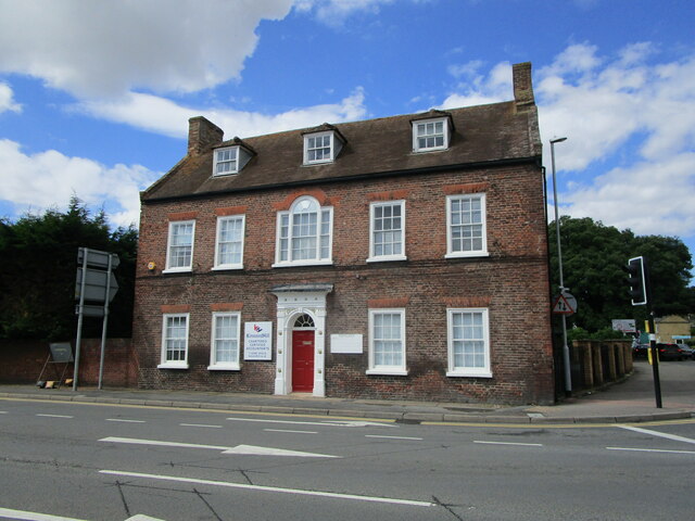
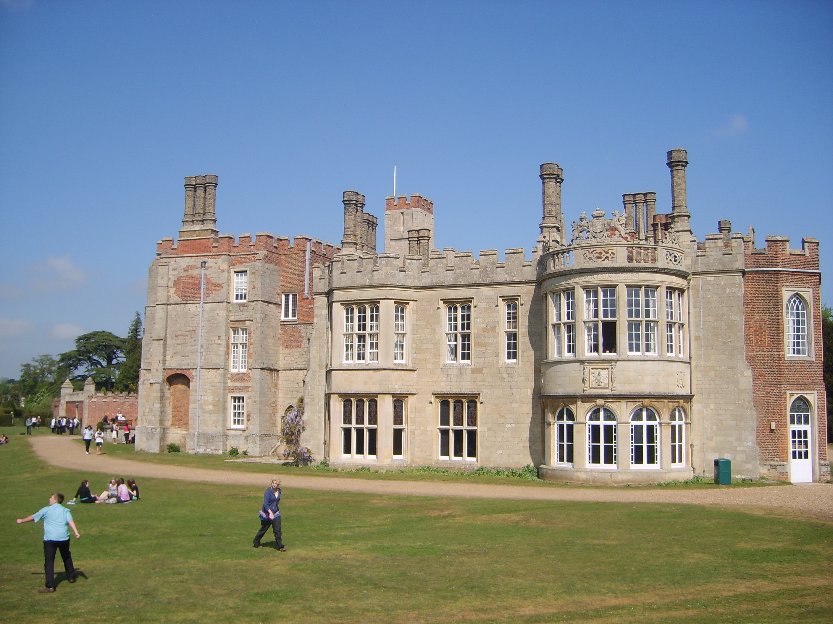
Hinchingbrooke House is a historic stately home located in Huntingdonshire, England. Situated near the town of Huntingdon, this magnificent mansion sits on the grounds of what was once a medieval nunnery. With its rich history dating back to the 11th century, it has become a prominent heritage site in the region.

Originally built as a Benedictine nunnery around 1086, the site was later converted into a country house in the 16th century. The house was extensively remodeled in the Georgian and Tudor architectural styles, resulting in its impressive appearance today. The stunning façade features a symmetrical design, with elegant windows and grand entranceways.

The interior of Hinchingbrooke House is equally impressive, boasting beautifully decorated rooms that reflect different periods of its history. Visitors can explore the grand hall, drawing room, library, and dining room, each showcasing exquisite period furniture, original artworks, and intricate plasterwork.

In addition to its architectural and historical significance, the house is also surrounded by picturesque gardens and parkland. The grounds offer a serene escape, with manicured lawns, vibrant flower beds, and peaceful woodland areas. The gardens are a popular spot for visitors to wander, relax, and enjoy the beauty of the estate.

Hinchingbrooke House is open to the public, welcoming visitors to explore its rich heritage and experience the grandeur of this magnificent stately home. It also serves as a venue for weddings, corporate events, and other special occasions, providing a unique and memorable setting for any celebration.

If you have any feedback on the listing, please let us know in the comments section below.

Hinchingbrooke House Images

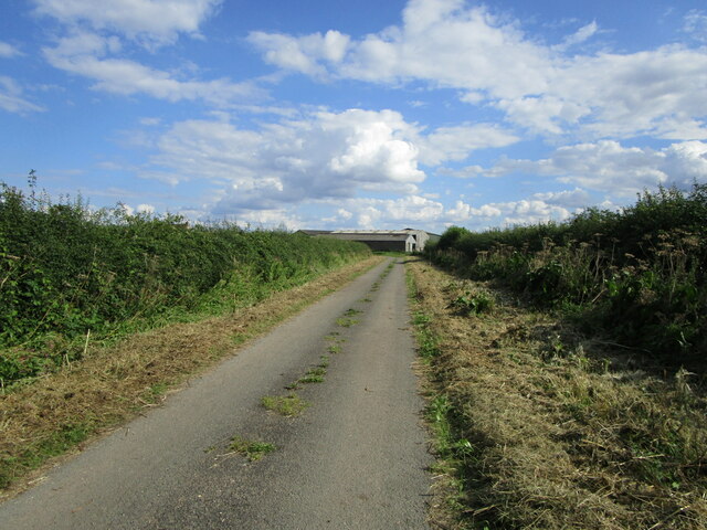
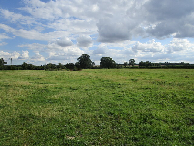
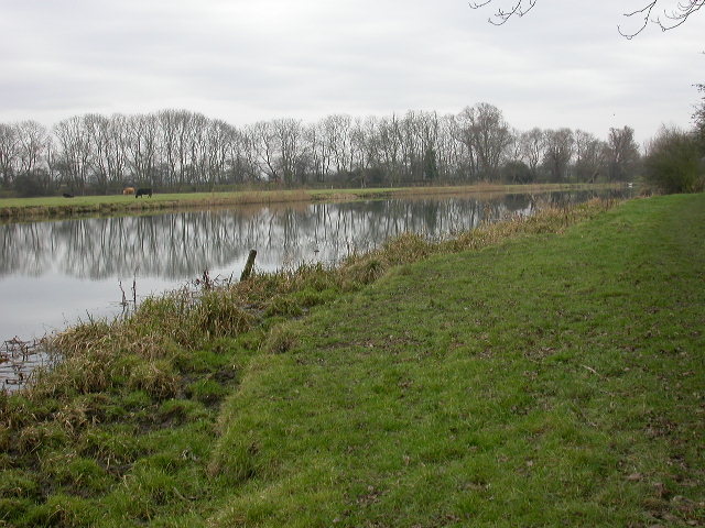
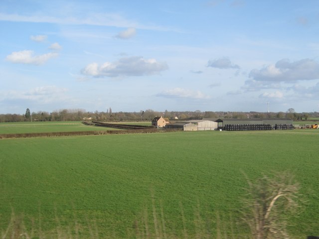
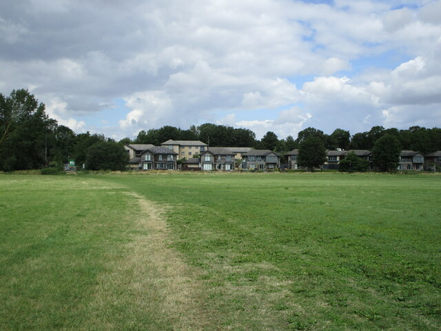
Images are sourced within 2km of 52.327/-0.202 or Grid Reference TL2271. Thanks to Geograph Open Source API. All images are credited.

Berry Lane
Berry Lane
Grass field off Berry Lane
Cows by the River The river has veered east and the far bank with cows is comfortably into the square, where I cannot go.
Cows by the River
The river has veered east and the far bank with cows is comfortably into the square, where I cannot go.
Weir on the River Great Ouse Follow the Ouse Valley Way from Offord Cluny and you will see this weir as you approach Brampton and Huntingdon
Weir on the River Great Ouse
Follow the Ouse Valley Way from Offord Cluny and you will see this weir as you approach Brampton and Huntingdon
View from a Peterborough-London train - Fields around Berry Lane
Tree upheaval Recent strong winds have downed six or seven poplar trees on the side of the B1043. Shallow rooting, dry soil, and the fact that they appear to have grown out on a roadstone surface haven't helped.
Tree upheaval
Recent strong winds have downed six or seven poplar trees on the side of the B1043. Shallow rooting, dry soil, and the fact that they appear to have grown out on a roadstone surface haven't helped.
Tree upheaval Poplar trees lying prone by the B1043.
Tree upheaval
Poplar trees lying prone by the B1043.
West Street, Godmanchester
Berry Lane
Berry Lane
Junction for Berry Lane
The River Great Ouse at Godmanchester
The Ouse Valley Way crossing Port Holme
Port Holme and Waters Meet Waters Meet is a housing development close to a minor branch of the River Great Ouse.
Port Holme and Waters Meet
Waters Meet is a housing development close to a minor branch of the River Great Ouse.
Montague House, Huntingdon Mid eighteenth century house <span class="nowrap"><a title="https://historicengland.org.uk/listing/the-list/list-entry/1128610" rel="nofollow ugc noopener" href="https://historicengland.org.uk/listing/the-list/list-entry/1128610">Link</a><img style="margin-left:2px;" alt="External link" title="External link - shift click to open in new window" src="https://s1.geograph.org.uk/img/external.png" width="10" height="10"/></span> isolated from the town centre by the Ring Road which passes in front of it.
Montague House, Huntingdon
Mid eighteenth century house LinkExternal link isolated from the town centre by the Ring Road which passes in front of it.
The River Great Ouse at Huntingdon The bridge used to carry the A14 which has now been diverted.
The River Great Ouse at Huntingdon
The bridge used to carry the A14 which has now been diverted.
Bridge over a branch of the River Great Ouse
31/32 West Street, Godmanchester The former Shepherd and Dog INN. Dates from 1593 <span class="nowrap"><a title="https://historicengland.org.uk/listing/the-list/list-entry/1162411" rel="nofollow ugc noopener" href="https://historicengland.org.uk/listing/the-list/list-entry/1162411">Link</a><img style="margin-left:2px;" alt="External link" title="External link - shift click to open in new window" src="https://s1.geograph.org.uk/img/external.png" width="10" height="10"/></span>
31/32 West Street, Godmanchester
The former Shepherd and Dog INN. Dates from 1593 LinkExternal link
Show me another place!

Hinchingbrooke House is located at Grid Ref: TL2271 (Lat: 52.327, Lng: -0.202)

Police Authority: Cambridgeshire

What 3 Words

///vent.thrashed.lively. Near Huntingdon, Cambridgeshire

Related Wikis

Hinchingbrooke School

Hinchingbrooke School is a large secondary school situated on the outskirts of Huntingdon in Cambridgeshire, historically in Huntingdonshire. Originally...

Hinchingbrooke House

Hinchingbrooke House is an English stately home in Huntingdon, Cambridgeshire, now part of Hinchingbrooke School. The house was built around an 11th-century...

Hinchingbrooke Hospital

Hinchingbrooke Hospital is a small district general hospital in Hinchingbrooke near Huntingdon, Cambridgeshire. Opened in 1983, it serves the Huntingdonshire...

Huntingdon East railway station

Huntingdon East railway station served the town of Huntingdon, Cambridgeshire, England from 1883 to 1959. == History == The station opened on 1 May 1883...

Nearby Amenities

Located within 500m of 52.327,-0.202
Traffic Signals
Traffic Signals: signal
Traffic Signals Direction: backward
Lat/Long: 52.3289322/-0.1964193
Traffic Signals
Traffic Signals: signal
Traffic Signals Direction: forward
Lat/Long: 52.329079/-0.1989689
Traffic Signals
Traffic Signals: signal
Traffic Signals Direction: backward
Lat/Long: 52.3291385/-0.1987608
Turning Circle
Lat/Long: 52.3296342/-0.2058202
Crossing
Lat/Long: 52.329015/-0.1965691
Crossing
Lat/Long: 52.3291766/-0.2003662
Barrier: lift_gate
Lat/Long: 52.3289382/-0.2002535
Man Made: mast
Lat/Long: 52.3309579/-0.2009264
Bus Station
Hinchingbrooke School bus bays
Bus: yes
Public Transport: station
Lat/Long: 52.3296799/-0.2016379
Post Box
Post Box Type: pillar
Ref: PE29 216D
Lat/Long: 52.3290178/-0.1958183
Post Box
Lat/Long: 52.331251/-0.2033502
Bus Stop
Bromholme Lane
Bus: yes
Naptan AtcoCode: 0500HBRAM005
Naptan Bearing: SW
Naptan CommonName: Bromholme Lane
Naptan Indicator: near
Naptan Landmark: Bromholme Lane
Naptan NaptanCode: cmbdmtaw
Naptan ShortCommonName: Bromholme Lane
Naptan Street: Huntingdon Road
Naptan Verified: no
Public Transport: platform
Source: naptan_import
Lat/Long: 52.3242385/-0.2046707
Bus Stop
Bromholme Lane
Bus: yes
Naptan AtcoCode: 0500HBRAM014
Naptan Bearing: NE
Naptan CommonName: Bromholme Lane
Naptan Indicator: opp
Naptan Landmark: Bromholme Lane
Naptan NaptanCode: cmbdmtgd
Naptan ShortCommonName: Bromholme Lane
Naptan Street: Huntingdon Road
Naptan Verified: no
Public Transport: platform
Source: naptan_import
Lat/Long: 52.3242647/-0.2052126
Bus Stop
Snowdonia Way
Bus: yes
Naptan AtcoCode: 0500HHUNT009
Naptan Bearing: SE
Naptan CommonName: Snowdonia Way
Naptan Indicator: opp
Naptan Landmark: Snowdonia Way
Naptan NaptanCode: cmbdpgpm
Naptan ShortCommonName: Snowdonia Way
Naptan Street: Hinchingbrooke Park Road
Naptan Verified: no
Public Transport: platform
Source: naptan_import
Lat/Long: 52.3305869/-0.2023295
Bus Stop
Playing Field
Bus: yes
Naptan AtcoCode: 0500HHUNT011
Naptan Bearing: SW
Naptan CommonName: Playing Field
Naptan Indicator: near
Naptan Landmark: Scholars Avenue
Naptan NaptanCode: cmbdpgpw
Naptan ShortCommonName: Playing Field
Naptan Street: Brampton Road
Naptan Verified: no
Public Transport: platform
Source: naptan_import
Lat/Long: 52.3289963/-0.1959679
Bus Stop
Snowdonia Way
Bus: yes
Naptan AtcoCode: 0500HHUNT045
Naptan Bearing: NW
Naptan CommonName: Snowdonia Way
Naptan Indicator: near
Naptan Landmark: Snowdonia Way
Naptan NaptanCode: cmbdpjgt
Naptan ShortCommonName: Snowdonia Way
Naptan Street: Hinchingbrooke Park Rd
Naptan Verified: no
Public Transport: platform
Source: naptan_import
Lat/Long: 52.3303236/-0.2021641
Bus Stop
Playing Field
Bus: yes
Naptan AtcoCode: 0500HHUNT073
Naptan Bearing: NE
Naptan CommonName: Playing Field
Naptan Indicator: opp
Naptan Landmark: Hinchingbrooke School
Naptan NaptanCode: cmbdpjwp
Naptan ShortCommonName: Playing Field
Naptan Street: Brampton Road
Naptan Verified: no
Public Transport: platform
Source: naptan_import
Lat/Long: 52.3278561/-0.1989621
Bus Stop
Hinchingbrooke School
Bus: yes
Naptan AtcoCode: 0500HHUNT099
Naptan Bearing: SE
Naptan BusStopType: CUS
Naptan CommonName: Hinchingbrooke School
Naptan Indicator: o/s
Naptan Landmark: Hinchingbrooke School
Naptan NaptanCode: cmbdpmja
Naptan ShortCommonName: Hinchingbrooke Sch
Naptan Street: Hinchingbrooke Park Road
Naptan Verified: no
Public Transport: platform
Source: naptan_import
Lat/Long: 52.3296383/-0.2017861
Crossing
Lat/Long: 52.3291088/-0.1995467
Library
LRC
Lat/Long: 52.3286976/-0.2018094
Entrance: yes
Lat/Long: 52.3289783/-0.2023279
Entrance: yes
Lat/Long: 52.3287818/-0.2019957
Entrance: yes
Lat/Long: 52.3282659/-0.2018701
Entrance: yes
Lat/Long: 52.328348/-0.2013435
Entrance: yes
Lat/Long: 52.328374/-0.2014054
Entrance: yes
Lat/Long: 52.328566/-0.2016424
Entrance: yes
Lat/Long: 52.3285722/-0.2010679
Entrance: yes
Lat/Long: 52.3287788/-0.2015483
Entrance: yes
Lat/Long: 52.3289652/-0.2016543
Entrance: yes
Lat/Long: 52.3288336/-0.2013693
Entrance: yes
Lat/Long: 52.3291617/-0.2012989
Entrance: yes
Lat/Long: 52.3290637/-0.2012586
Entrance: yes
Lat/Long: 52.3288886/-0.200775
Entrance: yes
Lat/Long: 52.3287709/-0.201007
Entrance: yes
Lat/Long: 52.328732/-0.2011512
Entrance: yes
Lat/Long: 52.3282818/-0.2035283
Entrance: yes
Lat/Long: 52.328653/-0.2028771
Entrance: yes
Lat/Long: 52.3292001/-0.2019909
Entrance: yes
Lat/Long: 52.3293456/-0.2020009
Entrance: yes
Lat/Long: 52.3289205/-0.2024712
Entrance: yes
Lat/Long: 52.3289856/-0.2026153
Entrance: yes
Lat/Long: 52.3286207/-0.2018676
Entrance: yes
Lat/Long: 52.3284595/-0.203131
Entrance: yes
Lat/Long: 52.3281726/-0.2026388
Entrance: yes
Lat/Long: 52.3278199/-0.2011916
Entrance: yes
Lat/Long: 52.3279478/-0.2009061
Entrance: yes
Lat/Long: 52.3278423/-0.2003421
Entrance: yes
Lat/Long: 52.327671/-0.2005713
Entrance: yes
Lat/Long: 52.3277558/-0.200712
Entrance: yes
Lat/Long: 52.3285453/-0.2003604
Entrance: yes
Lat/Long: 52.3287066/-0.2003687
Entrance: yes
Lat/Long: 52.3287701/-0.2005064
Entrance: yes
Lat/Long: 52.3297441/-0.2027187
Traffic Signals
Button Operated: yes
Crossing: traffic_signals
Lat/Long: 52.3293528/-0.1998683
Crossing
Crossing: traffic_signals
Lat/Long: 52.3293058/-0.1988274
Colour: red
Marker: post
Material: concrete
Utility: gas
Lat/Long: 52.3292156/-0.1996553
Colour: red
Fixme: I am 80% sure this is gas, (and gas markers are usually red as this one is) but the lettering at the top of this sign is not legible in any of the ~8 photos I've seen, so there is a 20% chance this is not gas.
Marker: post
Material: concrete
Utility: gas
Lat/Long: 52.3294711/-0.1970972
Leisure: playground
Lat/Long: 52.3305996/-0.2045758
Traffic Signals
Traffic Signals: signal
Traffic Signals Direction: forward
Lat/Long: 52.3291842/-0.1990587
Traffic Signals
Traffic Signals: signal
Traffic Signals Direction: backward
Lat/Long: 52.3293256/-0.1988137
Life Ring
Emergency: life_ring
Inscription: Fothpath entrance from Nun's Bridge
Ref: 9
Lat/Long: 52.3252348/-0.2038488
Bench
Lat/Long: 52.3244197/-0.2071817
Life Ring
Emergency: life_ring
Information: board
Ref: 4
Lat/Long: 52.3245714/-0.2047196
Information: board
Tourism: information
Lat/Long: 52.3263949/-0.2067021
Bench
Lat/Long: 52.327028/-0.2002562
Tourism: viewpoint
Lat/Long: 52.3273206/-0.199714
Man Made: manhole
Manhole: drain
Lat/Long: 52.3272083/-0.1986632
Man Made: manhole
Manhole: drain
Lat/Long: 52.3268947/-0.1987649
Traffic Signals
Traffic Signals: signal
Traffic Signals Direction: forward
Lat/Long: 52.329016/-0.1966263
The data included in this document is from www.openstreetmap.org. The data is made available under ODbL.

Have you been to Hinchingbrooke House?

Leave your review of Hinchingbrooke House below (or comments, questions and feedback).