Ebworth

Heritage Site in Gloucestershire

England

Ebworth

Faint line of a footpath Heading eastwards from Bunnage towards Whiteway.
Faint line of a footpath Credit: Jonathan Billinger

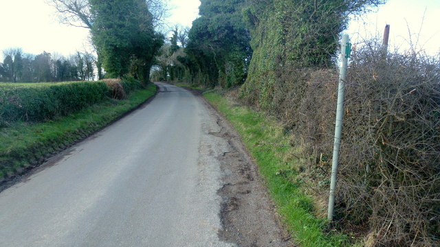
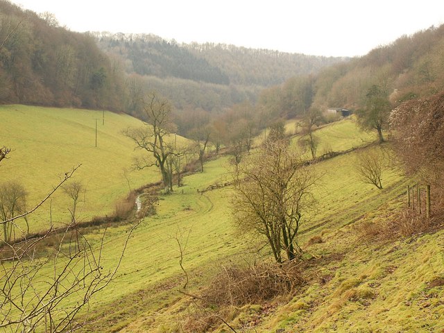
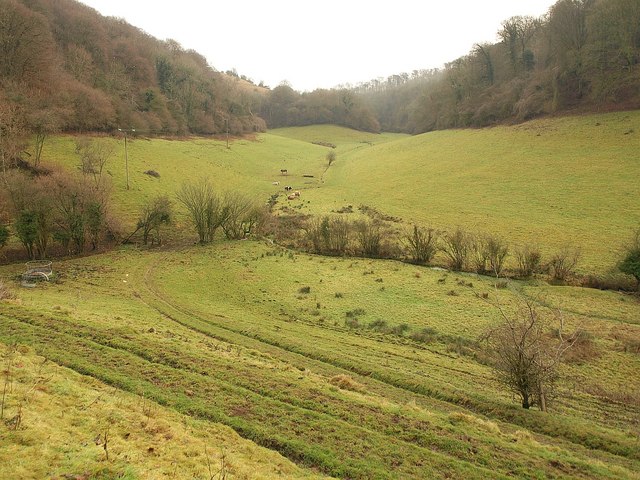
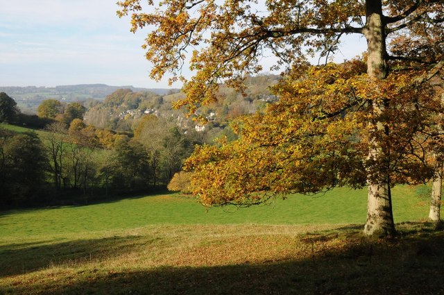
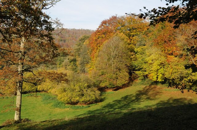
Ebworth is a small village located in the county of Gloucestershire, England. Situated within the Cotswolds Area of Outstanding Natural Beauty, it has gained recognition as a heritage site due to its rich historical and cultural significance. The village is nestled in a picturesque valley and is surrounded by rolling hills and lush greenery, making it an idyllic setting for visitors and locals alike.

The history of Ebworth dates back centuries, with evidence of human habitation in the area dating as far back as the Iron Age. The village itself grew and developed during the medieval period, and remnants of this era can still be seen today in the form of traditional stone cottages and historic buildings.

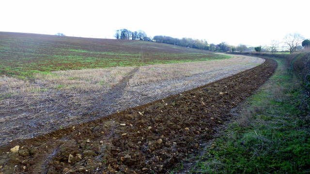
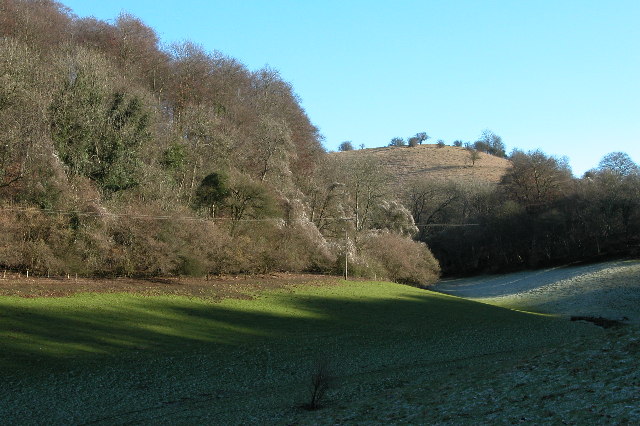
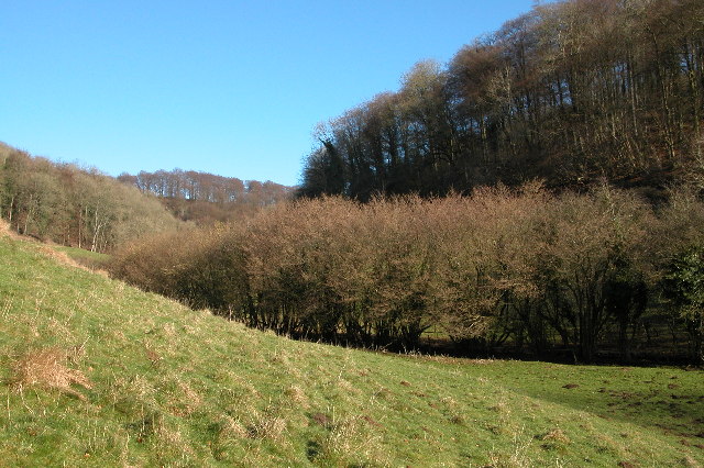
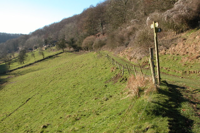
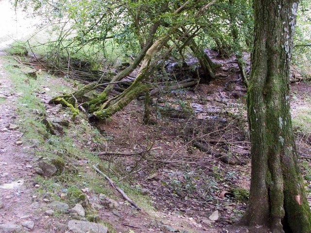
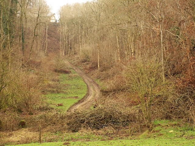
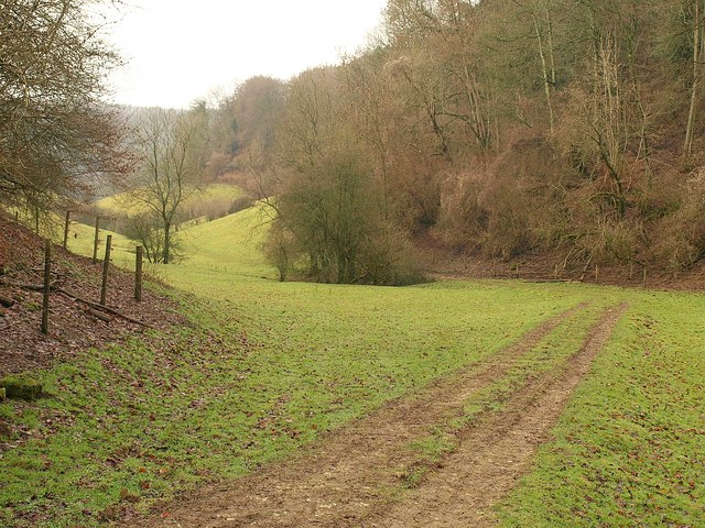
One of the standout features of Ebworth is its close proximity to the Ebworth Estate, a large area of land that was once used for farming and hunting. The estate is now managed by the National Trust and is open to the public. Visitors can explore the vast acres of woodland, meadows, and heathland, which are home to a diverse range of flora and fauna. The estate also offers numerous walking trails, allowing visitors to immerse themselves in the natural beauty of the area.

In addition to its natural attractions, Ebworth is also known for its vibrant community spirit. The village hosts regular events and festivals throughout the year, showcasing local talent and celebrating the area's heritage. Overall, Ebworth is a charming and historically significant village that offers a delightful blend of natural beauty and cultural heritage.

If you have any feedback on the listing, please let us know in the comments section below.

Ebworth Images

Images are sourced within 2km of 51.786/-2.161 or Grid Reference SO8809. Thanks to Geograph Open Source API. All images are credited.

Faint line of a footpath Heading eastwards from Bunnage towards Whiteway.
Faint line of a footpath
Heading eastwards from Bunnage towards Whiteway.
Lane to Bunnage Looking west from the footpath sign for this path; <a href="https://www.geograph.org.uk/photo/4865645">SO9009 : Faint line of a footpath</a>.
Lane to Bunnage
Looking west from the footpath sign for this path; SO9009 : Faint line of a footpath.
Wooden Carving, Ebworth Wooden carving near The Ebworth Centre and entrance to Workmans Wood.
Wooden Carving, Ebworth
Wooden carving near The Ebworth Centre and entrance to Workmans Wood.
Nottingham Scrubs This view is at the top end of the valley above the village of Slad.
Nottingham Scrubs
This view is at the top end of the valley above the village of Slad.
Famish Hill Plantation This is at the top of the Slad valley
Famish Hill Plantation
This is at the top of the Slad valley
A junction of footpaths in the Slad valley
Beanfield, Bunnage Farm Opposite Bunnage Farm (not Bunnage Field Farm) was this huge field of beans.
Beanfield, Bunnage Farm
Opposite Bunnage Farm (not Bunnage Field Farm) was this huge field of beans.
Source of Dillay Brook This spring is at the head of the beautiful Dillay valley.
Source of Dillay Brook
This spring is at the head of the beautiful Dillay valley.
Dillay Brook valley Partly covers the scene in <a href="https://www.geograph.org.uk/photo/114753">SO9008 : A junction of footpaths in the Slad valley</a>; the short field boundary with trees dropping down to the Dillay Brook appear in both images. This is taken close to where footpath MPA/146/1 emerges from a slippery descent through Down Wood. Downstream, the valley quickly crosses into <a href="https://www.geograph.org.uk/gridref/SO8908">SO8908</a>.
Dillay Brook valley
Partly covers the scene in SO9008 : A junction of footpaths in the Slad valley; the short field boundary with trees dropping down to the Dillay Brook appear in both images. This is taken close to where footpath MPA/146/1 emerges from a slippery descent through Down Wood. Downstream, the valley quickly crosses into SO8908.
Dillay Brook valley Looking up the valley, as it swings eastwards, from the same spot as <a href="https://www.geograph.org.uk/photo/2228029">SO9008 : Dillay Brook valley</a>. A branch of the valley continues up to the left to Famish Hill.
Dillay Brook valley
Looking up the valley, as it swings eastwards, from the same spot as SO9008 : Dillay Brook valley. A branch of the valley continues up to the left to Famish Hill.
Track up valley side, Famish Hill Seen from the valley floor, a steep track climbs through woods towards Bunnage.
Track up valley side, Famish Hill
Seen from the valley floor, a steep track climbs through woods towards Bunnage.
Valley below Famish Hill Looking down a tributary valley of the Dillay Brook, bending here where the track shown in <a href="https://www.geograph.org.uk/photo/2246108">SO9009 : Track up valley side, Famish Hill</a>.
Valley below Famish Hill
Looking down a tributary valley of the Dillay Brook, bending here where the track shown in SO9009 : Track up valley side, Famish Hill.
House on the corner of the B4070  and the Miserden junction
House on the corner of the B4070 and the Miserden junction
Sheepscombe valley Autumn colours in the Sheepscombe valley, viewed from the footpath through the woodland on Elder Hill.
Sheepscombe valley
Autumn colours in the Sheepscombe valley, viewed from the footpath through the woodland on Elder Hill.
Autumn colours on Elder Hill Autumn colours on Elder Hill at the head of the Sheepscombe.
Autumn colours on Elder Hill
Autumn colours on Elder Hill at the head of the Sheepscombe.
An interesting manoeuvre on the B4070, 1 A fast stretch of road with a deceptively close bend up ahead.
See <a href="https://www.geograph.org.uk/photo/4865641">SO9010 : An interesting manoeuvre on the B4070, 2</a> taken 2 seconds later.
An interesting manoeuvre on the B4070, 1
A fast stretch of road with a deceptively close bend up ahead. See SO9010 : An interesting manoeuvre on the B4070, 2 taken 2 seconds later.
An interesting manoeuvre on the B4070, 2 Photo taken 2 seconds after <a href="https://www.geograph.org.uk/photo/4865639">SO9010 : An interesting manoeuvre on the B4070, 1</a>.
An interesting manoeuvre on the B4070, 2
Old Milestone by the B4070, east of Sheepscombe Metal plate attached to stone post by the B4070, in parish of MISERDEN (STROUD District), Sheepscombe; 250m West of crossroads to Sheepscombe and Miserden, on the verge, on South side of road. Lightpill plate, erected by the Lightpill & Birdlip turnpike trust in the 19th century. 

Inscription reads:-
CHELTM.
9
STROUD
5  
Carved benchmark and rivet on top.

Milestone Society National ID: GL_SDCM05.
Old Milestone by the B4070, east of Sheepscombe
Metal plate attached to stone post by the B4070, in parish of MISERDEN (STROUD District), Sheepscombe; 250m West of crossroads to Sheepscombe and Miserden, on the verge, on South side of road. Lightpill plate, erected by the Lightpill & Birdlip turnpike trust in the 19th century. Inscription reads:- CHELTM. 9 STROUD 5 Carved benchmark and rivet on top. Milestone Society National ID: GL_SDCM05.
Show me another place!

Ebworth is located at Grid Ref: SO8809 (Lat: 51.786, Lng: -2.161)

Police Authority: Gloucestershire

What 3 Words

///gravest.doubts.repayment. Near Painswick, Gloucestershire

Related Wikis

Sheepscombe

Sheepscombe is a small village in the civil parish of Painswick, in the Stroud district, in the county of Gloucestershire, England. Sheepscombe is located...

Painswick Lodge

Painswick Lodge is a grade I listed house in Painswick, Gloucestershire, England. The rubble stone building, which has been extensively reworked and remodelled...

Workmans Wood, Sheepscombe

Workmans Wood (grid reference SO900109) is a wood just to the east of the village of Sheepscombe, in the Cotswolds, Gloucestershire. It is a biological...

Snows Farm Nature Reserve

Snows Farm Nature Reserve (grid reference SO887081) is a 21.3-hectare (53-acre) nature reserve in Gloucestershire. The site is listed in the ‘Stroud District...

Nearby Amenities

Located within 500m of 51.786,-2.161
Jacks Green
Is In: Gloucestershire, England, UK
Place: hamlet
Lat/Long: 51.7869446/-2.1605096
Bus Stop
Sheepscombe Methodist Church
Naptan AtcoCode: 1600GL4185
Naptan Bearing: E
Naptan BusStopType: CUS
Naptan CommonName: Sheepscombe Methodist Church
Naptan Indicator: Opp
Naptan NaptanCode: glodmawp
Naptan PlusbusZoneRef: STRUD
Naptan Street: Jack's Green
Naptan Verified: no
Source: naptan_import
Lat/Long: 51.7878983/-2.1616537
Bus Stop
Sheepscombe Methodist Church
Naptan AtcoCode: 1600GL4186
Naptan Bearing: W
Naptan CommonName: Sheepscombe Methodist Church
Naptan NaptanCode: glodmatp
Naptan PlusbusZoneRef: STRUD
Naptan Street: Jack's Green
Naptan Verified: no
Source: naptan_import
Lat/Long: 51.7878491/-2.1616592
Power: pole
Lat/Long: 51.7844199/-2.1584153
Power: pole
Lat/Long: 51.7843145/-2.1581927
Power: pole
Lat/Long: 51.7849848/-2.1539534
Power: pole
Lat/Long: 51.7850936/-2.1541224
Power: pole
Lat/Long: 51.7833073/-2.1652777
Power: pole
Lat/Long: 51.783752/-2.1624628
Power: pole
Lat/Long: 51.7831704/-2.1652174
Power: pole
Lat/Long: 51.7842158/-2.1597054
Power: pole
Lat/Long: 51.7834027/-2.1638092
Power: pole
Lat/Long: 51.7847642/-2.1553656
Power: pole
Lat/Long: 51.78363/-2.1623984
Power: pole
Lat/Long: 51.7835338/-2.1638696
Power: pole
Lat/Long: 51.7840026/-2.161009
Power: pole
Lat/Long: 51.7841005/-2.15957
Power: pole
Lat/Long: 51.7838682/-2.1609513
Power: pole
Lat/Long: 51.7848596/-2.1556821
Power: pole
Lat/Long: 51.7898945/-2.1608286
Power: pole
Lat/Long: 51.7899417/-2.1596739
Power: pole
Lat/Long: 51.7898488/-2.1619552
Power: transformer
Lat/Long: 51.7887497/-2.1617433
Bench
Lat/Long: 51.789829/-2.1578119
Historic: memorial
Material: stone
Memorial: war_memorial
Lat/Long: 51.7898994/-2.1578414
The data included in this document is from www.openstreetmap.org. The data is made available under ODbL.

Have you been to Ebworth?

Leave your review of Ebworth below (or comments, questions and feedback).