Longridge Wood

Wood, Forest in Gloucestershire Stroud

England

Longridge Wood

Nottingham Scrubs This view is at the top end of the valley above the village of Slad.
Nottingham Scrubs Credit: Philip Halling

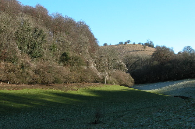
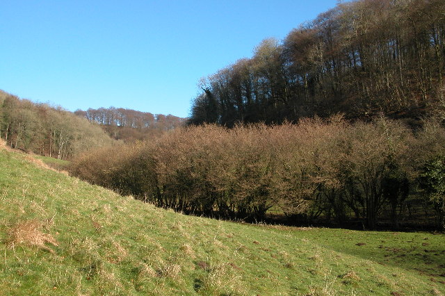
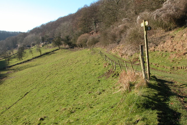
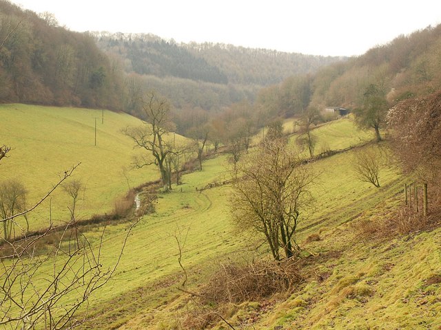
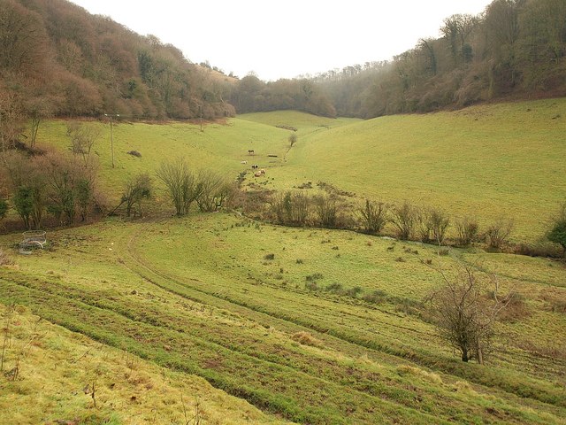
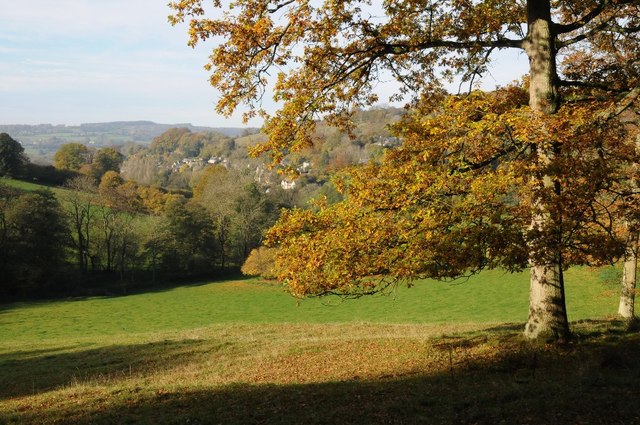
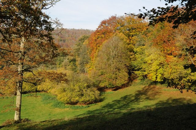
Longridge Wood is a picturesque woodland located in the county of Gloucestershire, England. Covering an area of approximately 100 acres, this stunning forest is known for its diverse range of flora and fauna, making it a popular destination for nature enthusiasts and walkers alike.

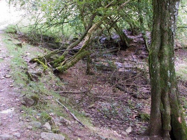
The wood is primarily composed of a mixture of deciduous and coniferous trees, including oak, beech, and pine. These majestic trees provide a lush green canopy, creating a tranquil and peaceful atmosphere within the woods. The forest floor is adorned with a rich carpet of ferns, mosses, and wildflowers, adding to the natural beauty of the area.

Longridge Wood is also home to a variety of wildlife. Birdwatchers can spot an array of species, such as woodpeckers, nuthatches, and tawny owls, while lucky visitors may even catch a glimpse of deer or foxes among the trees. The wood's diverse ecosystem also supports a range of insects, butterflies, and small mammals.

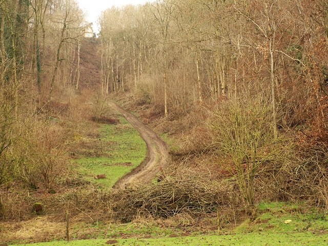
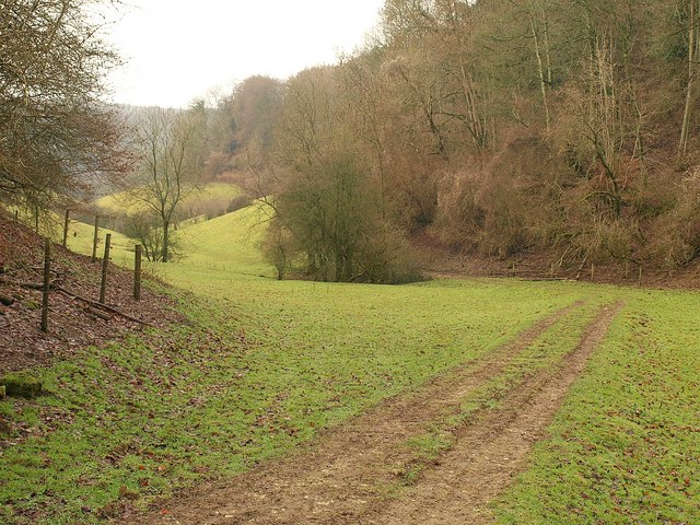
The wood offers several well-maintained walking trails, allowing visitors to explore the beauty of the forest at their own pace. For those seeking a longer hike, the wood is connected to a larger network of footpaths that wind through the surrounding countryside, providing stunning views of the rolling hills and valleys of Gloucestershire.

Longridge Wood offers a peaceful escape from the hustle and bustle of everyday life, providing a sanctuary for both nature lovers and those looking for a quiet retreat. With its natural beauty, abundant wildlife, and well-marked trails, Longridge Wood is a hidden gem in the heart of Gloucestershire.

If you have any feedback on the listing, please let us know in the comments section below.

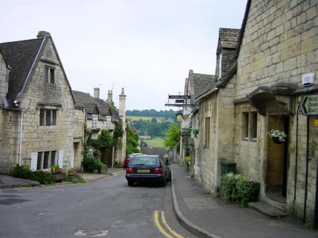
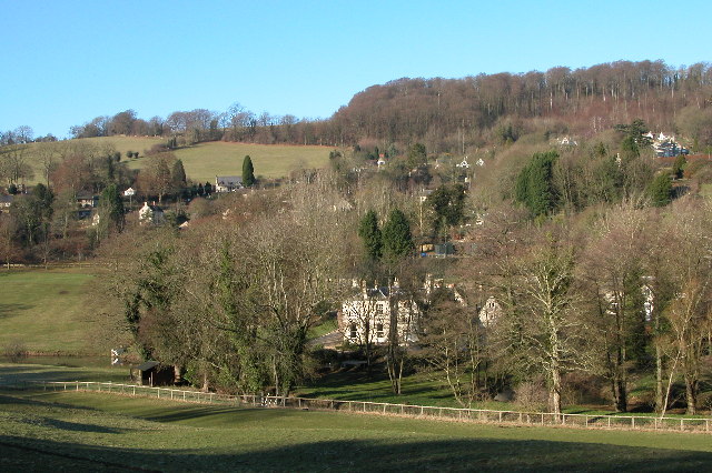
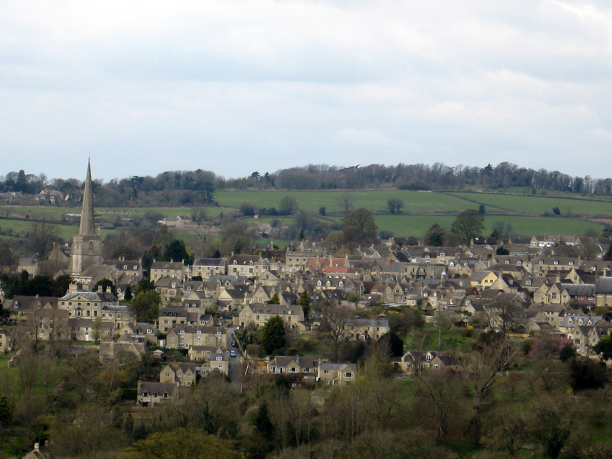
Longridge Wood Images

Images are sourced within 2km of 51.779854/-2.1657623 or Grid Reference SO8809. Thanks to Geograph Open Source API. All images are credited.

Nottingham Scrubs This view is at the top end of the valley above the village of Slad.
Nottingham Scrubs
This view is at the top end of the valley above the village of Slad.
Famish Hill Plantation This is at the top of the Slad valley
Famish Hill Plantation
This is at the top of the Slad valley
A junction of footpaths in the Slad valley
Beanfield, Bunnage Farm Opposite Bunnage Farm (not Bunnage Field Farm) was this huge field of beans.
Beanfield, Bunnage Farm
Opposite Bunnage Farm (not Bunnage Field Farm) was this huge field of beans.
Source of Dillay Brook This spring is at the head of the beautiful Dillay valley.
Source of Dillay Brook
This spring is at the head of the beautiful Dillay valley.
Dillay Brook valley Partly covers the scene in <a href="https://www.geograph.org.uk/photo/114753">SO9008 : A junction of footpaths in the Slad valley</a>; the short field boundary with trees dropping down to the Dillay Brook appear in both images. This is taken close to where footpath MPA/146/1 emerges from a slippery descent through Down Wood. Downstream, the valley quickly crosses into <a href="https://www.geograph.org.uk/gridref/SO8908">SO8908</a>.
Dillay Brook valley
Partly covers the scene in SO9008 : A junction of footpaths in the Slad valley; the short field boundary with trees dropping down to the Dillay Brook appear in both images. This is taken close to where footpath MPA/146/1 emerges from a slippery descent through Down Wood. Downstream, the valley quickly crosses into SO8908.
Dillay Brook valley Looking up the valley, as it swings eastwards, from the same spot as <a href="https://www.geograph.org.uk/photo/2228029">SO9008 : Dillay Brook valley</a>. A branch of the valley continues up to the left to Famish Hill.
Dillay Brook valley
Looking up the valley, as it swings eastwards, from the same spot as SO9008 : Dillay Brook valley. A branch of the valley continues up to the left to Famish Hill.
Track up valley side, Famish Hill Seen from the valley floor, a steep track climbs through woods towards Bunnage.
Track up valley side, Famish Hill
Seen from the valley floor, a steep track climbs through woods towards Bunnage.
Valley below Famish Hill Looking down a tributary valley of the Dillay Brook, bending here where the track shown in <a href="https://www.geograph.org.uk/photo/2246108">SO9009 : Track up valley side, Famish Hill</a>.
Valley below Famish Hill
Looking down a tributary valley of the Dillay Brook, bending here where the track shown in SO9009 : Track up valley side, Famish Hill.
House on the corner of the B4070  and the Miserden junction
House on the corner of the B4070 and the Miserden junction
Sheepscombe valley Autumn colours in the Sheepscombe valley, viewed from the footpath through the woodland on Elder Hill.
Sheepscombe valley
Autumn colours in the Sheepscombe valley, viewed from the footpath through the woodland on Elder Hill.
Autumn colours on Elder Hill Autumn colours on Elder Hill at the head of the Sheepscombe.
Autumn colours on Elder Hill
Autumn colours on Elder Hill at the head of the Sheepscombe.
An interesting manoeuvre on the B4070, 1 A fast stretch of road with a deceptively close bend up ahead.
See <a href="https://www.geograph.org.uk/photo/4865641">SO9010 : An interesting manoeuvre on the B4070, 2</a> taken 2 seconds later.
An interesting manoeuvre on the B4070, 1
A fast stretch of road with a deceptively close bend up ahead. See SO9010 : An interesting manoeuvre on the B4070, 2 taken 2 seconds later.
An interesting manoeuvre on the B4070, 2 Photo taken 2 seconds after <a href="https://www.geograph.org.uk/photo/4865639">SO9010 : An interesting manoeuvre on the B4070, 1</a>.
An interesting manoeuvre on the B4070, 2
Stone Stile off B4070 between Sheepscombe/Camp junctions  GS9252 Stone slab stile off B4070 between Sheepscombe and Camp junctions. On public right of way MMN52. View from field to road
Stone Stile off B4070 between Sheepscombe/Camp junctions GS9252
Stone slab stile off B4070 between Sheepscombe and Camp junctions. On public right of way MMN52. View from field to road
Stone Stile off B4070 between Sheepscombe/Camp junctions  GS9252 Stone slab stile off B4070 between Sheepscombe and Camp junctions. On public right of way MMN52
Stone Stile off B4070 between Sheepscombe/Camp junctions GS9252
Stone slab stile off B4070 between Sheepscombe and Camp junctions. On public right of way MMN52
Tibbiwell Lane, Painswick This road runs east and then SE down the hill to Brookhouse Mill.
Tibbiwell Lane, Painswick
This road runs east and then SE down the hill to Brookhouse Mill.
Slad The village of Slad lies in one of the valleys above Stroud and is famous as the home of writer Laurie Lee and the setting for his book 'Cider with Rosie'.
Slad
The village of Slad lies in one of the valleys above Stroud and is famous as the home of writer Laurie Lee and the setting for his book 'Cider with Rosie'.
Show me another place!

Longridge Wood is located at Grid Ref: SO8809 (Lat: 51.779854, Lng: -2.1657623)

Administrative County: Gloucestershire

District: Stroud

Police Authority: Gloucestershire

What 3 Words

///bloodshot.debut.reserving. Near Painswick, Gloucestershire

Related Wikis

Snows Farm Nature Reserve

Snows Farm Nature Reserve (grid reference SO887081) is a 21.3-hectare (53-acre) nature reserve in Gloucestershire. The site is listed in the ā€˜Stroud District...

Sheepscombe

Sheepscombe is a small village in the civil parish of Painswick, in the Stroud district, in the county of Gloucestershire, England. Sheepscombe is located...

Bull Cross, The Frith and Juniper Hill

Bull Cross, The Frith and Juniper Hill (grid reference SO872083) is a 42.33-hectare (104.6-acre) biological and geological Site of Special Scientific Interest...

Painswick Lodge

Painswick Lodge is a grade I listed house in Painswick, Gloucestershire, England. The rubble stone building, which has been extensively reworked and remodelled...

Slad

Slad is a village in Gloucestershire, England, in the Slad Valley about 2 miles (3 km) from Stroud on the B4070 road from Stroud to Birdlip. Slad is notable...

Court House, Painswick

The Court House is a grade I listed house in Hale Lane, Painswick, Gloucestershire, England, within the Cotswolds. The house was built in the late 16th...

Painswick

Painswick is a town and civil parish in the Stroud District in Gloucestershire, England. Originally the town grew from the wool trade, but it is now best...

Rough Bank, Miserden

Rough Bank, Miserden (grid reference SO907087) is a 9.2-hectare (23-acre) biological Site of Special Scientific Interest in Gloucestershire, notified in...

Related Videos

A WINTER ENGLISH COUNTRYSIDE ESCAPE TO PAINSWICK IN THE COTSWOLDS

This week Heidi and I escaped for a night away in the Cotswolds. This time choosing a location that we hadn't been to before.

A Breathtaking Walk in a Cotswold Village with Dramatic Views

So, today we are out and about walking in the small Cotswold village of Sheepscombe which is located approximately 10 km (6.5 ...

Walking at First Light Through a Beautiful Cotswold Village

So, today we are out and about walking at very first light in the village Of Bisley which is located around 4 miles east of Stroud in ...

Nearby Amenities

Located within 500m of 51.779854,-2.1657623
Power: pole
Lat/Long: 51.7828402/-2.1681477
Power: pole
Lat/Long: 51.7826801/-2.1682107
Power: pole
Lat/Long: 51.7826087/-2.1695679
Power: pole
Lat/Long: 51.7833073/-2.1652777
Power: pole
Lat/Long: 51.783752/-2.1624628
Power: pole
Lat/Long: 51.7831704/-2.1652174
Power: pole
Lat/Long: 51.7834027/-2.1638092
Power: pole
Lat/Long: 51.7824537/-2.1696296
Power: pole
Lat/Long: 51.7823774/-2.171027
Power: pole
Lat/Long: 51.78363/-2.1623984
Power: pole
Lat/Long: 51.7835338/-2.1638696
Power: pole
Lat/Long: 51.7822106/-2.1711746
Power: pole
Lat/Long: 51.7808876/-2.171802
Power: pole
Lat/Long: 51.7799382/-2.1729508
The data included in this document is from www.openstreetmap.org. The data is made available under ODbL.

Have you been to Longridge Wood?

Leave your review of Longridge Wood below (or comments, questions and feedback).