Black Hill British Settlement

Heritage Site in Dorset

England

Black Hill British Settlement

St Mary's church, Cerne Abbas Founded c.1300, St Mary's is the parish church of Cerne Abbas built for the parishioners by the monks of Cerne Abbey. The chancel is the oldest part of the church dating from the C14. Original murals painted on the walls on either side of the altar (now badly faded) also date from this time.
St Mary's church, Cerne Abbas Credit: Mike Searle

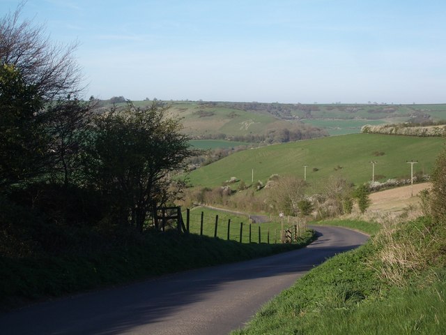
Black Hill British Settlement is a historic heritage site located in Dorset, England. It is an ancient settlement that dates back to the Iron Age, roughly around 600 BC. The site is situated on the top of Black Hill, which offers panoramic views of the surrounding landscape.

The settlement consists of several circular hut platforms, which were once the dwelling places for the people who lived here thousands of years ago. These platforms are made of stone and earth, and their circular shape suggests a well-organized community. The huts would have been made of organic materials like wood and thatch, which have long since decayed.

Archaeological excavations at the Black Hill British Settlement have revealed a wealth of artifacts, including pottery fragments, flint tools, and animal bones. These findings have provided valuable insights into the daily lives and activities of the Iron Age people who inhabited the site.

Visitors to Black Hill can explore the remains of the settlement and learn about the history and culture of the Iron Age inhabitants through interpretive panels. The site also offers breathtaking views of the surrounding countryside, making it a popular spot for nature enthusiasts and history buffs alike.

Black Hill British Settlement is an important archaeological site that provides valuable information about the early inhabitants of Dorset. Its historical significance, combined with its natural beauty, makes it a must-visit destination for those interested in the ancient history of the region.

If you have any feedback on the listing, please let us know in the comments section below.

Black Hill British Settlement Images

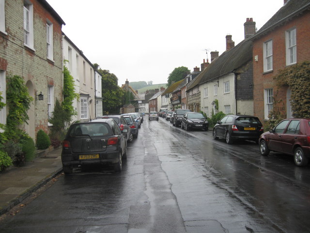
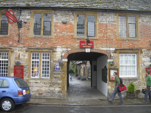
Images are sourced within 2km of 50.8034/-2.4679 or Grid Reference ST6700. Thanks to Geograph Open Source API. All images are credited.

St Mary's church, Cerne Abbas Founded c.1300, St Mary's is the parish church of Cerne Abbas built for the parishioners by the monks of Cerne Abbey. The chancel is the oldest part of the church dating from the C14. Original murals painted on the walls on either side of the altar (now badly faded) also date from this time.
St Mary's church, Cerne Abbas
Founded c.1300, St Mary's is the parish church of Cerne Abbas built for the parishioners by the monks of Cerne Abbey. The chancel is the oldest part of the church dating from the C14. Original murals painted on the walls on either side of the altar (now badly faded) also date from this time.
Cerne Abbas Giant (1992)
Farm Gateway near Cerne Abbas
Dickley Hill: the road down to Cerne Abbas (Cerne Giant just visible...)
Cerne Abbas Giant - 1987 The Cerne Abbas giant aka the Rude Man or the Rude Giant, is a hill figure of a giant naked man on a hillside near the village of Cerne Abbas, to the north of Dorchester, in Dorset, England. The 55 m high, 51 m wide figure is carved into the side of a steep hill, and is best viewed from the opposite side of the valley or from the air. The carving is formed by a trench 30 cm wide, and about the same depth, which has been cut through grass and earth into the underlying chalk. In his right hand the giant holds a knobbled club 37 m in length. A 1996 study found that some features of the image have changed over time; notably, the study concluded that the figure originally held a cloak in its left arm and stood over a disembodied head. The figure's origin and age is unknown.
Cerne Abbas Giant - 1987
The Cerne Abbas giant aka the Rude Man or the Rude Giant, is a hill figure of a giant naked man on a hillside near the village of Cerne Abbas, to the north of Dorchester, in Dorset, England. The 55 m high, 51 m wide figure is carved into the side of a steep hill, and is best viewed from the opposite side of the valley or from the air. The carving is formed by a trench 30 cm wide, and about the same depth, which has been cut through grass and earth into the underlying chalk. In his right hand the giant holds a knobbled club 37 m in length. A 1996 study found that some features of the image have changed over time; notably, the study concluded that the figure originally held a cloak in its left arm and stood over a disembodied head. The figure's origin and age is unknown.
Cerne Abbas Flood Defences This dam is built across the valley just upstream of the village . At the far end is a sluice gate which can be closed preventing flood waters coming down into the village. The waters are allowed to build up behind the dam and form a lake in the meadows on the left, and the waters are then slowly released. In the background can be seen the Cerne Abbas Giant. the cars on the right are in the Village hall Car park.
Cerne Abbas Flood Defences
This dam is built across the valley just upstream of the village . At the far end is a sluice gate which can be closed preventing flood waters coming down into the village. The waters are allowed to build up behind the dam and form a lake in the meadows on the left, and the waters are then slowly released. In the background can be seen the Cerne Abbas Giant. the cars on the right are in the Village hall Car park.
Cerne Abbas Flood defences This shows the dam in the background and the sluice gate and spillway which are used to control the stream in times of flood.
Cerne Abbas Flood defences
This shows the dam in the background and the sluice gate and spillway which are used to control the stream in times of flood.
Long Street, Cerne Abbas, in the wet
The New Inn, Cerne Abbas
The Giant, Cerne Abbas
Duck pond, Cerne Abbas
St Mary's Church, Cerne Abbas
The Giant, Cerne Abbas
The Giant, Cerne Abbas, Dorset As seen from the viewpoint.
The Giant, Cerne Abbas, Dorset
As seen from the viewpoint.
The Giant, Cerne Abbas, Dorset As seen from the viewpoint.
The Giant, Cerne Abbas, Dorset
As seen from the viewpoint.
Information Board, Cerne Abbas, Dorset Information board about the Giant figure on the hill.
Information Board, Cerne Abbas, Dorset
Information board about the Giant figure on the hill.
The Cerne Giant View of the "Rude Man" carved into the hillside above Cerne Abbas. It has been mooted to date back to Celtic British times but research published in 2021 dates the figure to the Saxon age C7-C11.
<span class="nowrap"><a title="http://en.wikipedia.org/wiki/Cerne_Abbas_Giant" rel="nofollow ugc noopener" href="http://en.wikipedia.org/wiki/Cerne_Abbas_Giant">Link</a><img style="margin-left:2px;" alt="External link" title="External link - shift click to open in new window" src="https://s1.geograph.org.uk/img/external.png" width="10" height="10"/></span>
The Cerne Giant
View of the "Rude Man" carved into the hillside above Cerne Abbas. It has been mooted to date back to Celtic British times but research published in 2021 dates the figure to the Saxon age C7-C11. LinkExternal link
Show me another place!

Black Hill British Settlement is located at Grid Ref: ST6700 (Lat: 50.8034, Lng: -2.4679)

Unitary Authority: Dorset

Police Authority: Dorset

What 3 Words

///gobbling.confining.starred. Near Charminster, Dorset

Related Wikis

Black Hill Down

Black Hill Down (grid reference ST668005) is a 71.84 hectare biological Site of Special Scientific Interest in Dorset, notified in 1989. == Sources... ==

Cerne Abbey

Cerne Abbey was a Benedictine monastery founded in 987 in the town now called Cerne Abbas, Dorset, by Æthelmær the Stout. == History == The abbey was founded...
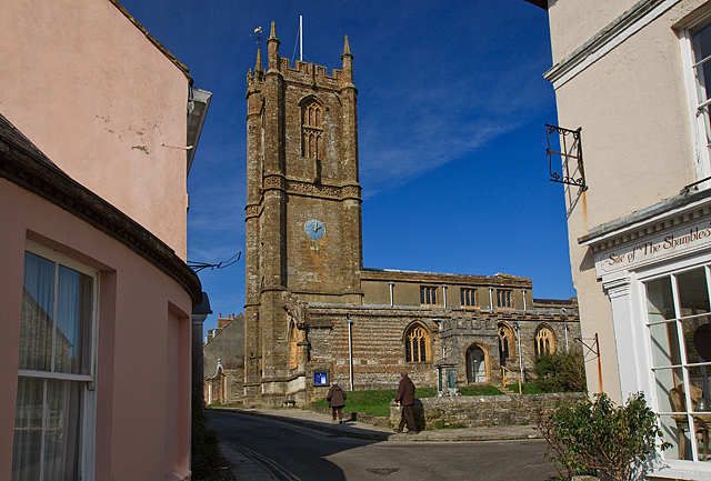
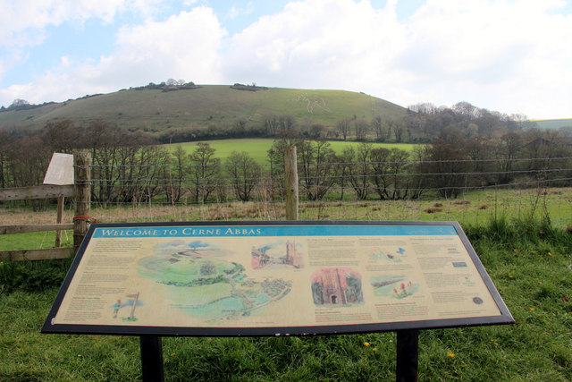
Cerne Abbas

Cerne Abbas () is a village and civil parish in the county of Dorset in southern England. It lies in the Dorset Council administrative area in the Cerne...
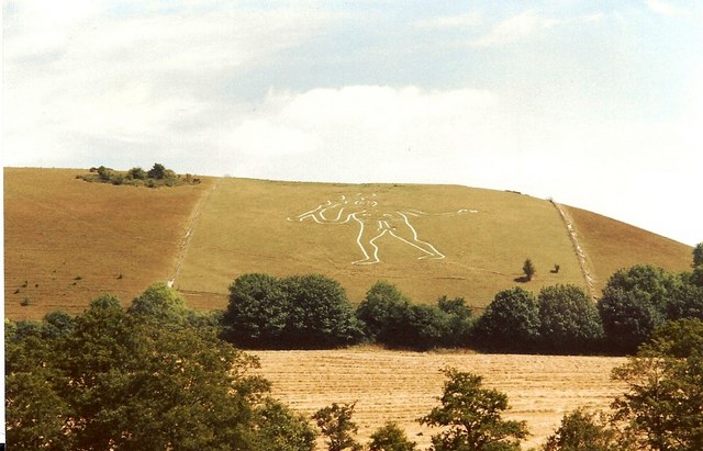
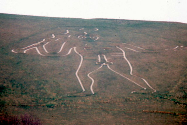
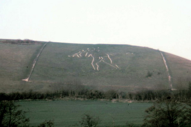
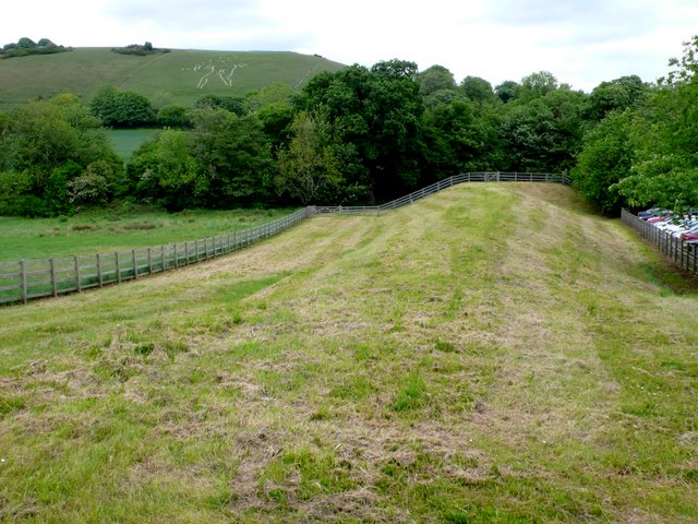
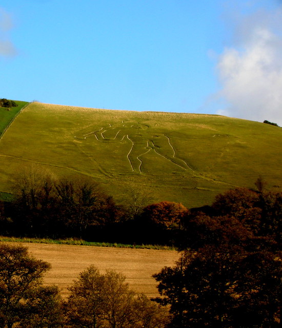
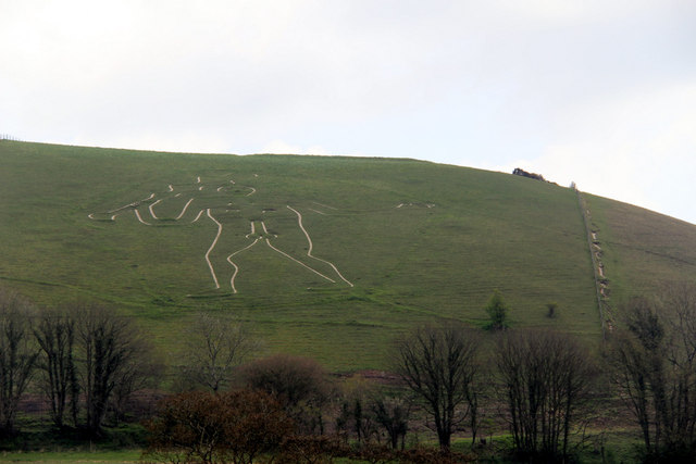
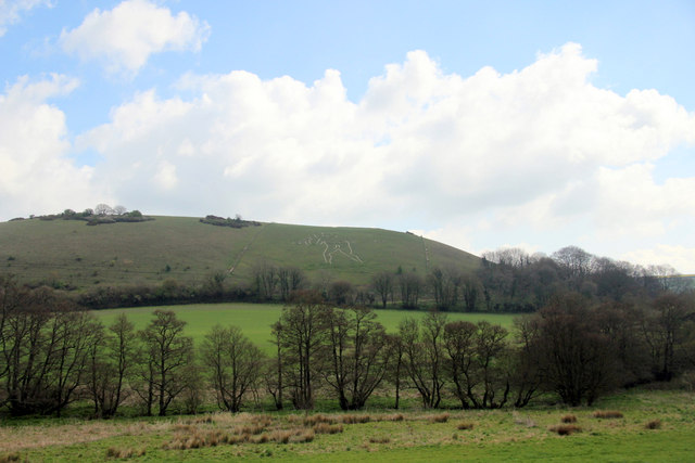
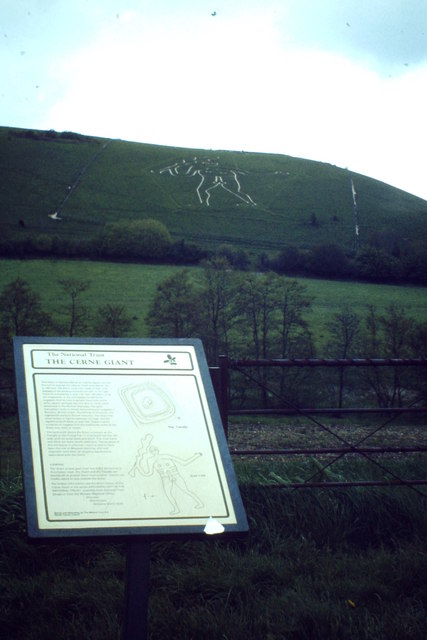
Cerne Abbas Giant

The Cerne Abbas Giant is a hill figure near the village of Cerne Abbas in Dorset, England. 55 metres (180 ft) high, it depicts a standing nude male with...

Nether Cerne

Nether Cerne is a hamlet and civil parish in the English county of Dorset. It lies within the Dorset unitary authority administrative area, about 5 miles...

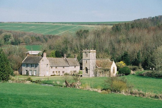
All Saints Church, Nether Cerne

All Saints Church in Nether Cerne, Dorset, England was built in the late 13th century. It is recorded in the National Heritage List for England as a designated...

Up Cerne

Up Cerne is a hamlet lying to the west of the River Cerne between Minterne Magna and Cerne Abbas in Dorset, England. It was the birthplace of John Mount...

Piddletrenthide Hoard

The Piddletrenthide Hoard is a Roman coin hoard dating from the 3rd century AD, found near Piddletrenthide, Dorset. It consisted of 2,114 base silver radiates...

Nearby Amenities

Located within 500m of 50.8034,-2.4679
Material: wood
Power: pole
Source: bing
Lat/Long: 50.8004041/-2.4687571
Material: wood
Power: pole
Source: bing
Lat/Long: 50.8004059/-2.464087
Material: wood
Power: pole
Source: bing
Lat/Long: 50.8008966/-2.465364
Material: wood
Power: pole
Source: bing
Lat/Long: 50.8014844/-2.4657593
Material: wood
Power: pole
Source: bing
Lat/Long: 50.8018331/-2.4647781
Material: wood
Power: pole
Source: bing
Lat/Long: 50.8019626/-2.4681314
Material: wood
Power: pole
Source: bing
Lat/Long: 50.8022016/-2.463757
Material: wood
Power: pole
Source: bing
Lat/Long: 50.8027007/-2.4700732
Material: wood
Power: pole
Source: bing
Lat/Long: 50.8033998/-2.4718712
Material: wood
Power: pole
Source: bing
Lat/Long: 50.8039158/-2.473287
Mini Roundabout
Lat/Long: 50.8066309/-2.4713878
The data included in this document is from www.openstreetmap.org. The data is made available under ODbL.

Have you been to Black Hill British Settlement?

Leave your review of Black Hill British Settlement below (or comments, questions and feedback).