Black Hill

Hill, Mountain in Dorset

England

Black Hill

St Mary's church, Cerne Abbas Founded c.1300, St Mary's is the parish church of Cerne Abbas built for the parishioners by the monks of Cerne Abbey. The chancel is the oldest part of the church dating from the C14. Original murals painted on the walls on either side of the altar (now badly faded) also date from this time.
St Mary's church, Cerne Abbas Credit: Mike Searle

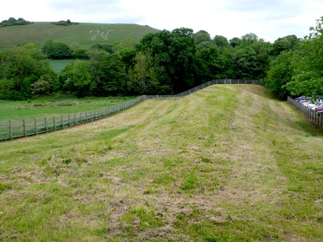
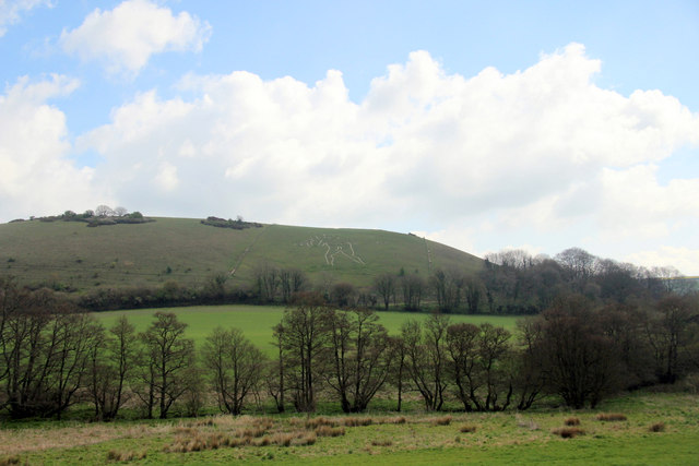
Black Hill is a prominent hill located in the county of Dorset, England. Situated near the village of Ibberton, it forms part of the picturesque landscape of the Blackmore Vale. Rising to an elevation of approximately 277 meters (909 feet), it is often referred to as a hill rather than a mountain due to its relatively modest height.

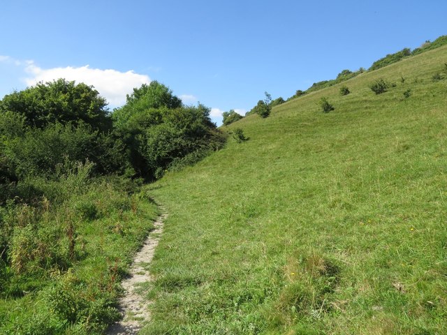
Black Hill is characterized by its distinctive conical shape and is primarily composed of chalk, a common feature of the Dorset Downs. The hill offers panoramic views of the surrounding countryside, including the nearby Dorset Downs and Cranborne Chase. On a clear day, visitors can enjoy breathtaking vistas stretching as far as the English Channel.

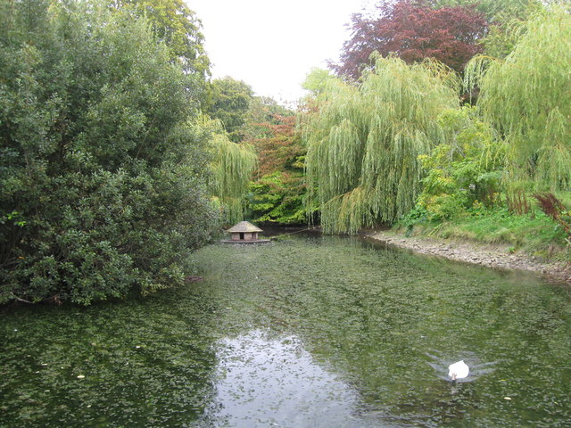
The area surrounding Black Hill is rich in natural beauty and biodiversity, with a variety of flora and fauna calling it home. The hill is covered in patches of grasses, wildflowers, and scrubland, providing habitats for a range of wildlife species. Birdwatchers often visit the hill to spot various avian species, including skylarks, stonechats, and wheatears.

Black Hill attracts outdoor enthusiasts and nature lovers who enjoy hiking and walking. Numerous footpaths and trails crisscross the hill, offering opportunities for exploration. The hill is accessible to the public, making it a popular destination for both locals and visitors alike.

Overall, Black Hill is a striking feature of Dorset's landscape, offering stunning views and recreational opportunities for those seeking a tranquil escape in the heart of the English countryside.

If you have any feedback on the listing, please let us know in the comments section below.

Black Hill Images

Images are sourced within 2km of 50.804178/-2.461416 or Grid Reference ST6700. Thanks to Geograph Open Source API. All images are credited.

St Mary's church, Cerne Abbas Founded c.1300, St Mary's is the parish church of Cerne Abbas built for the parishioners by the monks of Cerne Abbey. The chancel is the oldest part of the church dating from the C14. Original murals painted on the walls on either side of the altar (now badly faded) also date from this time.
St Mary's church, Cerne Abbas
Founded c.1300, St Mary's is the parish church of Cerne Abbas built for the parishioners by the monks of Cerne Abbey. The chancel is the oldest part of the church dating from the C14. Original murals painted on the walls on either side of the altar (now badly faded) also date from this time.
Cerne Abbas Giant (1992)
Cerne Abbas Giant - 1987 The Cerne Abbas giant aka the Rude Man or the Rude Giant, is a hill figure of a giant naked man on a hillside near the village of Cerne Abbas, to the north of Dorchester, in Dorset, England. The 55 m high, 51 m wide figure is carved into the side of a steep hill, and is best viewed from the opposite side of the valley or from the air. The carving is formed by a trench 30 cm wide, and about the same depth, which has been cut through grass and earth into the underlying chalk. In his right hand the giant holds a knobbled club 37 m in length. A 1996 study found that some features of the image have changed over time; notably, the study concluded that the figure originally held a cloak in its left arm and stood over a disembodied head. The figure's origin and age is unknown.
Cerne Abbas Giant - 1987
The Cerne Abbas giant aka the Rude Man or the Rude Giant, is a hill figure of a giant naked man on a hillside near the village of Cerne Abbas, to the north of Dorchester, in Dorset, England. The 55 m high, 51 m wide figure is carved into the side of a steep hill, and is best viewed from the opposite side of the valley or from the air. The carving is formed by a trench 30 cm wide, and about the same depth, which has been cut through grass and earth into the underlying chalk. In his right hand the giant holds a knobbled club 37 m in length. A 1996 study found that some features of the image have changed over time; notably, the study concluded that the figure originally held a cloak in its left arm and stood over a disembodied head. The figure's origin and age is unknown.
Cerne Abbas Flood Defences This dam is built across the valley just upstream of the village . At the far end is a sluice gate which can be closed preventing flood waters coming down into the village. The waters are allowed to build up behind the dam and form a lake in the meadows on the left, and the waters are then slowly released. In the background can be seen the Cerne Abbas Giant. the cars on the right are in the Village hall Car park.
Cerne Abbas Flood Defences
This dam is built across the valley just upstream of the village . At the far end is a sluice gate which can be closed preventing flood waters coming down into the village. The waters are allowed to build up behind the dam and form a lake in the meadows on the left, and the waters are then slowly released. In the background can be seen the Cerne Abbas Giant. the cars on the right are in the Village hall Car park.
Cerne Abbas Flood defences This shows the dam in the background and the sluice gate and spillway which are used to control the stream in times of flood.
Cerne Abbas Flood defences
This shows the dam in the background and the sluice gate and spillway which are used to control the stream in times of flood.
Long Street, Cerne Abbas, in the wet
The New Inn, Cerne Abbas
The Giant, Cerne Abbas
Duck pond, Cerne Abbas
St Mary's Church, Cerne Abbas
The Giant, Cerne Abbas
The Giant, Cerne Abbas, Dorset As seen from the viewpoint.
The Giant, Cerne Abbas, Dorset
As seen from the viewpoint.
The Giant, Cerne Abbas, Dorset As seen from the viewpoint.
The Giant, Cerne Abbas, Dorset
As seen from the viewpoint.
Information Board, Cerne Abbas, Dorset Information board about the Giant figure on the hill.
Information Board, Cerne Abbas, Dorset
Information board about the Giant figure on the hill.
The Cerne Giant View of the "Rude Man" carved into the hillside above Cerne Abbas. It has been mooted to date back to Celtic British times but research published in 2021 dates the figure to the Saxon age C7-C11.
<span class="nowrap"><a title="http://en.wikipedia.org/wiki/Cerne_Abbas_Giant" rel="nofollow ugc noopener" href="http://en.wikipedia.org/wiki/Cerne_Abbas_Giant">Link</a><img style="margin-left:2px;" alt="External link" title="External link - shift click to open in new window" src="https://s1.geograph.org.uk/img/external.png" width="10" height="10"/></span>
The Cerne Giant
View of the "Rude Man" carved into the hillside above Cerne Abbas. It has been mooted to date back to Celtic British times but research published in 2021 dates the figure to the Saxon age C7-C11. LinkExternal link
War memorial in the churchyard Many war memorials appeared in British towns and cities after the South African War of 1899-1902 (known popularly as the Boer War), but most were constructed after the First World War, known to contemporaries as the Great War (1914-19). These were updated after the Second World War (1939-45), usually by adding a plaque with the names of those killed in that conflict. Almost every town and village in Britain has a memorial erected after the Great War, the commonest types taking the form of a cross, an obelisk or a statue of a soldier. Some occupy a prominent public space; others stand in the local cemetery or can be found inside the local church. Memorials usually commemorate the inhabitants of a particular locality, the former pupils of a school, or the members of a military unit or branch of the armed forces. Other memorials, often bronze plaques placed indoors, commemorate the employees of a private company or public institution.
War memorial in the churchyard
Many war memorials appeared in British towns and cities after the South African War of 1899-1902 (known popularly as the Boer War), but most were constructed after the First World War, known to contemporaries as the Great War (1914-19). These were updated after the Second World War (1939-45), usually by adding a plaque with the names of those killed in that conflict. Almost every town and village in Britain has a memorial erected after the Great War, the commonest types taking the form of a cross, an obelisk or a statue of a soldier. Some occupy a prominent public space; others stand in the local cemetery or can be found inside the local church. Memorials usually commemorate the inhabitants of a particular locality, the former pupils of a school, or the members of a military unit or branch of the armed forces. Other memorials, often bronze plaques placed indoors, commemorate the employees of a private company or public institution.
Dreamy days in Dorset 62: Cerne Abbas Again, there is always one church I forget to shoot "full on" but others have covered my error <a title="https://www.geograph.org.uk/photo/1054627" href="https://www.geograph.org.uk/photo/1054627">Link</a>
Dreamy days in Dorset 62: Cerne Abbas
Again, there is always one church I forget to shoot "full on" but others have covered my error Link
Show me another place!

Black Hill is located at Grid Ref: ST6700 (Lat: 50.804178, Lng: -2.461416)

Unitary Authority: Dorset

Police Authority: Dorset

What 3 Words

///remarking.weds.freed. Near Charminster, Dorset

Related Wikis

Black Hill Down

Black Hill Down (grid reference ST668005) is a 71.84 hectare biological Site of Special Scientific Interest in Dorset, notified in 1989. == Sources... ==
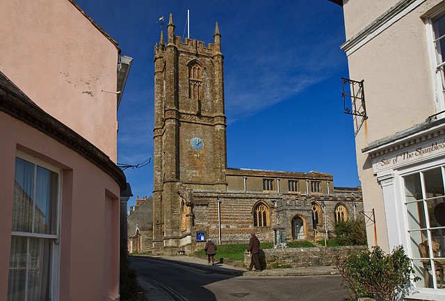
Cerne Abbey

Cerne Abbey was a Benedictine monastery founded in 987 in the town now called Cerne Abbas, Dorset, by Æthelmær the Stout. == History == The abbey was founded...
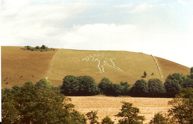
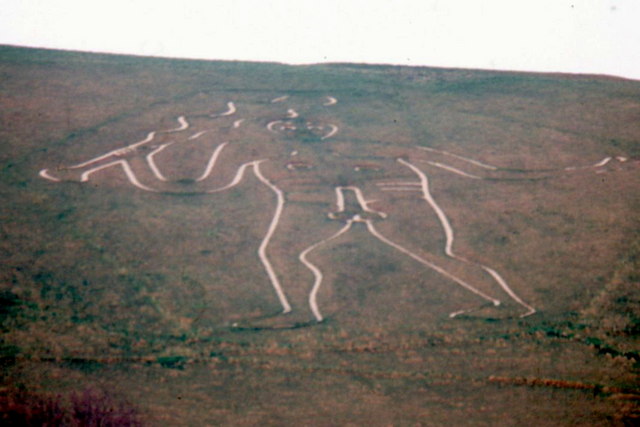
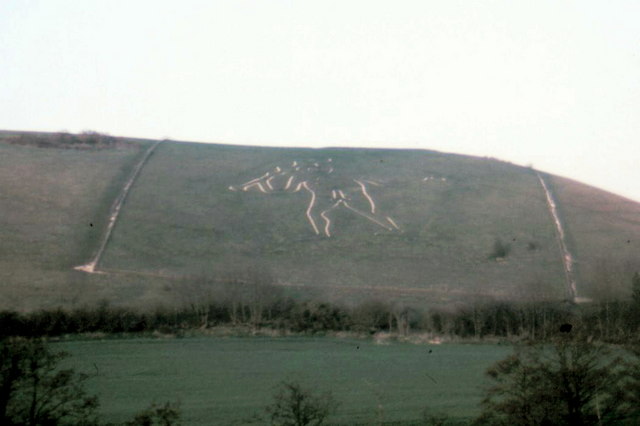
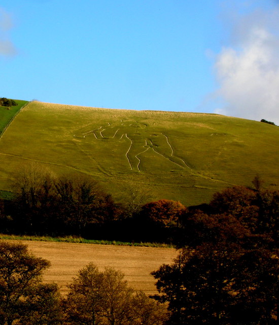
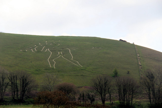
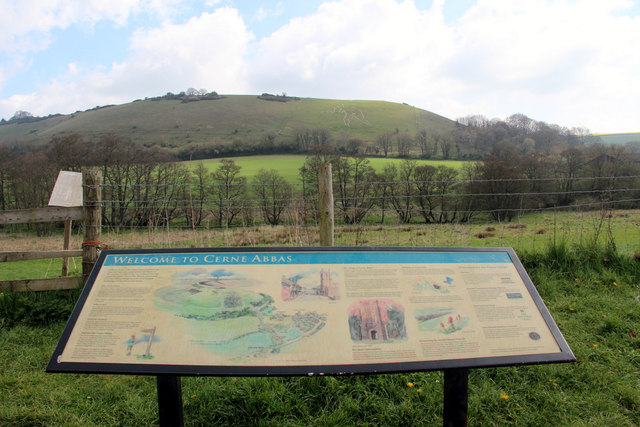
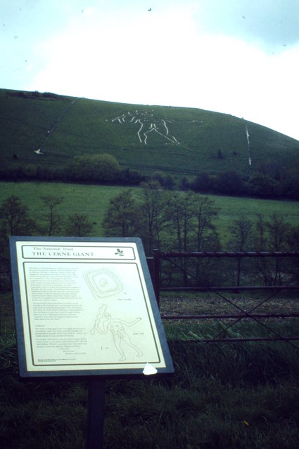
Cerne Abbas Giant

The Cerne Abbas Giant is a hill figure near the village of Cerne Abbas in Dorset, England. 55 metres (180 ft) high, it depicts a standing nude male with...
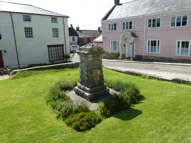
Cerne Abbas

Cerne Abbas () is a village and civil parish in the county of Dorset in southern England. It lies in the Dorset Council administrative area in the Cerne...
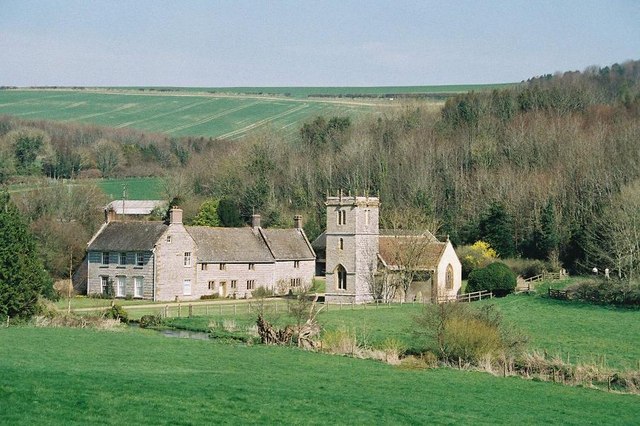
Nether Cerne

Nether Cerne is a hamlet and civil parish in the English county of Dorset. It lies within the Dorset unitary authority administrative area, about 5 miles...

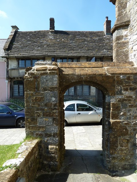
All Saints Church, Nether Cerne

All Saints Church in Nether Cerne, Dorset, England was built in the late 13th century. It is recorded in the National Heritage List for England as a designated...

Piddletrenthide Hoard

The Piddletrenthide Hoard is a Roman coin hoard dating from the 3rd century AD, found near Piddletrenthide, Dorset. It consisted of 2,114 base silver radiates...

Piddletrenthide

Piddletrenthide ( ) is a village and civil parish in the English county of Dorset. It is sited by the small River Piddle in a valley on the dip slope of...

Nearby Amenities

Located within 500m of 50.804178,-2.461416
Material: wood
Power: pole
Source: bing
Lat/Long: 50.8004059/-2.464087
Material: wood
Power: pole
Source: bing
Lat/Long: 50.8008966/-2.465364
Material: wood
Power: pole
Source: bing
Lat/Long: 50.8014844/-2.4657593
Material: wood
Power: pole
Source: bing
Lat/Long: 50.8018331/-2.4647781
Material: wood
Power: pole
Source: bing
Lat/Long: 50.8022016/-2.463757
The data included in this document is from www.openstreetmap.org. The data is made available under ODbL.

Have you been to Black Hill?

Leave your review of Black Hill below (or comments, questions and feedback).