Black Hill

Heritage Site in Perthshire

Scotland

Black Hill

A984 westbound
A984 westbound Credit: Alex McGregor

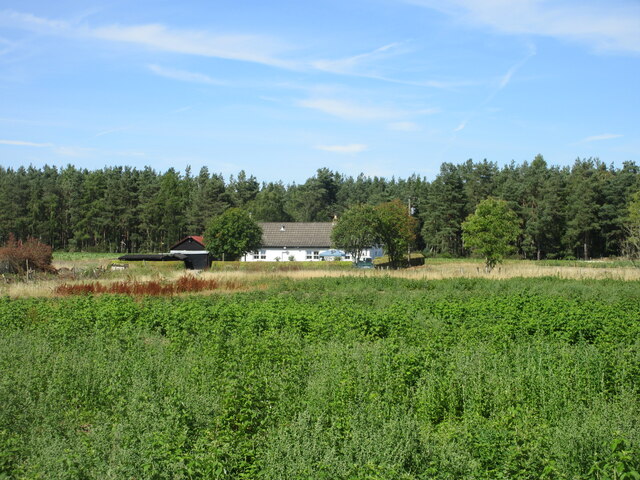
Black Hill is a prominent heritage site located in Perthshire, Scotland. Situated in the picturesque countryside, it is renowned for its historical and cultural significance. The hill stands at an impressive height of 1,044 feet (318 meters), making it an ideal spot for nature enthusiasts and hikers.

The area surrounding Black Hill is abundant with lush greenery, offering breathtaking views of the surrounding landscapes. The hill itself is covered in heather, giving it a stunning purple hue during the flowering season. Visitors can enjoy panoramic vistas of the surrounding Perthshire countryside, including the nearby Loch Tay and Ben Lawers, the highest mountain in the southern part of the Scottish Highlands.

In addition to its natural beauty, Black Hill holds historical importance. It was once home to an Iron Age fort, believed to have been occupied over 2,000 years ago. The remains of the fort can still be seen, providing a glimpse into the region's ancient past.

Black Hill is also known for its rich biodiversity, with various species of birds, plants, and mammals calling it home. Rare and protected species, such as the black grouse and red deer, can often be spotted in the area.

For those interested in outdoor activities, Black Hill offers a network of walking trails, catering to both experienced hikers and casual strollers. The paths are well-maintained and provide access to the summit, rewarding visitors with breathtaking panoramic views.

Overall, Black Hill in Perthshire is a captivating heritage site, combining natural beauty, historical significance, and outdoor recreational opportunities, making it a must-visit destination for nature lovers and history enthusiasts alike.

If you have any feedback on the listing, please let us know in the comments section below.
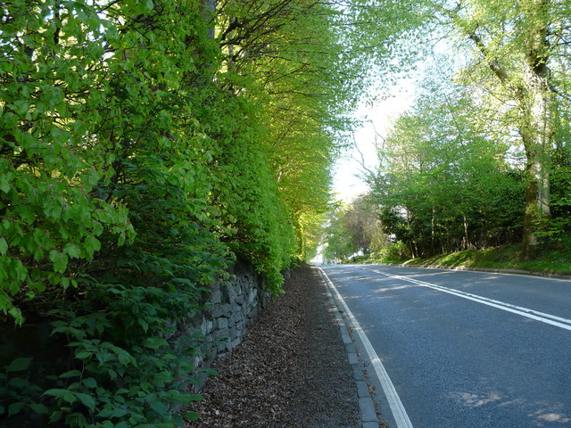
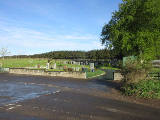
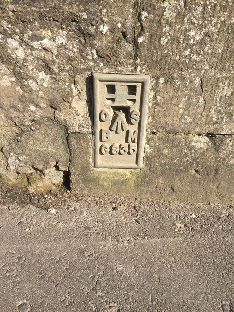
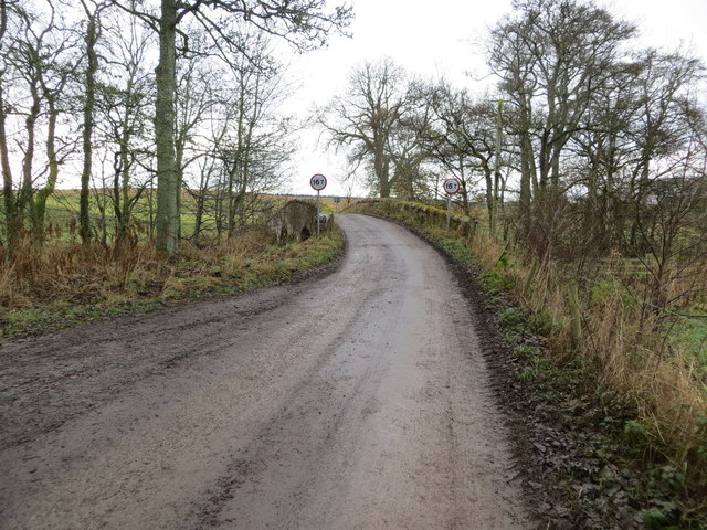
Black Hill Images

Images are sourced within 2km of 56.53669/-3.340978 or Grid Reference NO1738. Thanks to Geograph Open Source API. All images are credited.

A984 westbound
A984 westbound
Track to Hallhole
Track to Hallhole
Arable land by Hallhole Farmland between Meikleour and Coupar Angus.
Arable land by Hallhole
Farmland between Meikleour and Coupar Angus.
Meikleour Beech Hedge The beech hedge on the A93
Meikleour Beech Hedge
The beech hedge on the A93
Meiklour Beech Hedge
Entrance to Meikleour Southern entrance to Meikleour on the minor road leading off the A93.
Entrance to Meikleour
Southern entrance to Meikleour on the minor road leading off the A93.
The A93 heading north to Blairgowrie Long straight on the A93 south of the crossroads with the A984.
The A93 heading north to Blairgowrie
Long straight on the A93 south of the crossroads with the A984.
Northern end of the Beech Hedge The Beech Hedge on the A93 viewed from its northern end.
Northern end of the Beech Hedge
The Beech Hedge on the A93 viewed from its northern end.
Leystone Cemetery The countryside Leystone Cemetery viewed from the south-east.
Leystone Cemetery
The countryside Leystone Cemetery viewed from the south-east.
Road to Laystone The hedgerow lined road heading to Laystone viewed from west of the cemetery.
Road to Laystone
The hedgerow lined road heading to Laystone viewed from west of the cemetery.
Meikleour Beech Hedge This remarkable hedge, believed to have been planted in the autumn of 1745, has been officially recorded since 1966 as the world's tallest. It is approximately 580 yards long and has an average height of 100 feet, attaining over 120 feet at the northern end (shown in the photograph) and about 80 feet to the south. The hedge is trimmed once every ten years
Meikleour Beech Hedge
This remarkable hedge, believed to have been planted in the autumn of 1745, has been officially recorded since 1966 as the world's tallest. It is approximately 580 yards long and has an average height of 100 feet, attaining over 120 feet at the northern end (shown in the photograph) and about 80 feet to the south. The hedge is trimmed once every ten years
A93 east of Meikleour
Flush Bracket OSBM G835 on Bridge of Isla Ordnance Survey Flush Bracket OSBM G835 on Bridge of Isla
Flush Bracket OSBM G835 on Bridge of Isla
Ordnance Survey Flush Bracket OSBM G835 on Bridge of Isla
Minor road and bridge crossing Coupar Burn near to Little Keithick Looking south-westward.
Minor road and bridge crossing Coupar Burn near to Little Keithick
Looking south-westward.
Muirale House Looking north to Muirale House from the A984.
Muirale House
Looking north to Muirale House from the A984.
Bridge from the view of the dismantled railway path
The Meikleour Beech Hedge The A93 passes the tallest and longest hedge in the world (according to the Guinness book of records). It is 30 metres (98 feet) high and 530 metres (1,740 feet) long. It was planted in 1745 and is usually cut every 10 years.
The Meikleour Beech Hedge
The A93 passes the tallest and longest hedge in the world (according to the Guinness book of records). It is 30 metres (98 feet) high and 530 metres (1,740 feet) long. It was planted in 1745 and is usually cut every 10 years.
Cottages, The Row, Meikleour Both buildings to the left are Category C listed <span class="nowrap"><a title="https://portal.historicenvironment.scot/designation/LB4414" rel="nofollow ugc noopener" href="https://portal.historicenvironment.scot/designation/LB4414">Link</a><img style="margin-left:2px;" alt="External link" title="External link - shift click to open in new window" src="https://s1.geograph.org.uk/img/external.png" width="10" height="10"/></span> <span class="nowrap"><a title="https://portal.historicenvironment.scot/designation/LB4413" rel="nofollow ugc noopener" href="https://portal.historicenvironment.scot/designation/LB4413">Link</a><img style="margin-left:2px;" alt="External link" title="External link - shift click to open in new window" src="https://s1.geograph.org.uk/img/external.png" width="10" height="10"/></span>
Cottages, The Row, Meikleour
Both buildings to the left are Category C listed LinkExternal link LinkExternal link
Show me another place!

Black Hill is located at Grid Ref: NO1738 (Lat: 56.53669, Lng: -3.340978)

What 3 Words

///chip.scrap.beaks. Near Coupar Angus, Perth & Kinross

Nearby Locations

Black Hill

Related Wikis

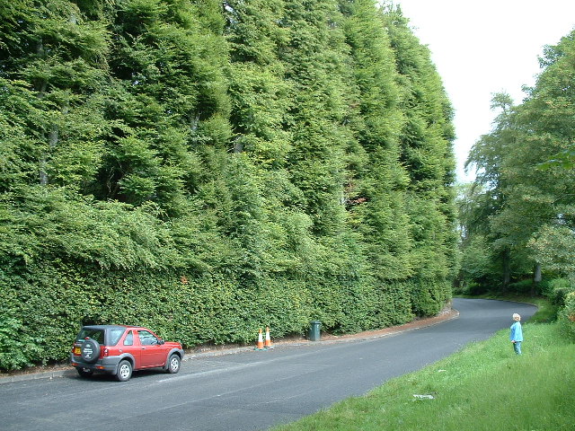
Meikleour Beech Hedges

The Meikleour Beech Hedge(s) (European Beech = Fagus sylvatica), located near Meikleour, Perth and Kinross, Scotland, was planted in the autumn of 1745...

River Isla, Perthshire

The River Isla (Scottish Gaelic: Abhainn Ìle) is a tributary of the River Tay in Angus and Perthshire, Scotland. It runs for 46 miles (74 km) through the...

Meikleour

Meikleour ( mi-KLOOR) is a village in Perth and Kinross, Scotland. It lies near the confluence of the Tay and the Isla in the valley of Strathmore, 12...

Meikleour Arms

Meikleour Arms (also known as the Meikleour Arms Hotel) is a Category B listed building in Meikleour, Perth and Kinross, Scotland. It dates to 1820, and...

Cargill railway station

Cargill railway station was in the Scottish county of Perth and Kinross. The station was opened by the Scottish Midland Junction Railway running between...

Woodside and Burrelton railway station

Woodside and Burrelton railway station was located in Burrelton in the Scottish county of Perth and Kinross. The station was opened by the Caledonian Railway...

Woodside, Perth and Kinross

Woodside (Scottish Gaelic: Both Bhùirnich) is a small village in Scotland, 12 miles (19 kilometres) from Perth, in the Perth and Kinross council area....

Burrelton

Burrelton is a small village in Scotland about 12 miles (19 kilometres) outside Perth. It is joined onto another smaller village, Woodside. The population...

Nearby Amenities

Located within 500m of 56.53669,-3.340978
Created By: almien_coastlines
Source: PGS
Lat/Long: 56.533248/-3.339351
Source: PGS
Lat/Long: 56.533437/-3.3379174
Source: PGS
Lat/Long: 56.5338304/-3.3362459
Source: PGS
Lat/Long: 56.5341038/-3.3356976
Source: PGS
Lat/Long: 56.5343203/-3.3350174
Source: PGS
Lat/Long: 56.5344623/-3.3345089
Source: PGS
Lat/Long: 56.5335501/-3.3361509
Source: PGS
Lat/Long: 56.5330719/-3.3383155
Source: PGS
Lat/Long: 56.5325744/-3.3438076
Source: PGS
Lat/Long: 56.5326832/-3.3430244
Source: PGS
Lat/Long: 56.5328169/-3.342371
Source: PGS
Lat/Long: 56.532927/-3.3416039
Source: PGS
Lat/Long: 56.5327264/-3.3401758
Source: PGS
Lat/Long: 56.5326229/-3.3409902
Source: PGS
Lat/Long: 56.5324069/-3.3419719
Created By: almien_coastlines
Source: PGS
Lat/Long: 56.533638/-3.337038
Source: PGS
Lat/Long: 56.534583/-3.3339188
Source: PGS
Lat/Long: 56.5341174/-3.3346403
Source: PGS
Lat/Long: 56.5339189/-3.3352491
Source: PGS
Lat/Long: 56.533211/-3.3372093
Source: PGS
Lat/Long: 56.5330719/-3.340384
Created By: almien_coastlines
Source: PGS
Lat/Long: 56.532833/-3.3395448
Power: pole
Lat/Long: 56.5329627/-3.3445824
Power: pole
Lat/Long: 56.5329843/-3.3431534
Power: pole
Lat/Long: 56.5330582/-3.3419038
Power: pole
Lat/Long: 56.5337859/-3.3410213
Power: pole
Lat/Long: 56.5343272/-3.3403491
Power: pole
Lat/Long: 56.5350128/-3.3394974
Power: pole
Lat/Long: 56.5355211/-3.3388892
Power: pole
Lat/Long: 56.5360794/-3.3381963
Power: pole
Lat/Long: 56.5366195/-3.3375262
Power: pole
Lat/Long: 56.5371698/-3.336854
Power: pole
Lat/Long: 56.5323862/-3.3414027
The data included in this document is from www.openstreetmap.org. The data is made available under ODbL.

Have you been to Black Hill ?

Leave your review of Black Hill below (or comments, questions and feedback).