Bardolfeston Village

Heritage Site in Dorset

England

Bardolfeston Village

Layby on the A35 Near Burleston looking west on a wet August morning.
Layby on the A35 Credit: Trevor Harris

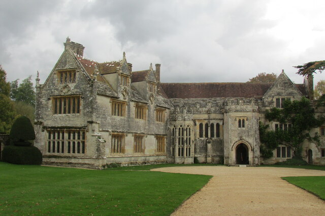
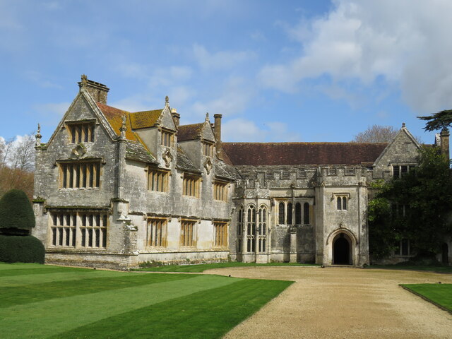
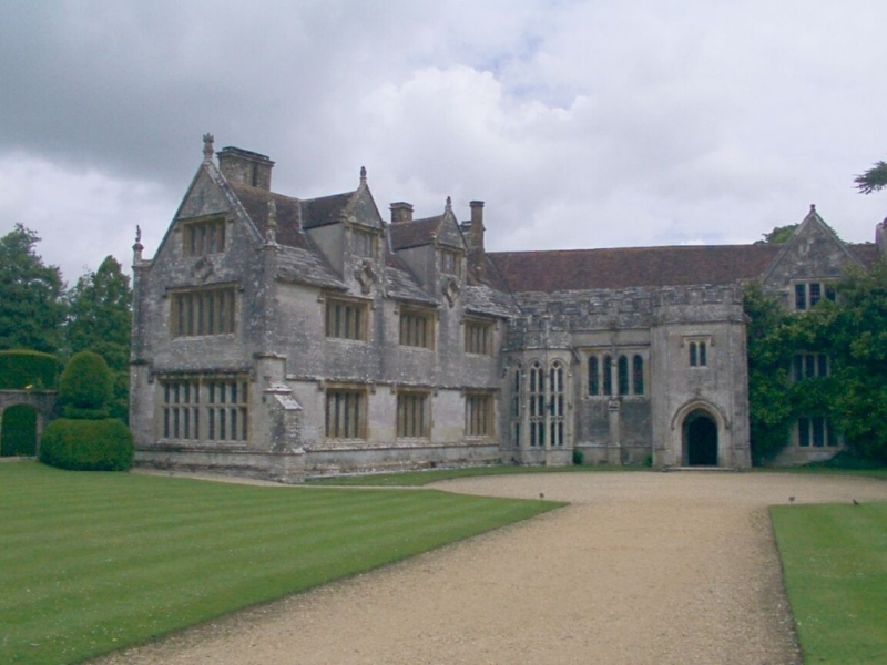
Bardolfeston Village, located in the picturesque county of Dorset, England, is a charming heritage site that offers a glimpse into the past. Steeped in history, this village is renowned for its well-preserved medieval architecture and traditional English charm.

Nestled amidst rolling green hills, Bardolfeston Village boasts a collection of ancient cottages, timber-framed houses, and thatched roofs that date back centuries. The village's narrow lanes and cobblestone streets add to its old-world charm, allowing visitors to immerse themselves in a bygone era.

One of the village's standout features is its historic church, St. Mary's, which dates back to the 12th century. This magnificent stone structure showcases stunning architectural details, including stained glass windows and a beautifully carved stone altar. The church serves as a hub for the local community and hosts regular services and events throughout the year.

Bardolfeston Village also offers visitors the opportunity to explore its rich agricultural heritage. The surrounding countryside is dotted with working farms and fields, where traditional farming practices are still carried out. For those interested in rural life, the village provides a unique opportunity to observe and learn about traditional farming methods and the importance of agriculture to the local economy.

Visitors to Bardolfeston Village can also enjoy a range of local amenities, including quaint tea rooms, traditional pubs, and charming shops selling locally produced crafts and goods. The village's warm and welcoming atmosphere, coupled with its well-preserved heritage, offers a delightful experience for history enthusiasts and tourists alike.

If you have any feedback on the listing, please let us know in the comments section below.

Bardolfeston Village Images

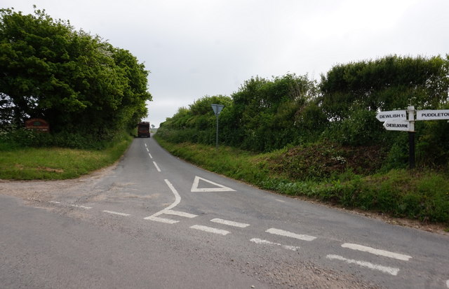
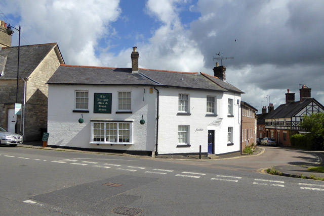
Images are sourced within 2km of 50.748/-2.333 or Grid Reference SY7694. Thanks to Geograph Open Source API. All images are credited.

Layby on the A35 Near Burleston looking west on a wet August morning.
Layby on the A35
Near Burleston looking west on a wet August morning.
Athelhampton House Dorset is blessed with some fine country houses.
Athelhampton House
Dorset is blessed with some fine country houses.
A35 bridge
A35 bridge
Athelhampton House One of West Dorset's finest country houses set by the River Piddle.
Athelhampton House
One of West Dorset's finest country houses set by the River Piddle.
Bridge over A35 north of Burleston It carries a farm track and public footpath over the shallow cutting.  The A35 is dropping to the stream known as Devil's Brook
Bridge over A35 north of Burleston
It carries a farm track and public footpath over the shallow cutting. The A35 is dropping to the stream known as Devil's Brook
A35 north-west of Burleston The end of a lay-by on the westbound carriageway, and a farm bridge with footpath in the background.  The nearer parapet of the bridge crosses the north-south gridline
A35 north-west of Burleston
The end of a lay-by on the westbound carriageway, and a farm bridge with footpath in the background. The nearer parapet of the bridge crosses the north-south gridline
Sign by the A35 ahead of A354 junction The A35 is a 97 mile long trunk road between Honiton and Southampton, via Poole and Bournemiouth. <span class="nowrap"><a title="http://www.sabre-roads.org.uk/wiki/index.php?title=A35" rel="nofollow ugc noopener" href="http://www.sabre-roads.org.uk/wiki/index.php?title=A35">Link</a><img style="margin-left:2px;" alt="External link" title="External link - shift click to open in new window" src="https://s1.geograph.org.uk/img/external.png" width="10" height="10"/></span>
Sign by the A35 ahead of A354 junction
The A35 is a 97 mile long trunk road between Honiton and Southampton, via Poole and Bournemiouth. LinkExternal link
Protected lay-by and farm bridge over A35 On the westbound carriageway approaching the Troy Town interchange
Protected lay-by and farm bridge over A35
On the westbound carriageway approaching the Troy Town interchange
St Mary's Church, Puddletown Puddletown was the inspiration for Wetherbury in Thomas Hardy's 'Far from the Madding Crowd' and the church was the setting where Captain Troy spends the night in the church porch after laying flowers on Fanny's grave.
St Mary's Church, Puddletown
Puddletown was the inspiration for Wetherbury in Thomas Hardy's 'Far from the Madding Crowd' and the church was the setting where Captain Troy spends the night in the church porch after laying flowers on Fanny's grave.
Athelhampton House main entrance
Athelhampton House through the main gateway
Puddletown: St. Mary's Church
Puddletown: The Square from St. Mary's Church
Road junction near Warren Hill Farm
Puddletown First School Puddletown C of E First School
Puddletown First School
Puddletown C of E First School
Entering Burleston A small hamlet, with a ruined church.
Entering Burleston
A small hamlet, with a ruined church.
Building on corner, Puddletown Grade II listed, early 19th century.
Building on corner, Puddletown
Grade II listed, early 19th century.
Building on large lay-by, Puddletown Shut up.
Building on large lay-by, Puddletown
Shut up.
Show me another place!

Bardolfeston Village is located at Grid Ref: SY7694 (Lat: 50.748, Lng: -2.333)

Unitary Authority: Dorset

Police Authority: Dorset

What 3 Words

///gravy.workroom.blacked. Near Puddletown, Dorset

Related Wikis

Nearby Amenities

Located within 500m of 50.748,-2.333
Dorset
Gns Classification: ADM1
Gns Uni: 6086908
Is In Country: United Kingdom
Is In Country Code: GB
Place: county
Source: GNS
Lat/Long: 50.75/-2.333333
Athelhampton
Place: village
Lat/Long: 50.746402/-2.3266853
Restaurant
Lat/Long: 50.7473911/-2.3274465
Material: wood
Power: pole
Source: bing
Lat/Long: 50.7439216/-2.3327926
Material: wood
Power: pole
Source: bing
Lat/Long: 50.7450695/-2.3334221
Material: wood
Power: pole
Source: bing
Lat/Long: 50.7459297/-2.3386631
Material: wood
Power: pole
Source: bing
Lat/Long: 50.7459603/-2.3338746
Material: wood
Power: pole
Source: bing
Lat/Long: 50.7461295/-2.337382
Material: wood
Power: pole
Source: bing
Lat/Long: 50.7465469/-2.3346911
Material: wood
Power: pole
Source: survey;bing
Switch: mechanical
Lat/Long: 50.7474382/-2.334629
Material: wood
Power: pole
Source: bing
Lat/Long: 50.7481856/-2.3324378
Material: wood
Note: Vertically stacked wires
Power: pole
Source: bing
Lat/Long: 50.7483902/-2.3345664
Material: wood
Power: pole
Source: bing
Lat/Long: 50.7487888/-2.3310783
Material: wood
Power: pole
Source: bing
Lat/Long: 50.7495459/-2.3305232
Material: wood
Power: pole
Source: bing
Lat/Long: 50.7502368/-2.3300224
Material: wood
Power: pole
Source: bing
Lat/Long: 50.7510359/-2.3294272
Entrance: main
Lat/Long: 50.7475328/-2.3266663
Entrance: yes
Lat/Long: 50.7474518/-2.3275947
Entrance: yes
Lat/Long: 50.7473425/-2.3273792
White Garden
Is In: Athelhampton House
Lat/Long: 50.7476024/-2.3260375
Power: pole
Source: bing
Transformer: distribution
Lat/Long: 50.7481047/-2.3316269
Power: pole
Source: bing
Lat/Long: 50.7463558/-2.336027
Henroost Wood
Place: locality
Lat/Long: 50.7449774/-2.331447
Colour: green
Fttc: yes
Man Made: street_cabinet
Manufacturer: Huawei
Operator: Openreach
Operator Wikidata: Q7096543
Ref: 7
Utility: telecom
Lat/Long: 50.746803/-2.3394616
Bus Stop
Zoar House
Bus: yes
Departures Board: no
Naptan AtcoCode: 1200POA10273
Naptan Bearing: E
Naptan CommonName: Zoar House
Naptan Indicator: E-bound
Naptan NaptanCode: doramtjm
Naptan Street: Athelhampton Road
Naptan Verified: no
Public Transport: platform
Shelter: no
Lat/Long: 50.7471625/-2.3377058
Bus Stop
Zoar House
Bus: yes
Departures Board: no
Naptan AtcoCode: 1200POA10272
Naptan Bearing: E
Naptan Indicator: E-bound
Naptan NaptanCode: doramtjp
Naptan Street: Athelhampton Road
Naptan Verified: yes
Public Transport: platform
Shelter: no
Source Date: 2024-03-03
Lat/Long: 50.7471125/-2.3376549
The data included in this document is from www.openstreetmap.org. The data is made available under ODbL.

Have you been to Bardolfeston Village?

Leave your review of Bardolfeston Village below (or comments, questions and feedback).