Barden Tower
Heritage Site in Yorkshire Craven
England
Barden Tower

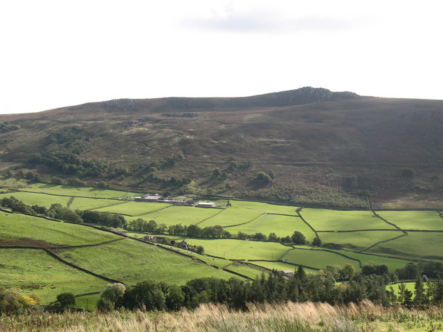
Barden Tower, located in the heart of the Yorkshire Dales National Park in North Yorkshire, England, is a magnificent heritage site that holds great historical significance. This medieval fortified house stands proudly on the banks of the River Wharfe, surrounded by picturesque landscapes, dense woodlands, and rolling hills.
Constructed in the late 15th century, Barden Tower was initially built as a hunting lodge for Henry Clifford, the 10th Lord de Clifford. Over the centuries, it evolved into a fortified residence and played a crucial role in the region's history. The tower witnessed several conflicts and sieges during the English Civil War in the 17th century.
The architecture of Barden Tower showcases a blend of medieval and Tudor styles. The stone structure features a square tower with four stories, each exhibiting distinctive architectural elements. The tower's interior boasts beautiful oak paneling, grand fireplaces, and impressive stone mullioned windows.
Today, Barden Tower stands as a fascinating heritage site open to the public, offering a glimpse into the past. Visitors can explore the tower's various rooms, including the Great Hall, the Lord's chamber, and the chapel. The surrounding gardens provide a tranquil setting to enjoy a leisurely stroll and admire the breathtaking views of the surrounding countryside.
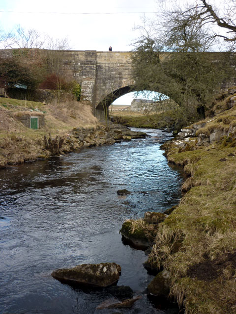
Barden Tower is also closely associated with the nearby ruins of Barden Bridge, Barden Chapel, and Bolton Abbey, all of which contribute to the historical significance and charm of the area. With its rich history and stunning setting, Barden Tower continues to captivate visitors and serves as a testament to Yorkshire's medieval heritage.
If you have any feedback on the listing, please let us know in the comments section below.
Barden Tower Images
Images are sourced within 2km of 54.013/-1.917 or Grid Reference SE0557. Thanks to Geograph Open Source API. All images are credited.
![A circular walk along the River Wharfe [8] The track is now somewhat higher above the water.
Starting from the Cavendish Pavilion, the walk follows the west bank of the River Wharfe upstream, passing The Strid, to the Barden Aqueduct Bridge. Crossing to the east bank, the walk continues downstream to return to the starting point. Just over 3½ miles.](https://s0.geograph.org.uk/geophotos/07/01/97/7019700_9fb6a40e.jpg)
![A circular walk along the River Wharfe [9] The river makes a bend to the right.
Starting from the Cavendish Pavilion, the walk follows the west bank of the River Wharfe upstream, passing The Strid, to the Barden Aqueduct Bridge. Crossing to the east bank, the walk continues downstream to return to the starting point. Just over 3½ miles.](https://s1.geograph.org.uk/geophotos/07/01/97/7019701_64868ed9.jpg)
![A circular walk along the River Wharfe [10] The Strid is a 15 foot (4.6 m) deep underwater channel caused by the narrowing of the river from 90 ft (27 m) wide, just to the north, to the width of a long stride less than 300 ft (91 m) later. It is especially dangerous as both banks are undercut. Its name comes from the Old English Stryth, meaning 'turmoil'. This was later corrupted to Strid, referring to 'the possibility of striding across'.
Starting from the Cavendish Pavilion, the walk follows the west bank of the River Wharfe upstream, passing The Strid, to the Barden Aqueduct Bridge. Crossing to the east bank, the walk continues downstream to return to the starting point. Just over 3½ miles.](https://s2.geograph.org.uk/geophotos/07/01/97/7019702_55b158f6.jpg)
![A circular walk along the River Wharfe [11] This part of The Strid looks deceptively calm. The Strid is a 15 foot (4.6 m) deep underwater channel caused by the narrowing of the river from 90 ft (27 m) wide, just to the north, to the width of a long stride less than 300 ft (91 m) later. It is especially dangerous as both banks are undercut. Its name comes from the Old English Stryth, meaning 'turmoil'. This was later corrupted to Strid, referring to 'the possibility of striding across'.
Starting from the Cavendish Pavilion, the walk follows the west bank of the River Wharfe upstream, passing The Strid, to the Barden Aqueduct Bridge. Crossing to the east bank, the walk continues downstream to return to the starting point. Just over 3½ miles.](https://s3.geograph.org.uk/geophotos/07/01/97/7019703_05b8e8b5.jpg)
![A circular walk along the River Wharfe [12] A view of the top of The Strid as the river narrows. The Strid is a 15 foot (4.6 m) deep underwater channel caused by the narrowing of the river from 90 ft (27 m) wide, just to the north, to the width of a long stride less than 300 ft (91 m) later. It is especially dangerous as both banks are undercut. Its name comes from the Old English Stryth, meaning 'turmoil'. This was later corrupted to Strid, referring to 'the possibility of striding across'.
Starting from the Cavendish Pavilion, the walk follows the west bank of the River Wharfe upstream, passing The Strid, to the Barden Aqueduct Bridge. Crossing to the east bank, the walk continues downstream to return to the starting point. Just over 3½ miles.](https://s1.geograph.org.uk/geophotos/07/01/97/7019705_a9519a71.jpg)
![A circular walk along the River Wharfe [13] The path continues through calm and peaceful Strid Wood in contrast to the tumult of the river below.
Starting from the Cavendish Pavilion, the walk follows the west bank of the River Wharfe upstream, passing The Strid, to the Barden Aqueduct Bridge. Crossing to the east bank, the walk continues downstream to return to the starting point. Just over 3½ miles.](https://s3.geograph.org.uk/geophotos/07/01/97/7019707_818019fe.jpg)
![A circular walk along the River Wharfe [14] The river is wider here before it begins to narrow to The Strid.
Starting from the Cavendish Pavilion, the walk follows the west bank of the River Wharfe upstream, passing The Strid, to the Barden Aqueduct Bridge. Crossing to the east bank, the walk continues downstream to return to the starting point. Just over 3½ miles.](https://s0.geograph.org.uk/geophotos/07/01/97/7019708_1f2b9a50.jpg)
![A circular walk along the River Wharfe [15] The path is carried over Bardon Beck on this footbridge.
Starting from the Cavendish Pavilion, the walk follows the west bank of the River Wharfe upstream, passing The Strid, to the Barden Aqueduct Bridge. Crossing to the east bank, the walk continues downstream to return to the starting point. Just over 3½ miles.](https://s1.geograph.org.uk/geophotos/07/01/97/7019709_498db184.jpg)
![A circular walk along the River Wharfe [16] The Barden Aqueduct Bridge carries the Nidd Aqueduct over the river. The aqueduct carries water from Angram and Scar House reservoirs in upper Nidderdale to Bradford in West Yorkshire.
Starting from the Cavendish Pavilion, the walk follows the west bank of the River Wharfe upstream, passing The Strid, to the Barden Aqueduct Bridge. Crossing to the east bank, the walk continues downstream to return to the starting point. Just over 3½ miles.](https://s2.geograph.org.uk/geophotos/07/01/97/7019710_6a8907e2.jpg)
![A circular walk along the River Wharfe [17] The path across the Barden Aqueduct Bridge which carries the Nidd Aqueduct over the river.
Starting from the Cavendish Pavilion, the walk follows the west bank of the River Wharfe upstream, passing The Strid, to the Barden Aqueduct Bridge. Crossing to the east bank, the walk continues downstream to return to the starting point. Just over 3½ miles.](https://s3.geograph.org.uk/geophotos/07/01/97/7019711_117d0d9b.jpg)
![A circular walk along the River Wharfe [18] The view upstream from Barden Aqueduct Bridge which carries the Nidd Aqueduct over the river.
Starting from the Cavendish Pavilion, the walk follows the west bank of the River Wharfe upstream, passing The Strid, to the Barden Aqueduct Bridge. Crossing to the east bank, the walk continues downstream to return to the starting point. Just over 3½ miles.](https://s0.geograph.org.uk/geophotos/07/01/97/7019716_08bffd71.jpg)
![A circular walk along the River Wharfe [19] The view downstream from Barden Aqueduct Bridge which carries the Nidd Aqueduct over the river.
Starting from the Cavendish Pavilion, the walk follows the west bank of the River Wharfe upstream, passing The Strid, to the Barden Aqueduct Bridge. Crossing to the east bank, the walk continues downstream to return to the starting point. Just over 3½ miles.](https://s2.geograph.org.uk/geophotos/07/01/97/7019718_db26f0d4.jpg)
![A circular walk along the River Wharfe [20] An uncomfortable looking seat alongside the river.
Starting from the Cavendish Pavilion, the walk follows the west bank of the River Wharfe upstream, passing The Strid, to the Barden Aqueduct Bridge. Crossing to the east bank, the walk continues downstream to return to the starting point. Just over 3½ miles.](https://s2.geograph.org.uk/geophotos/07/01/97/7019722_2b6a5ea8.jpg)
Barden Tower is located at Grid Ref: SE0557 (Lat: 54.013, Lng: -1.917)
Division: West Riding
Administrative County: North Yorkshire
District: Craven
Police Authority: North Yorkshire
What 3 Words
///bucks.downward.diplomats. Near Embsay, North Yorkshire
Nearby Locations
Related Wikis
Nearby Amenities
Located within 500m of 54.013,-1.917Have you been to Barden Tower?
Leave your review of Barden Tower below (or comments, questions and feedback).


