West End

Settlement in Yorkshire Richmondshire

England

West End

The Cow Pasture Barn Hawes, North Yorkshire.
The Cow Pasture Barn Credit: Andrew Abbott

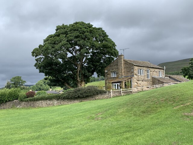
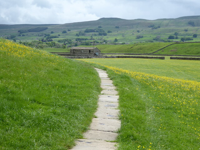
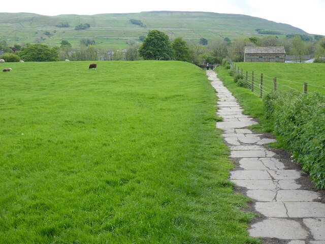
West End is a small village located in the county of Yorkshire, England. Situated in the heart of the Yorkshire Dales, this picturesque village offers stunning natural beauty and a peaceful rural atmosphere.

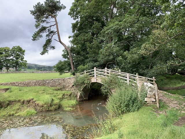
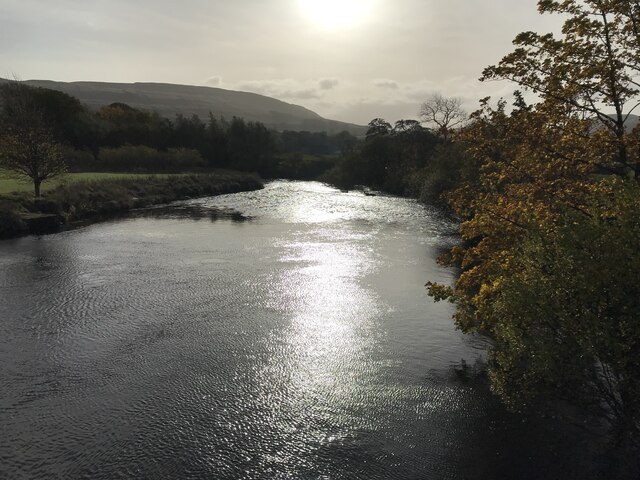
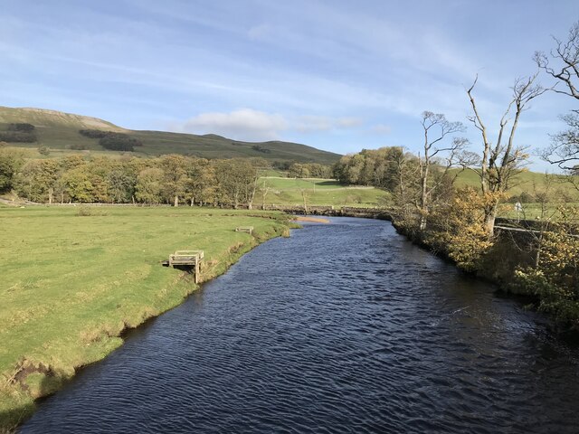
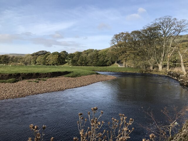
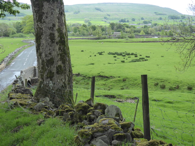
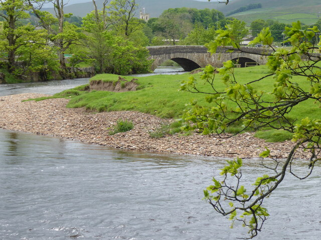
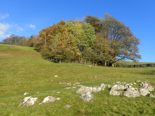
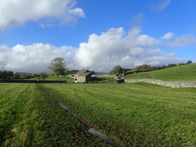
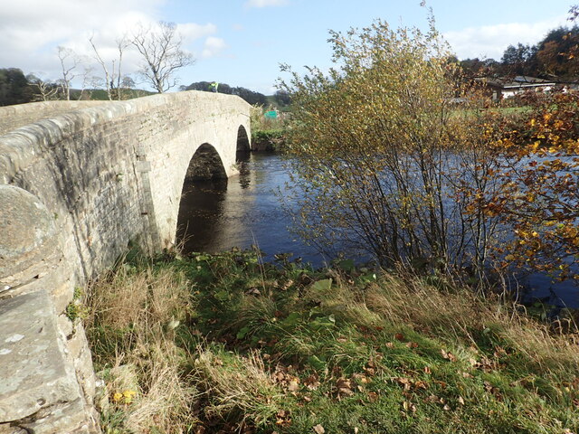
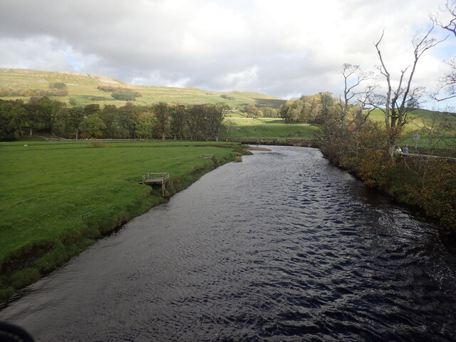
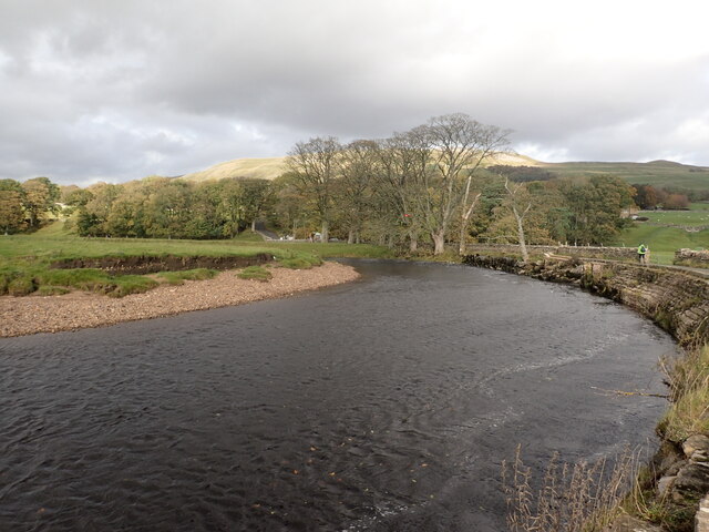
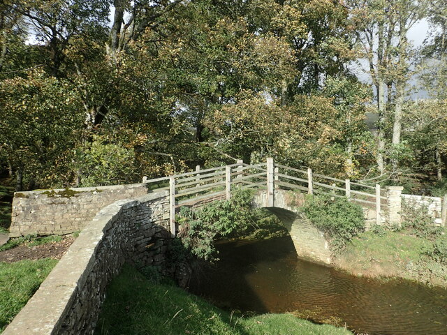
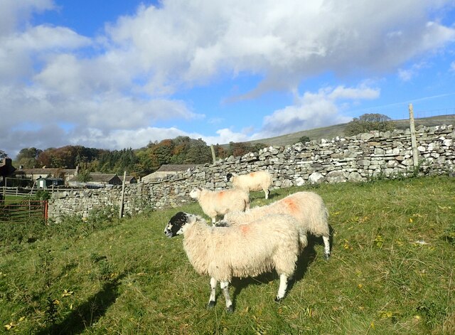
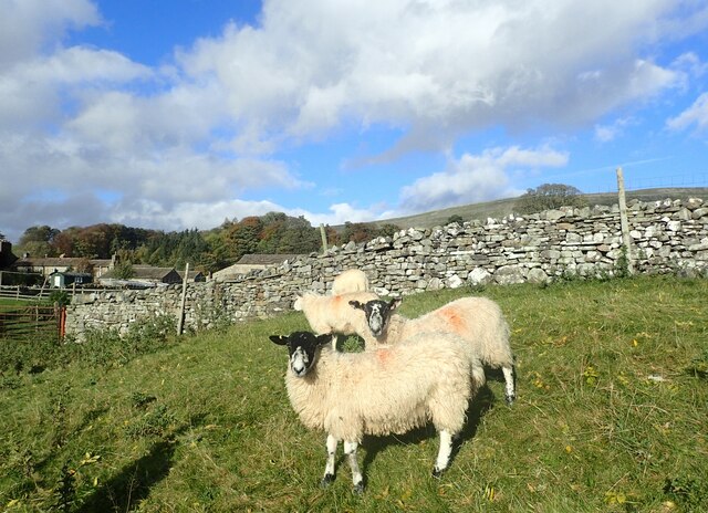
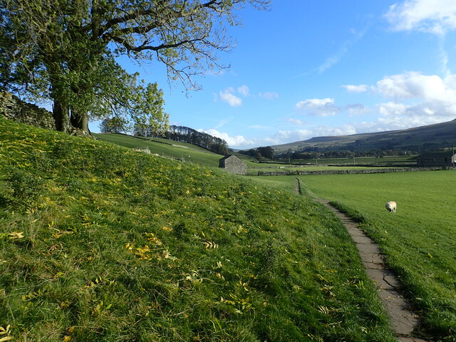
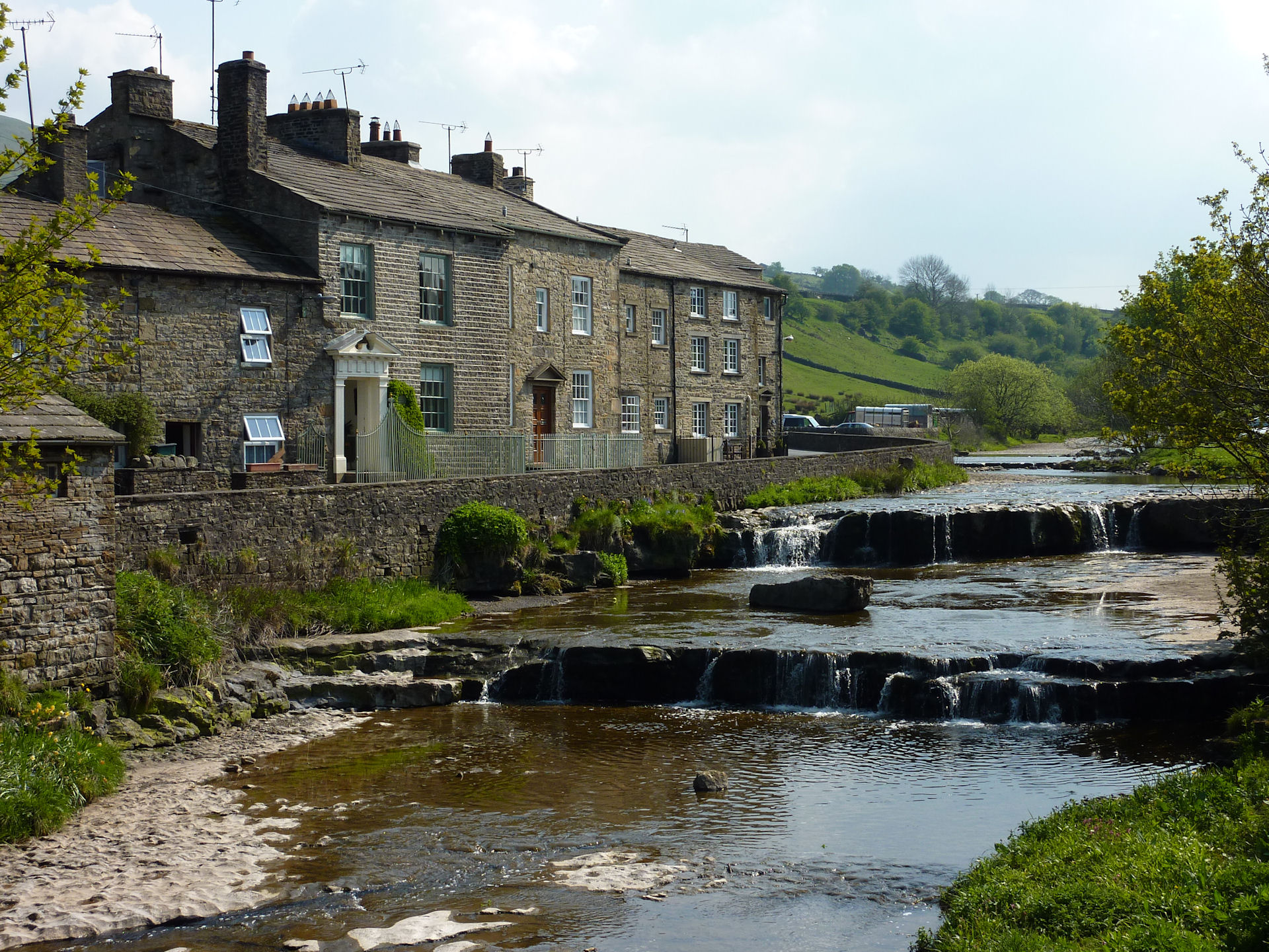
With a population of around 500 residents, West End maintains its traditional charm, characterized by its stone-built cottages and narrow winding streets. The village is surrounded by rolling hills, lush green meadows, and scenic landscapes, making it a popular destination for nature enthusiasts and hikers. The nearby River Wharfe adds to the village's tranquility, offering peaceful riverside walks and fishing opportunities.

Despite its small size, West End boasts a vibrant community spirit. The village has a local pub, The Wharfe Inn, which serves as a gathering place for locals and visitors alike. Additionally, the village hosts an annual summer fair, bringing together residents for a day of festivities and celebration.

West End is well-connected to nearby towns and cities, with regular bus services providing easy access to surrounding areas. The village is also just a short drive away from larger market towns, offering a range of amenities, including shops, restaurants, and leisure facilities.

Overall, West End, Yorkshire offers a perfect blend of rural tranquility and community spirit, making it an idyllic place to reside or visit for those seeking a slower pace of life and a connection with nature.

If you have any feedback on the listing, please let us know in the comments section below.

West End Images

Images are sourced within 2km of 54.297764/-2.20449 or Grid Reference SD8689. Thanks to Geograph Open Source API. All images are credited.

The Cow Pasture Barn Hawes, North Yorkshire.
The Cow Pasture Barn
Hawes, North Yorkshire.
Footbridge over the stream Near the River Ure.
Footbridge over the stream
Near the River Ure.
River Ure
River Ure
River Ure
River Ure
River Ure
River Ure
The Pennine Way near Hardraw
The Pennine Way near Haylands Bridge
Haylands Bridge from the Pennine Way
The Pennine Way near Brandymires
Autumn colours near Hardraw This is on the footpath between Hardraw and Burnt Acres Road.
Autumn colours near Hardraw
This is on the footpath between Hardraw and Burnt Acres Road.
Pennine Way to Hardraw This is on the Pennine Way between Burnt Acres Road and Hardraw which is a short distance ahead. The narrow-paved path helped a little across the rather wet field.
Pennine Way to Hardraw
This is on the Pennine Way between Burnt Acres Road and Hardraw which is a short distance ahead. The narrow-paved path helped a little across the rather wet field.
Bridge over the River Ure This is Burnt Acres Road.
Bridge over the River Ure
This is Burnt Acres Road.
River Ure This is looking upriver from where Burnt Acres Road is carried over the river. The road then bends round to the left to follow the river on the right here.
River Ure
This is looking upriver from where Burnt Acres Road is carried over the river. The road then bends round to the left to follow the river on the right here.
River Ure alongside Burnt Acres Road This is looking upriver from just after where Burnt Acres Road is carried over the river. The road then bends round to the left to follow the river on the right here.
River Ure alongside Burnt Acres Road
This is looking upriver from just after where Burnt Acres Road is carried over the river. The road then bends round to the left to follow the river on the right here.
Old footbridge over a tributary of the Ure This tributary reaches the Ure a short way to the right. The path leads from Burnt Acres Road to Bellow Hill.
Old footbridge over a tributary of the Ure
This tributary reaches the Ure a short way to the right. The path leads from Burnt Acres Road to Bellow Hill.
Sheep next to the Pennine Way These Swaledale sheep are in Wensleydale, just outside Hardraw.
Sheep next to the Pennine Way
These Swaledale sheep are in Wensleydale, just outside Hardraw.
Swaledale sheep in Wensleydale These Swaledale sheep are in Wensleydale, just outside Hardraw. They are standing next to the Pennine Way.
Swaledale sheep in Wensleydale
These Swaledale sheep are in Wensleydale, just outside Hardraw. They are standing next to the Pennine Way.
The Pennine Way near Hardraw The Pennine Way here is on its way from Hardraw to Hawes.
The Pennine Way near Hardraw
The Pennine Way here is on its way from Hardraw to Hawes.
Show me another place!

West End is located at Grid Ref: SD8689 (Lat: 54.297764, Lng: -2.20449)

Division: North Riding

Administrative County: North Yorkshire

District: Richmondshire

Police Authority: North Yorkshire

What 3 Words

///spoken.mount.pavilions. Near Sedbergh, Cumbria

Related Wikis

Gayle, North Yorkshire

Gayle is a hamlet 0.4-mile (0.64 km) south of Hawes in Wensleydale, North Yorkshire, England. It is noted for the beck that flows through it and the old...

Gayle Mill, North Yorkshire

Gayle Mill, dating from about 1784, is thought to be the oldest structurally unaltered cotton mill in existence. It is located in the Wensleydale hamlet...

St Margaret's Church, Hawes

St Margaret's Church is a Grade II listed parish church in the Church of England: 184  in Hawes, North Yorkshire. == History == Also known as Church of...

Hawes

Hawes is a market town and civil parish in North Yorkshire, England, at the head of Wensleydale in the Yorkshire Dales, and historically in the North Riding...

Nearby Amenities

Located within 500m of 54.297764,-2.20449
Gayle
Place: village
Wikidata: Q3695969
Wikipedia: en:Gayle, North Yorkshire
Lat/Long: 54.2990601/-2.2003907
Place Of Worship
Gayle Methodist Church
Denomination: methodist
Religion: christian
Lat/Long: 54.2988602/-2.2007315
Post Box
Collection Times: Mo-Fr 09:00; Sa 07:00
Operator: Royal Mail
Operator Wikidata: Q638098
Post Box Type: wall
Ref: DL8 133D
Royal Cypher: EIIR
Royal Cypher Wikidata: Q33102113
Source: survey
Survey Date: 2015-06-25
Lat/Long: 54.2989896/-2.1998974
Bench
Backrest: yes
Description: Presented by Gale Ladies
Start Date: 1990-03-29
Lat/Long: 54.2989036/-2.199258
Telephone
Booth: K6
Covered: booth
Listed Status: Grade II
Operator: BT
Payment Coins: no
Phone: +44 1969 667243
Wikidata: Q26544843
Lat/Long: 54.2989303/-2.199237
Bus Stop
Bus: yes
Departures Board: timetable
Lit: yes
Naptan AtcoCode: 3200YNB00981
Naptan NaptanCode: 32000981
Opposite: yes
Public Transport: platform
Shelter: yes
Lat/Long: 54.3001782/-2.2005894
Hazard Backward: children
Lat/Long: 54.3015761/-2.2013626
Power: substation
Lat/Long: 54.3002423/-2.200364
Hazard Forward: children
Lat/Long: 54.3003961/-2.2006483
Grit Bin
Lat/Long: 54.2989944/-2.2012863
Barrier: stile
Lat/Long: 54.2961357/-2.2062314
Barrier: stile
Foot: yes
Stile: squeezer
Lat/Long: 54.3002069/-2.2005798
Barrier: stile
Material: stone
Source: survey;gps
Stile: squeezer
Lat/Long: 54.2973549/-2.199569
Information: guidepost
Tourism: information
Lat/Long: 54.2989171/-2.1992785
Generator Method: photovoltaic
Generator Output Electricity: yes
Generator Source: solar
Generator Type: solar_photovoltaic_panel
Power: generator
Lat/Long: 54.3007275/-2.2015907
Power: pole
Lat/Long: 54.2992908/-2.1973005
Power: pole
Lat/Long: 54.2988455/-2.1986362
Power: pole
Lat/Long: 54.2992595/-2.1991928
Power: pole
Lat/Long: 54.3010059/-2.2010108
Power: pole
Lat/Long: 54.2999904/-2.19906
Power: pole
Lat/Long: 54.3004889/-2.1989796
Power: pole
Lat/Long: 54.3015442/-2.2016189
Power: pole
Lat/Long: 54.3016417/-2.202561
Power: pole
Lat/Long: 54.3021852/-2.2037029
Power: pole
Lat/Long: 54.3002956/-2.2000699
Power: pole
Lat/Long: 54.3007214/-2.1989594
Give Way
Lat/Long: 54.2988669/-2.1992167
Give Way
Direction: backward
Lat/Long: 54.2990379/-2.1999113
Power: pole
Lat/Long: 54.2935786/-2.2026059
Power: pole
Lat/Long: 54.2934428/-2.2034173
Power: pole
Lat/Long: 54.2940783/-2.2074956
Power: pole
Lat/Long: 54.2944227/-2.2084156
Power: pole
Lat/Long: 54.2946912/-2.2090942
Power: pole
Lat/Long: 54.2954449/-2.2110549
Power: pole
Lat/Long: 54.2945832/-2.2088373
Power: pole
Lat/Long: 54.3008255/-2.2099277
Power: pole
Lat/Long: 54.3009792/-2.2091927
Power: pole
Lat/Long: 54.3018119/-2.2043902
Power: pole
Lat/Long: 54.3012825/-2.2053686
Power: pole
Lat/Long: 54.3011643/-2.2069564
Power: pole
Lat/Long: 54.3010864/-2.2078865
Barrier: stile
Lat/Long: 54.2965104/-2.204091
Barrier: stile
Lat/Long: 54.2976102/-2.2047744
Barrier: stile
Lat/Long: 54.2971998/-2.2044691
Give Way
Lat/Long: 54.301845/-2.2013031
Give Way
Lat/Long: 54.2990652/-2.2015223
Give Way
Lat/Long: 54.2999287/-2.2003701
Give Way
Lat/Long: 54.3007839/-2.2009859
Barrier: stile
Lat/Long: 54.2954991/-2.205065
Barrier: stile
Lat/Long: 54.2938634/-2.2064955
Barrier: stile
Lat/Long: 54.2943683/-2.2055603
Barrier: stile
Lat/Long: 54.2986825/-2.1984426
Power: pole
Lat/Long: 54.2934616/-2.205905
Barrier: stile
Stile: squeezer
Lat/Long: 54.2990873/-2.2030144
Barrier: stile
Lat/Long: 54.2957839/-2.2080927
Power: pole
Lat/Long: 54.2995659/-2.2002087
Power: pole
Lat/Long: 54.3005109/-2.2016068
Power: pole
Lat/Long: 54.3002385/-2.201419
Power: pole
Lat/Long: 54.3000499/-2.2012896
Power: pole
Lat/Long: 54.3001262/-2.2009121
Power: pole
Lat/Long: 54.3002139/-2.2005708
Power: pole
Lat/Long: 54.3005022/-2.2007954
Power: pole
Lat/Long: 54.3008677/-2.2010864
Power: pole
Lat/Long: 54.3010931/-2.2012601
Power: pole
Lat/Long: 54.3014355/-2.2002328
Power: pole
Lat/Long: 54.3014092/-2.2011709
Power: pole
Lat/Long: 54.2981028/-2.2027963
Power: pole
Lat/Long: 54.2981028/-2.2030753
Power: pole
Lat/Long: 54.2985892/-2.2012333
Power: pole
Lat/Long: 54.2990521/-2.2011642
Power: pole
Lat/Long: 54.2985688/-2.2043493
Power: pole
Lat/Long: 54.2987218/-2.2039423
Power: pole
Lat/Long: 54.2990932/-2.2030156
Power: pole
Lat/Long: 54.2991108/-2.2017851
Power: pole
Lat/Long: 54.2975448/-2.2052968
Power: pole
Lat/Long: 54.2977068/-2.2044868
Power: pole
Lat/Long: 54.2978414/-2.2038317
Power: pole
Lat/Long: 54.2979603/-2.2032322
Barrier: stile
Lat/Long: 54.2989579/-2.2088643
Information: guidepost
Tourism: information
Lat/Long: 54.2996586/-2.2091287
Barrier: stile
Stile: squeezer
Lat/Long: 54.2989556/-2.2034855
Generator Method: photovoltaic
Generator Output Electricity: yes
Generator Source: solar
Generator Type: solar_photovoltaic_panel
Power: generator
Lat/Long: 54.2985618/-2.1999369
Entrance: main
Lat/Long: 54.3010325/-2.201018
Barrier: stile
Stile: squeezer
Lat/Long: 54.2948495/-2.2061698
Barrier: stile
Stile: squeezer
Lat/Long: 54.2945844/-2.2073339
Barrier: stile
Stile: squeezer
Lat/Long: 54.2942834/-2.2081733
Generator Method: photovoltaic
Generator Output Electricity: yes
Generator Source: solar
Generator Type: solar_photovoltaic_panel
Power: generator
Lat/Long: 54.2986726/-2.2028498
Generator Method: photovoltaic
Generator Output Electricity: yes
Generator Source: solar
Generator Type: solar_photovoltaic_panel
Power: generator
Lat/Long: 54.2984847/-2.2038462
Information: guidepost
Tourism: information
Lat/Long: 54.2964987/-2.2040447
The data included in this document is from www.openstreetmap.org. The data is made available under ODbL.

Have you been to West End?

Leave your review of West End below (or comments, questions and feedback).