Gayle

Settlement in Yorkshire Richmondshire

England

Gayle

Stone House Manor Grade II listed. Listing number 1167238.
1908. By architect Percy Morley Horder of London, for Hugh Arden Crallan (1867- 1929).
Stone House Manor Credit: Andrew Abbott

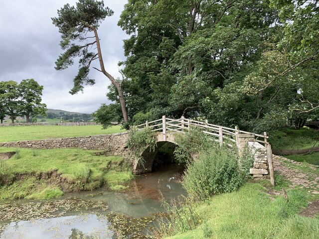
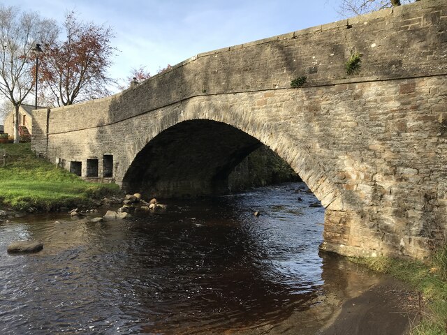
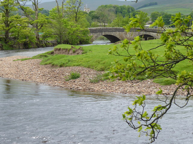
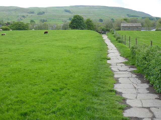
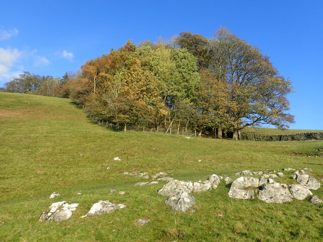
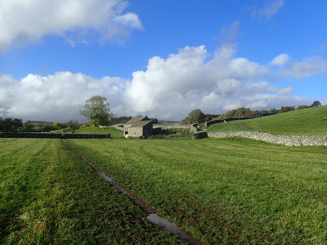
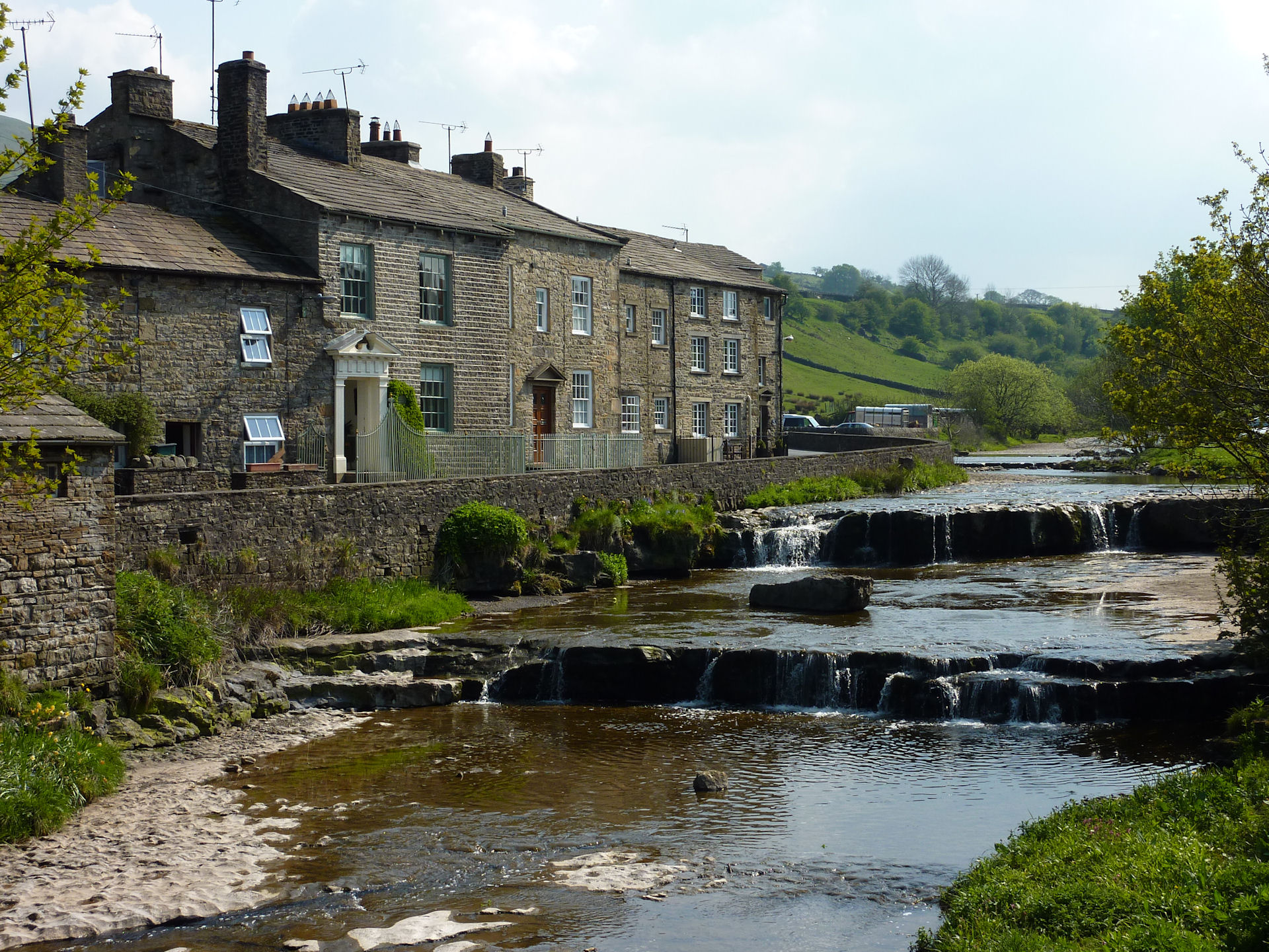
Gayle is a small village located in the Yorkshire Dales National Park, in North Yorkshire, England. Situated just a short distance from the market town of Hawes, Gayle is surrounded by picturesque countryside and stunning natural beauty. With a population of around 150 residents, the village offers a peaceful and tranquil atmosphere.

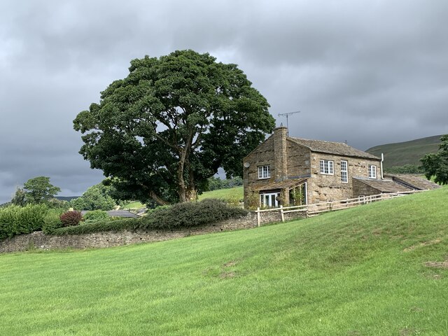
The village of Gayle is known for its charming stone houses, many of which date back to the 17th and 18th centuries. These traditional buildings add to the village's historic and rustic appeal. The local community takes great pride in maintaining the village's character and preserving its heritage.

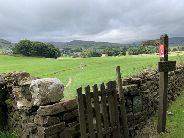
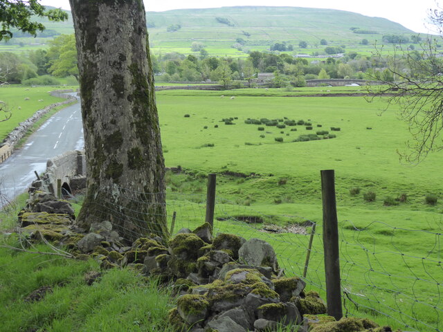
Gayle is renowned for its traditional farming practices, and visitors can often see sheep grazing in the surrounding fields. The village also has a strong connection to the textile industry, with several small mills and workshops producing wool and other fabrics.

One of the main attractions in Gayle is Gayle Mill, a restored 19th-century sawmill that showcases the industrial heritage of the area. The mill offers guided tours, allowing visitors to learn about the history of the mill and the woodworking techniques used in the past.

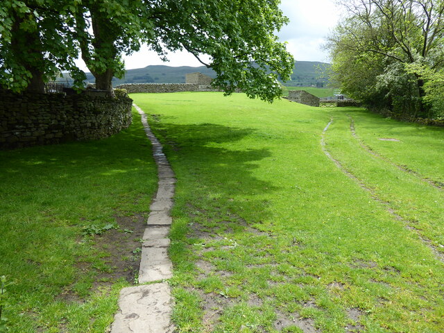
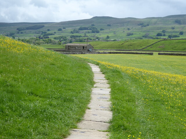
For outdoor enthusiasts, Gayle is an ideal destination. The village is surrounded by rolling hills, providing ample opportunities for hiking, cycling, and exploring the picturesque countryside. The nearby Wensleydale Creamery, famous for its production of Yorkshire Wensleydale cheese, is also well worth a visit.

Overall, Gayle offers a perfect escape for those seeking a tranquil and traditional village experience amidst the breathtaking landscapes of the Yorkshire Dales.

If you have any feedback on the listing, please let us know in the comments section below.
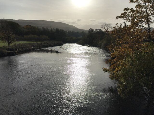
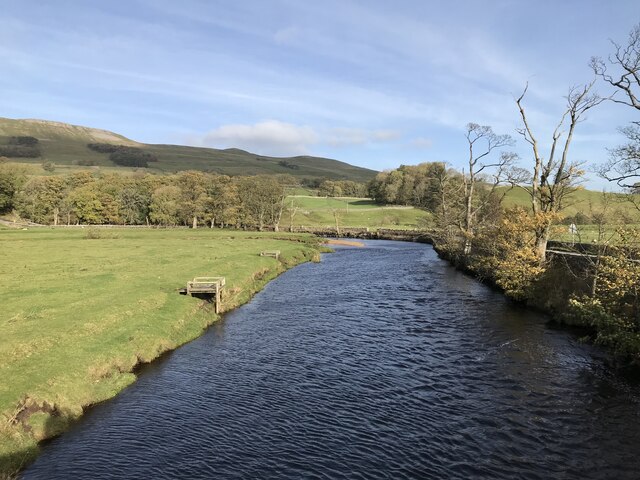
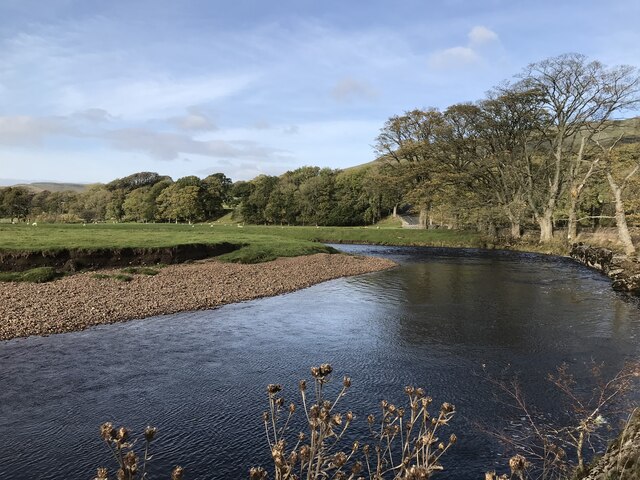
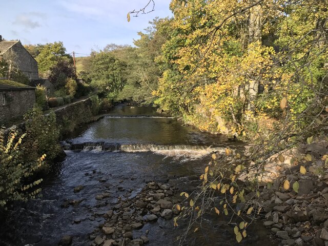
Gayle Images

Images are sourced within 2km of 54.299599/-2.203567 or Grid Reference SD8689. Thanks to Geograph Open Source API. All images are credited.

Stone House Manor Grade II listed. Listing number 1167238.
1908. By architect Percy Morley Horder of London, for Hugh Arden Crallan (1867- 1929).
Stone House Manor
Grade II listed. Listing number 1167238. 1908. By architect Percy Morley Horder of London, for Hugh Arden Crallan (1867- 1929).
Footpath to Haylands Bridge Above Hawes.
Footpath to Haylands Bridge
Above Hawes.
The Cow Pasture Barn Hawes, North Yorkshire.
The Cow Pasture Barn
Hawes, North Yorkshire.
Footbridge over the stream Near the River Ure.
Footbridge over the stream
Near the River Ure.
Dry stone wall on north side of road into Hardraw from the west Ordnance Survey documents indicate that a benchmark levelled at 232.477m above Newlyn Datum was verified in 1954 on a stone at the base of the wall
Dry stone wall on north side of road into Hardraw from the west
Ordnance Survey documents indicate that a benchmark levelled at 232.477m above Newlyn Datum was verified in 1954 on a stone at the base of the wall
River Ure
River Ure
River Ure
River Ure
River Ure
River Ure
Hardraw Beck
Hardraw Beck
Hardraw Bridge
Hardraw Bridge
The Pennine Way near Hardraw
The Pennine Way near Haylands Bridge
Haylands Bridge from the Pennine Way
The Pennine Way near Brandymires
The Cart House, Hardraw Tea room, shop and campsite office. The name gives a clue to its probable earlier use.
The Cart House, Hardraw
Tea room, shop and campsite office. The name gives a clue to its probable earlier use.
Autumn colours near Hardraw This is on the footpath between Hardraw and Burnt Acres Road.
Autumn colours near Hardraw
This is on the footpath between Hardraw and Burnt Acres Road.
Pennine Way to Hardraw This is on the Pennine Way between Burnt Acres Road and Hardraw which is a short distance ahead. The narrow-paved path helped a little across the rather wet field.
Pennine Way to Hardraw
This is on the Pennine Way between Burnt Acres Road and Hardraw which is a short distance ahead. The narrow-paved path helped a little across the rather wet field.
Show me another place!

Gayle is located at Grid Ref: SD8689 (Lat: 54.299599, Lng: -2.203567)

Division: North Riding

Administrative County: North Yorkshire

District: Richmondshire

Police Authority: North Yorkshire

What 3 Words

///baking.renews.estuaries. Near Sedbergh, Cumbria

Related Wikis

Gayle, North Yorkshire

Gayle is a hamlet 0.4-mile (0.64 km) south of Hawes in Wensleydale, North Yorkshire, England. It is noted for the beck that flows through it and the old...

Gayle Mill, North Yorkshire

Gayle Mill, dating from about 1784, is thought to be the oldest structurally unaltered cotton mill in existence. It is located in the Wensleydale hamlet...

St Margaret's Church, Hawes

St Margaret's Church is a Grade II listed parish church in the Church of England: 184  in Hawes, North Yorkshire. == History == Also known as Church of...

Hawes

Hawes is a market town and civil parish in North Yorkshire, England, at the head of Wensleydale in the Yorkshire Dales, and historically in the North Riding...

Nearby Amenities

Located within 500m of 54.299599,-2.203567
Gayle
Place: village
Wikidata: Q3695969
Wikipedia: en:Gayle, North Yorkshire
Lat/Long: 54.2990601/-2.2003907
Place Of Worship
Gayle Methodist Church
Denomination: methodist
Religion: christian
Lat/Long: 54.2988602/-2.2007315
Barrier: stile
Lat/Long: 54.3016816/-2.1986935
Bench
Backrest: yes
Lat/Long: 54.3020565/-2.2011711
Post Box
Collection Times: Mo-Fr 09:00; Sa 07:00
Operator: Royal Mail
Operator Wikidata: Q638098
Post Box Type: wall
Ref: DL8 133D
Royal Cypher: EIIR
Royal Cypher Wikidata: Q33102113
Source: survey
Survey Date: 2015-06-25
Lat/Long: 54.2989896/-2.1998974
Bench
Backrest: yes
Description: Presented by Gale Ladies
Start Date: 1990-03-29
Lat/Long: 54.2989036/-2.199258
Telephone
Booth: K6
Covered: booth
Listed Status: Grade II
Operator: BT
Payment Coins: no
Phone: +44 1969 667243
Wikidata: Q26544843
Lat/Long: 54.2989303/-2.199237
Bus Stop
Bus: yes
Departures Board: timetable
Lit: yes
Naptan AtcoCode: 3200YNB00981
Naptan NaptanCode: 32000981
Opposite: yes
Public Transport: platform
Shelter: yes
Lat/Long: 54.3001782/-2.2005894
Bench
Backrest: no
Lat/Long: 54.3018289/-2.1985928
Wensleydale Creamery
Addr City: Hawes
Addr Postcode: DL8 3RN
Addr Street: Gayle Lane
Attraction: local_producer
Description: Dairy producing EU protected geographical indication Yorkshire Wensleydale cheese. Dairy, cafe, shop and "museum"
Fee: no
Operator: Wensleydale Dairy Products Limited
Tourism: attraction
Website: https://www.wensleydale.co.uk/
Lat/Long: 54.3021677/-2.2007005
Hazard Backward: children
Lat/Long: 54.3015761/-2.2013626
Power: substation
Lat/Long: 54.3002423/-2.200364
Hazard Forward: children
Lat/Long: 54.3003961/-2.2006483
Grit Bin
Lat/Long: 54.2989944/-2.2012863
Stony Haw
Man Made: survey_point
Natural: peak
Source: OS 1:25k
Lat/Long: 54.3027/-2.1992885
Barrier: stile
Lat/Long: 54.2961357/-2.2062314
Barrier: stile
Foot: yes
Stile: squeezer
Lat/Long: 54.3002069/-2.2005798
Cafe
1897 Coffee Shop
Cuisine: coffee_shop
Description: Part of Wensleydale Creamery. Serves tea, coffee, cheese, sandwiches
Operator: Wensleydale Dairy Products Limited
Lat/Long: 54.3022166/-2.2010427
Cheese Shop
Operator: Wensleydale Dairy Products Limited
Shop: deli
Website: https://www.wensleydale.co.uk/
Lat/Long: 54.3023293/-2.2007691
Barrier: stile
Material: stone
Source: survey;gps
Stile: squeezer
Lat/Long: 54.2973549/-2.199569
Barrier: stile
Lat/Long: 54.3030102/-2.1989085
Restaurant
Calvert's Restaurant
Cuisine: regional
Description: Part of Wensleydale Creamery. Serves tea, coffee, cheese, sandwiches
Operator: Wensleydale Dairy Products Limited
Lat/Long: 54.3021837/-2.2008452
Vending Machine
Vending: parking_tickets
Lat/Long: 54.3035486/-2.2006823
Information: guidepost
Tourism: information
Lat/Long: 54.2989171/-2.1992785
Generator Method: photovoltaic
Generator Output Electricity: yes
Generator Source: solar
Generator Type: solar_photovoltaic_panel
Power: generator
Lat/Long: 54.3007275/-2.2015907
Power: pole
Lat/Long: 54.3016585/-2.198824
Power: pole
Lat/Long: 54.3018256/-2.1976505
Power: pole
Lat/Long: 54.2993307/-2.1968123
Power: pole
Lat/Long: 54.2992908/-2.1973005
Power: pole
Lat/Long: 54.2988455/-2.1986362
Power: pole
Lat/Long: 54.2992595/-2.1991928
Power: pole
Lat/Long: 54.3010059/-2.2010108
Power: pole
Lat/Long: 54.2999904/-2.19906
Power: pole
Lat/Long: 54.3004889/-2.1989796
Power: pole
Lat/Long: 54.3015442/-2.2016189
Power: pole
Lat/Long: 54.3016417/-2.202561
Power: pole
Lat/Long: 54.3021852/-2.2037029
Power: pole
Lat/Long: 54.3026621/-2.2046739
Power: pole
Lat/Long: 54.3031011/-2.2055671
Power: pole
Lat/Long: 54.3033429/-2.2060525
Power: pole
Lat/Long: 54.3034227/-2.2062175
Power: pole
Lat/Long: 54.3002956/-2.2000699
Power: pole
Lat/Long: 54.3007214/-2.1989594
Give Way
Lat/Long: 54.2988669/-2.1992167
Give Way
Direction: backward
Lat/Long: 54.2990379/-2.1999113
Power: pole
Lat/Long: 54.3008255/-2.2099277
Power: pole
Lat/Long: 54.3009792/-2.2091927
Power: pole
Lat/Long: 54.3018119/-2.2043902
Power: pole
Lat/Long: 54.3012825/-2.2053686
Power: pole
Lat/Long: 54.3011643/-2.2069564
Power: pole
Lat/Long: 54.3010864/-2.2078865
Barrier: stile
Lat/Long: 54.3027719/-2.1998305
Barrier: stile
Lat/Long: 54.2965104/-2.204091
Barrier: stile
Lat/Long: 54.2976102/-2.2047744
Barrier: stile
Lat/Long: 54.2971998/-2.2044691
Give Way
Lat/Long: 54.3029433/-2.2013344
Give Way
Lat/Long: 54.301845/-2.2013031
Give Way
Lat/Long: 54.2990652/-2.2015223
Give Way
Lat/Long: 54.2999287/-2.2003701
Give Way
Lat/Long: 54.3007839/-2.2009859
Barrier: stile
Lat/Long: 54.2954991/-2.205065
Barrier: stile
Lat/Long: 54.2977784/-2.1966319
Barrier: stile
Lat/Long: 54.2986825/-2.1984426
Power: pole
Lat/Long: 54.3035354/-2.205559
Power: pole
Lat/Long: 54.3035413/-2.2055309
Power: pole
Lat/Long: 54.303697/-2.2047617
Power: pole
Lat/Long: 54.3038844/-2.2040476
Power: pole
Lat/Long: 54.303994/-2.2033261
Power: pole
Lat/Long: 54.3037706/-2.2029968
Power: pole
Lat/Long: 54.3038786/-2.2024436
Barrier: stile
Stile: squeezer
Lat/Long: 54.2990873/-2.2030144
Power: pole
Lat/Long: 54.3033179/-2.2066929
Power: pole
Lat/Long: 54.2995659/-2.2002087
Power: pole
Lat/Long: 54.3005109/-2.2016068
Power: pole
Lat/Long: 54.3002385/-2.201419
Power: pole
Lat/Long: 54.3000499/-2.2012896
Power: pole
Lat/Long: 54.3001262/-2.2009121
Power: pole
Lat/Long: 54.3002139/-2.2005708
Power: pole
Lat/Long: 54.3005022/-2.2007954
Power: pole
Lat/Long: 54.3008677/-2.2010864
Power: pole
Lat/Long: 54.3010931/-2.2012601
Power: pole
Lat/Long: 54.3016378/-2.1988964
Power: pole
Lat/Long: 54.3014961/-2.1992712
Power: pole
Lat/Long: 54.3014355/-2.2002328
Power: pole
Lat/Long: 54.3014092/-2.2011709
Power: pole
Lat/Long: 54.3024144/-2.2012212
Power: pole
Lat/Long: 54.3030424/-2.2011709
Power: pole
Lat/Long: 54.3035667/-2.2003991
Power: pole
Lat/Long: 54.3036011/-2.2011927
Power: pole
Lat/Long: 54.3035988/-2.2014033
Power: pole
Lat/Long: 54.2981028/-2.2027963
Power: pole
Lat/Long: 54.2981028/-2.2030753
Power: pole
Lat/Long: 54.2985892/-2.2012333
Power: pole
Lat/Long: 54.2990521/-2.2011642
Power: pole
Lat/Long: 54.2985688/-2.2043493
Power: pole
Lat/Long: 54.2987218/-2.2039423
Power: pole
Lat/Long: 54.2990932/-2.2030156
Power: pole
Lat/Long: 54.2991108/-2.2017851
Power: pole
Lat/Long: 54.2975448/-2.2052968
Power: pole
Lat/Long: 54.2977068/-2.2044868
Power: pole
Lat/Long: 54.2978414/-2.2038317
Power: pole
Lat/Long: 54.2979603/-2.2032322
Barrier: stile
Lat/Long: 54.2989579/-2.2088643
Information: guidepost
Tourism: information
Lat/Long: 54.2996586/-2.2091287
Barrier: stile
Stile: squeezer
Lat/Long: 54.2989556/-2.2034855
Generator Method: photovoltaic
Generator Output Electricity: yes
Generator Source: solar
Generator Type: solar_photovoltaic_panel
Power: generator
Lat/Long: 54.2985618/-2.1999369
Entrance: main
Lat/Long: 54.3010325/-2.201018
Leisure: picnic_table
Lat/Long: 54.3020037/-2.2011667
Leisure: picnic_table
Lat/Long: 54.3020507/-2.2011083
Bench
Lat/Long: 54.3021211/-2.2004215
Bench
Lat/Long: 54.3020992/-2.2004215
Waste Basket
Lat/Long: 54.3021502/-2.2005699
Leisure: picnic_table
Lat/Long: 54.3033246/-2.2000454
Leisure: picnic_table
Lat/Long: 54.3033527/-2.1998523
Generator Method: photovoltaic
Generator Output Electricity: yes
Generator Source: solar
Generator Type: solar_photovoltaic_panel
Power: generator
Lat/Long: 54.2986726/-2.2028498
Generator Method: photovoltaic
Generator Output Electricity: yes
Generator Source: solar
Generator Type: solar_photovoltaic_panel
Power: generator
Lat/Long: 54.2984847/-2.2038462
Leisure: picnic_table
Lat/Long: 54.3020371/-2.2010234
Entrance: yes
Lat/Long: 54.3020998/-2.2007292
Toilets
Toilets Disposal: flush
Lat/Long: 54.3022573/-2.2006343
Information: guidepost
Tourism: information
Lat/Long: 54.2964987/-2.2040447
The data included in this document is from www.openstreetmap.org. The data is made available under ODbL.

Have you been to Gayle?

Leave your review of Gayle below (or comments, questions and feedback).