West Causewayhead

Settlement in Cumberland Allerdale

England

West Causewayhead

Silloth, West Beach The sand here is very gritty.  
Dozens of large tree trunks have been washed up on the shore here, some have obvious signs of being cut down, others don't.
Did they all appear at the same time after a storm?
I asked some locals, but no one seemed to know.
Silloth, West Beach Credit: kevin rothwell

West Causewayhead is a small village located in the county of Cumberland, England. Situated in the picturesque countryside, it is surrounded by rolling hills and lush green fields, offering residents and visitors a tranquil and idyllic setting.

The village has a rich history, with evidence of human habitation dating back to the Neolithic period. Over the centuries, it has served as a farming community, with agriculture being the primary occupation of its inhabitants.

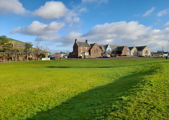
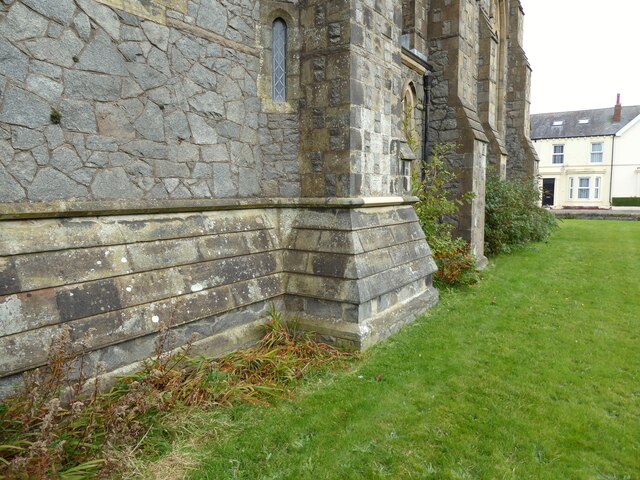
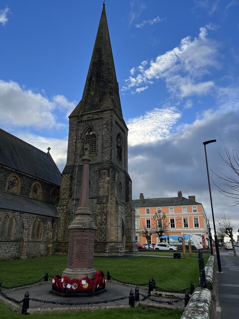
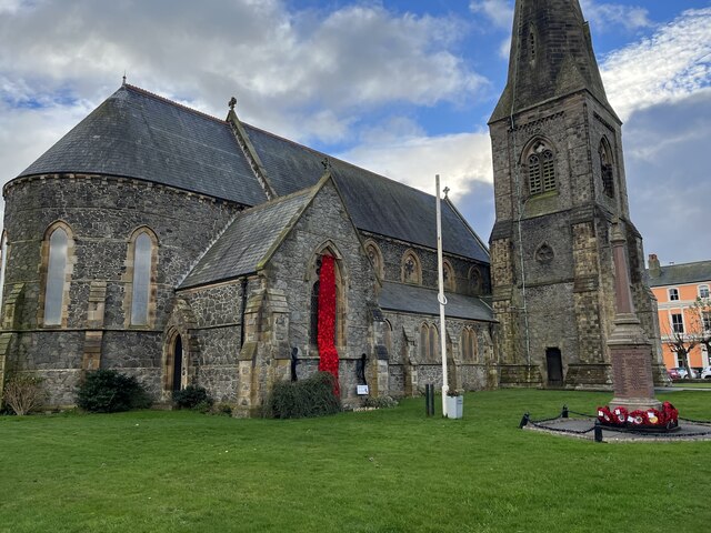
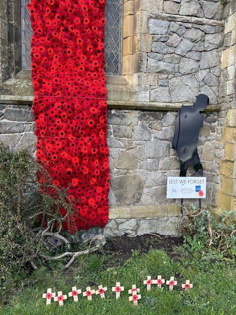
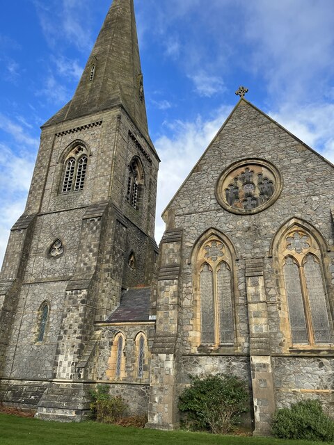
Today, West Causewayhead retains its rural charm and is home to a close-knit community. The village is characterized by its quaint stone cottages, which add to its traditional and timeless appeal. The local church, St. Mary's, stands as a prominent landmark, showcasing architectural features from different periods.

Despite its small size, West Causewayhead offers a range of amenities to its residents. These include a primary school, a village hall, and a local pub, where locals gather to socialize and enjoy a pint. The village also benefits from being in close proximity to larger towns, ensuring access to additional services and facilities.

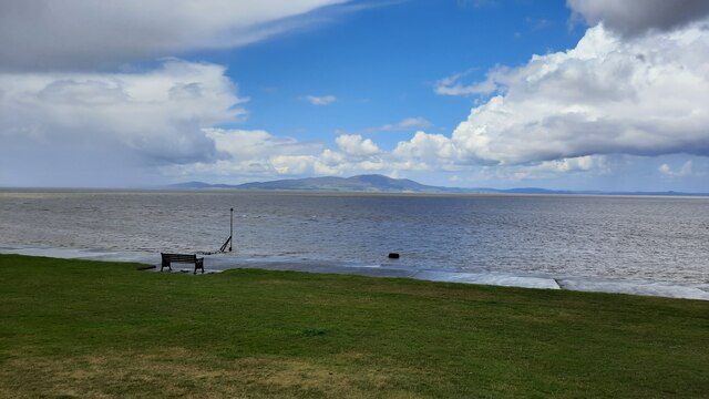
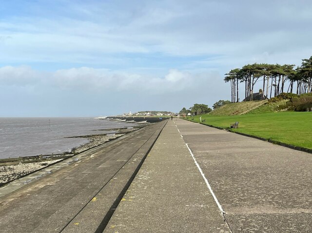
The surrounding countryside provides ample opportunities for outdoor activities, with numerous walking trails and cycling routes. The breathtaking landscape attracts nature enthusiasts and visitors seeking a peaceful retreat.

In summary, West Causewayhead is a charming and picturesque village in Cumberland, England. With its rich history, rural setting, and friendly community, it offers a tranquil escape for those seeking a slower pace of life.

If you have any feedback on the listing, please let us know in the comments section below.

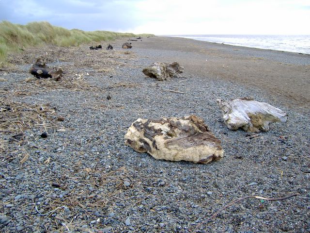
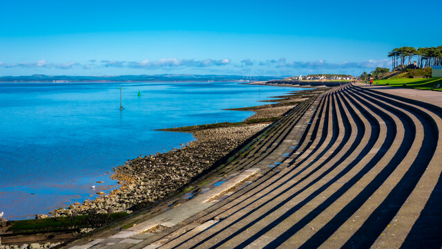
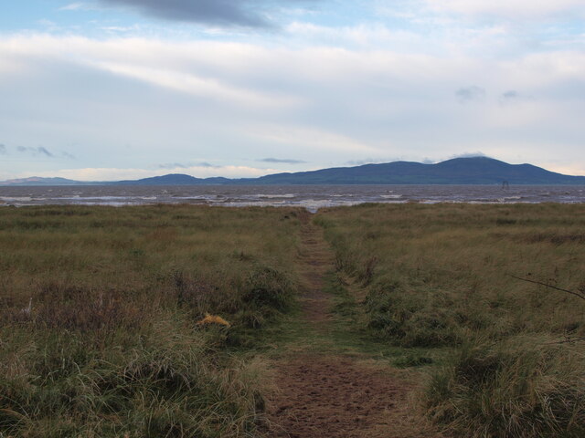
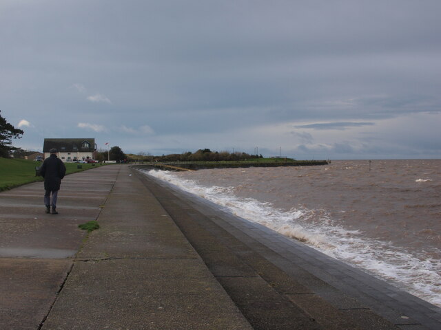
West Causewayhead Images

Images are sourced within 2km of 54.85978/-3.3732401 or Grid Reference NY1152. Thanks to Geograph Open Source API. All images are credited.

Silloth, West Beach The sand here is very gritty.  
Dozens of large tree trunks have been washed up on the shore here, some have obvious signs of being cut down, others don't.
Did they all appear at the same time after a storm?
I asked some locals, but no one seemed to know.
Silloth, West Beach
The sand here is very gritty. Dozens of large tree trunks have been washed up on the shore here, some have obvious signs of being cut down, others don't. Did they all appear at the same time after a storm? I asked some locals, but no one seemed to know.
Silloth Steps and Seafront
Path to the beach from Blitterlees The last stretch of this track crosses dunes before reaching the beach.
Path to the beach from Blitterlees
The last stretch of this track crosses dunes before reaching the beach.
Silloth seafront beside the Green Looking along the seafront towards the lifeboat station, on a windy December day.
Silloth seafront beside the Green
Looking along the seafront towards the lifeboat station, on a windy December day.
Solway Coast Discovery Centre The Solway Coast Discovery Centre on the edge of Silloth.
Solway Coast Discovery Centre
The Solway Coast Discovery Centre on the edge of Silloth.
Christ Church, Silloth Detail of the south west side of Christ Church, Silloth.
There is an Ordnance Survey cut benchmark on the base of the buttress in the foreground (photograph <a href="https://www.geograph.org.uk/photo/7122618">NY1153 : Benchmark, Christ Church, Silloth</a>).
Christ Church, Silloth
Detail of the south west side of Christ Church, Silloth. There is an Ordnance Survey cut benchmark on the base of the buttress in the foreground (photograph NY1153 : Benchmark, Christ Church, Silloth).
Benchmark, Christ Church, Silloth Detail of the Ordnance Survey cut benchmark on a buttress at the base of the spire on the south west side of Christ Church. The benchmark marks a height of 11.6869m above sea level (Ordnance Datum Newlyn) last levelled for height in 1961 and verified in 1971 (location photograph <a href="https://www.geograph.org.uk/photo/7122613">NY1153 : Christ Church, Silloth</a>).
Benchmark, Christ Church, Silloth
Detail of the Ordnance Survey cut benchmark on a buttress at the base of the spire on the south west side of Christ Church. The benchmark marks a height of 11.6869m above sea level (Ordnance Datum Newlyn) last levelled for height in 1961 and verified in 1971 (location photograph NY1153 : Christ Church, Silloth).
View of the Solway Firth from the Green Silloth
The Promenade, Silloth Silloth promenade follows the shore of the Solway Firth.  Skinburness is in the far distance, part of The Green is to the right and North House is visible behind the windblown Scots Pine trees.
The Promenade, Silloth
Silloth promenade follows the shore of the Solway Firth. Skinburness is in the far distance, part of The Green is to the right and North House is visible behind the windblown Scots Pine trees.
War Memorial at Silloth Situated in the grounds of Christ Church in Silloth.
War Memorial at Silloth
Situated in the grounds of Christ Church in Silloth.
War Memorial at Silloth The War Memorial is situated in the grounds of Christ Church.
War Memorial at Silloth
The War Memorial is situated in the grounds of Christ Church.
Christ Church Information Board at Silloth Christ Church belongs to the Parish of the Solway Plain. This church has very recently installed a new kitchen and has replaced its pews with comfortable seating. This provides an adaptable space for worship and community events. Last Sun 6th Nov the Dalston Male Voice Choir and the Gala Trio  gave a concert which raised hundreds of pounds.
Christ Church Information Board at Silloth
Christ Church belongs to the Parish of the Solway Plain. This church has very recently installed a new kitchen and has replaced its pews with comfortable seating. This provides an adaptable space for worship and community events. Last Sun 6th Nov the Dalston Male Voice Choir and the Gala Trio gave a concert which raised hundreds of pounds.
Christ Church Silloth Dating from 1871 and built in Victorian Gothic style.
Christ Church Silloth
Dating from 1871 and built in Victorian Gothic style.
Poppy Cascade at Christ Church Silloth Beautifully hand made crochet poppies hang in a curtain for Remembrance Sunday at Christ Church Silloth.
Poppy Cascade at Christ Church Silloth
Beautifully hand made crochet poppies hang in a curtain for Remembrance Sunday at Christ Church Silloth.
Poppy Curtain at Christ Church Silloth A wonderful poppy curtain for Remembrance Day in Silloth.

                         LEST WE FORGET
Poppy Curtain at Christ Church Silloth
A wonderful poppy curtain for Remembrance Day in Silloth. LEST WE FORGET
Christ Church in Silloth Constructed 1871 in the Victorian Gothic Style. Built of grey granite which was brought across as ballast in ships from Ireland. Designed by Cory and Ferguson.
Christ Church in Silloth
Constructed 1871 in the Victorian Gothic Style. Built of grey granite which was brought across as ballast in ships from Ireland. Designed by Cory and Ferguson.
Christ Church viewed from the Green in Silloth Viewed from the far side of the Green. The church spire is a significant landmark across the Solway Plain.
Christ Church viewed from the Green in Silloth
Viewed from the far side of the Green. The church spire is a significant landmark across the Solway Plain.
Mrs Wilson’s Coffee House & Eaterie Silloth Situated in Criffel Street, one of the many streets with wonderful paved setts. These setts are “ heritage” and now a tourist attraction. 
Mrs Wilson was the married name of Kathleen Ferrier CBE contralto singer 1912-1953. She shot to fame  while living in Silloth and performing in Cumberland.
Mrs Wilson’s Coffee House & Eaterie Silloth
Situated in Criffel Street, one of the many streets with wonderful paved setts. These setts are “ heritage” and now a tourist attraction. Mrs Wilson was the married name of Kathleen Ferrier CBE contralto singer 1912-1953. She shot to fame while living in Silloth and performing in Cumberland.
Show me another place!

West Causewayhead is located at Grid Ref: NY1152 (Lat: 54.85978, Lng: -3.3732401)

Administrative County: Cumbria

District: Allerdale

Police Authority: Cumbria

What 3 Words

///actor.shun.mothering. Near Silloth, Cumbria

Related Wikis

Causewayhead railway station

Causewayhead or, originally, Causey Head, was an early, short lived railway station near Causewayhead, Cumbria on the Carlisle & Silloth Bay Railway &...

Greenrow

Greenrow is a village in the civil parish of Holme Low in Cumbria, United Kingdom. It is located about 10 miles west of Wigton, near the town of Silloth...

Causewayhead

Causewayhead is a hamlet in the civil parish of Holme Low in Cumbria, England, about 1 mile (2 km) south-east of Silloth. The B5302 road runs through the...

Blitterlees

Blitterlees is a small hamlet in the parish of Holme Low, one mile south of Silloth in Cumbria, United Kingdom. The hamlet of Wolsty is located approximately...

Nearby Amenities

Located within 500m of 54.85978,-3.3732401
Power: pole
Lat/Long: 54.8610947/-3.3803599
Power: pole
Lat/Long: 54.8603043/-3.3797041
Power: pole
Lat/Long: 54.8594413/-3.379063
Power: pole
Lat/Long: 54.8586068/-3.3783656
Power: pole
Lat/Long: 54.8579993/-3.3778949
Power: pole
Lat/Long: 54.8570992/-3.37716
Power: pole
Lat/Long: 54.8564801/-3.3766678
Power: pole
Lat/Long: 54.8557568/-3.3761086
The data included in this document is from www.openstreetmap.org. The data is made available under ODbL.

Have you been to West Causewayhead?

Leave your review of West Causewayhead below (or comments, questions and feedback).