West Silloth

Settlement in Cumberland Allerdale

England

West Silloth

Looking out at Lees Scar Lighthouse Looking out at Lees Scar Lighthouse, above the incoming tide.
Looking out at Lees Scar Lighthouse Credit: Graham Robson

West Silloth is a small coastal village located in the county of Cumberland, England. Situated on the northwest coast, it lies within the Solway Coast Area of Outstanding Natural Beauty. With its picturesque setting, West Silloth attracts tourists and locals alike.

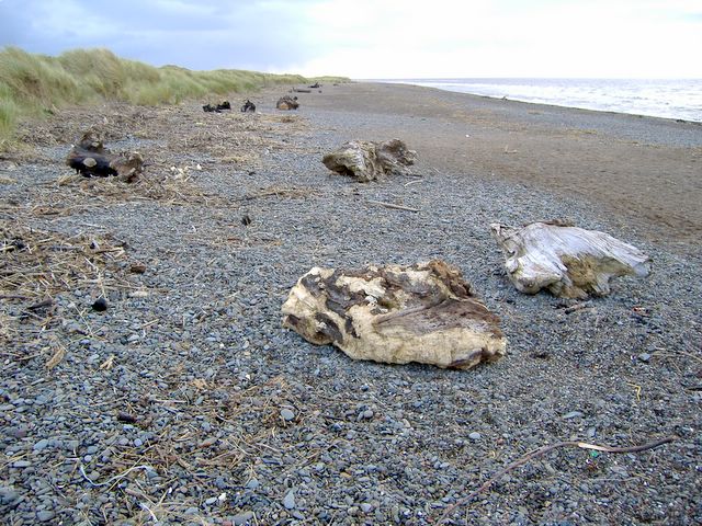
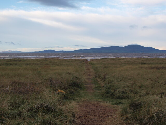
The village is known for its stunning sandy beach, which stretches for miles, offering breathtaking views of the Irish Sea. The beach is a popular spot for sunbathing, picnicking, and leisurely walks along the shore. It is also a haven for birdwatchers, as it is home to a variety of coastal and migratory bird species.

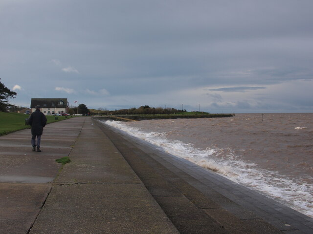
West Silloth has a rich maritime history, with a bustling harbor that was once a hub for trade and fishing. Today, the harbor is mainly used for recreational purposes, with boats and yachts docking there. Fishing remains an important industry in the village, with locals often seen casting their lines from the pier.

The village itself has a charming and laid-back atmosphere, with a few shops, cafes, and pubs scattered throughout. The community is close-knit, and residents take pride in maintaining the village's natural beauty and preserving its historical heritage.

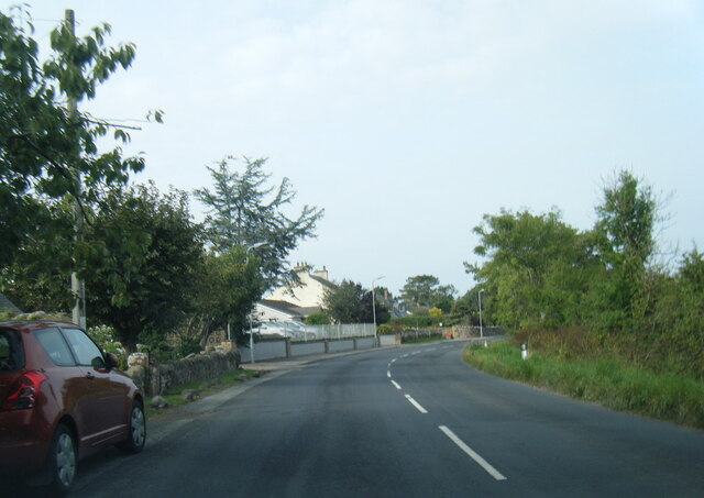
West Silloth is well-connected to other parts of Cumberland, with easy access to the nearby towns of Silloth and Carlisle. The village also benefits from its proximity to the Lake District National Park, just a short drive away, offering residents and visitors the opportunity to explore the stunning landscapes and outdoor activities the park has to offer.

Overall, West Silloth is a tranquil coastal village that offers a delightful blend of natural beauty, historical significance, and a strong sense of community.

If you have any feedback on the listing, please let us know in the comments section below.
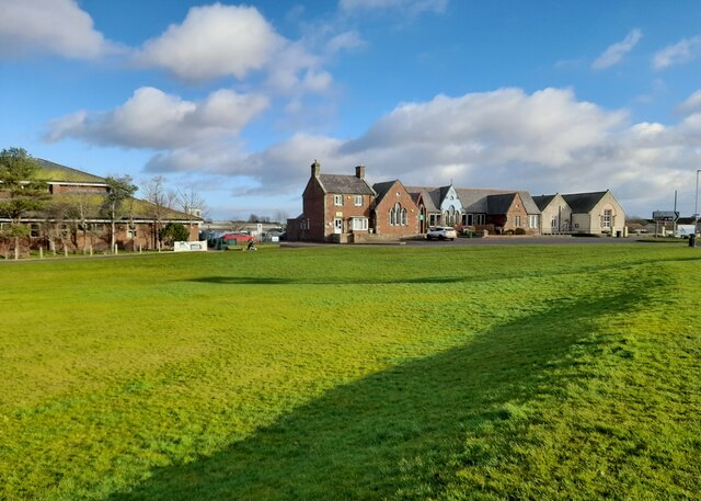
West Silloth Images

Images are sourced within 2km of 54.860908/-3.385493 or Grid Reference NY1152. Thanks to Geograph Open Source API. All images are credited.

Looking out at Lees Scar Lighthouse Looking out at Lees Scar Lighthouse, above the incoming tide.
Looking out at Lees Scar Lighthouse
Looking out at Lees Scar Lighthouse, above the incoming tide.
Incoming tide on the Solway Firth Looking out at the incoming tide and Lees Scar Lighthouse from the beach south of Silloth.
Incoming tide on the Solway Firth
Looking out at the incoming tide and Lees Scar Lighthouse from the beach south of Silloth.
Shingle area on beach south of Silloth  A "tongue" of shingle on the beach south of Silloth. The large buildings at Carrs flour mill can be seen in the distance.
Shingle area on beach south of Silloth
A "tongue" of shingle on the beach south of Silloth. The large buildings at Carrs flour mill can be seen in the distance.
The sun goes down over Lees Scar Lighthouse Looking out at Lees Scar Lighthouse in the Solway Firth. Scotland can be seen across the incoming tide on the other side of the firth.
The sun goes down over Lees Scar Lighthouse
Looking out at Lees Scar Lighthouse in the Solway Firth. Scotland can be seen across the incoming tide on the other side of the firth.
Patterns in the sand These wave like patterns were left in the sand on the beach east of Lees Scar Lighthouse. The tall building of Carr's Flour Mill can be seen in the distance at the Port of Silloth.
Patterns in the sand
These wave like patterns were left in the sand on the beach east of Lees Scar Lighthouse. The tall building of Carr's Flour Mill can be seen in the distance at the Port of Silloth.
Lees Scar Lighthouse at low tide A very low tide today.  Several people angling underneath the light tower.
Lees Scar Lighthouse at low tide
A very low tide today. Several people angling underneath the light tower.
Lees Scar Lighthouse at low tide Low tide exploration of Lees Scar lighthouse.
Lees Scar Lighthouse at low tide
Low tide exploration of Lees Scar lighthouse.
B5300 passing Wolsty Bank
Lees Scar Lighthouse Comorants perch on the Lees Scar lighthouse, shown at low tide looking to the west.
Lees Scar Lighthouse
Comorants perch on the Lees Scar lighthouse, shown at low tide looking to the west.
Low tide at Lees Scar Approaching Lees Scar lighthouse from the northeast at low tide.
Low tide at Lees Scar
Approaching Lees Scar lighthouse from the northeast at low tide.
Lees Scar Lighthouse at low water
Silloth, West Beach The sand here is very gritty.  
Dozens of large tree trunks have been washed up on the shore here, some have obvious signs of being cut down, others don't.
Did they all appear at the same time after a storm?
I asked some locals, but no one seemed to know.
Silloth, West Beach
The sand here is very gritty. Dozens of large tree trunks have been washed up on the shore here, some have obvious signs of being cut down, others don't. Did they all appear at the same time after a storm? I asked some locals, but no one seemed to know.
B5300 at Moordale Park Caravan Park
B5300 in Blitterlees
Silloth Steps and Seafront
Path to the beach from Blitterlees The last stretch of this track crosses dunes before reaching the beach.
Path to the beach from Blitterlees
The last stretch of this track crosses dunes before reaching the beach.
Silloth seafront beside the Green Looking along the seafront towards the lifeboat station, on a windy December day.
Silloth seafront beside the Green
Looking along the seafront towards the lifeboat station, on a windy December day.
Solway Coast Discovery Centre The Solway Coast Discovery Centre on the edge of Silloth.
Solway Coast Discovery Centre
The Solway Coast Discovery Centre on the edge of Silloth.
Show me another place!

West Silloth is located at Grid Ref: NY1152 (Lat: 54.860908, Lng: -3.385493)

Administrative County: Cumbria

District: Allerdale

Police Authority: Cumbria

What 3 Words

///pollution.improvise.gown. Near Silloth, Cumbria

Related Wikis

Greenrow

Greenrow is a village in the civil parish of Holme Low in Cumbria, United Kingdom. It is located about 10 miles west of Wigton, near the town of Silloth...

Blitterlees

Blitterlees is a small hamlet in the parish of Holme Low, one mile south of Silloth in Cumbria, United Kingdom. The hamlet of Wolsty is located approximately...

Milefortlet 12

Milefortlet 12 (Blitterlees) was a Milefortlet of the Roman Cumbrian Coast defences. These milefortlets and intervening stone watchtowers extended from...

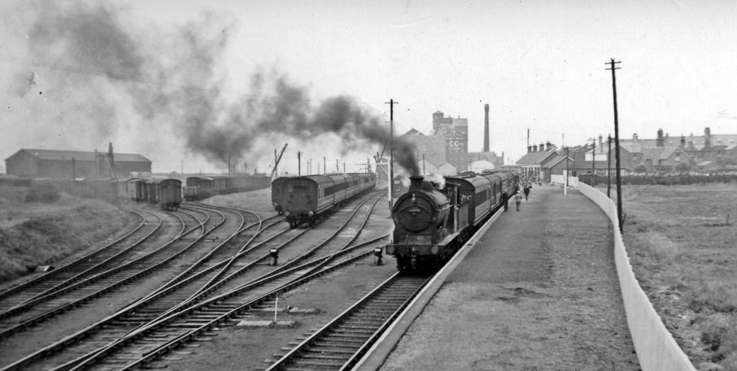
Silloth railway station

Silloth was the terminus of the Carlisle and Silloth Bay Railway, a branch railway from Carlisle, England. The town, dock and station at Silloth were built...

Nearby Amenities

Located within 500m of 54.860908,-3.385493
Bus Stop
The Cumberland Inn
Naptan AtcoCode: 090002491886
Naptan Bearing: N
Naptan CommonName: The Cumberland Inn
Naptan Indicator: opp
Naptan Landmark: The Cumberland Inn
Naptan NaptanCode: cumagmpg
Naptan Street: B5300
Naptan Verified: no
Source: naptan_import
Lat/Long: 54.8642864/-3.390385
Bus Stop
Prospect Place
Naptan AtcoCode: 090002492685
Naptan Bearing: S
Naptan CommonName: Prospect Place
Naptan Indicator: o/s
Naptan Landmark: no.s 8/9
Naptan NaptanCode: cumagmtd
Naptan Street: Prospect Place
Naptan Verified: no
Source: naptan_import
Lat/Long: 54.8640261/-3.3903605
Bus Stop
Bench: no
Covered: no
Shelter: no
Lat/Long: 54.8623983/-3.3888879
Bus Stop
Bench: no
Covered: no
Naptan AtcoCode: 090002492103
Naptan NaptanCode: cumagmpt
Shelter: no
Lat/Long: 54.8624462/-3.3893897
Bus Stop
Lat/Long: 54.8613825/-3.3866995
Turning Circle
Lat/Long: 54.8607676/-3.3908486
Turning Circle
Lat/Long: 54.8606286/-3.3918196
Turning Circle
Lat/Long: 54.8604187/-3.3913582
Turning Circle
Lat/Long: 54.8610037/-3.3913877
Turning Circle
Lat/Long: 54.8605113/-3.3902585
Turning Circle
Lat/Long: 54.8601778/-3.3908057
Turning Circle
Lat/Long: 54.8596931/-3.3898991
Turning Circle
Lat/Long: 54.8601284/-3.389985
Turning Circle
Lat/Long: 54.8592577/-3.3889979
Turning Circle
Lat/Long: 54.8593967/-3.3877212
Turning Circle
Lat/Long: 54.8599771/-3.3903283
Turning Circle
Lat/Long: 54.8595078/-3.3884507
Turning Circle
Lat/Long: 54.8594553/-3.3894378
Post Box
Ref: CA7 66
Lat/Long: 54.8623915/-3.3888105
Blitterlees
Place: hamlet
Wikidata: Q4926938
Wikipedia: en:Blitterlees
Lat/Long: 54.8574579/-3.3887452
Fast Food
A Taste Of Solway
Addr City: Silloth
Addr Street: Golf Terrace
Cuisine: fish_and_chips
Delivery: no
Drive Through: no
Takeaway: only
Lat/Long: 54.8622438/-3.3891606
Golf: pin
Lat/Long: 54.8631508/-3.3913249
Power: pole
Lat/Long: 54.8640671/-3.3813415
Power: pole
Lat/Long: 54.8632637/-3.3815373
Power: pole
Lat/Long: 54.8627257/-3.3816755
Power: pole
Lat/Long: 54.8619098/-3.3810116
Power: pole
Lat/Long: 54.8610947/-3.3803599
Power: pole
Lat/Long: 54.8603043/-3.3797041
Power: pole
Lat/Long: 54.8594413/-3.379063
Power: pole
Lat/Long: 54.8587989/-3.3823969
Power: pole
Lat/Long: 54.8594462/-3.3825386
Power: pole
Lat/Long: 54.86023/-3.3827789
Power: pole
Lat/Long: 54.8579015/-3.3826957
Power: pole
Lat/Long: 54.8568622/-3.3830439
The data included in this document is from www.openstreetmap.org. The data is made available under ODbL.

Have you been to West Silloth?

Leave your review of West Silloth below (or comments, questions and feedback).