Blitterlees

Settlement in Cumberland Allerdale

England

Blitterlees

B5300 west of Wolsty Hall
B5300 west of Wolsty Hall Credit: Colin Pyle

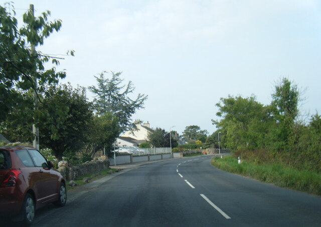
Blitterlees is a small village located in the county of Cumberland, England. Situated in the northwest part of the country, it is nestled amidst the picturesque landscape of the Lake District National Park. With a population of around 300 residents, Blitterlees exudes a tranquil and idyllic charm.

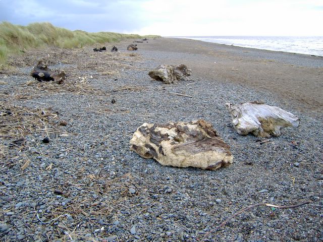
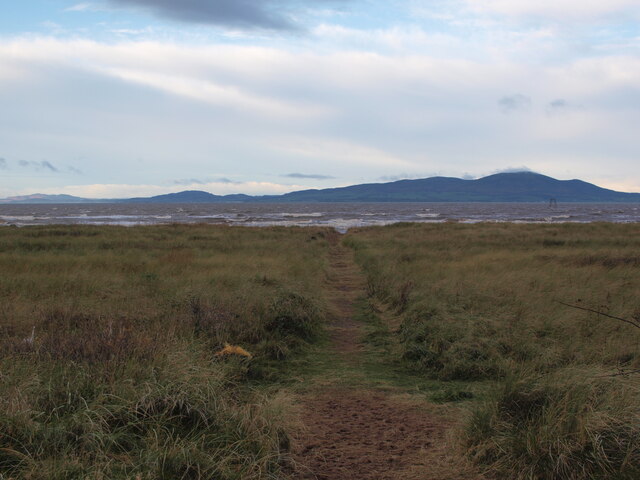
The village is characterized by its traditional stone cottages, many of which date back several centuries, giving it a timeless appeal. The surrounding countryside offers breathtaking views, with rolling hills, lush green fields, and nearby woodlands. Blitterlees is a haven for nature lovers, offering numerous opportunities for outdoor activities such as hiking, cycling, and birdwatching.

Despite its small size, Blitterlees boasts a strong sense of community. The village has a local pub, The Blitterlees Arms, which serves as a gathering place for residents and visitors alike. It is a hub for socializing and enjoying traditional British pub fare.

Blitterlees is conveniently located near the town of Maryport, which provides essential amenities such as shops, schools, and healthcare facilities. The village is also within a short driving distance of the coastal town of Workington, offering further options for shopping and entertainment.

Overall, Blitterlees offers a peaceful and picturesque retreat, perfect for those seeking a slower pace of life and a close connection with nature. Its charming architecture, sense of community, and proximity to the stunning Lake District make it an attractive place to live or visit.

If you have any feedback on the listing, please let us know in the comments section below.
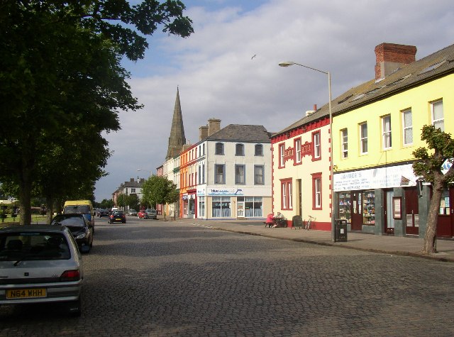
Blitterlees Images

Images are sourced within 2km of 54.858925/-3.387227 or Grid Reference NY1152. Thanks to Geograph Open Source API. All images are credited.

B5300 west of Wolsty Hall
Looking out at Lees Scar Lighthouse Looking out at Lees Scar Lighthouse, above the incoming tide.
Looking out at Lees Scar Lighthouse
Looking out at Lees Scar Lighthouse, above the incoming tide.
Incoming tide on the Solway Firth Looking out at the incoming tide and Lees Scar Lighthouse from the beach south of Silloth.
Incoming tide on the Solway Firth
Looking out at the incoming tide and Lees Scar Lighthouse from the beach south of Silloth.
Shingle area on beach south of Silloth  A "tongue" of shingle on the beach south of Silloth. The large buildings at Carrs flour mill can be seen in the distance.
Shingle area on beach south of Silloth
A "tongue" of shingle on the beach south of Silloth. The large buildings at Carrs flour mill can be seen in the distance.
The sun goes down over Lees Scar Lighthouse Looking out at Lees Scar Lighthouse in the Solway Firth. Scotland can be seen across the incoming tide on the other side of the firth.
The sun goes down over Lees Scar Lighthouse
Looking out at Lees Scar Lighthouse in the Solway Firth. Scotland can be seen across the incoming tide on the other side of the firth.
Patterns in the sand These wave like patterns were left in the sand on the beach east of Lees Scar Lighthouse. The tall building of Carr's Flour Mill can be seen in the distance at the Port of Silloth.
Patterns in the sand
These wave like patterns were left in the sand on the beach east of Lees Scar Lighthouse. The tall building of Carr's Flour Mill can be seen in the distance at the Port of Silloth.
Lees Scar Lighthouse at low tide A very low tide today.  Several people angling underneath the light tower.
Lees Scar Lighthouse at low tide
A very low tide today. Several people angling underneath the light tower.
Lees Scar Lighthouse at low tide Low tide exploration of Lees Scar lighthouse.
Lees Scar Lighthouse at low tide
Low tide exploration of Lees Scar lighthouse.
B5300 passing Wolsty Bank
Lees Scar Lighthouse Comorants perch on the Lees Scar lighthouse, shown at low tide looking to the west.
Lees Scar Lighthouse
Comorants perch on the Lees Scar lighthouse, shown at low tide looking to the west.
Low tide at Lees Scar Approaching Lees Scar lighthouse from the northeast at low tide.
Low tide at Lees Scar
Approaching Lees Scar lighthouse from the northeast at low tide.
Sheep The mother was lame and had difficulty in keeping up with her two lambs
Sheep
The mother was lame and had difficulty in keeping up with her two lambs
Lees Scar Lighthouse at low water
Silloth, West Beach The sand here is very gritty.  
Dozens of large tree trunks have been washed up on the shore here, some have obvious signs of being cut down, others don't.
Did they all appear at the same time after a storm?
I asked some locals, but no one seemed to know.
Silloth, West Beach
The sand here is very gritty. Dozens of large tree trunks have been washed up on the shore here, some have obvious signs of being cut down, others don't. Did they all appear at the same time after a storm? I asked some locals, but no one seemed to know.
B5300 at Moordale Park Caravan Park
B5300 in Blitterlees
Silloth Steps and Seafront
Path to the beach from Blitterlees The last stretch of this track crosses dunes before reaching the beach.
Path to the beach from Blitterlees
The last stretch of this track crosses dunes before reaching the beach.
Show me another place!

Blitterlees is located at Grid Ref: NY1152 (Lat: 54.858925, Lng: -3.387227)

Administrative County: Cumbria

District: Allerdale

Police Authority: Cumbria

What 3 Words

///desiring.binder.skins. Near Silloth, Cumbria

Related Wikis

Blitterlees

Blitterlees is a small hamlet in the parish of Holme Low, one mile south of Silloth in Cumbria, United Kingdom. The hamlet of Wolsty is located approximately...

Greenrow

Greenrow is a village in the civil parish of Holme Low in Cumbria, United Kingdom. It is located about 10 miles west of Wigton, near the town of Silloth...

Milefortlet 12

Milefortlet 12 (Blitterlees) was a Milefortlet of the Roman Cumbrian Coast defences. These milefortlets and intervening stone watchtowers extended from...

Silloth Battery Extension railway station

Silloth Battery Extension railway station was the terminus of the Blitterlees Branch, which turned southwards off the Carlisle and Silloth Bay Railway...

Cumberland and Westmorland Convalescent Institution railway station

Cumberland and Westmorland Convalescent Institution railway station was a terminus off the short Blitterlees Branch off the Carlisle and Silloth Bay Railway...

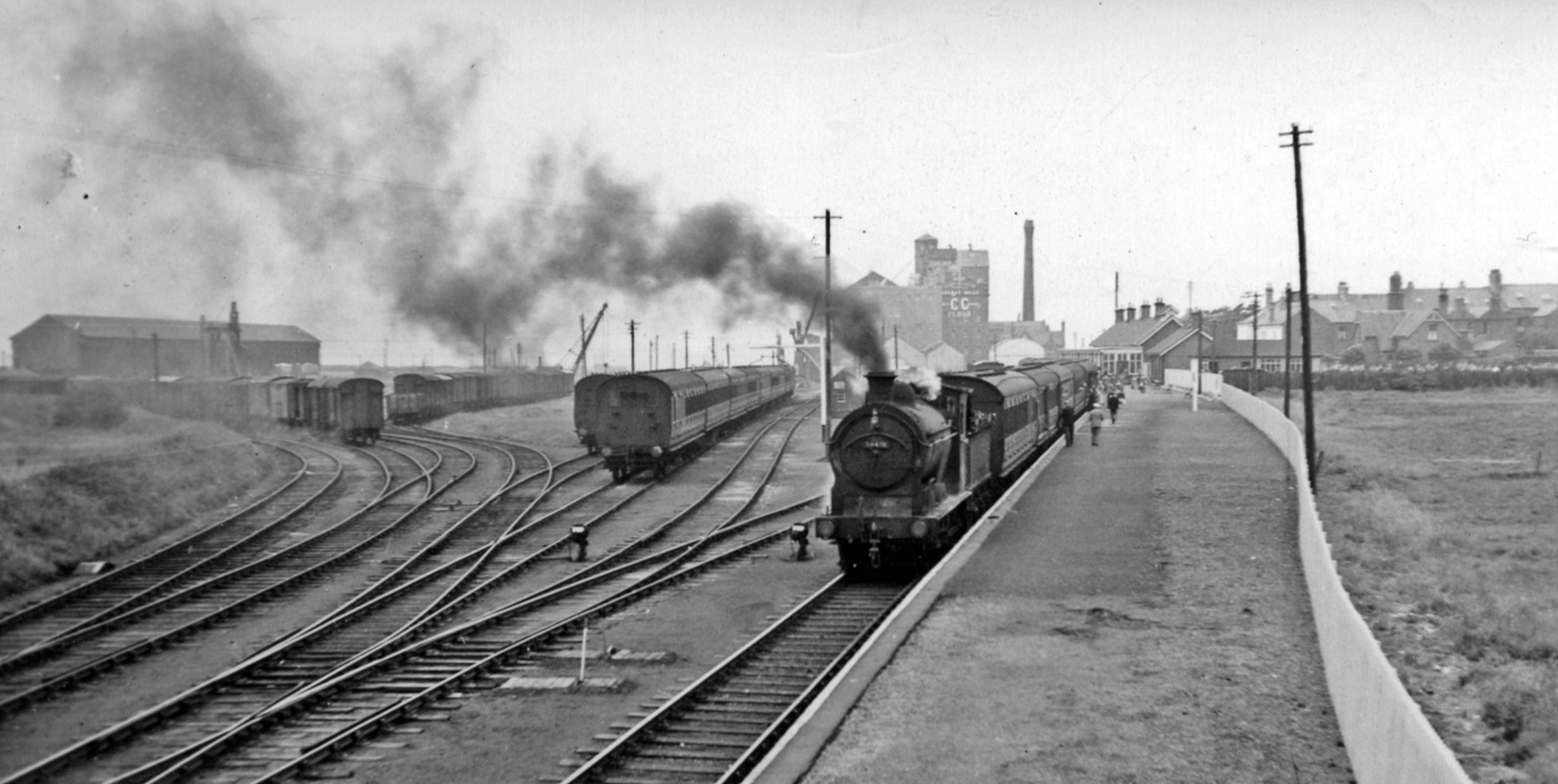
Silloth railway station

Silloth was the terminus of the Carlisle and Silloth Bay Railway, a branch railway from Carlisle, England. The town, dock and station at Silloth were built...

Silloth

Silloth (sometimes known as Silloth-on-Solway) is a port town and civil parish in Cumberland, Cumbria, England. Historically in the county of Cumberland...

Milefortlet 11

Milefortlet 11 was a Milefortlet of the Roman Cumbrian Coast defences. These milefortlets and intervening stone watchtowers extended from the western end...

Nearby Amenities

Located within 500m of 54.858925,-3.387227
Village Centre
Naptan AtcoCode: 090002492992
Naptan Bearing: S
Naptan BusStopType: CUS
Naptan CommonName: Village Centre
Naptan Indicator: near
Naptan Landmark: telephone box
Naptan NaptanCode: cumagmtm
Naptan Street: B5300
Naptan Verified: no
Source: naptan_import
Lat/Long: 54.8552853/-3.3892186
Bus Stop
Bench: no
Covered: no
Shelter: no
Lat/Long: 54.8623983/-3.3888879
Bus Stop
Bench: no
Covered: no
Naptan AtcoCode: 090002492103
Naptan NaptanCode: cumagmpt
Shelter: no
Lat/Long: 54.8624462/-3.3893897
Bus Stop
Lat/Long: 54.8613825/-3.3866995
Turning Circle
Lat/Long: 54.8607676/-3.3908486
Turning Circle
Lat/Long: 54.8606286/-3.3918196
Turning Circle
Lat/Long: 54.8604187/-3.3913582
Turning Circle
Lat/Long: 54.8610037/-3.3913877
Turning Circle
Lat/Long: 54.8605113/-3.3902585
Turning Circle
Lat/Long: 54.8601778/-3.3908057
Turning Circle
Lat/Long: 54.8596931/-3.3898991
Turning Circle
Lat/Long: 54.8601284/-3.389985
Turning Circle
Lat/Long: 54.8592577/-3.3889979
Turning Circle
Lat/Long: 54.8593967/-3.3877212
Turning Circle
Lat/Long: 54.8599771/-3.3903283
Turning Circle
Lat/Long: 54.8595078/-3.3884507
Turning Circle
Lat/Long: 54.8594553/-3.3894378
Post Box
Ref: CA7 143
Source: survey
Lat/Long: 54.8553945/-3.3891517
Post Box
Ref: CA7 66
Lat/Long: 54.8623915/-3.3888105
Blitterlees
Place: hamlet
Wikidata: Q4926938
Wikipedia: en:Blitterlees
Lat/Long: 54.8574579/-3.3887452
Fast Food
A Taste Of Solway
Addr City: Silloth
Addr Street: Golf Terrace
Cuisine: fish_and_chips
Delivery: no
Drive Through: no
Takeaway: only
Lat/Long: 54.8622438/-3.3891606
Power: pole
Lat/Long: 54.8587989/-3.3823969
Power: pole
Lat/Long: 54.8594462/-3.3825386
Power: pole
Lat/Long: 54.86023/-3.3827789
Power: pole
Lat/Long: 54.8579015/-3.3826957
Power: pole
Lat/Long: 54.8568622/-3.3830439
Power: pole
Lat/Long: 54.8557999/-3.3833736
The data included in this document is from www.openstreetmap.org. The data is made available under ODbL.

Have you been to Blitterlees?

Leave your review of Blitterlees below (or comments, questions and feedback).