Chaldon Boys

Settlement in Dorset

England

Chaldon Boys

National Trust sign at Whitenothe
National Trust sign at Whitenothe Credit: Becky Williamson

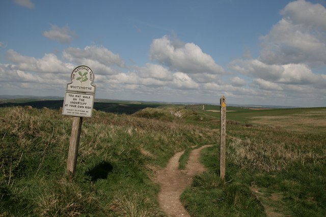
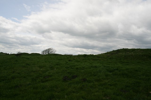
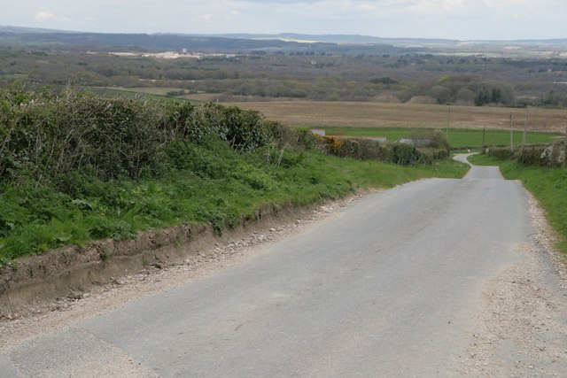
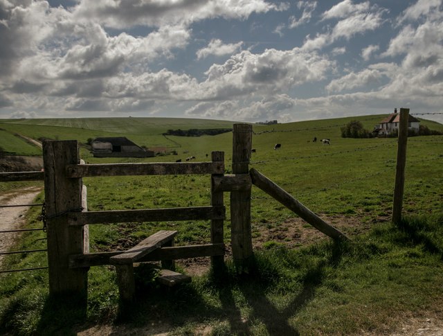
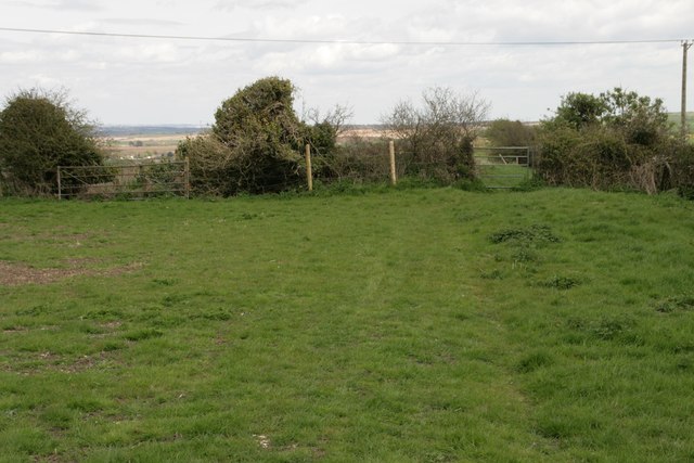
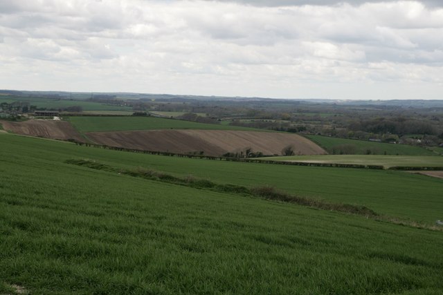
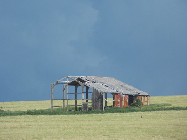
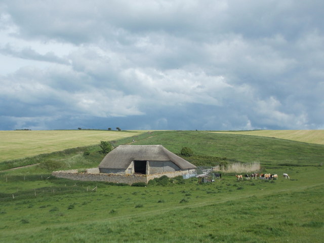
Chaldon Boys is a small rural village located in the county of Dorset, England. Situated in the South West region of the country, it lies approximately 6 miles northeast of the town of Dorchester. The village is nestled amidst picturesque rolling hills and lush green countryside, offering a tranquil and idyllic setting.

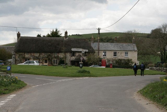
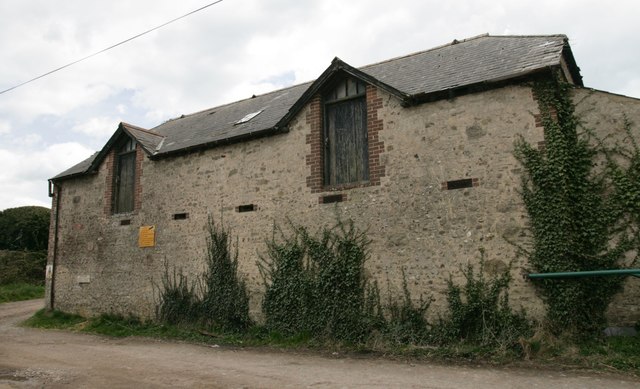
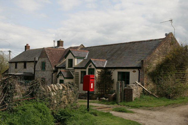
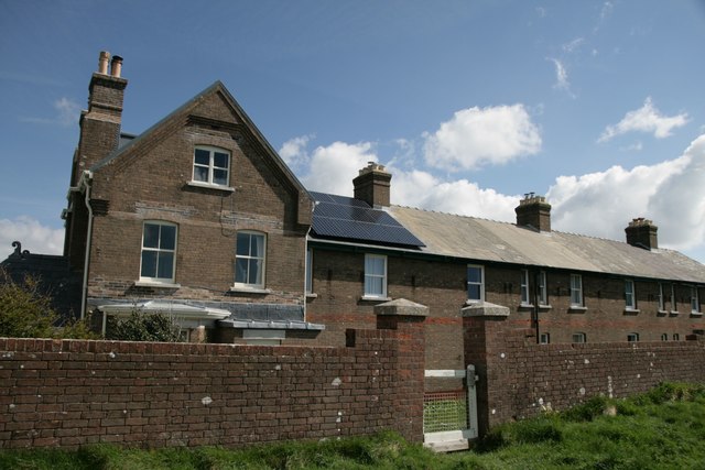
Chaldon Boys is characterized by its charming thatched-roof cottages, which add to its traditional and quintessentially English ambiance. The village is home to a close-knit community, with a population of around 200 residents. This tight community spirit is evident through the various local events and activities organized throughout the year, including village fairs and social gatherings.

The village boasts a rich history, with evidence of human settlement dating back to the Roman era. The St. Mary's Church, a Grade I listed building, stands as a testament to this rich heritage. The church, believed to have been built in the 12th century, showcases stunning architectural features and serves as a focal point for both residents and visitors alike.

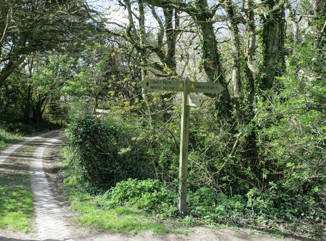
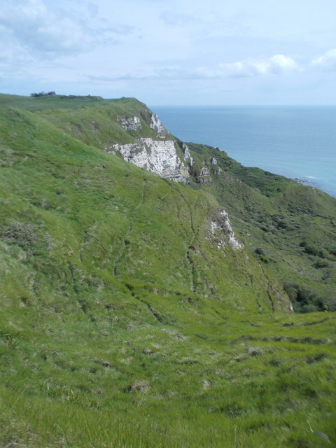
The surrounding countryside offers ample opportunities for outdoor enthusiasts, with numerous walking and cycling routes to explore. Chaldon Boys also benefits from its proximity to the Jurassic Coast, a UNESCO World Heritage Site renowned for its breathtaking cliffs and fossil-rich beaches. This makes it an attractive destination for nature lovers and fossil enthusiasts.

Although small in size, Chaldon Boys exudes charm and character, providing a peaceful retreat for those seeking a slower pace of life in the heart of the Dorset countryside.

If you have any feedback on the listing, please let us know in the comments section below.

Chaldon Boys Images

Images are sourced within 2km of 50.644424/-2.3153072 or Grid Reference SY7782. Thanks to Geograph Open Source API. All images are credited.

National Trust sign at Whitenothe
Five Marys tumuli
Five Marys tumuli
Chaldon Herring Village Centre
Signpost on South-west Coast Path
Road north of Holworth Owermoigne Down barn roof can just be seen to the left of the road.
Road north of Holworth
Owermoigne Down barn roof can just be seen to the left of the road.
Stile and footpath past Brimstone Bottom Barn
Painted sign at North Holworth Farm
Ridgeway path west of the Five Marys
Vicarage Farm, Chaldon Herring There is an Ordnance Survey benchmark on this building. See <a href="https://www.geograph.org.uk/photo/4923880">SY7983 : Benchmark on Vicarage Farm, Chaldon Herring</a>.
Vicarage Farm, Chaldon Herring
There is an Ordnance Survey benchmark on this building. See SY7983 : Benchmark on Vicarage Farm, Chaldon Herring.
Benchmark on Vicarage Farm, Chaldon Herring Ordnance Survey benchmark, described on database at <span class="nowrap"><a title="http://www.bench-marks.org.uk/bm75118" rel="nofollow ugc noopener" href="http://www.bench-marks.org.uk/bm75118">Link</a><img style="margin-left:2px;" alt="External link" title="External link - shift click to open in new window" src="https://s1.geograph.org.uk/img/external.png" width="10" height="10"/></span>. See also <a href="https://www.geograph.org.uk/photo/4923878">SY7983 : Vicarage Farm, Chaldon Herring</a>.
Benchmark on Vicarage Farm, Chaldon Herring
Ordnance Survey benchmark, described on database at LinkExternal link. See also SY7983 : Vicarage Farm, Chaldon Herring.
Cottages and letterbox at Holworth
Lord's Barrow near Owermoigne Bronze age burial ground.
Lord's Barrow near Owermoigne
Bronze age burial ground.
Whitenothe Cottages Once the coastguard cottages.
Whitenothe Cottages
Once the coastguard cottages.
Holworth: the chapel of St. Catherine’s-by-the-Sea Changes have been made to the chapel since I last photographed it in 2009 (see <a href="https://www.geograph.org.uk/photo/1416551">SY7681 : Holworth: the porch of St. Catherine’s</a>). Up to then, the entrance had been at the western end, making it difficult to photograph it in full without appearing to be from the back or side. 

Now, the entrance has been put into this northern side, making this a much more satisfactory picture.

Also, a little bell turret has been added, meaning that the bell is no longer contained in a separate frame in the churchyard (see <a href="https://www.geograph.org.uk/photo/1416570">SY7681 : Holworth: the bell of St. Catherine’s</a>).
Holworth: the chapel of St. Catherine’s-by-the-Sea
Changes have been made to the chapel since I last photographed it in 2009 (see SY7681 : Holworth: the porch of St. Catherine’s). Up to then, the entrance had been at the western end, making it difficult to photograph it in full without appearing to be from the back or side. Now, the entrance has been put into this northern side, making this a much more satisfactory picture. Also, a little bell turret has been added, meaning that the bell is no longer contained in a separate frame in the churchyard (see SY7681 : Holworth: the bell of St. Catherine’s).
Holworth: buttercups in St. Catherine’s churchyard A yellow carpet covers the churchyard on the seaward side of the <a href="https://www.geograph.org.uk/photo/4963768">SY7681 : Holworth: the chapel of St. Catherine’s-by-the-Sea</a>.
Holworth: buttercups in St. Catherine’s churchyard
A yellow carpet covers the churchyard on the seaward side of the SY7681 : Holworth: the chapel of St. Catherine’s-by-the-Sea.
Holworth: a derelict barn Looking along the northern edge of this square towards a decrepit looking barn on Brimstone Bottom. The darkish clouds look threatening but in fact the sunny appearance of the ground was far more representative of today's lovely weather - I don't think it rained all day nearby.
Holworth: a derelict barn
Looking along the northern edge of this square towards a decrepit looking barn on Brimstone Bottom. The darkish clouds look threatening but in fact the sunny appearance of the ground was far more representative of today's lovely weather - I don't think it rained all day nearby.
Holworth: a thatched barn A well built barn, a contrast to the sorry state of the one beyond but just out of sight to our left, <a href="https://www.geograph.org.uk/photo/4963779">SY7681 : Holworth: a derelict barn</a>.
Holworth: a thatched barn
A well built barn, a contrast to the sorry state of the one beyond but just out of sight to our left, SY7681 : Holworth: a derelict barn.
Holworth: the grassy cliffs of White Nothe The undulating landscape blurs the boundary between the cliff top and the cliff face, no doubt as a result of gradual slips. The white chalk cliff face, that gives the headland half of its name, is apparent beyond but in fact better appreciated from more distant viewpoints.
Holworth: the grassy cliffs of White Nothe
The undulating landscape blurs the boundary between the cliff top and the cliff face, no doubt as a result of gradual slips. The white chalk cliff face, that gives the headland half of its name, is apparent beyond but in fact better appreciated from more distant viewpoints.
Show me another place!

Chaldon Boys is located at Grid Ref: SY7782 (Lat: 50.644424, Lng: -2.3153072)

Unitary Authority: Dorset

Police Authority: Dorset

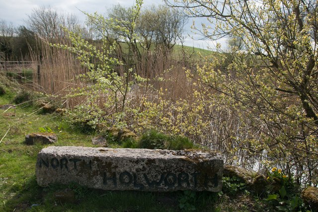
Also known as: West Chaldon

What 3 Words

///hello.worksheet.estate. Near Wool, Dorset

Related Wikis

Bindon Liberty

Bindon Liberty was a liberty in the county of Dorset, England, containing the following parishes: Chaldon Herring Edmondsham (part) Moreton (part) Pulham...

Chaldon Herring

Chaldon Herring or East Chaldon is a village and civil parish in the English county of Dorset, about 8 miles (13 km) south-east of the county town of Dorchester...

Chaldon Hill

Chaldon Hill, also called Chaldon Down, is one of the highest hills, 178 metres (584 ft), on South Dorset's Jurassic Coast in England. The summit is about...

Five Marys

The Five Marys is a group of Bronze Age round barrows near the village of Chaldon Herring, in Dorset, England. The site is a scheduled monument. ��2�...

Nearby Amenities

Located within 500m of 50.644424,-2.3153072
Material: wood
Note: Wires vertically stacked
Power: pole
Source: bing
Lat/Long: 50.6399741/-2.3153909
Material: wood
Power: pole
Source: bing
Switch: yes
Lat/Long: 50.6408411/-2.3141424
Material: wood
Power: pole
Source: bing
Lat/Long: 50.6414982/-2.3132278
Material: wood
Power: pole
Source: bing
Lat/Long: 50.6424126/-2.3119038
Material: wood
Power: pole
Ref: 2
Source: bing
Source Ref: interpolation
Lat/Long: 50.6425325/-2.3141386
Material: wood
Power: pole
Ref: 3
Source: bing
Source Ref: interpolation
Lat/Long: 50.643078/-2.3146015
Material: wood
Power: pole
Source: bing
Lat/Long: 50.6432126/-2.3107327
Material: wood
Power: pole
Ref: 53507145;4
Source: bing
Source Ref: survey
Lat/Long: 50.6435987/-2.3150466
Location Transition: yes
Material: wood
Power: pole
Ref: 53507146;5
Source: survey
Source Ref: survey
Lat/Long: 50.6440145/-2.3153385
Material: wood
Power: pole
Ref: 8
Source: bing
Source Ref: survey
Lat/Long: 50.6441098/-2.3094783
Material: wood
Power: pole
Source: bing
Transformer: distribution
Lat/Long: 50.6443496/-2.3156897
Material: wood
Power: pole
Ref: 1
Source: bing
Source Ref: interpolation
Lat/Long: 50.6419851/-2.3136611
Post Box
Collection Times: Mo-Fr 11:00; Sa 11:00
Operator: Royal Mail
Post Box Type: wall
Ref: DT2 11
Ref GB Uprn: 10015351817
Royal Cypher: VR
Royal Cypher Wikidata: Q33102356
Source: survey
Lat/Long: 50.6445513/-2.3154158
West Chaldon (Chaldon Boys)
Place: hamlet
Lat/Long: 50.6449391/-2.3155855
The data included in this document is from www.openstreetmap.org. The data is made available under ODbL.

Have you been to Chaldon Boys?

Leave your review of Chaldon Boys below (or comments, questions and feedback).