Brimstone Bottom

Valley in Dorset

England

Brimstone Bottom

Stile by old radar station bunker Also waymarker for coast path
Stile by old radar station bunker Credit: Alan Corby

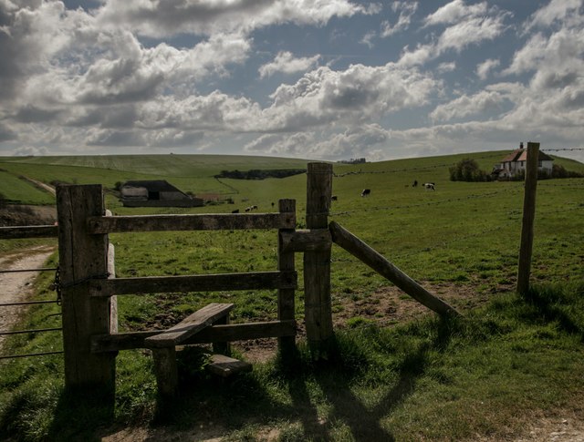
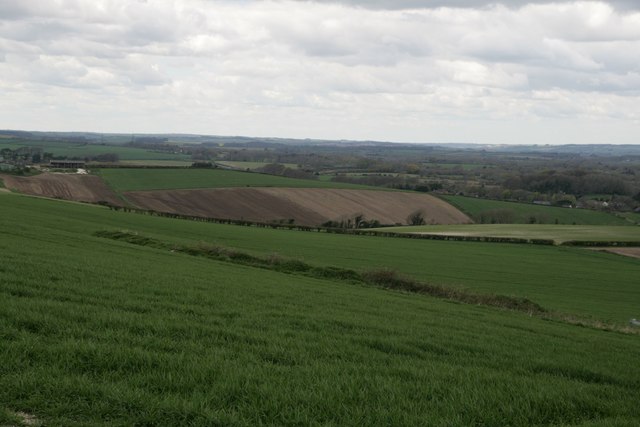
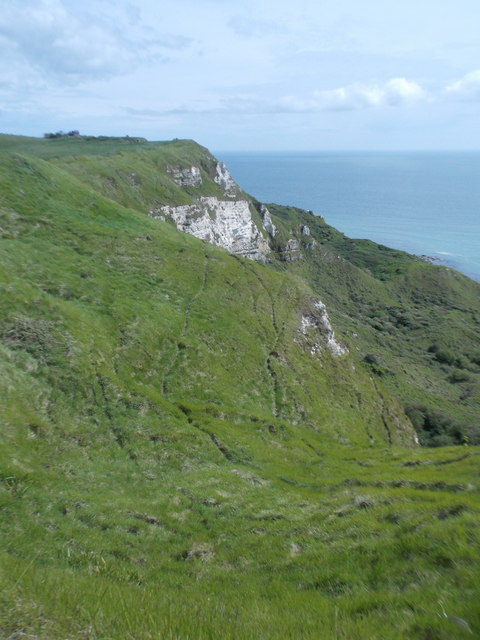
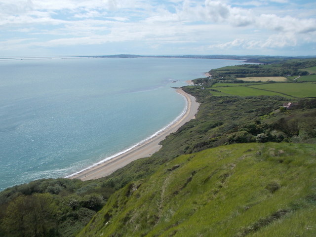
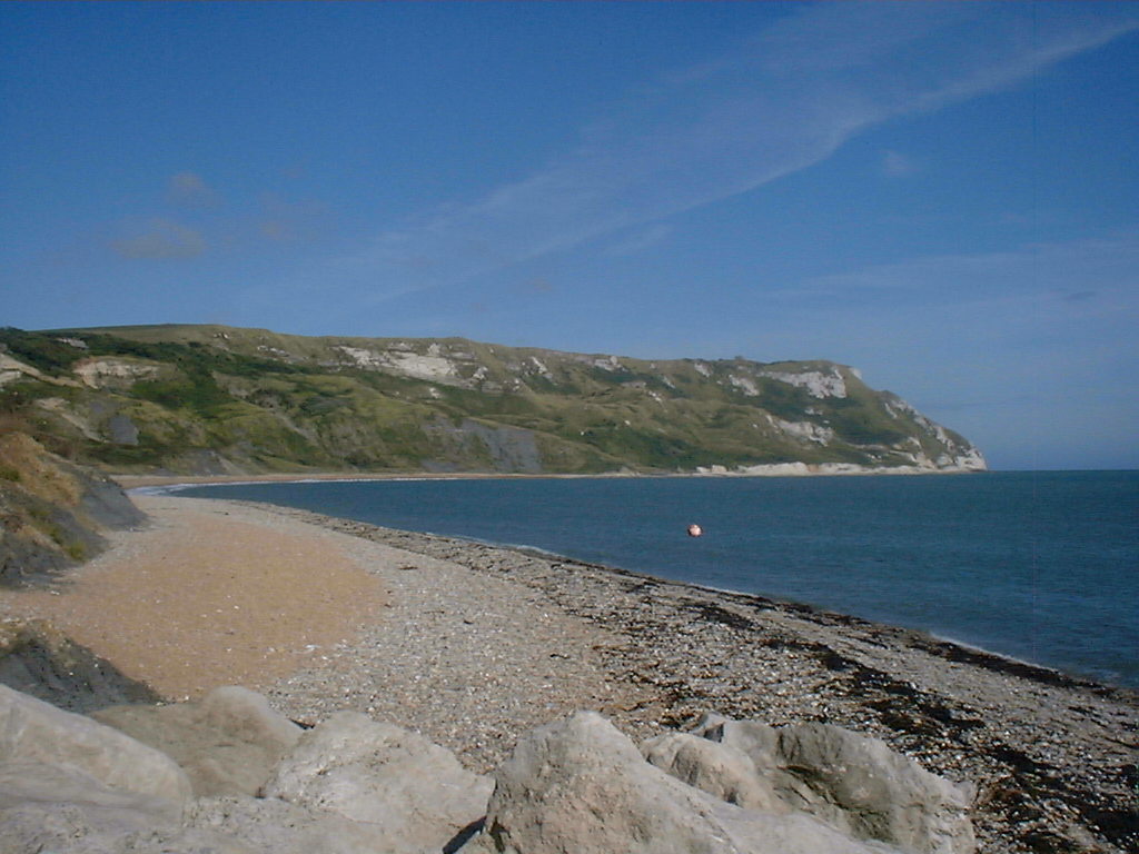
Brimstone Bottom is a picturesque valley located in the county of Dorset, England. Situated amidst the rolling hills and verdant countryside, this idyllic location boasts breathtaking natural beauty and a tranquil ambiance that attracts both locals and tourists alike.

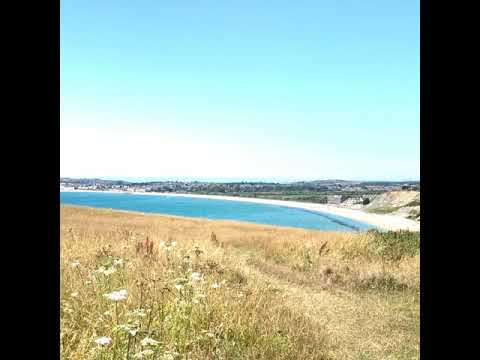
The valley is characterized by its lush green meadows, dotted with vibrant wildflowers during the summer months. The meandering Brimstone River flows through the valley, adding to its charm and providing a serene atmosphere. The river is known for its crystal-clear waters, making it a popular spot for fishing, kayaking, and other water activities.

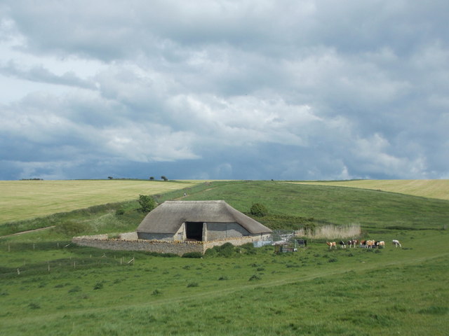
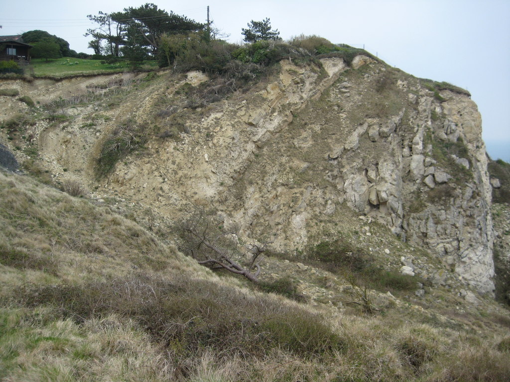
Surrounded by dense woodland, Brimstone Bottom offers excellent opportunities for hiking and exploring nature. The valley is crisscrossed by a network of winding footpaths and trails, allowing visitors to discover hidden gems and enjoy stunning panoramic views of the surrounding landscape.

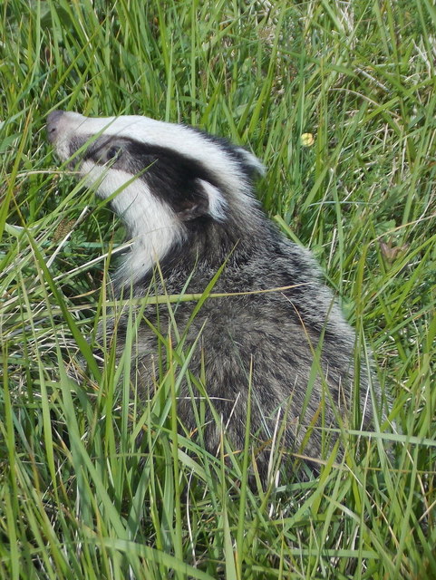
The area is also home to a diverse array of wildlife, making it a haven for nature enthusiasts. Birdwatchers can spot a variety of species, including kingfishers, herons, and even the occasional osprey. Deer and rabbits can be seen roaming freely in the meadows, and if lucky, one might even catch a glimpse of a fox or badger.

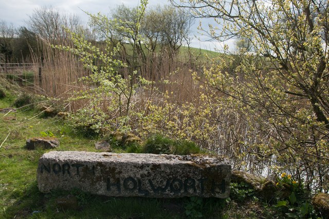
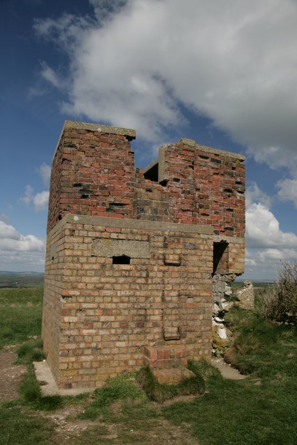
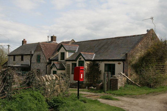
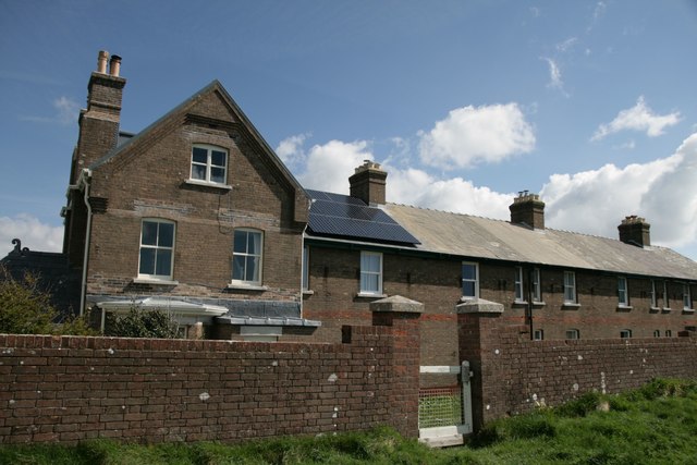
Brimstone Bottom is not only a natural paradise but also steeped in history. There are several ancient ruins and archaeological sites scattered across the valley, offering a glimpse into the region's rich past. The nearby village of Brimstone boasts a charming 14th-century church and traditional thatched-roof cottages, adding to the area's rustic charm.

Overall, Brimstone Bottom is a hidden gem in Dorset, offering visitors a chance to immerse themselves in nature, explore historical sites, and experience the peaceful allure of the English countryside.

If you have any feedback on the listing, please let us know in the comments section below.

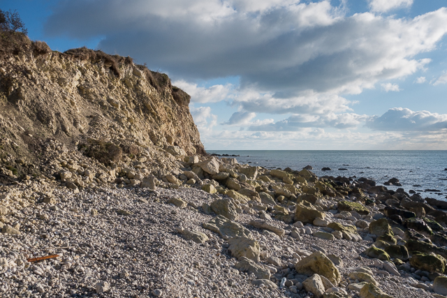
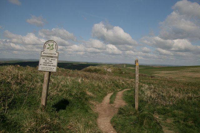
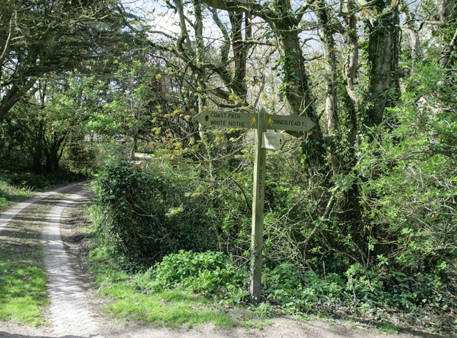
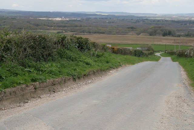
Brimstone Bottom Images

Images are sourced within 2km of 50.642898/-2.3239946 or Grid Reference SY7782. Thanks to Geograph Open Source API. All images are credited.

Stile by old radar station bunker Also waymarker for coast path
Stile by old radar station bunker
Also waymarker for coast path
Coastline in Ringstead Bay
National Trust sign at Whitenothe
Signpost on South-west Coast Path
Road north of Holworth Owermoigne Down barn roof can just be seen to the left of the road.
Road north of Holworth
Owermoigne Down barn roof can just be seen to the left of the road.
Stile and footpath past Brimstone Bottom Barn
Painted sign at North Holworth Farm
Whitenothe Pillbox
Whitenothe Pillbox
Cottages and letterbox at Holworth
Lord's Barrow near Owermoigne Bronze age burial ground.
Lord's Barrow near Owermoigne
Bronze age burial ground.
Whitenothe Cottages Once the coastguard cottages.
Whitenothe Cottages
Once the coastguard cottages.
Holworth: the chapel of St. Catherine’s-by-the-Sea Changes have been made to the chapel since I last photographed it in 2009 (see <a href="https://www.geograph.org.uk/photo/1416551">SY7681 : Holworth: the porch of St. Catherine’s</a>). Up to then, the entrance had been at the western end, making it difficult to photograph it in full without appearing to be from the back or side. 

Now, the entrance has been put into this northern side, making this a much more satisfactory picture.

Also, a little bell turret has been added, meaning that the bell is no longer contained in a separate frame in the churchyard (see <a href="https://www.geograph.org.uk/photo/1416570">SY7681 : Holworth: the bell of St. Catherine’s</a>).
Holworth: the chapel of St. Catherine’s-by-the-Sea
Changes have been made to the chapel since I last photographed it in 2009 (see SY7681 : Holworth: the porch of St. Catherine’s). Up to then, the entrance had been at the western end, making it difficult to photograph it in full without appearing to be from the back or side. Now, the entrance has been put into this northern side, making this a much more satisfactory picture. Also, a little bell turret has been added, meaning that the bell is no longer contained in a separate frame in the churchyard (see SY7681 : Holworth: the bell of St. Catherine’s).
Holworth: buttercups in St. Catherine’s churchyard A yellow carpet covers the churchyard on the seaward side of the <a href="https://www.geograph.org.uk/photo/4963768">SY7681 : Holworth: the chapel of St. Catherine’s-by-the-Sea</a>.
Holworth: buttercups in St. Catherine’s churchyard
A yellow carpet covers the churchyard on the seaward side of the SY7681 : Holworth: the chapel of St. Catherine’s-by-the-Sea.
Holworth: a derelict barn Looking along the northern edge of this square towards a decrepit looking barn on Brimstone Bottom. The darkish clouds look threatening but in fact the sunny appearance of the ground was far more representative of today's lovely weather - I don't think it rained all day nearby.
Holworth: a derelict barn
Looking along the northern edge of this square towards a decrepit looking barn on Brimstone Bottom. The darkish clouds look threatening but in fact the sunny appearance of the ground was far more representative of today's lovely weather - I don't think it rained all day nearby.
Holworth: a thatched barn A well built barn, a contrast to the sorry state of the one beyond but just out of sight to our left, <a href="https://www.geograph.org.uk/photo/4963779">SY7681 : Holworth: a derelict barn</a>.
Holworth: a thatched barn
A well built barn, a contrast to the sorry state of the one beyond but just out of sight to our left, SY7681 : Holworth: a derelict barn.
Holworth: the grassy cliffs of White Nothe The undulating landscape blurs the boundary between the cliff top and the cliff face, no doubt as a result of gradual slips. The white chalk cliff face, that gives the headland half of its name, is apparent beyond but in fact better appreciated from more distant viewpoints.
Holworth: the grassy cliffs of White Nothe
The undulating landscape blurs the boundary between the cliff top and the cliff face, no doubt as a result of gradual slips. The white chalk cliff face, that gives the headland half of its name, is apparent beyond but in fact better appreciated from more distant viewpoints.
Holworth: a badger on White Nothe cliffs This little chap was rummaging around the grassy slopes of White Nothe, not too bothered by my approach, although he did wander off once I was within a few feet.
Holworth: a badger on White Nothe cliffs
This little chap was rummaging around the grassy slopes of White Nothe, not too bothered by my approach, although he did wander off once I was within a few feet.
Holworth: the slopes of White Nothe drop down to Ringstead Bay Looking west from the cliff top at White Nothe - in this direction the cliffs are more like a grassy slope, although there are sheer, white chalk cliff faces behind us.

The land drops down to the shingle beach of Ringstead Bay, while the coastline continues in the background to Weymouth (the town centre is just right of centre) and Portland Harbour (the harbour walls can be seen far-left).
Holworth: the slopes of White Nothe drop down to Ringstead Bay
Looking west from the cliff top at White Nothe - in this direction the cliffs are more like a grassy slope, although there are sheer, white chalk cliff faces behind us. The land drops down to the shingle beach of Ringstead Bay, while the coastline continues in the background to Weymouth (the town centre is just right of centre) and Portland Harbour (the harbour walls can be seen far-left).
Show me another place!

Brimstone Bottom is located at Grid Ref: SY7782 (Lat: 50.642898, Lng: -2.3239946)

Unitary Authority: Dorset

Police Authority: Dorset

What 3 Words

///unclaimed.charts.registry. Near Overcombe, Dorset

Related Wikis

St Catherine-by-the-Sea, Holworth

St Catherine-by-the-Sea is a Church of England church in Holworth, Dorset, England. The small wooden church, which forms part of the Watercombe Benefice...

Burning Cliff

Burning Cliff is a cliff under the White Nothe headland at the eastern end of Ringstead Bay, in Dorset, England. The area is well known for its geology...

Ringstead Bay

Ringstead Bay, with the small village of Ringstead at the eastern end and the prominent headland of White Nothe at the western end, is located on the coast...

RAF Ringstead

RAF Ringstead is a former Royal Air Force radar station at Ringstead Bay, Dorset, England. It is notable for having served three separate functions: first...

Related Videos

WALKS IN DORSET at CHALDON HERRING or EAST CHALDON

In this episode of my series “Walks in Dorset”, I take a 6.5 mile circular walk from the village of Chaldon Herring (also known as ...

The South West Coast Path

A walk from Ringstead Bay - February 2024.

Nearby Amenities

Located within 500m of 50.642898,-2.3239946
Material: wood
Power: pole
Source: bing
Lat/Long: 50.6393917/-2.328008
Material: wood
Power: pole
Source: bing
Lat/Long: 50.6394819/-2.3261086
Material: wood
Power: pole
Source: bing
Lat/Long: 50.6395395/-2.3246157
Material: wood
Power: pole
Source: bing
Lat/Long: 50.6397464/-2.3201286
Material: wood
Power: pole
Source: bing
Lat/Long: 50.6397/-2.3214661
Material: wood
Power: pole
Source: bing
Lat/Long: 50.6396042/-2.3231874
The data included in this document is from www.openstreetmap.org. The data is made available under ODbL.

Have you been to Brimstone Bottom?

Leave your review of Brimstone Bottom below (or comments, questions and feedback).