Primrose

Settlement in Lancashire Lancaster

England

Primrose

Footbridge -- M6 northbound
Footbridge -- M6 northbound Credit: Dave Thompson

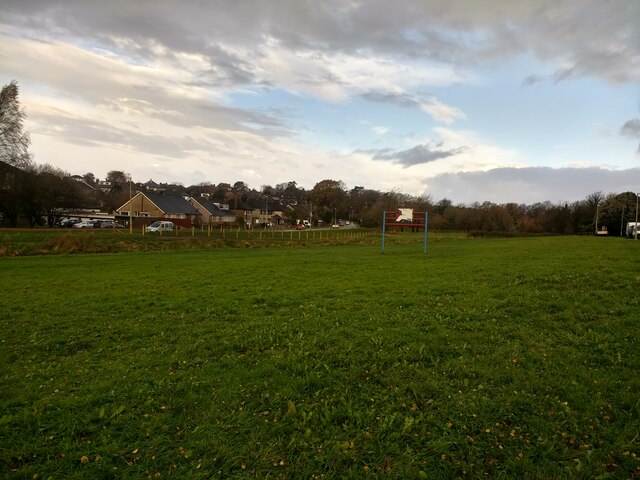
Primrose is a small village located in the county of Lancashire, in the northwest region of England. Nestled in the picturesque countryside, it is surrounded by rolling hills and lush green fields, offering residents and visitors a tranquil and idyllic setting.

With a population of around 1,500 people, Primrose has a close-knit community that prides itself on its friendly and welcoming atmosphere. The village is known for its strong sense of community spirit, with regular events and gatherings that bring residents together.

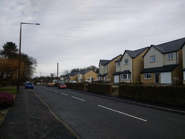
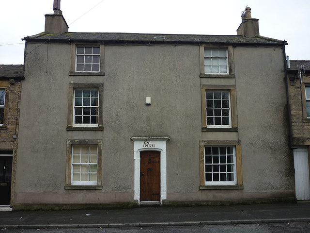
Primrose boasts a rich history, dating back to medieval times. It was once a thriving agricultural community, with farming being the main occupation of its inhabitants. Today, the village retains much of its rural charm, with traditional stone cottages and farmhouses dotting the landscape.

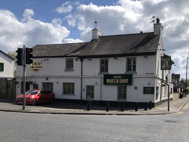
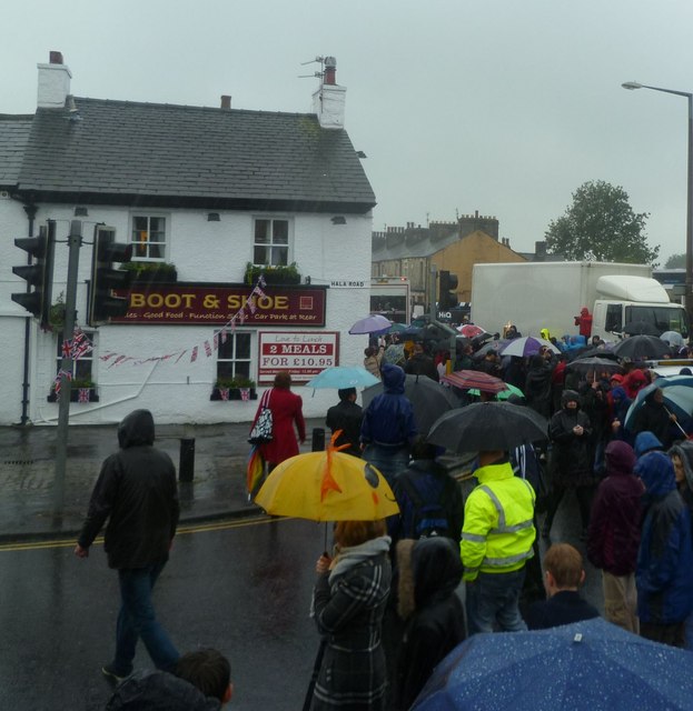
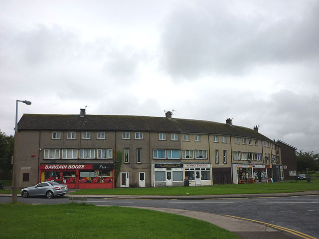
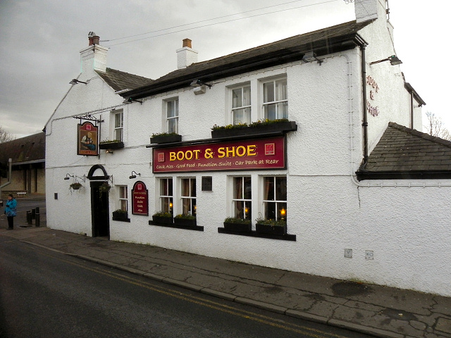
Although Primrose is a small village, it offers a range of amenities and services to cater to the needs of its residents. These include a primary school, a village hall, a local pub, and a small convenience store. For further amenities, the larger town of Lancaster is just a short drive away.

Nature enthusiasts will appreciate the abundance of natural beauty surrounding Primrose. The village is located close to the Forest of Bowland, an Area of Outstanding Natural Beauty, which offers opportunities for hiking, cycling, and wildlife spotting.

In conclusion, Primrose is a peaceful and picturesque village in Lancashire, offering a close-knit community, a rich history, and access to stunning natural landscapes.

If you have any feedback on the listing, please let us know in the comments section below.
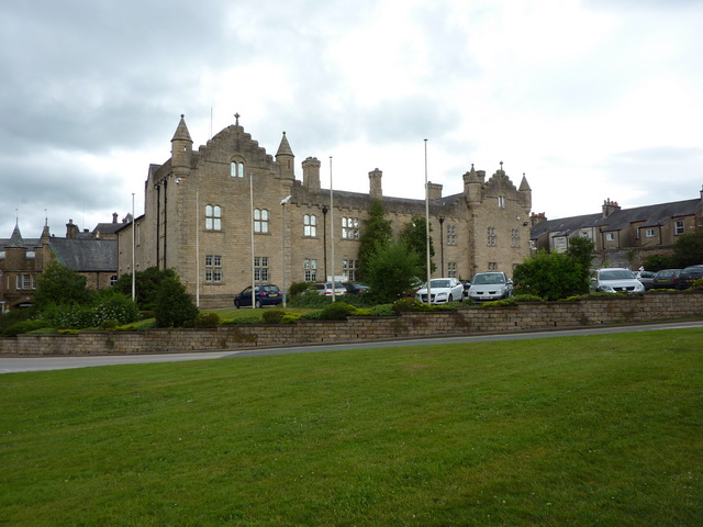
Primrose Images

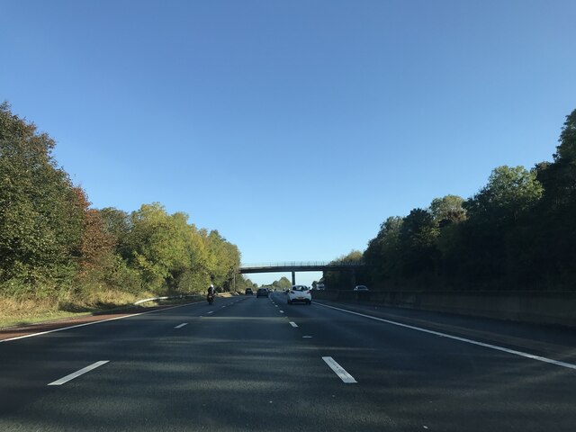
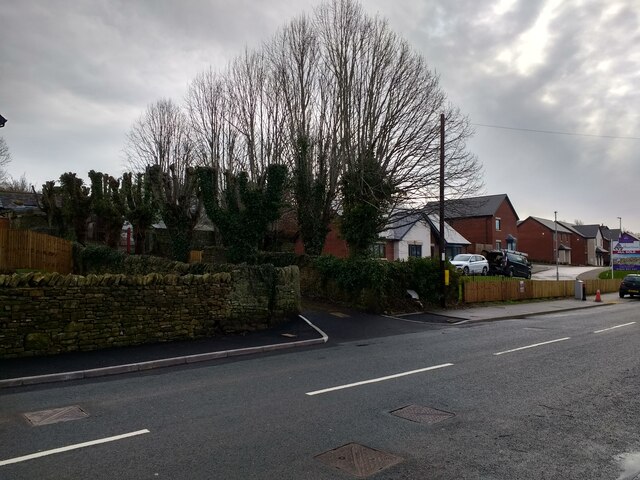
Images are sourced within 2km of 54.042115/-2.7937076 or Grid Reference SD4860. Thanks to Geograph Open Source API. All images are credited.

Footbridge -- M6 northbound
New houses and revamped driveway to Hala Carr Farm
New houses at The Paddocks
The Boot & Shoe, Scotforth
New flood defences finished and fenced off on Burrow Beck
Building formerly Lancaster School of Nursing Looks in disrepair, but around the late 80's, before it closed altogether and the school moved, it was a busy and thriving school, where registered nurse training was in full swing, and opportunities to visit the Royal Albert Hospital itself, for further training was the norm.
Building formerly Lancaster School of Nursing
Looks in disrepair, but around the late 80's, before it closed altogether and the school moved, it was a busy and thriving school, where registered nurse training was in full swing, and opportunities to visit the Royal Albert Hospital itself, for further training was the norm.
Farmland east of the M6 motorway
Quernmore Road
Quernmore Road
Footbridge over the M6 The M6 motorway runs from junction 19 of the M1 at the Catthorpe Interchange, near Rugby to the Gretna junction (J45). Here it becomes the A74(M) and M74 which continues to Glasgow.

The M6 is the longest motorway in the United Kingdom (232 miles) and one of the busiest. It incorporates the first length of motorway opened in the UK (the Preston bypass in 1958) and forms part of a motorway "Backbone of Britain", running north-south between London and Glasgow via the industrial north of England. It is also part of the east-west route between the Midlands and the east coast ports.
Footbridge over the M6
The M6 motorway runs from junction 19 of the M1 at the Catthorpe Interchange, near Rugby to the Gretna junction (J45). Here it becomes the A74(M) and M74 which continues to Glasgow. The M6 is the longest motorway in the United Kingdom (232 miles) and one of the busiest. It incorporates the first length of motorway opened in the UK (the Preston bypass in 1958) and forms part of a motorway "Backbone of Britain", running north-south between London and Glasgow via the industrial north of England. It is also part of the east-west route between the Midlands and the east coast ports.
Olympic Torch Relay, Lancaster Outside Booths on the A6 Scotforth, Lancaster. The torch bearer in white track suit almost totally obscured by an escorting runner.Best I could do! The flame just seen above the escorts head. The rain was torrential with strong winds. The torch appeared to be travelling right on the north south grid line. From Mount Olympus to a wet A6.
Olympic Torch Relay, Lancaster
Outside Booths on the A6 Scotforth, Lancaster. The torch bearer in white track suit almost totally obscured by an escorting runner.Best I could do! The flame just seen above the escorts head. The rain was torrential with strong winds. The torch appeared to be travelling right on the north south grid line. From Mount Olympus to a wet A6.
Olympic Torch Relay, Lancaster Outside The Boot and Shoe, Scotforth, Lancaster. Torch just visible in front of the White Van. Weather appalling! Large crowds in Lancaster and Morecambe today despite the poor conditions.
Olympic Torch Relay, Lancaster
Outside The Boot and Shoe, Scotforth, Lancaster. Torch just visible in front of the White Van. Weather appalling! Large crowds in Lancaster and Morecambe today despite the poor conditions.
Former post office, Scotforth This closed as a post office in about 2006 at a time when the local PO was becoming more and more unviable as a business. Now it is student house letting agency but before this I think it was a fitted window shop or something similar. I remember asking the last postmaster if he was sad about closing and surprisingly he said no. They'd had a violent robbery here not long before and I think they had just had enough.
Former post office, Scotforth
This closed as a post office in about 2006 at a time when the local PO was becoming more and more unviable as a business. Now it is student house letting agency but before this I think it was a fitted window shop or something similar. I remember asking the last postmaster if he was sad about closing and surprisingly he said no. They'd had a violent robbery here not long before and I think they had just had enough.
17th Century house, Hala Road, Scotforth The date stone reads 'EM IM 1698'. The house is Grade II listed <span class="nowrap"><a title="http://www.britishlistedbuildings.co.uk/en-383156-20-lancaster" rel="nofollow ugc noopener" href="http://www.britishlistedbuildings.co.uk/en-383156-20-lancaster">Link</a><img style="margin-left:2px;" alt="External link" title="External link - shift click to open in new window" src="https://s1.geograph.org.uk/img/external.png" width="10" height="10"/></span> but does not look to be currently occupied.
17th Century house, Hala Road, Scotforth
The date stone reads 'EM IM 1698'. The house is Grade II listed LinkExternal link but does not look to be currently occupied.
Shops at Hala
Shops at Hala
Ordnance Survey  Flush Bracket G2801 This bracket can be found on a residence converted from a farm building.
For more detail see : <span class="nowrap"><a title="http://www.bench-marks.org.uk/bm13630" rel="nofollow ugc noopener" href="http://www.bench-marks.org.uk/bm13630">Link</a><img style="margin-left:2px;" alt="External link" title="External link - shift click to open in new window" src="https://s1.geograph.org.uk/img/external.png" width="10" height="10"/></span>
Ordnance Survey Flush Bracket G2801
This bracket can be found on a residence converted from a farm building. For more detail see : LinkExternal link
Footbridge crosses the M6
Footbridge over the M6 The M6 motorway runs from junction 19 of the M1 at the Catthorpe Interchange, near Rugby to the Gretna junction (J45). Here it becomes the A74(M) and M74 which continues to Glasgow.

The M6 is the longest motorway in the United Kingdom (232 miles) and one of the busiest. It incorporates the first length of motorway opened in the UK (the Preston bypass in 1958) and forms part of a motorway "Backbone of Britain", running north-south between London and Glasgow via the industrial north of England. It is also part of the east-west route between the Midlands and the east coast ports.
Footbridge over the M6
The M6 motorway runs from junction 19 of the M1 at the Catthorpe Interchange, near Rugby to the Gretna junction (J45). Here it becomes the A74(M) and M74 which continues to Glasgow. The M6 is the longest motorway in the United Kingdom (232 miles) and one of the busiest. It incorporates the first length of motorway opened in the UK (the Preston bypass in 1958) and forms part of a motorway "Backbone of Britain", running north-south between London and Glasgow via the industrial north of England. It is also part of the east-west route between the Midlands and the east coast ports.
Boot and Shoe Public house on Scotforth Road, near Lancaster.
Boot and Shoe
Public house on Scotforth Road, near Lancaster.
Show me another place!

Primrose is located at Grid Ref: SD4860 (Lat: 54.042115, Lng: -2.7937076)

Administrative County: Lancashire

District: Lancaster

Police Authority: Lancashire

What 3 Words

///inform.funds.wounds. Near Lancaster, Lancashire

Related Wikis

Greaves Park

Greaves House, now known as Greaves Park, is a Grade II listed house in Lancaster, England, now a pub and restaurant, and is also the name of the surrounding...

Lancaster railway station (1840–1849)

The first Lancaster railway station was the northern terminus of the Lancaster and Preston Junction Railway, located in the Greaves area of the city of...

Springfield Barracks

Springfield Barracks is a former military installation in east side of South Road in Lancaster, England. It is a Grade II listed building. == History... ==

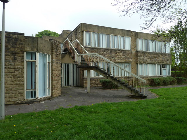
The Adult College, Lancaster

The Adult College was an adult education college located in the centre of Lancaster in Lancashire, England. The college was established in 1975, and moved...

Nearby Amenities

Located within 500m of 54.042115,-2.7937076
Park Hotel
Bus: yes
Public Transport: stop_position
Lat/Long: 54.0419081/-2.7924305
Cycleway: asl
Lat/Long: 54.044889/-2.7990417
Kerb: raised
Tactile Paving: no
Lat/Long: 54.0446043/-2.7990827
Crossing
Crossing: marked
Crossing Island: no
Crossing Markings: yes
Crossing Ref: zebra
Tactile Paving: yes
Lat/Long: 54.0463345/-2.7952067
Turning Circle
Source: Bing
Lat/Long: 54.0393671/-2.7923657
Turning Circle
Source: Bing
Lat/Long: 54.0388102/-2.7923951
Post Box
Collection Times: Mo-Fr 09:00, Sa 07:00
Operator: Royal Mail
Operator Wikidata: Q638098
Post Box Type: pillar
Ref: LA1 71
Royal Cypher: EIIR
Royal Cypher Wikidata: Q33102113
Lat/Long: 54.039529/-2.7963128
Noexit: yes
Lat/Long: 54.0408491/-2.7979384
Noexit: yes
Lat/Long: 54.04066/-2.7971224
Turning Circle
Lat/Long: 54.039588/-2.7994608
Crossing
Crossing: zebra
Kerb: flush
Tactile Paving: yes
Lat/Long: 54.0414878/-2.7962613
Barrier: entrance
Lat/Long: 54.0420262/-2.7924333
Place Of Worship
New Life Church Lancaster
Religion: christian
Website: https://www.newlifelancaster.org.uk/
Wheelchair: limited
Lat/Long: 54.0446864/-2.7977894
Bus Stop
Park Hotel
Bench: yes
Bin: yes
Bus: yes
Lit: yes
Naptan AtcoCode: 2500LA00222
Naptan Bearing: SE
Naptan CommonName: Park Hotel
Naptan Indicator: by
Naptan LocalityCode: N0078715
Naptan NaptanCode: langpgtm
Naptan Street: Bowerham Road
Public Transport: platform
Ref: langpgtm
Shelter: yes
Tactile Paving: no
Lat/Long: 54.0419523/-2.7923885
Medical Unit 1
Entrance: yes
Lat/Long: 54.0440482/-2.7992842
Post Office
Bowerham Road Post Office
Addr City: Lancaster
Addr Housenumber: 1
Addr Postcode: LA1 4BZ
Addr Street: Avondale Road
Branch: Bowerham Road
Brand: Post Office
Brand Wikidata: Q1783168
Check Date: 2020-02-20
Contact Website: https://www.postoffice.co.uk/branch-finder/1634186/bowerham-road
Level: 0
Opening Hours: Mo-We 08:30-17:30; Th,Fr 09:00-17:30; Sa 09:00-13:30
Ref Pol Id: 3932
Wheelchair: limited
Lat/Long: 54.0385472/-2.7900975
Place Of Worship
Hospital Chapel
Lat/Long: 54.0439206/-2.7998784
Bargain Booze
Addr City: Lancaster
Addr Housenumber: 2-4
Addr Postcode: LA1 4UD
Addr Street: Greaves Drive
Brand: Bargain Booze
Brand Wikidata: Q16971315
Brand Wikipedia: en:Bargain Booze
Check Date Opening Hours: 2021-01-13
Opening Hours: Mo-Su 07:30-22:00
Shop: convenience;alcohol
Wheelchair: yes
Lat/Long: 54.0395602/-2.7963622
Place Of Worship
University Chapel
Source: OS_OpenData_StreetView
Lat/Long: 54.0402449/-2.7877396
Post Box
Collection Times: Mo-Fr 09:00, Sa 07:00
Drive Through: no
Post Box Type: wall
Ref: LA1 45
Royal Cypher: EIIR
Royal Cypher Wikidata: Q33102113
Lat/Long: 54.0422533/-2.7948157
Addr City: Lancaster
Addr Housenumber: 2
Addr Postcode: LA1 3DE
Addr Street: Stirling Road
Entrance: yes
Lat/Long: 54.0459213/-2.792032
Fast Food
Masala
Addr City: Lancaster
Addr Housenumber: 6
Addr Postcode: LA1 3BG
Addr Street: Clarence Street
Cuisine: indian
Diet Vegetarian: yes
Drive Through: no
Fhrs Id: 583067
Opening Hours: Mo-Su 17:00-23:00
Phone: +44 1524 388744
Website: https://masalalancaster.co.uk/
Lat/Long: 54.0439338/-2.7923101
Bus Stop
Infirmary
Bench: yes
Bin: yes
Bus: yes
Lit: yes
Naptan AtcoCode: 250020112
Naptan Bearing: SE
Naptan CommonName: Infirmary
Naptan Indicator: opp
Naptan LocalityCode: N0078718
Naptan NaptanCode: lanatpjm
Naptan Street: South Road
Public Transport: platform
Public Transport Version: 2
Ref: lanatpjm
Shelter: yes
Tactile Paving: no
Wheelchair: yes
Lat/Long: 54.0440979/-2.7985407
Turning Circle
Source: Bing
Lat/Long: 54.03946/-2.7977301
Post Box
Collection Times: Mo-Fr 09:00; Sa 07:00
Post Box Type: pillar
Ref: LA1 7
Royal Cypher: GR
Royal Cypher Wikidata: Q33102273
Lat/Long: 54.0459259/-2.7926247
Bench
Backrest: yes
Seats: 2
Lat/Long: 54.0463679/-2.7945957
Crossing
Crossing: uncontrolled
Kerb: lowered
Tactile Paving: no
Lat/Long: 54.0415496/-2.7969107
Give Way
Direction: backward
Lat/Long: 54.0386773/-2.7899259
Direction: backward
Surface: asphalt
Traffic Calming: table
Lat/Long: 54.0421537/-2.8006489
Barrier: lift_gate
Lat/Long: 54.0416072/-2.7985772
Give Way
Direction: forward
Lat/Long: 54.0462908/-2.7948223
Give Way
Direction: forward
Lat/Long: 54.0453878/-2.7932052
Turning Circle
Source: Bing
Lat/Long: 54.0438527/-2.7876483
Turning Circle
Source: Bing
Lat/Long: 54.0438005/-2.7874096
Turning Circle
Lat/Long: 54.0433546/-2.7867241
Barrier: bollard
Bicycle: yes
Bollard: removable
Foot: yes
Lat/Long: 54.0418951/-2.7898943
Noexit: yes
Lat/Long: 54.0440056/-2.7913581
Direction: both
Surface: asphalt
Traffic Calming: hump
Lat/Long: 54.0437469/-2.79376
Noexit: yes
Lat/Long: 54.0414386/-2.7979053
Noexit: yes
Lat/Long: 54.0441729/-2.7984235
Crossing
Crossing: unmarked
Crossing Island: no
Crossing Markings: no
Tactile Paving: yes
Lat/Long: 54.0460356/-2.7952249
Mini Roundabout
Lat/Long: 54.046127/-2.7949443
Give Way
Direction: forward
Lat/Long: 54.0446368/-2.7954265
Noexit: yes
Lat/Long: 54.0449951/-2.7958789
Barrier: lift_gate
Lat/Long: 54.0453626/-2.7957566
Noexit: yes
Lat/Long: 54.0453726/-2.7955024
Noexit: yes
Lat/Long: 54.0447784/-2.7962196
Noexit: yes
Lat/Long: 54.0454046/-2.7959774
Noexit: yes
Lat/Long: 54.0447789/-2.7957557
Bus Stop
Sulby Drive
Bench: no
Bin: no
Bus: yes
Lit: yes
Naptan AtcoCode: 250020036
Naptan Bearing: S
Naptan CommonName: Sulby Drive
Naptan Indicator: opp
Naptan LocalityCode: E0016025
Naptan NaptanCode: lanatmgt
Naptan Street: Greaves Road
Public Transport: platform
Ref: lanatmgt
Shelter: yes
Tactile Paving: no
Lat/Long: 54.0401856/-2.7960261
Bus Stop
Pointer
Bench: yes
Bin: no
Bus: yes
Lit: yes
Naptan AtcoCode: 250020035
Naptan Bearing: SE
Naptan CommonName: Pointer
Naptan Indicator: by
Naptan Landmark: Meadowside South Road
Naptan LocalityCode: N0078718
Naptan NaptanCode: lanatmgp
Naptan Street: South Road
Naptan Verified: yes
Public Transport: platform
Ref: lanatmgp
Shelter: yes
Tactile Paving: no
Lat/Long: 54.042553/-2.7967873
Bus Stop
Infirmary
Bench: yes
Bin: yes
Bus: yes
Lit: yes
Naptan AtcoCode: 2500902
Naptan Bearing: S
Naptan CommonName: Infirmary
Naptan Indicator: o/s
Naptan Landmark: Royal Lancaster Infirmary
Naptan LocalityCode: N0078718
Naptan NaptanCode: landagpw
Naptan Street: Ashton Road
Naptan Verified: yes
Public Transport: platform
Public Transport Version: 2
Ref: landagpw
Shelter: yes
Tactile Paving: no
Wheelchair: yes
Lat/Long: 54.044114/-2.7988159
Fast Food
Goryeo
Addr City: Lancaster
Addr Housenumber: 116
Addr Postcode: LA1 3BH
Addr Street: Prospect Street
Cuisine: korean;fried_chicken
Diet Vegetarian: yes
Drive Through: no
Fhrs Id: 225412
Opening Hours: Mo-Sa 12:00-23:00; Su 16:00-23:00
Takeaway: only
Website: https://goryeolancaster.co.uk/
Lat/Long: 54.0424264/-2.7930567
Crossing
Bicycle: designated
Button Operated: yes
Crossing: traffic_signals
Crossing Ref: toucan
Kerb: flush
Tactile Paving: yes
Traffic Signals Sound: no
Traffic Signals Vibration: yes
Lat/Long: 54.0448005/-2.7992769
Emergency Ward Entrance
Emergency: emergency_ward_entrance
Emergency Ward Entrance: all
Entrance: yes
Level: 0
Wheelchair: yes
Lat/Long: 54.0419495/-2.798878
Entrance: yes
Lat/Long: 54.043369/-2.7988409
Addr Housename: Outpatients / Dermatology
Entrance: yes
Lat/Long: 54.0430089/-2.7986601
Addr Housename: Women's Services Outpatients
Entrance: yes
Lat/Long: 54.0426607/-2.7987191
Addr Housename: Women's Unit
Entrance: yes
Lat/Long: 54.0423891/-2.7991166
Access: yes
Addr Housename: Centenary Building
Entrance: main
Level: 0
Wheelchair: yes
Lat/Long: 54.0422161/-2.7995336
Crossing
Bicycle: yes
Button Operated: yes
Crossing: traffic_signals
Kerb: flush
Tactile Paving: yes
Traffic Signals Sound: no
Traffic Signals Vibration: yes
Lat/Long: 54.0448379/-2.7990786
Telephone
Booth: KX100
Covered: booth
Lat/Long: 54.0456677/-2.792918
Barkers Canine Beautician
Shop: pet_grooming
Lat/Long: 54.0458866/-2.7917718
Post Box
Collection Times: Mo-Fr 17:30, Sa 10:30
Post Box Type: pillar
Ref: LA1 221
Royal Cypher: EIIR
Royal Cypher Wikidata: Q33102113
Lat/Long: 54.044692/-2.7953235
Cafe
The Gatehouse Cafe & Restaurant
Addr City: Lancaster
Lat/Long: 54.0450935/-2.7973286
Fast Food
Fired Wok
Addr City: Lancaster
Addr Housenumber: 98
Addr Postcode: LA1 3BH
Addr Street: Prospect Street
Check Date Opening Hours: 2022-12-04
Cuisine: chinese
Delivery: yes
Diet Vegetarian: yes
Drive Through: no
Fhrs Id: 113354
Opening Hours: Tu-Su 17:00-22:00; Mo off
Phone: +44 1524 36000
Takeaway: only
Website: https://www.firedwok.co.uk/
Lat/Long: 54.0428365/-2.7930858
Fast Food
Hodgson's
Addr City: Lancaster
Addr Housenumber: 96
Addr Postcode: LA1 3BH
Addr Street: Prospect Street
Check Date Opening Hours: 2022-12-04
Cuisine: fish_and_chips
Diet Vegetarian: yes
Fhrs Id: 89887
Indoor Seating: no
Opening Hours: Mo-Sa 11:30-20:00; Su off
Outdoor Seating: no
Takeaway: only
Lat/Long: 54.0428884/-2.7930879
Go Local
Addr City: Lancaster
Addr Housenumber: 1
Addr Postcode: LA1 3AY
Addr Street: Eastham Street
Brand: Go Local
Brand Wikidata: Q120634011
Opening Hours Signed: no
Shop: convenience
Source Addr: FHRS Open Data
Lat/Long: 54.0429387/-2.7927881
Post Box
Collection Times: Mo-Fr 09:00; Sa 07:00
Ref: LA1 191
Royal Cypher: EIIR
Royal Cypher Wikidata: Q33102113
Lat/Long: 54.0430114/-2.7921945
Post Box
Collection Times: Mo-Fr 09:00; Sa 07:00
Post Box Type: pillar
Ref: LA1 224D
Royal Cypher: EIIR
Royal Cypher Wikidata: Q33102113
Lat/Long: 54.0407335/-2.7880199
Post Box
Collection Times: Mo-Fr 17:00; Sa 11:30
Ref: LA1 64
Royal Cypher: EIIR
Royal Cypher Wikidata: Q33102113
Lat/Long: 54.0385346/-2.790025
Waste Basket
Check Date: 2024-04-25
Lat/Long: 54.0381198/-2.7958939
Lancaster and Morecambe Makers
Addr City: Lancaster
Addr Housename: Harpers Mill
Addr Postcode: LA1 4XF
Addr Street: White Cross Business Park
Addr Unit: 4-4-8
Hackerspace: makerspace
Leisure: hackerspace
Website: https://lamm.space/
Workshop: fablab
Lat/Long: 54.0450899/-2.7959027
Bench
Backrest: yes
Check Date: 2024-04-25
Material: wood
Lat/Long: 54.0422803/-2.7969074
Railway Street
Location: indoor
Operator: Electricity North West
Operator Wikidata: Q5357804
Power: substation
Ref: 643276
Substation: minor_distribution
Lat/Long: 54.0420944/-2.7971805
Crossing
Crossing: uncontrolled
Kerb: lowered
Tactile Paving: no
Lat/Long: 54.0416233/-2.7970258
Access: permissive
Entrance: secondary
Exit: yes
Lat/Long: 54.0432099/-2.7996593
Waste Basket
Lat/Long: 54.0398922/-2.7947655
Waste Basket
Lat/Long: 54.0403831/-2.79556
Maxwidth Physical: 3
Lat/Long: 54.0404402/-2.796006
Barrier: bollard
Motor Vehicle: no
Lat/Long: 54.0380943/-2.7905473
Bench
Lat/Long: 54.0404245/-2.795371
Waste Basket
Check Date: 2023-11-07
Lat/Long: 54.0395287/-2.7962958
Bus Stop
Sulby Drive
Bench: no
Bin: no
Bus: yes
Lit: yes
Naptan AtcoCode: 250012188
Naptan Bearing: N
Naptan CommonName: Sulby Drive
Naptan Indicator: by
Naptan LocalityCode: E0016025
Naptan NaptanCode: lanagwpm
Naptan Street: Greaves Road
Public Transport: platform
Ref: lanagwpm
Shelter: yes
Tactile Paving: no
Lat/Long: 54.0396221/-2.7961696
Grit Bin
Lat/Long: 54.0390936/-2.7985158
Waste Basket
Check Date: 2023-11-07
Lat/Long: 54.0405752/-2.7960123
Bench
Backrest: yes
Mapillary: 806718500220756
Survey Date: 2019-02-09
Lat/Long: 54.0417638/-2.7958295
Bench
Backrest: yes
Lat/Long: 54.041405/-2.7958789
Bench
Backrest: yes
Lat/Long: 54.0412216/-2.7958928
Man Made: street_cabinet
Operator: Openreach
Operator Wikidata: Q7096543
Utility: telecom
Lat/Long: 54.0423341/-2.7961336
Man Made: street_cabinet
Operator: Openreach
Operator Wikidata: Q7096543
Utility: telecom
Lat/Long: 54.0423582/-2.7962796
Bench
Backrest: yes
Lat/Long: 54.0441628/-2.7985417
Bench
Backrest: yes
Lat/Long: 54.0441414/-2.798502
Waste Basket
Check Date: 2024-02-21
Lat/Long: 54.044126/-2.7984853
Waste Basket
Check Date: 2023-11-07
Lat/Long: 54.0423868/-2.7965244
Waste Basket
Lat/Long: 54.0384274/-2.7949304
Bus Stop
Greaves Park
Bench: yes
Bin: no
Bus: yes
Lit: yes
Naptan AtcoCode: 2500DCL3020
Naptan Bearing: W
Naptan CommonName: Greaves Park
Naptan Indicator: by
Naptan LocalityCode: E0016025
Naptan NaptanCode: landgjgj
Naptan Street: Bowerham Road
Note: 2017-09-30 Timetable in shelter shows routes 2, 2A, 2X, 3, 4, N2
Public Transport: platform
Public Transport Version: 2
Ref: landgjgj
Shelter: yes
Tactile Paving: no
Lat/Long: 54.0421241/-2.7944487
Waste Basket
Check Date: 2023-11-13
Lat/Long: 54.039192/-2.7989012
Bus Stop
Malvern Avenue
Bench: no
Bin: no
Bus: yes
Lit: yes
Naptan AtcoCode: 2500DCL3022
Naptan Bearing: S
Naptan CommonName: Malvern Avenue
Naptan Indicator: opp
Naptan LocalityCode: E0015942
Naptan NaptanCode: landgjgp
Naptan Street: Bowerham Road
Public Transport: platform
Public Transport Version: 2
Ref: landgjgp
Shelter: yes
Tactile Paving: no
Lat/Long: 54.0401593/-2.790662
Waste Basket
Lat/Long: 54.0386994/-2.7901264
Bus Stop
Malvern Avenue
Bench: yes
Bin: no
Bus: yes
Lit: yes
Naptan AtcoCode: 2500IMG1211
Naptan Bearing: N
Naptan CommonName: Malvern Avenue
Naptan Indicator: by
Naptan LocalityCode: E0015942
Naptan NaptanCode: landpmag
Naptan Street: Bowerham Road
Public Transport: platform
Public Transport Version: 2
Ref: landpmag
Shelter: yes
Tactile Paving: no
Lat/Long: 54.0399283/-2.7906881
Bench
Backrest: yes
Mapillary: 2950326728581443
Survey Date: 2018-05-30
Lat/Long: 54.0409016/-2.7911996
Waste Basket
Lat/Long: 54.040976/-2.7915579
Waste Basket
Lat/Long: 54.0408127/-2.7914367
Bus Stop
St Martins Road
Bench: yes
Bin: no
Bus: yes
Lit: yes
Naptan AtcoCode: 2500893
Naptan Bearing: S
Naptan CommonName: St Martins Road
Naptan Indicator: by
Naptan LocalityCode: N0078715
Naptan NaptanCode: landagmp
Naptan Street: St Martins Road
Public Transport: platform
Ref: landagmp
Shelter: no
Tactile Paving: no
Lat/Long: 54.0426308/-2.7894567
Bus Stop
Cathedral Primary School
Bench: no
Bin: no
Bus: yes
Lit: yes
Naptan AtcoCode: 2500DCL3083
Naptan Bearing: NE
Naptan CommonName: Cathedral Primary School
Naptan Indicator: o/s
Naptan LocalityCode: E0015965
Naptan NaptanCode: landgmpg
Naptan Street: Balmoral Road
Public Transport: platform
Ref: landgmpg
Shelter: no
Tactile Paving: no
Lat/Long: 54.0464814/-2.7928439
Bus Stop
Cathedral Primary School
Bench: no
Bin: no
Bus: yes
Departures Board: no
Lit: yes
Naptan AtcoCode: 2500LAA07490
Naptan Bearing: W
Naptan CommonName: Cathedral Primary School
Naptan Indicator: by
Naptan LocalityCode: E0015965
Naptan NaptanCode: lanjpgpm
Naptan Street: Balmoral Road
Public Transport: platform
Ref: lanjpgpm
Shelter: no
Tactile Paving: no
Lat/Long: 54.0463532/-2.7932785
Bus Stop
Prospect Street
Bench: no
Bus: yes
Naptan AtcoCode: 2500LAA16521
Naptan Bearing: SE
Naptan CommonName: Prospect Street
Naptan Indicator: opp
Naptan LocalityCode: N0078715
Naptan Street: Primrose Street
Physically Present: no
Public Transport: platform
Shelter: no
Lat/Long: 54.0450536/-2.7931065
Bus Stop
Quarry Mount Mews
Bus: yes
Naptan AtcoCode: 2500DCL3087
Naptan Bearing: S
Naptan CommonName: Quarry Mount Mews
Naptan Indicator: by
Naptan LocalityCode: E0015965
Naptan NaptanCode: landgmpw
Naptan Street: Quarry Road
Physically Present: no
Public Transport: platform
Ref: landgmpw
Lat/Long: 54.0456731/-2.7937898
Bus Stop
Prospect Street
Bench: no
Bus: yes
Naptan AtcoCode: 2500LAA16522
Naptan Bearing: N
Naptan CommonName: Prospect Street
Naptan Indicator: by
Naptan LocalityCode: N0078715
Naptan Street: Primrose Street
Physically Present: no
Public Transport: platform
Shelter: no
Lat/Long: 54.0446808/-2.7928767
Noexit: yes
Lat/Long: 54.0407223/-2.7965516
Crossing
Crossing: unmarked
Crossing Markings: no
Tactile Paving: no
Lat/Long: 54.0422086/-2.7960577
Crossing
Crossing: unmarked
Crossing Markings: no
Tactile Paving: no
Lat/Long: 54.0421275/-2.7959194
Crossing
Crossing: unmarked
Crossing Island: no
Tactile Paving: no
Lat/Long: 54.0407186/-2.7993056
Stop
Direction: forward
Lat/Long: 54.040686/-2.7992264
Waste Basket
Waste: dog_excrement
Lat/Long: 54.0443752/-2.800011
Give Way
Direction: forward
Lat/Long: 54.0377641/-2.7932147
Give Way
Direction: backward
Lat/Long: 54.0381935/-2.7932363
Give Way
Direction: backward
Lat/Long: 54.04019/-2.7908533
Give Way
Direction: backward
Lat/Long: 54.039666/-2.7905147
Give Way
Direction: backward
Lat/Long: 54.0391442/-2.7902533
Give Way
Direction: forward
Lat/Long: 54.0391754/-2.7901461
Give Way
Direction: backward
Lat/Long: 54.0378721/-2.795806
Give Way
Direction: forward
Lat/Long: 54.0383086/-2.7973886
Give Way
Direction: backward
Lat/Long: 54.0385476/-2.7959916
Give Way
Direction: backward
Lat/Long: 54.03944/-2.796099
Give Way
Direction: backward
Lat/Long: 54.0398897/-2.7961444
Give Way
Direction: backward
Lat/Long: 54.0399211/-2.7960472
Give Way
Direction: forward
Lat/Long: 54.040383/-2.7993712
Give Way
Direction: backward
Lat/Long: 54.040174/-2.7996524
Greaves Park
Bus: yes
Public Transport: stop_position
Public Transport Version: 2
Lat/Long: 54.0421687/-2.7944529
Malvern Avenue
Bus: yes
Public Transport: stop_position
Public Transport Version: 2
Lat/Long: 54.0401461/-2.7907231
Malvern Avenue
Bus: yes
Public Transport: stop_position
Public Transport Version: 2
Lat/Long: 54.039939/-2.7905978
Infirmary
Bus: yes
Public Transport: stop_position
Public Transport Version: 2
Lat/Long: 54.0440819/-2.798614
Infirmary
Bus: yes
Public Transport: stop_position
Public Transport Version: 2
Lat/Long: 54.0441447/-2.7986742
Pointer
Bus: yes
Public Transport: stop_position
Lat/Long: 54.0425669/-2.7968895
Quarry Mount Mews
Bus: yes
Public Transport: stop_position
Lat/Long: 54.0456344/-2.7938319
Prospect Street
Bus: yes
Public Transport: stop_position
Lat/Long: 54.0450011/-2.7931851
Prospect Street
Bus: yes
Public Transport: stop_position
Lat/Long: 54.0447098/-2.7928182
St Martin's Road
Bus: yes
Public Transport: stop_position
Lat/Long: 54.042637/-2.7895232
Cathedral Primary School
Bus: yes
Public Transport: stop_position
Lat/Long: 54.0464506/-2.7928475
Cathedral Primary School
Bus: yes
Public Transport: stop_position
Lat/Long: 54.0463958/-2.7932723
Sulby Drive
Bus: yes
Public Transport: stop_position
Lat/Long: 54.0401936/-2.796118
Sulby Drive
Bus: yes
Public Transport: stop_position
Public Transport Version: 2
Lat/Long: 54.0396004/-2.7960522
Crossing
Crossing: zebra
Kerb: flush
Tactile Paving: yes
Lat/Long: 54.0415345/-2.7960956
Natural: stone
Lat/Long: 54.040028/-2.7947773
Bench
Backrest: no
Lat/Long: 54.040113/-2.7951126
Bench
Backrest: no
Lat/Long: 54.0398142/-2.7952521
Bench
Backrest: no
Lat/Long: 54.0395641/-2.795586
Waste Basket
Check Date: 2024-04-24
Lat/Long: 54.042082/-2.7951432
Bench
Backrest: no
Lat/Long: 54.0411904/-2.7950185
Bench
Backrest: no
Lat/Long: 54.0413598/-2.7950397
Waste Basket
Lat/Long: 54.0412382/-2.7953154
Waste Basket
Lat/Long: 54.0415185/-2.7954888
Royal Infirmary Main Entrance
Bus: yes
Public Transport: stop_position
Lat/Long: 54.042188/-2.7992186
Bus Stop
Royal Infirmary Main Entrance
Bench: yes
Bus: yes
Departures Board: yes
Naptan AtcoCode: 2500LAA07314
Naptan Bearing: S
Naptan CommonName: Royal Infirmary Main Entrance
Naptan Indicator: by
Naptan Landmark: LRI
Naptan LocalityCode: N0078718
Naptan NaptanCode: lanjmwdp
Naptan Street: Ashton Road
Naptan Verified: yes
Public Transport: platform
Ref: lanjmwdp
Shelter: yes
Lat/Long: 54.0421485/-2.7992374
Entrance: main
Lat/Long: 54.0411884/-2.7991422
Waste Basket
Lat/Long: 54.0412266/-2.7990809
Bench
Backrest: yes
Lat/Long: 54.0439442/-2.7986652
Waste Basket
Lat/Long: 54.0440898/-2.798802
Telephone
Booth: KX100
Check Date: 2023-11-07
Covered: booth
Lat/Long: 54.0441347/-2.7990004
Recycling
Recycling Cans: yes
Recycling Glass Bottles: yes
Recycling Paper: yes
Recycling Plastic: no
Recycling Plastic Bottles: yes
Recycling Plastic Packaging: no
Recycling Type: container
Lat/Long: 54.0438993/-2.7989978
Waste Basket
Lat/Long: 54.0433272/-2.7986794
Recycling
Recycling Cardboard: yes
Recycling Plastic Bottles: yes
Recycling Type: container
Lat/Long: 54.0422417/-2.798757
Waste Basket
Lat/Long: 54.0421531/-2.798806
Barrier: lift_gate
Lat/Long: 54.0426599/-2.7982397
Barrier: lift_gate
Lat/Long: 54.0402154/-2.8001109
Check Date: 2024-04-23
Disused: yes
Disused Amenity: pub
Disused Name: Revolutions
Level: 0
Lat/Long: 54.0450893/-2.7993524
Give Way
Direction: backward
Lat/Long: 54.0450103/-2.7988768
Traffic Signals
Traffic Signals: signal
Traffic Signals Direction: forward
Lat/Long: 54.0448523/-2.7990682
Cycleway: asl
Lat/Long: 54.044961/-2.7991247
Traffic Signals
Traffic Signals: signal
Traffic Signals Direction: forward
Lat/Long: 54.0449423/-2.7991862
Traffic Signals
Traffic Signals: signal
Traffic Signals Direction: forward
Lat/Long: 54.0449947/-2.7992313
Crossing
Bicycle: designated
Button Operated: yes
Crossing: traffic_signals
Crossing Ref: toucan
Kerb: flush
Tactile Paving: yes
Traffic Signals Sound: no
Traffic Signals Vibration: yes
Lat/Long: 54.0449327/-2.799217
Crossing
Bicycle: designated
Button Operated: yes
Crossing: traffic_signals
Crossing Ref: toucan
Kerb: flush
Tactile Paving: yes
Traffic Signals Sound: no
Traffic Signals Vibration: yes
Lat/Long: 54.0449915/-2.7992633
Cycleway: asl
Lat/Long: 54.0447228/-2.7992083
Traffic Signals
Traffic Signals: signal
Traffic Signals Direction: forward
Lat/Long: 54.0447653/-2.7992474
Cycleway: asl
Lat/Long: 54.0447974/-2.7996787
Traffic Signals
Traffic Signals: signal
Traffic Signals Direction: backward
Lat/Long: 54.0448259/-2.7996056
Give Way
Direction: forward
Lat/Long: 54.044758/-2.7998855
Bowerham
Place: suburb
Lat/Long: 54.0378953/-2.7913711
Greaves
Place: suburb
Lat/Long: 54.0397322/-2.7971149
Moorlands
Place: suburb
Lat/Long: 54.0451815/-2.7928985
Primrose
Place: neighbourhood
Lat/Long: 54.0431818/-2.7917834
Bicycle Parking
Bicycle Parking: stands
Capacity: 6
Covered: no
Lat/Long: 54.0406237/-2.7875557
Man Made: street_cabinet
Ref: A3019
Street Cabinet: traffic_control
Lat/Long: 54.0448939/-2.7991427
Kindergarten
The Cathedral Playgroup & Pre-School
Addr City: Lancaster
Addr Postcode: LA1 3BT
Addr Street: Balmoral Road
Check Date: 2024-02-14
Fhrs Id: 733507
Preschool: yes
Website: https://cathedralpreschool.wixsite.com/cpps
Lat/Long: 54.0463817/-2.7943726
Pharmacy
Pharmacy Department
Addr City: Lancaster
Addr Housename: Royal Lancaster Infirmary
Addr Postcode: LA1 4RP
Addr Street: Ashton Road
Dispensing: yes
Healthcare: pharmacy
Lat/Long: 54.0435174/-2.7999146
Cafe
Atkinson's Sandwich Bar
Addr City: Lancaster
Addr Housenumber: 2
Addr Postcode: LA1 3BN
Addr Street: Primrose Street
Cuisine: sandwich;coffee
Diet Vegetarian: yes
Fhrs Id: 1065236
Opening Hours: Mo-Fr 08:00-14:00; Sa-Su off
Outdoor Seating: yes
Takeaway: only
Lat/Long: 54.0447685/-2.7931424
Give Way
Direction: backward
Lat/Long: 54.0408226/-2.7995035
Give Way
Direction: backward
Lat/Long: 54.0409786/-2.7999222
Give Way
Direction: backward
Lat/Long: 54.0411726/-2.8003863
Give Way
Direction: forward
Lat/Long: 54.0423406/-2.8007742
Grit Bin
Lat/Long: 54.0422035/-2.8007964
Bench
Backrest: yes
Lat/Long: 54.04222/-2.8008002
Bench
Backrest: yes
Lat/Long: 54.0421763/-2.8010743
Crossing
Crossing: zebra
Crossing Island: no
Kerb: lowered
Tactile Paving: no
Lat/Long: 54.0423416/-2.8007874
Give Way
Direction: backward
Lat/Long: 54.0422042/-2.8006367
Crossing
Crossing: zebra
Crossing Island: no
Tactile Paving: no
Lat/Long: 54.0428031/-2.8006542
Give Way
Direction: forward
Lat/Long: 54.0427966/-2.8006391
Man Made: chimney
Lat/Long: 54.0431406/-2.8008447
Entrance: yes
Wheelchair: yes
Lat/Long: 54.0430721/-2.7994528
Crossing
Crossing: zebra
Crossing Island: no
Tactile Paving: no
Lat/Long: 54.042854/-2.8003155
Content: liquid_oxygen
Man Made: storage_tank
Lat/Long: 54.0427639/-2.8002699
Stop
Direction: forward
Stop: minor
Lat/Long: 54.0422225/-2.8011478
Entrance: main
Lat/Long: 54.042331/-2.8013024
Barrier: entrance
Lat/Long: 54.0451462/-2.7883678
Waste Basket
Lat/Long: 54.0449527/-2.7877599
Give Way
Direction: backward
Lat/Long: 54.0409131/-2.7988736
Entrance: main
Lat/Long: 54.0406094/-2.7988489
Entrance: main
Lat/Long: 54.040228/-2.7993166
Waste Basket
Lat/Long: 54.0392411/-2.7987347
Give Way
Direction: forward
Lat/Long: 54.0422517/-2.7959
Crossing
Crossing: uncontrolled
Crossing Island: no
Kerb: lowered
Lat/Long: 54.0423422/-2.7959589
Waste Basket
Lat/Long: 54.0422807/-2.7953156
Barrier: entrance
Lat/Long: 54.0422373/-2.7946054
Waste Basket
Lat/Long: 54.0420759/-2.7936703
Crossing
Crossing: uncontrolled
Crossing Island: yes
Kerb: flush
Tactile Paving: no
Lat/Long: 54.042131/-2.7935694
Direction: both
Surface: asphalt
Traffic Calming: hump
Lat/Long: 54.0426061/-2.7937265
Direction: both
Surface: asphalt
Traffic Calming: hump
Lat/Long: 54.0432053/-2.7937533
Direction: both
Surface: asphalt
Traffic Calming: hump
Lat/Long: 54.0444019/-2.7934406
Give Way
Direction: forward
Lat/Long: 54.0448514/-2.7932349
Entrance: yes
Lat/Long: 54.0420306/-2.7942925
Barrier: entrance
Lat/Long: 54.042103/-2.7942771
Entrance: main
Lat/Long: 54.0433438/-2.7955375
Origin Spinal Care
Office: company
Lat/Long: 54.0452134/-2.7967126
Recycling
Auction Mart Recycling Point
Opening Hours: 24/7
Recycling Cans: yes
Recycling Cardboard: yes
Recycling Cartons: yes
Recycling Clothes: yes
Recycling Dog Waste: yes
Recycling Glass: yes
Recycling Glass Bottles: yes
Recycling Paper: yes
Recycling Paper Cups: yes
Recycling Plastic Bottles: yes
Recycling Shoes: yes
Recycling Small Electrical Appliances: yes
Recycling Tetrapak: yes
Recycling Type: centre
Wheelchair: yes
Lat/Long: 54.0451936/-2.7978254
Waste Basket
Lat/Long: 54.0450068/-2.7986386
Barrier: height_restrictor
Maxheight: 2.28
Lat/Long: 54.0450127/-2.7987179
Barrier: entrance
Lat/Long: 54.0446911/-2.7989897
Barrier: bollard
Bicycle: designated
Bollard: fixed
Foot: designated
Lat/Long: 54.0446004/-2.7992151
Waste Basket
Lat/Long: 54.0445724/-2.7991757
Barrier: entrance
Lat/Long: 54.044779/-2.7993785
Bench
Backrest: yes
Lat/Long: 54.0446506/-2.7997985
Bench
Backrest: no
Lat/Long: 54.0446408/-2.7998441
Bench
Backrest: yes
Lat/Long: 54.0446264/-2.7998906
Bench
Backrest: yes
Lat/Long: 54.0446881/-2.7996416
Bench
Backrest: no
Lat/Long: 54.044702/-2.7995987
Bench
Backrest: yes
Lat/Long: 54.0447164/-2.799547
Bench
Backrest: yes
Lat/Long: 54.0447535/-2.7993716
Bench
Backrest: no
Lat/Long: 54.044615/-2.8000475
Bench
Backrest: no
Lat/Long: 54.0446264/-2.7999957
Bench
Backrest: no
Seats: 4
Lat/Long: 54.0457782/-2.7968753
Bench
Backrest: no
Seats: 4
Lat/Long: 54.0458686/-2.79686
Bench
Backrest: no
Seats: 4
Lat/Long: 54.0458663/-2.7967608
Barrier: entrance
Lat/Long: 54.0462919/-2.795701
Entrance: main
Lat/Long: 54.0461542/-2.7956278
Crossing
Crossing: unmarked
Crossing Island: no
Crossing Markings: no
Kerb: flush
Tactile Paving: yes
Lat/Long: 54.0461709/-2.7951445
Give Way
Direction: forward
Lat/Long: 54.0462303/-2.7949162
Crossing
Crossing: unmarked
Crossing Island: yes
Crossing Markings: no
Tactile Paving: no
Lat/Long: 54.0462107/-2.794924
Give Way
Direction: forward
Lat/Long: 54.0445385/-2.7924346
Give Way
Direction: forward
Lat/Long: 54.044129/-2.7926891
Waste Basket
Lat/Long: 54.0444351/-2.7924715
Waste Basket
Lat/Long: 54.044776/-2.7930644
Vending Machine
Vending: parking_tickets
Lat/Long: 54.0455594/-2.7978752
Charging Station
Authentication Membership Card: yes
Brand: BP chargemaster
Capacity: 2
Fee: no
Motorcar: yes
Network: Polar
Opening Hours: 24/7
Operator: Lancaster City Council
Operator Wikidata: Q73072658
Parking Fee: yes
Ref: 11693
Socket Type2: 2
Socket Type2 Current: 32A
Socket Type2 Output: 22kW
Lat/Long: 54.0450304/-2.7985674
Addr Housename: Revolution
Addr Street: Penny Street
Disused Entrance: yes
Lat/Long: 54.0450898/-2.7993794
Entrance: yes
Lat/Long: 54.0448842/-2.7995987
Entrance: yes
Lat/Long: 54.0449956/-2.7995562
Access: private
Addr Housename: Thurnham Mews
Addr Street: Thurnham Street
Entrance: yes
Lat/Long: 54.0452424/-2.7988781
Access: private
Addr Housename: Victoria Court
Addr Street: Thurnham Street
Entrance: yes
Wheelchair: no
Lat/Long: 54.0453288/-2.7987935
Barrier: entrance
Lat/Long: 54.0456021/-2.798548
Barrier: entrance
Lat/Long: 54.0454399/-2.7986786
Lancaster Blood Donor Centre
Addr City: Lancaster
Addr Housename: Royal Lancaster Infirmary
Addr Postcode: LA1 4RP
Addr Street: Ashton Road
Blood Platelets: yes
Blood Whole: yes
Healthcare: blood_donation
Website: https://www.blood.co.uk/the-donation-process/about-our-donation-venues/lancaster/
Lat/Long: 54.0431274/-2.7997107
Noexit: yes
Lat/Long: 54.046459/-2.7955328
Barrier: entrance
Lat/Long: 54.0463885/-2.7952248
Give Way
Direction: backward
Lat/Long: 54.0465292/-2.7947057
Bench
Backrest: yes
Seats: 2
Lat/Long: 54.0464326/-2.7945251
Waste Basket
Lat/Long: 54.0462975/-2.7947168
Give Way
Direction: forward
Lat/Long: 54.0386623/-2.7900365
Generator Method: photovoltaic
Generator Orientation: south
Generator Output Electricity: yes
Generator Solar Modules: 6
Generator Source: solar
Generator Type: solar_photovoltaic_panel
Location: roof
Power: generator
Lat/Long: 54.0385007/-2.7903785
Give Way
Direction: backward
Lat/Long: 54.0421731/-2.7951216
Give Way
Direction: forward
Lat/Long: 54.0421386/-2.7929133
Give Way
Direction: backward
Lat/Long: 54.042059/-2.7926027
Entrance: main
Wheelchair: yes
Lat/Long: 54.0422018/-2.7927101
Grit Bin
Lat/Long: 54.0420361/-2.7924589
Waste Basket
Lat/Long: 54.0419695/-2.7924196
Bench
Backrest: yes
Material: metal
Seats: 2
Lat/Long: 54.0419985/-2.7924083
Give Way
Direction: forward
Lat/Long: 54.0410681/-2.791364
Access: private
Addr City: Lancaster
Addr Housenumber: 4
Addr Postcode: LA1 4UD
Addr Street: Greaves Drive
Entrance: yes
Lat/Long: 54.0395408/-2.7964545
Access: private
Addr City: Lancaster
Addr Housenumber: 2
Addr Postcode: LA1 4UD
Addr Street: Greaves Drive
Entrance: yes
Lat/Long: 54.0395462/-2.7962742
Access: customers
Entrance: main
Wheelchair: designated
Lat/Long: 54.0395399/-2.796384
Parcel Locker
Brand: UPS
Operator: Bargain Booze
Parcel Mail In: yes
Lat/Long: 54.0395502/-2.7963105
Generator Method: photovoltaic
Generator Orientation: south_west
Generator Output Electricity: yes
Generator Solar Modules: 7
Generator Source: solar
Generator Type: solar_photovoltaic_panel
Location: roof
Power: generator
Lat/Long: 54.0390785/-2.7971435
Generator Method: photovoltaic
Generator Orientation: south
Generator Output Electricity: yes
Generator Solar Modules: 6
Generator Source: solar
Generator Type: solar_photovoltaic_panel
Location: roof
Power: generator
Lat/Long: 54.038208/-2.7971622
Generator Method: photovoltaic
Generator Orientation: south
Generator Output Electricity: yes
Generator Solar Modules: 4
Generator Source: solar
Generator Type: solar_photovoltaic_panel
Location: roof
Power: generator
Lat/Long: 54.0462854/-2.7917458
Generator Method: photovoltaic
Generator Orientation: west
Generator Output Electricity: yes
Generator Solar Modules: 8
Generator Source: solar
Generator Type: solar_photovoltaic_panel
Location: roof
Power: generator
Lat/Long: 54.0462451/-2.791752
Generator Method: photovoltaic
Generator Orientation: south
Generator Output Electricity: yes
Generator Solar Modules: 8
Generator Source: solar
Generator Type: solar_photovoltaic_panel
Location: roof
Power: generator
Lat/Long: 54.0425145/-2.7917049
Generator Method: photovoltaic
Generator Orientation: west
Generator Output Electricity: yes
Generator Solar Modules: 14
Generator Source: solar
Generator Type: solar_photovoltaic_panel
Location: roof
Power: generator
Lat/Long: 54.0441952/-2.7875519
Generator Method: photovoltaic
Generator Orientation: west
Generator Output Electricity: yes
Generator Solar Modules: 5
Generator Source: solar
Generator Type: solar_photovoltaic_panel
Location: roof
Power: generator
Lat/Long: 54.0435963/-2.7869334
Generator Method: photovoltaic
Generator Orientation: south
Generator Output Electricity: yes
Generator Solar Modules: 5
Generator Source: solar
Generator Type: solar_photovoltaic_panel
Location: roof
Power: generator
Lat/Long: 54.0435674/-2.7869006
Generator Method: photovoltaic
Generator Orientation: south_east
Generator Output Electricity: yes
Generator Solar Modules: 7
Generator Source: solar
Generator Type: solar_photovoltaic_panel
Location: roof
Power: generator
Lat/Long: 54.0390697/-2.7970855
Generator Method: photovoltaic
Generator Orientation: east
Generator Output Electricity: yes
Generator Solar Modules: 6
Generator Source: solar
Generator Type: solar_photovoltaic_panel
Location: roof
Power: generator
Lat/Long: 54.0404173/-2.7981584
Generator Method: photovoltaic
Generator Orientation: west
Generator Output Electricity: yes
Generator Solar Modules: 6
Generator Source: solar
Generator Type: solar_photovoltaic_panel
Location: roof
Power: generator
Lat/Long: 54.0404286/-2.7982513
Generator Method: photovoltaic
Generator Orientation: south_west
Generator Output Electricity: yes
Generator Solar Modules: 8
Generator Source: solar
Generator Type: solar_photovoltaic_panel
Location: roof
Power: generator
Lat/Long: 54.0386356/-2.7925102
Bus Stop
Medical Unit 2
Bench: yes
Bin: no
Bus: yes
Lit: yes
Naptan AtcoCode: 2500LAA07315
Naptan NaptanCode: lanjmwdt
Public Transport: platform
Shelter: no
Tactile Paving: no
Wheelchair: limited
Lat/Long: 54.0422481/-2.8007806
Entrance: yes
Lat/Long: 54.0461979/-2.7939264
Entrance: yes
Lat/Long: 54.0460864/-2.7939809
Entrance: yes
Lat/Long: 54.0462196/-2.793461
Entrance: yes
Lat/Long: 54.0462039/-2.7935455
Entrance: yes
Lat/Long: 54.0462066/-2.7935823
Barrier: entrance
Lat/Long: 54.0461219/-2.7943483
Entrance: yes
Lat/Long: 54.0457308/-2.7935958
Entrance: yes
Lat/Long: 54.045698/-2.7936035
Entrance: yes
Lat/Long: 54.045823/-2.7935793
Entrance: yes
Lat/Long: 54.0459047/-2.7939251
Entrance: yes
Lat/Long: 54.0459177/-2.7938421
Entrance: yes
Lat/Long: 54.0459119/-2.7937855
Entrance: yes
Lat/Long: 54.0460171/-2.7934285
Entrance: yes
Lat/Long: 54.0459817/-2.7934365
Entrance: yes
Lat/Long: 54.0460718/-2.7933812
Entrance: yes
Lat/Long: 54.0461076/-2.7933731
Entrance: yes
Lat/Long: 54.0459074/-2.7935421
Entrance: yes
Lat/Long: 54.0458965/-2.7935244
Entrance: home
Lat/Long: 54.046336/-2.7930414
Man Made: street_cabinet
Lat/Long: 54.0465043/-2.7927317
Entrance: main
Lat/Long: 54.0465191/-2.7929963
Give Way
Direction: backward
Lat/Long: 54.0464149/-2.7924432
Man Made: street_cabinet
Lat/Long: 54.0456784/-2.7929123
Man Made: street_cabinet
Lat/Long: 54.045657/-2.7929239
Man Made: street_cabinet
Lat/Long: 54.0456043/-2.7929603
Bicycle Parking
Access: yes
Bicycle Parking: stands
Capacity: 12
Covered: no
Fee: no
Lat/Long: 54.0454439/-2.7968229
Bench
Backrest: no
Material: wood
Seats: 6
Lat/Long: 54.0449059/-2.7879335
Bench
Backrest: no
Material: wood
Seats: 2
Lat/Long: 54.044211/-2.7899544
Waste Basket
Lat/Long: 54.043599/-2.789248
Bicycle Parking
Access: customers
Bicycle Parking: stands
Capacity: 6
Covered: no
Fee: no
Operator: Royal Lancaster Infirmary
Lat/Long: 54.0438765/-2.7992544
Addr City: Lancaster
Addr Housenumber: 2A
Addr Postcode: LA1 3DE
Addr Street: Stirling Road
Entrance: yes
Lat/Long: 54.0458521/-2.792051
Access: customers
Leisure: outdoor_seating
Operator: The Park
Lat/Long: 54.0424212/-2.792759
Traffic Calming: hump
Lat/Long: 54.0429505/-2.7929282
Traffic Calming: hump
Lat/Long: 54.0435491/-2.7929392
Traffic Calming: hump
Lat/Long: 54.0440248/-2.7928063
Addr Housenumber: Flat 1
Addr Street: Westham Street
Entrance: yes
Lat/Long: 54.0424567/-2.7924432
Addr Housenumber: Flat 2
Addr Street: Westham Street
Entrance: yes
Lat/Long: 54.0424485/-2.7923095
Give Way
Direction: forward
Lat/Long: 54.0419807/-2.7878545
Barrier: bollard
Bollard: fixed
Motor Vehicle: no
Lat/Long: 54.042187/-2.7924893
Access: customers
Leisure: outdoor_seating
Operator: The Water Witch
Lat/Long: 54.0437715/-2.8008069
Post Box
Collection Times: Mo-Fr 17:30, Sa 10:30
Post Box Type: meter
Ref: LA1 222P
Royal Cypher: EIIR
Royal Cypher Wikidata: Q33102113
Lat/Long: 54.0446592/-2.7953231
Generator Method: photovoltaic
Generator Orientation: east
Generator Output Electricity: yes
Generator Solar Modules: 6
Generator Source: solar
Generator Type: solar_photovoltaic_panel
Location: roof
Power: generator
Lat/Long: 54.0450453/-2.7898039
Grit Bin
Lat/Long: 54.0454346/-2.7923062
Barrier: entrance
Lat/Long: 54.0465346/-2.7943709
Barrier: entrance
Lat/Long: 54.0464639/-2.7936501
Man Made: street_cabinet
Lat/Long: 54.045911/-2.7914022
Barrier: bollard
Bollard: fixed
Lat/Long: 54.046016/-2.7914444
Man Made: street_cabinet
Lat/Long: 54.0453184/-2.7917017
Man Made: street_cabinet
Lat/Long: 54.0451639/-2.7908463
Man Made: street_cabinet
Lat/Long: 54.0458816/-2.7907155
Man Made: street_cabinet
Lat/Long: 54.0458675/-2.7904871
Man Made: street_cabinet
Lat/Long: 54.0450921/-2.7904639
Man Made: street_cabinet
Lat/Long: 54.045023/-2.790138
Grit Bin
Lat/Long: 54.0450125/-2.7900869
Man Made: street_cabinet
Lat/Long: 54.0449326/-2.7896341
Man Made: street_cabinet
Lat/Long: 54.0448085/-2.7890163
Man Made: street_cabinet
Lat/Long: 54.0454098/-2.7887307
Entrance: yes
Wheelchair: yes
Lat/Long: 54.0429979/-2.8000908
Entrance: exit
Wheelchair: no
Lat/Long: 54.0430845/-2.7997528
Entrance: yes
Wheelchair: no
Lat/Long: 54.0430532/-2.7996253
Traffic Calming: bump
Lat/Long: 54.0402911/-2.7882166
Atm
Barclays
Brand: Barclays
Brand Wikidata: Q245343
Brand Wikipedia: en:Barclays
Cash In: no
Fee: no
Operator: Barclays
Operator Wikidata: Q245343
Lat/Long: 54.0403697/-2.7883551
Recycling
Recycling Cans: yes
Recycling Type: container
Lat/Long: 54.0404222/-2.7882156
Recycling
Recycling Plastic: yes
Recycling Type: container
Lat/Long: 54.0404166/-2.7882258
Recycling
Recycling Paper: yes
Recycling Type: container
Lat/Long: 54.0404094/-2.788238
Board Type: notice
Information: board
Tourism: information
Lat/Long: 54.040525/-2.7882191
Board Type: notice
Information: board
Tourism: information
Lat/Long: 54.0403891/-2.787957
Covered: no
Leisure: picnic_table
Lat/Long: 54.0407148/-2.7883564
Covered: no
Leisure: picnic_table
Lat/Long: 54.0407134/-2.7883237
Waste Basket
Lat/Long: 54.0406911/-2.7883424
Entrance: main
Lat/Long: 54.0405469/-2.7883293
Barrier: bollard
Bollard: fixed
Lat/Long: 54.0406055/-2.7882353
Barrier: bollard
Bollard: fixed
Lat/Long: 54.0408332/-2.7883423
Crossing
Crossing: unmarked
Crossing Island: no
Crossing Markings: no
Tactile Paving: yes
Lat/Long: 54.0460643/-2.7951011
Crossing
Crossing: unmarked
Crossing Island: yes
Crossing Markings: no
Tactile Paving: yes
Lat/Long: 54.0460322/-2.794924
Man Made: street_cabinet
Lat/Long: 54.0460087/-2.7948028
Man Made: street_cabinet
Lat/Long: 54.0459882/-2.7947865
Grit Bin
Lat/Long: 54.0459728/-2.794771
Give Way
Direction: forward
Lat/Long: 54.0459215/-2.7948524
Addr City: Lancaster
Addr Housename: Hightown
Addr Postcode: LA1 4XS
Addr Street: White Cross Business Park
Addr Unit: 2
Entrance: yes
Level: 0
Lat/Long: 54.045875/-2.7948157
Grit Bin
Lat/Long: 54.0455145/-2.7938777
Give Way
Direction: forward
Lat/Long: 54.0451296/-2.7931197
Addr City: Lancaster
Addr Housename: Hightown
Addr Postcode: LA1 4XS
Addr Street: White Cross Business Park
Addr Unit: 8
Entrance: yes
Level: 1
Lat/Long: 54.0452558/-2.7942266
Give Way
Direction: forward
Lat/Long: 54.0453817/-2.7951674
Entrance: yes
Level: 1
Lat/Long: 54.0449537/-2.794358
Grit Bin
Lat/Long: 54.0453192/-2.7951637
Information: map
Map Size: site
Map Type: street
Tourism: information
Lat/Long: 54.0453374/-2.7951729
Stop
Direction: forward
Stop: minor
Lat/Long: 54.045226/-2.7954258
Addr City: Lancaster
Addr Housename: Hightown
Addr Postcode: LA1 4XS
Addr Street: White Cross Business Park
Addr Unit: 11-13
Entrance: yes
Level: 0
Lat/Long: 54.0450428/-2.7951211
Addr City: Lancaster
Addr Housename: Crosslands
Addr Postcode: LA1 4XS
Addr Street: White Cross Business Park
Entrance: yes
Level: 1
Lat/Long: 54.0447869/-2.7935226
Addr City: Lancaster
Addr Housename: Crosslands
Addr Postcode: LA1 4XS
Addr Street: White Cross Business Park
Entrance: yes
Level: 1
Lat/Long: 54.0446978/-2.7935369
Access: delivery
Door: roller
Entrance: service
Lat/Long: 54.0441658/-2.7958415
Noexit: yes
Lat/Long: 54.0440116/-2.7957579
Noexit: yes
Lat/Long: 54.0438585/-2.7957435
Give Way
Direction: backward
Lat/Long: 54.0446598/-2.7959744
Stop
Direction: forward
Stop: minor
Lat/Long: 54.0446482/-2.7955721
Grit Bin
Lat/Long: 54.0446876/-2.7956844
Noexit: yes
Lat/Long: 54.0448867/-2.7956329
Give Way
Direction: forward
Lat/Long: 54.0448837/-2.7954935
Give Way
Direction: forward
Lat/Long: 54.0450043/-2.7954881
Noexit: yes
Lat/Long: 54.0447897/-2.7956453
Give Way
Direction: forward
Lat/Long: 54.044785/-2.795506
Entrance: yes
Level: 2
Lat/Long: 54.0451018/-2.7956969
Information: map
Map Size: site
Map Type: street
Tourism: information
Lat/Long: 54.0445858/-2.7962571
Noexit: yes
Lat/Long: 54.0447722/-2.7963211
Grit Bin
Lat/Long: 54.0446539/-2.7962694
Give Way
Direction: backward
Lat/Long: 54.0447657/-2.7965067
Give Way
Direction: forward
Lat/Long: 54.0448714/-2.7965076
Crossing
Crossing: marked
Crossing Island: no
Crossing Markings: yes
Tactile Paving: no
Lat/Long: 54.0452557/-2.795647
Entrance: yes
Level: 3
Lat/Long: 54.0449957/-2.7962748
Entrance: yes
Level: 3
Lat/Long: 54.0450689/-2.7961834
Grit Bin
Lat/Long: 54.0453017/-2.7931317
Man Made: street_cabinet
Lat/Long: 54.0450383/-2.793092
Man Made: street_cabinet
Lat/Long: 54.0450115/-2.793094
Give Way
Direction: forward
Lat/Long: 54.0460099/-2.7951668
Barrier: lift_gate
Lat/Long: 54.0459778/-2.7951649
Crossing
Crossing: marked
Crossing Island: no
Crossing Markings: yes
Tactile Paving: yes
Lat/Long: 54.0459492/-2.7951632
Crossing
Crossing: marked
Crossing Island: no
Crossing Markings: yes
Tactile Paving: yes
Lat/Long: 54.045504/-2.7955978
Grit Bin
Lat/Long: 54.0455954/-2.7954554
Bicycle Parking
Access: yes
Bicycle Parking: stands
Capacity: 10
Covered: no
Fee: no
Lat/Long: 54.0457743/-2.7954073
Door: sliding
Entrance: main
Level: 1
Wheelchair: yes
Lat/Long: 54.0456401/-2.795438
Door: sliding
Entrance: main
Level: 1
Wheelchair: yes
Lat/Long: 54.0457519/-2.7954156
Bench
Backrest: yes
Material: wood
Seats: 2
Lat/Long: 54.0458211/-2.7953731
Grit Bin
Lat/Long: 54.0458088/-2.795438
Grit Bin
Lat/Long: 54.0458415/-2.7959304
Man Made: street_cabinet
Lat/Long: 54.0459527/-2.7952131
Entrance: emergency
Lat/Long: 54.044319/-2.7979446
Give Way
Direction: forward
Lat/Long: 54.0443475/-2.7986559
Waste Basket
Lat/Long: 54.0453998/-2.7929842
Generator Method: photovoltaic
Generator Orientation: west
Generator Output Electricity: yes
Generator Solar Modules: 6
Generator Source: solar
Generator Type: solar_photovoltaic_panel
Location: roof
Power: generator
Lat/Long: 54.0382037/-2.7945551
Generator Method: photovoltaic
Generator Orientation: east
Generator Output Electricity: yes
Generator Solar Modules: 6
Generator Source: solar
Generator Type: solar_photovoltaic_panel
Location: roof
Power: generator
Lat/Long: 54.038209/-2.7944967
Fast Food
Dessert Avenue
Addr City: Lancaster
Addr Housenumber: 134
Addr Postcode: LA1 4UW
Addr Street: Greaves Road
Indoor Seating: no
Outdoor Seating: no
Takeaway: only
Lat/Long: 54.0380648/-2.7959183
Grit Bin
Lat/Long: 54.0449632/-2.7925758
Crossing
Crossing: marked
Crossing Markings: yes
Lat/Long: 54.0423541/-2.7988942
Bench
Backrest: yes
Lat/Long: 54.0421311/-2.7895775
Bench
Backrest: yes
Lat/Long: 54.0419337/-2.7897234
Bench
Backrest: yes
Lat/Long: 54.0426192/-2.7894532
Waste Basket
Lat/Long: 54.042937/-2.7862402
Waste Basket
Lat/Long: 54.0427007/-2.786352
Bench
Backrest: no
Lat/Long: 54.0427276/-2.7864211
Bench
Backrest: no
Lat/Long: 54.0426715/-2.7862585
Boot Scraper
Lat/Long: 54.042653/-2.786293
Vending Machine
Vending: parking_tickets
Lat/Long: 54.0427502/-2.7862453
Information: map
Map Size: campus
Map Type: yes
Tourism: information
Lat/Long: 54.0429645/-2.7862077
Bicycle Parking
Bicycle Parking: stands
Capacity: 14
Covered: yes
Lat/Long: 54.042866/-2.7863266
Vending Machine
Vending: parking_tickets
Lat/Long: 54.041802/-2.7875977
Information: guidepost
Tourism: information
Lat/Long: 54.0418442/-2.7898915
Information: guidepost
Tourism: information
Lat/Long: 54.0411585/-2.7890801
Vending Machine
Vending: parking_tickets
Lat/Long: 54.0412217/-2.7883124
Manedresser
Addr City: Lancaster
Addr Postcode: LA1 3BL
Addr Street: Prospect Street
Check Date Opening Hours: 2022-12-04
Contact Facebook: https://www.facebook.com/Manedressers/
Opening Hours Signed: no
Shop: hairdresser
Lat/Long: 54.0427981/-2.7928145
Recycling
Check Date Recycling: 2024-02-20
Operator: SOEX UK;Lancaster City Council
Recycling Clothes: yes
Recycling Shoes: yes
Recycling Type: container
Lat/Long: 54.0461403/-2.7951895
Bicycle Parking
Access: private
Bicycle Parking: shed
Capacity: 16
Covered: yes
Operator: Royal Lancaster Infirmary
Lat/Long: 54.0421346/-2.7994159
Bicycle Parking
Access: customers
Bicycle Parking: stands
Capacity: 6
Covered: no
Operator: Royal Lancaster Infirmary
Lat/Long: 54.0423495/-2.7995248
Lancaster
Alt Name: Lancaster Greaves
Historic Railway: station
Railway: site
Wikidata: Q6483095
Wikipedia: en:Lancaster railway station (1840–1849)
Lat/Long: 54.0428127/-2.7980447
Waste Basket
Lat/Long: 54.0434276/-2.7893641
Bench
Backrest: yes
Lat/Long: 54.0433712/-2.7892651
Taxi
Lat/Long: 54.0423126/-2.7895582
Bicycle Parking
Bicycle Parking: stands
Capacity: 12
Covered: no
Lat/Long: 54.04122/-2.7866278
Cafe
Café Martineau
Addr City: Lancaster
Addr Housename: Alexandra Building
Addr Place: University of Cumbria
Addr Postcode: LA1 3JD
Addr Street: Bowerham Road
Fhrs Id: 107130
Lat/Long: 54.041349/-2.7863903
Information: board
Tourism: information
Lat/Long: 54.0410609/-2.7871442
Bench
Lat/Long: 54.0412645/-2.7871799
Bench
Lat/Long: 54.0412287/-2.7871878
Bench
Lat/Long: 54.0411897/-2.7871347
Bench
Lat/Long: 54.0411778/-2.7871179
Bench
Lat/Long: 54.0411648/-2.7870878
Bench
Lat/Long: 54.0411643/-2.7869082
Bench
Lat/Long: 54.04121/-2.7869286
Historic: memorial
Lat/Long: 54.0409182/-2.7915223
Access: private
Fitness Station: balance_beam
Leisure: fitness_station
Sport: fitness
Lat/Long: 54.040357/-2.7927171
Access: private
Fitness Station: balance_beam
Leisure: fitness_station
Sport: fitness
Lat/Long: 54.0403726/-2.7928516
Access: private
Fitness Station: balance_beam
Leisure: fitness_station
Sport: fitness
Lat/Long: 54.0403134/-2.793018
Access: private
Fitness Station: balance_beam
Leisure: fitness_station
Sport: fitness
Lat/Long: 54.0403258/-2.7927109
Access: private
Fitness Station: balance_beam
Leisure: fitness_station
Sport: fitness
Lat/Long: 54.0403196/-2.7928313
Access: private
Fitness Station: balance_beam
Leisure: fitness_station
Sport: fitness
Lat/Long: 54.0402863/-2.7929454
Addr City: Lancaster
Addr Housenumber: 1
Addr Postcode: LA1 3DE
Addr Street: Stirling Road
Construction Shop: yes
Level: 0
Wheelchair: no
Lat/Long: 54.0460688/-2.7924695
Reception Desk
Level: 0
Reception Desk For: visitors;delivery
Wheelchair: yes
Lat/Long: 54.0448368/-2.7977695
Cafe
Positive Futures Cafe
Addr City: Lancaster
Addr Housename: Cameron House
Addr Place: White Cross Industrial Estate
Addr Postcode: LA1 4XQ
Addr Street: South Road
Addr Unit: 701
Fhrs Id: 1084684
Outdoor Seating: yes
Website: http://www.mypositivefuture.net/cafe.html
Lat/Long: 54.0452576/-2.7970656
Social Facility
The Olive Branch
Addr City: Lancaster
Addr Housename: Alston House
Addr Postcode: LA1 4XF
Addr Street: White Cross Business Park
Addr Unit: 6-0-5
Social Facility: food_bank
Website: https://the-olivebranch.org.uk/
Lat/Long: 54.0451215/-2.7970186
Man Made: street_cabinet
Utility: power
Lat/Long: 54.0412565/-2.7937927
Charging Station
Brand: Tritium
Capacity: 2
Lat/Long: 54.0412852/-2.7938415
Charging Station
Brand: Tritium
Capacity: 2
Lat/Long: 54.0412932/-2.7939142
Bench
Backrest: no
Material: stone
Lat/Long: 54.0441973/-2.7888051
Bench
Backrest: no
Material: stone
Lat/Long: 54.0444706/-2.7884128
Fraser House Hub
Addr City: Lancaster
Addr Housename: Fraser House
Addr Postcode: LA1 4XQ
Addr Street: White Cross Business Park
Contact Email: hello@fraserhousehub.co.uk
Office: coworking
Website: https://fraserhousehub.co.uk/
Lat/Long: 54.0444575/-2.7972015
Give Way
Direction: forward
Lat/Long: 54.0422818/-2.7988596
Grit Bin
Lat/Long: 54.0418701/-2.7989755
Entrance: emergency
Lat/Long: 54.041431/-2.799231
Give Way
Direction: forward
Lat/Long: 54.0407437/-2.7992921
Give Way
Direction: backward
Lat/Long: 54.0406898/-2.7993213
Barrier: lift_gate
Lift Gate Type: single
Lat/Long: 54.0407263/-2.7993223
Give Way
Direction: backward
Lat/Long: 54.0409159/-2.799002
Crossing
Crossing: uncontrolled
Crossing Markings: yes
Lat/Long: 54.0415952/-2.7984917
Crossing
Crossing: uncontrolled
Crossing Markings: yes
Lat/Long: 54.0426611/-2.7981961
Barrier: cycle_barrier
Lat/Long: 54.0422007/-2.7983545
Barrier: bollard
Lat/Long: 54.0422103/-2.7982053
Vending Machine
Vending: parking_tickets
Lat/Long: 54.0422737/-2.7982126
Give Way
Direction: backward
Lat/Long: 54.0430842/-2.7985646
Entrance: main
Lat/Long: 54.0434507/-2.7988795
Grit Bin
Lat/Long: 54.0423306/-2.7995065
Clinic
Audiology Department
Healthcare: clinic
Lat/Long: 54.0433129/-2.7991466
Clinic
ENT Department
Healthcare: clinic
Lat/Long: 54.043342/-2.7989111
Clinic
Maxillo Facial Unit
Healthcare: clinic
Lat/Long: 54.043423/-2.7991931
Dentist
Community Dental Service
Addr City: Lancaster
Addr Housename: Ashton Road Clinic
Addr Postcode: LA1 4RP
Addr Street: Ashton Road
Healthcare: dentist
Lat/Long: 54.0434539/-2.7989576
Lancaster Tyres
Addr City: Lancaster
Addr Housename: The Workshop
Addr Postcode: LA1 3DW
Addr Street: Kirkes Road
Check Date Opening Hours: 2024-02-11
Opening Hours Signed: no
Shop: tyres
Website: https://www.themobiletyres.com/
Lat/Long: 54.0449534/-2.7879671
Addr City: Lancaster
Addr Flats: 1-2
Addr Housename: Quarry Heights
Addr Housenumber: 110
Addr Postcode: LA1 3TR
Addr Street: Quarry Road
Entrance: yes
Lat/Long: 54.0454882/-2.7932426
Addr City: Lancaster
Addr Housename: Quarry Heights
Addr Housenumber: 36
Addr Postcode: LA1 3BX
Addr Street: Dumbarton Road
Addr Unit: 3
Entrance: yes
Lat/Long: 54.0455149/-2.7931006
Addr City: Lancaster
Addr Housename: Quarry Heights
Addr Housenumber: 36
Addr Postcode: LA1 3BX
Addr Street: Dumbarton Road
Addr Unit: 4
Entrance: yes
Lat/Long: 54.0455652/-2.7930492
Addr City: Lancaster
Addr Housename: Quarry Heights
Addr Housenumber: 36
Addr Postcode: LA1 3BX
Addr Street: Dumbarton Road
Addr Unit: 5
Entrance: yes
Lat/Long: 54.0456211/-2.7930508
Entrance: yes
Lat/Long: 54.0461723/-2.7956515
Barrier: bollard
Lat/Long: 54.0460678/-2.7951818
Barrier: bollard
Lat/Long: 54.0460697/-2.7951637
Barrier: bollard
Lat/Long: 54.0460738/-2.7951482
Barrier: bollard
Lat/Long: 54.0460799/-2.7951301
Barrier: bollard
Lat/Long: 54.0460959/-2.7950932
Barrier: bollard
Lat/Long: 54.0461042/-2.7950738
Barrier: bollard
Lat/Long: 54.0461175/-2.7950693
Barrier: bollard
Lat/Long: 54.046135/-2.7950997
Barrier: bollard
Lat/Long: 54.0461399/-2.7951204
Barrier: bollard
Lat/Long: 54.0461293/-2.795077
Barrier: bollard
Lat/Long: 54.0461881/-2.7951036
Barrier: bollard
Lat/Long: 54.0461904/-2.7950777
Barrier: bollard
Lat/Long: 54.0462003/-2.7950583
Barrier: bollard
Lat/Long: 54.0462125/-2.7950505
Barrier: bollard
Lat/Long: 54.0462242/-2.795077
Barrier: bollard
Lat/Long: 54.0462333/-2.7950951
Barrier: bollard
Lat/Long: 54.0462531/-2.795132
Barrier: bollard
Lat/Long: 54.0462437/-2.7951168
Barrier: bollard
Lat/Long: 54.0462618/-2.7951485
Barrier: bollard
Lat/Long: 54.0460423/-2.7950018
Barrier: bollard
Lat/Long: 54.0460393/-2.7950173
Barrier: bollard
Lat/Long: 54.0460346/-2.7950357
Barrier: bollard
Lat/Long: 54.0460216/-2.7950772
Barrier: bollard
Lat/Long: 54.046016/-2.7950918
Barrier: bollard
Lat/Long: 54.0460105/-2.7951088
Access: yes
Addr Housename: Centenary Building
Description: Lower ground floor (canteen) entrance
Entrance: yes
Level: -1
Wheelchair: yes
Lat/Long: 54.0421776/-2.7997933
Parcel Locker
Brand: InPost
Brand Wikidata: Q3182097
Opening Hours: 24/7
Parcel Mail In: yes
Parcel Pickup: yes
Wheelchair: yes
Lat/Long: 54.0422271/-2.7999556
Direction: forward
Surface: asphalt
Traffic Calming: table
Lat/Long: 54.0424125/-2.8007114
Direction: forward
Surface: asphalt
Traffic Calming: table
Lat/Long: 54.0423241/-2.8009104
Vending Machine
Vending: parking_tickets
Lat/Long: 54.0418807/-2.8013342
Give Way
Direction: forward
Lat/Long: 54.040563/-2.7993571
Give Way
Direction: backward
Lat/Long: 54.0405198/-2.7992444
Give Way
Direction: forward
Note: ‘Cyclists rejoin main carriageway’ sign here
Lat/Long: 54.04021/-2.7996521
Give Way
Direction: backward
Note: ‘Cyclists rejoin main carriageway’ sign here
Lat/Long: 54.0404004/-2.7993077
The data included in this document is from www.openstreetmap.org. The data is made available under ODbL.

Have you been to Primrose?

Leave your review of Primrose below (or comments, questions and feedback).