Primmore Corner
Settlement in Somerset Sedgemoor
England
Primmore Corner

Primmore Corner is a small rural hamlet located in the county of Somerset, England. Situated near the town of Taunton, it is nestled amidst the picturesque countryside and is known for its tranquil atmosphere and natural beauty.
The hamlet is surrounded by rolling hills and green fields, offering breathtaking views of the surrounding landscape. Primmore Corner is home to a small number of houses, most of which are traditional stone cottages that exude charm and character. The community in Primmore Corner is close-knit, with friendly residents who take pride in their surroundings.
Despite its rural setting, Primmore Corner benefits from its proximity to nearby amenities. The town of Taunton is only a short drive away, where residents can access a range of facilities including shops, supermarkets, schools, and healthcare services. The hamlet is also well-connected by road, with easy access to the A358, allowing for convenient travel to other parts of Somerset and beyond.
Nature lovers are drawn to Primmore Corner for its beautiful surroundings and opportunities for outdoor activities. The area is crisscrossed with walking and cycling trails, allowing residents and visitors to explore the stunning countryside at their own pace. Additionally, the nearby Quantock Hills, designated an Area of Outstanding Natural Beauty, are a popular destination for hikers and nature enthusiasts.
In summary, Primmore Corner offers a peaceful and picturesque retreat in the heart of Somerset. With its charming cottages, friendly community, and stunning countryside, it is an idyllic place for those seeking a rural lifestyle with easy access to amenities and natural beauty.
If you have any feedback on the listing, please let us know in the comments section below.
Primmore Corner Images
Images are sourced within 2km of 51.056806/-2.9999039 or Grid Reference ST3029. Thanks to Geograph Open Source API. All images are credited.


Primmore Corner is located at Grid Ref: ST3029 (Lat: 51.056806, Lng: -2.9999039)
Administrative County: Somerset
District: Sedgemoor
Police Authority: Avon and Somerset
What 3 Words
///group.standing.erupted. Near North Petherton, Somerset
Nearby Locations
Related Wikis

Buckland Priory
Buckland Priory (also known as Minchin Buckland Preceptory or Buckland Sororum (Latin: "Buckland of the Sisters")) was established around 1167 in Lower...
Durston
Durston is a village and civil parish in Somerset, England, situated on the A361 road 5 miles (8.0 km) north east of Taunton and 6 miles (9.7 km) south...

Somerset Space Walk
The Somerset Space Walk is a sculpture trail model of the Solar System, located in Somerset, England. The model uses the towpath of the 22-kilometre (14...

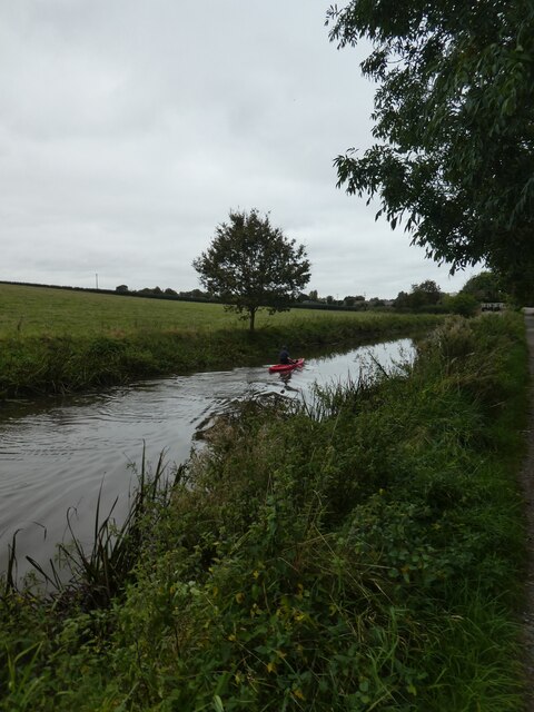
Bridgwater and Taunton Canal
The Bridgwater and Taunton Canal is a canal in the south-west of England between Bridgwater and Taunton, opened in 1827 and linking the River Tone to the...

Maunsel House
Maunsel House in the English county of Somerset was built in the late 14th or early 15th century. The house stands south of the hamlet of North Newton...

Cogload Junction
Cogload Junction is a railway junction in Durston, Somerset, England. It is where the 1906-opened London to Penzance Line via Castle Cary joins the original...

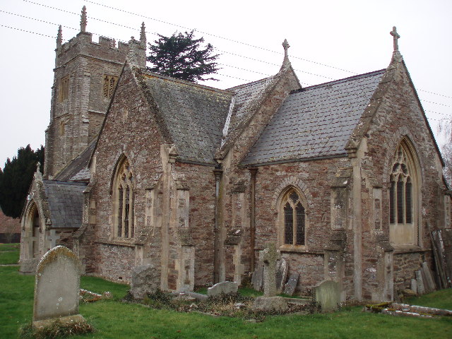
Church of St Peter, North Newton
The Anglican Church of St Peter in North Newton within the English county of Somerset has a tower believed to date from Saxon times. It is a Grade II*...

North Moor
North Moor (grid reference ST325305) is a 676.3 hectare biological Site of Special Scientific Interest near Lyng in Somerset, England. It was designated...
Nearby Amenities
Located within 500m of 51.056806,-2.9999039Have you been to Primmore Corner?
Leave your review of Primmore Corner below (or comments, questions and feedback).