Primrose

Settlement in Lancashire Ribble Valley

England

Primrose

Fields near the A59
Fields near the A59 Credit: Anthony Parkes

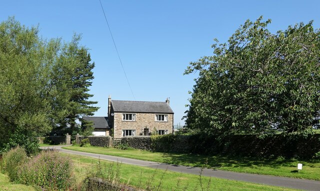
Primrose is a small village located in the county of Lancashire, England. Situated near the larger town of Burnley, Primrose is known for its picturesque rural setting and close-knit community.

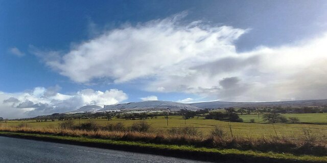
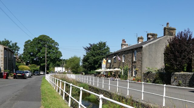
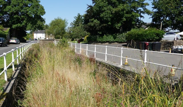
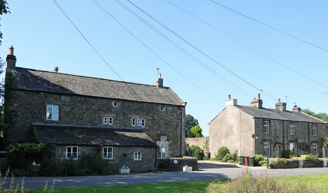
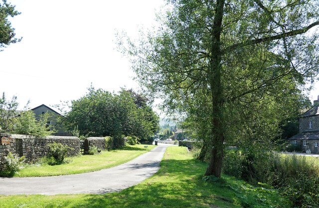
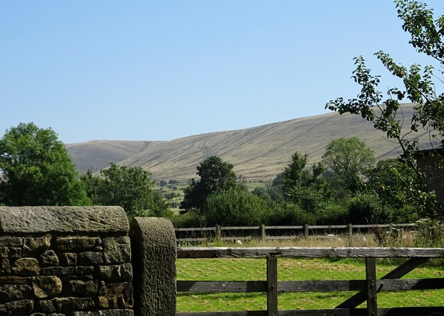
The village is surrounded by rolling hills and green fields, providing residents with stunning views of the Lancashire countryside. The area is primarily residential, with a mix of traditional stone-built houses and newer developments. Primrose retains a charming, village-like atmosphere, with a peaceful and tranquil ambiance.

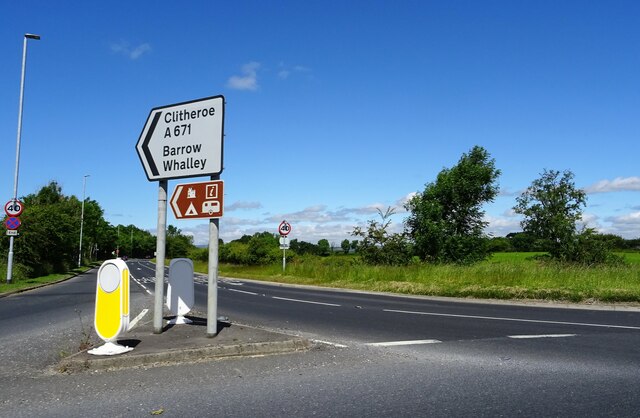
Although small in size, Primrose offers a range of amenities for its residents. Local shops and businesses provide everyday necessities, while nearby Burnley provides access to a wider range of services and facilities. The village is also well-connected, with good transport links to surrounding towns and cities.

Primrose benefits from its proximity to natural beauty spots, such as Towneley Park and the Forest of Bowland, which offer opportunities for outdoor activities such as hiking, cycling, and wildlife spotting. The village is also close to the Leeds and Liverpool Canal, providing scenic walking routes along the waterway.

The community in Primrose is known for its friendliness and strong sense of belonging. Residents often come together for social events and community initiatives, fostering a sense of unity and pride in the village.

In summary, Primrose is a charming and peaceful village in Lancashire, offering a close-knit community, beautiful natural surroundings, and a range of amenities for its residents.

If you have any feedback on the listing, please let us know in the comments section below.
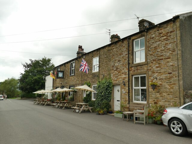
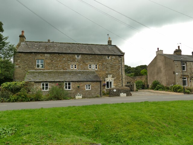
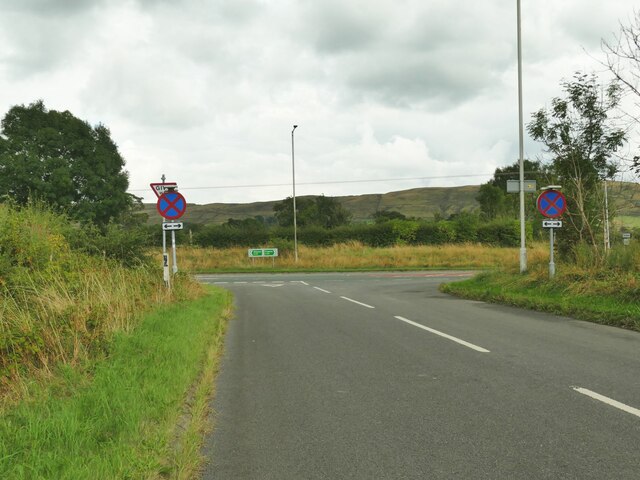
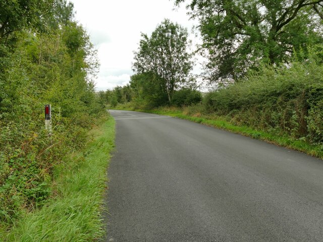
Primrose Images

Images are sourced within 2km of 53.862815/-2.3966385 or Grid Reference SD7440. Thanks to Geograph Open Source API. All images are credited.

Fields near the A59
Fields near the A59
Road Junction The junction of A59 and A671.
Road Junction
The junction of A59 and A671.
The Swan With Two Necks A pub in Pendleton.
The Swan With Two Necks
A pub in Pendleton.
Overgrown watercourse Pendleton Brook runs through the village. At present the watercourse is much overgrown with weeds and grasses.
Overgrown watercourse
Pendleton Brook runs through the village. At present the watercourse is much overgrown with weeds and grasses.
Bracken Dene A house in Pendleton.
Bracken Dene
A house in Pendleton.
Bulcocks farmhouse A grade II listed building in Pendleton. A datestone suggests that it was built in  1693.
Bulcocks farmhouse
A grade II listed building in Pendleton. A datestone suggests that it was built in 1693.
Pendleton village The village was mentioned in the Domesday (Doomsday) Book with the name Peniltune.
Pendleton village
The village was mentioned in the Domesday (Doomsday) Book with the name Peniltune.
Looking towards Pendle Hill From Pendleton village.
Looking towards Pendle Hill
From Pendleton village.
The Swan with Two Necks, Pendleton  Not a unique pub name, and one that is a corruption of 'Swan with two nicks'.
The Swan with Two Necks, Pendleton
Not a unique pub name, and one that is a corruption of 'Swan with two nicks'.
Pendleton Village Hall A modern building. Note the defibrillator to the right.
Pendleton Village Hall
A modern building. Note the defibrillator to the right.
Sundial outside Pendleton Village Hall A Diamond Jubilee project in 2012.
Sundial outside Pendleton Village Hall
A Diamond Jubilee project in 2012.
Road bridge in Pendleton  The road through this linear village crosses the Pendleton Brook at this point.
Road bridge in Pendleton
The road through this linear village crosses the Pendleton Brook at this point.
Bulcocks Farm, Pendleton  The farmhouse, one of several around the village, dates from 1693 and is grade II listed (list entry 1165197).
Bulcocks Farm, Pendleton
The farmhouse, one of several around the village, dates from 1693 and is grade II listed (list entry 1165197).
Road junction on the A59 outside Clitheroe A minor road leading to Pendleton has been realigned to form a pair of T-junctions with the bypass.
Road junction on the A59 outside Clitheroe
A minor road leading to Pendleton has been realigned to form a pair of T-junctions with the bypass.
Road towards the A59 outside Clitheroe A minor road leading to Pendleton, which used to run straight at this point but was realigned from the bend seen here to form a pair of T-junctions with the bypass.
Road towards the A59 outside Clitheroe
A minor road leading to Pendleton, which used to run straight at this point but was realigned from the bend seen here to form a pair of T-junctions with the bypass.
"Alder Cone" Sculpture by Halima Cassell, one of the sculptures on the Ribble Valley Sculpture Trail. Dated 2009, this is one of the most recent sculptures on the Trail.
"Alder Cone"
Sculpture by Halima Cassell, one of the sculptures on the Ribble Valley Sculpture Trail. Dated 2009, this is one of the most recent sculptures on the Trail.
Bowland Brewery bus One of the attractions at the Holmes Mill retail development.
Bowland Brewery bus
One of the attractions at the Holmes Mill retail development.
Bowland Food Hall Part of the Holmes Mill retail development.
Bowland Food Hall
Part of the Holmes Mill retail development.
Show me another place!

Primrose is located at Grid Ref: SD7440 (Lat: 53.862815, Lng: -2.3966385)

Administrative County: Lancashire

District: Ribble Valley

Police Authority: Lancashire

What 3 Words

///shameless.responded.captions. Near Clitheroe, Lancashire

Related Wikis

Ribblesdale High School

Ribblesdale High School is a coeducational secondary school located in Clitheroe in the English county of Lancashire, administered by Lancashire County...

North West Sound Archive

The North West Sound Archive, founded in Manchester in 1979, was the largest archive of sound recordings in the UK outside of London, with over 140,000...

Clitheroe Rural District

Clitheroe Rural District was a rural district in the county of Lancashire, England. It was created in 1894 and abolished in 1974 under the Local Government...
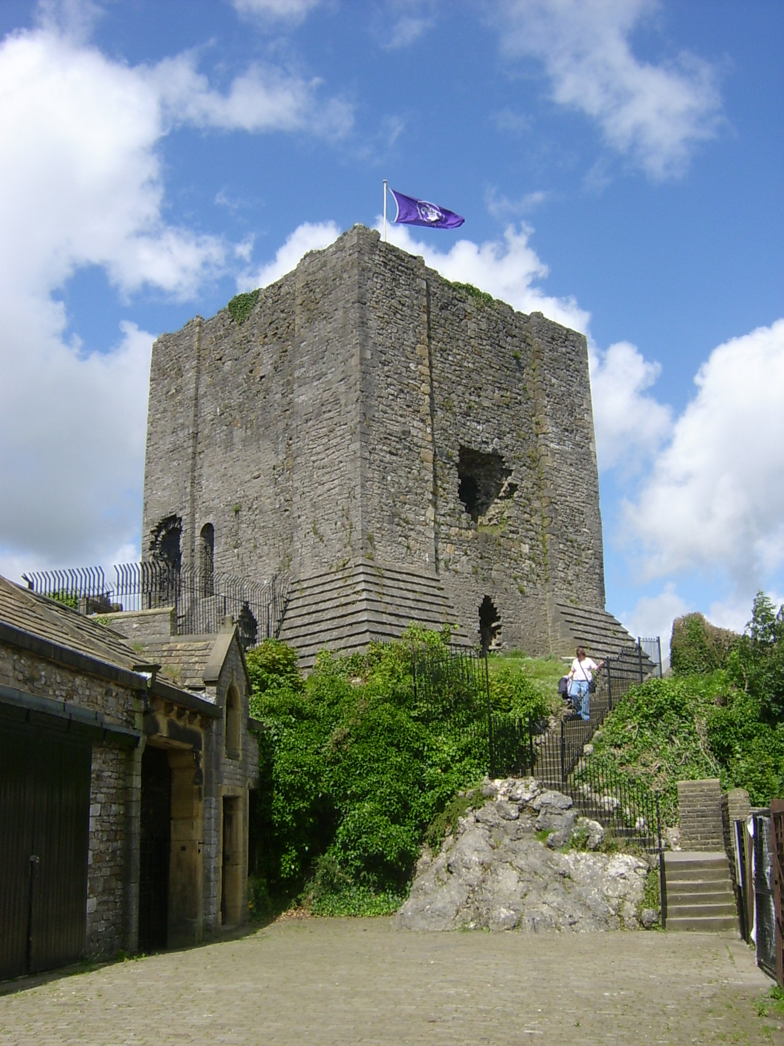
Clitheroe Castle

Clitheroe Castle is a ruined early medieval castle in Clitheroe in Lancashire, England. It was the caput of the Honour of Clitheroe, a vast estate stretching...

Nearby Amenities

Located within 500m of 53.862815,-2.3966385
Post Box
Post Box Design: type_g
Post Box Type: pillar
Ref: BB7 460
Royal Cypher: EIIR
Royal Cypher Wikidata: Q33102113
Lat/Long: 53.8628015/-2.3961731
Barrier: bollard
Lat/Long: 53.8652763/-2.393954
Eclipse
Shop: hairdresser
Lat/Long: 53.8656297/-2.3980683
Fast Food
Woone Lane Chip Shop
Lat/Long: 53.8665566/-2.396749
Place Of Worship
United Reform Church
Denomination: united_reformed
Religion: christian
Lat/Long: 53.8667064/-2.3962865
Mark's Artisan Bakery and Pie Shop
Shop: bakery
Lat/Long: 53.8669242/-2.3937724
Fast Food
Whalley Road Chippy
Drive Through: no
Operator: Whalley Road Chippy
Wpt Description: 21-APR-10 8:32:46
Wpt Symbol: Restaurant
Lat/Long: 53.8667137/-2.3939211
Restaurant
Tiger Lounge
Lat/Long: 53.8663965/-2.3941875
Fast Food
Pizza House
Lat/Long: 53.8664586/-2.3937379
Railway: crossing
Lat/Long: 53.8645794/-2.4024481
Barrier: lift_gate
Lat/Long: 53.8618686/-2.3956625
Turning Circle
Lat/Long: 53.8624033/-2.3979243
Fuel
Addr City: Clitheroe
Addr Housename: Primrose Garage
Addr Postcode: BB7 1HU
Addr Street: Whalley Road
Brand: Texaco
Fuel Diesel: yes
Fuel Unleaded: yes
Payment Cash: yes
Payment Credit Cards: yes
Payment Debit Cards: yes
Phone: +44 1200 429894
Lat/Long: 53.8638249/-2.3950843
Pets at Home
Brand: Pets at Home
Brand Wikidata: Q7179258
Brand Wikipedia: en:Pets at Home
Shop: pet
Website: https://community.petsathome.com/store/clitheroe/
Lat/Long: 53.8627239/-2.394551
ALDI
Brand: ALDI
Brand Wikidata: Q41171672
Brand Wikipedia: en:Aldi
Contact Website: https://stores.aldi.co.uk/clitheroe/whalley-road
Shop: supermarket
Lat/Long: 53.8630855/-2.3951776
Veterinary
Lat/Long: 53.8628965/-2.3944364
Noexit: yes
Lat/Long: 53.8627311/-2.4007563
Fast Food
Subway
Brand: Subway
Brand Wikidata: Q244457
Brand Wikipedia: en:Subway (restaurant)
Contact Website: https://restaurants.subway.com/united-kingdom/en/clitheroe/primrose-garage-whalley-road
Cuisine: sandwich
Delivery: no
Drive Through: no
Takeaway: yes
Lat/Long: 53.8636259/-2.3952571
Spar
Brand: Spar
Brand Wikidata: Q610492
Brand Wikipedia: en:Spar (retailer)
Operator: SPAR
Shop: convenience
Lat/Long: 53.8636022/-2.3950533
Generator Method: photovoltaic
Generator Output Electricity: yes
Generator Source: solar
Generator Type: solar_photovoltaic_panel
Location: roof
Power: generator
Lat/Long: 53.8644403/-2.4029911
Generator Method: photovoltaic
Generator Output Electricity: yes
Generator Source: solar
Generator Type: solar_photovoltaic_panel
Location: roof
Power: generator
Lat/Long: 53.8663358/-2.3920808
Generator Method: photovoltaic
Generator Output Electricity: yes
Generator Source: solar
Generator Type: solar_photovoltaic_panel
Location: roof
Power: generator
Lat/Long: 53.8659777/-2.3932975
Generator Method: photovoltaic
Generator Output Electricity: yes
Generator Source: solar
Generator Type: solar_photovoltaic_panel
Location: roof
Power: generator
Lat/Long: 53.8647899/-2.3930132
Generator Method: photovoltaic
Generator Output Electricity: yes
Generator Source: solar
Generator Type: solar_photovoltaic_panel
Location: roof
Power: generator
Lat/Long: 53.8658668/-2.3989436
Bus Stop
St James's Street
Bus: yes
Naptan AtcoCode: 250011252
Naptan NaptanCode: lanagajt
Public Transport: platform
Lat/Long: 53.8664337/-2.3940365
Bus Stop
Park Street
Bus: yes
Naptan AtcoCode: 2500IMG2350
Naptan NaptanCode: langatgt
Public Transport: platform
Lat/Long: 53.8652941/-2.3946883
Bus Stop
Park Street
Bus: yes
Naptan AtcoCode: 2500DCL476
Naptan NaptanCode: landmamw
Public Transport: platform
Lat/Long: 53.864708/-2.3952195
Bus Stop
Littlemoor Road
Bus: yes
Public Transport: platform
Lat/Long: 53.8633131/-2.3958395
Bus Stop
Littlemoor Road
Bus: yes
Public Transport: platform
Lat/Long: 53.8628311/-2.3959514
Waterway: weir
Lat/Long: 53.8663024/-2.395547
Tourism: viewpoint
Lat/Long: 53.863472/-2.3996662
Waterway: weir
Lat/Long: 53.8655344/-2.3965501
Barrier: stile
Lat/Long: 53.859847/-2.3976398
Barrier: stile
Lat/Long: 53.8591316/-2.394548
Sitting Pretty
Beauty: nails
Shop: beauty
Lat/Long: 53.8669754/-2.3937336
Jagos
Shop: pet_grooming
Lat/Long: 53.8668555/-2.3938199
Fast Food
Taste of India
Lat/Long: 53.8667973/-2.3938553
Clitheroe Blinds
Shop: yes
Lat/Long: 53.8665713/-2.3936467
Nexo Pc & Mobile clinic
Craft: electronics_repair
Lat/Long: 53.8665298/-2.3936908
Restaurant
Jun Yue
Cuisine: chinese
Lat/Long: 53.866248/-2.3942978
The data included in this document is from www.openstreetmap.org. The data is made available under ODbL.

Have you been to Primrose?

Leave your review of Primrose below (or comments, questions and feedback).