Northampton

Settlement in Worcestershire Wychavon

England

Northampton

Farmland north of Ombersley Flat meadows as far as the eye can see
Farmland north of Ombersley Credit: Eirian Evans

Northampton is a small town located in the county of Worcestershire, in the West Midlands region of England. It lies approximately 10 miles east of the city of Worcester and is nestled in the picturesque countryside of the Severn Valley. The town has a population of around 2,500 people.

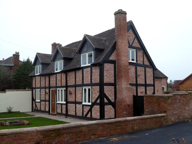
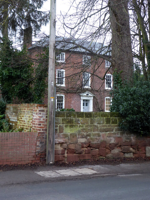
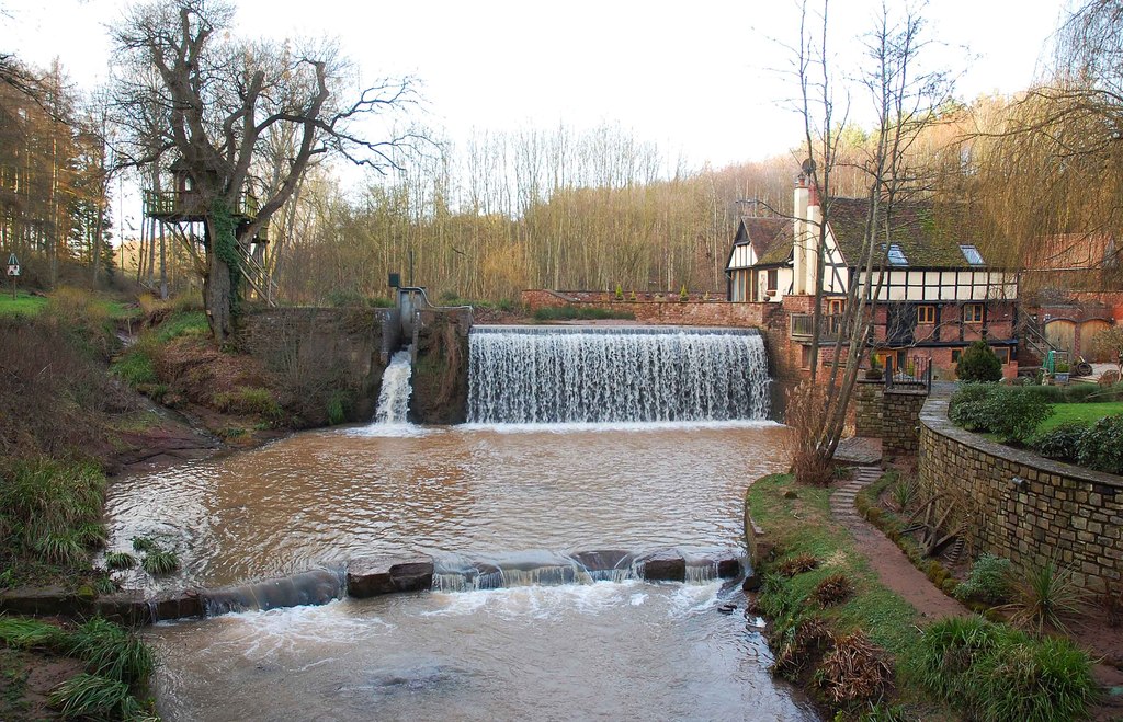
Northampton is known for its rich history, dating back to the medieval period. The town's origins can be traced back to the Anglo-Saxon era, and it has seen various developments and changes over the centuries. Today, Northampton retains its traditional charm with its well-preserved historic buildings, including St. Andrew's Church, which dates back to the 12th century.

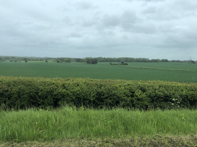
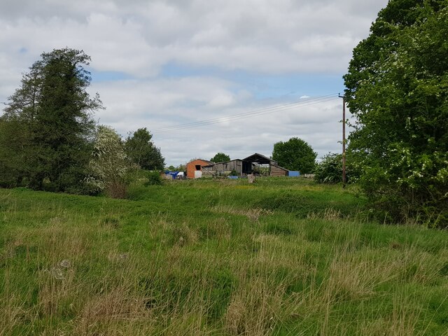
The town is surrounded by stunning natural beauty, with the River Severn flowing nearby and the rolling hills of Worcestershire providing a scenic backdrop. This makes Northampton an ideal destination for nature lovers and outdoor enthusiasts, with plenty of opportunities for walking, cycling, and exploring the countryside.

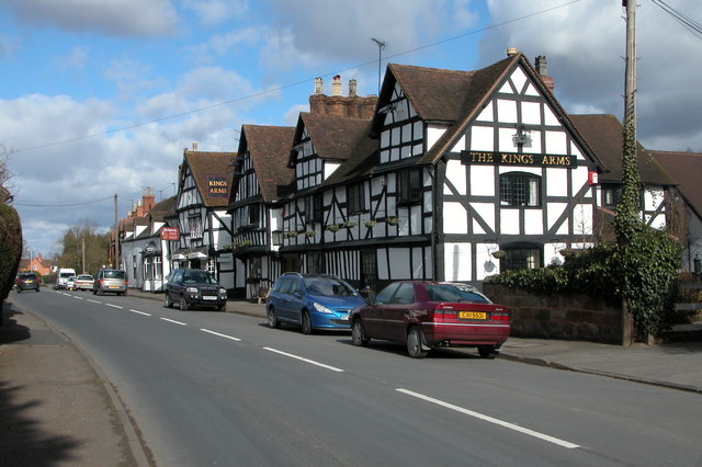
Despite its small size, Northampton offers a range of amenities to its residents and visitors. There are several local shops, pubs, and restaurants, providing a taste of traditional English village life. The town also has a primary school, a community center, and a village hall, which host various events and activities throughout the year.

Northampton's location in Worcestershire provides easy access to nearby attractions, such as Worcester Cathedral, the Malvern Hills, and the historic city of Stratford-upon-Avon. The town is well-connected by road, with the A449 passing through, and the nearest railway station is approximately 4 miles away in the neighboring town of Hartlebury.

Overall, Northampton offers a peaceful and picturesque setting, steeped in history and surrounded by natural beauty, making it an idyllic place to live or visit in Worcestershire.

If you have any feedback on the listing, please let us know in the comments section below.
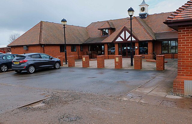
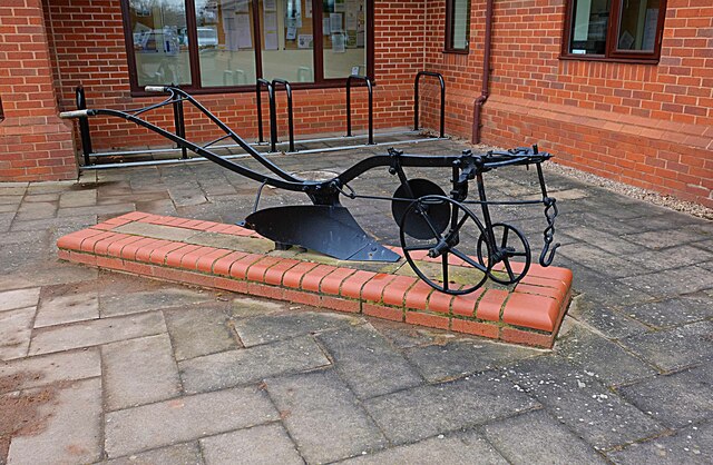
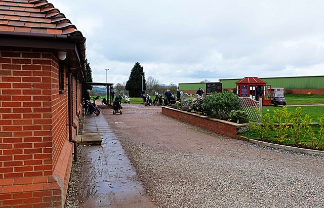
Northampton Images

Images are sourced within 2km of 52.288963/-2.2416075 or Grid Reference SO8365. Thanks to Geograph Open Source API. All images are credited.

Farmland north of Ombersley Flat meadows as far as the eye can see
Farmland north of Ombersley
Flat meadows as far as the eye can see
Fields next to a footpath, near to Uphampton
Field boundary near Uphampton, Worcestershire
Walkers heading for Boreley House With the Abberley Hills in the distance.
Walkers heading for Boreley House
With the Abberley Hills in the distance.
Farm buildings at Boreley House with Woodbury Hill behind
Black Barn, Boreley Lane from the field side
A very distant view of Abberley Clocktower
Brook Cottages, Boreley Lane, Ombersley
Bristol House, Ombersley A 17th century timber framed house with mid-19th and mid-20th century alterations and additions. Listed Grade II.
Bristol House, Ombersley
A 17th century timber framed house with mid-19th and mid-20th century alterations and additions. Listed Grade II.
Cross Keys public house, Ombersley It used to be a regular call for food and drink but not tried it for a few years. It was very good.
Cross Keys public house, Ombersley
It used to be a regular call for food and drink but not tried it for a few years. It was very good.
Wellington House, Ombersley Early 19th century 3 storey red brick house with mid-20th century alterations round the back. Listed Grade II.
Wellington House, Ombersley
Early 19th century 3 storey red brick house with mid-20th century alterations round the back. Listed Grade II.
Walkers heading for Yarding's Farm
Yarding's Farm, Oldfield
Ombersley Golf Club Clubhouse (1), Bishops Wood Road, near Ombersley, Worcs The club was developed by a local farming family who continue to run it. The course opened in late 1991. The impressive Clubhouse includes a bar and restaurant which is open to the public, including those who do not play golf.  There is a large car park in front with access from Bishops Wood Road.

<a href="https://www.geograph.org.uk/photo/7436394">SO8267 : Ombersley Golf Club Clubhouse (2), Bishops Wood Road, near Ombersley, Worcs</a>.
Ombersley Golf Club Clubhouse (1), Bishops Wood Road, near Ombersley, Worcs
The club was developed by a local farming family who continue to run it. The course opened in late 1991. The impressive Clubhouse includes a bar and restaurant which is open to the public, including those who do not play golf. There is a large car park in front with access from Bishops Wood Road. SO8267 : Ombersley Golf Club Clubhouse (2), Bishops Wood Road, near Ombersley, Worcs.
Plough in front of Clubhouse, Ombersley Golf Club, near Ombersley, Worcs The Ombersley Golf Club is located in a very rural area and on former farmland. The plough is a symbol of this.

<a href="https://www.geograph.org.uk/photo/7436273">SO8367 : Ombersley Golf Club Clubhouse (1), Bishops Wood Road, near Ombersley, Worcs</a>.
<a href="https://www.geograph.org.uk/photo/7436394">SO8267 : Ombersley Golf Club Clubhouse (2), Bishops Wood Road, near Ombersley, Worcs</a>.
Plough in front of Clubhouse, Ombersley Golf Club, near Ombersley, Worcs
The Ombersley Golf Club is located in a very rural area and on former farmland. The plough is a symbol of this. SO8367 : Ombersley Golf Club Clubhouse (1), Bishops Wood Road, near Ombersley, Worcs. SO8267 : Ombersley Golf Club Clubhouse (2), Bishops Wood Road, near Ombersley, Worcs.
Ombersley Golf Club Clubhouse (2), Bishops Wood Road, near Ombersley, Worcs The clubhouse includes a bar and restaurant and an extensively stocked golf shop.

<a href="https://www.geograph.org.uk/photo/7436273">SO8367 : Ombersley Golf Club Clubhouse (1), Bishops Wood Road, near Ombersley, Worcs</a>.
Ombersley Golf Club Clubhouse (2), Bishops Wood Road, near Ombersley, Worcs
The clubhouse includes a bar and restaurant and an extensively stocked golf shop. SO8367 : Ombersley Golf Club Clubhouse (1), Bishops Wood Road, near Ombersley, Worcs.
Path by Ombersley Golf Course Clubhouse to Driving Range, near Ombersley, Worcs The path leads to the Driving Range, which is the green building in the distance.
Path by Ombersley Golf Course Clubhouse to Driving Range, near Ombersley, Worcs
The path leads to the Driving Range, which is the green building in the distance.
Golf buggies at Ombersley Golf Club, Bishops Wood Road, near Ombersley, Worcs Golf buggies (a.k.a. golf carts) parked near the Clubhouse.
Golf buggies at Ombersley Golf Club, Bishops Wood Road, near Ombersley, Worcs
Golf buggies (a.k.a. golf carts) parked near the Clubhouse.
Show me another place!

Northampton is located at Grid Ref: SO8365 (Lat: 52.288963, Lng: -2.2416075)

Administrative County: Worcestershire

District: Wychavon

Police Authority: West Merica

What 3 Words

///discussed.squashes.lookout. Near Hartlebury, Worcestershire

Related Wikis

Dunhampton

Dunhampton is a village in Worcestershire, England.

Ombersley and Doverdale

Ombersley and Doverdale is an area in Wychavon district, Worcestershire, England served by a single parish council but comprising the two separate civil...

Ombersley

Ombersley is a village and civil parish in Wychavon district, in the county of Worcestershire, England. The parish includes the hamlet of Holt Fleet,...

Dick Brook

Dick Brook is small tributary stream of the River Severn that flows through Worcestershire, England.The brook is formed from two small unnamed streams...

Holt Fleet Bridge

Holt Fleet Bridge, also known as Holt Bridge, is a cast-iron arch bridge over the River Severn, at Holt in Worcestershire, England. It has a span of 150...

Crossway Green

Crossway Green is a village in Worcestershire, England.

Doverdale

Doverdale is a small village and civil parish in Worcestershire, England, to the west of Droitwich. It has a parish church. Doverdale Manor is one of largest...

Shrawley

Shrawley is a village and civil parish in the Malvern Hills District in the county of Worcestershire, England. The village is situated on the western bank...

Nearby Amenities

Located within 500m of 52.288963,-2.2416075
Post Box
Collection Times: Mo-Fr 16:00; Sa 09:15
Post Box Type: wall
Ref: WR9 357
Royal Cypher: EVIIR
Royal Cypher Wikidata: Q33102324
Lat/Long: 52.2906654/-2.2410645
Northampton
Place: hamlet
Source: OS_OpenData_StreetView
Lat/Long: 52.2877582/-2.2421229
Burnhill
Location Transition: yes
Power: pole
Transformer: distribution
Voltage Primary: 11000
Lat/Long: 52.2869099/-2.2444698
Power: pole
Lat/Long: 52.287051/-2.2432387
Power: pole
Lat/Long: 52.2872578/-2.2415502
Power: pole
Lat/Long: 52.2867377/-2.2410192
Woodfield
Power: pole
Transformer: distribution
Voltage Primary: 11000
Lat/Long: 52.286156/-2.240417
Power: pole
Lat/Long: 52.2861815/-2.2399409
Power: pole
Lat/Long: 52.2864571/-2.2388345
Power: pole
Lat/Long: 52.2864079/-2.2377053
Power: pole
Lat/Long: 52.2866417/-2.2369033
Power: pole
Lat/Long: 52.286864/-2.2360986
Power: pole
Lat/Long: 52.2868878/-2.2353396
Mere Pool Cottages
Power: pole
Transformer: distribution
Voltage Primary: 11000
Lat/Long: 52.29116/-2.2449727
Power: pole
Lat/Long: 52.2902438/-2.2431522
Burnhill Lodge
Power: pole
Transformer: distribution
Voltage Primary: 11000
Lat/Long: 52.2885892/-2.2457814
Power: pole
Lat/Long: 52.2894481/-2.245186
Power: pole
Lat/Long: 52.2900453/-2.2447756
Power: pole
Lat/Long: 52.2908381/-2.2442606
Power: pole
Lat/Long: 52.2896987/-2.2422469
Yewtree House
Power: pole
Transformer: distribution
Voltage Primary: 11000
Lat/Long: 52.2896958/-2.2415502
Power: pole
Lat/Long: 52.2896622/-2.240928
Power: pole
Lat/Long: 52.2897696/-2.2402467
Power: pole
Lat/Long: 52.2899907/-2.2388533
Power: pole
Lat/Long: 52.2898783/-2.23955
Dutshill Cottage
Power: pole
Transformer: distribution
Voltage Primary: 11000
Lat/Long: 52.2901396/-2.2378206
Power: pole
Lat/Long: 52.2902996/-2.2367866
Power: pole
Lat/Long: 52.2905137/-2.2353704
The data included in this document is from www.openstreetmap.org. The data is made available under ODbL.

Have you been to Northampton?

Leave your review of Northampton below (or comments, questions and feedback).