Nevill Park

Settlement in Kent Tunbridge Wells

England

Nevill Park

TN1, Monson Rd Monson Road is a short curved shopping street in Tunbridge Wells. One side of the road is taken up by a row of Victorian houses with a first floor balcony and ground floor shops, which are Grade II listed. <span class="nowrap"><a title="http://www.britishlistedbuildings.co.uk/en-168065-8-36-royal-tunbridge-wells" rel="nofollow ugc noopener" href="http://www.britishlistedbuildings.co.uk/en-168065-8-36-royal-tunbridge-wells">Link</a><img style="margin-left:2px;" alt="External link" title="External link - shift click to open in new window" src="https://s1.geograph.org.uk/img/external.png" width="10" height="10"/></span> 
Tunbridge Wells Adult Education Centre is also on this road.
TN1, Monson Rd Credit: N Chadwick

Nevill Park is a picturesque residential area located in the county of Kent, in southeastern England. Situated on the outskirts of the historic town of Tunbridge Wells, Nevill Park is known for its leafy streets, charming houses, and close proximity to the beautiful Nevill Golf Club.

The area is characterized by its peaceful ambiance and well-maintained properties, making it an attractive place to live for families and professionals alike. The houses in Nevill Park range from traditional Victorian and Edwardian architecture to modern, contemporary designs, catering to a diverse range of tastes.

One of the main draws of Nevill Park is its close proximity to the Nevill Golf Club, which offers stunning views over the surrounding countryside. Golf enthusiasts can enjoy a round of golf on the challenging course, while also taking advantage of the club's excellent facilities, including a clubhouse and a pro shop.

The location of Nevill Park also offers convenient access to a range of amenities and services. The neighboring town of Tunbridge Wells provides residents with a wide array of shops, restaurants, cafes, and entertainment options. Additionally, the area benefits from excellent transportation links, with regular train services connecting to London and other major cities in the region.

Overall, Nevill Park in Kent is a highly desirable residential area that combines natural beauty, a peaceful atmosphere, and convenient access to amenities, making it an ideal place to call home.

If you have any feedback on the listing, please let us know in the comments section below.
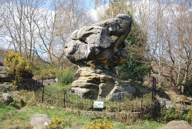
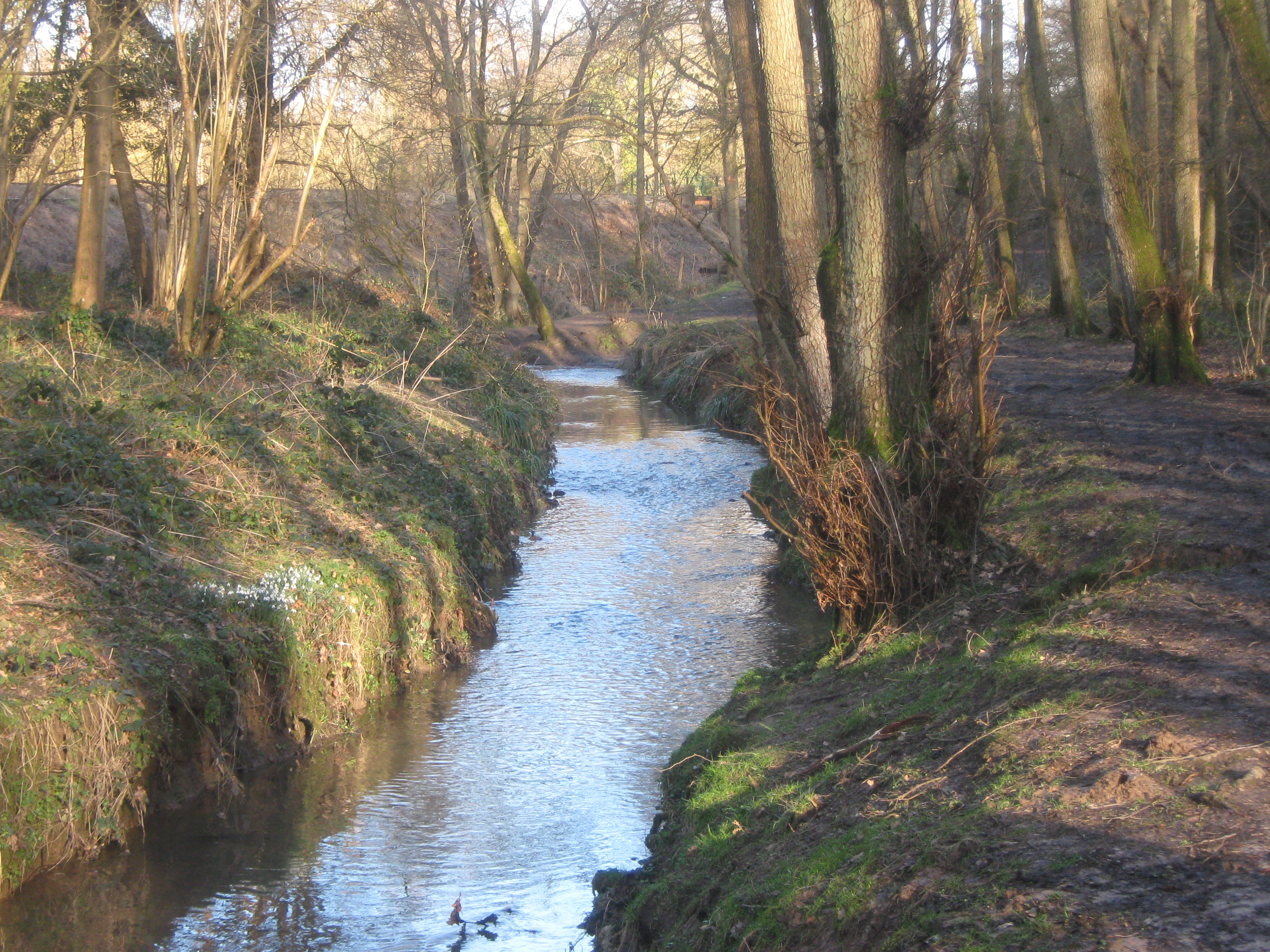
Nevill Park Images

Images are sourced within 2km of 51.128214/0.23872878 or Grid Reference TQ5638. Thanks to Geograph Open Source API. All images are credited.

TN1, Monson Rd Monson Road is a short curved shopping street in Tunbridge Wells. One side of the road is taken up by a row of Victorian houses with a first floor balcony and ground floor shops, which are Grade II listed. <span class="nowrap"><a title="http://www.britishlistedbuildings.co.uk/en-168065-8-36-royal-tunbridge-wells" rel="nofollow ugc noopener" href="http://www.britishlistedbuildings.co.uk/en-168065-8-36-royal-tunbridge-wells">Link</a><img style="margin-left:2px;" alt="External link" title="External link - shift click to open in new window" src="https://s1.geograph.org.uk/img/external.png" width="10" height="10"/></span> 
Tunbridge Wells Adult Education Centre is also on this road.
TN1, Monson Rd
Monson Road is a short curved shopping street in Tunbridge Wells. One side of the road is taken up by a row of Victorian houses with a first floor balcony and ground floor shops, which are Grade II listed. LinkExternal link Tunbridge Wells Adult Education Centre is also on this road.
Former Congregational Church Jabez Scholes may have been the original architect of this large Classical-style chapel, erected for £3,700 in 1845–48. The Tuscan portico at the front cost a further £1,400 in 1866. Acquired by Pentecostalists in 1977, it was sold three years later and turned into shops.At present occupied by Cotswold.
Grade II* listed. <span class="nowrap"><a title="http://www.britishlistedbuildings.co.uk/en-168097-lecture-hall-mount-pleasant-congregation" rel="nofollow ugc noopener" href="http://www.britishlistedbuildings.co.uk/en-168097-lecture-hall-mount-pleasant-congregation">Link</a><img style="margin-left:2px;" alt="External link" title="External link - shift click to open in new window" src="https://s1.geograph.org.uk/img/external.png" width="10" height="10"/></span>
Former Congregational Church
Jabez Scholes may have been the original architect of this large Classical-style chapel, erected for £3,700 in 1845–48. The Tuscan portico at the front cost a further £1,400 in 1866. Acquired by Pentecostalists in 1977, it was sold three years later and turned into shops.At present occupied by Cotswold. Grade II* listed. LinkExternal link
Tunbridge Wells War Memorial The memorial is in the form of a low wall surrounding a central memorial with the figure of a soldier holding a rifle mounted on a plinth. The names of the dead from World War 1, 764 names, are set in plaques around the wall. The memorial was unveiled and dedicated February 1923; the sculptor was  Stanley Babb.
Grade II listed. <span class="nowrap"><a title="http://www.britishlistedbuildings.co.uk/en-1401309-tunbridge-wells-war-memorial-non-civil-" rel="nofollow ugc noopener" href="http://www.britishlistedbuildings.co.uk/en-1401309-tunbridge-wells-war-memorial-non-civil-">Link</a><img style="margin-left:2px;" alt="External link" title="External link - shift click to open in new window" src="https://s1.geograph.org.uk/img/external.png" width="10" height="10"/></span> 
More information at <span class="nowrap"><a title="http://www.roll-of-honour.com/Kent/TunbridgeWells.html" rel="nofollow ugc noopener" href="http://www.roll-of-honour.com/Kent/TunbridgeWells.html">Link</a><img style="margin-left:2px;" alt="External link" title="External link - shift click to open in new window" src="https://s1.geograph.org.uk/img/external.png" width="10" height="10"/></span>
Tunbridge Wells War Memorial
The memorial is in the form of a low wall surrounding a central memorial with the figure of a soldier holding a rifle mounted on a plinth. The names of the dead from World War 1, 764 names, are set in plaques around the wall. The memorial was unveiled and dedicated February 1923; the sculptor was Stanley Babb. Grade II listed. LinkExternal link More information at LinkExternal link
Vacant Site The three-screen cinema at the corner of Mount Pleasant Road and Church Road closed in October 2000, after a new multiplex opened on the edge of town. The building was built around 1934.  Previously the site was Belvedere House. 

Along with the adjoining shop buildings on Mount Pleasant Road and Church Road, the site had numerous planning applications and owners since it was disused in 2000, and the old buildings were finally demolished and cleared in 2014.

A new planning application for the site was submitted in July 2017. It includes retail and restaurant use, cinema, and 99 flats (Application ref 17/02262/FULL ).
Vacant Site
The three-screen cinema at the corner of Mount Pleasant Road and Church Road closed in October 2000, after a new multiplex opened on the edge of town. The building was built around 1934. Previously the site was Belvedere House. Along with the adjoining shop buildings on Mount Pleasant Road and Church Road, the site had numerous planning applications and owners since it was disused in 2000, and the old buildings were finally demolished and cleared in 2014. A new planning application for the site was submitted in July 2017. It includes retail and restaurant use, cinema, and 99 flats (Application ref 17/02262/FULL ).
Mount Pleasant Rd
Mount Pleasant Rd
Tunbridge Wells Station Tunbridge Wells Station was opened by the South Eastern Railway (SER) on 25th November 1846. It is on "the Hastings line" ( <a title="https://www.geograph.org.uk/snippet/2428" href="https://www.geograph.org.uk/snippet/2428">Link</a> ). The station is a cut station with access in both directions by tunnels, the Grove Tunnel from the south and the Wells Tunnel from the north.
The station has a regular service to both London Charing Cross and Hastings as well as shuttles to Tonbridge and some to London Bridge via Redhill.
A Grade II listed building. <span class="nowrap"><a title="http://www.britishlistedbuildings.co.uk/en-168166-tunbridge-wells-central-railway-station-" rel="nofollow ugc noopener" href="http://www.britishlistedbuildings.co.uk/en-168166-tunbridge-wells-central-railway-station-">Link</a><img style="margin-left:2px;" alt="External link" title="External link - shift click to open in new window" src="https://s1.geograph.org.uk/img/external.png" width="10" height="10"/></span>
Tunbridge Wells Station
Tunbridge Wells Station was opened by the South Eastern Railway (SER) on 25th November 1846. It is on "the Hastings line" ( Link ). The station is a cut station with access in both directions by tunnels, the Grove Tunnel from the south and the Wells Tunnel from the north. The station has a regular service to both London Charing Cross and Hastings as well as shuttles to Tonbridge and some to London Bridge via Redhill. A Grade II listed building. LinkExternal link
The Bedford
The Bedford
High St
High St
The White Bear
The White Bear
Zizzi, High St
Zizzi, High St
Church of King Charles the Martyr Built in 1676, as the first permanent building in Tunbridge Wells. 
A full history is at <span class="nowrap"><a title="http://kcmtw.org/heritage/history/" rel="nofollow ugc noopener" href="http://kcmtw.org/heritage/history/">Link</a><img style="margin-left:2px;" alt="External link" title="External link - shift click to open in new window" src="https://s1.geograph.org.uk/img/external.png" width="10" height="10"/></span> 
A Grade I listed building <span class="nowrap"><a title="http://www.britishlistedbuildings.co.uk/en-168037" rel="nofollow ugc noopener" href="http://www.britishlistedbuildings.co.uk/en-168037">Link</a><img style="margin-left:2px;" alt="External link" title="External link - shift click to open in new window" src="https://s1.geograph.org.uk/img/external.png" width="10" height="10"/></span>
Church of King Charles the Martyr
Built in 1676, as the first permanent building in Tunbridge Wells. A full history is at LinkExternal link A Grade I listed building LinkExternal link
The Pantiles The Pantiles is the most famous street in Tunbridge Wells. It was originally a grove of trees until the Chalybeate spring was discovered in 1606. It rapidly developed into the hub of the new spa town. The street has over 40 listed buildings on it.
The Pantiles and Tunbridge Wells itself, owe their beginnings to the discovery of the Chalybeate Spring in the early 17th century and the popularity of the spa water amongst the gentry and royalty of Georgian England. As Tunbridge Wells grew in popularity as a spa resort, so did the area surrounding the Spring - eventually leading to the building of the colonnaded walkway in the 18th century, later known as The Pantiles. 
In its heyday in Georgian times, the 'Walks' as they were then known, were the place to see and be seen for visitors to Tunbridge Wells. A strict protocol was adhered to - gentry on the 'Upper Walks', the colonnade, and everyone else on the 'Lower Walks'. Richard Beau Nash, a dandy of the day made it his business to ensure that this protocol was adhered to by acting as a kind of Master of Ceremonies during 'the season' in Tunbridge Wells and in the town's rival, Bath. Things are much more relaxed nowadays and the Pantiles is now a very attractive and stylish part of Royal Tunbridge Wells.
Much of the colonnade has been renewed since its beginnings in the 17th century but most of the surrounding buildings date from the 18th and 19th centuries.
The tiled surface is Grade II listed. <span class="nowrap"><a title="https://historicengland.org.uk/listing/the-list/list-entry/1084405" rel="nofollow ugc noopener" href="https://historicengland.org.uk/listing/the-list/list-entry/1084405">Link</a><img style="margin-left:2px;" alt="External link" title="External link - shift click to open in new window" src="https://s1.geograph.org.uk/img/external.png" width="10" height="10"/></span>
The Pantiles
The Pantiles is the most famous street in Tunbridge Wells. It was originally a grove of trees until the Chalybeate spring was discovered in 1606. It rapidly developed into the hub of the new spa town. The street has over 40 listed buildings on it. The Pantiles and Tunbridge Wells itself, owe their beginnings to the discovery of the Chalybeate Spring in the early 17th century and the popularity of the spa water amongst the gentry and royalty of Georgian England. As Tunbridge Wells grew in popularity as a spa resort, so did the area surrounding the Spring - eventually leading to the building of the colonnaded walkway in the 18th century, later known as The Pantiles. In its heyday in Georgian times, the 'Walks' as they were then known, were the place to see and be seen for visitors to Tunbridge Wells. A strict protocol was adhered to - gentry on the 'Upper Walks', the colonnade, and everyone else on the 'Lower Walks'. Richard Beau Nash, a dandy of the day made it his business to ensure that this protocol was adhered to by acting as a kind of Master of Ceremonies during 'the season' in Tunbridge Wells and in the town's rival, Bath. Things are much more relaxed nowadays and the Pantiles is now a very attractive and stylish part of Royal Tunbridge Wells. Much of the colonnade has been renewed since its beginnings in the 17th century but most of the surrounding buildings date from the 18th and 19th centuries. The tiled surface is Grade II listed. LinkExternal link
Bath House The Pantiles is the most famous street in Tunbridge Wells. It was originally a grove of trees until the Chalybeate spring was discovered in 1606. It rapidly developed into the hub of the new spa town. The street has over 40 listed buildings on it.
The Pantiles and Tunbridge Wells itself, owe their beginnings to the discovery of the Chalybeate Spring in the early 17th century and the popularity of the spa water amongst the gentry and royalty of Georgian England. As Tunbridge Wells grew in popularity as a spa resort, so did the area surrounding the Spring - eventually leading to the building of the colonnaded walkway in the 18th century, later known as The Pantiles. 
In its heyday in Georgian times, the 'Walks' as they were then known, were the place to see and be seen for visitors to Tunbridge Wells. A strict protocol was adhered to - gentry on the 'Upper Walks', the colonnade, and everyone else on the 'Lower Walks'. Richard Beau Nash, a dandy of the day made it his business to ensure that this protocol was adhered to by acting as a kind of Master of Ceremonies during 'the season' in Tunbridge Wells and in the town's rival, Bath. Things are much more relaxed nowadays and the Pantiles is now a very attractive and stylish part of Royal Tunbridge Wells.
Much of the colonnade has been renewed since its beginnings in the 17th century but most of the surrounding buildings date from the 18th and 19th centuries.
The tiled surface is Grade II listed. <span class="nowrap"><a title="https://historicengland.org.uk/listing/the-list/list-entry/1084405" rel="nofollow ugc noopener" href="https://historicengland.org.uk/listing/the-list/list-entry/1084405">Link</a><img style="margin-left:2px;" alt="External link" title="External link - shift click to open in new window" src="https://s1.geograph.org.uk/img/external.png" width="10" height="10"/></span>
Bath House
The Pantiles is the most famous street in Tunbridge Wells. It was originally a grove of trees until the Chalybeate spring was discovered in 1606. It rapidly developed into the hub of the new spa town. The street has over 40 listed buildings on it. The Pantiles and Tunbridge Wells itself, owe their beginnings to the discovery of the Chalybeate Spring in the early 17th century and the popularity of the spa water amongst the gentry and royalty of Georgian England. As Tunbridge Wells grew in popularity as a spa resort, so did the area surrounding the Spring - eventually leading to the building of the colonnaded walkway in the 18th century, later known as The Pantiles. In its heyday in Georgian times, the 'Walks' as they were then known, were the place to see and be seen for visitors to Tunbridge Wells. A strict protocol was adhered to - gentry on the 'Upper Walks', the colonnade, and everyone else on the 'Lower Walks'. Richard Beau Nash, a dandy of the day made it his business to ensure that this protocol was adhered to by acting as a kind of Master of Ceremonies during 'the season' in Tunbridge Wells and in the town's rival, Bath. Things are much more relaxed nowadays and the Pantiles is now a very attractive and stylish part of Royal Tunbridge Wells. Much of the colonnade has been renewed since its beginnings in the 17th century but most of the surrounding buildings date from the 18th and 19th centuries. The tiled surface is Grade II listed. LinkExternal link
The Forum The Forum is an independent music venue in Royal Tunbridge Wells with a standing capacity of 250. The Forum opened in 1993.
The building was built in 1939 as rest rooms for visitors to The Common.
Wikipedia: <span class="nowrap"><a title="https://en.wikipedia.org/wiki/Tunbridge_Wells_Forum" rel="nofollow ugc noopener" href="https://en.wikipedia.org/wiki/Tunbridge_Wells_Forum">Link</a><img style="margin-left:2px;" alt="External link" title="External link - shift click to open in new window" src="https://s1.geograph.org.uk/img/external.png" width="10" height="10"/></span>
The Forum
The Forum is an independent music venue in Royal Tunbridge Wells with a standing capacity of 250. The Forum opened in 1993. The building was built in 1939 as rest rooms for visitors to The Common. Wikipedia: LinkExternal link
Frog Lane Frog Lane is one of the oldest streets in Tunbridge Wells. It is located in the Mount Sion area of town. The surface of the lane is Grade II listed. <span class="nowrap"><a title="http://www.britishlistedbuildings.co.uk/en-167989-granite-surface-to-frog-lane-kent" rel="nofollow ugc noopener" href="http://www.britishlistedbuildings.co.uk/en-167989-granite-surface-to-frog-lane-kent">Link</a><img style="margin-left:2px;" alt="External link" title="External link - shift click to open in new window" src="https://s1.geograph.org.uk/img/external.png" width="10" height="10"/></span>
Frog Lane
Frog Lane is one of the oldest streets in Tunbridge Wells. It is located in the Mount Sion area of town. The surface of the lane is Grade II listed. LinkExternal link
The Range The Range is a home, leisure and garden retailer, with over 130 stores around the country.
Website: <span class="nowrap"><a title="https://www.therange.co.uk/" rel="nofollow ugc noopener" href="https://www.therange.co.uk/">Link</a><img style="margin-left:2px;" alt="External link" title="External link - shift click to open in new window" src="https://s1.geograph.org.uk/img/external.png" width="10" height="10"/></span>
The Range
The Range is a home, leisure and garden retailer, with over 130 stores around the country. Website: LinkExternal link
Hoopers Hoopers are an independent chain of department stores. The first store opened in 1982 and now have 5 stores across the country in Carlisle, Harrogate, Tunbridge Wells, Torquay and Wilmslow.
Website: <span class="nowrap"><a title="http://www.hoopers.ltd.uk/" rel="nofollow ugc noopener" href="http://www.hoopers.ltd.uk/">Link</a><img style="margin-left:2px;" alt="External link" title="External link - shift click to open in new window" src="https://s1.geograph.org.uk/img/external.png" width="10" height="10"/></span>
Hoopers
Hoopers are an independent chain of department stores. The first store opened in 1982 and now have 5 stores across the country in Carlisle, Harrogate, Tunbridge Wells, Torquay and Wilmslow. Website: LinkExternal link
Show me another place!

Nevill Park is located at Grid Ref: TQ5638 (Lat: 51.128214, Lng: 0.23872878)

Administrative County: Kent

District: Tunbridge Wells

Police Authority: Kent

What 3 Words

///shunts.whimpered.overhead. Near Rusthall, Kent

Related Wikis

St Paul's Church, Rusthall

St Paul's Church is a Church of England parish church in Rusthall, Kent, England. It is a Grade II listed building. == History == St Paul's Church was...

Spa Valley Railway

The Spa Valley Railway (SVR) is a standard gauge heritage railway in England that runs from Tunbridge Wells West railway station in Tunbridge Wells to...

Rusthall Common

Rusthall Common is a 2.7-hectare (6.7-acre) geological Site of Special Scientific Interest in Rusthall, a suburb of Tunbridge Wells in Kent. It is a Geological...

Rusthall

Rusthall is a village located approximately 2 miles to the west of the spa town of Tunbridge Wells in Kent. The village grew up around a large property...

Friezland Wood

Friezland Wood is a woodland in Kent, England, near Tunbridge Wells. It covers a total area of 7.69 hectares (19.00 acres). It is owned and managed by...

Linden Park Cricket Club

Linden Park Cricket Club (LPCC) is a cricket club based at Higher Cricket Ground, Fir Tree Road, Royal Tunbridge Wells, Kent, England.The club has a senior...

Higher Common Ground

Higher Common Ground is a cricket ground on Tunbridge Wells Common in the town of Royal Tunbridge Wells in Kent. It was used as a ground by Kent County...

High Rocks railway station

High Rocks railway station is a station on the Spa Valley Railway in High Rocks, East Sussex, England. The original High Rocks Halt opened on 1 June 1907...

Nearby Amenities

Located within 500m of 51.128214,0.23872878
Bus Stop
Church
Naptan AtcoCode: 2400A007900A
Naptan Bearing: E
Naptan CommonName: Church
Naptan Indicator: E-bound
Naptan Landmark: O/S Ch
Naptan NaptanCode: kntajpgw
Naptan PlusbusZoneRef: TUNWELL
Naptan Street: Rusthall Rd
Naptan Verified: no
Public Transport: platform
Source: naptan_import
Lat/Long: 51.1322602/0.2370357
Bus Stop
Langton Road
Bench: no
Bin: no
Lit: no
Naptan AtcoCode: 2400A007950A
Naptan Bearing: W
Naptan CommonName: Langton Road
Naptan Indicator: W-bound
Naptan Landmark: Near Tunbridge Wells Golf Club
Naptan NaptanCode: kntajpjp
Naptan PlusbusZoneRef: TUNWELL
Naptan Street: Langton Rd
Naptan Verified: no
Public Transport: platform
Shelter: no
Source: naptan_import
Tactile Paving: no
Lat/Long: 51.1303845/0.2428227
Bus Stop
Harmony Street
Naptan AtcoCode: 2400A035120A
Naptan Bearing: NW
Naptan CommonName: Harmony Street
Naptan Indicator: opp
Naptan Landmark: Harmony Street
Naptan NaptanCode: kntdmgpj
Naptan PlusbusZoneRef: TUNWELL
Naptan Street: Rusthall Rd
Naptan Verified: no
Source: naptan_import
Lat/Long: 51.132205/0.240659
Bus Stop
Harmony Street
Naptan AtcoCode: 2400A035130A
Naptan Bearing: SE
Naptan CommonName: Harmony Street
Naptan Indicator: adj
Naptan Landmark: Harmony Street
Naptan NaptanCode: kntdmgpm
Naptan PlusbusZoneRef: TUNWELL
Naptan Street: Rusthall Rd
Naptan Verified: no
Source: naptan_import
Lat/Long: 51.1321882/0.2409862
Crossing
Crossing: unmarked
Crossing Island: no
Tactile Paving: yes
Lat/Long: 51.1308334/0.2416749
Mini Roundabout
Direction: clockwise
Lat/Long: 51.1280337/0.2375605
Nevill Park
Place: suburb
Lat/Long: 51.1281586/0.2389634
Post Box
Operator: Royal Mail
Post Box Type: wall
Ref: TN4 91D
Royal Cypher: EIIR
Royal Cypher Wikidata: Q33102113
Lat/Long: 51.1290347/0.2422575
Barrier: stile
Foot: yes
Material: wood
Stile: stepover
Lat/Long: 51.1257017/0.2334244
Bench
Backrest: yes
Lat/Long: 51.1308576/0.2418467
The data included in this document is from www.openstreetmap.org. The data is made available under ODbL.

Have you been to Nevill Park?

Leave your review of Nevill Park below (or comments, questions and feedback).