Neville's Cross

Settlement in Durham

England

Neville's Cross

Stone Circle, Low Burnhall Wood There are a lot of tracks and trails around Low Burnhall Wood with various features at intervals. Some stone, like this, some wickerwork, and some old industrial relics.
Stone Circle, Low Burnhall Wood Credit: Des Blenkinsopp

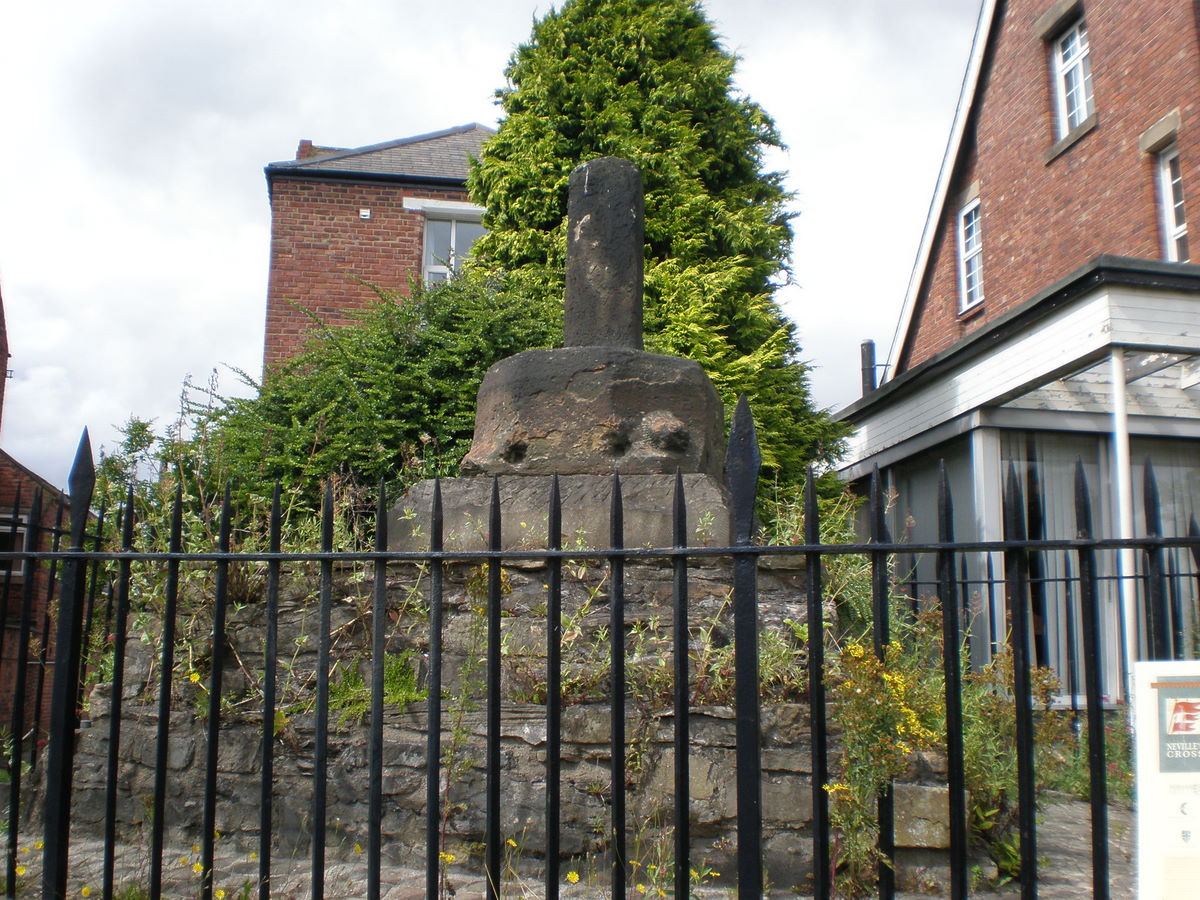
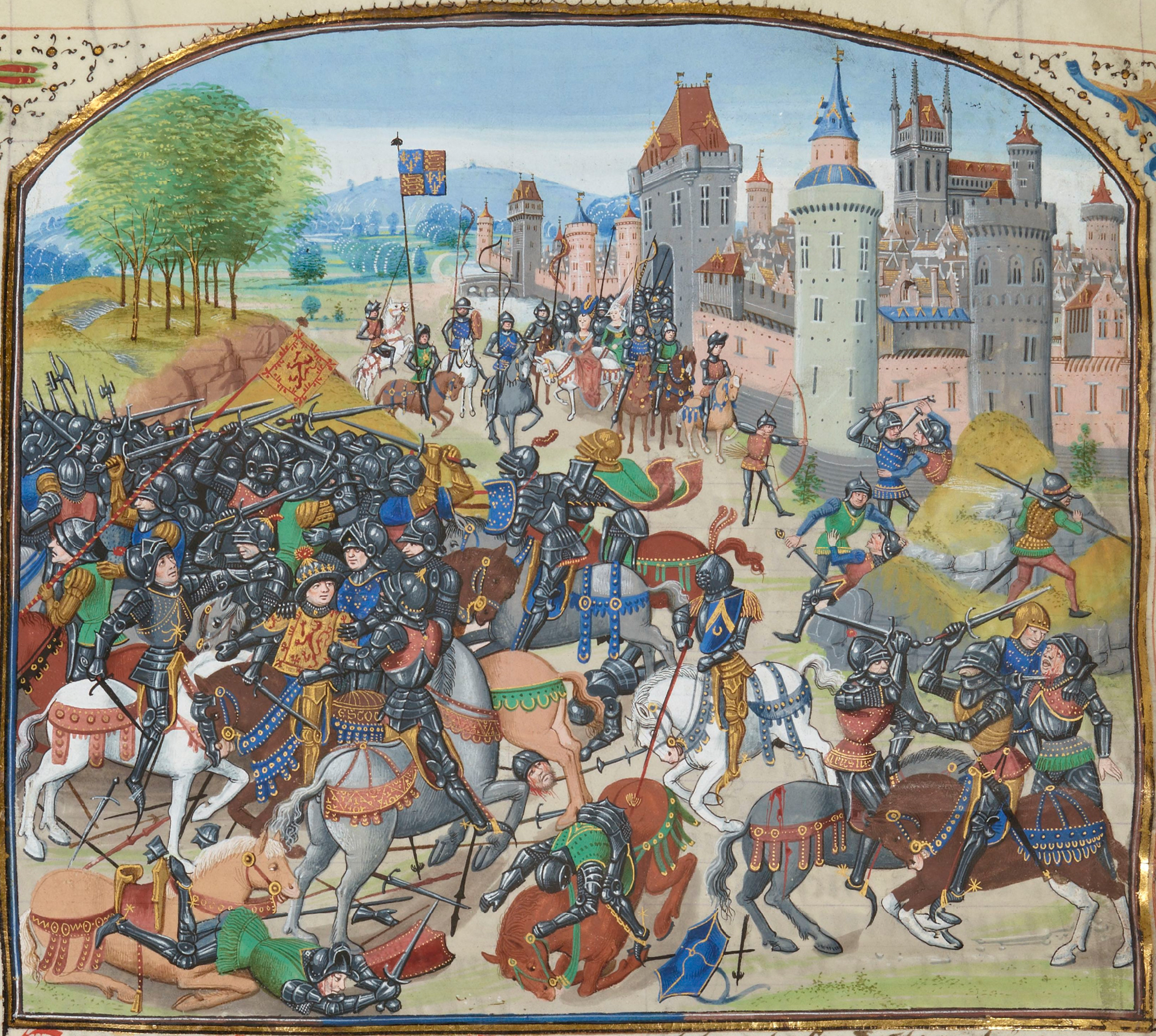
Neville's Cross is a historic area located in Durham, England. It is named after the famous Battle of Neville's Cross, which took place on October 17, 1346, during the Hundred Years' War. The battle saw a decisive victory for the English against the invading Scottish army led by King David II.

The area is primarily known for the Neville's Cross Inn, a popular pub and restaurant that has been serving locals and visitors for centuries. The inn is housed in a charming 18th-century building, which adds to its appeal. It offers a warm and inviting atmosphere, making it a favorite spot for both social gatherings and casual dining.

Neville's Cross is also home to the Neville's Cross Primary School, which has been serving the local community since 1908. The school is known for its high academic standards and nurturing environment, offering a well-rounded education to its students.

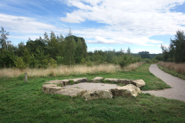
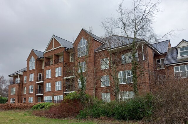
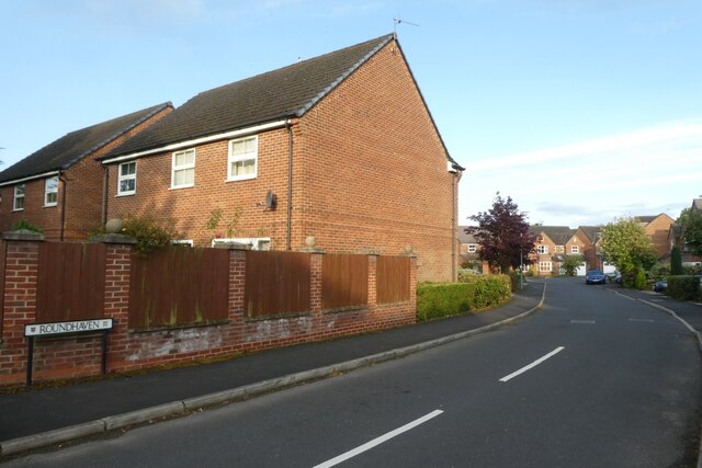
Surrounding the area is a mix of residential homes, ranging from historic properties to more modern constructions. The neighborhood is highly sought after due to its proximity to Durham City Centre and its excellent transport links.

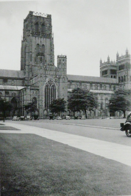
Nearby attractions include Durham Cathedral, a UNESCO World Heritage site, and Durham University, one of the oldest and most prestigious universities in the UK. Both landmarks contribute to the cultural and intellectual vibrancy of Neville's Cross, making it an appealing place to live and visit.

If you have any feedback on the listing, please let us know in the comments section below.

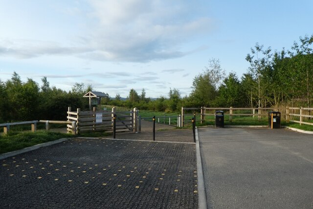
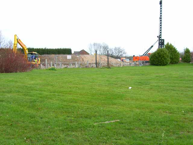
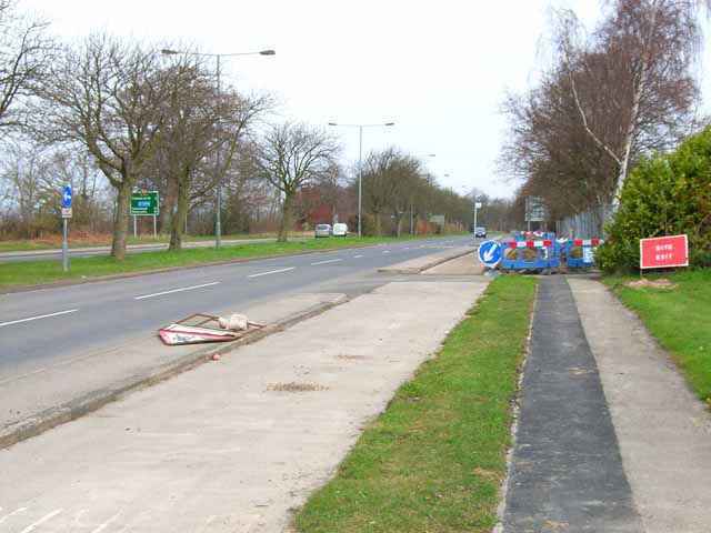
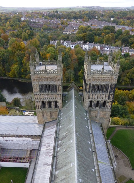
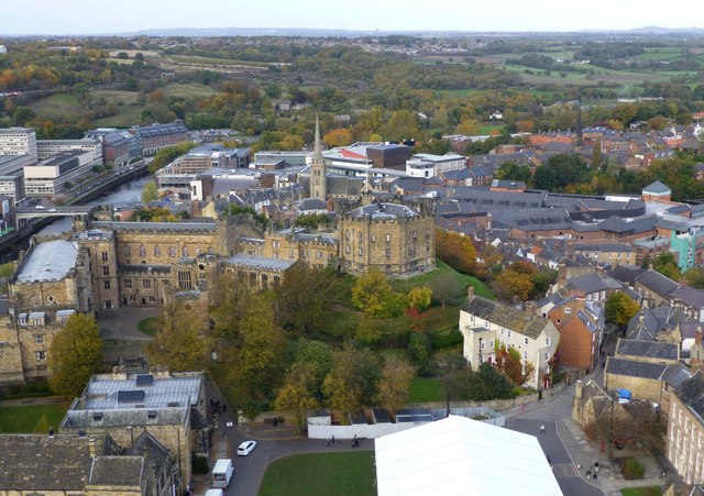
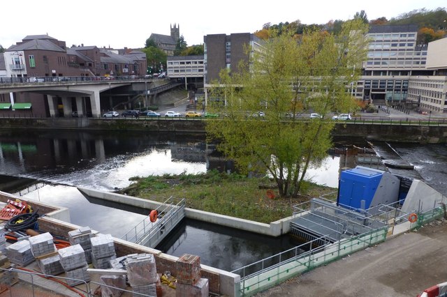
Neville's Cross Images

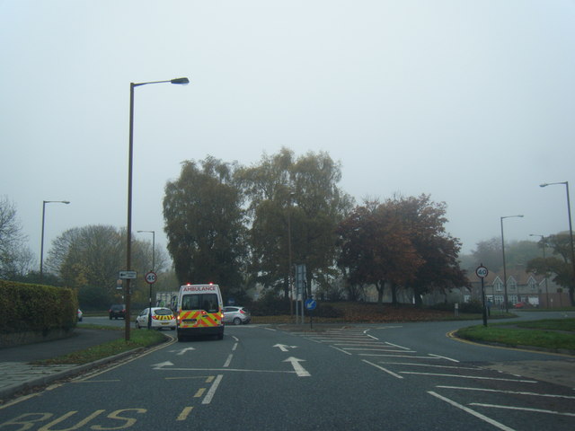
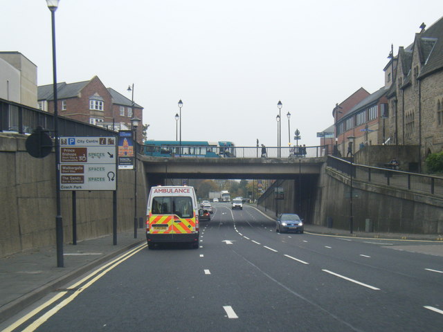
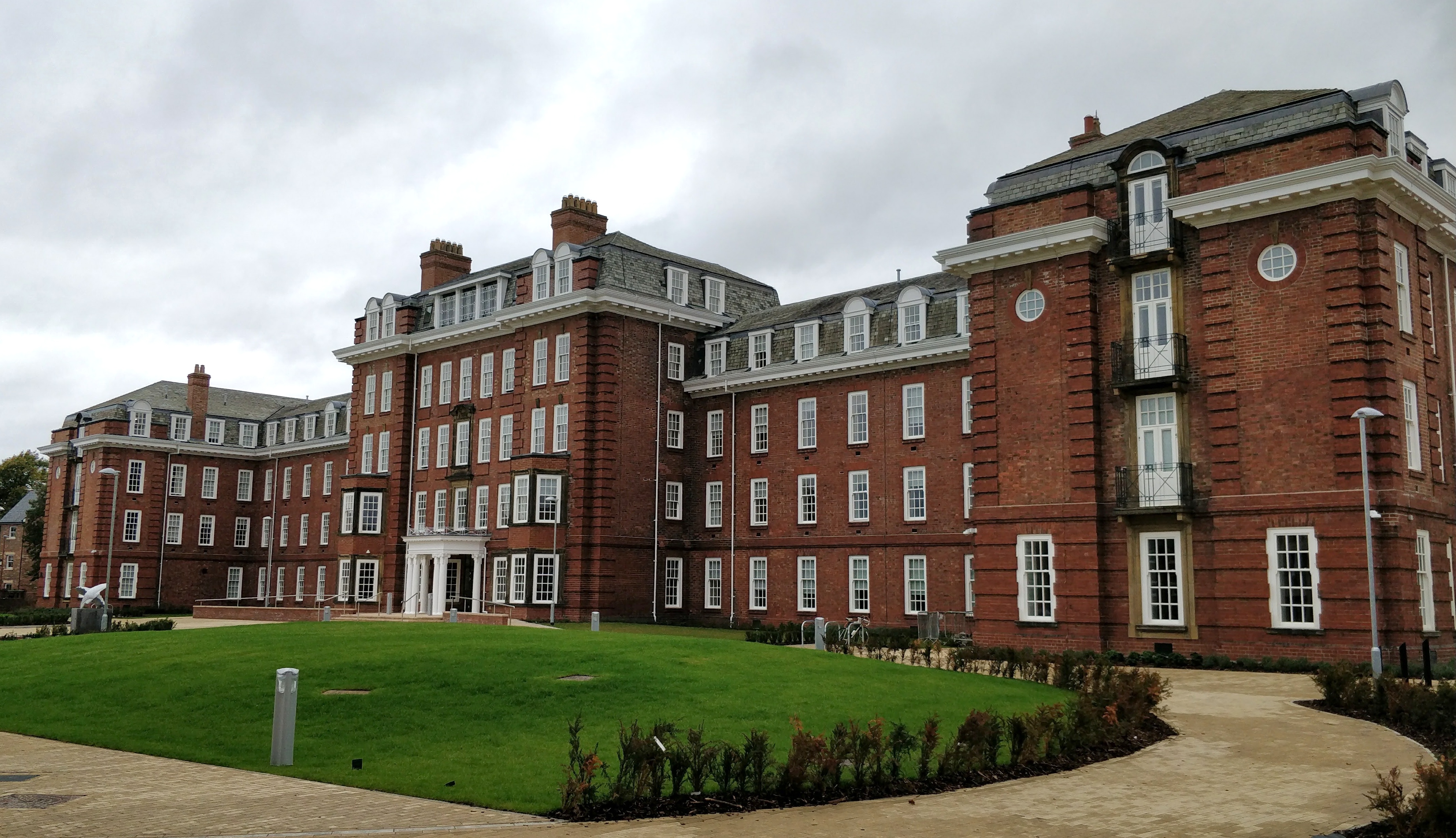
Images are sourced within 2km of 54.77079/-1.5900788 or Grid Reference NZ2641. Thanks to Geograph Open Source API. All images are credited.

Stone Circle, Low Burnhall Wood There are a lot of tracks and trails around Low Burnhall Wood with various features at intervals. Some stone, like this, some wickerwork, and some old industrial relics.
Stone Circle, Low Burnhall Wood
There are a lot of tracks and trails around Low Burnhall Wood with various features at intervals. Some stone, like this, some wickerwork, and some old industrial relics.
Durham, Cock of the North Hotel According to the OS benchmark database the OS Flush Bracket 8969 was embedded into the pub and hotel which was at this location. The pub has been demolished and replaced with new housing. It is likely the Flush Bracket has been destroyed.
Durham, Cock of the North Hotel
According to the OS benchmark database the OS Flush Bracket 8969 was embedded into the pub and hotel which was at this location. The pub has been demolished and replaced with new housing. It is likely the Flush Bracket has been destroyed.
Roundhaven from the A177 A street off South Road in Durham.
Roundhaven from the A177
A street off South Road in Durham.
Entrance to Low Burnhall An entrance to the Woodland Trust car park off the A177 South Road near Cock o' the North roundabout.
Entrance to Low Burnhall
An entrance to the Woodland Trust car park off the A177 South Road near Cock o' the North roundabout.
Car park at Low Burnhall Low Burnhall is a Woodland Trust site to the south of Durham.
Car park at Low Burnhall
Low Burnhall is a Woodland Trust site to the south of Durham.
Where the Cock o' the North once stood Until recently a roadhouse named Cock o'the North stood here on the A167 at the southern approaches to Durham. Now a building site for more "executive homese"
Where the Cock o' the North once stood
Until recently a roadhouse named Cock o'the North stood here on the A167 at the southern approaches to Durham. Now a building site for more "executive homese"
A167 on the southern approaches to Durham This section of road was at one time the A1 (Great North Road). Hence the dual carriageway and cycle tracks alongside. Despite the construction of the A1(M) on the east side of the city, this road is still extremely busy
A167 on the southern approaches to Durham
This section of road was at one time the A1 (Great North Road). Hence the dual carriageway and cycle tracks alongside. Despite the construction of the A1(M) on the east side of the city, this road is still extremely busy
Durham Cathedral, 1936 Taken by my grandfather, George W Baker. His son/my father took a similar photo two years later of <a href="https://www.geograph.org.uk/photo/2161815">NZ2742 : Durham Cathedral in 1938</a>.
Durham Cathedral, 1936
Taken by my grandfather, George W Baker. His son/my father took a similar photo two years later of NZ2742 : Durham Cathedral in 1938.
The Western Towers of Durham Cathedral Viewed from the top of the Central Tower.
The Cathedral’s original western towers were small, and were later incorporated into the larger, current structures when these were built around 1200.
The Cathedral’s towers were especially important in Durham, where the building stands surrounded by rising land, and would otherwise be hidden from view.
The Western Towers of Durham Cathedral
Viewed from the top of the Central Tower. The Cathedral’s original western towers were small, and were later incorporated into the larger, current structures when these were built around 1200. The Cathedral’s towers were especially important in Durham, where the building stands surrounded by rising land, and would otherwise be hidden from view.
Durham Castle Viewed from the top of the Central Tower of Durham Cathedral.
Durham Castle
Viewed from the top of the Central Tower of Durham Cathedral.
Archimedean screw  An Archimedean screw harvesting energy from the River Wear to drive a 100kw generator capable of supplying 75% of the total energy requirement of the new Freeman’s Reach development in Durham City.
Energy had previously been extracted for more than 800 years to drive the medieval Bishop’s Mill near the site.
<span class="nowrap"><a title="http://www.thejournal.co.uk/news/20-tonne-water-power-installation-7199432" rel="nofollow ugc noopener" href="http://www.thejournal.co.uk/news/20-tonne-water-power-installation-7199432">Link</a><img style="margin-left:2px;" alt="External link" title="External link - shift click to open in new window" src="https://s1.geograph.org.uk/img/external.png" width="10" height="10"/></span>
Archimedean screw
An Archimedean screw harvesting energy from the River Wear to drive a 100kw generator capable of supplying 75% of the total energy requirement of the new Freeman’s Reach development in Durham City. Energy had previously been extracted for more than 800 years to drive the medieval Bishop’s Mill near the site. LinkExternal link
Durham Cathedral door knocker (1965)
B6532 near County Hall
A690 Leazes Road, Durham
Durham Cathedral-Lumiere 2015 Amazing view of the Cathedral during Lumiere 2015
Durham Cathedral-Lumiere 2015
Amazing view of the Cathedral during Lumiere 2015
Durham Cathedral during Lumiere 2015 Wonderful illuminations on the Cathedral
Durham Cathedral during Lumiere 2015
Wonderful illuminations on the Cathedral
Old Shire Hall, Durham The building is being lit as part of the Durham Lumiere Light Festival 2015
Old Shire Hall, Durham
The building is being lit as part of the Durham Lumiere Light Festival 2015
St. John's College, Durham Lumiere 2015
Show me another place!

Neville's Cross is located at Grid Ref: NZ2641 (Lat: 54.77079, Lng: -1.5900788)

Unitary Authority: County Durham

Police Authority: Durham

What 3 Words

///burst.swaps.alert. Near Durham, Co. Durham

Related Wikis

Ustinov College, Durham

Ustinov College is the largest college of Durham University, located in Durham, North East England. Founded as the Graduate Society in 1965, it became...

Neville's Cross

Neville's Cross is a place in County Durham, in England. It is also a ward of Durham with a population taken at the 2011 census of 9,940. It is situated...

Battle of Neville's Cross

The Battle of Neville's Cross took place during the Second War of Scottish Independence on 17 October 1346, half a mile (800 m) to the west of Durham,...

Durham Miners Heritage Centre

The Durham Miners Heritage Centre was a museum, now closed, run by the Durham Miners Heritage Group at Neville's Cross, Durham, England. It had a display...

Nearby Amenities

Located within 500m of 54.77079,-1.5900788
Post Box
Collection Times: Mo-Sa 09:30
Ref: DH1 26D
Royal Cypher: EIIR
Royal Cypher Wikidata: Q33102113
Lat/Long: 54.7728155/-1.5909992
Traffic Signals
Button Operated: yes
Crossing: traffic_signals
Tactile Paving: yes
Traffic Signals Sound: no
Lat/Long: 54.7670588/-1.59233
Post Box
Collection Times: Mo-Fr 16:00; Sa 11:30; Su off
Drive Through: no
Operator: Royal Mail
Post Box Type: pillar
Ref: DH1 57
Royal Cypher: EIIR
Royal Cypher Wikidata: Q33102113
Lat/Long: 54.7667286/-1.5930957
Removed Amenity: telephone
Lat/Long: 54.7667201/-1.5931454
Barrier: bollard
Lat/Long: 54.7684667/-1.5887482
Barrier: bollard
Lat/Long: 54.7677266/-1.5926546
Turning Circle
Lat/Long: 54.7716885/-1.5938802
Neville's Cross
HE Ref: 1323226
Designation: scheduled_monument
Historic: memorial
Listed Status: Grade II
Note HE Ref: refers to listed status
Wikidata: Q17665604
Wikimedia Commons: File:Neville's Cross - geograph.org.uk - 883804.jpg
Lat/Long: 54.7724418/-1.5933593
Neville's Cross
Place: suburb
Wikidata: Q15041225
Lat/Long: 54.7720023/-1.5941791
Communication Television: yes
Man Made: mast
Operator: Arqiva
Tower Type: communication
Lat/Long: 54.7752228/-1.5907688
Traffic Signals
Crossing: traffic_signals
Lat/Long: 54.7668841/-1.591915
Crossing
Crossing: unmarked
Crossing Island: yes
Kerb: lowered
Tactile Paving: yes
Lat/Long: 54.7683253/-1.5933288
Traffic Signals
Bicycle: yes
Crossing: traffic_signals
Crossing Island: yes
Kerb: lowered
Tactile Paving: yes
Lat/Long: 54.7720352/-1.5942998
Turning Circle
Lat/Long: 54.7726697/-1.5853323
Turning Circle
Lat/Long: 54.7739374/-1.5845105
Crossing
Crossing: unmarked
Crossing Island: yes
Kerb: lowered
Tactile Paving: no
Lat/Long: 54.7724683/-1.591491
Turning Circle
Lat/Long: 54.7715771/-1.5907184
Turning Circle
Lat/Long: 54.772151/-1.5909848
Bench
Backrest: yes
Ele: 95.3
Inscription: For the benefit of residents and visitors alike. Pause for a while and enjoy the area. Durham City Council
Lat/Long: 54.7667514/-1.5920089
Post Box
Collection Times: Mo-Sa 09:30
Ref: DH1 35
Royal Cypher: EIIR
Royal Cypher Wikidata: Q33102113
Lat/Long: 54.7714415/-1.5956737
Old Name: Newsmarket
Razed Shop: convenience
Lat/Long: 54.7707637/-1.5959269
Restaurant
Antico
Addr City: Durham
Addr Postcode: DH1 4JX
Addr Street: Darlington Road
Cuisine: italian
Fhrs Id: 1251338
Old Name: Bella Mamma
Phone: +44 191 3709922
Source Postcode: Business website
Website: https://durham.anticorestaurant.com/
Wheelchair: no
Lat/Long: 54.7715245/-1.5949561
Turning Circle
Lat/Long: 54.7746777/-1.5907984
Barrier: stile
Foot: yes
Lat/Long: 54.7688528/-1.5836157
Bus Stop
St. Margarets School
Bench: no
Bin: no
Bus: yes
Naptan AtcoCode: 13005011G
Naptan Bearing: W
Naptan CommonName: St. Margarets School
Naptan Indicator: west bound
Naptan Landmark: Bus Stop
Naptan NaptanCode: durdgjma
Naptan PlusbusZoneRef: DRHM
Naptan Street: Crossgate Peth
Naptan Verified: yes
Public Transport: platform
Shelter: no
Source: naptan_import; survey
Tactile Paving: no
Lat/Long: 54.7726336/-1.5891576
Bus Stop
Neville's Cross, Post Office
Bench: no
Bin: no
Naptan AtcoCode: 13005047B
Naptan Bearing: NE
Naptan CommonName: Post Office
Naptan Indicator: north east bound
Naptan Landmark: Landmark not known
Naptan NaptanCode: durdgmtg
Naptan Notes: On A690 Nevilles Cross Bank- S of 11 Rhodes Terrace- Durham
Naptan PlusbusZoneRef: DRHM
Naptan Street: A690 - Nevilles Cross Bk
Naptan Verified: yes
Note: NAPTAN name is just "Post Office", but timetable includes "Neville's Cross"
Shelter: no
Source: naptan_import; survey
Tactile Paving: no
Lat/Long: 54.771521/-1.5954313
Bus Stop
Neville's Cross, Post Office
Bench: no
Check Date Shelter: 2023-12-22
Naptan AtcoCode: 13005047F
Naptan Bearing: SW
Naptan CommonName: Post Office
Naptan Indicator: south west bound
Naptan Landmark: Landmark not known
Naptan NaptanCode: durdgmtj
Naptan Notes: opp 1 fenwick ter- nevilles cross bank- Durham
Naptan PlusbusZoneRef: DRHM
Naptan Street: A690 - Nevilles Cross Bk
Naptan Verified: yes
Note: NAPTAN name is just "Post Office", but timetable includes "Neville's Cross"
Shelter: no
Source: naptan_import; survey
Lat/Long: 54.7703444/-1.5964634
Bus Stop
Durham School
Naptan AtcoCode: 13005101H
Naptan Bearing: NW
Naptan CommonName: Durham School
Naptan Indicator: north west bound
Naptan Landmark: Landmark not known
Naptan NaptanCode: durdgtwg
Naptan Notes: 20m south of Durham School entrance on Quarryheads Lane- Durham
Naptan PlusbusZoneRef: DRHM
Naptan Street: Margery Lane
Seats: no
Shelter: no
Source: naptan_import
Lat/Long: 54.771792/-1.5825184
Bus Stop
A167-Cross Valley Court
Naptan AtcoCode: 13005500D
Naptan Bearing: SE
Naptan BusStopType: MKD
Naptan CommonName: Club (A167 - 724-X24 only)
Naptan Indicator: SE-bound
Naptan Landmark: Landmark not known
Naptan NaptanCode: durdmatm
Naptan PlusbusZoneRef: DRHM
Naptan RevisionNumber: 4
Naptan Street: A167 - Newcastle Road
Naptan Verified: yes
Old Name: Club (A167 - 724-X24 only)
Source: naptan_import; survey
Lat/Long: 54.7727068/-1.5948336
Bus Stop
A167-Cross Valley Court
Naptan AtcoCode: 13005500H
Naptan Bearing: NW
Naptan BusStopType: MKD
Naptan CommonName: A167-Cross Valley Court
Naptan Indicator: NW-bound
Naptan Landmark: Landmark not known
Naptan NaptanCode: durdmatp
Naptan Notes: On A167 Newcastle Road- but opposite 11 & 12 George Street- and outside the large laundry facto
Naptan PlusbusZoneRef: DRHM
Naptan RevisionNumber: 4
Naptan Street: A167 - Newcastle Road
Naptan Verified: no
Old Name: Club (A167 - 724-X24 only)
Shelter: yes
Source: naptan_import
Lat/Long: 54.7728057/-1.5952394
Bus Stop
Neville's Cross, Duke of Wellington
Bench: no
Bin: yes
Bus: yes
Check Date Shelter: 2022-06-22
Departures Board: timetable
Lit: yes
Naptan AtcoCode: 13005641H
Naptan Bearing: NW
Naptan CommonName: Duke of Wellington
Naptan Indicator: north west bound
Naptan Landmark: Landmark not known
Naptan NaptanCode: durdmgdg
Naptan Notes: opp entrance to clay lane- darlington road (a167)- Durham
Naptan PlusbusZoneRef: DRHM
Naptan Street: A167
Naptan Verified: yes
Public Transport: platform
Shelter: yes
Source: naptan_import; survey
Tactile Paving: no
Lat/Long: 54.7676739/-1.59298
Bus Stop
Neville's Cross, Ellam Avenue
Bench: yes
Bus: yes
Naptan AtcoCode: 13005642A
Naptan Bearing: N
Naptan CommonName: Ellam Avenue
Naptan Indicator: north bound
Naptan Landmark: Landmark not known
Naptan NaptanCode: durdmgdj
Naptan Notes: opp no. 1 and rental garage- darlington rd (a167)- Durham
Naptan PlusbusZoneRef: DRHM
Naptan Street: A167
Naptan Verified: yes
Public Transport: platform
Shelter: yes
Source: naptan_import; survey
Lat/Long: 54.770318/-1.594527
Bus Stop
Ellam Avenue
Bench: no
Bus: yes
Check Date Shelter: 2022-06-22
Departures Board: timetable
Naptan AtcoCode: 13005642E
Naptan Bearing: S
Naptan CommonName: Ellam Avenue
Naptan Indicator: south bound
Naptan Landmark: Landmark not known
Naptan NaptanCode: durdmgdm
Naptan Notes: 5- darlington road (A167)- Durham
Naptan PlusbusZoneRef: DRHM
Naptan Street: A167
Naptan Verified: yes
Passenger Information Display: no
Public Transport: platform
Shelter: no
Source: naptan_import; survey
Lat/Long: 54.7699314/-1.5942254
Bus Stop
Neville's Cross, Church
Bench: no
Bin: no
Bus: yes
Naptan AtcoCode: 13005643C
Naptan Bearing: E
Naptan CommonName: Church
Naptan Indicator: east bound
Naptan Landmark: Landmark not known
Naptan NaptanCode: durdmgdp
Naptan Notes: opp 6- howcroft villas (a690)- Durham
Naptan PlusbusZoneRef: DRHM
Naptan Street: A690
Naptan Verified: yes
Note: NAPTAN name is just "Church", but timetable includes "Neville's Cross"
Public Transport: platform
Shelter: yes
Source: naptan_import; survey
Tactile Paving: no
Lat/Long: 54.7725197/-1.5922436
Bus Stop
Neville's Cross, Church
Bench: yes
Bin: yes
Bus: yes
Departures Board: timetable
Naptan AtcoCode: 13005643G
Naptan Bearing: W
Naptan CommonName: Church
Naptan Indicator: west bound
Naptan Landmark: Landmark not known
Naptan NaptanCode: durdmgdt
Naptan Notes: st johns church- nevilles cross (a690) Durham
Naptan PlusbusZoneRef: DRHM
Naptan Street: A690
Naptan Verified: yes
Note: NAPTAN name is just "Church", but timetable includes "Neville's Cross"
Public Transport: platform
Shelter: yes
Source: naptan_import; survey
Tactile Paving: no
Lat/Long: 54.7723656/-1.5926773
Traffic Signals
Bicycle: no
Button Operated: yes
Crossing: traffic_signals
Kerb: lowered
Tactile Paving: yes
Lat/Long: 54.772202/-1.5942941
Crossing
Button Operated: yes
Crossing: traffic_signals
Crossing Island: yes
Kerb: lowered
Tactile Paving: yes
Lat/Long: 54.7718588/-1.5947122
Turning Circle
Lat/Long: 54.7716063/-1.5921921
Archery Rise
Power: substation
Lat/Long: 54.7707489/-1.5888415
Barrier: bollard
Lat/Long: 54.7695569/-1.588437
Barrier: bollard
Bollard: fixed
Lat/Long: 54.7701656/-1.5872128
Waste Basket
Source: survey
Lat/Long: 54.7702632/-1.5915246
Bench
Source: survey
Lat/Long: 54.7703213/-1.591306
Bench
Source: survey
Lat/Long: 54.7703303/-1.5912563
Bench
Source: survey
Lat/Long: 54.7703521/-1.5912563
Bench
Source: survey
Lat/Long: 54.7703659/-1.5912793
Grit Bin
Operator: Durham County Council
Operator Type: government
Operator Wikidata: Q5316492
Ref: DU256
Lat/Long: 54.7745482/-1.5882468
Entrance: main
Lat/Long: 54.7749875/-1.5882939
Grit Bin
Lat/Long: 54.7750542/-1.5884314
Noexit: yes
Lat/Long: 54.7752069/-1.5888197
Traffic Signals
Button Operated: yes
Crossing: traffic_signals
Kerb: lowered
Tactile Paving: yes
Lat/Long: 54.7719496/-1.5948073
Waste Basket
Lat/Long: 54.7671678/-1.5877391
Entrance: yes
Lat/Long: 54.7672847/-1.5894876
Street Lamp
Lat/Long: 54.7673072/-1.5894406
Street Lamp
Lat/Long: 54.7671036/-1.5892407
Entrance: yes
Lat/Long: 54.7670466/-1.5892136
Entrance: yes
Lat/Long: 54.7670931/-1.5894912
Entrance: yes
Lat/Long: 54.7674416/-1.5894132
Addr City: Durham
Addr Housenumber: 16
Addr Postcode: DH1 4FG
Addr Street: Faraday Court
Lat/Long: 54.7685634/-1.5895755
Addr City: Durham
Addr Housenumber: 22
Addr Postcode: DH1 4FG
Addr Street: Faraday Court
Lat/Long: 54.7688566/-1.589275
Addr City: Durham
Addr Housenumber: 24
Addr Postcode: DH1 4FG
Addr Street: Faraday Court
Lat/Long: 54.7688468/-1.5896188
Addr City: Durham
Addr Housenumber: 25
Addr Postcode: DH1 4FG
Addr Street: Faraday Court
Lat/Long: 54.7688425/-1.5897003
Addr City: Durham
Addr Housenumber: 27
Addr Postcode: DH1 4FG
Addr Street: Faraday Court
Lat/Long: 54.7688608/-1.5898758
Addr City: Durham
Addr Housenumber: 31
Addr Postcode: DH1 4FG
Addr Street: Faraday Court
Lat/Long: 54.7691282/-1.5896501
Addr City: Durham
Addr Housenumber: 32
Addr Postcode: DH1 4FG
Addr Street: Faraday Court
Lat/Long: 54.7689938/-1.589289
Street Lamp
Lat/Long: 54.7670299/-1.5876025
Street Lamp
Lat/Long: 54.7671071/-1.5880059
Addr City: Durham
Addr Housenumber: 40
Addr Postcode: DH1 4FG
Addr Street: Faraday Court
Lat/Long: 54.7694143/-1.5896332
Addr City: Durham
Addr Housenumber: 47
Addr Postcode: DH1 4FG
Addr Street: Faraday Court
Lat/Long: 54.7691415/-1.5903527
Addr City: Durham
Addr Housenumber: 37
Addr Postcode: DH1 4PF
Addr Street: Geoffrey Avenue
Source Postcode: CodePoint Open
Lat/Long: 54.7714287/-1.5940079
Addr City: Durham
Addr Housenumber: 5
Addr Postcode: DH1 4FG
Addr Street: Faraday Court
Lat/Long: 54.7686206/-1.59025
Addr City: Durham
Addr Housenumber: 11
Addr Postcode: DH1 4FG
Addr Street: Faraday Court
Lat/Long: 54.7685783/-1.5899054
Addr City: Durham
Addr Housenumber: 17
Addr Postcode: DH1 4FG
Addr Street: Faraday Court
Lat/Long: 54.7685611/-1.5894697
Addr City: Durham
Addr Housenumber: 28
Addr Postcode: DH1 4FG
Addr Street: Faraday Court
Lat/Long: 54.7690884/-1.5899164
Addr City: Durham
Addr Housenumber: 29
Addr Postcode: DH1 4FG
Addr Street: Faraday Court
Lat/Long: 54.7691216/-1.589822
Bench
Backrest: yes
Check Date: 2022-06-22
Material: wood
Lat/Long: 54.7713523/-1.5942225
Street Lamp
Lat/Long: 54.7696093/-1.5943186
Waste Basket
Lat/Long: 54.7695613/-1.5943083
Addr City: Durham
Addr Housenumber: 14
Addr Postcode: DH1 4PG
Addr Street: Ellam Avenue
Source Postcode: CodePoint Open
Lat/Long: 54.7699557/-1.5925236
Bicycle Parking
Bicycle Parking: stands
Capacity: 8
Covered: no
Lat/Long: 54.7718109/-1.5930866
Addr City: Durham
Addr Housenumber: 39
Addr Postcode: DH1 4PF
Addr Street: Geoffrey Avenue
Source Postcode: CodePoint Open
Lat/Long: 54.7715111/-1.5940176
Addr City: Durham
Addr Housenumber: 20
Addr Postcode: DH1 4PF
Addr Street: Geoffrey Avenue
Source Postcode: CodePoint Open
Lat/Long: 54.7709632/-1.5934263
Addr City: Durham
Addr Housenumber: 15
Addr Postcode: DH1 4PG
Addr Street: Ellam Avenue
Source Postcode: CodePoint Open
Lat/Long: 54.7699467/-1.5926199
Street Lamp
Lat/Long: 54.7685136/-1.5927152
Addr City: Durham
Addr Housenumber: 1
Addr Postcode: DH1 4FG
Addr Street: Faraday Court
Lat/Long: 54.7684247/-1.5902647
Addr City: Durham
Addr Housenumber: 6
Addr Postcode: DH1 4FG
Addr Street: Faraday Court
Lat/Long: 54.7686679/-1.5902541
Street Lamp
Lat/Long: 54.7689924/-1.5902798
Addr City: Durham
Addr Housenumber: 15
Addr Postcode: DH1 4FG
Addr Street: Faraday Court
Lat/Long: 54.7685673/-1.5896573
Barrier: bollard
Lat/Long: 54.7689949/-1.5895154
Addr City: Durham
Addr Housenumber: 26
Addr Postcode: DH1 4FG
Addr Street: Faraday Court
Lat/Long: 54.7688396/-1.5897721
Street Lamp
Lat/Long: 54.77005/-1.5905789
Addr City: Durham
Addr Housenumber: 30
Addr Postcode: DH1 4PF
Addr Street: Geoffrey Avenue
Source Postcode: CodePoint Open
Lat/Long: 54.7713808/-1.5935744
Addr City: Durham
Addr Housenumber: 33
Addr Postcode: DH1 4PF
Addr Street: Geoffrey Avenue
Source Postcode: CodePoint Open
Lat/Long: 54.7712799/-1.5939612
Grit Bin
Operator: Durham County Council
Operator Type: government
Operator Wikidata: Q5316492
Ref: DU383
Lat/Long: 54.7689279/-1.5902873
Street Lamp
Lat/Long: 54.7687805/-1.5899976
Addr City: Durham
Addr Housenumber: 41
Addr Postcode: DH1 4FG
Addr Street: Faraday Court
Lat/Long: 54.7694028/-1.589752
Addr City: Durham
Addr Housenumber: 42
Addr Postcode: DH1 4FG
Addr Street: Faraday Court
Lat/Long: 54.7693981/-1.5898374
Addr City: Durham
Addr Housenumber: 22
Addr Postcode: DH1 4PF
Addr Street: Geoffrey Avenue
Source Postcode: CodePoint Open
Lat/Long: 54.7710284/-1.5934514
Addr City: Durham
Addr Housenumber: 12
Addr Postcode: DH1 4PF
Addr Street: Geoffrey Avenue
Source Postcode: CodePoint Open
Lat/Long: 54.7706061/-1.5932643
Grit Bin
Operator: Durham County Council
Operator Type: government
Operator Wikidata: Q5316492
Ref: DU 244
Lat/Long: 54.7697587/-1.5938827
Addr City: Durham
Addr Housenumber: 21
Addr Postcode: DH1 4FG
Addr Street: Faraday Court
Lat/Long: 54.7688016/-1.5892622
Addr City: Durham
Addr Housenumber: 39
Addr Postcode: DH1 4FG
Addr Street: Faraday Court
Lat/Long: 54.7694186/-1.5895485
Addr City: Durham
Addr Housenumber: 43
Addr Postcode: DH1 4FG
Addr Street: Faraday Court
Lat/Long: 54.7693827/-1.5899255
Addr City: Durham
Addr Housenumber: 51
Addr Postcode: DH1 4FG
Addr Street: Faraday Court
Lat/Long: 54.7693523/-1.5903317
Grit Bin
Operator: Durham County Council
Operator Type: government
Operator Wikidata: Q5316492
Ref: DU358
Lat/Long: 54.7671027/-1.5878556
Addr City: Durham
Addr Housenumber: 2
Addr Postcode: DH1 4FG
Addr Street: Faraday Court
Lat/Long: 54.7684768/-1.5902675
Addr City: Durham
Addr Housenumber: 23
Addr Postcode: DH1 4FG
Addr Street: Faraday Court
Lat/Long: 54.768913/-1.5892908
Addr City: Durham
Addr Housenumber: 36
Addr Postcode: DH1 4FG
Addr Street: Faraday Court
Lat/Long: 54.7694096/-1.5892931
Addr City: Durham
Addr Housenumber: 44
Addr Postcode: DH1 4FG
Addr Street: Faraday Court
Lat/Long: 54.7693626/-1.5900308
Grit Bin
Operator: Durham County Council
Operator Type: government
Operator Wikidata: Q5316492
Ref: DU384
Lat/Long: 54.7700591/-1.5901601
Waste Basket
Check Date: 2022-06-22
Lat/Long: 54.7713181/-1.594225
Addr City: Durham
Addr Housenumber: 14
Addr Postcode: DH1 4PF
Addr Street: Geoffrey Avenue
Source Postcode: CodePoint Open
Lat/Long: 54.7706678/-1.5932986
Addr City: Durham
Addr Housenumber: 14
Addr Postcode: DH1 4FG
Addr Street: Faraday Court
Lat/Long: 54.7685681/-1.5897346
Addr City: Durham
Addr Housenumber: 37
Addr Postcode: DH1 4FG
Addr Street: Faraday Court
Lat/Long: 54.7694191/-1.589399
Addr City: Durham
Addr Housenumber: 48
Addr Postcode: DH1 4FG
Addr Street: Faraday Court
Lat/Long: 54.7691938/-1.5903626
Addr City: Durham
Addr Housenumber: 49
Addr Postcode: DH1 4FG
Addr Street: Faraday Court
Lat/Long: 54.7692447/-1.5903661
Addr City: Durham
Addr Housenumber: 50
Addr Postcode: DH1 4FG
Addr Street: Faraday Court
Lat/Long: 54.7693045/-1.5903717
Bench
Backrest: yes
Check Date: 2022-06-22
Material: wood
Lat/Long: 54.7712808/-1.5942252
Addr City: Durham
Addr Housenumber: 35
Addr Postcode: DH1 4PF
Addr Street: Geoffrey Avenue
Source Postcode: CodePoint Open
Lat/Long: 54.7713534/-1.593979
Addr City: Durham
Addr Housenumber: 16
Addr Postcode: DH1 4PF
Addr Street: Geoffrey Avenue
Source Postcode: CodePoint Open
Lat/Long: 54.7707693/-1.5933359
Addr City: Durham
Addr Housenumber: 3
Addr Postcode: DH1 4FG
Addr Street: Faraday Court
Lat/Long: 54.7685296/-1.5902536
Addr City: Durham
Addr Housenumber: 18
Addr Postcode: DH1 4PF
Addr Street: Geoffrey Avenue
Source Postcode: CodePoint Open
Lat/Long: 54.7708485/-1.5933746
Car Rental
Enterprise
Brand: Enterprise
Brand Wikidata: Q17085454
Official Name: Enterprise Rent-A-Car
Operator: Enterprise
Website: https://www.enterprise.co.uk/en/car-hire/locations/uk/durham-u832.html
Lat/Long: 54.7704956/-1.594195
Addr City: Durham
Addr Housenumber: 28
Addr Postcode: DH1 4PF
Addr Street: Geoffrey Avenue
Source Postcode: CodePoint Open
Lat/Long: 54.7713163/-1.5935477
Addr City: Durham
Addr Housenumber: 12
Addr Postcode: DH1 4FG
Addr Street: Faraday Court
Lat/Long: 54.7685623/-1.5898132
Addr City: Durham
Addr Housenumber: 33
Addr Postcode: DH1 4FG
Addr Street: Faraday Court
Lat/Long: 54.7690505/-1.5893084
Grit Bin
Note: second half of ref missing on bin, 2016-05-20
Ref: DU ?
Lat/Long: 54.7685542/-1.5926569
Grit Bin
Operator: Durham County Council
Operator Type: government
Operator Wikidata: Q5316492
Ref: DU239
Lat/Long: 54.7667565/-1.5896781
Addr City: Durham
Addr Housenumber: 30
Addr Postcode: DH1 4FG
Addr Street: Faraday Court
Lat/Long: 54.7691212/-1.5897396
Addr City: Durham
Addr Housenumber: 34
Addr Postcode: DH1 4FG
Addr Street: Faraday Court
Lat/Long: 54.7691124/-1.5893073
Addr City: Durham
Addr Housenumber: 38
Addr Postcode: DH1 4FG
Addr Street: Faraday Court
Lat/Long: 54.7694174/-1.5894723
Addr City: Durham
Addr Housenumber: 45
Addr Postcode: DH1 4FG
Addr Street: Faraday Court
Lat/Long: 54.7690253/-1.5903318
Addr City: Durham
Addr Housenumber: 46
Addr Postcode: DH1 4FG
Addr Street: Faraday Court
Lat/Long: 54.769084/-1.5903353
Addr City: Durham
Addr Housenumber: 52
Addr Postcode: DH1 4FG
Addr Street: Faraday Court
Lat/Long: 54.7693985/-1.5903356
Addr City: Durham
Addr Housenumber: 53
Addr Postcode: DH1 4FG
Addr Street: Faraday Court
Lat/Long: 54.7694478/-1.5902832
Barrier: stile
Foot: yes
Stile: squeezer
Lat/Long: 54.7685025/-1.5858208
Street Lamp
Lat/Long: 54.7680156/-1.5948597
Grit Bin
Operator: Durham County Council
Operator Type: government
Operator Wikidata: Q5316492
Ref: DU 242
Lat/Long: 54.7683866/-1.5957692
Addr City: Durham
Addr Housenumber: 15
Addr Postcode: DH1 4NS
Addr Street: Lowes Rise
Source Postcode: CodePoint Open
Lat/Long: 54.7683072/-1.5963269
Street Lamp
Lat/Long: 54.7697737/-1.595478
Street Lamp
Lat/Long: 54.7696184/-1.5953054
Addr City: Durham
Addr Housenumber: 14
Addr Postcode: DH1 4NS
Addr Street: Lowes Rise
Source Postcode: CodePoint Open
Lat/Long: 54.7682285/-1.5963584
Street Lamp
Lat/Long: 54.7680482/-1.5946299
Grit Bin
Operator: Durham County Council
Operator Type: government
Operator Wikidata: Q5316492
Ref: DU241
Lat/Long: 54.7680056/-1.5946159
Street Lamp
Lat/Long: 54.7690506/-1.5968336
Grit Bin
Operator: Durham County Council
Operator Type: government
Operator Wikidata: Q5316492
Ref: DU243
Lat/Long: 54.7692773/-1.5949596
Grit Bin
Operator: Durham County Council
Operator Type: government
Operator Wikidata: Q5316492
Ref: DU240
Lat/Long: 54.7686407/-1.594245
Street Lamp
Lat/Long: 54.7683204/-1.5955486
Grit Bin
Ref: DU 387
Lat/Long: 54.7691373/-1.5931868
Street Lamp
Lat/Long: 54.768648/-1.5942612
Street Lamp
Lat/Long: 54.7694226/-1.5949934
Street Lamp
Lat/Long: 54.7691504/-1.5972876
Traffic Signals
Button Operated: no
Crossing: traffic_signals
Tactile Paving: yes
Traffic Signals Sound: no
Lat/Long: 54.7667176/-1.5922496
Addr City: Durham
Addr Housenumber: 4
Addr Postcode: DH1 4FG
Addr Street: Faraday Court
Lat/Long: 54.7685744/-1.5902561
Addr City: Durham
Addr Housenumber: 13
Addr Postcode: DH1 4NS
Addr Street: Lowes Rise
Survey Date: 2016-12-27
Lat/Long: 54.7682459/-1.5962503
Hair Quarters
Addr City: Durham
Addr Housenumber: 10
Addr Postcode: DH1 4JJ
Addr Street: Fenwick Terrace
Contact Facebook: HairQuartersDurham
Disused Amenity: cafe
Female: yes
Old Name: Vanilla Mamas
Shop: hairdresser
Lat/Long: 54.770119/-1.5969982
Waste Basket
Check Date: 2022-06-18
Lat/Long: 54.7714398/-1.59571
Addr City: Durham
Addr Housenumber: 12
Addr Postcode: DH1 4NS
Addr Street: Lowes Rise
Survey Date: 2016-12-27
Lat/Long: 54.7681736/-1.5962952
Grit Bin
Operator: Durham County Council
Operator Type: government
Operator Wikidata: Q5316492
Ref: DU 386
Lat/Long: 54.7683145/-1.5906105
Crossing
Lat/Long: 54.7713742/-1.5956596
Restaurant
Holi and Bhang
Addr City: Durham
Addr Postcode: DH1 4DX
Cuisine: indian
Fhrs Id: 1138026
Source Postcode: FHRS data
Url: https://www.farnley-tower.co.uk/holi-and-bhang-restaurant.html
Lat/Long: 54.77326/-1.589868
Grit Bin
Operator: Durham County Council
Operator Type: government
Operator Wikidata: Q5316492
Ref: DU254
Lat/Long: 54.7732147/-1.5890748
Bench
Backrest: yes
Inscription: Donated by; Merry Oaks W.I.; September 1973
Mapillary: 2112588418877469
Lat/Long: 54.7724868/-1.5930323
Community Notice Board
Board Type: notice
Information: board
Tourism: information
Lat/Long: 54.7724791/-1.5930672
The Battle
Board Type: history
Information: board
Tourism: information
Lat/Long: 54.7724181/-1.5933441
Curlz
Addr Street: Neville's Cross Bank
Contact Facebook: curlzdurham
Phone: +44 1913847131
Shop: hairdresser
Lat/Long: 54.7714673/-1.5951731
Bicycle Parking
Lat/Long: 54.769161/-1.5911458
Bicycle Parking
Covered: yes
Lat/Long: 54.7684584/-1.5907976
Vending Machine
Currency GBP: yes
Currency Others: no
Payment Coins: yes
Payment Notes: no
Lat/Long: 54.7727016/-1.5919662
Vending Machine
Currency GBP: yes
Currency Others: no
Payment Coins: yes
Payment Notes: no
Vending: parking_tickets
Lat/Long: 54.7727687/-1.5911975
Vending Machine
Vending: parking_tickets
Lat/Long: 54.7746659/-1.5864918
Traffic Signals
Button Operated: no
Crossing: traffic_signals
Tactile Paving: yes
Traffic Signals Sound: no
Lat/Long: 54.7668903/-1.5925938
Parking
Access: private
Parking: surface
Lat/Long: 54.7710603/-1.5873715
Barrier: bollard
Bollard: foldable
Foot: yes
Lat/Long: 54.768316/-1.5904076
Waste Basket
Waste: dog_excrement
Lat/Long: 54.7719368/-1.5929331
Waste Basket
Waste: dog_excrement
Lat/Long: 54.7719994/-1.5915155
Parking
Access: private
Parking: surface
Lat/Long: 54.772189/-1.5927292
Barrier: bollard
Bicycle: yes
Bollard: fixed
Foot: yes
Lat/Long: 54.7726399/-1.5914613
Barrier: entrance
Lat/Long: 54.7683717/-1.5854139
Grit Bin
Operator: Durham County Council
Operator Type: government
Operator Wikidata: Q5316492
Ref: DU263
Lat/Long: 54.7732/-1.5847832
Entrance: main
Lat/Long: 54.7720315/-1.5872581
Grit Bin
Operator: Durham County Council
Operator Type: government
Operator Wikidata: Q5316492
Ref: DU266
Lat/Long: 54.7736533/-1.5868109
Grit Bin
Operator: Durham County Council
Operator Type: government
Operator Wikidata: Q5316492
Ref: DU253
Lat/Long: 54.7725549/-1.5916497
Vending Machine
Vending: parking_tickets
Lat/Long: 54.7733718/-1.5927708
Grit Bin
Operator: Durham County Council
Operator Type: government
Operator Wikidata: Q5316492
Ref: DU357
Lat/Long: 54.7743867/-1.593487
Traffic Signals
Button Operated: yes
Crossing: traffic_signals
Kerb: lowered
Tactile Paving: yes
Lat/Long: 54.7720883/-1.59457
Traffic Signals
Button Operated: yes
Crossing: traffic_signals
Crossing Island: yes
Kerb: lowered
Tactile Paving: yes
Lat/Long: 54.7717821/-1.5944818
Traffic Signals
Button Operated: yes
Crossing: traffic_signals
Kerb: lowered
Tactile Paving: yes
Lat/Long: 54.7717333/-1.5946752
Barrier: bollard
Bollard: fixed
Foot: yes
Lat/Long: 54.7727502/-1.5886389
Grit Bin
Operator: Durham County Council
Operator Type: government
Operator Wikidata: Q5316492
Ref: DU 247
Lat/Long: 54.7716482/-1.590263
Grit Bin
Operator: Durham County Council
Operator Type: government
Operator Wikidata: Q5316492
Ref: DU246
Lat/Long: 54.7707292/-1.5900403
Grit Bin
Operator: Durham County Council
Operator Type: government
Operator Wikidata: Q5316492
Ref: DU248
Lat/Long: 54.7722694/-1.5900135
Addr City: Durham
Addr Housenumber: 10A
Addr Postcode: DH1 4JJ
Addr Street: Fenwick Terrace
Entrance: home
Lat/Long: 54.7700937/-1.5969979
Addr City: Durham
Addr Housenumber: 4
Addr Postcode: DH1 4JJ
Addr Street: Fenwick Terrace
Entrance: home
Source Postcode: CodePoint Open
Lat/Long: 54.7703267/-1.5967819
Addr City: Durham
Addr Housenumber: 3
Addr Postcode: DH1 4JJ
Addr Street: Fenwick Terrace
Entrance: home
Source Postcode: CodePoint Open
Lat/Long: 54.7703362/-1.5967733
Addr City: Durham
Addr Housenumber: 1
Addr Postcode: DH1 4JJ
Addr Street: Fenwick Terrace
Entrance: home
Source Postcode: CodePoint Open
Lat/Long: 54.7703651/-1.596747
Addr City: Durham
Addr Housenumber: 2
Addr Postcode: DH1 4JJ
Addr Street: Fenwick Terrace
Entrance: home
Source Postcode: CodePoint Open
Lat/Long: 54.7703554/-1.5967558
Turning Circle
Lat/Long: 54.7703767/-1.5959618
Grit Bin
Operator: Durham County Council
Operator Type: government
Operator Wikidata: Q5316492
Ref: DU261
Lat/Long: 54.7733455/-1.5858628
Barrier: entrance
Foot: yes
Lat/Long: 54.7723008/-1.5931125
Barrier: entrance
Lat/Long: 54.7723511/-1.59273
Waste Basket
Waste: trash
Lat/Long: 54.7724315/-1.5945498
Bench
Backrest: yes
Lat/Long: 54.7724075/-1.5944948
Grit Bin
Operator: Durham County Council
Operator Type: government
Operator Wikidata: Q5316492
Ref: DU250
Lat/Long: 54.7731095/-1.591702
Grit Bin
Operator: Durham County Council
Operator Type: government
Operator Wikidata: Q5316492
Ref: DU 251
Lat/Long: 54.773542/-1.5904936
Grit Bin
Operator: Durham County Council
Operator Type: government
Operator Wikidata: Q5316492
Ref: DU252
Lat/Long: 54.7730631/-1.590153
Entrance: main
Lat/Long: 54.7732474/-1.5899474
Parking
Access: private
Parking: surface
Lat/Long: 54.7723603/-1.593835
Barrier: bollard
Foot: yes
Lat/Long: 54.7734225/-1.5886776
Barrier: bollard
Lat/Long: 54.7710536/-1.5960095
Telephone
Booth: KX100
Covered: booth
Lat/Long: 54.7723708/-1.5926065
Noexit: yes
Lat/Long: 54.7677565/-1.5889363
Neville's Cross / Darlington Road
Camera Mount: pole
Camera Type: fixed
Contact Webcam: https://dcc.ussgroup.co.uk/i_dutmc_41.html
Man Made: surveillance
Operator: Durham County Council
Surveillance: public
Surveillance Type: camera
Surveillance Zone: traffic
Website: http://www.durham.gov.uk/article/6255
Lat/Long: 54.7710487/-1.5942635
Entrance: yes
Lat/Long: 54.768667/-1.5912451
Entrance: main
Lat/Long: 54.7692093/-1.5914792
Leisure: picnic_table
Lat/Long: 54.7690534/-1.591761
Leisure: picnic_table
Lat/Long: 54.7689942/-1.591767
Bench
Lat/Long: 54.7689822/-1.5913519
A167 Darlington Road/Duke of Wellington
Camera Mount: pole
Camera Type: fixed
Contact Webcam: https://dcc.ussgroup.co.uk/i_dutmc_35.html
Man Made: surveillance
Operator: Durham County Council
Surveillance: public
Surveillance Type: camera
Surveillance Zone: traffic
Website: http://www.durham.gov.uk/article/21807
Lat/Long: 54.7670218/-1.5921794
Addr City: Durham
Addr Housenumber: 8
Addr Postcode: DH1 4JT
Addr Street: Homer Terrace
Entrance: yes
Lat/Long: 54.7712235/-1.5955042
Addr City: Durham
Addr Housenumber: 9
Addr Postcode: DH1 4JT
Addr Street: Homer Terrace
Entrance: yes
Lat/Long: 54.7712617/-1.5954481
Addr City: Durham
Addr Housenumber: 10
Addr Postcode: DH1 4JT
Addr Street: Homer Terrace
Entrance: yes
Lat/Long: 54.7712801/-1.5954324
Addr City: Durham
Addr Housenumber: 11
Addr Postcode: DH1 4JT
Addr Street: Homer Terrace
Entrance: yes
Lat/Long: 54.7713165/-1.5953788
Addr City: Durham
Addr Housenumber: 12
Addr Postcode: DH1 4JT
Addr Street: Homer Terrace
Entrance: yes
Lat/Long: 54.7713378/-1.59536
Addr City: Durham
Addr Housenumber: 13
Addr Postcode: DH1 4JT
Addr Street: Homer Terrace
Entrance: yes
Lat/Long: 54.7713731/-1.5953079
Historic: memorial
Memorial: war_memorial
Lat/Long: 54.7722153/-1.5928365
Vending Machine
Lat/Long: 54.7733215/-1.5891485
Social Facility
Nevilles Court
Addr City: Durham
Addr Postcode: DH1 4JX
Operator: Careline Lifestyles
Social Facility: assisted_living
Website: https://carelinelifestyles.co.uk/our-homes/nevilles-court
Lat/Long: 54.7715306/-1.5950319
Crossing
Crossing: unmarked
Crossing Island: yes
Tactile Paving: yes
Lat/Long: 54.7683496/-1.5932538
Crossing
Crossing: unmarked
Crossing Island: yes
Tactile Paving: yes
Lat/Long: 54.7685126/-1.5935926
Barrier: bollard
Lat/Long: 54.770485/-1.5945162
Crossing
Crossing: unmarked
Crossing Island: yes
Tactile Paving: yes
Lat/Long: 54.7701799/-1.5943721
Charging Station
Capacity: 2
Motorcar: yes
Opening Hours: 24/7
Operator: mer
Ref: MER-UK-AD00586
Lat/Long: 54.7713516/-1.594641
Charging Station
Capacity: 2
Motorcar: yes
Opening Hours: 24/7
Operator: mer
Ref: MER-UK-TR0013
Socket Chademo: 1
Socket Type2 Combo: 1
Lat/Long: 54.7713048/-1.5946282
Crossing
Crossing: unmarked
Crossing Island: yes
Tactile Paving: yes
Lat/Long: 54.7679333/-1.5930635
Barrier: entrance
Lat/Long: 54.7722023/-1.583212
Boundary: marker
Fixme: Confirm exact location
Image: https://www.geograph.org.uk/photo/6492536
Lat/Long: 54.7721062/-1.5835963
Barrier: swing_gate
Lat/Long: 54.7710883/-1.5869559
Sheraton Park International Sculpture Garden
Information: board
Tourism: information
Lat/Long: 54.7687672/-1.5914766
America
Artwork Type: sculpture
Tourism: artwork
Lat/Long: 54.7688469/-1.5913553
China
Artwork Type: sculpture
Tourism: artwork
Lat/Long: 54.7689529/-1.5913157
Italy
Artwork Type: sculpture
Tourism: artwork
Lat/Long: 54.7690311/-1.5914109
Neville House
Historic: memorial
Memorial: plaque
Lat/Long: 54.7692184/-1.5915477
Defibrillator
Access: yes
Emergency: defibrillator
Indoor: no
Opening Hours: 24/7
Lat/Long: 54.7717893/-1.5930812
Crossing
Lat/Long: 54.772613/-1.5951199
Crossing
Lat/Long: 54.7732555/-1.5956249
The data included in this document is from www.openstreetmap.org. The data is made available under ODbL.

Have you been to Neville's Cross?

Leave your review of Neville's Cross below (or comments, questions and feedback).