New Apley

Settlement in Lincolnshire West Lindsey

England

New Apley

Site of Medieval settlement of Apley: aerial 2021 See <span class="nowrap"><a title="https://www.heritagegateway.org.uk/Gateway/Results_Single.aspx?uid=MLI50506&resourceID=1006" rel="nofollow ugc noopener" href="https://www.heritagegateway.org.uk/Gateway/Results_Single.aspx?uid=MLI50506&resourceID=1006">Link</a><img style="margin-left:2px;" alt="External link" title="External link - shift click to open in new window" src="https://s1.geograph.org.uk/img/external.png" width="10" height="10"/></span>.

Evidence for former settlement exists both as earthworks and as surface pottery scatters. A main hollow way running east to west is flanked along its north side by rectangular closes. A different pattern of large rectangular ditched closes to the south side resembles earthworks identified as monastic granges, demesne manors or farms within villages elsewhere in the area. These closes are all full of ridge and furrow (except at their northern end which may overlie earlier occupation). The Tithe map of 1849 shows that in addition to the surviving north to south farm track, a further way ran up the east side of the churchyard...

The medieval settlement of Apley was a hamlet established by the late 11th century. After the foundation of Stainfield Priory in the mid 12th century the settlement was granted to the nunnery and managed as a monastic manor or grange. Documentary references to a priest at Apley occur from the early 13th century onwards. The population of the settlement, which remained low throughout the medieval period, declined after the Dissolution when 'Apley Grange' was granted, with the rest of the Stainfield Priory estate, to Sir Robert Tyrwhitt, who enclosed large areas of land for sheep pasture. The medieval church at Apley remained standing until the beginning of the 18th century; the present St Andrew's chapel, which stands on an adjacent site and is not included in the scheduling, was constructed in 1871. The remains of the medieval settlement of Apley and the surviving parts of its open fields are visible as earthworks with associated buried remains and lie in two separate areas of protection.
Site of Medieval settlement of Apley: aerial 2021 Credit: Chris

New Apley is a small village located in the county of Lincolnshire, England. Situated in the East Midlands region, it is part of the West Lindsey district. The village is surrounded by picturesque countryside, offering residents and visitors a tranquil setting.

With a population of around 500 residents, New Apley is known for its close-knit community and friendly atmosphere. The village is primarily residential, characterized by charming cottages and well-maintained gardens. Many of the houses in New Apley date back several centuries, showcasing traditional Lincolnshire architecture.

One of the village's notable features is its beautiful parish church, St. Peter's. This historic church, built in the 13th century, is an architectural gem and a prominent landmark in the area. Its intricate stained glass windows and stunning interior make it a popular destination for tourists and locals alike.

New Apley benefits from its proximity to the market town of Gainsborough, which is just a short drive away. Here, residents can find a range of amenities, including shops, supermarkets, schools, and healthcare facilities. The village also has good transportation links, with regular bus services connecting it to neighboring towns and villages.

The surrounding countryside offers opportunities for outdoor activities such as hiking, cycling, and bird-watching. The village is also within easy reach of the Lincolnshire Wolds, an Area of Outstanding Natural Beauty, which attracts visitors with its rolling hills and scenic landscapes.

Overall, New Apley offers a peaceful and picturesque setting, making it an attractive place to live or visit for those seeking a rural retreat in Lincolnshire.

If you have any feedback on the listing, please let us know in the comments section below.
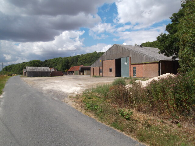
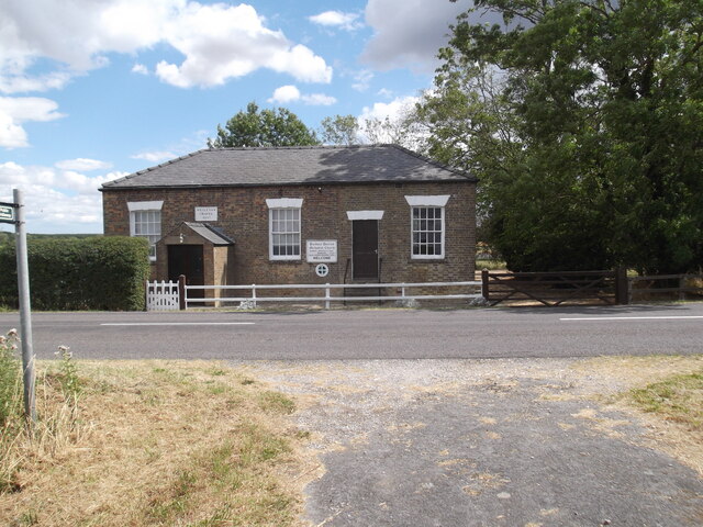
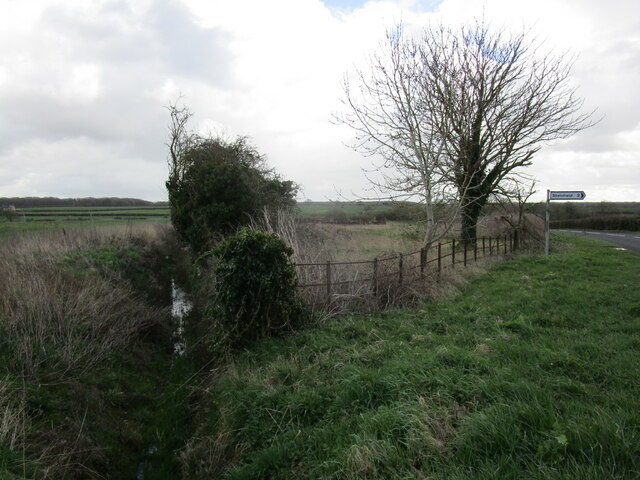
New Apley Images

Images are sourced within 2km of 53.259872/-0.32101055 or Grid Reference TF1274. Thanks to Geograph Open Source API. All images are credited.

Site of Medieval settlement of Apley: aerial 2021 See <span class="nowrap"><a title="https://www.heritagegateway.org.uk/Gateway/Results_Single.aspx?uid=MLI50506&resourceID=1006" rel="nofollow ugc noopener" href="https://www.heritagegateway.org.uk/Gateway/Results_Single.aspx?uid=MLI50506&resourceID=1006">Link</a><img style="margin-left:2px;" alt="External link" title="External link - shift click to open in new window" src="https://s1.geograph.org.uk/img/external.png" width="10" height="10"/></span>.

Evidence for former settlement exists both as earthworks and as surface pottery scatters. A main hollow way running east to west is flanked along its north side by rectangular closes. A different pattern of large rectangular ditched closes to the south side resembles earthworks identified as monastic granges, demesne manors or farms within villages elsewhere in the area. These closes are all full of ridge and furrow (except at their northern end which may overlie earlier occupation). The Tithe map of 1849 shows that in addition to the surviving north to south farm track, a further way ran up the east side of the churchyard...

The medieval settlement of Apley was a hamlet established by the late 11th century. After the foundation of Stainfield Priory in the mid 12th century the settlement was granted to the nunnery and managed as a monastic manor or grange. Documentary references to a priest at Apley occur from the early 13th century onwards. The population of the settlement, which remained low throughout the medieval period, declined after the Dissolution when 'Apley Grange' was granted, with the rest of the Stainfield Priory estate, to Sir Robert Tyrwhitt, who enclosed large areas of land for sheep pasture. The medieval church at Apley remained standing until the beginning of the 18th century; the present St Andrew's chapel, which stands on an adjacent site and is not included in the scheduling, was constructed in 1871. The remains of the medieval settlement of Apley and the surviving parts of its open fields are visible as earthworks with associated buried remains and lie in two separate areas of protection.
Site of Medieval settlement of Apley: aerial 2021
See LinkExternal link. Evidence for former settlement exists both as earthworks and as surface pottery scatters. A main hollow way running east to west is flanked along its north side by rectangular closes. A different pattern of large rectangular ditched closes to the south side resembles earthworks identified as monastic granges, demesne manors or farms within villages elsewhere in the area. These closes are all full of ridge and furrow (except at their northern end which may overlie earlier occupation). The Tithe map of 1849 shows that in addition to the surviving north to south farm track, a further way ran up the east side of the churchyard... The medieval settlement of Apley was a hamlet established by the late 11th century. After the foundation of Stainfield Priory in the mid 12th century the settlement was granted to the nunnery and managed as a monastic manor or grange. Documentary references to a priest at Apley occur from the early 13th century onwards. The population of the settlement, which remained low throughout the medieval period, declined after the Dissolution when 'Apley Grange' was granted, with the rest of the Stainfield Priory estate, to Sir Robert Tyrwhitt, who enclosed large areas of land for sheep pasture. The medieval church at Apley remained standing until the beginning of the 18th century; the present St Andrew's chapel, which stands on an adjacent site and is not included in the scheduling, was constructed in 1871. The remains of the medieval settlement of Apley and the surviving parts of its open fields are visible as earthworks with associated buried remains and lie in two separate areas of protection.
Settlement of Apley: aerial 2022 The medieval settlement of Apley was a hamlet established by the late 11th century. After the foundation of Stainfield Priory in the mid 12th century the settlement was granted to the nunnery and managed as a monastic manor or grange. Documentary references to a priest at Apley occur from the early 13th century onwards. The population of the settlement, which remained low throughout the medieval period, declined after the Dissolution when 'Apley Grange' was granted, with the rest of the Stainfield Priory estate, to Sir Robert Tyrwhitt, who enclosed large areas of land for sheep pasture. The medieval church at Apley remained standing until the beginning of the 18th century; the present St Andrew's chapel, which stands on an adjacent site and is not included in the scheduling, was constructed in 1871. The remains of the medieval settlement of Apley and the surviving parts of its open fields are visible as earthworks with associated buried remains and lie in two separate areas of protection.

See <span class="nowrap"><a title="https://www.heritagegateway.org.uk/Gateway/Results_Single.aspx?uid=MLI50506&resourceID=1006" rel="nofollow ugc noopener" href="https://www.heritagegateway.org.uk/Gateway/Results_Single.aspx?uid=MLI50506&resourceID=1006">Link</a><img style="margin-left:2px;" alt="External link" title="External link - shift click to open in new window" src="https://s1.geograph.org.uk/img/external.png" width="10" height="10"/></span>
Settlement of Apley: aerial 2022
The medieval settlement of Apley was a hamlet established by the late 11th century. After the foundation of Stainfield Priory in the mid 12th century the settlement was granted to the nunnery and managed as a monastic manor or grange. Documentary references to a priest at Apley occur from the early 13th century onwards. The population of the settlement, which remained low throughout the medieval period, declined after the Dissolution when 'Apley Grange' was granted, with the rest of the Stainfield Priory estate, to Sir Robert Tyrwhitt, who enclosed large areas of land for sheep pasture. The medieval church at Apley remained standing until the beginning of the 18th century; the present St Andrew's chapel, which stands on an adjacent site and is not included in the scheduling, was constructed in 1871. The remains of the medieval settlement of Apley and the surviving parts of its open fields are visible as earthworks with associated buried remains and lie in two separate areas of protection. See LinkExternal link
Former farm buildings, Stainfield Now converted to dwellings <span class="nowrap"><a title="https://historicengland.org.uk/listing/the-list/list-entry/1147857?section=official-list-entry" rel="nofollow ugc noopener" href="https://historicengland.org.uk/listing/the-list/list-entry/1147857?section=official-list-entry">Link</a><img style="margin-left:2px;" alt="External link" title="External link - shift click to open in new window" src="https://s1.geograph.org.uk/img/external.png" width="10" height="10"/></span>
Former farm buildings, Stainfield
Now converted to dwellings LinkExternal link
Golden fields near Shepherd's Farm
Path to the Black Plantation
Path by Thistle Storr Wood
In Bardney Limewoods Nature Reserve
Entrance off the B1202
Farm track near Kingthorpe
Cream Poke Farm
Cream Poke Farm
Stainfield Beck
Stainfield Beck
Bardney Dairies Methodist Church
Hoop Lane
Hoop Lane
Drain and signpost at Kingthorpe
Entering Kingthorpe
Entering Kingthorpe
St.Andrew's church, Apley Barely a church, more a cemetery chapel. You could probably fit the entire population of Apley inside though !
St.Andrew's church, Apley
Barely a church, more a cemetery chapel. You could probably fit the entire population of Apley inside though !
Sambre Beck Old bridge over Sambre Beck on the Viking Way, looking North
Sambre Beck
Old bridge over Sambre Beck on the Viking Way, looking North
Farmhouse with a view An isolated farmhouse between Apley and Goltho with a great view of the lightly rolling hills in this part of Lincolnshire
Farmhouse with a view
An isolated farmhouse between Apley and Goltho with a great view of the lightly rolling hills in this part of Lincolnshire
Show me another place!

New Apley is located at Grid Ref: TF1274 (Lat: 53.259872, Lng: -0.32101055)

Division: Parts of Lindsey

Administrative County: Lincolnshire

District: West Lindsey

Police Authority: Lincolnshire

What 3 Words

///agency.adjusted.songbook. Near Wragby, Lincolnshire

Nearby Locations

Cream Poke Wood New Apley

Related Wikis

Kingthorpe

Kingthorpe is a hamlet in the West Lindsey district of Lincolnshire, England. The hamlet is in the civil parish of Apley, and is 10 miles (16 km) east...

Apley

Apley is a hamlet and civil parish in the West Lindsey district of Lincolnshire, England. It is situated 1 mile (1.6 km) west from the hamlet of Kingthorpe...

Kingthorpe railway station

Kingthorpe railway station was a railway station that served the village of Kingthorpe, Lincolnshire, England between 1874 and 1956, on the Louth to Bardney...

Stainfield Priory

Stainfield Priory was a Benedictine nunnery at Stainfield in the North of Lincolnshire, England, between Wragby and Fiskerton. The priory of St Mary at...

Nearby Amenities

Located within 500m of 53.259872,-0.32101055
Grange Farm Lane End
Naptan AtcoCode: 270000009610
Naptan Bearing: SE
Naptan BusStopType: CUS
Naptan CommonName: Grange Farm Lane End
Naptan Indicator: opp
Naptan Landmark: Grange Farm Lane End
Naptan NaptanCode: linjdjwd
Naptan Street: Apley Road
Naptan Verified: no
Source: naptan_import
Lat/Long: 53.2599283/-0.3209706
Grange Farm Lane End
Naptan AtcoCode: 2700LAGFL471
Naptan Bearing: NW
Naptan BusStopType: CUS
Naptan CommonName: Grange Farm Lane End
Naptan Indicator: adj
Naptan Landmark: Grange Farm Lane End
Naptan NaptanCode: linadtag
Naptan Street: Apley Road
Naptan Verified: no
Source: naptan_import
Lat/Long: 53.2599662/-0.321104
Beck Farm
Place: farm
Source: Bing
Lat/Long: 53.2606012/-0.3153668
Grange Farm
Place: farm
Source: Bing
Lat/Long: 53.2597683/-0.3265605
New Apley
Place: hamlet
Source: Bing
Lat/Long: 53.2588307/-0.3201252
Power: pole
Lat/Long: 53.2566623/-0.3184757
Power: pole
Lat/Long: 53.2573392/-0.3198463
Power: pole
Lat/Long: 53.2581994/-0.320836
Power: pole
Lat/Long: 53.2590819/-0.3219051
Power: pole
Lat/Long: 53.2599833/-0.3229958
Power: pole
Lat/Long: 53.2608305/-0.3239935
Power: pole
Lat/Long: 53.2617396/-0.325079
Power: pole
Lat/Long: 53.2626053/-0.3260973
Power: pole
Lat/Long: 53.2578054/-0.3160203
Power: pole
Lat/Long: 53.2579854/-0.3175752
Power: pole
Lat/Long: 53.2581629/-0.3191363
Power: pole
Lat/Long: 53.2583672/-0.3207177
Power: pole
Lat/Long: 53.2585301/-0.3220674
Power: pole
Lat/Long: 53.2586979/-0.3234841
Power: pole
Lat/Long: 53.2588706/-0.3249151
Power: pole
Lat/Long: 53.2590347/-0.3263461
Power: pole
Lat/Long: 53.259205/-0.3278401
The data included in this document is from www.openstreetmap.org. The data is made available under ODbL.

Have you been to New Apley?

Leave your review of New Apley below (or comments, questions and feedback).