Leesbrook

Settlement in Lancashire

England

Leesbrook

A672 Ripponden Road at Collett Street
A672 Ripponden Road at Collett Street Credit: Colin Pyle

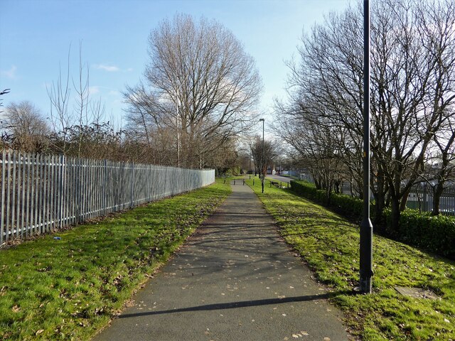
Leesbrook is a small village located in the county of Lancashire, England. Situated in the heart of the Rossendale Valley, it is surrounded by picturesque countryside and offers a tranquil and peaceful setting.

The village is known for its rich history, dating back to the industrial revolution when it was a thriving hub for textile mills. Today, remnants of this industrial past can still be seen in the form of preserved mill buildings and factories. However, Leesbrook has evolved into a predominantly residential area, offering a close-knit community atmosphere.

The village boasts a range of amenities and facilities for its residents. There is a local primary school, providing education for the younger population, and a community center that hosts various events and activities throughout the year. Additionally, a few local shops and businesses cater to the daily needs of the residents.

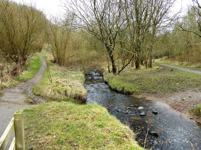
For those who enjoy outdoor activities, Leesbrook offers ample opportunities. The surrounding countryside provides excellent hiking and walking trails, allowing residents to explore the natural beauty of the area. The nearby River Irwell also offers fishing and boating opportunities.

Leesbrook benefits from good transportation links, with regular bus services connecting it to neighboring towns and cities. The village is also within easy reach of major road networks, making it accessible for commuters.

Overall, Leesbrook in Lancashire is a charming village with a rich industrial heritage and a strong sense of community. Its idyllic location and range of amenities make it an attractive place to live for those seeking a quieter rural lifestyle.

If you have any feedback on the listing, please let us know in the comments section below.
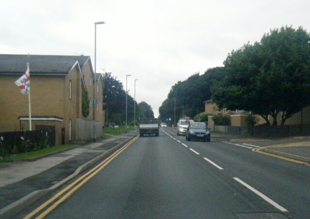
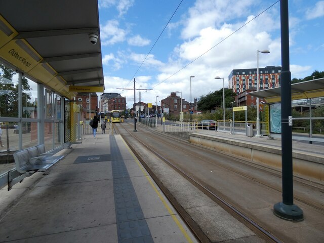
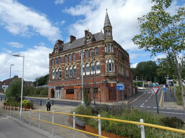
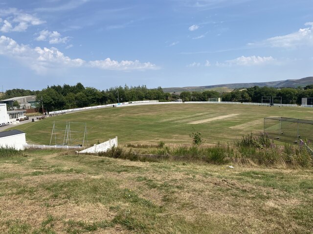
Leesbrook Images

Images are sourced within 2km of 53.5375/-2.0800662 or Grid Reference SD9404. Thanks to Geograph Open Source API. All images are credited.

A672 Ripponden Road at Collett Street
Egerton Street at Bridgewater Street, Mumps
Derker Mills, Oldham
Oldham Mumps Tram Stop 
A railway line from Manchester to Oldham was opened in 1847. In 1863 the line was extended to Rochdale. Railway operations ended on 3 October 2009, and the Oldham Loop Line was closed for conversion to Matrolink. The line was completely rebuilt, with all of the former infrastructure, including the former stations and station buildings demolished, and replaced, and overhead wiring added. The line was re-opened in phases: Tram services started on 13 June 2012 between Manchester and Oldham Mumps: As a temporary measure, until the town centre line was completed, the former railway line through Oldham Mumps was retained, and a temporary tram stop constructed in place of the former railway station. A permanent stop called Oldham Mumps was later opened on the town centre line in a different location. Services were extended to Shaw and Crompton on 16 December 2012, and to Rochdale Railway Station on 28 February 2013. The Oldham town centre line opened on 27 January 2014, allowing the section of former railway line, and temporary stop at Oldham Mumps to be permanently closed. The Rochdale town centre line opened on 31 March 2014.
Oldham Mumps Tram Stop
A railway line from Manchester to Oldham was opened in 1847. In 1863 the line was extended to Rochdale. Railway operations ended on 3 October 2009, and the Oldham Loop Line was closed for conversion to Matrolink. The line was completely rebuilt, with all of the former infrastructure, including the former stations and station buildings demolished, and replaced, and overhead wiring added. The line was re-opened in phases: Tram services started on 13 June 2012 between Manchester and Oldham Mumps: As a temporary measure, until the town centre line was completed, the former railway line through Oldham Mumps was retained, and a temporary tram stop constructed in place of the former railway station. A permanent stop called Oldham Mumps was later opened on the town centre line in a different location. Services were extended to Shaw and Crompton on 16 December 2012, and to Rochdale Railway Station on 28 February 2013. The Oldham town centre line opened on 27 January 2014, allowing the section of former railway line, and temporary stop at Oldham Mumps to be permanently closed. The Rochdale town centre line opened on 31 March 2014.
Former NatWest bank 
The Grade II listed former bank <span class="nowrap"><a title="https://historicengland.org.uk/listing/the-list/list-entry/1201682?section=official-list-entry" rel="nofollow ugc noopener" href="https://historicengland.org.uk/listing/the-list/list-entry/1201682?section=official-list-entry">Link</a><img style="margin-left:2px;" alt="External link" title="External link - shift click to open in new window" src="https://s1.geograph.org.uk/img/external.png" width="10" height="10"/></span> at Mumps dates from 1902. The bank, originally the Manchester and County, was created by renowned Manchester architects Mills & Murgatroyd. It featured a unique baroque copper-crowned tower and a polished red granite base. Inside, the banking hall housed a 50ft mahogany counter. The bank was taken over by NatWest in 1970. In 1995 it was closed when NatWest merged their Mumps and Yorkshire Street branches. It was put on the market for £170,000. Plans the following year to turn the building into a pub fell through. Several later refurbishment plans have also failed. The building is a focal point within the bus/metrolink tram interchange.
Former NatWest bank
The Grade II listed former bank LinkExternal link at Mumps dates from 1902. The bank, originally the Manchester and County, was created by renowned Manchester architects Mills & Murgatroyd. It featured a unique baroque copper-crowned tower and a polished red granite base. Inside, the banking hall housed a 50ft mahogany counter. The bank was taken over by NatWest in 1970. In 1995 it was closed when NatWest merged their Mumps and Yorkshire Street branches. It was put on the market for £170,000. Plans the following year to turn the building into a pub fell through. Several later refurbishment plans have also failed. The building is a focal point within the bus/metrolink tram interchange.
Mumps transport interchange 
Next to the Metrolink tram stop at Mumps are several bus stops. On the left is  the Grade II listed former NatWest bank <span class="nowrap"><a title="https://historicengland.org.uk/listing/the-list/list-entry/1201682?section=official-list-entry" rel="nofollow ugc noopener" href="https://historicengland.org.uk/listing/the-list/list-entry/1201682?section=official-list-entry">Link</a><img style="margin-left:2px;" alt="External link" title="External link - shift click to open in new window" src="https://s1.geograph.org.uk/img/external.png" width="10" height="10"/></span> <a href="https://www.geograph.org.uk/photo/7263233">SD9305 : Former NatWest bank</a>.
Mumps transport interchange
Next to the Metrolink tram stop at Mumps are several bus stops. On the left is the Grade II listed former NatWest bank LinkExternal link SD9305 : Former NatWest bank.
17-21 Mumps 
Only the ground floor of this three storey building are currently occupied. Before becoming Frango's this was Fusion 21. Before that the right hand portion had been Kava and the left hand portion  the site office for Westshield. Before Westshield that part had been The Hair Lounge. Around 2012 the right hand side was called  Langham House. In 2009 the building was home to a photography studio Xpressions. All the adjoining buildings towards Yorkshire Street were demolished around 2016. There are plans to convert the upper storeys into apartments.
17-21 Mumps
Only the ground floor of this three storey building are currently occupied. Before becoming Frango's this was Fusion 21. Before that the right hand portion had been Kava and the left hand portion the site office for Westshield. Before Westshield that part had been The Hair Lounge. Around 2012 the right hand side was called Langham House. In 2009 the building was home to a photography studio Xpressions. All the adjoining buildings towards Yorkshire Street were demolished around 2016. There are plans to convert the upper storeys into apartments.
Cricket Pitch
Cricket Pitch
Slack Hall Trig Point Flush Bracket S2785
Cricket Pitch
Cricket Pitch
The Rock Trig Point Flush Bracket S2786
OS Cut Mark - Park Bridge, Keverlow Farm <span class="nowrap"><a title="https://www.bench-marks.org.uk/bm60764" rel="nofollow ugc noopener" href="https://www.bench-marks.org.uk/bm60764">Link</a><img style="margin-left:2px;" alt="External link" title="External link - shift click to open in new window" src="https://s1.geograph.org.uk/img/external.png" width="10" height="10"/></span>
OS Cut Mark - Park Bridge, Keverlow Farm
Mill Brow
Mill Brow
Cycle path following route of former railway The path goes from Oldham to Grotton following the Oldham to Greenfield railway line. Much of the route is on infill such as here looking east from Glodwick Road, Oldham
Cycle path following route of former railway
The path goes from Oldham to Grotton following the Oldham to Greenfield railway line. Much of the route is on infill such as here looking east from Glodwick Road, Oldham
Cycle route following line of former railway This view across Cranbrook Street just off the path shows the route is on the top of infill, since only the bridge parapet is visible of the former railway bridge. The path is on the  former Oldham to Greenfield line.
Cycle route following line of former railway
This view across Cranbrook Street just off the path shows the route is on the top of infill, since only the bridge parapet is visible of the former railway bridge. The path is on the former Oldham to Greenfield line.
Cycle path following route of former railway The path is approaching the former railway bridge at St. John Street which is one of the few not infilled on the route. The path runs from Oldham to Grotton along the former line to Greenfield.
Cycle path following route of former railway
The path is approaching the former railway bridge at St. John Street which is one of the few not infilled on the route. The path runs from Oldham to Grotton along the former line to Greenfield.
Former Bank A listed building at Mumps
Former Bank
A listed building at Mumps
River Medlock at Lees View on the Medlock Valley Way from a footbridge
River Medlock at Lees
View on the Medlock Valley Way from a footbridge
Show me another place!

Leesbrook is located at Grid Ref: SD9404 (Lat: 53.5375, Lng: -2.0800662)

Unitary Authority: Oldham

Police Authority: Greater Manchester

What 3 Words

///composers.faces.become. Near Oldham, Manchester

Related Wikis

Glodwick

Glodwick is an area of Oldham, Greater Manchester, England. It is south-east of Oldham town centre. Glodwick is a multi-ethnic residential area in the...

Salem Moravian Church

Salem Moravian Church was founded in Oldham, Lancashire, England in 1825 by John Lees. Br Lees, who lived in the Clarksfield area of Oldham, was associated...

Oasis Academy Leesbrook

Oasis Academy Leesbrook is coeducational secondary school located in the Oldham in Greater Manchester, England. It is part of the Oasis Community Learning...

Breeze Hill School

Breeze Hill School was a mixed-sex comprehensive secondary school for 11- to 16-year-olds in Oldham, Greater Manchester, England. It was a specialist Humanities...

Lees, Greater Manchester

Lees is a village in the Metropolitan Borough of Oldham, Greater Manchester, England, amongst the Pennines east of the River Medlock, 1.8 miles (2.9 km...

Lees railway station

Lees railway station opened on 5 July 1856 at Lees, Lancashire, when the London and North Western Railway (L&NWR) opened the branch from Greenfield to...

Abbey Hills

Abbey Hills (archaically Wabbow Hills) is an area of Oldham in Greater Manchester. It is contiguous with Glodwick and Alt. Lying on the eastern border...

Greenacres, Greater Manchester

Greenacres , archaically Greenacres Moor, is an area of Oldham, in Greater Manchester, England. It lies on the west side of the River Medlock opposite...

Related Videos

Oldham Edge, Oldham, Greater Manchester

Oldham Edge is where Michael has not been for a long time. Its a naturalist's paradise, thickly wooded, impenetrable in parts, but ...

Full Walking Tour around Oldham Town Centre #takiatravels

Full Walking Tour around Oldham Town Centre in New Year's Day 2023 @takiatravels #walking #walkingtour #oldham ...

Oldham

A Walk In Oldham.

Nearby Amenities

Located within 500m of 53.5375,-2.0800662
Lees
Is In: Oldham, Greater Manchester, England, UK
Is In District: Oldham
Name Ur: لیز
Note: Wikipedia says suburb/village instead of town, but I'm happy with 'town' as there is a High Street!
Place: village
Population: 12630
Population Date: 2021
Source: npe
Wikidata: Q6516401
Wikipedia: en:Lees, Greater Manchester
Wikipedia En: Lees, Greater Manchester
Lat/Long: 53.5382578/-2.0733461
Salem
Place: locality
Lat/Long: 53.5383853/-2.0817467
Bus Stop
New Earth Street/Wren Street
Bus: yes
Naptan AtcoCode: 1800ED09551
Naptan Bearing: NE
Naptan CommonName: New Earth Street/Wren Street
Naptan Indicator: Bowling Green
Naptan Landmark: BOWLING GREEN
Naptan NaptanCode: manamgpw
Naptan PlusbusZoneRef: MNCRPIC
Naptan ShortCommonName: Wren Street
Naptan Street: New Earth Street
Naptan Verified: no
Network: TfGM
Public Transport: platform
Source: naptan_import
Lat/Long: 53.538157/-2.0860531
Bus Stop
New Earth Street/Tyndall Street
Bus: yes
Naptan AtcoCode: 1800ED09561
Naptan Bearing: NE
Naptan CommonName: New Earth Street/Tyndall Street
Naptan Indicator: Os House 66
Naptan Landmark: HOUSE 66
Naptan NaptanCode: manamgtd
Naptan PlusbusZoneRef: MNCRPIC
Naptan ShortCommonName: Tyndall Street
Naptan Street: New Earth Street
Naptan Verified: no
Network: TfGM
Public Transport: platform
Source: naptan_import
Lat/Long: 53.5370776/-2.0871675
Bus Stop
New Earth Street/Wren Street
Bus: yes
Naptan AtcoCode: 1800ED10431
Naptan Bearing: SW
Naptan CommonName: New Earth Street/Wren Street
Naptan Indicator: Bowling Green
Naptan Landmark: BOWLING GREEN
Naptan NaptanCode: mantgptg
Naptan PlusbusZoneRef: MNCRPIC
Naptan ShortCommonName: Wren Street
Naptan Street: New Earth Street
Naptan Verified: no
Network: TfGM
Public Transport: platform
Source: naptan_import
Lat/Long: 53.5381301/-2.0859474
Bus Stop
New Earth Street/Tyndall Street
Bus: yes
Naptan AtcoCode: 1800ED10441
Naptan Bearing: SW
Naptan CommonName: New Earth Street/Tyndall Street
Naptan Indicator: Os House 66
Naptan Landmark: HOUSE 66
Naptan NaptanCode: mantgptj
Naptan PlusbusZoneRef: MNCRPIC
Naptan ShortCommonName: Tyndall Street
Naptan Street: New Earth Street
Naptan Verified: no
Network: TfGM
Public Transport: platform
Source: naptan_import
Lat/Long: 53.5370507/-2.0870618
Bus Stop
Lees, High Street / Lees Post Office (Stop B)
Bus: yes
Local Ref: B
Naptan AtcoCode: 1800ED30831
Naptan Bearing: E
Naptan CommonName: High Street/Lees Post Office (Stop B)
Naptan Indicator: Stop B
Naptan Landmark: PUBLIC HOUSE
Naptan NaptanCode: manatpap
Naptan PlusbusZoneRef: MNCRPIC
Naptan ShortCommonName: Lees Post Office
Naptan Street: High Street
Naptan Verified: no
Network: TfGM
Operator: TfGM
Public Transport: platform
Ref: B
Source: naptan_import
Lat/Long: 53.5380695/-2.0728755
Bus Stop
Lees, High Street / Lees Post Office (Stop A)
Bus: yes
Local Ref: A
Naptan AtcoCode: 1800ED30841
Naptan Bearing: W
Naptan CommonName: High Street/Lees Post Office (Stop A)
Naptan Indicator: Stop A
Naptan Landmark: LAY BY
Naptan NaptanCode: manatpat
Naptan PlusbusZoneRef: MNCRPIC
Naptan ShortCommonName: Lees Post Office
Naptan Street: High Street
Naptan Verified: no
Network: TfGM
Operator: TfGM
Public Transport: platform
Ref: A
Source: naptan_import
Lat/Long: 53.5379489/-2.0736409
Bus Stop
Lees, Lees Road / opposite Leesbrook Mill
Bus: yes
Naptan AtcoCode: 1800ED30851
Naptan Bearing: E
Naptan CommonName: Lees Road/Leesbrook Mill
Naptan Indicator: Fox & Owl
Naptan Landmark: FOX & OWL
Naptan NaptanCode: manatpaw
Naptan PlusbusZoneRef: MNCRPIC
Naptan ShortCommonName: Leesbrook Mill
Naptan Street: LEES ROAD
Naptan Verified: no
Network: TfGM
Operator: TfGM
Public Transport: platform
Source: naptan_import
Lat/Long: 53.5372358/-2.0777711
Bus Stop
Lees, Lees Road / outside Leesbrook Mill
Bus: yes
Naptan AtcoCode: 1800ED30861
Naptan Bearing: W
Naptan CommonName: Lees Road/Leesbrook Mill
Naptan Indicator: Bridge Inn
Naptan Landmark: MILL
Naptan NaptanCode: manatpda
Naptan PlusbusZoneRef: MNCRPIC
Naptan ShortCommonName: Leesbrook Mill
Naptan Street: LEES ROAD
Naptan Verified: no
Network: TfGM
Operator: TfGM
Public Transport: platform
Source: naptan_import
Lat/Long: 53.5370878/-2.0783417
Bus Stop
Salem, Lees Road / opposite Old Street
Bus: yes
Naptan AtcoCode: 1800ED30871
Naptan Bearing: E
Naptan CommonName: Lees Road/Gibraltar Street
Naptan Indicator: Nr Open Land
Naptan Landmark: NR OPEN LAND
Naptan NaptanCode: manatpdg
Naptan Notes: LOCATION AMENDED
Naptan PlusbusZoneRef: MNCRPIC
Naptan ShortCommonName: Gibraltar Street
Naptan Street: LEES ROAD
Naptan Verified: no
Network: TfGM
Operator: TfGM
Public Transport: platform
Source: naptan_import
Lat/Long: 53.537702/-2.0806346
Bus Stop
Salem, Lees Road / near Gibraltar Street
Bus: yes
Naptan AtcoCode: 1800ED30881
Naptan Bearing: W
Naptan CommonName: Lees Road/Gibraltar Street
Naptan Indicator: Opp House 479
Naptan Landmark: HOUSE 481
Naptan NaptanCode: manatpdj
Naptan PlusbusZoneRef: MNCRPIC
Naptan ShortCommonName: Gibraltar Street
Naptan Street: LEES ROAD
Naptan Verified: no
Network: TfGM
Operator: TfGM
Public Transport: platform
Source: naptan_import
Lat/Long: 53.5377975/-2.0822804
Bus Stop
Salem, Lees Road / opposite New Earth Street
Bus: yes
Naptan AtcoCode: 1800ED30891
Naptan Bearing: E
Naptan CommonName: Lees Road/New Earth Street
Naptan Indicator: Grass Verge
Naptan Landmark: ESTATE AGENTS
Naptan NaptanCode: manatpdm
Naptan PlusbusZoneRef: MNCRPIC
Naptan ShortCommonName: New Earth Street
Naptan Street: LEES ROAD
Naptan Verified: no
Network: TfGM
Operator: TfGM
Public Transport: platform
Source: naptan_import
Lat/Long: 53.5386166/-2.0857362
Bus Stop
Salem, Lees Road / near New Earth Street
Bus: yes
Naptan AtcoCode: 1800ED30901
Naptan Bearing: NW
Naptan CommonName: Lees Road/New Earth Street
Naptan Indicator: Royal Hotel
Naptan Landmark: NEWSAGENT
Naptan NaptanCode: manatpdp
Naptan PlusbusZoneRef: MNCRPIC
Naptan ShortCommonName: New Earth Street
Naptan Street: LEES ROAD
Naptan Verified: no
Network: TfGM
Operator: TfGM
Public Transport: platform
Source: naptan_import
Lat/Long: 53.5385256/-2.0859482
Noexit: yes
Lat/Long: 53.5385846/-2.0741889
Turning Circle
Lat/Long: 53.5413628/-2.0798569
Turning Circle
Lat/Long: 53.5415508/-2.0788159
Turning Circle
Lat/Long: 53.5364232/-2.0833493
Noexit: yes
Lat/Long: 53.5378533/-2.074455
Turning Circle
Lat/Long: 53.5392492/-2.0822414
Noexit: yes
Lat/Long: 53.5388581/-2.0838082
Noexit: yes
Lat/Long: 53.534596/-2.0776025
Turning Circle
Lat/Long: 53.5400463/-2.0832136
Turning Circle
Lat/Long: 53.5404272/-2.082366
Noexit: yes
Lat/Long: 53.5386005/-2.0729899
Foot: yes
Ford: yes
Motor Vehicle: yes
Lat/Long: 53.5378273/-2.0767164
Pub
Friendship Inn
Addr Housenumber: 495
Addr Postcode: OL4 3AF
Addr Street: Lees Road
Check Date: 2023-08-03
Fhrs Id: 78834
Source: survey
Source Addr: FHRS Open Data
Lat/Long: 53.5379399/-2.0816915
Pub
Lighthouse
Addr Housenumber: 505
Addr Postcode: OL4 3AF
Addr Street: Lees Road
Check Date: 2023-08-03
Fhrs Id: 88382
Source: survey
Source Addr: FHRS Open Data
Lat/Long: 53.537823/-2.0811807
Speed Camera
Note: markings on both sides of road, gatson might not be right
Source: survey
Speed Camera Type: gatso
Lat/Long: 53.5376587/-2.0805185
Crossing
Crossing: traffic_signals
Source: Bing
Lat/Long: 53.5377843/-2.0814843
Addr Postcode: OL4 3BP
Source Addr: FHRS Open Data
Lat/Long: 53.5390651/-2.0747928
Noexit: yes
Lat/Long: 53.5415223/-2.0820547
Noexit: yes
Lat/Long: 53.5414344/-2.0819268
Noexit: yes
Lat/Long: 53.5412155/-2.0808798
Noexit: yes
Lat/Long: 53.5408629/-2.0779916
Noexit: yes
Lat/Long: 53.5370574/-2.076608
Turning Circle
Lat/Long: 53.5398183/-2.073796
Noexit: yes
Lat/Long: 53.5407027/-2.0747654
Generator Method: photovoltaic
Generator Output Electricity: yes
Generator Source: solar
Generator Type: solar_photovoltaic_panel
Location: roof
Power: generator
Lat/Long: 53.5395542/-2.0851403
Generator Method: photovoltaic
Generator Output Electricity: yes
Generator Source: solar
Generator Type: solar_photovoltaic_panel
Location: roof
Power: generator
Lat/Long: 53.539551/-2.0852556
Generator Method: photovoltaic
Generator Output Electricity: yes
Generator Source: solar
Generator Type: solar_photovoltaic_panel
Location: roof
Power: generator
Lat/Long: 53.5395622/-2.0857867
Generator Method: photovoltaic
Generator Output Electricity: yes
Generator Source: solar
Generator Type: solar_photovoltaic_panel
Location: roof
Power: generator
Lat/Long: 53.5395685/-2.0859986
Direction: 215
Generator Method: photovoltaic
Generator Output Electricity: yes
Generator Solar Modules: 10
Generator Source: solar
Generator Type: solar_photovoltaic_panel
Location: roof
Power: generator
Lat/Long: 53.5374795/-2.0856814
Generator Method: photovoltaic
Generator Output Electricity: yes
Generator Source: solar
Generator Type: solar_photovoltaic_panel
Location: roof
Power: generator
Lat/Long: 53.5361015/-2.084982
Generator Method: photovoltaic
Generator Output Electricity: yes
Generator Source: solar
Generator Type: solar_photovoltaic_panel
Location: roof
Power: generator
Lat/Long: 53.5359621/-2.0829502
Generator Method: photovoltaic
Generator Output Electricity: yes
Generator Source: solar
Generator Type: solar_photovoltaic_panel
Location: roof
Power: generator
Lat/Long: 53.536359/-2.0831434
Generator Method: photovoltaic
Generator Output Electricity: yes
Generator Source: solar
Generator Type: solar_photovoltaic_panel
Location: roof
Power: generator
Lat/Long: 53.5371751/-2.0828644
Generator Method: photovoltaic
Generator Output Electricity: yes
Generator Source: solar
Generator Type: solar_photovoltaic_panel
Location: roof
Power: generator
Lat/Long: 53.5355205/-2.0821992
Generator Method: photovoltaic
Generator Output Electricity: yes
Generator Source: solar
Generator Type: solar_photovoltaic_panel
Location: roof
Power: generator
Lat/Long: 53.5356751/-2.0754374
Generator Method: photovoltaic
Generator Output Electricity: yes
Generator Source: solar
Generator Type: solar_photovoltaic_panel
Location: roof
Power: generator
Lat/Long: 53.5390162/-2.0730073
Barrier: bollard
Lat/Long: 53.5390242/-2.0734012
Barrier: bollard
Lat/Long: 53.5391611/-2.0733753
Post Box
Brand: Royal Mail
Brand Wikidata: Q638098
Brand Wikipedia: en:Royal Mail
Drive Through: no
Operator: Royal Mail
Operator Wikidata: Q638098
Lat/Long: 53.53414/-2.0754163
Generator Method: photovoltaic
Generator Output Electricity: yes
Generator Source: solar
Generator Type: solar_photovoltaic_panel
Power: generator
Lat/Long: 53.5405251/-2.0834687
Generator Method: photovoltaic
Generator Output Electricity: yes
Generator Source: solar
Generator Type: solar_photovoltaic_panel
Power: generator
Lat/Long: 53.5405088/-2.0834218
Crossing
Lat/Long: 53.5375572/-2.0831463
Noexit: yes
Lat/Long: 53.5411216/-2.0780171
Addisons
Addr City: Oldham
Addr Housenumber: 46-48
Addr Postcode: OL4 5AQ
Addr Street: High Street
Addr Suburb: Lees
Shop: pet
Lat/Long: 53.5379502/-2.073323
Traffic Calming: island
Lat/Long: 53.5380553/-2.0748767
Traffic Calming: island
Lat/Long: 53.5379662/-2.0746322
Stitch & Seam
Addr City: Oldham
Addr Housenumber: 42
Addr Postcode: OL4 5AQ
Addr Street: High Street
Addr Suburb: Lees
Shop: tailor
Lat/Long: 53.5379449/-2.0738353
Addr City: Oldham
Addr Housenumber: 40
Addr Postcode: OL4 5AQ
Addr Street: High Street
Addr Suburb: Lees
Lat/Long: 53.5379457/-2.0739099
Post Office
Lees Post Office
Addr City: Oldham
Addr Housenumber: 38
Addr Postcode: OL4 5AQ
Addr Street: High Street
Addr Suburb: Lees
Brand: Post Office
Brand Wikidata: Q1783168
Check Date: 2023-09-27
Ref Pol Id: 5547
Website: https://www.postoffice.co.uk/branch-finder/183424x/lees
Lat/Long: 53.5379421/-2.0739871
Dentist
Riaz Dentist
Addr City: Oldham
Addr Housenumber: 36
Addr Postcode: OL4 5AQ
Addr Street: High Street
Addr Suburb: Lees
Healthcare: dentist
Lat/Long: 53.5379424/-2.0740634
Addr City: Oldham
Addr Housenumber: 34
Addr Postcode: OL4 5AQ
Addr Street: High Street
Addr Suburb: Lees
Lat/Long: 53.5379403/-2.074132
Addr City: Oldham
Addr Housenumber: 32
Addr Postcode: OL4 5AQ
Addr Street: High Street
Addr Suburb: Lees
Lat/Long: 53.53794/-2.0741945
The Edge Hair & Beauty
Addr City: Oldham
Addr Housenumber: 32A
Addr Postcode: OL4 5AQ
Addr Street: High Street
Addr Suburb: Lees
Shop: hairdresser
Lat/Long: 53.537904/-2.0742758
Retox Aesthetics
Addr City: Oldham
Addr Housenumber: 32B
Addr Postcode: OL4 5AQ
Addr Street: High Street
Addr Suburb: Lees
Healthcare Speciality: plastic_surgery
Shop: beauty
Lat/Long: 53.5378596/-2.0743353
Addr City: Oldham
Addr Housenumber: 1A
Addr Postcode: OL4 5AH
Addr Street: Spring Lane
Addr Suburb: Lees
Lat/Long: 53.5378281/-2.0743831
Addr City: Oldham
Addr Housenumber: 3A
Addr Postcode: OL4 5AH
Addr Street: Spring Lane
Addr Suburb: Lees
Lat/Long: 53.537793/-2.0744292
Addr City: Oldham
Addr Housenumber: 5A
Addr Postcode: OL4 5AH
Addr Street: Spring Lane
Addr Suburb: Lees
Lat/Long: 53.5377653/-2.0744724
Addr City: Oldham
Addr Housenumber: 7A
Addr Postcode: OL4 5AH
Addr Street: Spring Lane
Addr Suburb: Lees
Lat/Long: 53.5377268/-2.0745278
Noexit: yes
Lat/Long: 53.5377381/-2.0742341
Noexit: yes
Lat/Long: 53.5377446/-2.0740635
Noexit: yes
Lat/Long: 53.5378056/-2.0739786
Noexit: yes
Lat/Long: 53.5377699/-2.0738033
Noexit: yes
Lat/Long: 53.5382056/-2.0743511
Cartax Radio Cars
Addr City: Oldham
Addr Housenumber: 49
Addr Postcode: OL4 3BN
Addr Street: High Street
Addr Suburb: Lees
Office: taxi
Lat/Long: 53.5380907/-2.0740901
Wild Aroma
Addr City: Oldham
Addr Housenumber: 51
Addr Postcode: OL4 3BN
Addr Street: High Street
Addr Suburb: Lees
Shop: candles
Lat/Long: 53.5380911/-2.0740123
True Gents Barbershop
Addr City: Oldham
Addr Housenumber: 53
Addr Postcode: OL4 3BN
Addr Street: High Street
Addr Suburb: Lees
Shop: hairdresser
Lat/Long: 53.5380899/-2.0739472
Techniques Hairdressing
Addr City: Oldham
Addr Housenumber: 55
Addr Postcode: OL4 3BN
Addr Street: High Street
Addr Suburb: Lees
Shop: hairdresser
Lat/Long: 53.5380907/-2.0738842
Restaurant
La Bella
Addr City: Oldham
Addr Housenumber: 57-59
Addr Postcode: OL4 3BN
Addr Street: High Street
Addr Suburb: Lees
Cuisine: italian
Lat/Long: 53.538094/-2.0737818
Noexit: yes
Lat/Long: 53.5382303/-2.07336
Fast Food
Selwyn's English Fish & Chips
Addr City: Oldham
Addr Housenumber: 61
Addr Postcode: OL4 3BN
Addr Street: High Street
Addr Suburb: Lees
Cuisine: fish_and_chips
Lat/Long: 53.5381045/-2.0735339
Alfie's Attic Workshop
Addr City: Oldham
Addr Housenumber: 63
Addr Postcode: OL4 3BN
Addr Street: High Street
Addr Suburb: Lees
Shop: second_hand
Lat/Long: 53.5381024/-2.0734767
Sub Space
Addr City: Oldham
Addr Housenumber: 63
Addr Postcode: OL4 3BN
Addr Street: High Street
Addr Suburb: Lees
Tourism: gallery
Lat/Long: 53.5381024/-2.073447
Windsor Meats
Addr City: Oldham
Addr Housenumber: 65
Addr Postcode: OL4 3BN
Addr Street: High Street
Addr Suburb: Lees
Shop: butcher
Lat/Long: 53.5381042/-2.0733863
Belvoir Lettings
Addr City: Oldham
Addr Housenumber: 67
Addr Postcode: OL4 3BN
Addr Street: High Street
Addr Suburb: Lees
Office: estate_agent
Lat/Long: 53.5381087/-2.0733168
Restaurant
Paach Baii
Addr City: Oldham
Addr Housenumber: 69-71
Addr Postcode: OL4 3BN
Addr Street: High Street
Addr Suburb: Lees
Cuisine: indian
Delivery: yes
Fhrs Id: 86457
Opening Hours: We-Mo 16:45-23:00
Website: https://paachbaii.co.uk
Website Menu: https://www.paachbaii.co.uk/#/menu
Lat/Long: 53.5381101/-2.0732111
Noexit: yes
Lat/Long: 53.5382357/-2.0727652
Noexit: yes
Lat/Long: 53.5382194/-2.0729269
Restaurant
Lees Spice Lounge
Addr City: Oldham
Addr Housenumber: 73
Addr Postcode: OL4 3BN
Addr Street: High Street
Addr Suburb: Lees
Cuisine: indian
Opening Hours: Mo-Th 17:00-23:00; Fr-Sa 17:00-00:00; Su 15:00-22:00
Website: https://www.leesspicelounge.co.uk
Lat/Long: 53.5381017/-2.0729842
Fast Food
Village Pizza
Addr City: Oldham
Addr Housenumber: 75
Addr Postcode: OL4 3BN
Addr Street: High Street
Addr Suburb: Lees
Cuisine: pizza
Lat/Long: 53.5380962/-2.0728663
Northwood
Addr City: Oldham
Addr Housenumber: 79-81
Addr Postcode: OL4 3BN
Addr Street: High Street
Addr Suburb: Lees
Office: estate_agent
Lat/Long: 53.5380888/-2.0727177
Addr City: Oldham
Addr Housenumber: 2
Addr Postcode: OL4 3BX
Addr Street: Booth Street
Addr Suburb: Lees
Lat/Long: 53.5382513/-2.0729982
Addr City: Oldham
Addr Housenumber: 4
Addr Postcode: OL4 3BX
Addr Street: Booth Street
Addr Suburb: Lees
Lat/Long: 53.5382912/-2.0729894
Addr City: Oldham
Addr Housenumber: 2
Addr Postcode: OL4 3BT
Addr Street: Cross Street
Addr Suburb: Lees
Lat/Long: 53.5383543/-2.0729509
Addr City: Oldham
Addr Housenumber: 4
Addr Postcode: OL4 3BT
Addr Street: Cross Street
Addr Suburb: Lees
Lat/Long: 53.538348/-2.0728732
Addr City: Oldham
Addr Housenumber: 6
Addr Postcode: OL4 3BT
Addr Street: Cross Street
Addr Suburb: Lees
Lat/Long: 53.5383442/-2.0728114
Addr City: Oldham
Addr Housenumber: 8
Addr Postcode: OL4 3BT
Addr Street: Cross Street
Addr Suburb: Lees
Lat/Long: 53.5383408/-2.0727547
Addr City: Oldham
Addr Housenumber: 10
Addr Postcode: OL4 3BT
Addr Street: Cross Street
Addr Suburb: Lees
Lat/Long: 53.5383363/-2.0726958
Addr City: Oldham
Addr Housenumber: 12
Addr Postcode: OL4 3BT
Addr Street: Cross Street
Addr Suburb: Lees
Lat/Long: 53.5383317/-2.0726246
Addr City: Oldham
Addr Housenumber: 7
Addr Postcode: OL4 3BS
Addr Street: Mellor Street
Addr Suburb: Lees
Lat/Long: 53.5382636/-2.0726228
A&D Appliance Engineers
Addr City: Oldham
Addr Housenumber: 2A
Addr Postcode: OL4 3BW
Addr Street: Nicholson Street
Addr Suburb: Lees
Shop: appliance
Lat/Long: 53.5381656/-2.0741108
Pub
Angel Inn
Addr City: Oldham
Addr Housenumber: 2
Addr Postcode: OL4 3BW
Addr Street: Nicholson Street
Addr Suburb: Lees
Lat/Long: 53.5382514/-2.074108
Noexit: yes
Lat/Long: 53.5385998/-2.0741488
Addr City: Oldham
Addr Housenumber: 7
Addr Postcode: OL4 5AF
Addr Street: Princess Street
Addr Suburb: Lees
Lat/Long: 53.5377242/-2.0737366
Addr City: Oldham
Addr Housenumber: 5
Addr Postcode: OL4 5AF
Addr Street: Princess Street
Addr Suburb: Lees
Lat/Long: 53.5377238/-2.0736624
Addr City: Oldham
Addr Housenumber: 4
Addr Postcode: OL4 3BW
Addr Street: Nicholson Street
Addr Suburb: Lees
Lat/Long: 53.5383684/-2.074114
Addr City: Oldham
Addr Housenumber: 6
Addr Postcode: OL4 3BW
Addr Street: Nicholson Street
Addr Suburb: Lees
Lat/Long: 53.5384052/-2.0741129
Addr City: Oldham
Addr Housenumber: 8
Addr Postcode: OL4 3BW
Addr Street: Nicholson Street
Addr Suburb: Lees
Lat/Long: 53.5384503/-2.0741164
Addr City: Oldham
Addr Housenumber: 10
Addr Postcode: OL4 3BW
Addr Street: Nicholson Street
Addr Suburb: Lees
Lat/Long: 53.5385023/-2.0741146
Addr City: Oldham
Addr Housenumber: 12
Addr Postcode: OL4 3BW
Addr Street: Nicholson Street
Addr Suburb: Lees
Lat/Long: 53.5385592/-2.074117
Noexit: yes
Lat/Long: 53.5385965/-2.0738041
Noexit: yes
Lat/Long: 53.5383767/-2.0738457
Addr City: Oldham
Addr Housename: 9 Old Village Court
Addr Postcode: OL4 3LS
Addr Street: New Street
Addr Suburb: Lees
Lat/Long: 53.5386435/-2.0736755
Addr City: Oldham
Addr Housename: 8 Old Village Court
Addr Postcode: OL4 3LS
Addr Street: New Street
Addr Suburb: Lees
Lat/Long: 53.5386136/-2.0736809
Addr City: Oldham
Addr Housename: 7 Old Village Court
Addr Postcode: OL4 3LS
Addr Street: New Street
Addr Suburb: Lees
Lat/Long: 53.5385831/-2.0736853
Addr City: Oldham
Addr Housename: 6 Old Village Court
Addr Postcode: OL4 3LS
Addr Street: New Street
Addr Suburb: Lees
Lat/Long: 53.5385447/-2.073695
Addr City: Oldham
Addr Housename: 5 Old Village Court
Addr Postcode: OL4 3LS
Addr Street: New Street
Addr Suburb: Lees
Lat/Long: 53.5384947/-2.0736986
Addr City: Oldham
Addr Housename: 4 Old Village Court
Addr Postcode: OL4 3LS
Addr Street: New Street
Addr Suburb: Lees
Lat/Long: 53.5383496/-2.0737322
Addr City: Oldham
Addr Housename: 3 Old Village Court
Addr Postcode: OL4 3LS
Addr Street: New Street
Addr Suburb: Lees
Lat/Long: 53.5383133/-2.0737375
Addr City: Oldham
Addr Housename: 2 Old Village Court
Addr Postcode: OL4 3LS
Addr Street: New Street
Addr Suburb: Lees
Lat/Long: 53.5382718/-2.0737446
Addr City: Oldham
Addr Housename: 1 Old Village Court
Addr Postcode: OL4 3LS
Addr Street: New Street
Addr Suburb: Lees
Lat/Long: 53.5382318/-2.0737516
Noexit: yes
Lat/Long: 53.5384425/-2.0731967
Noexit: yes
Lat/Long: 53.5383052/-2.0732244
Addr City: Oldham
Addr Housenumber: 1A
Addr Postcode: OL4 3BX
Addr Street: Booth Street
Addr Suburb: Lees
Lat/Long: 53.5383363/-2.0731389
Addr City: Oldham
Addr Housenumber: 1
Addr Postcode: OL4 3BX
Addr Street: Booth Street
Addr Suburb: Lees
Lat/Long: 53.5383935/-2.0731274
Addr City: Oldham
Addr Housenumber: 3
Addr Postcode: OL4 3BX
Addr Street: Booth Street
Addr Suburb: Lees
Lat/Long: 53.53847/-2.0731004
Addr City: Oldham
Addr Housenumber: 5
Addr Postcode: OL4 3BX
Addr Street: Booth Street
Addr Suburb: Lees
Lat/Long: 53.538513/-2.0730904
Addr City: Oldham
Addr Housenumber: 7
Addr Postcode: OL4 3BX
Addr Street: Booth Street
Addr Suburb: Lees
Lat/Long: 53.5385547/-2.0730843
Addr City: Oldham
Addr Housenumber: 9
Addr Postcode: OL4 3BX
Addr Street: Booth Street
Addr Suburb: Lees
Lat/Long: 53.5385913/-2.0730781
Noexit: yes
Lat/Long: 53.5384875/-2.0727138
Noexit: yes
Lat/Long: 53.5386099/-2.0729509
Childcare
Cornerhouse Day Nursery
Addr City: Oldham
Addr Housename: Cornerhouse Day Nursery
Addr Postcode: OL4 3BT
Addr Street: Cross Street
Addr Suburb: Lees
Lat/Long: 53.5384529/-2.0728672
Noexit: yes
Lat/Long: 53.5388602/-2.0730987
Noexit: yes
Lat/Long: 53.5388418/-2.0728651
Lees Mini Market
Addr City: Oldham
Addr Housenumber: 52
Addr Postcode: OL4 5AA
Addr Street: High Street
Addr Suburb: Lees
Shop: convenience
Lat/Long: 53.5379491/-2.0730643
Fast Food
Lees Tandoori
Addr City: Oldham
Addr Housenumber: 54
Addr Postcode: OL4 5AA
Addr Street: High Street
Addr Suburb: Lees
Cuisine: indian
Lat/Long: 53.5379495/-2.072965
Lee's Barbers
Addr City: Oldham
Addr Housenumber: 56
Addr Postcode: OL4 5AA
Addr Street: High Street
Addr Suburb: Lees
Shop: hairdresser
Lat/Long: 53.537948/-2.0729127
L.A. Florist
Addr City: Oldham
Addr Housenumber: 58A
Addr Postcode: OL4 5AA
Addr Street: High Street
Addr Suburb: Lees
Shop: florist
Lat/Long: 53.537944/-2.0728457
Addr City: Oldham
Addr Housenumber: 58
Addr Postcode: OL4 5AA
Addr Street: High Street
Addr Suburb: Lees
Lat/Long: 53.5379424/-2.0728168
Studio 22 Photography
Addr City: Oldham
Addr Housenumber: 72
Addr Postcode: OL4 5AA
Addr Street: High Street
Addr Suburb: Lees
Craft: photographer
Lat/Long: 53.5379376/-2.0727545
CIA 2000 Fire & Security
Addr City: Oldham
Addr Housenumber: 72
Addr Postcode: OL4 5AA
Addr Street: High Street
Addr Suburb: Lees
Office: security
Lat/Long: 53.5379368/-2.0727136
Addr City: Oldham
Addr Housenumber: 72
Addr Postcode: OL4 5AA
Addr Street: High Street
Addr Suburb: Lees
Lat/Long: 53.537928/-2.0725513
Noexit: yes
Lat/Long: 53.5377664/-2.0726436
Royal British Legion - Lees & District
Addr City: Oldham
Addr Housenumber: 1
Addr Postcode: OL4 5AG
Addr Street: Princess Street
Addr Suburb: Lees
Club: social
Lat/Long: 53.5377525/-2.0729999
Addr City: Oldham
Addr Housenumber: 3
Addr Postcode: OL4 5AG
Addr Street: Princess Street
Lat/Long: 53.5377415/-2.0728637
Noexit: yes
Lat/Long: 53.5362195/-2.0741448
Give Way
Direction: backward
Lat/Long: 53.5366595/-2.0755194
Stop
Direction: backward
Lat/Long: 53.5373172/-2.0767133
Addr City: Oldham
Addr Housenumber: 2
Addr Postcode: OL4 5AH
Addr Street: Spring Lane
Addr Suburb: Lees
Lat/Long: 53.5377053/-2.0748334
Addr City: Oldham
Addr Housenumber: 4
Addr Postcode: OL4 5AH
Addr Street: Spring Lane
Addr Suburb: Lees
Lat/Long: 53.5376858/-2.074864
Addr City: Oldham
Addr Housenumber: 6
Addr Postcode: OL4 5AH
Addr Street: Spring Lane
Addr Suburb: Lees
Lat/Long: 53.537666/-2.0749035
Addr City: Oldham
Addr Housenumber: 8
Addr Postcode: OL4 5AH
Addr Street: Spring Lane
Addr Suburb: Lees
Lat/Long: 53.5376465/-2.0749341
Addr City: Oldham
Addr Housenumber: 10
Addr Postcode: OL4 5AH
Addr Street: Spring Lane
Addr Suburb: Lees
Lat/Long: 53.5376248/-2.0749692
Addr City: Oldham
Addr Housenumber: 12
Addr Postcode: OL4 5AH
Addr Street: Spring Lane
Addr Suburb: Lees
Lat/Long: 53.5376053/-2.0749999
Addr City: Oldham
Addr Housenumber: 14
Addr Postcode: OL4 5AH
Addr Street: Spring Lane
Addr Suburb: Lees
Lat/Long: 53.5375858/-2.0750437
Addr City: Oldham
Addr Housenumber: 16
Addr Postcode: OL4 5AH
Addr Street: Spring Lane
Addr Suburb: Lees
Lat/Long: 53.5375662/-2.0750743
Noexit: yes
Lat/Long: 53.5374594/-2.07512
Addr City: Oldham
Addr Housename: St Edwards RC Presbytery
Addr Postcode: OL4 5AJ
Addr Street: Spring Lane
Addr Suburb: Lees
Lat/Long: 53.5374371/-2.0752105
Place Of Worship
St Edwards RC Church
Addr City: Oldham
Addr Housename: St Edwards RC Church
Addr Postcode: OL4 5AJ
Addr Street: Spring Lane
Addr Suburb: Lees
Denomination: roman_catholic
Religion: christian
Lat/Long: 53.5373191/-2.0754206
Addr City: Oldham
Addr Housename: St Edwards RC Church Hall
Addr Postcode: OL4 5AJ
Addr Street: Spring Lane
Addr Suburb: Lees
Lat/Long: 53.536978/-2.075496
Addr City: Oldham
Addr Housename: Marlinstones
Addr Postcode: OL4 5AJ
Addr Street: Spring Lane
Addr Suburb: Lees
Lat/Long: 53.5375105/-2.0747617
Addr City: Oldham
Addr Housename: Springside House
Addr Postcode: OL4 5AJ
Addr Street: Spring Lane
Addr Suburb: Lees
Lat/Long: 53.5374436/-2.0748194
Addr City: Oldham
Addr Housenumber: 1
Addr Postcode: OL4 5AJ
Addr Street: Spring Lane
Addr Suburb: Lees
Lat/Long: 53.5373813/-2.074879
Addr City: Oldham
Addr Housenumber: 3
Addr Postcode: OL4 5AJ
Addr Street: Spring Lane
Addr Suburb: Lees
Lat/Long: 53.5373274/-2.0749234
Addr City: Oldham
Addr Housenumber: 5
Addr Postcode: OL4 5AJ
Addr Street: Spring Lane
Addr Suburb: Lees
Lat/Long: 53.5372796/-2.0749587
Addr City: Oldham
Addr Housename: Victoria Mill
Addr Postcode: OL4 5AF
Addr Street: Princess Street
Addr Suburb: Lees
Lat/Long: 53.5375966/-2.0745686
Noexit: yes
Lat/Long: 53.5375664/-2.0741595
Noexit: yes
Lat/Long: 53.537383/-2.0739178
Ferndale Joinery
Addr City: Oldham
Addr Housename: Ferndale Joinery
Addr Postcode: OL4 5AL
Addr Street: Princess Street
Addr Suburb: Lees
Craft: joiner
Lat/Long: 53.5374898/-2.0742539
Noexit: yes
Lat/Long: 53.537571/-2.0737856
Addr City: Oldham
Addr Housename: The Old Chapel
Addr Postcode: OL4 5AF
Addr Street: Princess Street
Addr Suburb: Lees
Lat/Long: 53.537581/-2.0739123
Noexit: yes
Lat/Long: 53.5369677/-2.0778681
Lees DIY Centre
Addr City: Oldham
Addr Housenumber: 616
Addr Postcode: OL4 5JL
Addr Street: Lees Road
Addr Suburb: Lees
Shop: doityourself
Lat/Long: 53.5370982/-2.0777558
Addr City: Oldham
Addr Housename: Lees Brook Mill
Addr Postcode: OL4 5JL
Addr Street: Lees Road
Addr Suburb: Lees
Lat/Long: 53.5365279/-2.0782505
Traffic Calming: island
Lat/Long: 53.537407/-2.0795614
Noexit: yes
Lat/Long: 53.5367231/-2.0753368
Addr City: Oldham
Addr Housenumber: 9A
Addr Postcode: OL4 5AJ
Addr Street: Spring Lane
Addr Suburb: Lees
Lat/Long: 53.5371168/-2.0750199
Addr City: Oldham
Addr Housenumber: 11A
Addr Postcode: OL4 5AJ
Addr Street: Spring Lane
Addr Suburb: Lees
Lat/Long: 53.5370648/-2.0750657
Addr City: Oldham
Addr Housenumber: 15A
Addr Postcode: OL4 5AJ
Addr Street: Spring Lane
Addr Suburb: Lees
Lat/Long: 53.5370093/-2.0751104
Addr City: Oldham
Addr Housenumber: 7
Addr Postcode: OL4 5AJ
Addr Street: Spring Lane
Addr Suburb: Lees
Lat/Long: 53.5369301/-2.0751663
Addr City: Oldham
Addr Housenumber: 9
Addr Postcode: OL4 5AJ
Addr Street: Spring Lane
Addr Suburb: Lees
Lat/Long: 53.5368891/-2.0752039
Addr City: Oldham
Addr Housenumber: 11
Addr Postcode: OL4 5AJ
Addr Street: Spring Lane
Addr Suburb: Lees
Lat/Long: 53.536845/-2.0752385
Addr City: Oldham
Addr Housenumber: 13
Addr Postcode: OL4 5AJ
Addr Street: Spring Lane
Addr Suburb: Lees
Lat/Long: 53.5367985/-2.0752771
Addr City: Oldham
Addr Housenumber: 15
Addr Postcode: OL4 5AJ
Addr Street: Spring Lane
Addr Suburb: Lees
Lat/Long: 53.536755/-2.0753116
Addr City: Oldham
Addr Housenumber: 1A
Addr Postcode: OL4 5AF
Addr Street: Princess Street
Addr Suburb: Lees
Lat/Long: 53.5376071/-2.0737151
Addr City: Oldham
Addr Housenumber: 2A
Addr Postcode: OL4 5AF
Addr Street: Princess Street
Addr Suburb: Lees
Lat/Long: 53.5376099/-2.0736491
Addr City: Oldham
Addr Housenumber: 2
Addr Postcode: OL4 5AF
Addr Street: Princess Street
Addr Suburb: Lees
Lat/Long: 53.5376118/-2.0735782
Addr City: Oldham
Addr Housenumber: 4
Addr Postcode: OL4 5AF
Addr Street: Princess Street
Addr Suburb: Lees
Lat/Long: 53.5376127/-2.0735051
Storm Motorcycles
Addr City: Oldham
Addr Housename: Storm Motorcycles
Addr Postcode: OL4 5AE
Addr Street: Warrington Street
Addr Suburb: Lees
Shop: motorcycle_repair
Lat/Long: 53.5375962/-2.0733703
Noexit: yes
Lat/Long: 53.5373237/-2.0740724
Addr City: Oldham
Addr Housenumber: 10
Addr Postcode: OL4 5AE
Addr Street: Warrington Street
Addr Suburb: Lees
Lat/Long: 53.5374577/-2.0733872
Addr City: Oldham
Addr Housenumber: 12
Addr Postcode: OL4 5AE
Addr Street: Warrington Street
Addr Suburb: Lees
Lat/Long: 53.5374142/-2.0733995
Addr City: Oldham
Addr Housenumber: 14
Addr Postcode: OL4 5AE
Addr Street: Warrington Street
Addr Suburb: Lees
Lat/Long: 53.5373689/-2.0734065
Addr City: Oldham
Addr Housenumber: 16
Addr Postcode: OL4 5AE
Addr Street: Warrington Street
Addr Suburb: Lees
Lat/Long: 53.5373322/-2.0734119
Addr City: Oldham
Addr Housenumber: 18
Addr Postcode: OL4 5AE
Addr Street: Warrington Street
Addr Suburb: Lees
Lat/Long: 53.5372938/-2.0734234
Addr City: Oldham
Addr Housenumber: 20
Addr Postcode: OL4 5AE
Addr Street: Warrington Street
Addr Suburb: Lees
Lat/Long: 53.5372599/-2.073435
Addr City: Oldham
Addr Housenumber: 22
Addr Postcode: OL4 5AE
Addr Street: Warrington Street
Addr Suburb: Lees
Lat/Long: 53.537221/-2.0734388
Addr City: Oldham
Addr Housenumber: 24
Addr Postcode: OL4 5AE
Addr Street: Warrington Street
Addr Suburb: Lees
Lat/Long: 53.5371899/-2.0734457
Addr City: Oldham
Addr Housenumber: 26
Addr Postcode: OL4 5AE
Addr Street: Warrington Street
Addr Suburb: Lees
Lat/Long: 53.5371478/-2.0734542
Addr City: Oldham
Addr Housenumber: 7
Addr Postcode: OL4 5AE
Addr Street: Warrington Street
Addr Suburb: Lees
Lat/Long: 53.5375145/-2.0731661
Addr City: Oldham
Addr Housenumber: 5
Addr Postcode: OL4 5AE
Addr Street: Warrington Street
Addr Suburb: Lees
Lat/Long: 53.5375522/-2.0731626
Addr City: Oldham
Addr Housenumber: 3
Addr Postcode: OL4 5AE
Addr Street: Warrington Street
Addr Suburb: Lees
Lat/Long: 53.5376474/-2.0731443
Addr City: Oldham
Addr Housenumber: 6
Addr Postcode: OL4 5AG
Addr Street: Princess Street
Addr Suburb: Lees
Lat/Long: 53.5376447/-2.0730635
Addr City: Oldham
Addr Housenumber: 8
Addr Postcode: OL4 5AG
Addr Street: Princess Street
Addr Suburb: Lees
Lat/Long: 53.5376395/-2.0729913
Addr City: Oldham
Addr Housenumber: 10
Addr Postcode: OL4 5AG
Addr Street: Princess Street
Addr Suburb: Lees
Lat/Long: 53.5376289/-2.0728858
Addr City: Oldham
Addr Housenumber: 12
Addr Postcode: OL4 5AG
Addr Street: Princess Street
Addr Suburb: Lees
Lat/Long: 53.5376252/-2.0728165
Addr City: Oldham
Addr Housenumber: 14
Addr Postcode: OL4 5AG
Addr Street: Princess Street
Addr Suburb: Lees
Lat/Long: 53.537622/-2.0727525
Addr City: Oldham
Addr Housenumber: 16
Addr Postcode: OL4 5AG
Addr Street: Princess Street
Addr Suburb: Lees
Lat/Long: 53.5376152/-2.0726832
Addr City: Oldham
Addr Housenumber: 18
Addr Postcode: OL4 5AG
Addr Street: Princess Street
Addr Suburb: Lees
Lat/Long: 53.5376111/-2.0726131
Addr City: Oldham
Addr Housenumber: 20
Addr Postcode: OL4 5AG
Addr Street: Princess Street
Addr Suburb: Lees
Lat/Long: 53.5376028/-2.0725422
Noexit: yes
Lat/Long: 53.5368086/-2.0729961
Addr City: Oldham
Addr Housenumber: 3
Addr Postcode: OL4 5AN
Addr Street: Catherine Street
Addr Suburb: Lees
Lat/Long: 53.5372386/-2.0745577
Addr City: Oldham
Addr Housenumber: 5
Addr Postcode: OL4 5AN
Addr Street: Catherine Street
Addr Suburb: Lees
Lat/Long: 53.5372318/-2.0744883
Addr City: Oldham
Addr Housenumber: 7
Addr Postcode: OL4 5AN
Addr Street: Catherine Street
Addr Suburb: Lees
Lat/Long: 53.5372237/-2.0744202
Addr City: Oldham
Addr Housenumber: 9
Addr Postcode: OL4 5AN
Addr Street: Catherine Street
Addr Suburb: Lees
Lat/Long: 53.5372184/-2.0743604
Addr City: Oldham
Addr Housenumber: 11
Addr Postcode: OL4 5AN
Addr Street: Catherine Street
Addr Suburb: Lees
Lat/Long: 53.5372111/-2.0742891
Addr City: Oldham
Addr Housenumber: 13
Addr Postcode: OL4 5AN
Addr Street: Catherine Street
Addr Suburb: Lees
Lat/Long: 53.5372046/-2.0742261
Addr City: Oldham
Addr Housenumber: 15
Addr Postcode: OL4 5AN
Addr Street: Catherine Street
Addr Suburb: Lees
Lat/Long: 53.5371989/-2.0741574
Addr City: Oldham
Addr Housenumber: 17
Addr Postcode: OL4 5AN
Addr Street: Catherine Street
Addr Suburb: Lees
Lat/Long: 53.5371924/-2.0740925
Addr City: Oldham
Addr Housenumber: 19
Addr Postcode: OL4 5AN
Addr Street: Catherine Street
Addr Suburb: Lees
Lat/Long: 53.5371878/-2.0740276
Addr City: Oldham
Addr Housenumber: 21
Addr Postcode: OL4 5AN
Addr Street: Catherine Street
Addr Suburb: Lees
Lat/Long: 53.537181/-2.0739614
Addr City: Oldham
Addr Housenumber: 23
Addr Postcode: OL4 5AN
Addr Street: Catherine Street
Addr Suburb: Lees
Lat/Long: 53.5371756/-2.0738952
Addr City: Oldham
Addr Housenumber: 25
Addr Postcode: OL4 5AN
Addr Street: Catherine Street
Addr Suburb: Lees
Lat/Long: 53.537168/-2.0738226
Addr City: Oldham
Addr Housenumber: 27
Addr Postcode: OL4 5AN
Addr Street: Catherine Street
Addr Suburb: Lees
Lat/Long: 53.5371603/-2.073741
Noexit: yes
Lat/Long: 53.5374518/-2.0726302
Addr City: Oldham
Addr Housenumber: 19
Addr Postcode: OL4 5AD
Addr Street: Wild Street
Addr Suburb: Lees
Lat/Long: 53.5372929/-2.0725733
Addr City: Oldham
Addr Housenumber: 17
Addr Postcode: OL4 5AD
Addr Street: Wild Street
Addr Suburb: Lees
Lat/Long: 53.5372964/-2.0726422
Addr City: Oldham
Addr Housenumber: 15
Addr Postcode: OL4 5AD
Addr Street: Wild Street
Addr Suburb: Lees
Lat/Long: 53.5373033/-2.0727054
Addr City: Oldham
Addr Housenumber: 13
Addr Postcode: OL4 5AD
Addr Street: Wild Street
Addr Suburb: Lees
Lat/Long: 53.5373095/-2.0727759
Addr City: Oldham
Addr Housenumber: 11
Addr Postcode: OL4 5AD
Addr Street: Wild Street
Addr Suburb: Lees
Lat/Long: 53.5373138/-2.072839
Addr City: Oldham
Addr Housenumber: 9
Addr Postcode: OL4 5AD
Addr Street: Wild Street
Addr Suburb: Lees
Lat/Long: 53.5373221/-2.0728979
Addr City: Oldham
Addr Housenumber: 7
Addr Postcode: OL4 5AD
Addr Street: Wild Street
Addr Suburb: Lees
Lat/Long: 53.5373273/-2.0729765
Addr City: Oldham
Addr Housenumber: 5
Addr Postcode: OL4 5AD
Addr Street: Wild Street
Addr Suburb: Lees
Lat/Long: 53.5373331/-2.0730381
Addr City: Oldham
Addr Housenumber: 3
Addr Postcode: OL4 5AD
Addr Street: Wild Street
Addr Suburb: Lees
Lat/Long: 53.5373369/-2.0731021
Addr City: Oldham
Addr Housenumber: 1
Addr Postcode: OL4 5AD
Addr Street: Wild Street
Addr Suburb: Lees
Lat/Long: 53.5373408/-2.0731756
Waste Basket
Lat/Long: 53.5385087/-2.075165
Addr City: Oldham
Addr Housenumber: 22
Addr Postcode: OL4 5AX
Addr Street: Dawson Street
Addr Suburb: Lees
Lat/Long: 53.5371238/-2.0746616
Addr City: Oldham
Addr Housenumber: 20
Addr Postcode: OL4 5AX
Addr Street: Dawson Street
Addr Suburb: Lees
Lat/Long: 53.5370808/-2.074669
Addr City: Oldham
Addr Housenumber: 18
Addr Postcode: OL4 5AX
Addr Street: Dawson Street
Addr Suburb: Lees
Lat/Long: 53.5370402/-2.0746723
Addr City: Oldham
Addr Housenumber: 16
Addr Postcode: OL4 5AX
Addr Street: Dawson Street
Addr Suburb: Lees
Lat/Long: 53.5369987/-2.074675
Addr City: Oldham
Addr Housenumber: 14
Addr Postcode: OL4 5AX
Addr Street: Dawson Street
Addr Suburb: Lees
Lat/Long: 53.5369601/-2.0746817
Addr City: Oldham
Addr Housenumber: 12
Addr Postcode: OL4 5AX
Addr Street: Dawson Street
Addr Suburb: Lees
Lat/Long: 53.536921/-2.0746831
Addr City: Oldham
Addr Housenumber: 10
Addr Postcode: OL4 5AX
Addr Street: Dawson Street
Addr Suburb: Lees
Lat/Long: 53.5368851/-2.0746891
Addr City: Oldham
Addr Housenumber: 8
Addr Postcode: OL4 5AX
Addr Street: Dawson Street
Addr Suburb: Lees
Lat/Long: 53.5368457/-2.0746911
Addr City: Oldham
Addr Housenumber: 6
Addr Postcode: OL4 5AX
Addr Street: Dawson Street
Addr Suburb: Lees
Lat/Long: 53.5368098/-2.0746938
Addr City: Oldham
Addr Housenumber: 4
Addr Postcode: OL4 5AX
Addr Street: Dawson Street
Addr Suburb: Lees
Lat/Long: 53.5367712/-2.0746971
Addr City: Oldham
Addr Housenumber: 2
Addr Postcode: OL4 5AX
Addr Street: Dawson Street
Addr Suburb: Lees
Lat/Long: 53.5367297/-2.0747025
Addr City: Oldham
Addr Housenumber: 13
Addr Postcode: OL4 5AS
Addr Street: West Street
Addr Suburb: Lees
Lat/Long: 53.5366783/-2.0746389
Addr City: Oldham
Addr Housenumber: 15
Addr Postcode: OL4 5AS
Addr Street: West Street
Addr Suburb: Lees
Lat/Long: 53.5366758/-2.0745438
Noexit: yes
Lat/Long: 53.5378778/-2.0753913
Noexit: yes
Lat/Long: 53.5378384/-2.0757435
Noexit: yes
Lat/Long: 53.5378293/-2.075806
Noexit: yes
Lat/Long: 53.5378179/-2.0758669
Noexit: yes
Lat/Long: 53.5377608/-2.0764081
Noexit: yes
Lat/Long: 53.5377398/-2.0762479
Noexit: yes
Lat/Long: 53.5376304/-2.0768222
Noexit: yes
Lat/Long: 53.5385394/-2.0754413
Addr City: Oldham
Addr Housenumber: 9
Addr Postcode: OL4 3BH
Addr Street: High Street
Addr Suburb: Lees
Lat/Long: 53.5376508/-2.0766613
Addr City: Oldham
Addr Flats: 1-3
Addr Housename: Blake House
Addr Housenumber: 11
Addr Postcode: OL4 3BH
Addr Street: High Street
Addr Suburb: Lees
Lat/Long: 53.5376417/-2.0762913
Addr City: Oldham
Addr Flats: 1-4
Addr Housename: Stuart House
Addr Postcode: OL4 3BH
Addr Street: High Street
Addr Suburb: Lees
Lat/Long: 53.5377209/-2.0759956
Addr City: Oldham
Addr Housenumber: 15
Addr Postcode: OL4 3BH
Addr Street: High Street
Addr Suburb: Lees
Lat/Long: 53.5377523/-2.0758431
Addr City: Oldham
Addr Housenumber: 17
Addr Postcode: OL4 3BH
Addr Street: High Street
Addr Suburb: Lees
Lat/Long: 53.5377638/-2.075772
Addr City: Oldham
Addr Housenumber: 19
Addr Postcode: OL4 3BH
Addr Street: High Street
Addr Suburb: Lees
Lat/Long: 53.5377698/-2.0757171
Addr City: Oldham
Addr Housenumber: 21
Addr Postcode: OL4 3BH
Addr Street: High Street
Addr Suburb: Lees
Lat/Long: 53.5378115/-2.0756134
Addr City: Oldham
Addr Housenumber: 23
Addr Postcode: OL4 3BH
Addr Street: High Street
Addr Suburb: Lees
Lat/Long: 53.5378381/-2.0754843
P Harley & Co Accountants
Addr City: Oldham
Addr Housename: Blake House
Addr Housenumber: 11
Addr Postcode: OL4 3BH
Addr Street: High Street
Addr Suburb: Lees
Office: accountant
Lat/Long: 53.5376031/-2.0762608
Addr City: Oldham
Addr Housenumber: 2
Addr Postcode: OL4 5AN
Addr Street: Catherine Street
Addr Suburb: Lees
Lat/Long: 53.5371135/-2.0743867
Addr City: Oldham
Addr Housenumber: 4
Addr Postcode: OL4 5AN
Addr Street: Catherine Street
Addr Suburb: Lees
Lat/Long: 53.537107/-2.0743306
Addr City: Oldham
Addr Housenumber: 6
Addr Postcode: OL4 5AN
Addr Street: Catherine Street
Addr Suburb: Lees
Lat/Long: 53.537101/-2.0742719
Addr City: Oldham
Addr Housenumber: 17
Addr Postcode: OL4 5AS
Addr Street: West Street
Addr Suburb: Lees
Lat/Long: 53.5366697/-2.0744174
Addr City: Oldham
Addr Housenumber: 19
Addr Postcode: OL4 5AS
Addr Street: West Street
Addr Suburb: Lees
Lat/Long: 53.536666/-2.0743364
Addr City: Oldham
Addr Housenumber: 21
Addr Postcode: OL4 5AS
Addr Street: West Street
Addr Suburb: Lees
Lat/Long: 53.5366628/-2.0742561
Addr City: Oldham
Addr Housenumber: 12
Addr Postcode: OL4 5AW
Addr Street: Nelson Street
Addr Suburb: Lees
Lat/Long: 53.5368286/-2.0742205
Addr City: Oldham
Addr Housenumber: 10
Addr Postcode: OL4 5AW
Addr Street: Nelson Street
Addr Suburb: Lees
Lat/Long: 53.5368699/-2.0742173
Addr City: Oldham
Addr Housenumber: 8
Addr Postcode: OL4 5AW
Addr Street: Nelson Street
Addr Suburb: Lees
Lat/Long: 53.5369074/-2.0742097
Addr City: Oldham
Addr Housenumber: 6
Addr Postcode: OL4 5AW
Addr Street: Nelson Street
Addr Suburb: Lees
Lat/Long: 53.5369442/-2.0742097
Addr City: Oldham
Addr Housenumber: 4
Addr Postcode: OL4 5AW
Addr Street: Nelson Street
Addr Suburb: Lees
Lat/Long: 53.5369874/-2.0742039
Addr City: Oldham
Addr Housenumber: 2
Addr Postcode: OL4 5AW
Addr Street: Nelson Street
Addr Suburb: Lees
Lat/Long: 53.5370765/-2.074195
Addr City: Oldham
Addr Housenumber: 8
Addr Postcode: OL4 5AN
Addr Street: Catherine Street
Addr Suburb: Lees
Lat/Long: 53.53708/-2.0739973
Addr City: Oldham
Addr Housenumber: 10
Addr Postcode: OL4 5AN
Addr Street: Catherine Street
Addr Suburb: Lees
Lat/Long: 53.5370737/-2.0739271
Addr City: Oldham
Addr Housenumber: 12
Addr Postcode: OL4 5AN
Addr Street: Catherine Street
Addr Suburb: Lees
Lat/Long: 53.5370656/-2.0738619
Addr City: Oldham
Addr Housenumber: 5
Addr Postcode: OL4 5AW
Addr Street: Nelson Street
Addr Suburb: Lees
Lat/Long: 53.5368787/-2.0740219
Addr City: Oldham
Addr Housenumber: 7
Addr Postcode: OL4 5AW
Addr Street: Nelson Street
Addr Suburb: Lees
Lat/Long: 53.5368371/-2.0740377
Addr City: Oldham
Addr Housenumber: 9
Addr Postcode: OL4 5AW
Addr Street: Nelson Street
Addr Suburb: Lees
Lat/Long: 53.5367957/-2.0740388
Addr City: Oldham
Addr Housenumber: 23
Addr Postcode: OL4 5AS
Addr Street: West Street
Addr Suburb: Lees
Lat/Long: 53.5366688/-2.0740399
Addr City: Oldham
Addr Housenumber: 25
Addr Postcode: OL4 5AS
Addr Street: West Street
Addr Suburb: Lees
Lat/Long: 53.536664/-2.0739615
Addr City: Oldham
Addr Housenumber: 27
Addr Postcode: OL4 5AS
Addr Street: West Street
Addr Suburb: Lees
Lat/Long: 53.5366604/-2.0738766
Noexit: yes
Lat/Long: 53.5380568/-2.0761703
Noexit: yes
Lat/Long: 53.5379944/-2.0760987
Noexit: yes
Lat/Long: 53.5381455/-2.0760963
Noexit: yes
Lat/Long: 53.5382376/-2.076063
Noexit: yes
Lat/Long: 53.5382696/-2.0760312
Noexit: yes
Lat/Long: 53.5383829/-2.0759346
Noexit: yes
Lat/Long: 53.5384699/-2.0759164
Addr City: Oldham
Addr Housenumber: 1
Addr Postcode: OL4 3FL
Addr Street: Owls Gate
Addr Suburb: Lees
Lat/Long: 53.5380057/-2.0763303
Addr City: Oldham
Addr Housenumber: 2
Addr Postcode: OL4 3FL
Addr Street: Owls Gate
Addr Suburb: Lees
Lat/Long: 53.5380293/-2.0763159
Addr City: Oldham
Addr Housenumber: 3
Addr Postcode: OL4 3FL
Addr Street: Owls Gate
Addr Suburb: Lees
Lat/Long: 53.538054/-2.0763005
Addr City: Oldham
Addr Housenumber: 4
Addr Postcode: OL4 3FL
Addr Street: Owls Gate
Addr Suburb: Lees
Lat/Long: 53.5381312/-2.0761666
Addr City: Oldham
Addr Housenumber: 5
Addr Postcode: OL4 3FL
Addr Street: Owls Gate
Addr Suburb: Lees
Lat/Long: 53.5382119/-2.076112
Addr City: Oldham
Addr Housenumber: 6
Addr Postcode: OL4 3FL
Addr Street: Owls Gate
Addr Suburb: Lees
Lat/Long: 53.5383011/-2.0760542
Addr City: Oldham
Addr Housenumber: 7
Addr Postcode: OL4 3FL
Addr Street: Owls Gate
Addr Suburb: Lees
Lat/Long: 53.5383794/-2.0760051
Addr City: Oldham
Addr Housenumber: 8
Addr Postcode: OL4 3FL
Addr Street: Owls Gate
Addr Suburb: Lees
Lat/Long: 53.5384521/-2.0759722
Addr City: Oldham
Addr Housenumber: 29
Addr Postcode: OL4 5AS
Addr Street: West Street
Addr Suburb: Lees
Lat/Long: 53.5366429/-2.0737493
Addr City: Oldham
Addr Housenumber: 31
Addr Postcode: OL4 5AS
Addr Street: West Street
Addr Suburb: Lees
Lat/Long: 53.5366367/-2.073681
Addr City: Oldham
Addr Housenumber: 33
Addr Postcode: OL4 5AS
Addr Street: West Street
Addr Suburb: Lees
Lat/Long: 53.5366335/-2.0736267
Addr City: Oldham
Addr Housenumber: 35
Addr Postcode: OL4 5AS
Addr Street: West Street
Addr Suburb: Lees
Lat/Long: 53.5366318/-2.073559
Addr City: Oldham
Addr Housenumber: 12A
Addr Postcode: OL4 5AN
Addr Street: Catherine Street
Addr Suburb: Lees
Lat/Long: 53.5370495/-2.0737019
Addr City: Oldham
Addr Housenumber: 14
Addr Postcode: OL4 5AN
Addr Street: Catherine Street
Addr Suburb: Lees
Lat/Long: 53.5370455/-2.0736288
Addr City: Oldham
Addr Housenumber: 16
Addr Postcode: OL4 5AN
Addr Street: Catherine Street
Addr Suburb: Lees
Lat/Long: 53.5370356/-2.0735068
Addr City: Oldham
Addr Housenumber: 30
Addr Postcode: OL4 5AP
Addr Street: Warrington Street
Addr Suburb: Lees
Lat/Long: 53.5369889/-2.0734793
Addr City: Oldham
Addr Housenumber: 32
Addr Postcode: OL4 5AP
Addr Street: Warrington Street
Addr Suburb: Lees
Lat/Long: 53.5369531/-2.0734846
Addr City: Oldham
Addr Housenumber: 34
Addr Postcode: OL4 5AP
Addr Street: Warrington Street
Addr Suburb: Lees
Lat/Long: 53.5369192/-2.073494
Addr City: Oldham
Addr Housenumber: 36
Addr Postcode: OL4 5AP
Addr Street: Warrington Street
Addr Suburb: Lees
Lat/Long: 53.5368781/-2.0735021
Addr City: Oldham
Addr Housenumber: 38
Addr Postcode: OL4 5AP
Addr Street: Warrington Street
Addr Suburb: Lees
Lat/Long: 53.5368355/-2.0735121
Addr City: Oldham
Addr Housenumber: 40
Addr Postcode: OL4 5AP
Addr Street: Warrington Street
Addr Suburb: Lees
Lat/Long: 53.5367953/-2.0735168
Addr City: Oldham
Addr Housenumber: 42
Addr Postcode: OL4 5AP
Addr Street: Warrington Street
Addr Suburb: Lees
Lat/Long: 53.5367562/-2.0735255
Addr City: Oldham
Addr Housenumber: 44
Addr Postcode: OL4 5AP
Addr Street: Warrington Street
Addr Suburb: Lees
Lat/Long: 53.5367171/-2.0735322
Give Way
Direction: forward
Lat/Long: 53.5366871/-2.0756241
Noexit: yes
Lat/Long: 53.5385605/-2.0759079
Noexit: yes
Lat/Long: 53.53858/-2.0759012
Noexit: yes
Lat/Long: 53.5386254/-2.0758563
Noexit: yes
Lat/Long: 53.538666/-2.0758415
Noexit: yes
Lat/Long: 53.5387083/-2.0758008
Noexit: yes
Lat/Long: 53.5387321/-2.075781
Noexit: yes
Lat/Long: 53.5388282/-2.0756299
Noexit: yes
Lat/Long: 53.5388916/-2.0756004
Noexit: yes
Lat/Long: 53.5391329/-2.0754786
Noexit: yes
Lat/Long: 53.5390503/-2.0755475
Noexit: yes
Lat/Long: 53.5389872/-2.0755405
Addr City: Oldham
Addr Housenumber: 9
Addr Postcode: OL4 3FL
Addr Street: Owls Gate
Addr Suburb: Lees
Lat/Long: 53.5385353/-2.0759549
Addr City: Oldham
Addr Housenumber: 10
Addr Postcode: OL4 3FL
Addr Street: Owls Gate
Addr Suburb: Lees
Lat/Long: 53.5386114/-2.0759153
Addr City: Oldham
Addr Housenumber: 11
Addr Postcode: OL4 3FL
Addr Street: Owls Gate
Addr Suburb: Lees
Lat/Long: 53.5386802/-2.0758787
Addr City: Oldham
Addr Housenumber: 12
Addr Postcode: OL4 3FL
Addr Street: Owls Gate
Addr Suburb: Lees
Lat/Long: 53.5387509/-2.0758035
Addr City: Oldham
Addr Housenumber: 14
Addr Postcode: OL4 3FL
Addr Street: Owls Gate
Addr Suburb: Lees
Lat/Long: 53.5388306/-2.0757476
Addr City: Oldham
Addr Housenumber: 15
Addr Postcode: OL4 3FL
Addr Street: Owls Gate
Addr Suburb: Lees
Lat/Long: 53.5389273/-2.0756927
Addr City: Oldham
Addr Housenumber: 16
Addr Postcode: OL4 3FL
Addr Street: Owls Gate
Addr Suburb: Lees
Lat/Long: 53.5389877/-2.0756459
Addr City: Oldham
Addr Housenumber: 17
Addr Postcode: OL4 3FL
Addr Street: Owls Gate
Addr Suburb: Lees
Lat/Long: 53.5390849/-2.0756114
Noexit: yes
Lat/Long: 53.5385628/-2.0754385
Noexit: yes
Lat/Long: 53.5385262/-2.0755388
Noexit: yes
Lat/Long: 53.5384199/-2.0756596
Noexit: yes
Lat/Long: 53.5383212/-2.0757288
Noexit: yes
Lat/Long: 53.5382661/-2.0757345
Noexit: yes
Lat/Long: 53.5381495/-2.0758102
Noexit: yes
Lat/Long: 53.5380211/-2.0758279
Addr City: Oldham
Addr Housenumber: 25
Addr Postcode: OL4 3FL
Addr Street: Owls Gate
Addr Suburb: Lees
Lat/Long: 53.5380369/-2.0757937
Addr City: Oldham
Addr Housenumber: 24
Addr Postcode: OL4 3FL
Addr Street: Owls Gate
Addr Suburb: Lees
Lat/Long: 53.5381484/-2.0757575
Addr City: Oldham
Addr Housenumber: 23
Addr Postcode: OL4 3FL
Addr Street: Owls Gate
Addr Suburb: Lees
Lat/Long: 53.538231/-2.0757203
Addr City: Oldham
Addr Housenumber: 22
Addr Postcode: OL4 3FL
Addr Street: Owls Gate
Addr Suburb: Lees
Lat/Long: 53.538323/-2.0756734
Addr City: Oldham
Addr Housenumber: 21
Addr Postcode: OL4 3FL
Addr Street: Owls Gate
Addr Suburb: Lees
Lat/Long: 53.5383892/-2.075638
Addr City: Oldham
Addr Housenumber: 20
Addr Postcode: OL4 3FL
Addr Street: Owls Gate
Addr Suburb: Lees
Lat/Long: 53.5384692/-2.075584
Addr City: Oldham
Addr Housenumber: 19
Addr Postcode: OL4 3FL
Addr Street: Owls Gate
Addr Suburb: Lees
Lat/Long: 53.5386211/-2.0755124
Addr City: Oldham
Addr Housenumber: 18
Addr Postcode: OL4 3FL
Addr Street: Owls Gate
Addr Suburb: Lees
Lat/Long: 53.5386348/-2.075584
Noexit: yes
Lat/Long: 53.5405231/-2.0748838
Noexit: yes
Lat/Long: 53.5390794/-2.073019
Addr City: Oldham
Addr Housenumber: 1
Addr Postcode: OL4 3BY
Addr Street: Taylor Street
Addr Suburb: Lees
Lat/Long: 53.539055/-2.073279
Addr City: Oldham
Addr Housenumber: 3
Addr Postcode: OL4 3BY
Addr Street: Taylor Street
Addr Suburb: Lees
Lat/Long: 53.5390461/-2.0731834
Noexit: yes
Lat/Long: 53.5370939/-2.0730505
Noexit: yes
Lat/Long: 53.5370027/-2.0730383
Noexit: yes
Lat/Long: 53.5369491/-2.0730482
Noexit: yes
Lat/Long: 53.5368568/-2.0730636
Addr City: Oldham
Addr Housenumber: 1
Addr Parentstreet: Wild Street
Addr Postcode: OL4 5EJ
Addr Street: Felix Court
Addr Suburb: Lees
Lat/Long: 53.537019/-2.0730822
Addr City: Oldham
Addr Housenumber: 2
Addr Parentstreet: Wild Street
Addr Postcode: OL4 5EJ
Addr Street: Felix Court
Addr Suburb: Lees
Lat/Long: 53.5369345/-2.0730983
Addr City: Oldham
Addr Housenumber: 3
Addr Parentstreet: Wild Street
Addr Postcode: OL4 5EJ
Addr Street: Felix Court
Addr Suburb: Lees
Lat/Long: 53.5368395/-2.0731208
Addr City: Oldham
Addr Housename: St Thomas' Leesfield CofE School Annex
Addr Postcode: OL4 5AT
Addr Street: West Street
Addr Suburb: Lees
Lat/Long: 53.5366503/-2.0731815
Addr City: Oldham
Addr Housename: St Thomas' Leesfield CofE School
Addr Postcode: OL4 5AT
Addr Street: West Street
Addr Suburb: Lees
Lat/Long: 53.5364744/-2.0728166
Pharmacy
Rowlands Pharmacy
Addr Housename: Lees Medical Practice
Addr Postcode: OL4 3BP
Addr Street: Athens Way
Brand: Rowlands Pharmacy
Brand Wikidata: Q62663235
Dispensing: yes
Drive Through: no
Healthcare: pharmacy
Website: https://rowlandspharmacy.co.uk/find-local-pharmacy#!/l/oldham/athens-way/1179
Lat/Long: 53.5402336/-2.074706
Noexit: yes
Lat/Long: 53.5370789/-2.0727966
Addr City: Oldham
Addr Housename: The Vicarage
Addr Postcode: OL4 5AD
Addr Street: Wild Street
Addr Suburb: Lees
Lat/Long: 53.5369944/-2.0727185
ALDI
Brand: ALDI
Brand Wikidata: Q41171672
Shop: supermarket
Website: https://stores.aldi.co.uk/north-west/oldham/athens-way-lees
Lat/Long: 53.5388732/-2.0743739
Addr City: Oldham
Addr Housenumber: 62
Addr Postcode: OL4 3LP
Addr Street: New Street
Addr Suburb: Lees
Source: code-point_open;aerial imagery
Lat/Long: 53.5392675/-2.0732253
Addr City: Oldham
Addr Housenumber: 64
Addr Postcode: OL4 3LP
Addr Street: New Street
Addr Suburb: Lees
Source: code-point_open;aerial imagery
Lat/Long: 53.5393111/-2.0732151
Addr City: Oldham
Addr Housenumber: 66
Addr Postcode: OL4 3LP
Addr Street: New Street
Addr Suburb: Lees
Source: code-point_open;aerial imagery
Lat/Long: 53.5393522/-2.0732011
Addr City: Oldham
Addr Housenumber: 68
Addr Postcode: OL4 3LP
Addr Street: New Street
Addr Suburb: Lees
Source: code-point_open;aerial imagery
Lat/Long: 53.5393891/-2.0731936
Westmoreland Contractors Ltd
Addr City: Oldham
Addr Housename: Blake House
Addr Housenumber: 11
Addr Postcode: OL4 3BH
Addr Street: High Street
Craft: yes
Description: pothole repairs & tarmac surfacing professionals
Email: info@westmorelandcontractors.co.uk
Phone: 0345 366 5828
Website: https://westmorelandcontractors.co.uk/
Lat/Long: 53.5375899/-2.0763484
The data included in this document is from www.openstreetmap.org. The data is made available under ODbL.

Have you been to Leesbrook?

Leave your review of Leesbrook below (or comments, questions and feedback).