Jericho

Settlement in Oxfordshire Oxford

England

Jericho

St Lawrence Church
St Lawrence Church Credit: AJD

Jericho is a vibrant neighborhood located in the city of Oxford, Oxfordshire, England. Situated just north of the city center, it is bounded by the Oxford Canal to the west and the Cherwell River to the east. With its rich history and diverse community, Jericho has become a popular destination for locals and tourists alike.

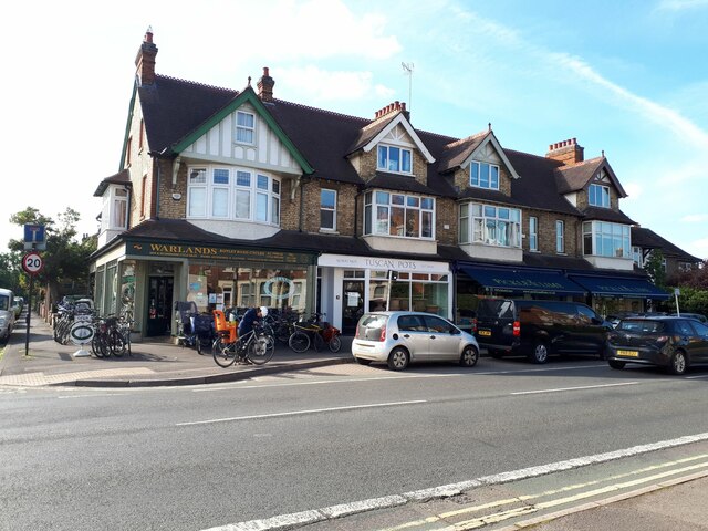
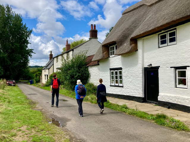
Originally an industrial area in the 19th century, Jericho has undergone significant transformation over the years. Today, it is well-known for its charming Victorian terraced houses, which line the streets and create a picturesque atmosphere. The neighborhood is also home to a mix of independent shops, boutiques, restaurants, and cafes, giving it a vibrant and eclectic character.

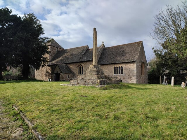
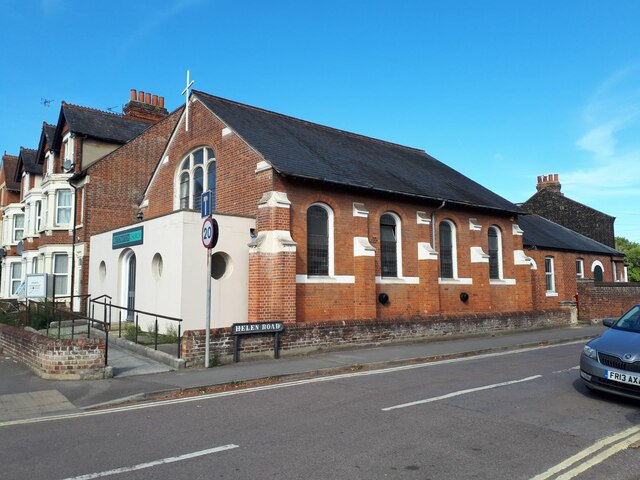
One of the notable landmarks in Jericho is St. Barnabas Church, a stunning example of Gothic Revival architecture. This church stands as a testament to the area's history and provides a tranquil place for residents and visitors to gather.

The community spirit is strong in Jericho, with several annual events taking place throughout the year. The Jericho Street Fair, held in May, is a popular event that showcases local talent, food, and crafts. Additionally, the annual Jericho Boat Festival celebrates the neighborhood's canal heritage, with boat races and various water activities.

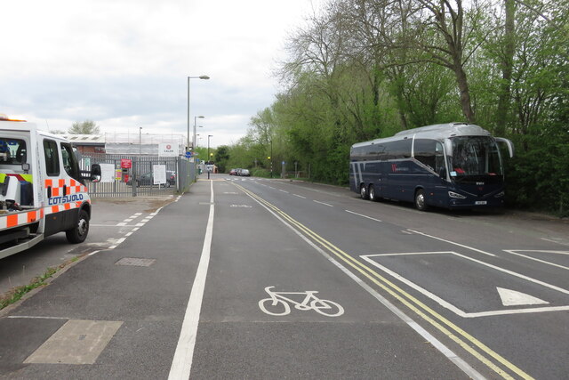
Jericho's central location makes it an ideal base for exploring Oxford. The city center, with its world-renowned university, museums, and attractions, is just a short walk away. Moreover, the neighborhood is well-served by public transportation, including bus routes and the nearby Oxford railway station.

In conclusion, Jericho offers a unique blend of history, culture, and community spirit. Its charming streets, independent businesses, and close proximity to Oxford's main attractions make it an appealing destination for visitors and a sought-after residential area for locals.

If you have any feedback on the listing, please let us know in the comments section below.

Jericho Images

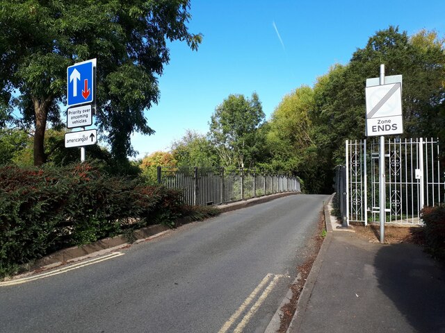
Images are sourced within 2km of 51.758536/-1.2682756 or Grid Reference SP5006. Thanks to Geograph Open Source API. All images are credited.

St Lawrence Church
St Lawrence Church
Barn, Binsey
Barn, Binsey
Bridge, Lane to Binsey Church
Memorial Stone John Thompson stone, in Burgess Field, Oxford.
Memorial Stone
John Thompson stone, in Burgess Field, Oxford.
Ferry Hinksey Road Spine road for the Osney Mead insutrial estate.
Ferry Hinksey Road
Spine road for the Osney Mead insutrial estate.
Horses in Thames amused by dinghy sailors Commoners' horses graze on Port Meadow, dinghy from Medley sailing club the other side of the Thames.
Horses in Thames amused by dinghy sailors
Commoners' horses graze on Port Meadow, dinghy from Medley sailing club the other side of the Thames.
Restoration Church, Helen Road, Osney Only a few years ago this was the Elim Chapel <a href="https://www.geograph.org.uk/photo/6217755">SP4906 : Elim Chapel, Helen Road</a> but it was probably not built as a church, as the 1921 map labels it a 'hall'. The style looks to be late 19th / early 20th century.
Restoration Church, Helen Road, Osney
Only a few years ago this was the Elim Chapel SP4906 : Elim Chapel, Helen Road but it was probably not built as a church, as the 1921 map labels it a 'hall'. The style looks to be late 19th / early 20th century.
Shops on Botley Road Currently comprising a cycle sales / repair business, high quality greengrocer and an antique shop specialising in Tuscan pottery. All very Oxford.
Shops on Botley Road
Currently comprising a cycle sales / repair business, high quality greengrocer and an antique shop specialising in Tuscan pottery. All very Oxford.
Binsey Lane bridge A narrow bridge taking a country lane over the Bulstake Stream, one of the many minor branches of the Thames around Oxford. <a href="https://www.geograph.org.uk/photo/6606806">SP4906 : Bridge over Bulstake Stream</a> shows it from the side.
Binsey Lane bridge
A narrow bridge taking a country lane over the Bulstake Stream, one of the many minor branches of the Thames around Oxford. SP4906 : Bridge over Bulstake Stream shows it from the side.
Binsey Lane A country lane from Osney to Binsey. There's something not quite right about those trees to the left: diseased, or badly pruned? The metal gates to the right are the access to an electricity substation.
Binsey Lane
A country lane from Osney to Binsey. There's something not quite right about those trees to the left: diseased, or badly pruned? The metal gates to the right are the access to an electricity substation.
DFS on Botley Road, Oxford I seem to remember DFS stands for Direct Furniture Services. I haven't been able to confirm it online.
DFS on Botley Road, Oxford
I seem to remember DFS stands for Direct Furniture Services. I haven't been able to confirm it online.
View across the Thames and bridge from the Towing Path Looking across the river toward Bossom's boatyard and Binsey from the towpath (seated at path level).
View across the Thames and bridge from the Towing Path
Looking across the river toward Bossom's boatyard and Binsey from the towpath (seated at path level).
Seacourt Lane
Seacourt Lane
Cycle Path beside the A34
Marina on the Thames near Binsey A view from the footpath over the Thames.
Marina on the Thames near Binsey
A view from the footpath over the Thames.
Medley Beer Garden by the Thames Not a pub, just a beer garden.
Medley Beer Garden by the Thames
Not a pub, just a beer garden.
Walking through Binsey Village A quiet village beside the River Thames.
Walking through Binsey Village
A quiet village beside the River Thames.
North Hinksey Conduit House Roofed reservoir for Oxford's first water mains, built during the early 17th century.
North Hinksey Conduit House
Roofed reservoir for Oxford's first water mains, built during the early 17th century.
Show me another place!

Jericho is located at Grid Ref: SP5006 (Lat: 51.758536, Lng: -1.2682756)

Administrative County: Oxfordshire

District: Oxford

Police Authority: Thames Valley

What 3 Words

///sands.bliss.along. Near Oxford, Oxfordshire

Related Wikis

Jericho, Oxford

Jericho is an historic suburb of the English city of Oxford. It consists of the streets bounded by the Oxford Canal, Worcester College, Walton Street and...

Great Clarendon Street

Great Clarendon Street is one of the principal thoroughfares of the Jericho district of Oxford, England, an inner suburb northwest of the centre of the...

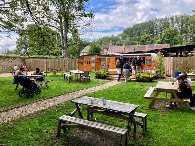
Canal Street, Oxford

Canal Street is a residential street in Jericho, an inner suburb of Oxford, England, northwest of the city centre. The annual Jericho Street Fair takes...

St Barnabas Church, Oxford

St Barnabas Church is a Church of England parish church in Jericho, central Oxford, England, located close to the Oxford Canal. == History == St Barnabas...

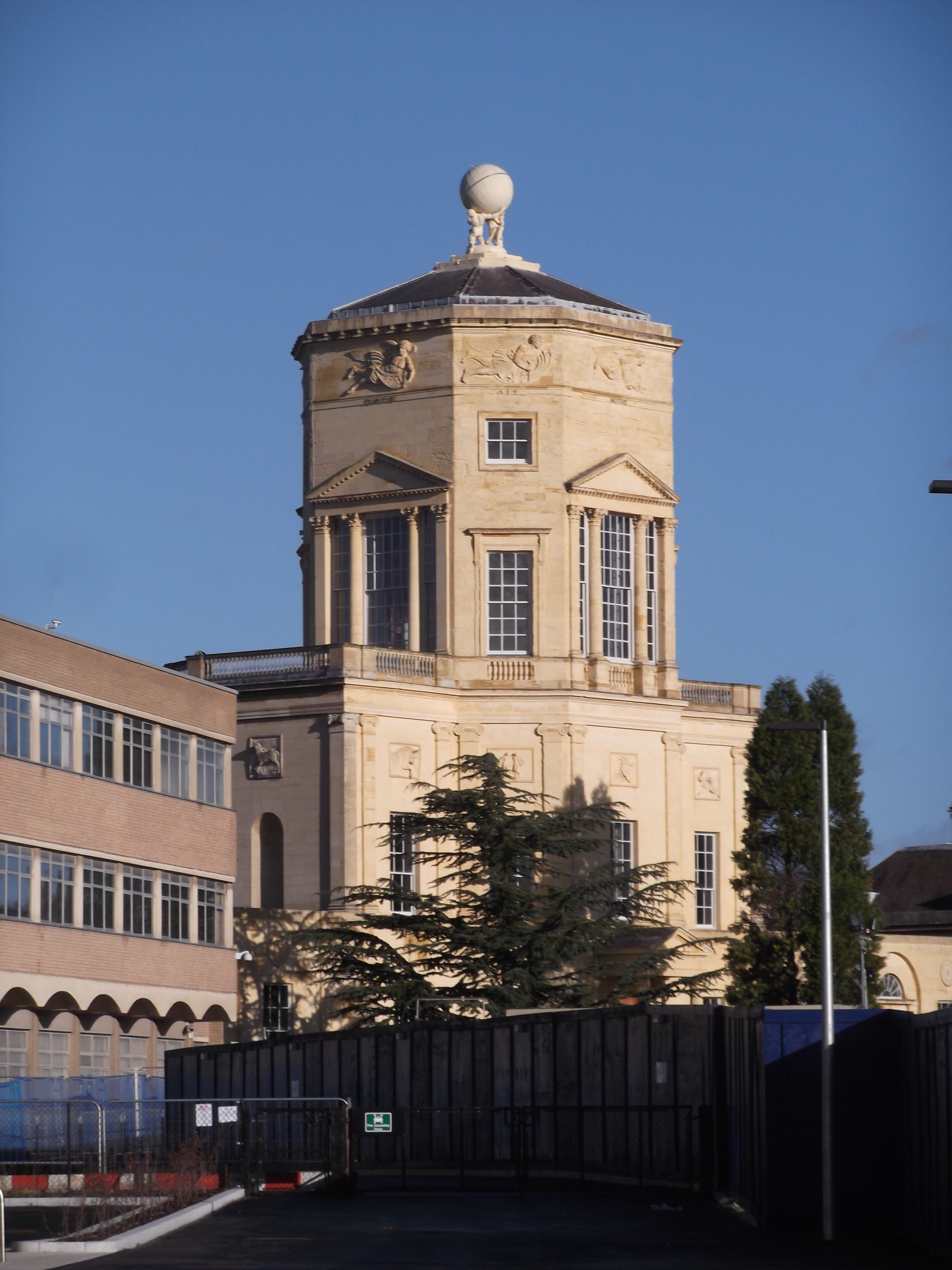
Tower of the Winds (Oxford)

The Tower of the Winds is the prominent octagonal tower on top of the old Radcliffe Observatory building in Oxford, England. The building now forms a centrepiece...

Art Jericho

Art Jericho is a contemporary art gallery in Jericho, northwest central Oxford, England.The gallery is managed by Jenny Blyth Fine Art. It participates...

Jericho Tavern

The Jericho Tavern is a music venue and pub in the Jericho area of Oxford, England, at 56 Walton Street. In the late 1980s and early 1990s it was an important...

Juxon Street

Juxon Street is a street in the north of Jericho, an inner suburb of Oxford, England. == Location == To the east is a junction with Walton Street. To the...

Nearby Amenities

Located within 500m of 51.758536,-1.2682756
Barrier: bollard
Bollard: fixed
Lat/Long: 51.7579779/-1.2622433
Access: private
Lat/Long: 51.7570017/-1.2689838
Access: no
Barrier: swing_gate
Height: 2
Material: metal
Lat/Long: 51.7571459/-1.2710079
Turning Circle
Turning Circle: hammer
Lat/Long: 51.7545424/-1.2694352
Mini Roundabout
Direction: clockwise
Source: photograph
Lat/Long: 51.7541107/-1.2677935
Mini Roundabout
Direction: clockwise
Lat/Long: 51.7618039/-1.2682069
Crossing
Crossing: uncontrolled;marked
Crossing Island: no
Crossing Ref: zebra
Tactile Paving: yes
Lat/Long: 51.7618153/-1.2684383
Jericho
Place: suburb
Wikidata: Q1507872
Lat/Long: 51.7587059/-1.2681711
Seamark Type: gate
Waterway: lock_gate
Lat/Long: 51.7560885/-1.269336
Seamark Type: gate
Waterway: lock_gate
Lat/Long: 51.7559014/-1.269102
Pub
The Old Bookbinders
Addr Housenumber: 17-18
Addr Postcode: OX2 6BT
Addr Street: Victor Street
Brewery: various
Cuisine: french
Opening Hours: Tu-Sa 12:00-24:00; Su 16:00-23:00
Phone: +44 1865 553549
Toilets Wheelchair: no
Website: http://oldbookbinders.co.uk/
Wheelchair: limited
Lat/Long: 51.7584939/-1.2697797
Post Box
Brand: Royal Mail
Brand Wikidata: Q638098
Brand Wikipedia: en:Royal Mail
Collection Times: Mo-Fr 18:30; Sa 11:30
Operator: Royal Mail
Operator Wikidata: Q638098
Post Box Type: pillar
Postal Code: OX1
Ref: OX1 115
Royal Cypher: GVIR
Royal Cypher Wikidata: Q33102169
Source: Bing; survey
Survey Date: 2014-11-05
Lat/Long: 51.7574005/-1.2624027
Traffic Calming: choker
Lat/Long: 51.762941/-1.2687679
Bicycle Parking
Bicycle Parking: stands
Capacity: 32
Covered: yes
Created By: Potlatch 0.10f
Source: photograph;gps_survey
Lat/Long: 51.7584462/-1.2621708
Bicycle Parking
Bicycle Parking: stands
Capacity: 8
Covered: no
Source: photograph;gps_survey
Lat/Long: 51.7581693/-1.2625632
Rewley Abbey
Historic: ruins
Source: local_knowledge
Wikidata: Q2147035
Wikipedia: en:Rewley Abbey
Lat/Long: 51.7543071/-1.2683555
Bicycle Parking
Capacity: 12
Lat/Long: 51.7548664/-1.2690207
Bicycle Parking
Capacity: 4
Source: survey
Lat/Long: 51.7564881/-1.270872
Bicycle Parking
Capacity: 16
Source: survey
Lat/Long: 51.7560703/-1.270408
Bicycle Parking
Bicycle Parking: stands
Capacity: 6
Check Date Capacity: 2023-07-29
Covered: no
Fee: no
Source: Bing;survey;yahoo_imagery
Lat/Long: 51.757981/-1.262301
Bicycle Parking
Bicycle Parking: stands
Capacity: 18
Covered: no
Fee: no
Source: Bing;survey;yahoo_imagery
Lat/Long: 51.757954/-1.262196
Bicycle Parking
Bicycle Parking: stands
Capacity: 24
Covered: no
Fee: no
Source: survey;yahoo_imagery
Lat/Long: 51.757814/-1.262873
Created By: osm2go v0.6-7
Lat/Long: 51.7586479/-1.264253
Bicycle Parking
Bicycle Parking: stands
Capacity: 26
Covered: no
Lat/Long: 51.7606213/-1.2669917
Turning Circle
Source: Bing
Turning Circle: knuckle
Lat/Long: 51.7599068/-1.2672716
Post Box
Collection Times: Mo-Fr 09:00; Sa 07:00
Post Box Type: pillar
Postal Code: OX2
Ref: OX2 20
Royal Cypher: EIIR
Royal Cypher Wikidata: Q33102113
Lat/Long: 51.7591439/-1.2673369
Recycling
Location: overground
Recycling Clothes: yes
Recycling Electrical Appliances: yes
Recycling Glass Bottles: yes
Recycling Green Waste: yes
Recycling Paper: yes
Recycling Plastic: yes
Recycling Shoes: yes
Recycling Type: container
Lat/Long: 51.7595127/-1.2664269
Bicycle Parking
Bicycle Parking: stands
Capacity: 8
Covered: no
Created By: Potlatch 0.10f
Lat/Long: 51.7591683/-1.2648138
Bicycle Parking
Bicycle Parking: stands
Capacity: 48
Covered: no
Lat/Long: 51.7598046/-1.2614332
Post Box
Brand: Royal Mail
Brand Wikidata: Q638098
Brand Wikipedia: en:Royal Mail
Check Date: 2022-02-21
Collection Times: Mo-Fr 09:00; Sa 07:00
Operator: Royal Mail
Operator Wikidata: Q638098
Post Box Type: pillar
Postal Code: OX2
Ref: OX2 65D
Royal Cypher: EVIIR
Royal Cypher Wikidata: Q33102324
Lat/Long: 51.7593448/-1.2653155
Bicycle Parking
Bicycle Parking: stands
Capacity: 42
Covered: yes
Created By: Potlatch 0.10f
Note: These are double-length Sheffields so should be able to take twice as manay as usual, but they end on a wall, so counted as normal length
Lat/Long: 51.75834/-1.2621022
Bicycle Parking
Capacity: 16
Lat/Long: 51.7567964/-1.2723802
Addr City: Oxford
Addr Housenumber: 1
Addr Street: Venneit Close
Lat/Long: 51.7574189/-1.2725538
Addr Housenumber: 27
Addr Street: Venneit Close
Lat/Long: 51.7581826/-1.272795
Addr Housenumber: 87
Addr Street: Venneit Close
Lat/Long: 51.757228/-1.2728385
Bicycle Parking
Capacity: 25
Lat/Long: 51.7574808/-1.2731697
Fountain
Created By: osm2go v0.6.13-maemo1
Lat/Long: 51.7616005/-1.270703
Created By: osm2go v0.6.13-maemo1
Lat/Long: 51.7619385/-1.2707607
Created By: osm2go v0.6.13-maemo1
Lat/Long: 51.7617733/-1.2697435
Bicycle Parking
Capacity: 10
Created By: osm2go v0.6.13-maemo1
Lat/Long: 51.7617466/-1.2696896
Barrier: bollard
Bicycle: yes
Foot: yes
Motorcycle: yes
Note: rising bollard
Lat/Long: 51.7618255/-1.2702229
Parking
Access: private
Parking: underground
Lat/Long: 51.7616692/-1.2689277
Addr City: Oxford
Addr Country: GB
Addr Housenumber: 80
Addr Street: Walton Street
Lat/Long: 51.761277/-1.268499
Recycling
Created By: Potlatch 0.10f
Location: overground
Recycling Cans: yes
Recycling Cardboard: yes
Recycling Glass: yes
Recycling Magazines: yes
Recycling Paper: yes
Recycling Plastic: yes
Recycling Type: container
Lat/Long: 51.7599567/-1.2699998
Bench
Lat/Long: 51.7596066/-1.2697564
Bench
Backrest: yes
Check Date: 2021-04-29
Lat/Long: 51.7593366/-1.2703961
Bench
Check Date: 2020-12-25
Lat/Long: 51.762204/-1.2709643
Bench
Backrest: yes
Check Date: 2021-04-29
Lat/Long: 51.7593116/-1.2705049
Bar
Angels
Addr City: Oxford
Addr Housename: Unit 3, Dartington House
Addr Housenumber: 55
Addr Postcode: OX1 2HS
Addr Street: Little Clarendon Street
Addr Unit: Unit 3
Fhrs Id: 268937
Phone: +44 1865 554224
Source Addr: FHRS Open Data
Website: https://www.angelscocktailbar.co.uk/
Lat/Long: 51.7586197/-1.2615518
The Little Barber Shop
Addr Housenumber: 36-38
Addr Street: Little Clarendon Street
Shop: hairdresser
Lat/Long: 51.7581417/-1.2625482
Bus Stop
Little Clarendon Street
Bus: yes
Frequency: 0
Naptan AtcoCode: 340000001W
Naptan Bearing: W
Naptan CommonName: Little Clarendon Street
Naptan Indicator: University Offices
Naptan Landmark: University Offices
Naptan NaptanCode: oxfamgmp
Naptan Notes: Case Only
Naptan PlusbusZoneRef: OXFD
Naptan Street: Little Clarendon Street
Naptan Verified: no
Physically Present: no
Public Transport: platform
Source: naptan_import
Lat/Long: 51.7582364/-1.2624682
Bus Stop
Radcliffe Observatory Quarter
Bench: yes
Bin: no
Bus: yes
Check Date Shelter: 2021-10-25
Departures Board: realtime
Lit: yes
Naptan AtcoCode: 340001002OUT
Naptan Bearing: N
Naptan CommonName: Radcliffe Infirmary
Naptan Indicator: Outside
Naptan Landmark: Radcliffe Infirmary
Naptan NaptanCode: oxfadtjt
Naptan PlusbusZoneRef: OXFD
Naptan Street: Woodstock Road
Network: Stagecoach
Park And Ride: 300
Public Transport: platform
Ref: 69323858
Shelter: yes
Source: naptan_import
Tactile Paving: no
Wheelchair: yes
Lat/Long: 51.7607832/-1.2619925
Bus Stop
Victoria Arms
Bus: yes
Naptan AtcoCode: 340001043PLT
Naptan Bearing: SE
Naptan CommonName: Victoria Arms
Naptan Indicator: Plantation Road
Naptan Landmark: Victoria Arms
Naptan NaptanCode: oxfagdwm
Naptan PlusbusZoneRef: OXFD
Naptan Street: Plantation Road
Naptan Verified: no
Public Transport: platform
Route Ref: 17;17A;17C
Source: naptan_import
Lat/Long: 51.7620092/-1.2682378
Bus Stop
Victoria Arms
Bus: yes
Naptan AtcoCode: 340001043WEL
Naptan Bearing: N
Naptan CommonName: Victoria Arms
Naptan Indicator: Walton Well Road
Naptan Landmark: Victoria Arms
Naptan NaptanCode: oxfagdpg
Naptan PlusbusZoneRef: OXFD
Naptan Street: Walton Well Road
Naptan Verified: no
Public Transport: platform
Source: naptan_import
Lat/Long: 51.7625121/-1.2686964
Bus Stop
Phoenix Cinema
Bench: no
Bin: yes
Bus: yes
Check Date Shelter: 2021-10-18
Frequency: 0
Naptan AtcoCode: 340001044OPP
Naptan Bearing: S
Naptan CommonName: Phoenix Cinema
Naptan Indicator: Opposite
Naptan Landmark: Phoenix Cinema
Naptan NaptanCode: oxfagdpd
Naptan PlusbusZoneRef: OXFD
Naptan Street: Walton Street
Public Transport: platform
Shelter: no
Source: naptan_import
Tactile Paving: no
Timetable: yes
Lat/Long: 51.7605536/-1.2666811
Bus Stop
Phoenix Cinema
Bus: yes
Frequency: 0
Naptan AtcoCode: 340001044OUT
Naptan Bearing: N
Naptan CommonName: Phoenix Cinema
Naptan Indicator: Outside
Naptan Landmark: Phoenix Cinema
Naptan NaptanCode: oxfagdpa
Naptan PlusbusZoneRef: OXFD
Naptan Street: Walton Street
Public Transport: platform
Shelter: no
Source: naptan_import
Timetable: yes
Lat/Long: 51.7602826/-1.2664849
Bus Stop
Ruskin College
Bus: yes
Naptan AtcoCode: 340001046OPP
Naptan Bearing: S
Naptan CommonName: Ruskin College
Naptan Indicator: Opposite
Naptan Landmark: Ruskin College
Naptan NaptanCode: oxfagdmp
Naptan PlusbusZoneRef: OXFD
Naptan Street: Walton Street
Naptan Verified: no
Public Transport: platform
Source: naptan_import
Lat/Long: 51.7557771/-1.2631892
Bus Stop
Ruskin College
Bench: no
Bin: yes
Bus: yes
Naptan AtcoCode: 340001046OUT
Naptan Bearing: N
Naptan CommonName: Ruskin College
Naptan Indicator: Outside
Naptan Landmark: Ruskin College
Naptan NaptanCode: oxfagdmj
Naptan PlusbusZoneRef: OXFD
Naptan Street: Walton Street
Public Transport: platform
Route Ref: 17;17A;17C
Shelter: no
Source: naptan_import
Lat/Long: 51.756157/-1.2633382
Bus Stop
Canal Street
Bus: yes
Naptan AtcoCode: 340002053CR
Naptan Bearing: S
Naptan CommonName: Canal Street
Naptan Indicator: Southbound
Naptan Landmark: Canal Street
Naptan NaptanCode: oxfatwtp
Naptan PlusbusZoneRef: OXFD
Naptan Street: Canal Street
Naptan Verified: no
Public Transport: platform
Source: naptan_import
Lat/Long: 51.7585523/-1.2698814
Bus Stop
Canal Street
Bus: yes
Naptan AtcoCode: 340002053VS
Naptan Bearing: N
Naptan CommonName: Canal Street
Naptan Indicator: Northbound
Naptan Landmark: Canal Street
Naptan NaptanCode: oxfatwtm
Naptan PlusbusZoneRef: OXFD
Naptan Street: Canal Street
Naptan Verified: no
Public Transport: platform
Source: naptan_import
Lat/Long: 51.758273/-1.2697845
Bus Stop
Cranham Street
Bus: yes
Naptan AtcoCode: 340002054EAS
Naptan Bearing: E
Naptan BusStopType: CUS
Naptan CommonName: Cranham Street
Naptan Indicator: Outside Health Centre
Naptan Landmark: Health Centre
Naptan NaptanCode: oxfatwtj
Naptan PlusbusZoneRef: OXFD
Naptan Street: Cranham Street
Naptan Verified: no
Public Transport: platform
Source: naptan_import
Lat/Long: 51.7604208/-1.2669037
Bus Stop
Cranham Street
Bus: yes
Naptan AtcoCode: 340002054WES
Naptan Bearing: W
Naptan CommonName: Cranham Street
Naptan Indicator: Opp Health Centre
Naptan Landmark: Health Centre
Naptan NaptanCode: oxfatwtg
Naptan PlusbusZoneRef: OXFD
Naptan Street: Cranham Street
Naptan Verified: no
Public Transport: platform
Source: naptan_import
Lat/Long: 51.7604673/-1.2669671
Grit Bin
Lat/Long: 51.756264/-1.2718255
Bar
Love Jericho
Addr Housenumber: 30
Addr Postcode: OX2 6AA
Addr Street: Walton Street
Email: l.jbarlounge@hotmail.com
Food: yes
Phone: +44 1865 424631
Website: https://lovejericho-oxford.co.uk/
Lat/Long: 51.7579867/-1.2637336
Bar
Raoul's
Addr City: Oxford
Addr Housenumber: 32
Addr Postcode: OX2 6AA
Addr Street: Walton Street
Fhrs Id: 269431
Source Addr: FHRS Open Data
Website: https://www.raoulsbar.com/
Lat/Long: 51.7580796/-1.2637446
Cafe
Opera Cafe
Addr Housenumber: 31
Addr Postcode: OX2 6AA
Addr Street: Walton Street
Food: yes
Outdoor Seating: yes
Lat/Long: 51.7580266/-1.2637328
The Big Bang
Abandoned: yes
Demolished: 2012
Disused Amenity: restaurant
Phone: +44 1865 511441
Lat/Long: 51.7581609/-1.2635099
Barrier: cycle_barrier
Lat/Long: 51.7622821/-1.2661936
Source: Bing
Lat/Long: 51.7611913/-1.2632081
Traffic Calming: table
Lat/Long: 51.7560447/-1.2632422
Source Postcode: OS_OpenData_CodePoint
Lat/Long: 51.7621143/-1.2662402
Access: private
Entrance: main
Foot: private
Motor Vehicle: no
Wheelchair: yes
Lat/Long: 51.7597428/-1.2614427
Entrance: yes
Lat/Long: 51.7596396/-1.2617865
Entrance: yes
Lat/Long: 51.7585835/-1.2634972
Entrance: yes
Lat/Long: 51.7585797/-1.2636727
Entrance: yes
Lat/Long: 51.7588679/-1.2637306
Entrance: yes
Wheelchair: yes
Lat/Long: 51.7597222/-1.2615118
Entrance: yes
Lat/Long: 51.7587552/-1.2638528
Entrance: yes
Lat/Long: 51.7596096/-1.2618864
Addr Housenumber: 76
Addr Postcode: OX2 6EJ
Addr Street: Saint Bernard's Road
Source Addr: survey
Source Postcode: OS_OpenData_CodePoint
Lat/Long: 51.7620871/-1.2651804
Addr Housenumber: 86
Addr Postcode: OX2 6EJ
Addr Street: Saint Bernard's Road
Source Addr: survey
Source Postcode: OS_OpenData_CodePoint
Lat/Long: 51.7622239/-1.264262
Addr Housenumber: 73
Addr Postcode: OX2 6EJ
Addr Street: Saint Bernard's Road
Source Addr: survey
Source Postcode: OS_OpenData_CodePoint
Lat/Long: 51.7620487/-1.2654415
Addr Housenumber: 8
Addr Street: Saint Bernard's Road
Source Addr: survey
Source Postcode: OS_OpenData_CodePoint
Lat/Long: 51.7623436/-1.2646642
Addr Housenumber: 79
Addr Postcode: OX2 6EJ
Addr Street: Saint Bernard's Road
Source Addr: survey
Source Postcode: OS_OpenData_CodePoint
Lat/Long: 51.7621391/-1.2648572
Addr Housenumber: 67
Addr Postcode: OX2 6EJ
Addr Street: Saint Bernard's Road
Source Addr: survey
Source Postcode: OS_OpenData_CodePoint
Lat/Long: 51.7619797/-1.2660016
Addr Housenumber: 14
Addr Street: Saint Bernard's Road
Source Addr: survey
Source Postcode: OS_OpenData_CodePoint
Lat/Long: 51.7622746/-1.2651851
Check Date: 2021-10-18
Source: survey
Traffic Calming: choker
Lat/Long: 51.7621135/-1.2654988
Addr Housenumber: 63
Addr Postcode: OX2 6EJ
Addr Street: Saint Bernard's Road
Source Addr: survey
Source Postcode: OS_OpenData_CodePoint
Lat/Long: 51.7619366/-1.26634
Addr Housenumber: 9
Addr Street: Saint Bernard's Road
Source Addr: survey
Source Postcode: OS_OpenData_CodePoint
Lat/Long: 51.7623325/-1.2648142
Source: Bing
Traffic Calming: chicane;hump
Lat/Long: 51.7574679/-1.2634392
Crossing
Crossing: uncontrolled
Crossing Island: no
Crossing Ref: zebra
Source: Bing
Tactile Paving: yes
Lat/Long: 51.7580179/-1.2635749
Entrance: yes
Source: survey
Lat/Long: 51.761112/-1.2677696
Entrance: yes
Lat/Long: 51.7607852/-1.2669918
Entrance: yes
Source: survey
Lat/Long: 51.7604359/-1.2668021
Entrance: yes
Source: survey
Lat/Long: 51.7597082/-1.2658308
Entrance: yes
Source: survey
Lat/Long: 51.7607061/-1.266883
Barrier: bollard
Bicycle: yes
Bollard: foldable
Foot: yes
Lat/Long: 51.7601714/-1.2663685
Addr Postcode: OX2 6EB
Lat/Long: 51.7613295/-1.2677133
Crossing
Crossing: zebra
Crossing Island: no
Kerb: lowered
Tactile Paving: yes
Traffic Calming: choked_table
Lat/Long: 51.7607222/-1.2669914
Entrance: yes
Lat/Long: 51.7608855/-1.2671298
Entrance: yes
Source: survey
Lat/Long: 51.7603887/-1.266658
Entrance: yes
Source: survey
Lat/Long: 51.7597543/-1.2659039
Entrance: yes
Source: survey
Lat/Long: 51.761221/-1.2679111
Entrance: yes
Source: survey
Lat/Long: 51.7607496/-1.2669428
Barrier: bollard
Bicycle: yes
Foot: yes
Lat/Long: 51.7600063/-1.2666759
Entrance: yes
Source: survey
Lat/Long: 51.7610754/-1.2677173
Addr Housenumber: 47A
Addr Street: Walton Street
Entrance: yes
Lat/Long: 51.7596876/-1.265803
Entrance: yes
Source: survey
Lat/Long: 51.7603396/-1.2665797
Addr Housenumber: 48A
Addr Street: Walton Street
Entrance: yes
Source: survey
Lat/Long: 51.759722/-1.2658495
Entrance: yes
Source: survey
Lat/Long: 51.7611857/-1.2678656
Check Date: 2021-10-18
Source: survey
Traffic Calming: choker
Lat/Long: 51.7613004/-1.2678372
Check Date: 2021-10-18
Traffic Calming: hump
Lat/Long: 51.7602416/-1.2663562
Atm
Cash In: no
Check Date: 2024-03-12
Operator: Bank Machine
Lat/Long: 51.759455/-1.2654887
Entrance: yes
Lat/Long: 51.7595071/-1.2655591
Turning Circle
Turning Circle: knuckle
Lat/Long: 51.7604038/-1.2676215
Entrance: yes
Source: survey
Lat/Long: 51.761152/-1.2678221
Entrance: yes
Lat/Long: 51.7606916/-1.266863
Entrance: yes
Source: survey
Lat/Long: 51.7612917/-1.2680023
Check Date: 2021-10-18
Traffic Calming: hump
Lat/Long: 51.7596065/-1.2655163
Addr Housenumber: 110A
Addr Street: Walton Street
Entrance: yes
Source: survey
Lat/Long: 51.7607387/-1.2669278
Addr Housenumber: 43A
Addr Street: Walton Street
Entrance: yes
Lat/Long: 51.7595657/-1.2656382
Entrance: yes
Source: survey
Lat/Long: 51.7589349/-1.2610762
Entrance: yes
Source: survey
Lat/Long: 51.7588661/-1.2610502
Entrance: yes
Source: survey
Lat/Long: 51.7593266/-1.2612161
Entrance: yes
Source: survey
Lat/Long: 51.7592127/-1.2611753
Entrance: yes
Source: survey
Lat/Long: 51.7593954/-1.2612414
Entrance: yes
Source: survey
Lat/Long: 51.7592494/-1.2611885
Entrance: yes
Source: survey
Lat/Long: 51.7591107/-1.261139
Entrance: yes
Lat/Long: 51.7596654/-1.2684577
Crossing
Crossing: priority
Crossing Island: no
Crossing Ref: zebra
Tactile Paving: yes
Lat/Long: 51.7591175/-1.2648287
Traffic Calming: choker
Lat/Long: 51.7622623/-1.268474
Direction: forward
Source: Bing
Traffic Calming: choker
Lat/Long: 51.7620062/-1.2664311
Walton Well Drinking Fountain
HE Ref: 1047105
Access: yes
Disused Amenity: drinking_water
Drinking Water: no
Inscription: Drink and think of him who is the fountain of life
Inscription 2: With the consent of the Lords of the Manor, this drinking fountain is erected by Mr. William Ward to mark the site of a celebrated spring known as Walton Well adjacent to the ancient fordway into Port Meadow called Walton Ford
Listed Status: Grade II
Nickname: Belmont Drinking Fountain
Note: The "Brumman's Well" name was also given to Aristotle's Well, nearby. The name refers to "Brumman le Rich or de Walton" (see source). I can't find anything backing up the "Belmont Drinking Fountain" name.
Old Name: Bruman's Well
Source: local_knowledge; http://www.oxfordhistory.org.uk/streets/inscriptions/north/drinking_fountain.html
Source Old Name: Robert Charles Hope, _The legendary lore of the holy wells of England: including rivers, lakes, fountains and springs_, 1893 London Elliot Stock, https://archive.org/details/legendaryloreofh00hope/mode/2up (as "Brumman's Well")
Start Date: 1885
Tourism: attraction
Wikidata: Q26299218
Lat/Long: 51.7622249/-1.2699357
Addr Housenumber: 13B
Lat/Long: 51.7625363/-1.2689556
Telephone
Booth: KX100
Check Date: 2021-10-25
Covered: booth
Operator: BT
Operator Wikidata: Q593786
Phone: +44 1865 559390
Source: photograph
Lat/Long: 51.7581897/-1.2625008
Barrier: entrance
Note Barrier: gate, but left open
Lat/Long: 51.756553/-1.2725575
College Cruisers
Designation: waterway=boatyard
Leisure: marina
Waterway: marina
Lat/Long: 51.7580246/-1.270422
Barrier: bollard
Lat/Long: 51.7582047/-1.2624283
Railway: buffer_stop
Lat/Long: 51.7546473/-1.2701496
Waterway: weir
Lat/Long: 51.7568071/-1.2702138
Waterway: weir
Lat/Long: 51.7566982/-1.2701494
Barrier: cycle_barrier
Lat/Long: 51.7620496/-1.2710124
Bicycle Parking
Bicycle Parking: stands
Capacity: 12
Covered: yes
Lat/Long: 51.7554487/-1.2638139
Addr City: Oxford
Addr Housenumber: 34
Addr Postcode: OX2 6AA
Addr Street: Walton Street
Source: survey
Lat/Long: 51.7581354/-1.2637619
Doctors
Jericho Health Centre
Addr City: Oxford
Addr Housename: New Radcliffe House
Addr Postcode: OX2 6NW
Addr Street: Walton Street
Check Date: 2023-07-29
Healthcare: centre
Opening Hours: Mo-Fr 08:30-18:00; Sa 08:30-11:30
Phone: +441865429993
Website: https://www.gpjerichotwo.co.uk/
Wikidata: Q6182162
Wikipedia: en:Jericho Health Centre
Lat/Long: 51.7600536/-1.2655578
Bicycle Parking
Bicycle Parking: stands
Capacity: 12
Covered: no
Lit: yes
Source: photograph
Lat/Long: 51.759973/-1.2656683
Bicycle Parking
Bicycle Parking: stands
Capacity: 26
Covered: no
Lit: yes
Source: photograph
Lat/Long: 51.7600956/-1.2654268
Operator: Network Rail
Railway: switch
Lat/Long: 51.756048/-1.2710257
Operator: Network Rail
Railway: switch
Lat/Long: 51.757458/-1.271589
Operator: Network Rail
Railway: switch
Lat/Long: 51.7587684/-1.2722533
William Lucy Ironworks Memorial
Tourism: artwork
Lat/Long: 51.7615766/-1.2703315
Addr Housename: Furnace House
Addr Housenumber: 18-44
Addr Postcode: OX2 6GF
Addr Street: Walton Well Road
Entrance: yes
Lat/Long: 51.7615228/-1.2699983
Addr Housename: Furnace House
Addr Housenumber: 46-83
Addr Postcode: OX2 6GF
Addr Street: Walton Well Road
Entrance: yes
Lat/Long: 51.7617629/-1.2691715
Addr Housename: Furnace House
Addr Housenumber: 1-17
Addr Postcode: OX2 6GF
Addr Street: Walton Well Road
Entrance: yes
Lat/Long: 51.7616666/-1.2702114
Addr Housename: Fettlers House
Addr Housenumber: 1-20
Addr Postcode: OX2 6GE
Addr Street: Walton Well Road
Entrance: yes
Lat/Long: 51.7617216/-1.2705597
Addr Housename: Foundry House
Addr Housenumber: 1-23
Addr Postcode: OX2 6AQ
Addr Street: Walton Well Road
Entrance: yes
Lat/Long: 51.7614478/-1.2702599
Addr Housename: Foundry House
Addr Housenumber: 24-66
Addr Postcode: OX2 6AQ
Addr Street: Walton Well Road
Entrance: yes
Lat/Long: 51.7611031/-1.2704992
Addr Housename: Foundry House
Addr Housenumber: 27-89
Addr Postcode: OX2 6AQ
Addr Street: Walton Well Road
Entrance: yes
Lat/Long: 51.7607688/-1.2704995
Entrance: yes
Lat/Long: 51.761684/-1.2689994
Entrance: yes
Lat/Long: 51.7576266/-1.2634068
Entrance: yes
Lat/Long: 51.7576714/-1.2634152
Entrance: yes
Wheelchair: no
Lat/Long: 51.7570495/-1.2623516
Entrance: yes
Lat/Long: 51.7584168/-1.2620101
Entrance: yes
Wheelchair: no
Lat/Long: 51.7577207/-1.2628606
Entrance: yes
Wheelchair: no
Lat/Long: 51.7566349/-1.2631835
Addr City: Oxford
Addr Housenumber: 1
Addr Street: Wellington Square
Entrance: yes
Lat/Long: 51.7571874/-1.2621606
Department of Social Policy and Intervention
Addr City: Oxford
Addr Housenumber: 32
Addr Postcode: OX1 2ER
Addr Street: Wellington Square
Office: university
Operator: University of Oxford
Phone: +44 1865 270325
Website: https://www.spi.ox.ac.uk/department
Lat/Long: 51.7577338/-1.2628837
Faculty of Linguistics, Philology, and Phonetics
Learning: oxford_department
Lat/Long: 51.7566191/-1.2631337
Institute for Chinese Studies
Learning: oxford_department
Lat/Long: 51.7566664/-1.2631435
Entrance: yes
Wheelchair: yes
Lat/Long: 51.7601497/-1.262271
Entrance: yes
Wheelchair: yes
Lat/Long: 51.7566433/-1.2628946
Entrance: yes
Wheelchair: yes
Lat/Long: 51.7597301/-1.2614851
Entrance: yes
Lat/Long: 51.758423/-1.262256
Entrance: yes
Lat/Long: 51.7585348/-1.2622659
Entrance: yes
Wheelchair: on request
Lat/Long: 51.7586943/-1.2626211
Entrance: yes
Wheelchair: no
Lat/Long: 51.7593396/-1.2631154
Elevator
Lat/Long: 51.7570279/-1.2625161
Access: private
Entrance: yes
Wheelchair: yes
Lat/Long: 51.75704/-1.26252
Entrance: yes
Wheelchair: yes
Lat/Long: 51.7576407/-1.2629729
The Co-operative Food
Brand: The Co-operative Food
Brand Wikidata: Q107617274
Opening Hours: Mo-Su 07:00-22:00
Operator: Midcounties Co-operative
Operator Wikidata: Q6841138
Shop: convenience
Lat/Long: 51.7581639/-1.2635572
Waterway: turning_point
Lat/Long: 51.7555542/-1.2689789
Maxlength: 52ft
Waterway: turning_point
Lat/Long: 51.7564295/-1.2696943
Entrance: yes
Lat/Long: 51.7604603/-1.2626148
Sobell House
Check Date: 2023-06-02
Shop: charity
Lat/Long: 51.7585757/-1.2616394
Operator: Network Rail
Railway: switch
Lat/Long: 51.7556847/-1.2708296
Operator: Network Rail
Railway: switch
Lat/Long: 51.7559441/-1.2709205
Railway: buffer_stop
Lat/Long: 51.7561038/-1.2708745
Railway: switch
Lat/Long: 51.758034/-1.2715015
Operator: Network Rail
Railway: switch
Lat/Long: 51.7583216/-1.2715602
Operator: Network Rail
Railway: switch
Lat/Long: 51.7586815/-1.2716395
Operator: Network Rail
Railway: switch
Lat/Long: 51.7575253/-1.2713908
Operator: Network Rail
Railway: switch
Lat/Long: 51.7566418/-1.2711511
Operator: Network Rail
Railway: switch
Lat/Long: 51.7575831/-1.2714039
Bicycle Parking
Bicycle Parking: stands
Capacity: 4
Covered: no
Fee: no
Lat/Long: 51.759935/-1.270989
Railway: buffer_stop
Lat/Long: 51.761535/-1.272438
Oxford Up Carriage Sidings
Operator: Network Rail
Railway: switch
Ref Tiploc: OXFDCS2
Lat/Long: 51.7569445/-1.2712496
Operator: Network Rail
Railway: switch
Lat/Long: 51.7584056/-1.271882
Operator: Network Rail
Railway: switch
Lat/Long: 51.7570331/-1.271555
Operator: Network Rail
Railway: switch
Lat/Long: 51.7587074/-1.2722307
Operator: Network Rail
Railway: switch
Lat/Long: 51.7581285/-1.2719374
Cowboymod and Son
Addr City: Oxford
Addr Housenumber: 33
Addr Postcode: OX2 6AA
Addr Street: Walton Street
Contact Phone: +44 1865 452637
Contact Website: http://www.cowboymod.com/
Opening Hours: Mo-Sa 10:00-18:00; PH off
Shop: hairdresser
Source: http://www.cowboymod.com/index.php/photo-gallery/category/C5/
Lat/Long: 51.7581097/-1.2637559
Waste Basket
Check Date: 2021-10-18
Lat/Long: 51.7599715/-1.2657025
Restaurant
Mamma Mia Pizzeria
Addr City: Oxford
Addr Housenumber: 102
Addr Postcode: OX2 6EB
Addr Street: Walton Street
Check Date: 2023-07-30
Cuisine: pizza
Opening Hours: Mo-Fr 12:00-15:00, 17:00-22:30; Sa-Su 12:00-22:30
Phone: +44 1865 311211
Website: https://mammamiapizzeria.co.uk/
Lat/Long: 51.7610843/-1.2674011
Access: permissive
Entrance: main
Lat/Long: 51.7578266/-1.2698761
Access: permissive
Entrance: main
Lat/Long: 51.759363/-1.2669383
Bench
Backrest: no
Check Date: 2022-12-18
Lat/Long: 51.75927/-1.2663913
Bench
Backrest: no
Check Date: 2022-12-18
Lat/Long: 51.7592099/-1.2665107
Mini Roundabout
Direction: clockwise
Lat/Long: 51.7605261/-1.2635937
Operator: Network Rail
Railway: switch
Lat/Long: 51.7564111/-1.2712741
Operator: Network Rail
Railway: switch
Lat/Long: 51.7557081/-1.2711151
Access: private
Addr City: Oxford
Addr Housenumber: 53
Addr Postcode: OX2 6AX
Addr Street: Great Clarendon Street
Description: Peter and Christine a house
Entrance: home
Wheelchair: no
Lat/Long: 51.7573292/-1.2690716
Addr City: Oxford
Addr Housenumber: 54
Addr Street: Great Clarendon Street
Entrance: yes
Lat/Long: 51.7573126/-1.2691053
Addr City: Oxford
Addr Housenumber: 55
Addr Street: Great Clarendon Street
Entrance: yes
Lat/Long: 51.7572808/-1.2691703
Addr City: Oxford
Addr Housenumber: 56
Addr Street: Great Clarendon Street
Entrance: yes
Lat/Long: 51.7572675/-1.2691975
Olivia May
Addr City: Oxford
Addr Housenumber: 31
Addr Postcode: OX1 2HU
Addr Street: Little Clarendon Street
Clothes: women
Shop: clothes
Lat/Long: 51.7581089/-1.2631376
Mahogany
Addr City: Oxford
Addr Street: Little Clarendon Street
Shop: hairdresser
Lat/Long: 51.7581355/-1.2630719
Addr City: Oxford
Addr Housenumber: 29
Addr Postcode: OX1 2HU
Addr Street: Little Clarendon Street
Lat/Long: 51.7581513/-1.2630169
Clement & Church
Addr City: Oxford
Addr Housenumber: 27
Addr Street: Little Clarendon Street
Clothes: men
Shop: clothes
Lat/Long: 51.7581811/-1.2629257
Wild Honey
Addr City: Oxford
Addr Housenumber: 26
Addr Street: Little Clarendon Street
Diet Vegan: yes
Shop: health_food
Website: https://www.wildhoneylove.com/
Lat/Long: 51.7582102/-1.2628533
Jericho Cheese Company
Addr City: Oxford
Addr Housenumber: 25
Addr Postcode: OX1 2HU
Addr Street: Little Clarendon Street
Check Date: 2023-06-02
Email: hello@jerichocheese.co.uk
Fhrs Id: 989697
Level: 0
Opening Hours: Tu-Sa 10:00-18:00; Su 11:00-16:00
Phone: +44 1865 516000
Shop: cheese
Website: https://www.jerichocheese.co.uk
Lat/Long: 51.7582359/-1.2627829
Popham
Addr City: Oxford
Addr Street: Little Clarendon Street
Alt Name: Walton and Giles
Shop: hairdresser
Lat/Long: 51.7582691/-1.2627085
Fast Food
Moshi
Addr City: Oxford
Addr Housenumber: 23
Addr Postcode: OX1 2HU
Addr Street: Little Clarendon Street
Check Date: 2023-06-02
Cuisine: japanese
Drive Through: no
Fhrs Id: 406128
Source Addr: FHRS Open Data
Website: moshioxford.co.uk
Lat/Long: 51.7582924/-1.2626401
Addr City: Oxford
Addr Housenumber: 20
Addr Postcode: OX1 2HP
Addr Street: Little Clarendon Street
Fhrs Id: 997133
Source Addr: FHRS Open Data
Lat/Long: 51.7583746/-1.2624483
Posh Frocks
Shop: clothes
Lat/Long: 51.7580794/-1.2627212
Shop: vacant
Lat/Long: 51.7580263/-1.2628701
Cafe
Common Ground
Addr City: Oxford
Addr Housenumber: 37-38
Addr Postcode: OX1 2HF
Addr Street: Little Clarendon Street
Internet Access: yes
Office: coworking
Opening Hours: Mo-Fr 08:00-18:00, Sa 08:00-17:00
Theme: bicycle
Lat/Long: 51.7581176/-1.2626327
Clinic
Isis Centre
Healthcare: clinic
Lat/Long: 51.7585534/-1.2617006
Entrance: main
Lat/Long: 51.7591175/-1.2645482
Entrance: yes
Lat/Long: 51.7579616/-1.2634613
Entrance: yes
Lat/Long: 51.7580495/-1.2632964
Entrance: yes
Lat/Long: 51.7580576/-1.2635258
Entrance: yes
Lat/Long: 51.7580985/-1.2633159
Entrance: yes
Lat/Long: 51.7581494/-1.2635818
Turning Circle
Lat/Long: 51.7570418/-1.2618167
Bar
Oxford Wine Cafe
Addr City: Oxford
Addr Housenumber: 32
Addr Postcode: OX1 2HU
Addr Street: Little Clarendon Street
Email: george@oxfordwine.co.uk
Fhrs Id: 997140
Opening Hours: Mo-Sa 10:00-19:00; Su 10:00-18:00
Phone: +44 1865 604334
Website: https://www.oxfordwinecafe.co.uk/
Wheelchair: yes
Lat/Long: 51.7580165/-1.2634269
Bicycle Parking
Bicycle Parking: stands
Capacity: 150
Covered: no
Lat/Long: 51.7605171/-1.2624835
Barrier: entrance
Lat/Long: 51.7606133/-1.2619568
Bicycle Parking
Bicycle Parking: stands
Capacity: 66
Covered: no
Lit: yes
Lat/Long: 51.7590944/-1.263956
Barrier: bollard
Bicycle: yes
Foot: yes
Vehicle: permit
Lat/Long: 51.7590757/-1.2642095
Traffic Calming: bump
Lat/Long: 51.7584659/-1.2724822
Turning Circle
Lat/Long: 51.7583592/-1.2725662
Railway: buffer_stop
Lat/Long: 51.7570118/-1.2720791
Operator: Network Rail
Railway: switch
Lat/Long: 51.7577332/-1.2721471
Operator: Network Rail
Railway: switch
Lat/Long: 51.7579482/-1.2721742
Railway: buffer_stop
Lat/Long: 51.7570133/-1.2721343
Railway: buffer_stop
Lat/Long: 51.7570107/-1.2720019
Operator: Network Rail
Railway: switch
Lat/Long: 51.7583329/-1.2723145
Railway: buffer_stop
Lat/Long: 51.7594464/-1.2727605
Operator: Network Rail
Railway: switch
Lat/Long: 51.7576436/-1.2718957
Railway: buffer_stop
Lat/Long: 51.7608868/-1.272823
Operator: Network Rail
Railway: switch
Lat/Long: 51.7591165/-1.2724168
Railway: buffer_stop
Lat/Long: 51.7619442/-1.2728109
Railway: buffer_stop
Lat/Long: 51.76069/-1.2728703
Addr City: Oxford
Addr Housenumber: 30
Addr Street: Adelaide Street
Source: survey
Lat/Long: 51.7619683/-1.2648197
Addr City: Oxford
Addr Housenumber: 12
Addr Street: Adelaide Street
Source: survey
Lat/Long: 51.761519/-1.2659171
Addr City: Oxford
Addr Housenumber: 71A
Addr Street: Observatory Street
Lat/Long: 51.7617326/-1.2644461
Addr Housenumber: 79
Addr Street: Observatory Street
Lat/Long: 51.7619465/-1.2639653
Addr Housenumber: 39
Addr Street: Saint Bernard's Road
Lat/Long: 51.7619955/-1.2671545
Addr City: Oxford
Addr Housenumber: 28
Addr Street: Saint Bernard's Road
Lat/Long: 51.7621137/-1.2663777
Addr Housenumber: 62
Addr Street: Saint Bernard's Road
Lat/Long: 51.761865/-1.266438
Addr Housenumber: 61
Addr Street: Saint Bernard's Road
Lat/Long: 51.7618505/-1.2665318
Addr Housenumber: 59
Addr Street: Saint Bernard's Road
Lat/Long: 51.7618308/-1.2666674
Addr Housenumber: 58
Addr Street: Saint Bernard's Road
Lat/Long: 51.7618059/-1.2668398
Addr City: Oxford
Addr Housenumber: 55
Addr Street: Saint Bernard's Road
Lat/Long: 51.7617727/-1.2671391
Addr Housenumber: 56
Addr Street: Saint Bernard's Road
Lat/Long: 51.7617846/-1.2670453
Addr City: Oxford
Addr Housenumber: 57
Addr Street: Saint Bernard's Road
Lat/Long: 51.7617976/-1.2669534
Man Made: surveillance
Lat/Long: 51.7548421/-1.268945
Man Made: surveillance
Lat/Long: 51.7557906/-1.2703897
Bicycle Parking
Access: permissive
Bicycle Parking: informal
Capacity: 4
Covered: no
Description: Former public bike hire scheme
Disused Amenity: bicycle_rental
Disused Network: Oxonbikes
Lit: yes
Lat/Long: 51.7605042/-1.2619774
Addr City: Oxford
Addr Housenumber: 1
Addr Street: Albert Street
Lat/Long: 51.7570386/-1.2667427
Addr City: Oxford
Addr Housenumber: 7
Addr Street: Albert Street
Lat/Long: 51.7571512/-1.2668207
Addr City: Oxford
Addr Housenumber: 8
Addr Street: Albert Street
Lat/Long: 51.7571783/-1.2668561
Cafe
GAIL's
Addr City: Oxford
Addr Housenumber: 21-22
Addr Postcode: OX1 2HU
Addr Street: Little Clarendon Street
Brand: GAIL's Bakery
Brand Wikidata: Q110662562
Check Date: 2023-06-02
Cuisine: bakery
Email: jericho@gailsbread.co.uk
Fhrs Id: 964599
Level: 0
Opening Hours: Mo-Fr 07:00-19:00; Sa-Su, PH 08:00-19:00
Phone: +44 1865 557839
Shop: bakery
Website: https://gailsbread.co.uk/bakeries/jericho/
Lat/Long: 51.7583431/-1.2625328
Door: hinged
Door Opening: inside
Door Wings: 1
Entrance: main
Lat/Long: 51.7594073/-1.2615642
Door: hinged
Door Opening: inside
Door Wings: 1
Entrance: main
Lat/Long: 51.7593933/-1.2615569
Bench
Armrest: yes
Backrest: yes
Material: wood
Lat/Long: 51.7603509/-1.2617684
Vending Machine
Brand: Schwalbe
Check Date: 2023-07-30
Operator: Walton Street Cycles
Payment Coins: yes
Vending: bicycle_tube
Lat/Long: 51.7613223/-1.2679664
Crossing
Crossing: uncontrolled
Crossing Island: yes
Crossing Ref: zebra
Kerb: lowered
Tactile Paving: yes
Lat/Long: 51.7616962/-1.2680961
Waste Disposal
Lat/Long: 51.7587415/-1.263468
Bicycle Parking
Covered: yes
Lat/Long: 51.7563598/-1.265714
Entrance: yes
Lat/Long: 51.7590353/-1.2671979
Entrance: yes
Lat/Long: 51.7589487/-1.2671042
Entrance: yes
Lat/Long: 51.7592202/-1.2669896
Oxford Down Turnback Lane
Railway: junction
Ref Tiploc: OXFDDTB
Lat/Long: 51.7578799/-1.2718499
Telephone
Booth: KX200
Covered: booth
Operator: BT
Lat/Long: 51.7620316/-1.2682559
Bench
Lat/Long: 51.7619918/-1.2682237
Waste Basket
Lat/Long: 51.7619719/-1.268221
Bench
Backrest: yes
Lat/Long: 51.7582204/-1.2699127
Ice Cream
George & Davis
Addr City: Oxford
Addr Housename: Unit 2, Dartington House
Addr Housenumber: 55
Addr Postcode: OX1 2HS
Addr Street: Little Clarendon Street
Addr Unit: 2
Check Date: 2023-06-02
Opening Hours: Mo-Su 08:00-24:00
Outdoor Seating: no
Phone: +44 1865 516652
Website: http://www.gdcafe.com/website/index.php/Locations/LC
Lat/Long: 51.7586475/-1.2614419
Department for Continuing Education
Department: OUDCE
Office: university
Operator: University of Oxford
Wikidata: Q15264888
Wikipedia: en:Oxford University Department for Continuing Education
Lat/Long: 51.7572169/-1.2620841
Entrance: yes
Lat/Long: 51.7581153/-1.2621863
Parking Entrance
Lat/Long: 51.7544055/-1.2695258
Bicycle Parking
Bicycle Parking: stands
Capacity: 8
Covered: no
Source: Oxfordshire County Council
Lat/Long: 51.7586199/-1.2682824
Bicycle Parking
Bicycle Parking: stands
Capacity: 8
Source: Oxfordshire County Council
Lat/Long: 51.7596372/-1.2680456
Bicycle Parking
Capacity: 18
Source: Oxford City Council
Lat/Long: 51.7595372/-1.2699655
Bicycle Parking
Bicycle Parking: wall_loops
Capacity: 10
Covered: no
Source: Oxford City Council
Lat/Long: 51.7595762/-1.2656203
Bicycle Parking
Bicycle Parking: stands
Capacity: 4
Covered: no
Fee: yes
Source: Oxford City Council
Lat/Long: 51.7583619/-1.269677
Oxford University IT Services
Addr City: Oxford
Addr Housename: Dartington House
Addr Postcode: OX1 2JD
Addr Street: Wellington Square
Office: it
Operator: University of Oxford
Website: https://www.it.ox.ac.uk
Lat/Long: 51.7585288/-1.2614969
Oxford University IT Services
Addr City: Oxford
Addr Housename: Gibson Building
Addr Postcode: OX2 6GG
Addr Street: Woodstock Road
Office: it
Operator: University of Oxford
Website: https://www.it.ox.ac.uk
Lat/Long: 51.7607647/-1.2649636
Barrier: lift_gate
Bicycle: yes
Foot: yes
Motor Vehicle: no
Lat/Long: 51.760812/-1.2626043
Barrier: bollard
Lat/Long: 51.7608518/-1.2630273
Operator: Network Rail
Railway: switch
Lat/Long: 51.7580676/-1.2719129
Railway: buffer_stop
Lat/Long: 51.7614306/-1.2721208
Operator: Network Rail
Railway: switch
Lat/Long: 51.7565235/-1.2711787
Operator: Network Rail
Railway: railway_crossing
Lat/Long: 51.7562924/-1.27108
Railway: buffer_stop
Lat/Long: 51.761536/-1.2723608
Railway: buffer_stop
Lat/Long: 51.7610529/-1.2722616
Railway: buffer_stop
Lat/Long: 51.7610579/-1.2721717
Operator: Network Rail
Railway: switch
Lat/Long: 51.7596137/-1.272664
Operator: Network Rail
Railway: switch
Lat/Long: 51.7579716/-1.2720966
Bench
Backrest: yes
Lat/Long: 51.7556674/-1.2720027
Bench
Backrest: yes
Lat/Long: 51.755787/-1.2721555
The Jericho Hotel
Addr Street: Walton Crescent
Internet Access: wlan
Internet Access Fee: no
Note: no breakfast
Rooms: 12
Stars: 1
Tourism: hotel
Wheelchair: no
Lat/Long: 51.7571102/-1.2661169
Traffic Calming: table
Lat/Long: 51.7553397/-1.2631775
Fixme: solar panels?
Lat/Long: 51.7559966/-1.2645479
Traffic Calming: table
Lat/Long: 51.756717/-1.2632931
Give Way
Direction: backward
Lat/Long: 51.7570277/-1.2663737
Direction: 220
Generator Method: photovoltaic
Generator Output Electricity: yes
Generator Solar Modules: 11
Generator Source: solar
Generator Type: solar_photovoltaic_panel
Location: roof
Power: generator
Lat/Long: 51.7564359/-1.2662146
Fixme: solar panels?
Lat/Long: 51.7562967/-1.2703876
Generator Method: photovoltaic
Generator Output Electricity: yes
Generator Solar Modules: 31
Generator Source: solar
Generator Type: solar_photovoltaic_panel
Location: roof
Power: generator
Tilted: no
Lat/Long: 51.7583264/-1.2676989
Direction: 140
Generator Method: photovoltaic
Generator Output Electricity: yes
Generator Solar Modules: 9
Generator Source: solar
Generator Type: solar_photovoltaic_panel
Location: roof
Power: generator
Lat/Long: 51.7584896/-1.267212
Direction: 145
Generator Method: photovoltaic
Generator Output Electricity: yes
Generator Solar Modules: 4
Generator Source: solar
Generator Type: solar_photovoltaic_panel
Location: roof
Power: generator
Lat/Long: 51.7570923/-1.2670982
Direction: 160
Generator Method: photovoltaic
Generator Output Electricity: yes
Generator Solar Modules: 11
Generator Source: solar
Generator Type: solar_photovoltaic_panel
Location: roof
Power: generator
Lat/Long: 51.7574112/-1.2642095
Fixme: solar panels?
Lat/Long: 51.7581899/-1.2634078
Direction: 240
Generator Method: photovoltaic
Generator Output Electricity: yes
Generator Solar Modules: 15
Generator Source: solar
Generator Type: solar_photovoltaic_panel
Location: roof
Power: generator
Lat/Long: 51.7583553/-1.2632679
Direction: 60
Generator Method: photovoltaic
Generator Output Electricity: yes
Generator Solar Modules: 15
Generator Source: solar
Generator Type: solar_photovoltaic_panel
Location: roof
Power: generator
Lat/Long: 51.7583585/-1.2632573
Generator Method: photovoltaic
Generator Output Electricity: yes
Generator Solar Modules: 55
Generator Source: solar
Generator Type: solar_photovoltaic_panel
Location: roof
Power: generator
Tilted: no
Lat/Long: 51.759338/-1.2641305
Give Way
Direction: forward
Lat/Long: 51.7622928/-1.2700423
Direction: 155
Generator Method: photovoltaic
Generator Output Electricity: yes
Generator Solar Modules: 30
Generator Source: solar
Generator Type: solar_photovoltaic_panel
Location: roof
Power: generator
Lat/Long: 51.7597465/-1.2624112
Generator Method: photovoltaic
Generator Output Electricity: yes
Generator Solar Modules: 124
Generator Source: solar
Generator Type: solar_photovoltaic_panel
Location: roof
Power: generator
Tilted: no
Lat/Long: 51.7603029/-1.2658343
Direction: 70
Generator Method: photovoltaic
Generator Output Electricity: yes
Generator Solar Modules: 5
Generator Source: solar
Generator Type: solar_photovoltaic_panel
Location: roof
Power: generator
Lat/Long: 51.7623781/-1.2682983
Direction: 160
Generator Method: photovoltaic
Generator Output Electricity: yes
Generator Solar Modules: 2
Generator Source: solar
Generator Type: solar_photovoltaic_panel
Location: roof
Power: generator
Lat/Long: 51.7623976/-1.2682533
Bench
Backrest: yes
Material: wood
Lat/Long: 51.7592687/-1.2704723
Waste Basket
Material: metal
Waste: trash
Lat/Long: 51.7582198/-1.2697834
Waste Basket
Material: metal
Waste: trash
Lat/Long: 51.7591649/-1.2704601
Waste Basket
Material: metal
Waste: trash
Lat/Long: 51.7592247/-1.2651301
Waste Basket
Material: metal
Waste: trash
Lat/Long: 51.7581581/-1.2636502
Cafe
pi cafe
Check Date: 2023-03-05
Lat/Long: 51.7600444/-1.2629649
Bicycle Parking
Bicycle Parking: stands
Capacity: 8
Covered: no
Lat/Long: 51.759218/-1.2703832
Bench
Backrest: yes
Check Date: 2021-04-29
Lat/Long: 51.7592793/-1.2706122
Fire Hydrant
Emergency: fire_hydrant
Fire Hydrant Type: underground
Lat/Long: 51.7589179/-1.2644827
Fire Hydrant
Emergency: fire_hydrant
Fire Hydrant Diameter: 75
Fire Hydrant Type: underground
Lat/Long: 51.7585031/-1.2639305
Bicycle Parking
Access: permissive
Bicycle Parking: stands
Capacity: 14
Covered: no
Lit: yes
Lat/Long: 51.7605205/-1.2619258
Access: private
Entrance: yes
Wheelchair: designated
Lat/Long: 51.7605968/-1.2630385
Bicycle Parking
Access: permissive
Bicycle Parking: stands
Capacity: 30
Covered: yes
Lat/Long: 51.7599011/-1.2624748
Bicycle Parking
Access: permissive
Bicycle Parking: stands
Capacity: 10
Covered: no
Lat/Long: 51.7599066/-1.2622534
Bicycle Parking
Access: permissive
Bicycle Parking: stands
Capacity: 6
Covered: no
Lat/Long: 51.7597407/-1.2628755
Bench
Backrest: no
Material: wood
Seats: 34
Lat/Long: 51.7599326/-1.2630362
Bicycle Parking
Access: permissive
Bicycle Parking: stands
Capacity: 10
Covered: no
Lat/Long: 51.7599683/-1.2620448
Bicycle Parking
Access: permissive
Bicycle Parking: stands
Capacity: 12
Covered: no
Lat/Long: 51.7596596/-1.2628262
Bicycle Parking
Access: permissive
Bicycle Parking: stands
Capacity: 18
Covered: no
Lat/Long: 51.7602925/-1.2633335
Bicycle Parking
Access: permissive
Bicycle Parking: stands
Capacity: 68
Covered: no
Lat/Long: 51.7600982/-1.2631639
Parking
Capacity: 1
Capacity Disabled: 1
Parking: surface
Lat/Long: 51.7602151/-1.2622884
Bicycle Parking
Access: permissive
Bicycle Parking: stands
Capacity: 6
Covered: no
Lat/Long: 51.759759/-1.2624968
Bicycle Parking
Access: permissive
Bicycle Parking: stands
Capacity: 28
Covered: no
Lat/Long: 51.7598997/-1.2624083
Bicycle Parking
Access: permissive
Bicycle Parking: stands
Capacity: 34
Covered: no
Note: 4th one in has a little artwork on it, and the inscription "any fact becomes important when it's connected to another"
Lat/Long: 51.7598115/-1.2629568
Parking
Capacity: 2
Capacity Disabled: 2
Parking: surface
Lat/Long: 51.7600915/-1.2621917
Bicycle Parking
Access: permissive
Bicycle Parking: stands
Capacity: 12
Covered: no
Lat/Long: 51.7600289/-1.2620682
Bicycle Parking
Access: permissive
Bicycle Parking: stands
Capacity: 20
Covered: no
Lat/Long: 51.7602552/-1.2623199
Bicycle Parking
Access: permissive
Bicycle Parking: stands
Capacity: 8
Covered: no
Lat/Long: 51.7606193/-1.2643989
Motorcycle Parking
Capacity: 4
Lit: yes
Parking: surface
Lat/Long: 51.7605947/-1.2644808
Waste Basket
Waste: trash
Lat/Long: 51.7606111/-1.2644244
Bicycle Parking
Access: permissive
Bicycle Parking: stands
Capacity: 18
Covered: no
Lat/Long: 51.7606288/-1.2650897
Bicycle Parking
Access: permissive
Bicycle Parking: stands
Capacity: 30
Covered: no
Lit: yes
Lat/Long: 51.7604869/-1.2648059
Bicycle Parking
Access: permissive
Bicycle Parking: stands
Capacity: 10
Covered: no
Lat/Long: 51.7605619/-1.2654916
Waste Basket
Waste: trash
Lat/Long: 51.7604321/-1.2653004
Bicycle Parking
Access: permissive
Bicycle Parking: stands
Capacity: 10
Covered: no
Lat/Long: 51.7606468/-1.2654334
Bicycle Repair Station
Deluxe Repair Station
Brand: cyclehoop
Service Bicycle Pump: yes
Service Bicycle Stand: yes
Service Bicycle Tools: yes
Lat/Long: 51.7604061/-1.265251
The Alchemical Tree
Artist Name: Simon Periton
Artwork Subject: figurative
Artwork Type: sculpture
Material: metal
Tourism: artwork
Lat/Long: 51.7604528/-1.26335
John Radcliffe
Artist Wikipedia: en:Martin_Jennings
Artist Name: Martin Jennings
Artwork Type: statue
Material: bronze
Subject Wikipedia: en:John_Radcliffe_(physician)
Tourism: artwork
Wikimedia Commons: File:John_Radcliffe_statue_3.jpg
Lat/Long: 51.7606997/-1.2637684
Bicycle Parking
Bicycle Parking: stands
Capacity: 38
Covered: no
Lit: yes
Lat/Long: 51.7590397/-1.2642438
Bicycle Parking
Bicycle Parking: stands
Capacity: 6
Covered: no
Lit: yes
Lat/Long: 51.7590919/-1.2641573
Bicycle Parking
Bicycle Parking: stands
Capacity: 26
Covered: no
Lit: yes
Lat/Long: 51.7597171/-1.2648988
Bicycle Parking
Bicycle Parking: stands
Capacity: 20
Covered: yes
Lit: yes
Lat/Long: 51.7596757/-1.2650456
Bicycle Parking
Bicycle Parking: stands
Capacity: 16
Covered: no
Lit: yes
Lat/Long: 51.7596603/-1.2644774
Bicycle Parking
Bicycle Parking: stands
Capacity: 28
Covered: no
Lit: yes
Lat/Long: 51.7599432/-1.265525
Bicycle Parking
Bicycle Parking: stands
Capacity: 28
Covered: no
Lit: yes
Lat/Long: 51.7600555/-1.2653025
Grit Bin
Lat/Long: 51.7600956/-1.2651519
Bicycle Parking
Bicycle Parking: stands
Capacity: 8
Covered: no
Lit: yes
Lat/Long: 51.7599505/-1.2657986
Bench
Backrest: no
Material: wood
Seats: 2
Lat/Long: 51.759791/-1.2657123
Waste Basket
Waste: trash
Lat/Long: 51.7597212/-1.2681634
Bicycle Parking
Bicycle Parking: stands
Capacity: 8
Covered: no
Lit: yes
Lat/Long: 51.7595135/-1.2678768
Entrance: yes
Wheelchair: limited
Lat/Long: 51.7600024/-1.2672843
Entrance: yes
Lat/Long: 51.7597906/-1.2677458
Addr Flats: 4
Addr Housename: Grantham House
Lat/Long: 51.7597365/-1.2678233
Addr Housenumber: 8A
Lat/Long: 51.7596097/-1.2683871
Addr Housenumber: 9A
Lat/Long: 51.7596377/-1.2685414
Bicycle Parking
Bicycle Parking: stands
Capacity: 4
Covered: no
Lit: no
Lat/Long: 51.759858/-1.2678544
Addr City: Oxford
Addr Housenumber: 5
Addr Street: Cranham Street
Lat/Long: 51.7601876/-1.2672311
Addr City: Oxford
Addr Housenumber: 4
Addr Street: Cranham Street
Lat/Long: 51.7602054/-1.2672009
Entrance: yes
Lat/Long: 51.7599653/-1.2675687
Triad
Artist Wikipedia: en:Wendy_Taylor
Artist Name: Wendy Taylor
Artwork Type: sculpture
Material: metal
Tourism: artwork
Lat/Long: 51.7590218/-1.2624166
Elipsodrome
Artist Wikipedia: de:Friederich_Werthmann
Artist Name: Friederich Werthmann
Artwork Type: sculpture
Material: bronze
Tourism: artwork
Lat/Long: 51.7593642/-1.2626754
Life Ring
Emergency: life_ring
Lat/Long: 51.7558253/-1.2721742
Waste Basket
Lat/Long: 51.7558053/-1.2721643
Leisure: slipway
Lat/Long: 51.7557611/-1.2722224
Addr Housenumber: 66
Addr Street: Cardigan Street
Lat/Long: 51.7585204/-1.2684708
Addr City: Oxford
Addr Housenumber: 82
Addr Street: Abbey Road
Lat/Long: 51.7554747/-1.2714008
Addr City: Oxford
Addr Housenumber: 46
Addr Street: Abbey Road
Lat/Long: 51.754687/-1.2712899
Addr City: Oxford
Addr Housenumber: 54
Addr Street: Rewley Road
Lat/Long: 51.7560239/-1.2700875
Addr City: Oxford
Addr Housenumber: 102
Addr Street: Rewley Road
Lat/Long: 51.7570398/-1.2708674
Railway: switch
Lat/Long: 51.7556941/-1.271111
Defibrillator
Defibrillator Location: Outside wall facing Al Shami Restaurant
Emergency: defibrillator
Indoor: no
Lat/Long: 51.7568967/-1.2660911
Defibrillator
Access: private
Defibrillator Location: Exeter College, Cohen Quad Front Desk
Emergency: defibrillator
Indoor: yes
Lat/Long: 51.756218/-1.2634
The data included in this document is from www.openstreetmap.org. The data is made available under ODbL.

Have you been to Jericho?

Leave your review of Jericho below (or comments, questions and feedback).