Wareham Stream

Lake, Pool, Pond, Freshwater Marsh in Oxfordshire Oxford

England

Wareham Stream

St Lawrence Church
St Lawrence Church Credit: AJD

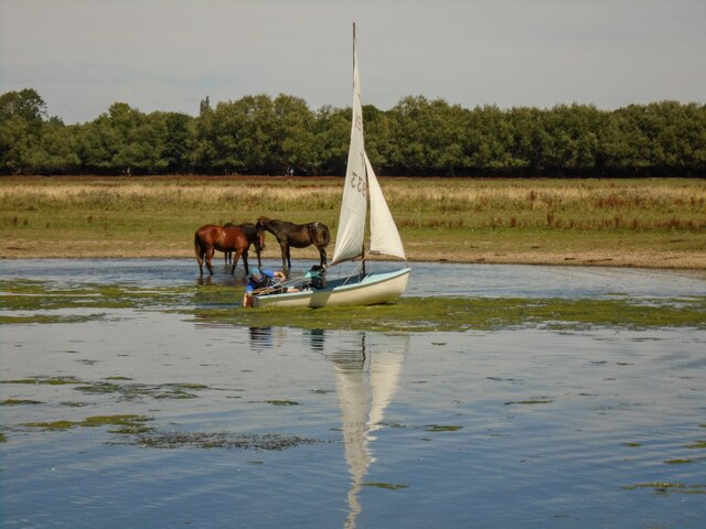
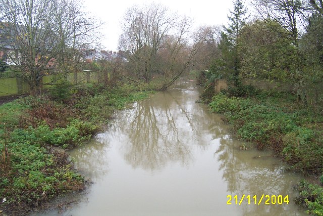
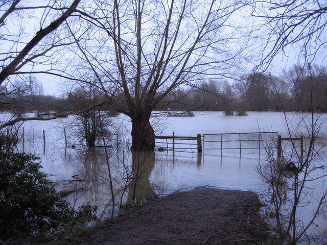
Wareham Stream is a freshwater body located in Oxfordshire, England. Situated in the heart of the picturesque countryside, it is classified as a lake and spans an area of approximately 8 acres. The stream is fed by numerous small tributaries, resulting in a constant flow of freshwater.

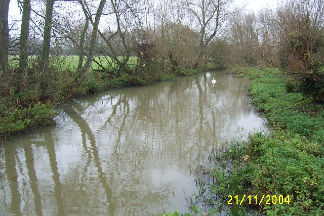
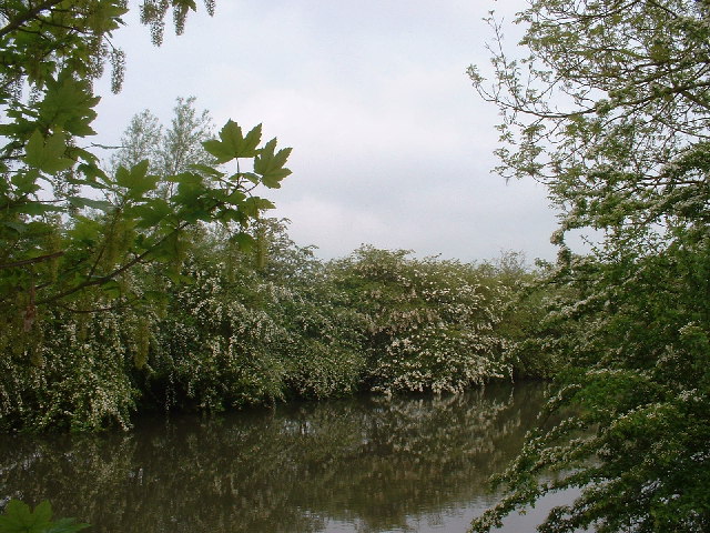
Surrounded by lush greenery and dense vegetation, Wareham Stream serves as a vital habitat for various flora and fauna. The water is crystal clear and teeming with life, providing a perfect environment for aquatic plants to thrive. Dense beds of reeds and lilies can be found along the edges of the stream, creating a beautiful natural border.

The stream is also home to a diverse range of aquatic animals. Fish species such as perch, roach, and pike can be found swimming beneath the surface, attracting anglers from far and wide. Additionally, the stream serves as a haven for waterfowl, including ducks and swans, which can be seen gracefully gliding across the water.

The surrounding area of the stream is a haven for wildlife enthusiasts and nature lovers. The stream's freshwater marshes provide a vital habitat for various bird species, attracting birdwatchers who come to spot rare and migratory birds. Additionally, the stream is surrounded by walking trails, allowing visitors to explore the serene countryside and take in the breathtaking views.

Wareham Stream is not only a natural beauty but also plays a crucial role in the local ecosystem. It acts as a water source for nearby farmlands, providing irrigation for crops and sustaining agricultural activities in the region. It is also an important water supply for the surrounding villages, ensuring a constant and reliable source of freshwater.

Overall, Wareham Stream is a tranquil and captivating freshwater body that offers not only a stunning visual experience but also supports the delicate balance of the local ecosystem.

If you have any feedback on the listing, please let us know in the comments section below.

Wareham Stream Images

Images are sourced within 2km of 51.752151/-1.2652786 or Grid Reference SP5006. Thanks to Geograph Open Source API. All images are credited.

St Lawrence Church
St Lawrence Church
Ferry Hinksey Road Spine road for the Osney Mead insutrial estate.
Ferry Hinksey Road
Spine road for the Osney Mead insutrial estate.
Horses in Thames amused by dinghy sailors Commoners' horses graze on Port Meadow, dinghy from Medley sailing club the other side of the Thames.
Horses in Thames amused by dinghy sailors
Commoners' horses graze on Port Meadow, dinghy from Medley sailing club the other side of the Thames.
Restoration Church, Helen Road, Osney Only a few years ago this was the Elim Chapel <a href="https://www.geograph.org.uk/photo/6217755">SP4906 : Elim Chapel, Helen Road</a> but it was probably not built as a church, as the 1921 map labels it a 'hall'. The style looks to be late 19th / early 20th century.
Restoration Church, Helen Road, Osney
Only a few years ago this was the Elim Chapel SP4906 : Elim Chapel, Helen Road but it was probably not built as a church, as the 1921 map labels it a 'hall'. The style looks to be late 19th / early 20th century.
Shops on Botley Road Currently comprising a cycle sales / repair business, high quality greengrocer and an antique shop specialising in Tuscan pottery. All very Oxford.
Shops on Botley Road
Currently comprising a cycle sales / repair business, high quality greengrocer and an antique shop specialising in Tuscan pottery. All very Oxford.
Binsey Lane bridge A narrow bridge taking a country lane over the Bulstake Stream, one of the many minor branches of the Thames around Oxford. <a href="https://www.geograph.org.uk/photo/6606806">SP4906 : Bridge over Bulstake Stream</a> shows it from the side.
Binsey Lane bridge
A narrow bridge taking a country lane over the Bulstake Stream, one of the many minor branches of the Thames around Oxford. SP4906 : Bridge over Bulstake Stream shows it from the side.
Binsey Lane A country lane from Osney to Binsey. There's something not quite right about those trees to the left: diseased, or badly pruned? The metal gates to the right are the access to an electricity substation.
Binsey Lane
A country lane from Osney to Binsey. There's something not quite right about those trees to the left: diseased, or badly pruned? The metal gates to the right are the access to an electricity substation.
DFS on Botley Road, Oxford I seem to remember DFS stands for Direct Furniture Services. I haven't been able to confirm it online.
DFS on Botley Road, Oxford
I seem to remember DFS stands for Direct Furniture Services. I haven't been able to confirm it online.
View across the Thames and bridge from the Towing Path Looking across the river toward Bossom's boatyard and Binsey from the towpath (seated at path level).
View across the Thames and bridge from the Towing Path
Looking across the river toward Bossom's boatyard and Binsey from the towpath (seated at path level).
Marina on the Thames near Binsey A view from the footpath over the Thames.
Marina on the Thames near Binsey
A view from the footpath over the Thames.
Medley Beer Garden by the Thames Not a pub, just a beer garden.
Medley Beer Garden by the Thames
Not a pub, just a beer garden.
North Hinksey Conduit House Roofed reservoir for Oxford's first water mains, built during the early 17th century.
North Hinksey Conduit House
Roofed reservoir for Oxford's first water mains, built during the early 17th century.
St Lawrence's Church, North Hinksey, Oxon. The church is built in the village within earshot of the busy A34 Oxford Ring-Road. Most of the building is dated to the 12th century with a tower added a century later. The fine mid-12th-century arch of the south door has chevron mouldings.
St Lawrence's Church, North Hinksey, Oxon.
The church is built in the village within earshot of the busy A34 Oxford Ring-Road. Most of the building is dated to the 12th century with a tower added a century later. The fine mid-12th-century arch of the south door has chevron mouldings.
Oxford: Bulstake Stream, New Botley Viewed looking upstream and northwards from the footbridge in the park.
Oxford: Bulstake Stream, New Botley
Viewed looking upstream and northwards from the footbridge in the park.
Hinksey Stream, North Hinksey Village Viewed looking downstream and south-eastwards from the footbridge behind The Fishes pub.
Hinksey Stream, North Hinksey Village
Viewed looking downstream and south-eastwards from the footbridge behind The Fishes pub.
The Thames at Oxford Early morning in May.
The Thames at Oxford
Early morning in May.
Botley across flooded field Looking NW from Willow Walk across flooded field to Botley
Botley across flooded field
Looking NW from Willow Walk across flooded field to Botley
Hinksey Floods Looking SEE from Willow Walk across flooded fields in North Hinksey
Hinksey Floods
Looking SEE from Willow Walk across flooded fields in North Hinksey
Show me another place!

Wareham Stream is located at Grid Ref: SP5006 (Lat: 51.752151, Lng: -1.2652786)

Administrative County: Oxfordshire

District: Oxford

Police Authority: Thames Valley

What 3 Words

///overnight.retire.bonds. Near Oxford, Oxfordshire

Related Wikis

Oxford Institute of Legal Practice

The Oxford Institute of Legal Practice (OXILP) was a law school based in Oxford, England, which specialised in teaching the Postgraduate Diploma in Legal...

Park End Street

Park End Street is a street in central Oxford, England, to the west of the centre of the city, close to the railway station at its western end. == Location... ==

Quaking Bridge

Quaking Bridge is a bridge over the Castle Mill Stream in the city of Oxford, England. It connects to St Thomas' Street and Paradise Street and Tidmarsh...

The Lighthouse in Oxford

The Lighthouse is a public house in central Oxford, England. The pub is located at 1 Park End Street, next to the Castle Mill Stream and close to the end...

Hythe Bridge Street

Hythe Bridge Street is in the west of central Oxford, England, forming part of the A4144 road. == History == There has been a road here since at least...

Oxford International College

Oxford International College (OIC) is an independent college based in central Oxford, United Kingdom for girls and boys from 14 to 18 years. The school...

Hythe Bridge

Hythe Bridge (formerly known as High Bridge) is a Victorian flat cast iron beamed bridge on Hythe Bridge Street in the west of central Oxford, England...

Oxford Castle

Oxford Castle is a large, partly ruined medieval castle on the western side of central Oxford in Oxfordshire, England. Most of the original moated, wooden...

Nearby Amenities

Located within 500m of 51.752151,-1.2652786
Traffic Signals
Source: local_knowledge
Lat/Long: 51.7484349/-1.261458
Traffic Signals
Source: survey
Lat/Long: 51.7527886/-1.2638501
Turning Circle
Turning Circle: hammer
Lat/Long: 51.7545424/-1.2694352
Mini Roundabout
Direction: clockwise
Source: photograph
Lat/Long: 51.7541107/-1.2677935
Maxspeed: 20 mph
Maxspeed Note: Oxford 20 mph zone
Maxspeed Spec: 10m E of jn w/ Abbey Rd
Lat/Long: 51.7525531/-1.271837
Created By: osm2go v0.6-6
Lat/Long: 51.7498603/-1.260194
Arts Centre
Modern Art Oxford
Addr City: Oxford
Addr Country: GB
Addr Housenumber: 30
Addr Postcode: OX1 1BP
Addr Street: Pembroke Street
Contact Email: info@modernartoxford.org.uk
Contact Facebook: https://www.facebook.com/modartoxford/
Opening Hours: Tu-Sa 11:00-18:00; Su 12:00-17:00
Phone: +44 1865 722733
Toilets Wheelchair: yes
Website: https://www.modernartoxford.org.uk/
Wheelchair: yes
Wikidata: Q3859943
Wikipedia: en:Modern Art Oxford
Lat/Long: 51.7508596/-1.2591806
Operator: Network Rail
Railway: switch
Lat/Long: 51.7518769/-1.2699211
Railway: switch
Lat/Long: 51.7503002/-1.2693719
Seamark Type: gate
Waterway: lock_gate
Lat/Long: 51.7559014/-1.269102
Waterway: weir
Lat/Long: 51.7515466/-1.2637154
Level: -1
Lat/Long: 51.7545039/-1.261892
Barrier: bollard
Lat/Long: 51.7522121/-1.2624312
Barrier: bollard
Lat/Long: 51.7509803/-1.2629193
Barrier: bollard
Bollard: removable
Lat/Long: 51.7510529/-1.2617465
Crossing
Button Operated: yes
Crossing: traffic_signals
Crossing Island: no
Crossing Ref: pelican
Lat/Long: 51.7484703/-1.2611028
Barrier: bollard
Bicycle: yes
Bollard: fixed
Foot: yes
Motor Vehicle: no
Lat/Long: 51.7519104/-1.2598949
Crossing: uncontrolled
Crossing Ref: zebra
Lat/Long: 51.7534853/-1.2696062
Main Entrance
Access: permissive
Entrance: main
Lat/Long: 51.7534655/-1.2697717
Pub
Three Goats Heads
Addr City: Oxford
Addr Housenumber: 3A
Addr Postcode: OX1 2DR
Addr Street: St Michael's Street
Check Date: 2024-04-21
Dailyinfo Venue Id: 473
Fhrs Id: 269382
Food: yes
Operator: Sam Smiths
Source Addr: FHRS Open Data
Wheelchair: no
Lat/Long: 51.7534413/-1.2591019
Restaurant
Bangkok House
Addr City: Oxford
Addr Housenumber: 42a
Addr Postcode: OX1 2EP
Addr Street: Hythe Bridge Street
Cuisine: thai
Fhrs Id: 268811
Phone: +44 1865 200705
Lat/Long: 51.7534475/-1.2659115
Fast Food
Gourmet Burger Kitchen
Addr City: Oxford
Addr Housenumber: 29-31
Addr Postcode: OX1 2AY
Addr Street: George Street
Brand: Gourmet Burger Kitchen
Brand Wikidata: Q5588445
Brand Wikipedia: en:Gourmet Burger Kitchen
Contact Website: https://restaurants.gbk.co.uk/oxford/oxford
Cuisine: burger
Diet Vegan: limited
Diet Vegetarian: yes
Fhrs Id: 268903
Level: 0
Opening Hours: Mo-Sa 11:30-23:00; Su 12:00-22:00
Operator: Gourmet Burger Kitchen
Short Name: GBK
Takeaway: yes
Wheelchair: no
Lat/Long: 51.753617/-1.2603506
Restaurant
Kaspa's
Addr Housenumber: 100-101
Addr Postcode: OX1 2DF
Addr Street: Gloucester Green
Branch: Desserts
Brand: Kaspa's
Brand Wikidata: Q24439133
Brand Wikipedia: en:Kaspa's
Cuisine: asian
Shop: confectionery
Website: https://kaspas.co.uk/location/oxford/
Lat/Long: 51.7543041/-1.2613962
Entrance: main
Level: 0
Lat/Long: 51.7508792/-1.2614282
Restaurant
Sichuan Grand
Addr Postcode: OX1 2DF
Addr Street: Gloucester Green
Check Date: 2024-04-21
Fhrs Id: 269258
Url: http://www.mysichuan.co.uk/
Lat/Long: 51.7545076/-1.2624617
Bike Zone
Addr City: Oxford
Addr Housenumber: 28-32
Addr Postcode: OX1 2EB
Addr Street: St Michael's Street
Opening Hours: Mo-Fr 08:00-18:00, Sa 09:00-18:00, Su 10:30-16:30
Phone: +441865728877
Shop: bicycle
Website: https://www.bike-zone.co.uk/
Lat/Long: 51.7532683/-1.260381
Post Box
Brand: Royal Mail
Brand Wikidata: Q638098
Brand Wikipedia: en:Royal Mail
Check Date Collection Times: 2019-03-08
Collection Times: Mo-Fr 17:30; Sa 11:00
Colour: red
Drive Through: no
Operator: Royal Mail
Operator Wikidata: Q638098
Post Box Apertures: 1
Post Box Type: pillar
Postal Code: OX1
Ref: OX1 37
Lat/Long: 51.7549021/-1.2613885
Liaison
Addr Housenumber: 29
Addr Postcode: OX1 1LJ
Addr Street: Castle Street
Cuisine: chinese
Disused Amenity: restaurant
Lat/Long: 51.7509823/-1.2617505
Restaurant
Nando's
Addr City: Oxford
Addr Housenumber: 77-79
Addr Postcode: OX1 2BQ
Addr Street: George Street
Brand: Nando's
Brand Wikidata: Q3472954
Brand Wikipedia: en:Nando's
Check Date: 2023-09-24
Cuisine: chicken;portuguese
Diet Vegan: no
Diet Vegetarian: yes
Fhrs Id: 269026
Operator: Nando's
Phone: +44 1865 727465
Website: https://www.nandos.co.uk/restaurants/oxford-george-street
Wheelchair: no
Lat/Long: 51.7534515/-1.2633304
Traffic Signals
Source: local_knowledge
Traffic Signals: pedestrian_crossing
Lat/Long: 51.7549304/-1.2630124
Pub
The Grapes
Addr City: Oxford
Addr Housenumber: 7
Addr Postcode: OX1 2AT
Addr Street: George Street
Dailyinfo Venue Id: 462
Lat/Long: 51.7537486/-1.2595821
The Brewery Gate
Addr Housenumber: 5
Addr Postcode: OX1 1JJ
Addr Street: St Thomas Street
Disused: yes
Disused Amenity: pub
Source: photograph
Lat/Long: 51.7516078/-1.2643798
Theatre
New Theatre
Addr City: Oxford
Addr Housename: The New Theatre
Addr Housenumber: 18-20
Addr Postcode: OX1 2AG
Addr Street: George Street
Fhrs Id: 268631
Source Addr: FHRS Open Data
Wheelchair: yes
Wikidata: Q15262100
Wikipedia: en:New Theatre Oxford
Lat/Long: 51.7538627/-1.2598378
Arts Centre
Old Fire Station
Alt Name: OFS
Check Date: 2024-04-21
Lat/Long: 51.7538165/-1.2621293
Bicycle Parking
Access: yes
Bicycle Parking: stands
Capacity: 24
Covered: no
Fee: no
Level: 0
Source: photograph;gps_survey
Lat/Long: 51.754301/-1.262556
Bicycle Parking
Bicycle Parking: stands
Capacity: 46
Check Date: 2023-08-18
Covered: no
Source: photograph;gps_survey
Lat/Long: 51.7541279/-1.2612424
Bicycle Parking
Bicycle Parking: stands
Capacity: 54
Covered: no
Source: photograph;gps_survey
Lat/Long: 51.7535401/-1.2614395
Bicycle Parking
Bicycle Parking: stands
Capacity: 12
Covered: no
Source: photograph;gps_survey
Lat/Long: 51.7532216/-1.2603705
Rewley Abbey
Historic: ruins
Source: local_knowledge
Wikidata: Q2147035
Wikipedia: en:Rewley Abbey
Lat/Long: 51.7543071/-1.2683555
Bicycle Parking
Bicycle Parking: stands
Capacity: 36
Check Date: 2022-05-01
Covered: no
Source: survey
Lat/Long: 51.7532022/-1.2696227
Bicycle Parking
Bicycle Parking: stands
Capacity: 24
Check Date: 2022-10-15
Covered: no
Source: survey
Lat/Long: 51.7536822/-1.2697794
Bicycle Parking
Capacity: 12
Lat/Long: 51.7548664/-1.2690207
Traffic Signals
Traffic Signals Direction: forward
Lat/Long: 51.7534053/-1.2635272
Bicycle Parking
Capacity: 5
Note: End hoop too close to wall so reduced space from 6 to 5
Source: photograph
Lat/Long: 51.7551171/-1.2613414
Bicycle Parking
Capacity: 10
Check Date: 2022-12-18
Covered: no
Source: photograph;gps_survey
Lat/Long: 51.7549774/-1.2629535
Source: Yahoo
Lat/Long: 51.7502427/-1.2590736
Bank
NatWest
Atm: yes
Brand: NatWest
Brand Wikidata: Q2740021
Brand Wikipedia: en:NatWest
Operator: NatWest
Website: https://www.natwest.com/search-results/locator/branch.html?sortcode=542123&name=Oxford%20Central
Wheelchair: yes
Lat/Long: 51.7533084/-1.2586235
Atm
Barclays
Brand: Barclays
Brand Wikidata: Q245343
Check Date: 2023-10-23
Currency GBP: yes
Operator: Barclays
Operator Wikidata: Q245343
Lat/Long: 51.752533/-1.2581974
Bicycle Parking
Capacity: 8
Source: survey
Lat/Long: 51.7528956/-1.2642018
Tesco Express
Addr Postcode: OX1 3AD
Addr Street: Magdalen Street
Brand: Tesco Express
Brand Wikidata: Q98456772
Contact Website: https://www.tesco.com/store-locator/oxford/magdalen-st
Fhrs Id: 269253
Not Shop: convenience
Opening Hours: Mo-Sa 07:00-24:00; Su 11:00-17:00
Phone: +44 845 0269682
Shop: supermarket
Wheelchair: limited
Lat/Long: 51.7544669/-1.2592052
Sainsbury's Local
Addr Housenumber: 7
Addr Postcode: OX1 3AD
Addr Street: Magdalen Street
Brand: Sainsbury's Local
Brand Wikidata: Q13218434
Brand Wikipedia: en:Sainsbury's Local
Opening Hours: Mo-Su 07:00-24:00
Shop: convenience
Website: https://stores.sainsburys.co.uk/4049/northgate-local
Wheelchair: yes
Lat/Long: 51.7542945/-1.2591266
Restaurant
Turtle Bay
Addr City: Oxford
Addr Housenumber: 11-12
Addr Postcode: OX1 2BY
Addr Street: Friars Entry
Cuisine: jamaican
Phone: +44 1865 242 141
Website: https://turtlebay.co.uk/restaurants/oxford
Lat/Long: 51.7544039/-1.2601659
Pub
Royal Blenheim
Addr City: Oxford
Addr Housenumber: 13
Addr Postcode: OX1 1PT
Addr Street: St Ebbes Street
Fhrs Id: 988122
Food: yes
Note: some services like kitchen and sundy alchol times are are subset see website for details. Site currently has sewing and quiz nights according to the website.
Opening Hours: Mo-Tu 12:00-23:00; We-Th 12:00-23:30; Fr-Sa 11:30-24:00; Su 11:30-22:00
Operator: White Horse Brewery
Real Ale: yes
Toilets Wheelchair: yes
Website: http://www.royalblenheim.co.uk/
Website Operator: http://www.breweryoxfordshire.co.uk/
Wheelchair: limited
Lat/Long: 51.7507753/-1.2593443
Created By: osm2go v0.5-5
Lat/Long: 51.751063/-1.2670288
Woodin's Shop
Shop: convenience
Lat/Long: 51.7513251/-1.2639581
Bicycle Parking
Bicycle Parking: stands
Capacity: 34
Covered: no
Fee: no
Lat/Long: 51.750681/-1.259673
Bicycle Parking
Bicycle Parking: stands
Capacity: 6
Covered: no
Fee: no
Lat/Long: 51.7505614/-1.2600282
Bicycle Parking
Capacity: 28
Lat/Long: 51.7498057/-1.2596371
Bicycle Parking
Access: yes
Bicycle Parking: stands
Capacity: 58
Covered: no
Fee: no
Lat/Long: 51.751351/-1.259763
Created By: osm2go v0.6-6
Lat/Long: 51.7503734/-1.2633726
Created By: osm2go v0.6-6
Lat/Long: 51.7508906/-1.2630582
Created By: osm2go v0.6-6
Lat/Long: 51.7508302/-1.2629038
Bicycle Parking
Bicycle Parking: stands
Capacity: 50
Covered: no
Created By: osm2go v0.6-6
Fee: no
Lat/Long: 51.751135/-1.262954
Bicycle Parking
Bicycle Parking: stands
Capacity: 24
Check Date: 2023-09-24
Covered: no
Fee: no
Lat/Long: 51.750967/-1.262951
Pub
The Swan & Castle
Addr City: Oxford
Addr County: Oxfordshire
Addr Postcode: OX1 1AY
Addr Street: Castle Street
Address1: Castle Street
Brand: Wetherspoon
Brand Wikidata: Q6109362
Brand Wikipedia: en:Wetherspoons
Contact Phone: 01865 260690
Contact Website: https://www.jdwetherspoon.com/pubs/all-pubs/england/oxfordshire/the-swan--castle-oxford
Diet Vegan: Yes
Diet Vegetarian: Yes
Fhrs Id: 269229
Food: yes
Note: Has TV screens
Opening Hours: Mo-Th 08:00-24:00; Fr-Sa 08:00-01:00; Su 08:00-12:00
Outdoor Seating: yes
Payment Debit Cards: Yes
Payment Mastercard: Yes
Payment Visa: Yes
Real Ale: yes
Source Addr: FHRS Open Data
Toilets: yes
Toilets Access: customers
Wheelchair: yes
Wikidata: Q88917761
Lat/Long: 51.7511201/-1.2616715
Addr City: Oxford
Addr Housenumber: 6
Addr Postcode: OX1 1AY
Addr Street: Oxford Castle, New Road
Disused Amenity: restaurant
Lat/Long: 51.7515086/-1.2620471
Bicycle Parking
Capacity: 48
Created By: osm2go v0.6-6
Lat/Long: 51.75177/-1.2621444
Prezzo
Addr City: Oxford
Addr Housenumber: 2
Addr Postcode: OX1 1AY
Addr Street: Oxford Castle, New Road
Brand: Prezzo
Brand Wikidata: Q7242489
Cuisine: italian
Disused Amenity: restaurant
Fhrs Id: 268669
Source Addr: FHRS Open Data
Wheelchair: yes
Lat/Long: 51.7519387/-1.2622709
Crossing
Crossing: traffic_signals
Crossing Ref: pelican
Lat/Long: 51.7490178/-1.2647489
Created By: osm2go v0.6-8
Lat/Long: 51.751865/-1.2622239
Atm
Brand: Lloyds Bank
Brand Wikidata: Q1152847
Operator: Lloyds Bank
Operator Wikidata: Q1152847
Lat/Long: 51.7515838/-1.2622167
Bicycle Parking
Capacity: 10
Created By: osm2go v0.6-7
Lat/Long: 51.7518471/-1.2627169
Cafe
Castleyard Café
Addr Housenumber: 45
Addr Postcode: OX1 1AY
Addr Street: Oxford Castle, New Road
Old Name: Café 1071
Lat/Long: 51.7518141/-1.2633443
Cafe
Dore Dore Bakery and Cafe
Addr City: Oxford
Addr Housenumber: 22
Addr Postcode: OX1 2DW
Addr Street: New Inn Hall Street
Cuisine: bakery;asian
Lat/Long: 51.7523678/-1.2600295
Cafe
George Street Social
Addr City: Oxford
Addr Housenumber: 35
Addr Postcode: OX1 2DH
Addr Street: New Inn Hall Street
Check Date: 2024-04-21
Cuisine: coffee_shop
Diet Vegan: limited
Diet Vegetarian: yes
Fhrs Id: 854391
Internet Access: wlan
Note: Coffee, Tea, Breakfast , Afternoon Tea
Old Name: Java&Co Independent Coffee Shop
Opening Hours: Mo-Fr 07:00 - 23:00, Sa 09:00-23:00, Su 09:00-23:00
Phone: +44 1865 204735
Smoking: no
Website: https://www.georgestreetsocial.com/
Wheelchair: limited
Lat/Long: 51.7535411/-1.2610652
Pub
Slug and Lettuce
Addr City: Oxford
Addr Housename: Oxford Castle
Addr Postcode: OX1 1AY
Addr Street: New Road
Addr Unit: 1
Brand: Slug & Lettuce
Brand Wikidata: Q7542224
Fhrs Id: 708562
Operator: Stonegate
Operator Wikidata: Q7619176
Source Addr: FHRS Open Data
Website: https://www.slugandlettuce.co.uk/oxford
Lat/Long: 51.7521347/-1.262214
Parking
Access: private
Lat/Long: 51.7517493/-1.2623689
Created By: osm2go v0.6-8
Lat/Long: 51.7518582/-1.2673073
Post Box
Brand: Royal Mail
Brand Wikidata: Q638098
Brand Wikipedia: en:Royal Mail
Collection Plate: CP1D
Collection Times: Mo-Fr 09:00; Sa 07:00
Operator: Royal Mail
Operator Wikidata: Q638098
Post Box Type: pillar
Postal Code: OX1
Ref: OX1 72D
Royal Cypher: GR
Royal Cypher Wikidata: Q33102273
Source: survey
Survey Date: 2013-02-23
Lat/Long: 51.7526034/-1.2679919
Telephone
Booth: KX100
Check Date: 2021-09-11
Covered: booth
Operator: BT
Operator Wikidata: Q593786
Payment Coins: yes
Payment Credit Cards: yes
Payment Debit Cards: yes
Source: photograph;Bing
Lat/Long: 51.7525888/-1.2677354
Post Box
Brand: Royal Mail
Brand Wikidata: Q638098
Brand Wikipedia: en:Royal Mail
Collection Times: Mo-Fr 19:15; Sa 12:00
Mail Meter: yes
Operator: Royal Mail
Operator Wikidata: Q638098
Post Box Apertures: 2
Post Box Type: wall
Postal Code: OX1
Ref: OX1 2002
Royal Cypher: no
Lat/Long: 51.7506182/-1.2671456
Bicycle Parking
Bicycle Parking: stands
Capacity: 30
Check Date: 2023-09-24
Covered: no
Fee: no
Lat/Long: 51.75218/-1.263776
Telephone
Booth: KX100
Covered: booth
Lat/Long: 51.7528795/-1.2640124
Sushimania
Addr Housenumber: 40-41
Addr Postcode: OX1 1JD
Addr Street: Park End Street
Cuisine: tapas
Disused Amenity: restaurant
Opening Hours: Mo-Fr 12:00-15:00,18:00-23:00; Sa,Su 12:00-23:00
Website: https://www.oxford.sushimania.co.uk/menu.aspx
Wheelchair: yes
Lat/Long: 51.7526613/-1.2651527
Nightclub
ATIK Oxford
Addr Postcode: OX1 1JD
Addr Street: Park End Street
Loc Name: Park End
Old Name: Park End Club
Opening Hours: Fr-Sa 22:00-03:00
Operator: Deltic Group
Smoking: outside
Website: https://www.atikclub.co.uk/oxford
Lat/Long: 51.7526452/-1.2656116
Pub
The Oxford Retreat
Addr City: Oxford
Addr Housenumber: 1-2
Addr Postcode: OX1 2TA
Addr Street: Hythe Bridge Street
Diet Vegan: limited
Diet Vegetarian: yes
Fhrs Id: 989695
Food: yes
Real Ale: yes
Source Addr: FHRS Open Data
Website: https://www.theoxfordretreat.com/
Wheelchair: yes
Lat/Long: 51.7533425/-1.2652021
Bicycle Parking
Bicycle Parking: stands
Capacity: 6
Covered: no
Fee: no
Lat/Long: 51.7536084/-1.265294
Bicycle Parking
Bicycle Parking: stands
Capacity: 30
Covered: no
Fee: no
Lat/Long: 51.7523941/-1.2622763
O3 Gallery
Shop: art
Lat/Long: 51.7510947/-1.2626345
Tirah Memorial
Historic: memorial
Man Made: obelisk
Memorial: war_memorial
Wikidata: Q7809085
Wikipedia: en:Tirah Memorial
Lat/Long: 51.7517423/-1.2600009
Telephone
Booth: K2
Covered: booth
Listed Status: Grade II
Man Made: telephone_box
Old Phone: +44 1865 791903
Lat/Long: 51.7519809/-1.2580581
Removed Amenity: telephone
Lat/Long: 51.7514019/-1.2597889
Toilets
Created By: osm2go v0.6-8
Wheelchair: no
Lat/Long: 51.7537065/-1.2623037
Eurobar Café & Hotel
Addr City: Oxford
Addr Housenumber: 48
Addr Postcode: OX1 2AQ
Addr Street: George Street
Check Date: 2024-04-21
Fhrs Id: 268628
Source Addr: FHRS Open Data
Tourism: hotel
Lat/Long: 51.7535655/-1.262646
Crossing
Crossing: uncontrolled
Crossing Ref: zebra
Lat/Long: 51.7537378/-1.2628664
Jamie's Italian
Addr Housenumber: 24-26
Addr Street: George Street
Check Date: 2022-05-01
Cuisine: italian
Disused Amenity: restaurant
Phone: +44 1865 838383
Website: https://www.jamieoliver.com/italian/restaurants/oxford
Wheelchair: yes
Lat/Long: 51.7537756/-1.2605203
Telephone
Booth: KX100
Check Date: 2022-05-01
Covered: booth
Payment Coins: yes
Lat/Long: 51.7537527/-1.2606995
Bicycle Parking
Bicycle Parking: stands
Capacity: 32
Check Date: 2023-08-18
Covered: no
Lat/Long: 51.7538247/-1.2607673
Disused Amenity: post_box
Operator: Royal Mail
Post Box Type: pillar
Postal Code: OX1
Ref: OX1 85
Royal Cypher: VR
Source: survey
Survey Date: 2013-02-18
Lat/Long: 51.7535148/-1.2616461
Restaurant
Côte Brasserie
Addr Housenumber: 41-47
Addr Street: George Street
Brand: Côte Brasserie
Brand Wikidata: Q48699908
Brand Wikipedia: en:Côte
Cuisine: french
Diet Gluten Free: yes
Diet Vegan: yes
Diet Vegetarian: yes
Smoking: no
Website: http://www.cote-restaurants.co.uk/Cote_Restaurant_Oxford.html
Wheelchair: yes
Lat/Long: 51.7534444/-1.2617999
Theatre
Old Fire Station Theatre
Check Date: 2024-04-21
Wikidata: Q7072486
Lat/Long: 51.7535626/-1.2622441
Restaurant
Zizzi
Addr City: Oxford
Addr Housenumber: 59
Addr Postcode: OX1 2BE
Addr Street: George Street
Brand: Zizzi
Brand Wikidata: Q8072944
Brand Wikipedia: en:Zizzi
Cuisine: italian
Diet Gluten Free: yes
Diet Vegan: yes
Diet Vegetarian: yes
Fhrs Id: 268629
Opening Hours: Mo-Sa 12:00-23:00; Su 12:00-22:30
Operator: Zizzi
Phone: +44 1865 202993
Website: https://www.zizzi.co.uk/italian/restaurants/oxford
Lat/Long: 51.753356/-1.2623797
Bicycle Parking
Capacity: 32
Lat/Long: 51.7532468/-1.2621883
Addr Housenumber: 73-75
Addr Postcode: OX1 2BQ
Addr Street: George Street
Old Name: Yo! Sushi
Was Amenity: restaurant
Lat/Long: 51.7534282/-1.2631468
Restaurant
GLUT
Addr Housenumber: 71
Addr Postcode: OX1 2BQ
Addr Street: George Street
Check Date: 2024-04-21
Diet Vegan: yes
Diet Vegetarian: yes
Level: 0
Wheelchair: yes
Lat/Long: 51.7534108/-1.2629992
Restaurant
Chutneys Indian Brasserie
Addr City: Oxford
Addr Housenumber: 36
Addr Postcode: OX1 2EB
Addr Street: St Michael's Street
Cuisine: indian
Fhrs Id: 269386
Phone: +44 1865 724241
Website: https://www.chutneysoxford.co.uk/
Wheelchair: no
Lat/Long: 51.7532183/-1.2605985
Bicycle Parking
Bicycle Parking: stands
Capacity: 30
Covered: no
Lat/Long: 51.7534272/-1.2594923
St Michael's Guest House
Addr Housenumber: 26
Addr Postcode: OX1 2EB
Addr Street: St Michael's Street
Tourism: guest_house
Wikidata: Q26321573
Lat/Long: 51.7533041/-1.2602209
Bicycle Parking
Capacity: 54
Lat/Long: 51.751678/-1.2615112
M&S Simply Food
Brand: M&S Simply Food
Brand Wikidata: Q714491
Brand Wikipedia: en:Marks & Spencer
Contact Website: https://www.marksandspencer.com/stores/oxford-rail-simply-food-120
Opening Hours: Mo-We 07:00-20:00; Th-Sa 07:00-22:00; Su 10:00-18:00
Shop: convenience
Source: local_knowledge
Wheelchair: yes
Lat/Long: 51.7532066/-1.2699836
Bicycle Parking
Capacity: 22
Created By: Potlatch 0.10f
Lat/Long: 51.7491525/-1.2601171
Bicycle Parking
Capacity: 28
Lat/Long: 51.7505294/-1.2593608
Bicycle Parking
Bicycle Parking: stands
Capacity: 6
Covered: no
Created By: Potlatch 0.10f
Fee: no
Lat/Long: 51.754491/-1.259846
Bicycle Parking
Bicycle Parking: stands
Capacity: 8
Check Date: 2022-05-01
Covered: no
Created By: Potlatch 0.10f
Lat/Long: 51.7533453/-1.2661184
Bicycle Parking
Access: private
Capacity: 28
Lat/Long: 51.7532932/-1.2657912
Bicycle Parking
Bicycle Parking: stands
Capacity: 18
Check Date Capacity: 2023-09-24
Covered: no
Fee: no
Source: Bing
Lat/Long: 51.7535432/-1.2637087
Crossing
Button Operated: yes
Crossing: traffic_signals
Crossing Island: no
Crossing Markings: dashes
Crossing Ref: pelican
Tactile Paving: yes
Traffic Signals Sound: yes
Traffic Signals Vibration: no
Lat/Long: 51.752577/-1.271608
Crossing
Kerb: lowered
Lat/Long: 51.7483152/-1.261508
Bus Stop
Park End Street
Bus: yes
Local Ref: D1
Naptan AtcoCode: 340002070D1
Naptan Bearing: E
Naptan CommonName: Park End Street
Naptan Indicator: Stop D1
Naptan Landmark: Stop D1
Naptan NaptanCode: oxfgwadt
Naptan PlusbusZoneRef: OXFD
Naptan Street: Park End Street
Park And Ride: 500
Public Transport: platform
Ref: D1
Route Ref: 1;4;4A;4B;4C;5;7;13;14;14A;280;400;500;S3;X3
Source: survey
Lat/Long: 51.7528132/-1.2651947
Bus Stop
Oxford Rail Station
Bench: yes
Bin: yes
Bus: yes
Lit: yes
Local Bearing: N
Local Ref: R2
Naptan AtcoCode: 340000006R2
Naptan CommonName: Railway Station
Naptan Indicator: Stop R2
Naptan Landmark: Stop R2
Naptan NaptanCode: oxfamjmj
Naptan PlusbusZoneRef: OXFD
Naptan Street: Station Forecourt
Public Transport: platform
Route Ref: 1;5
Shelter: yes
Short Route Ref: 1/5
Source: naptan_import
Tactile Paving: no
Lat/Long: 51.7533096/-1.269649
Bus Stop
Magdalen Street
Bench: yes
Bin: no
Bus: yes
Lit: yes
Local Ref: C1
Naptan AtcoCode: 340000005C1
Naptan Bearing: N
Naptan CommonName: Magdalen Street
Naptan Indicator: Stop C1
Naptan Landmark: Stop C1
Naptan NaptanCode: oxfamjgm
Naptan PlusbusZoneRef: OXFD
Naptan Street: Magdalen Street
Public Transport: platform
Route Ref: 2;2A;2B;2C;2D;N2
Shelter: yes
Short Route Ref: 2
Source: naptan_import;survey
Tactile Paving: no
Lat/Long: 51.754303/-1.2590142
Bench
Backrest: yes
Lat/Long: 51.7526318/-1.264915
Bench
Lat/Long: 51.7524396/-1.2648927
Bench
Backrest: no
Lat/Long: 51.7538808/-1.2651854
Bus Stop
Randolph Hotel
Bench: no
Bin: no
Bus: yes
Local Ref: W-Bound
Public Transport: platform
Shelter: no
Tour Bus Only: yes
Lat/Long: 51.7549836/-1.2605573
Bus Stop
Oxford Rail Station
Bench: yes
Bin: yes
Bus: yes
Lit: yes
Local Bearing: W
Local Ref: R1
Naptan AtcoCode: 340000006R1
Naptan CommonName: Railway Station
Naptan Indicator: Stop R1
Naptan Landmark: Stop R1
Naptan NaptanCode: oxfamjmp
Naptan PlusbusZoneRef: OXFD
Naptan Street: Station Forecourt
Public Transport: platform
Route Ref: 500
Shelter: yes
Source: naptan_import
Tactile Paving: no
Lat/Long: 51.7531137/-1.2694204
Bus Stop
Oxford Rail Station
Bench: yes
Bin: no
Bus: yes
Check Date: 2024-03-21
Lit: yes
Local Bearing: N
Local Ref: R3
Naptan AtcoCode: 340000006R3
Naptan CommonName: Railway Station
Naptan Indicator: Stop R3
Naptan Landmark: Stop R3
Naptan NaptanCode: oxfamjmg
Naptan PlusbusZoneRef: OXFD
Naptan Street: Station Forecourt
Note: X3 currently not running to station
Public Transport: platform
Route Ref: X3
Shelter: yes
Source: naptan_import
Tactile Paving: no
Lat/Long: 51.7535388/-1.2696854
Crossing: uncontrolled
Crossing Ref: zebra
Lat/Long: 51.7535066/-1.2694297
Crossing: uncontrolled
Crossing Ref: zebra
Lat/Long: 51.7535301/-1.2692349
Frideswide Square
Abandoned Highway: bus_stop
Local Ref: R8
Naptan AtcoCode: 340002070R8
Naptan Bearing: E
Naptan CommonName: Frideswide Square
Naptan Indicator: R8
Naptan Landmark: Stop R8
Naptan NaptanCode: oxfatwmt
Naptan PlusbusZoneRef: OXFD
Naptan Street: Frideswide Square
Ref: R8
Route Ref: 11;14;14A;17A;17C;44;63;66;280;S1;NS1;U1;NU1;X30;N30;31
Source: naptan_import;photograph
Lat/Long: 51.7527766/-1.2662004
Bus Stop
Gloucester Green Bus Station
Bench: yes
Bin: yes
Bus: yes
Level: 0
Lit: yes
Local Ref: 14
Naptan AtcoCode: 34000000014
Naptan CommonName: Gloucester Green Bus Station
Naptan Indicator: Bay 14
Naptan Landmark: Bay 14
Naptan NaptanCode: oxfgapma
Naptan PlusbusZoneRef: OXFD
Naptan Street: Gloucester Green
Public Transport: platform
Ref: Bay 14
Route Ref: CitySightseeing
Shelter: yes
Source: naptan_import;survey
Tactile Paving: no
Wheelchair: yes
Lat/Long: 51.754258/-1.2624366
Bus Stop
Gloucester Green Bus Station
Bench: yes
Bin: yes
Bus: yes
Level: 0
Lit: yes
Local Bearing: S
Local Ref: 13
Naptan AtcoCode: 34000000013
Naptan CommonName: Gloucester Green Bus Station
Naptan Indicator: Bay 13
Naptan Landmark: Bay 13
Naptan NaptanCode: oxfamgtp
Naptan PlusbusZoneRef: OXFD
Naptan Street: Gloucester Green
Note: unused
Public Transport: platform
Ref: Bay 13
Shelter: yes
Source: naptan_import;survey
Tactile Paving: no
Wheelchair: yes
Lat/Long: 51.7542258/-1.2624431
Bus Stop
Gloucester Green Bus Station
Bench: yes
Bin: no
Bus: yes
Level: 0
Lit: yes
Local Bearing: S
Local Ref: 10
Naptan AtcoCode: 34000000010
Naptan CommonName: Gloucester Green Bus Station
Naptan Indicator: Bay 10
Naptan Landmark: Bay 10
Naptan NaptanCode: oxfamgwd
Naptan PlusbusZoneRef: OXFD
Naptan Street: Gloucester Green
Note: also National Express
Public Transport: platform
Ref: Bay 10
Shelter: yes
Source: naptan_import;survey
Tactile Paving: no
Wheelchair: yes
Lat/Long: 51.7541201/-1.2624658
Bus Stop
Gloucester Green Bus Station
Bench: yes
Bin: yes
Bus: yes
Level: 0
Lit: yes
Local Bearing: S
Local Ref: 9
Naptan AtcoCode: 34000000009
Naptan CommonName: Gloucester Green Bus Station
Naptan Indicator: Bay 9
Naptan Landmark: Bay 9
Naptan NaptanCode: oxfamgwg
Naptan PlusbusZoneRef: OXFD
Naptan Street: Gloucester Green
Public Transport: platform
Ref: Bay 9
Route Ref: National Express
Shelter: yes
Source: naptan_import;survey
Tactile Paving: no
Wheelchair: yes
Lat/Long: 51.7540801/-1.2624746
Bus Stop
Gloucester Green Bus Station
Bench: yes
Bin: yes
Bus: yes
Level: 0
Lit: yes
Local Bearing: S
Local Ref: 8
Naptan AtcoCode: 34000000008
Naptan CommonName: Gloucester Green Bus Station
Naptan Indicator: Bay 8
Naptan Landmark: Bay 8
Naptan NaptanCode: oxfamgwj
Naptan PlusbusZoneRef: OXFD
Naptan Street: Gloucester Green
Note: S1 also calls in the evening
Public Transport: platform
Ref: Bay 8
Route Ref: S2;S3
Shelter: yes
Source: naptan_import;survey
Tactile Paving: no
Wheelchair: yes
Lat/Long: 51.7540479/-1.2624811
Bus Stop
Gloucester Green Bus Station
Bench: yes
Bin: yes
Bus: yes
Level: 0
Lit: yes
Local Bearing: S
Local Ref: 7
Naptan AtcoCode: 34000000007
Naptan CommonName: Gloucester Green Bus Station
Naptan Indicator: Bay 7
Naptan Landmark: Bay 7
Naptan NaptanCode: oxfamgwm
Naptan PlusbusZoneRef: OXFD
Naptan Street: Gloucester Green
Public Transport: platform
Ref: Bay 7
Route Ref: X70
Shelter: yes
Source: naptan_import;survey
Tactile Paving: no
Wheelchair: yes
Lat/Long: 51.754011/-1.2624886
Bus Stop
Gloucester Green Bus Station
Bench: yes
Bin: yes
Bus: yes
Level: 0
Lit: yes
Local Bearing: S
Local Ref: 6
Naptan AtcoCode: 34000000006
Naptan CommonName: Gloucester Green Bus Station
Naptan Indicator: Bay 6
Naptan Landmark: Bay 6
Naptan NaptanCode: oxfamgwp
Naptan PlusbusZoneRef: OXFD
Naptan Street: Gloucester Green
Public Transport: platform
Ref: Bay 6
Route Ref: X80
Shelter: yes
Source: naptan_import;survey
Tactile Paving: no
Wheelchair: yes
Lat/Long: 51.7539753/-1.2624972
Bus Stop
Gloucester Green Bus Station
Bench: yes
Bin: yes
Bus: yes
Level: 0
Lit: yes
Local Bearing: S
Local Ref: 4
Naptan AtcoCode: 34000000004
Naptan CommonName: Gloucester Green Bus Station
Naptan Indicator: Bay 4
Naptan Landmark: Bay 4
Naptan NaptanCode: oxfamjad
Naptan PlusbusZoneRef: OXFD
Naptan Street: Gloucester Green
Public Transport: platform
Ref: Bay 4
Shelter: yes
Source: naptan_import;survey
Tactile Paving: no
Wheelchair: yes
Lat/Long: 51.7538907/-1.2625159
Bus Stop
Gloucester Green Bus Station
Bench: yes
Bin: yes
Bus: yes
Level: 0
Lit: yes
Local Bearing: S
Local Ref: 2
Naptan AtcoCode: 34000000002
Naptan CommonName: Gloucester Green Bus Station
Naptan Indicator: Bay 2
Naptan Landmark: Bay 2
Naptan NaptanCode: oxfagwdw
Naptan PlusbusZoneRef: OXFD
Naptan Street: Gloucester Green
Public Transport: platform
Ref: Baay 2
Shelter: yes
Source: naptan_import;survey
Tactile Paving: no
Wheelchair: yes
Lat/Long: 51.7538006/-1.2625344
Bus Stop
George Street
Bench: no
Bin: no
Bus: yes
Lit: yes
Local Ref: A2
Naptan AtcoCode: 340000864A2
Naptan Bearing: W
Naptan CommonName: George Street
Naptan Indicator: Stop A2
Naptan Landmark: Stop A2
Naptan NaptanCode: oxfapjap
Naptan PlusbusZoneRef: OXFD
Naptan ShortCommonName: George Street
Naptan Street: George Street
Park And Ride: 300
Public Transport: platform
Ref: 69327527
Route Ref: 300
Shelter: no
Source: naptan_import
Lat/Long: 51.7537057/-1.2600825
Bus Stop
George Street
Bench: no
Bin: no
Bus: yes
Lit: yes
Local Ref: A3
Naptan AtcoCode: 340000864A3
Naptan Bearing: W
Naptan CommonName: George Street
Naptan Indicator: Stop A3
Naptan Landmark: Stop A3
Naptan NaptanCode: oxfapgtj
Naptan PlusbusZoneRef: OXFD
Naptan Street: George Street
Public Transport: platform
Ref: 69327485
Route Ref: S1;NS1
Shelter: no
Short Route Ref: S1
Source: naptan_import
Lat/Long: 51.7536738/-1.2603256
Bus Stop
Park End Street
Bench: no
Bin: yes
Bus: yes
Lit: yes
Local Ref: E-Bound
Naptan AtcoCode: 340002070DCS
Naptan NaptanCode: oxfgwdma
Public Transport: platform
Route Ref: CitySightseeing
Shelter: no
Tactile Paving: no
Tour Bus Only: yes
Lat/Long: 51.7527905/-1.2665693
Barrier: bollard
Lat/Long: 51.7510747/-1.2642262
Crossing
Crossing: uncontrolled
Crossing Island: no
Crossing Ref: zebra
Kerb: lowered
Tactile Paving: yes
Lat/Long: 51.7517319/-1.2608368
Pub
The Four Candles
Addr City: Oxford
Addr Country: GB
Addr Housenumber: 51-53
Addr Postcode: OX1 2BE
Addr Street: George Street
Brand: Wetherspoon
Brand Wikidata: Q6109362
Brand Wikipedia: en:Wetherspoons
Dailyinfo Venue Id: 620
Diet Vegan: yes
Diet Vegetarian: yes
Fhrs Id: 269058
Food: yes
Opening Hours: Mo-We 09:00-23:00; Th-Sa 09:00-01:00; Su 09:00-24:00
Phone: +44 1865 263110
Website: https://www.jdwetherspoon.com/pubs/all-pubs/england/oxfordshire/the-four-candles-oxford
Wheelchair: limited
Wikidata: Q88917759
Lat/Long: 51.7533993/-1.2620909
Fast Food
McDonald's
Addr City: Oxford
Addr Housenumber: 57
Addr Postcode: OX1 3HB
Addr Street: Cornmarket Street
Brand: McDonald's
Brand Wikidata: Q38076
Brand Wikipedia: en:McDonald's
Contact Website: https://www.mcdonalds.com/gb/en-gb/location/oxford/oxford/57-cornmarket-street/8260155.html
Cuisine: burger
Drive Through: no
Fhrs Id: 268487
Operator: McDonald's
Source Addr: FHRS Open Data
Takeaway: yes
Lat/Long: 51.752373/-1.2581493
Fast Food
KFC
Addr City: Oxford
Addr Country: GB
Addr Housenumber: 35
Addr Postcode: OX1 3EZ
Addr Street: Cornmarket Street
Alt Name: Kentucky Fried Chicken
Brand: KFC
Brand Wikidata: Q524757
Brand Wikipedia: en:KFC
Contact Website: https://www.kfc.co.uk/kfc-near-me/oxford-cornmarket-street
Cuisine: chicken
Drive Through: no
Fhrs Id: 1065520
Source Addr: FHRS Open Data
Takeaway: yes
Wheelchair: limited
Wikidata: Q26586944
Lat/Long: 51.7537492/-1.2588583
Maxspeed: 20 mph
Maxspeed Note: Oxford 20 mph zone
Lat/Long: 51.7506972/-1.2670028
Maxspeed: 20 mph
Maxspeed Note: Oxford 20 mph zone
Lat/Long: 51.7509396/-1.2671098
Barrier: cycle_barrier
Lat/Long: 51.7483878/-1.2635728
Barrier: cycle_barrier
Cycle Barrier: double
Fixme: position very approximate
Source: photograph
Lat/Long: 51.7485158/-1.2625903
Post Box
Brand: Royal Mail
Brand Wikidata: Q638098
Brand Wikipedia: en:Royal Mail
Check Date: 2021-11-27
Collection Times: Mo-Fr 17:30, Sa 11:00
Operator: Royal Mail
Operator Wikidata: Q638098
Post Box Type: pillar
Ref: OX1 9
Royal Cypher: EIIR
Royal Cypher Wikidata: Q33102113
Source: survey
Lat/Long: 51.7535639/-1.2700965
Bus Stop
Gloucester Green Bus Station
Bench: yes
Bin: yes
Bus: yes
Level: 0
Lit: yes
Local Bearing: S
Local Ref: 3
Naptan AtcoCode: 34000000003
Naptan CommonName: Gloucester Green Bus Station
Naptan Indicator: Bay 3
Naptan Landmark: Bay 3
Naptan NaptanCode: oxfamjag
Naptan PlusbusZoneRef: OXFD
Naptan Street: Gloucester Green
Note: middle of the three bays they seem to occupy
Public Transport: platform
Ref: Bay 3
Route Ref: Tube
Shelter: yes
Source: naptan_import;survey
Tactile Paving: no
Wheelchair: yes
Lat/Long: 51.7538414/-1.2625248
Bus Stop
Gloucester Green Bus Station
Bench: yes
Bin: yes
Bus: yes
Level: 0
Lit: yes
Local Bearing: S
Local Ref: 5
Naptan AtcoCode: 34000000005
Naptan CommonName: Gloucester Green Bus Station
Naptan Indicator: Bay 5
Naptan Landmark: Bay 5
Naptan NaptanCode: oxfamgwt
Naptan PlusbusZoneRef: OXFD
Naptan Street: Gloucester Green
Public Transport: platform
Ref: Bay 5
Route Ref: X90
Shelter: yes
Source: naptan_import;survey
Tactile Paving: no
Wheelchair: yes
Lat/Long: 51.7539347/-1.2625045
Bus Stop
Gloucester Green Bus Station
Bench: yes
Bin: yes
Bus: yes
Level: 0
Lit: yes
Local Bearing: S
Local Ref: 11
Naptan AtcoCode: 34000000011
Naptan CommonName: Gloucester Green Bus Station
Naptan Indicator: Bay 11
Naptan Landmark: Bay 11
Naptan NaptanCode: oxfamgwa
Naptan PlusbusZoneRef: OXFD
Naptan Street: Gloucester Green
Public Transport: platform
Ref: Bay 11
Route Ref: X5;66
Shelter: yes
Source: naptan_import;survey
Tactile Paving: no
Wheelchair: yes
Lat/Long: 51.754154/-1.2624583
Bus Stop
Gloucester Green Bus Station
Bench: yes
Bin: yes
Bus: yes
Level: 0
Lit: yes
Local Bearing: S
Local Ref: 12
Naptan AtcoCode: 34000000012
Naptan CommonName: Gloucester Green Bus Station
Naptan Indicator: Bay 12
Naptan Landmark: Bay 12
Naptan NaptanCode: oxfamgtw
Naptan PlusbusZoneRef: OXFD
Naptan Street: Gloucester Green
Public Transport: platform
Ref: Bay 12
Shelter: yes
Source: naptan_import;survey
Tactile Paving: no
Wheelchair: yes
Lat/Long: 51.7541922/-1.2624509
Bus Stop
Magdalen Street
Bench: yes
Bin: yes
Bus: yes
Lit: yes
Local Ref: C2
Naptan AtcoCode: 340000005C2
Naptan Bearing: N
Naptan CommonName: Magdalen Street
Naptan Indicator: Stop C2
Naptan Landmark: Stop C2
Naptan NaptanCode: oxfamgtm
Naptan PlusbusZoneRef: OXFD
Naptan Street: Magdalen Street
Park And Ride: 300
Public Transport: platform
Route Ref: 300
Shelter: yes
Short Route Ref: 300
Source: naptan_import;survey
Tactile Paving: no
Lat/Long: 51.7545316/-1.2591199
Bus Stop
Oxford Rail Station
Bench: yes
Bin: no
Bus: yes
Lit: yes
Local Bearing: N
Local Ref: R4
Naptan AtcoCode: 340000006R4
Naptan CommonName: Railway Station
Naptan Indicator: Stop R4
Naptan Landmark: Stop R4
Naptan NaptanCode: oxfamjmd
Naptan PlusbusZoneRef: OXFD
Naptan Street: Station Forecourt
Note: 13 currently not running to station
Public Transport: platform
Route Ref: 13; 14
Shelter: no
Short Route Ref: 14
Source: naptan_import
Tactile Paving: no
Lat/Long: 51.7536972/-1.2697663
Bus Stop
Oxford Rail Station stop R5
Bench: yes
Bin: yes
Bus: yes
Lit: yes
Local Bearing: N
Local Ref: R5
Naptan AtcoCode: 340000006R5
Naptan CommonName: Railway Station
Naptan Indicator: Stop R5
Naptan Landmark: Stop R5
Naptan NaptanCode: oxfamjma
Naptan PlusbusZoneRef: OXFD
Naptan Street: Station Forecourt
Public Transport: platform
Route Ref: 7;280;S3
Shelter: yes
Short Route Ref: 7 S3
Source: naptan_import
Tactile Paving: no
Lat/Long: 51.7533884/-1.2694569
Bus Stop
Oxford Rail Station
Bench: yes
Bin: yes
Bus: yes
Lit: yes
Local Bearing: N
Local Ref: R6
Naptan AtcoCode: 340000006R6
Naptan CommonName: Railway Station
Naptan Indicator: Stop R6
Naptan Landmark: Stop R6
Naptan NaptanCode: oxfamjgw
Naptan PlusbusZoneRef: OXFD
Naptan Street: Station Forecourt
Public Transport: platform
Route Ref: CitySightseeing
Shelter: yes
Source: naptan_import
Tactile Paving: no
Lat/Long: 51.7536151/-1.2695161
Bus Stop
Westgate
Bench: yes
Bus: yes
Local Ref: E1
Naptan AtcoCode: 340002072E1
Naptan Bearing: N
Naptan CommonName: Westgate
Naptan Indicator: Stop E1
Naptan Landmark: Stop E1
Naptan NaptanCode: oxfgwagt
Naptan PlusbusZoneRef: OXFD
Naptan Street: Norfolk Street
Note: inbound
Old Name: Castle Street
Public Transport: platform
Route Ref: 3
Shelter: yes
Source: survey
Tactile Paving: no
Lat/Long: 51.7500168/-1.2621104
Disused Highway: bus_stop
Local Ref: E3
Naptan AtcoCode: 34000000703
Naptan Bearing: NE
Naptan CommonName: Castle Street
Naptan Indicator: Stop E3
Naptan Landmark: Stop E3
Naptan NaptanCode: oxfamjam
Naptan PlusbusZoneRef: OXFD
Naptan Street: Castle Street
Note: S5 omitted since very infrequent extension
Old Name: Castle Street
Ref: 69326526
Route Ref: 8;9;N8
Short Route Ref: 8/9
Source: naptan_import
Lat/Long: 51.7516003/-1.2609577
Queen Street
Disused Highway: bus_stop
Local Ref: F1
Naptan AtcoCode: 340000056F1
Naptan Bearing: E
Naptan CommonName: Queen Street
Naptan Indicator: Stop F1
Naptan Landmark: Stop F1
Naptan NaptanCode: oxfamgdp
Naptan PlusbusZoneRef: OXFD
Naptan Street: Queen Street
Naptan Verified: no
Source: naptan_import
Lat/Long: 51.7516656/-1.2594769
Queen Street
Disused Highway: bus_stop
Local Ref: F2
Naptan AtcoCode: 340000056F2
Naptan Bearing: E
Naptan CommonName: Queen Street
Naptan Indicator: Stop F2
Naptan Landmark: Stop F2
Naptan NaptanCode: oxfamdpt
Naptan PlusbusZoneRef: OXFD
Naptan Street: Queen Street
Naptan Verified: no
Source: naptan_import
Lat/Long: 51.7516709/-1.2592623
Queen Street
Disused Highway: bus_stop
Local Ref: F3
Naptan AtcoCode: 340000056F3
Naptan Bearing: E
Naptan CommonName: Queen Street
Naptan Indicator: Stop F3
Naptan Landmark: Stop F3
Naptan NaptanCode: oxfamgmd
Naptan PlusbusZoneRef: OXFD
Naptan Street: Queen Street
Naptan Verified: no
Source: naptan_import
Lat/Long: 51.7517187/-1.2590305
Queen Street
Disused Highway: bus_stop
Local Ref: F4
Naptan AtcoCode: 340000056F4
Naptan Bearing: E
Naptan CommonName: Queen Street
Naptan Indicator: Stop F4
Naptan Landmark: Stop F4
Naptan NaptanCode: oxfamgma
Naptan PlusbusZoneRef: OXFD
Naptan Street: Queen Street
Naptan Verified: no
Source: naptan_import
Lat/Long: 51.7517506/-1.2587645
Queen Street
Disused Highway: bus_stop
Local Ref: F5
Naptan AtcoCode: 340000056F5
Naptan Bearing: E
Naptan CommonName: Queen Street
Naptan Indicator: Stop F5
Naptan Landmark: Stop F5
Naptan NaptanCode: oxfamgjw
Naptan PlusbusZoneRef: OXFD
Naptan Street: Queen Street
Naptan Verified: no
Source: naptan_import
Lat/Long: 51.751794/-1.2584538
Queen Street
Disused Highway: bus_stop
Local Ref: F6
Naptan AtcoCode: 340000056F6
Naptan Bearing: E
Naptan CommonName: Queen Street
Naptan Indicator: Stop F6
Naptan Landmark: Stop F6
Naptan NaptanCode: oxfamgjt
Naptan PlusbusZoneRef: OXFD
Naptan Street: Queen Street
Naptan Verified: no
Source: naptan_import
Lat/Long: 51.7518226/-1.2582063
Bus Stop
George Street
Bench: no
Bin: no
Bus: yes
Lit: yes
Local Ref: A1
Naptan AtcoCode: 340000864A1
Naptan Bearing: W
Naptan CommonName: George Street
Naptan Indicator: Stop A1
Naptan Landmark: Stop A1
Naptan NaptanCode: oxfapjat
Naptan PlusbusZoneRef: OXFD
Naptan Street: George Street
Public Transport: platform
Ref: 69327528
Route Ref: 14;14A;17;17A;17C;218;S2;S3
Shelter: no
Source: naptan_import
Tactile Paving: no
Lat/Long: 51.7538135/-1.2595012
Bus Stop
George Street
Bench: yes
Bin: no
Bus: yes
Local Ref: A5
Naptan AtcoCode: 340000864A5
Naptan Bearing: W
Naptan CommonName: George Street
Naptan Indicator: Stop A5
Naptan Landmark: Stop A5
Naptan NaptanCode: oxfapjaj
Naptan PlusbusZoneRef: OXFD
Naptan Street: George Street
Park And Ride: 300
Public Transport: platform
Ref: 69327525
Route Ref: 14;14A;17;17A;17C;300;S1;S3;NS1
Shelter: yes
Source: naptan_import
Lat/Long: 51.7534537/-1.2625271
Bus Stop
George Street
Bench: no
Bin: no
Bus: yes
Lit: yes
Local Ref: B1
Naptan AtcoCode: 340000864B1
Naptan Bearing: E
Naptan CommonName: George Street
Naptan Indicator: Stop B1
Naptan Landmark: Stop B1
Naptan NaptanCode: oxfapjgj
Naptan PlusbusZoneRef: OXFD
Naptan Street: George Street
Park And Ride: 300
Public Transport: platform
Ref: 69327545
Route Ref: 14;14A;17;17A;17C;18;18A;218;300;S1
Shelter: no
Source: naptan_import
Lat/Long: 51.7535219/-1.2622956
Bus Stop
George Street
Bench: no
Bin: no
Bus: yes
Lit: yes
Local Ref: B3
Naptan AtcoCode: 340000864B2
Naptan Bearing: E
Naptan CommonName: George Street
Naptan Indicator: Stop B3
Naptan Landmark: Stop B3
Naptan NaptanCode: oxfapjad
Naptan PlusbusZoneRef: OXFD
Naptan Street: George Street
Public Transport: platform
Ref: 69327523
Route Ref: 7;S2;S3
Shelter: no
Short Route Ref: S2 S3
Source: naptan_import
Lat/Long: 51.7539177/-1.2594786
Bus Stop
Westgate
Bus: yes
Local Ref: E7
Naptan AtcoCode: 340002071F2
Naptan Bearing: NW
Naptan CommonName: Westgate
Naptan Indicator: Stop E7
Naptan Landmark: Castle mound
Naptan NaptanCode: oxfgwagm
Naptan PlusbusZoneRef: OXFD
Naptan ShortCommonName: New Road E7
Naptan Street: New Road
Old Name: County Hall
Public Transport: platform
Route Ref: S9;U1
Short Route Ref: U1
Source: survey
Lat/Long: 51.7520882/-1.2617936
Bus Stop
New Road
Bench: yes
Bin: yes
Bus: yes
Lit: yes
Local Ref: D2
Naptan AtcoCode: 340002070D2
Naptan Bearing: SE
Naptan CommonName: New Road
Naptan Indicator: Stop D2
Naptan Landmark: Castle mound
Naptan NaptanCode: oxfgwadw
Naptan PlusbusZoneRef: OXFD
Naptan ShortCommonName: New Road D2
Naptan Street: New Road
Public Transport: platform
Ref: unknown
Route Ref: 13;X3
Shelter: yes
Short Route Ref: 13 X3
Source: naptan_import
Tactile Paving: no
Lat/Long: 51.7526214/-1.2630565
Bus Stop
New Road
Bus: yes
Local Ref: D3
Naptan AtcoCode: 340002070D3
Naptan Bearing: SE
Naptan CommonName: New Road
Naptan Indicator: Stop D3
Naptan Landmark: Castle mound
Naptan NaptanCode: oxfgwaga
Naptan PlusbusZoneRef: OXFD
Naptan ShortCommonName: New Road D3
Naptan Street: New Road
Public Transport: platform
Route Ref: CitySightseeing
Source: naptan_import
Tour Bus Only: yes
Lat/Long: 51.7525418/-1.262806
Bus Stop
New Road
Bench: yes
Bin: no
Bus: yes
Lit: yes
Local Ref: D4
Naptan AtcoCode: 340002070D4
Naptan Bearing: SE
Naptan CommonName: New Road
Naptan Indicator: Stop D4
Naptan Landmark: castle mound
Naptan NaptanCode: oxfgwagd
Naptan PlusbusZoneRef: OXFD
Naptan ShortCommonName: New Road D4
Naptan Street: New Road
Public Transport: platform
Ref: unknown
Route Ref: 11;S9
Shelter: yes
Short Route Ref: S9
Source: survey
Tactile Paving: no
Lat/Long: 51.7523979/-1.2623346
Bus Stop
Ruskin College
Bus: yes
Naptan AtcoCode: 340001046OPP
Naptan Bearing: S
Naptan CommonName: Ruskin College
Naptan Indicator: Opposite
Naptan Landmark: Ruskin College
Naptan NaptanCode: oxfagdmp
Naptan PlusbusZoneRef: OXFD
Naptan Street: Walton Street
Naptan Verified: no
Public Transport: platform
Source: naptan_import
Lat/Long: 51.7557771/-1.2631892
Bus Stop
Ruskin College
Bench: no
Bin: yes
Bus: yes
Naptan AtcoCode: 340001046OUT
Naptan Bearing: N
Naptan CommonName: Ruskin College
Naptan Indicator: Outside
Naptan Landmark: Ruskin College
Naptan NaptanCode: oxfagdmj
Naptan PlusbusZoneRef: OXFD
Naptan Street: Walton Street
Public Transport: platform
Route Ref: 17;17A;17C
Shelter: no
Source: naptan_import
Lat/Long: 51.756157/-1.2633382
Bonn Square
Disused Highway: bus_stop
Local Ref: D4
Naptan AtcoCode: 340001915D4
Naptan Bearing: E
Naptan CommonName: Bonn Square D4
Naptan Crossing: Castle Street
Naptan Landmark: Bonn Square
Naptan NaptanCode: oxfgjapg
Naptan PlusbusZoneRef: OXFD
Naptan ShortCommonName: Bonn Square D4
Naptan Street: Bonn Square
Ref: 69345274
Route Ref: 3;3B;N3
Short Route Ref: 3
Source: naptan_import
Lat/Long: 51.7516049/-1.2601797
Bus Stop
Westgate
Bus: yes
Local Ref: E6
Naptan AtcoCode: 340002071F1
Naptan Bearing: NW
Naptan CommonName: Westgate
Naptan Indicator: Stop E6
Naptan Landmark: County Hall
Naptan NaptanCode: oxfgwagp
Naptan PlusbusZoneRef: OXFD
Naptan ShortCommonName: New Road E6
Naptan Street: New Road
Old Name: County Hall
Public Transport: platform
Ref: unknown
Route Ref: 4;4A;4B;4C
Short Route Ref: 4
Source: naptan_import
Lat/Long: 51.7520135/-1.2616139
Bus Stop
Frideswide Square
Bench: no
Bin: no
Bus: yes
Lit: yes
Local Ref: D6
Naptan AtcoCode: 340000009R9
Naptan Bearing: W
Naptan CommonName: Park End Street
Naptan Indicator: Stop D6
Naptan Landmark: Stop D6
Naptan NaptanCode: oxfgwadp
Naptan PlusbusZoneRef: OXFD
Naptan Street: Park End Street
Public Transport: platform
Route Ref: 5;7;13;14;14A;X3;280;500;S3
Set Down Only: yes
Shelter: no
Source: naptan_import;photograph
Tactile Paving: no
Lat/Long: 51.7526909/-1.2670249
Frideswide Square
Bench: yes
Bin: no
Bus: yes
Disused Highway: bus_stop
Disused Public Transport: platform
Lit: yes
Local Ref: R8
Naptan AtcoCode: 340002070R8
Naptan Bearing: W
Naptan CommonName: Frideswide Square
Naptan Indicator: R8
Naptan Landmark: Stop R8
Naptan NaptanCode: oxfatwmp
Naptan PlusbusZoneRef: OXFD
Naptan Street: Frideswide Square
Note: [2023-11-26] green county council bag: BUS STOP NOT IN USE
Park And Ride: 400
Ref: 69349234
Route Ref: 3B;4;4A;4B;4C;11;66;400;U1;NU1;X30;S1;NS1
Shelter: yes
Source: naptan_import;photograph
Lat/Long: 51.7527457/-1.2684944
Bus Stop
Westgate
Bus: yes
Local Ref: E8
Naptan AtcoCode: 340002074F3
Naptan Bearing: NW
Naptan NaptanCode: oxfgwatm
Old Name: County Hall
Public Transport: platform
Route Ref: 5;X3;13;280
Lat/Long: 51.7522059/-1.2621144
Crossing
Crossing: zebra
Crossing Island: no
Source: Bing
Tactile Paving: yes
Lat/Long: 51.7511497/-1.2671615
Crossing
Button Operated: yes
Crossing: traffic_signals
Crossing Ref: pelican
Traffic Signals Sound: yes
Traffic Signals Vibration: yes
Lat/Long: 51.7539966/-1.2589579
Place Of Worship
Catacombs Youth and Prayer Centre
Addr Housenumber: 12
Addr Street: Littlegate Street
Alt Name: Oxford Prayer Room and Youth Centre
Community Centre For: juvenile
Operator: St Aldates Church
Religion: christian
Source: Bing;local_knowledge
Source Name: photograph
Lat/Long: 51.7493108/-1.259761
Bicycle Parking
Bicycle Parking: stands
Capacity: 10
Covered: no
Created By: created_by
Fee: no
Lat/Long: 51.752244/-1.260052
Becket House B&B
Addr Housenumber: 5
Addr Postcode: OX1 1PP
Addr Street: Becket Street
Disused Tourism: guest_house
Phone: +44 1865 724675
Lat/Long: 51.7521313/-1.268827
Fast Food
Domino's
Addr City: Oxford
Addr Country: GB
Addr Housenumber: 18
Addr Postcode: OX1 1HU
Addr Street: Park End Street
Brand: Domino's
Brand Wikidata: Q839466
Brand Wikipedia: en:Domino's Pizza
Contact Phone: +44 1865 200222
Contact Website: https://www.dominos.co.uk/pizza-near-me/oxford/18-19-park-end-street
Cuisine: pizza
Fhrs Id: 269148
Takeaway: yes
Lat/Long: 51.7525133/-1.2688666
Fast Food
Dosa Park
Addr City: Oxford
Addr Housenumber: 25
Addr Postcode: OX1 1HU
Addr Street: Park End Street
Cuisine: indian
Drive Through: no
Fhrs Id: 269171
Outdoor Seating: yes
Phone: +44 1865 791197
Lat/Long: 51.7525435/-1.2680803
Finders Keepers
Addr Housenumber: 20-21
Addr Postcode: OX1 1HU
Addr Street: Park End Street
Cuisine: chinese
Phone: +44 1865 250988
Shop: estate_agent
Lat/Long: 51.752519/-1.268527
Emporium
Disused Amenity: nightclub
Note: updated the name for the winter term. I think it is similar management as the old website auto diverts to the new one but it could just be transfered in the same deal.
Operator: Oxford Leisure
Website: http://emporiumoxford.co.uk/
Lat/Long: 51.7508176/-1.2596335
SBS Common Room
Addr Postcode: OX1 1HP
Lat/Long: 51.7538837/-1.2685483
Addr City: Oxford
Addr Housenumber: 24
Addr Postcode: OX1 3EY
Addr Street: Cornmarket Street
Disused Amenity: fast_food
Old Name: Burger King
Takeaway: yes
Lat/Long: 51.7533195/-1.2582884
Pub
The Crown
Addr City: Oxford
Addr Housenumber: 59a
Addr Postcode: OX1 3HB
Addr Street: Cornmarket Street
Brand: Nicholson's
Brand Wikidata: Q113130666
Fhrs Id: 268488
Website: https://www.nicholsonspubs.co.uk/restaurants/southeast/thecrownoxford
Lat/Long: 51.7522047/-1.2583282
Post Box
Brand: Royal Mail
Brand Wikidata: Q638098
Brand Wikipedia: en:Royal Mail
Check Date: 2021-09-28
Collection Times: Mo-Fr 09:00; Sa 07:00
Operator: Royal Mail
Operator Wikidata: Q638098
Post Box Design: type_n
Post Box Type: lamp
Ref: OX1 24
Royal Cypher: EIIR
Royal Cypher Wikidata: Q33102113
Source: survey
Lat/Long: 51.7514515/-1.263894
Addr Housenumber: 67-69
Addr Street: George Street
Shop: vacant
Lat/Long: 51.7533992/-1.2628177
Restaurant
Pizza Hut
Addr City: Oxford
Addr Housenumber: 61-63
Addr Postcode: OX1 2BQ
Addr Street: George Street
Brand: Pizza Hut
Brand Wikidata: Q191615
Brand Wikipedia: en:Pizza Hut
Cuisine: pizza
Diet Vegetarian: yes
Fhrs Id: 268630
Source Addr: FHRS Open Data
Lat/Long: 51.7533701/-1.2625352
Cafe
Crisis Skylight Cafe
Check Date: 2024-04-21
Cuisine: sandwich
Lat/Long: 51.7535567/-1.2623561
Fast Food
Kebab Kid
Cuisine: kebab
Wheelchair: no
Wheelchair Description: 2 uneven steps to get in from the street
Lat/Long: 51.7537451/-1.2612004
Restaurant
Angrid Thai
Addr City: Oxford
Addr Housename: Threeways House
Addr Postcode: OX1 2BJ
Addr Street: George Street
Addr Unit: Unit D
Check Date: 2024-04-21
Cuisine: thai
Fhrs Id: 269224
Opening Hours: Su-Th 11:30-23:00; Fr-Sa 11:30-23:30
Phone: +44 1865 791898
Source: photograph
Source Addr: FHRS Open Data
Wheelchair: limited
Wheelchair Description: Restaurant is accessible from the street with no steps, however toilets are downstairs... Many steps.
Lat/Long: 51.7538069/-1.2612334
Pub
O'Neill's
Brand: O'Neill's
Brand Wikidata: Q7071905
Food: yes
Wheelchair: limited
Lat/Long: 51.7535341/-1.2607996
Restaurant
Chozen Noodle
Addr City: Oxford
Addr Housenumber: 22
Addr Postcode: OX1 2AG
Addr Street: George Street
Cuisine: asian
Level: 0
Old Name: La Croissanterie
Lat/Long: 51.753797/-1.2603457
Pub
Wig and Pen
Addr City: Oxford
Addr Housenumber: 9-13
Addr Postcode: OX1 2AU
Addr Street: George Street
Brand: Greene King
Brand Wikidata: Q5564162
Brand Wikipedia: en:Greene King
Diet Vegan: limited
Diet Vegetarian: yes
Fhrs Id: 268617
Operator: Greene King
Real Ale: yes
Source Addr Postcode: FHRS Open Data
Toilets: yes
Toilets Access: customers
Toilets Wheelchair: yes
Website: https://www.greeneking.co.uk/pubs/oxfordshire/wig-and-pen
Wheelchair: limited
Lat/Long: 51.7537177/-1.2597135
Restaurant
ASK Italian
Addr City: Oxford
Addr Housenumber: 5
Addr Postcode: OX1 2AT
Addr Street: George Street
Brand: ASK Italian
Brand Wikidata: Q4807056
Brand Wikipedia: en:ASK Italian
Cuisine: italian
Diet Vegan: yes
Diet Vegetarian: yes
Fhrs Id: 268615
Level: 0
Source Addr Postcode: FHRS Open Data
Website: https://www.askitalian.co.uk/italian/restaurants/oxford
Wheelchair: yes
Lat/Long: 51.753761/-1.2594773
Restaurant
Bella Italia
Addr City: Oxford
Addr Housenumber: 14-16
Addr Postcode: OX1 2AF
Addr Street: George Street
Brand: Bella Italia
Brand Wikidata: Q4883362
Brand Wikipedia: en:Bella Italia
Cuisine: italian
Diet Vegan: no
Diet Vegetarian: yes
Fhrs Id: 268618
Source Addr Postcode: FHRS Open Data
Website: https://www.bellaitalia.co.uk/italian-restaurant/oxford/george-street
Wheelchair: yes
Lat/Long: 51.7538971/-1.2596433
Fast Food
Mission Burrito
Addr City: Oxford
Addr Housenumber: 8
Addr Postcode: OX1 2DU
Addr Street: St Michael's Street
Check Date: 2024-04-21
Cuisine: mexican
Fhrs Id: 269384
Opening Hours: Mo-We 11:00-22:00; Th-Sa 11:00-23:00; Su 11:00-22:00
Phone: +44 1865 202016
Website: https://missionburrito.co.uk/stores/oxford-cornmarket/
Lat/Long: 51.7535353/-1.2592255
Bicycle Parking
Bicycle Parking: wall_loops
Capacity: 40
Covered: no
Lat/Long: 51.7489601/-1.2652675
The Nosebag
Addr City: Oxford
Addr Housenumber: 6-8
Addr Postcode: OX1 2DU
Addr Street: St Michael's Street
Disused Amenity: restaurant
Fhrs Id: 269383
Phone: +44 1865 721033
Wheelchair: no
Lat/Long: 51.7535519/-1.2591152
Oaks
Addr City: Oxford
Addr Street: St Ebbes Street
Disused Shop: clothes
Note: done recheck. Jessops closed their high-street shops durring the ression but like borders uk they are available online at http://www.jessops.com/
Source: semi suvey
Lat/Long: 51.7509075/-1.2594315
Cafe
BRICK @ Modern Art Oxford
Cuisine: bar;coffee_shop
Internet Access: yes
Operator: Modern Art Oxford
Outdoor Seating: no
Lat/Long: 51.7507854/-1.2592047
Crossing
Button Operated: yes
Crossing: traffic_signals
Crossing Island: yes
Crossing Note: no ped signal
Tactile Paving: yes
Traffic Signals Vibration: no
Lat/Long: 51.7549385/-1.2628738
Crossing
Button Operated: yes
Crossing: traffic_signals
Crossing Island: yes
Crossing Note: no ped signal
Tactile Paving: yes
Lat/Long: 51.7549978/-1.2630621
Crossing
Crossing: traffic_signals
Crossing Island: no
Crossing Ref: pelican
Source: local_knowledge
Tactile Paving: yes
Lat/Long: 51.7527972/-1.2639537
Crossing
Button Operated: yes
Crossing: traffic_signals
Crossing Island: no
Crossing Ref: puffin
Source: local_knowledge
Tactile Paving: yes
Traffic Signals Sound: no
Traffic Signals Vibration: yes
Lat/Long: 51.7535912/-1.2633291
Crossing
Button Operated: yes
Check Date Crossing: 2023-09-24
Crossing: traffic_signals
Crossing Island: no
Crossing Ref: pelican
Tactile Paving: yes
Traffic Signals Vibration: yes
Lat/Long: 51.7548015/-1.2631185
Crossing
Crossing: traffic_signals
Crossing Island: no
Crossing Ref: pelican
Source: local_knowledge
Tactile Paving: yes
Lat/Long: 51.7528628/-1.263808
Crossing
Button Operated: yes
Crossing: traffic_signals
Crossing Island: no
Crossing Ref: puffin
Source: local_knowledge
Tactile Paving: yes
Traffic Signals Sound: yes
Traffic Signals Vibration: no
Lat/Long: 51.7534805/-1.2635243
Crossing
Crossing: traffic_signals
Crossing Island: no
Crossing Ref: pelican
Source: local_knowledge
Tactile Paving: yes
Lat/Long: 51.7527712/-1.2637512
Crossing
Crossing: informal
Crossing Island: no
Kerb: flush
Tactile Paving: yes
Lat/Long: 51.7531753/-1.2674651
Access Hgv: @ (18:00-10:00)
Barrier: bollard
Bicycle: yes
Bollard: flexible
Fixme: check conditional tagging is ok. also cant see the bollard, just a width restriction
Foot: yes
Motorcar: no
Source: local_knowledge
Source 1: https://www.oxfordshire.gov.uk/cms/sites/default/files/folders/documents/roadsandtransport/traffic/lorryaccessmap.pdf
Lat/Long: 51.7535552/-1.2587385
Jiamart Chinese Supermarket
Shop: convenience
Lat/Long: 51.7522519/-1.2599867
Ecco
Brand: Ecco
Brand Wikidata: Q1280255
Brand Wikipedia: en:ECCO
Shop: shoes
Lat/Long: 51.7522906/-1.2599761
Building: university
Learning: oxford_college
Operator: Pembroke College
Lat/Long: 51.7501134/-1.2590877
Traffic Signals
Lat/Long: 51.7540551/-1.2588644
Barrier: lift_gate
Lat/Long: 51.7525015/-1.2632898
Level: 0
Lat/Long: 51.7544824/-1.2613438
Check Date: 2024-02-22
Disused Name: Debenhams
Disused Operator: Debenhams Retail plc
Disused Shop: department_store
Disused Wheelchair: yes
Lat/Long: 51.7540766/-1.2590274
Traffic Calming: table
Lat/Long: 51.7560447/-1.2632422
Barrier: lift_gate
Source: Bing
Lat/Long: 51.7518188/-1.2690855
Westgate Cafe
Door: hinged
Entrance: yes
Lat/Long: 51.7524921/-1.2710927
Atm
Brand: Cashzone
Brand Wikidata: Q110738461
Cash In: no
Fee: £1.95
Network: Allpoint
Network Wikidata: Q4733264
Opening Hours: 24/7
Operator: Cashzone
Lat/Long: 51.753948/-1.261313
Barrier: bollard
Lat/Long: 51.7506528/-1.2700317
Cafe
AMT Coffee
Addr City: Oxford
Addr Housename: St Michael's Church
Addr Postcode: OX1 3EY
Addr Street: Cornmarket Street
Brand: AMT Coffee
Brand Wikidata: Q80229
Brand Wikipedia: en:AMT Coffee
Cuisine: coffee_shop
Fhrs Id: 268490
Takeaway: yes
Website: http://amtcoffee.co.uk/
Lat/Long: 51.753645/-1.2585989
Crossing
Crossing: informal
Crossing Island: yes
Kerb: flush
Tactile Paving: yes
Lat/Long: 51.7525761/-1.2673886
Man Made: surveillance
Source: survey;Bing
Source Man Made: survey
Surveillance: outdoor
Lat/Long: 51.7526234/-1.2699446
Bicycle Rental
Brompton Dock Oxford - 2624
Access: private
Bicycle Parking: lockers
Capacity: 10
Covered: yes
Lockable: yes
Operator: Brompton Dock
Ref: 2624
Source: survey
Website: http://www.bromptondock.co.uk/our-docks/oxford-2624/
Lat/Long: 51.7529843/-1.2699294
Man Made: surveillance
Source Man Made: survey
Lat/Long: 51.7530963/-1.2700311
Man Made: surveillance
Source: survey;Bing
Source Man Made: survey
Surveillance: outdoor
Lat/Long: 51.7528173/-1.2698364
Board Type: notice
Check Date: 2022-05-01
Information: board
Source: local_knowledge
Tourism: information
Lat/Long: 51.7528615/-1.2691423
Crossing
Crossing: informal
Crossing Island: no
Kerb: flush
Tactile Paving: yes
Lat/Long: 51.753138/-1.2671854
Uni Food and Wine
Shop: kiosk
Lat/Long: 51.7525159/-1.2687975
Man Made: surveillance
Source: photograph;Bing
Surveillance: outdoor
Lat/Long: 51.7531176/-1.2677054
Barrier: bollard
Bicycle: yes
Bollard: fixed
Foot: yes
Lat/Long: 51.7516404/-1.2655472
White Walls
Shop: estate_agent
Lat/Long: 51.7516924/-1.2670783
Man Made: chimney
Lat/Long: 51.7502964/-1.2650205
Crossing
Crossing: unmarked
Crossing Island: yes
Tactile Paving: yes
Lat/Long: 51.7549851/-1.2615187
Crossing
Crossing: unmarked
Crossing Island: yes
Kerb: lowered
Tactile Paving: yes
Lat/Long: 51.754998/-1.261094
Cycleway: asl
Lat/Long: 51.7547535/-1.2631228
Crossing
Button Operated: yes
Crossing: traffic_signals
Crossing Island: no
Crossing Ref: puffin
Tactile Paving: yes
Traffic Signals Sound: yes
Traffic Signals Vibration: yes
Lat/Long: 51.7537371/-1.263503
Traffic Signals
Button Operated: yes
Crossing: traffic_signals
Crossing Ref: pelican
Tactile Paving: yes
Traffic Signals Sound: yes
Traffic Signals Vibration: no
Lat/Long: 51.7534432/-1.265392
Barrier: kerb
Kerb: flush
Tactile Paving: yes
Lat/Long: 51.7531783/-1.2674014
Crossing
Crossing: uncontrolled
Crossing Markings: surface
Tactile Paving: yes
Lat/Long: 51.7526184/-1.2718504
Crossing
Kerb: lowered
Lat/Long: 51.7527321/-1.2641858
Barrier: swing_gate
Lat/Long: 51.7487481/-1.2642016
Entrance: main
Lat/Long: 51.7549134/-1.2634293
Barrier: bollard
Bollard: fixed
Lat/Long: 51.7539003/-1.2597427
Crossing
Crossing: uncontrolled
Crossing Island: no
Kerb: lowered
Tactile Paving: yes
Lat/Long: 51.7549228/-1.2612782
Crossing
Crossing: informal
Crossing Island: yes
Kerb: flush
Tactile Paving: yes
Lat/Long: 51.7525978/-1.2689528
Ryman
Addr Housenumber: 9–10
Addr Postcode: OX1 1EJ
Brand: Ryman
Brand Wikidata: Q7385188
Brand Wikipedia: en:Ryman
Check Date: 2023-09-24
Shop: stationery
Lat/Long: 51.751659/-1.2585427
Bicycle Parking
Access: yes
Bicycle Parking: stands
Capacity: 8
Covered: no
Fee: no
Source: survey
Lat/Long: 51.751553/-1.259605
Marks & Spencer
Addr City: Oxford
Addr Housenumber: 13-18
Addr Postcode: OX1 1AB
Addr Street: Queen Street
Brand: Marks & Spencer
Brand Wikidata: Q714491
Brand Wikipedia: en:Marks & Spencer
Check Date: 2023-09-24
Note: I'm begining to transfer and check tag details to the main building area as I'm filling the stor with intior details
Opening Hours: Mo-We 08:00-19:00; Th 08:00-20:00; Fr-Sa 08:00-19:00; Su 11:00-17:00
Operator: Marks and Spencer
Phone: +441865248075
Shop: department_store
Source: survey
Source Location: local_knowledge
Website: https://www.marksandspencer.com/stores/oxford-2011
Wheelchair: yes
Lat/Long: 51.7514437/-1.2588851
Addr Housenumber: 20-22
Addr Postcode: OX1 1EP
Disused Name: BHS
Disused Shop: department_store
Source Location: local_knowledge
Wheelchair: yes
Lat/Long: 51.751372/-1.2594468
Barrier: lift_gate
Bicycle: yes
Foot: yes
Horse: no
Lat/Long: 51.7545855/-1.2629973
Barrier: ticket_barrier
Entrance: main
Lat/Long: 51.7534185/-1.2701235
Pumpkin
Brand: Pumpkin
Brand Wikidata: Q27825961
Cuisine: coffee_shop
Disused Amenity: cafe
Takeaway: yes
Lat/Long: 51.7536025/-1.2706508
Toilets
Fee: no
Wheelchair: yes
Lat/Long: 51.753616/-1.2701369
Elevator
Level: 0;1
Wheelchair: yes
Lat/Long: 51.7539031/-1.2706103
Elevator
Level: 0;1
Wheelchair: yes
Lat/Long: 51.7539378/-1.2702906
Railway: buffer_stop
Lat/Long: 51.7546473/-1.2701496
Castle News
Addr City: Oxford
Addr Housenumber: 11
Addr Postcode: OX1 1LT
Addr Street: New Road
Fhrs Id: 977892
Shop: convenience
Lat/Long: 51.7518789/-1.2608507
Barrier: kerb
Kerb: flush
Lat/Long: 51.7550263/-1.2629999
Bicycle Parking
Bicycle Parking: stands
Capacity: 12
Covered: yes
Lat/Long: 51.7554487/-1.2638139
Restaurant
Sojo
Addr City: Oxford
Addr Housename: SoJo
Addr Housenumber: 6-9
Addr Postcode: OX1 2TA
Addr Street: Hythe Bridge Street
Cuisine: chinese
Fhrs Id: 268807
Phone: +44 1865 202888
Source Addr Postcode: FHRS Open Data
Website: http://sojooxford.co.uk/
Lat/Long: 51.7531836/-1.266041
Operator: Network Rail
Railway: switch
Lat/Long: 51.7524811/-1.2699914
Operator: Network Rail
Railway: switch
Lat/Long: 51.7518448/-1.269862
Restaurant
ASK Italian
Addr Housenumber: 1
Addr Street: George Street
Brand: ASK Italian
Brand Wikidata: Q4807056
Cuisine: italian
Level: 0
Lat/Long: 51.7538123/-1.2594773
Restaurant
Byron
Addr City: Oxford
Addr Housenumber: 33-35
Addr Postcode: OX1 2AY
Addr Street: George Street
Brand: Byron
Brand Wikidata: Q16828673
Brand Wikipedia: en:Byron Hamburgers
Cuisine: burger
Diet Vegan: yes
Diet Vegetarian: yes
Fhrs Id: 729281
Level: 0
Opening Hours: Mo-Th 12:00-23:00; Fr 12:00-23:30; Sa 11:00-23:30; Su 11:00-22:30
Operator: Byron
Website: https://www.byronhamburgers.com/
Lat/Long: 51.7535887/-1.2605604
Oxford
Public Transport: stop_position
Railway: stop
Ref: 4
Train: yes
Lat/Long: 51.7534272/-1.2704053
Oxford
Public Transport: stop_position
Railway: stop
Ref: 3
Train: yes
Lat/Long: 51.7534418/-1.2702618
Sainsbury's
Addr City: Oxford
Addr Housename: Westgate Centre
Addr Postcode: OX1 1PA
Addr Street: Westgate
Addr Unit: 21
Branch: Oxford Superstore
Brand: Sainsbury's
Brand Wikidata: Q152096
Brand Wikipedia: en:Sainsbury's
Check Date: 2023-01-25
Description: Supermarket
Fhrs Id: 269464
Level: 0
Level Ref: UG
Opening Hours: Mo-Sa 07:00-20:00; Su 11:00-17:00
Phone: +44 1865 722179
Ref: 0730
Shop: supermarket
Website: https://stores.sainsburys.co.uk/0730/oxford
Lat/Long: 51.7503908/-1.2603255
WHSmith
Addr City: Oxford
Addr Housename: Oxford Railway Station
Addr Postcode: OX1 1HS
Addr Street: Park End Street
Brand: WHSmith
Brand Wikidata: Q1548712
Brand Wikipedia: en:WHSmith
Fhrs Id: 269158
Opening Hours: Mo-Th 06:00-20:30; Fr 06:00-21:00; Sa 06:30-21:00; Su 09:00-20:30
Shop: newsagent
Source Addr: FHRS Open Data
Wheelchair: yes
Lat/Long: 51.7531564/-1.269782
Bicycle Parking
Bicycle Parking: stands
Capacity: 16
Check Date: 2024-02-04
Covered: no
Lat/Long: 51.7544873/-1.2628766
Addr Housenumber: 1
Addr Street: Osney Lane
Lat/Long: 51.7511569/-1.2665574
Addr Housenumber: 5
Addr Street: Osney Lane
Lat/Long: 51.7510996/-1.2669349
Central Backpackers Oxford
Addr Housenumber: 13
Addr Postcode: OX1 1HH
Addr Street: Park End Street
Level: 1
Phone: +44 1865 242288
Tourism: hostel
Website: https://www.centralbackpackers.co.uk/
Lat/Long: 51.7528733/-1.2657992
Bicycle Parking
Bicycle Parking: stands
Capacity: 20
Check Date Capacity: 2021-08-09
Covered: no
Fee: no
Source: survey
Survey Date: 2013-02-21
Lat/Long: 51.7532392/-1.2637029
Bicycle Parking
Bicycle Parking: stands
Capacity: 7
Check Date: 2024-02-04
Covered: no
Fee: no
Source: survey
Lat/Long: 51.7537204/-1.2629872
Door: hinged
Door Opening: inside
Door Wings: 2
Entrance: main
Wheelchair: yes
Lat/Long: 51.755259/-1.2613643
Entrance: yes
Wheelchair: yes
Lat/Long: 51.7532664/-1.2616651
Entrance: yes
Wheelchair: no
Lat/Long: 51.7534308/-1.2615055
Entrance: yes
Wheelchair: yes
Lat/Long: 51.7557129/-1.2608788
Entrance: yes
Wheelchair: no
Lat/Long: 51.7550867/-1.2610177
Entrance: main
Wheelchair: yes
Lat/Long: 51.7532229/-1.2682899
Board Type: notice
Check Date: 2021-09-11
Information: map
Source: local_knowledge
Tourism: information
Lat/Long: 51.7526121/-1.2677516
Telephone
Addr Postcode: OX1 1HH
Booth: KX100
Check Date: 2021-09-11
Covered: booth
Operator: BT
Operator Wikidata: Q593786
Payment Coins: yes
Payment Credit Cards: yes
Payment Debit Cards: yes
Phone: +44 1865 244217
Source: photograph;Bing
Lat/Long: 51.7525884/-1.2677609
Entrance: yes
Wheelchair: yes
Lat/Long: 51.7534816/-1.2632391
Entrance: main
Lat/Long: 51.7527931/-1.2606922
Access: private
Entrance: yes
Wheelchair: on request
Lat/Long: 51.7551788/-1.2612827
Access: private
Entrance: yes
Wheelchair: on request
Lat/Long: 51.7552211/-1.2612868
Elevator
Lat/Long: 51.7534719/-1.2632423
Public Transport: stop_position
Railway: stop
Train: yes
Lat/Long: 51.7539696/-1.2701911
Cafe
Ashmolean Cafe
Check Date: 2023-06-28
Level: -1
Lat/Long: 51.7553892/-1.2602828
The Oxfordshire Yeomanry
Historic: memorial
Inscription: In 1794 at the Star Inn near this site The Oxfordshire Yeomanry (Queen’s Own Oxfordshire Hussars) was formed.
Memorial: blue_plaque
Openplaques Id: 1007
Lat/Long: 51.7529337/-1.2584085
Parking
Gloucester Street Car Park
Access: yes
Fee: yes
Layer: -1
Parking: underground
Lat/Long: 51.7543933/-1.2619106
Waterway: turning_point
Lat/Long: 51.7555542/-1.2689789
Note: Premases? substation just inside the loading bay. note the area was redeveloped in 2000AD so the substation may have been outside before being built around.
Power: substation
Lat/Long: 51.7542347/-1.2602514
Entrance: yes
Note: rear entrance to "New theatre". Wide and well decorated.
Lat/Long: 51.7541675/-1.2602953
Public Transport: stop_position
Railway: stop
Train: yes
Lat/Long: 51.7539662/-1.2702377
Access: private
Entrance: staircase
Lat/Long: 51.753886/-1.2636968
Access: private
Entrance: staircase
Lat/Long: 51.7537697/-1.2637992
Taxi
Level: 0
Lat/Long: 51.7537452/-1.261302
Entrance: yes
Lat/Long: 51.7505331/-1.259907
Entrance: yes
Lat/Long: 51.7506688/-1.2597447
Entrance: yes
Lat/Long: 51.7505956/-1.2598506
Bicycle Parking
Bicycle Parking: stands
Capacity: 74
Covered: no
Fee: no
Lat/Long: 51.7540939/-1.2696291
Parking Entrance
Gloucester Green Car park
Entrance: yes
Lat/Long: 51.7538658/-1.2624051
Parking Entrance
Gloucester street Carpark
Entrance: yes
Lat/Long: 51.7542813/-1.2624222
Parking Entrance
Gloucester Green carpark
Entrance: yes
Lat/Long: 51.7542949/-1.2625359
Parking Entrance
Gloucester Green carpark
Entrance: yes
Lat/Long: 51.7539153/-1.2630453
Parking Entrance
To Residents carpark
Entrance: yes
Lat/Long: 51.7544434/-1.2613631
To Restrauant
Access: private
Entrance: yes
Lat/Long: 51.754436/-1.2614241
To flats
Entrance: yes
Lat/Long: 51.7543391/-1.2621887
Parking Entrance
To residents carpark
Lat/Long: 51.7544717/-1.2620186
Parking Entrance
To residents carpark
Lat/Long: 51.7544541/-1.261794
Bicycle Parking
Bicycle Parking: stands
Capacity: 8
Covered: no
Fee: no
Lat/Long: 51.7516387/-1.2717288
Bicycle Parking
Bicycle Parking: stands
Capacity: 14
Covered: yes
Fee: no
Lat/Long: 51.751104/-1.265451
Bicycle Parking
Bicycle Parking: stands
Capacity: 6
Covered: no
Fee: no
Lat/Long: 51.751092/-1.265486
Bicycle Parking
Bicycle Parking: stands
Capacity: 14
Covered: no
Fee: no
Lat/Long: 51.751124/-1.265526
Barrier: cycle_barrier
Lat/Long: 51.7484844/-1.2637644
Restaurant
Taylors
Addr City: Oxford
Addr Housenumber: 89
Addr Postcode: OX1 2BU
Addr Street: Gloucester Green
Cuisine: sandwich
Opening Hours: Mo-Sa 07:00-17:30; Su 08:30-16:30
Website: https://www.taylorsoxford.co.uk/
Lat/Long: 51.7540084/-1.262155
Access: permissive
Addr City: Oxford
Addr Housenumber: County Hall
Addr Postcode: OX1 1ND
Addr Street: New Road
Entrance: main
Lat/Long: 51.7515503/-1.2613201
Barrier: bollard
Bollard: fixed
Lat/Long: 51.7514088/-1.2597517
Mapillary: 507700681083640
Removed Amenity: telephone
Survey Date: 2022-05-01
Lat/Long: 51.7513926/-1.2597841
Post Box
Brand: Royal Mail
Brand Wikidata: Q638098
Brand Wikipedia: en:Royal Mail
Collection Times: Mo-Fr 17:30; Sa 11:00
Operator: Royal Mail
Operator Wikidata: Q638098
Post Box Type: wall
Postal Code: OX2
Ref: OX2 103
Royal Cypher: GR
Royal Cypher Wikidata: Q33102273
Source: survey
Survey Date: 2014-01-15
Lat/Long: 51.7527466/-1.2712478
Bank
TSB
Addr City: Oxford
Addr Postcode: OX1 2AB
Addr Street: George Street
Atm: yes
Brand: TSB
Brand Wikidata: Q7671560
Drive Through: no
Opening Hours: Mo-Fr 09:00-17:00; We 09:45-17:00; Sa 09:00-12:00
Wheelchair: yes
Lat/Long: 51.753695/-1.259888
Telephone
Booth: K6
Covered: booth
Man Made: telephone_box
Note: had been converted to phone and atm, but they have been removed
Old Phone: +44 1865 793381
Lat/Long: 51.7517244/-1.2606915
Social Facility
Aspire
Site Use: HQ
Site Use 2: Workshops
Addr City: Oxford
Addr Postcode: OX1 1NJ
Addr Street: Osney Lane
Organisation: Aspire
Social Facility: outreach
Social Facility For: homeless
Source: Used-it
Website: https://www.aspireoxfordshire.co.uk/
Lat/Long: 51.751012/-1.2660875
Atm
Cash In: no
Check Date: 2024-01-11
Covered: yes
Drive Through: no
Fee: no
Indoor: yes
Network: Link
Operator: LINK
Lat/Long: 51.7536107/-1.2700124
Laird Hatters
Check Date: 2024-04-21
Clothes: hats
Shop: clothes
Website: https://lairdlondon.co.uk/
Lat/Long: 51.7534897/-1.2584559
Fast Food
Pret A Manger
Addr City: Oxford
Addr Housenumber: 2
Addr Postcode: OX1 3EX
Addr Street: Cornmarket Street
Brand: Pret A Manger
Brand Wikidata: Q2109109
Brand Wikipedia: en:Pret a Manger
Cuisine: sandwich
Fhrs Id: 268481
Short Name: Pret
Source Addr: FHRS Open Data
Takeaway: yes
Lat/Long: 51.7533946/-1.2583388
Entrance: main
Lat/Long: 51.7525454/-1.2625867
Entrance: yes
Lat/Long: 51.7526534/-1.2637209
Entrance: main
Lat/Long: 51.7526991/-1.2640846
Entrance: main
Lat/Long: 51.7527195/-1.2643205
Entrance: main
Lat/Long: 51.752878/-1.2644032
Entrance: yes
Lat/Long: 51.7525888/-1.259489
Entrance: yes
Lat/Long: 51.7527535/-1.259677
Entrance: yes
Lat/Long: 51.7528899/-1.2596822
Entrance: main
Lat/Long: 51.7531415/-1.2595478
Grave Yard
Disused: yes
Lat/Long: 51.7517082/-1.2601959
Access: disabled
Entrance: yes
Lat/Long: 51.752514/-1.2604041
Entrance: main
Lat/Long: 51.7497847/-1.259173
Entrance: yes
Lat/Long: 51.749901/-1.2591319
Entrance: main
Lat/Long: 51.7501973/-1.2589014
Entrance: main
Lat/Long: 51.7502536/-1.258896
Addr Unit: 10
Entrance: staircase
Lat/Long: 51.7502643/-1.2587633
Addr Unit: 11
Entrance: staircase
Lat/Long: 51.7504266/-1.2588829
Entrance: main
Lat/Long: 51.7504818/-1.2590309
Addr Unit: 14
Entrance: staircase
Lat/Long: 51.750546/-1.2588085
Addr Unit: 12
Entrance: staircase
Lat/Long: 51.7505603/-1.2590108
Addr Unit: 16
Entrance: staircase
Lat/Long: 51.7505677/-1.258503
Addr Unit: 15
Entrance: staircase
Lat/Long: 51.7505719/-1.2587335
Addr Unit: 13
Entrance: staircase
Lat/Long: 51.7505886/-1.2589
Entrance: main
Lat/Long: 51.7529804/-1.2589906
Cafe
The Handlebar Cafe & Kitchen
Addr City: Oxford
Addr Housenumber: 28-32
Addr Postcode: OX1 2EB
Addr Street: St. Michaels Street
Check Date: 2022-10-15
Cost Coffee: GBP2.00
Diet Gluten Free: yes
Diet Vegan: yes
Diet Vegetarian: yes
Ele: 1
Indoor Seating: yes
Internet Access: no
Opening Hours: Mo-Fr 09:00-15:00; Sa-Su 09:00-16:30
Outdoor Seating: yes
Payment Credit Cards: yes
Payment Debit Cards: yes
Phone: +44 1865 251 315
Smoking: no
Theme: bicycle
Website: https://www.handlebaroxford.co.uk/
Lat/Long: 51.7532545/-1.2604274
Bicycle Parking
Bicycle Parking: stands
Capacity: 10
Covered: yes
Lat/Long: 51.7520788/-1.2592682
Oxford Railway Station Ticket Office
Shop: ticket
Wheelchair: yes
Lat/Long: 51.7537418/-1.2700441
Vending Machine
Check Date: 2024-04-29
Indoor: yes
Vending: public_transport_tickets
Lat/Long: 51.7535804/-1.2700043
4500 Miles from Delhi
Addr City: Oxford
Addr Housenumber: 40-41
Addr Postcode: OX1 1JD
Addr Street: Park End Street
Cuisine: indian
Disused Amenity: restaurant
Fhrs Id: 269028
Source Addr: FHRS Open Data
Wheelchair: yes
Lat/Long: 51.752669/-1.265448
Classy Barbers
Male: yes
Phone: +44 1865 249298
Shop: hairdresser
Wheelchair: yes
Lat/Long: 51.751838/-1.2607564
Cafe
Thirsty Meeples
Cafe: board_game
Contact Instagram: thirsty_meeples
Description: A board gaming cafe.
Opening Hours: Mo-Fr 11:00+; Sa,Su 09:00+
Opening Hours Url: https://thirstymeeples.co.uk/pages/thirsty-meeples-board-game-caf#opening
Phone: +44 1865 244247
Website: https://thirstymeeples.co.uk/
Wheelchair: yes
Lat/Long: 51.754357/-1.2618893
Door: sliding
Entrance: main
Lat/Long: 51.7530404/-1.2606996
Entrance: yes
Lat/Long: 51.7530489/-1.2610503
Entrance: yes
Lat/Long: 51.7549266/-1.2608467
Post Depot
Oxford Delivery Office
Opening Hours: Mo-Tu 08:00-18:00; We 08:00-20:00; Th-Fr 08:00-18:00; Sa 06:00-14:00
Operator: Royal Mail
Operator Type: private
Operator Wikidata: Q638098
Lat/Long: 51.7505353/-1.2671027
American Nails
Shop: beauty
Lat/Long: 51.7522865/-1.259695
Arcadia
Shop: antiques
Wheelchair: no
Lat/Long: 51.7535687/-1.2590044
Addr City: Oxford
Addr Postcode: OX1 2RP
Addr Street: New Inn Hall Street
Disused Brand: Argos
Disused Brand Wikidata: Q4789707
Disused Brand Wikipedia: en:Argos (retailer)
Disused Name: Argos
Disused Shop: catalogue
Lat/Long: 51.7519957/-1.2597864
Beaverbrooks
Brand: Beaverbrooks
Brand Wikidata: Q4878226
Opening Hours: Mo-Sa 09:30-17:45, Su 11:00-17:00
Shop: jewelry
Lat/Long: 51.7516936/-1.2595815
Restaurant
Bill's
Addr City: Oxford
Addr Housename: Northgate Hall
Addr Housenumber: 18
Addr Postcode: OX1 2DU
Addr Street: St Michael's Street
Brand: Bill's
Brand Wikidata: Q47012702
Brand Wikipedia: en:Bill's
Cuisine: british
Fhrs Id: 542347
Website: https://bills-website.co.uk/restaurants/oxford
Wikidata: Q7059448
Wikipedia: en:Northgate Hall
Lat/Long: 51.7535054/-1.259408
Cafe
Caffè Nero
Brand: Caffè Nero
Brand Wikidata: Q675808
Brand Wikipedia: en:Caffè Nero
Check Date: 2023-01-25
Contact Website: https://caffenero.com/uk/store/oxford-gloucester-green-309/
Cuisine: coffee_shop
Internet Access: wlan
Internet Access Fee: no
Outdoor Seating: yes
Takeaway: yes
Lat/Long: 51.7541076/-1.262143
Caspian News
Addr City: Oxford
Addr Housenumber: 33
Addr Postcode: OX1 2AY
Addr Street: George Street
Check Date: 2024-04-21
Fhrs Id: 268624
Level: 0
Shop: convenience
Source Addr Postcode: FHRS Open Data
Lat/Long: 51.7536065/-1.2604707
Addr City: Oxford
Addr Housenumber: 27-29
Addr Postcode: OX1 2AU
Addr Street: George Street
Level: 0
Lat/Long: 51.7536501/-1.2601521
Clarks
Brand: Clarks
Brand Wikidata: Q1095857
Brand Wikipedia: en:C. & J. Clark
Shop: shoes
Lat/Long: 51.7530958/-1.2585185
Conway Opticians
Check Date: 2024-04-21
Shop: optician
Lat/Long: 51.7535622/-1.2625299
Cafe
Costa
Addr City: Oxford
Addr Housenumber: 30
Addr Postcode: OX1 1ER
Addr Street: Queen Street
Brand: Costa
Brand Wikidata: Q608845
Brand Wikipedia: en:Costa Coffee
Cuisine: coffee_shop
Fhrs Id: 269252
Source Addr: FHRS Open Data
Takeaway: yes
Lat/Long: 51.7517339/-1.2592573
Shop: vacant
Lat/Long: 51.7524977/-1.2581886
EE
Brand: EE
Brand Wikidata: Q5322942
Brand Wikipedia: en:EE Limited
Shop: mobile_phone
Lat/Long: 51.7533487/-1.2586429
Vision Express
Brand: Vision Express
Brand Wikidata: Q7936150
Brand Wikipedia: en:Vision Express
Shop: optician
Lat/Long: 51.7517494/-1.2591888
Western Computer
Shop: computer
Lat/Long: 51.7543433/-1.26175
Check Date: 2024-02-06
Disused Name: Geek Retreat
Disused Shop: games
Lat/Long: 51.7532951/-1.2608851
HMV
Brand: HMV
Brand Wikidata: Q10854572
Building Levels: 0,1
Shop: music
Lat/Long: 51.7527626/-1.2583217
Cafe
Oxford Brunch Bar
Addr City: Oxford
Addr Housenumber: 19
Addr Postcode: OX1 2AU
Addr Street: George Street
Level: 0
Website: https://www.oxfordbrunchbar.co.uk/
Lat/Long: 51.753682/-1.2599651
Globe Newsmarket
Shop: convenience
Lat/Long: 51.7519133/-1.2599748
Fast Food
Tortilla
Addr City: Oxford
Addr Housenumber: 53a
Addr Postcode: OX1 3HB
Addr Street: Cornmarket Street
Brand: Tortilla
Brand Wikidata: Q21006828
Brand Wikipedia: en:Tortilla (restaurant chain)
Cuisine: tex-mex
Opening Hours: Mo-Sa 11:00-21:00, Su 11:00-19:00
Phone: +441865203067
Takeaway: yes
Website: https://www.tortilla.co.uk/
Lat/Long: 51.7526645/-1.258293
Check Date: 2024-02-07
Disused Name: Hotter
Disused Shop: shoes
Lat/Long: 51.7515225/-1.2591984
Fast Food
itsu
Brand: itsu
Brand Wikidata: Q6094914
Brand Wikipedia: en:Itsu
Cuisine: asian
Takeaway: yes
Wheelchair: no
Lat/Long: 51.7536863/-1.2588401
Fast Food
Five Guys
Addr City: Oxford
Addr Housenumber: 13-15
Addr Postcode: OX1 3AE
Addr Street: Magdalen Street
Brand: Five Guys
Brand Wikidata: Q1131810
Cuisine: burger
Drive Through: no
Official Name: Five Guys Burgers and Fries
Opening Hours: Mo-We 11:00-23:00; Su 11:00-22:00; Th-Sa 11:00-24:00
Outdoor Seating: no
Takeaway: yes
Website: https://restaurants.fiveguys.co.uk/south-east/13-15-magdalen-st
Lat/Long: 51.7546883/-1.2593126
L'Occitane
Brand: L'Occitane
Brand Wikidata: Q1880676
Brand Wikipedia: en:L'Occitane en Provence
Shop: cosmetics
Lat/Long: 51.7531463/-1.2585433
Addr City: Oxford
Addr Floor: Ground Floor And First Floor
Addr Housename: North Bailey House
Addr Postcode: OX1 2DW
Addr Street: New Inn Hall Street
Disused Amenity: fast_food
Disused Cuisine: sandwich
Disused Fhrs Id: 268791
Disused Name: La Baguette
Disused Source Addr: FHRS Open Data
Lat/Long: 51.7520674/-1.2598278
Bar
Hanks Bar
Addr City: Oxford
Addr Housenumber: 36-37
Addr Postcode: OX1 1ER
Addr Street: Queen Street
Cocktails: yes
Level: 1
Phone: +44 1865 242 192
Website: https://www.hanksbar.co.uk/
Lat/Long: 51.7518363/-1.2587392
Holland & Barrett
Brand: Holland & Barrett
Brand Wikidata: Q5880870
Shop: health_food
Lat/Long: 51.7517753/-1.2589398
Fast Food
Greggs
Addr City: Oxford
Addr Housenumber: 59
Addr Postcode: OX1 3HB
Addr Street: Cornmarket Street
Brand: Greggs
Brand Wikidata: Q3403981
Cuisine: sandwich;bakery
Takeaway: yes
Lat/Long: 51.7522463/-1.2580734
Oxford News
Check Date: 2024-04-21
Shop: newsagent
Lat/Long: 51.7540625/-1.2621471
Oxford Shop
Addr City: Oxford
Addr Housenumber: 42
Addr Postcode: OX1 2AQ
Addr Street: George Street
Check Date: 2024-04-21
Fhrs Id: 679551
Shop: convenience
Source Addr: FHRS Open Data
Lat/Long: 51.7535583/-1.262451
Fast Food
Shake Shack
Brand: Shake Shack
Cuisine: burger
Takeaway: yes
Lat/Long: 51.7538198/-1.2589005
Fast Food
Popeyes
Brand: Popeyes
Brand Wikidata: Q1330910
Cuisine: chicken
Official Name: Popeyes Louisiana Kitchen
Takeaway: yes
Lat/Long: 51.7517908/-1.2587994
Scribbler
Brand: Scribbler
Brand Wikidata: Q28457455
Shop: gift
Lat/Long: 51.751876/-1.2597324
Merkur Cashino
Brand Wikidata: Q22000565
Leisure: adult_gaming_centre
Lat/Long: 51.7539833/-1.2612599
Shurpody
Addr City: Oxford
Addr Housenumber: 5
Addr Postcode: OX1 2DH
Addr Street: New Inn Hall Street
Shop: shoes
Lat/Long: 51.752027/-1.260049
Snappy Snaps
Brand: Snappy Snaps
Brand Wikidata: Q7547351
Brand Wikipedia: en:Snappy Snaps
Opening Hours: Mo-Fr 09:00-18:00, Sa 09:00-17:30, Su 11:00-17:00
Shop: photo
Wheelchair: yes
Lat/Long: 51.7533992/-1.2586678
Sta Travel
Disused Shop: travel_agency
Wheelchair: yes
Lat/Long: 51.7536859/-1.2611166
Strand
Shop: hairdresser
Lat/Long: 51.7522926/-1.2595923
Disused Shop: yes
Lat/Long: 51.7543496/-1.2620701
The Bacardo
Shop: hairdresser
Lat/Long: 51.753788/-1.2604272
The White Company
Brand: The White Company
Brand Wikidata: Q48814470
Check Date: 2023-09-24
Opening Hours: Mo-We,Fr,Sa 09:30-18:00, Th 09:30-19:00, Su 11:00-17:00
Shop: clothes
Wheelchair: yes
Lat/Long: 51.7517021/-1.2584052
Three.
Brand: Three
Brand Wikidata: Q407009
Brand Wikipedia: en:3 (company)
Shop: mobile_phone
Lat/Long: 51.7531969/-1.2585682
Timpson
Brand: Timpson
Brand Wikidata: Q7807658
Craft: shoemaker
Lat/Long: 51.7534498/-1.2586927
Toni & Guy
Brand: Toni & Guy
Brand Wikidata: Q324784
Brand Wikipedia: en:Toni & Guy
Shop: hairdresser
Lat/Long: 51.753669/-1.2600422
Van Brugh House
Tourism: hotel
Lat/Long: 51.7534411/-1.2597452
George Oxford Hotel
Addr City: Oxford
Addr Housenumber: 29-30
Addr Postcode: OX1 2AY
Addr Street: George Street
Tourism: hotel
Website: https://www.georgeoxfordhotel.com/
Lat/Long: 51.75363/-1.2602735
Addr City: Oxford
Addr Housenumber: 37
Addr Postcode: OX1 3DJ
Addr Street: Cornmarket Street
Disused Shop: yes
Lat/Long: 51.753614/-1.2588256
Specsavers
Addr Housenumber: 33
Addr Street: Queen Street
Brand: Specsavers
Brand Wikidata: Q2000610
Brand Wikipedia: en:Specsavers
Check Date: 2023-09-24
Contact Website: https://www.specsavers.co.uk/stores/oxford
Phone: +44 1865 255710
Shop: optician
Wheelchair: yes
Lat/Long: 51.751766/-1.2590467
Jessops
Addr City: Oxford
Addr Housenumber: 3
Addr Postcode: OX1 2DH
Addr Street: New Inn Hall Street
Brand: Jessops
Brand Wikidata: Q3191701
Brand Wikipedia: en:Jessops
Shop: camera
Lat/Long: 51.751975/-1.2600151
Fast Food
LEON
Addr City: Oxford
Addr Housenumber: 44-46
Addr Postcode: OX1 3HA
Addr Street: Cornmarket Street
Brand: LEON
Brand Wikidata: Q6524851
Cuisine: burger;sandwich
Fhrs Id: 949727
Opening Hours: Mo-Su 11:00-18:00
Phone: +44 1865202108
Takeaway: yes
Website: https://leon.co/restaurants/oxford/
Lat/Long: 51.7532475/-1.2585931
Restaurant
Cosmo
Addr City: Oxford
Addr Postcode: OX1 3AD
Addr Street: Magdalen Street
Branch: World Kitchen
Brand: Cosmo
Brand Wikidata: Q5174239
Cuisine: international
Email: oxford@cosmo-restaurants.co.uk
Level: -1
Opening Hours: Mo-Fr 12:00-15:00, Mo-Th 17:00-22:30, Sa 12:00-16:00, Fr,Sa 17:00-23:00, Su 12:00-22:00, PH 12:00-22:00
Phone: +44 1865 297575
Website: https://www.cosmo-restaurants.co.uk/
Wheelchair: yes
Lat/Long: 51.7543756/-1.2591636
Taxi
Lat/Long: 51.7536905/-1.2696263
Bicycle Parking
Bicycle Parking: stands
Capacity: 6
Covered: no
Fee: no
Lat/Long: 51.749441/-1.2595027
Crossing
Crossing: unmarked
Crossing Island: yes
Crossing Markings: no
Kerb: flush
Tactile Paving: yes
Lat/Long: 51.7530158/-1.2690076
Crossing
Crossing: informal
Crossing Island: yes
Kerb: flush
Tactile Paving: yes
Lat/Long: 51.752746/-1.2691862
CASTLE ST 1800
Level: -1
Location: indoor
Note: Warning: Automatic Carbon Dioxide Fire Extingusures are set to flood the room during a fire.
Operator: Scotish & Southern Electricity PLC
Power: substation
Ref: CASTLE STREET *2318000*
Substation: distribution
Lat/Long: 51.7508643/-1.2614661
Entrance: service
Lat/Long: 51.7508778/-1.2614661
Paradise Hights
Building: yes
Operator: Scotish & Southern Electric
Power: substation
Source: survey visit
Substation: distribution
Lat/Long: 51.7510073/-1.2644011
Barrier: fence
Lat/Long: 51.7501283/-1.2636452
Entrance: yes
Lat/Long: 51.7496644/-1.2643025
Entrance: yes
Lat/Long: 51.74976/-1.2644181
Entrance: yes
Lat/Long: 51.7497683/-1.2644724
Door: fire_door
Indoor: door
Lat/Long: 51.749779/-1.2644384
Door: fire_door
Indoor: door
Lat/Long: 51.7497411/-1.2644495
Note: kennet is taller than the estates building and the lower levels have a roomed part with the above over hanging to allow a path to pass around estates at his point
Lat/Long: 51.7504447/-1.265142
Entrance: main
Lat/Long: 51.7505153/-1.2644311
Entrance: main
Lat/Long: 51.7502653/-1.2645103
Entrance: main
Lat/Long: 51.750213/-1.2645265
Bicycle Parking
Lat/Long: 51.7496153/-1.2649829
Bicycle Parking
Covered: yes
Lat/Long: 51.7494391/-1.2650488
Bicycle Parking
Lat/Long: 51.7504038/-1.2646502
Motorcycle Parking
Lat/Long: 51.7502925/-1.2653275
Level: 0
Lat/Long: 51.7491631/-1.2663674
Level: 0
Lat/Long: 51.7491563/-1.2663541
Level: 0.2
Lat/Long: 51.7491738/-1.2663331
Level: 0.2
Lat/Long: 51.7491804/-1.2663454
Level: 0.2
Lat/Long: 51.7493874/-1.2660534
Level: 0.2
Lat/Long: 51.7493922/-1.2660623
Level: 0
Lat/Long: 51.7493997/-1.2660354
Level: 0
Lat/Long: 51.7494058/-1.2660451
Entrance: main
Level: 0.2
Lat/Long: 51.7493871/-1.2660691
Entrance: main
Level: 0.2
Lat/Long: 51.7493613/-1.2661036
Entrance: main
Level: 0.2
Lat/Long: 51.749318/-1.2661615
Entrance: main
Level: 0.2
Lat/Long: 51.7492588/-1.2662407
Entrance: main
Level: 0.2
Lat/Long: 51.7492027/-1.2663157
Camera Mount: pole
Man Made: surveillance
Surveillance Type: camera
Lat/Long: 51.7490671/-1.2664524
Mini Roundabout
Direction: clockwise
Lat/Long: 51.7526881/-1.2673723
Note: not sure how far back this was but I think it ran prpincular out from the back of these buildings [the fenceline]
Source: visit
Lat/Long: 51.7523906/-1.2686499
Mini Roundabout
Direction: clockwise
Lat/Long: 51.7509652/-1.2671167
Access: customers
Entrance: main
Lat/Long: 51.7525782/-1.267184
Mini Roundabout
Direction: clockwise
Lat/Long: 51.7527509/-1.2689472
Entrance: service
Substation: local
Lat/Long: 51.7555948/-1.2612813
Crossing
Crossing: informal
Crossing Island: yes
Kerb: flush
Tactile Paving: yes
Lat/Long: 51.7527141/-1.2671159
Crossing
Crossing: informal
Crossing Island: yes
Kerb: flush
Tactile Paving: yes
Lat/Long: 51.7527743/-1.2686862
Crossing
Crossing: informal
Crossing Island: yes
Kerb: flush
Tactile Paving: yes
Lat/Long: 51.7528461/-1.2679585
Bus Stop
Frideswide Square
Bench: yes
Bin: yes
Bus: yes
Lit: yes
Local Ref: R7
Naptan AtcoCode: 340002070R7
Naptan Bearing: E
Naptan CommonName: Frideswide Square
Naptan Indicator: R7
Naptan Landmark: Stop R7
Naptan NaptanCode: oxfatwmw
Naptan PlusbusZoneRef: OXFD
Naptan Street: Frideswide Square
Park And Ride: 400
Public Transport: platform
Ref: R7
Route Ref: 3B;4;4A;4B;4C;11;66;400;S1;NS1;U1;NU1;X30
Shelter: yes
Source: naptan_import;photograph
Tactile Paving: no
Lat/Long: 51.7528455/-1.2680785
Restaurant
Thaikhun
Addr City: Oxford
Addr Housename: Threeways House
Addr Housenumber: 36
Addr Postcode: OX1 2BJ
Addr Street: George Street
Addr Unit: Unit A
Check Date: 2024-04-21
Cuisine: thai
Diet Vegan: yes
Diet Vegetarian: yes
Fhrs Id: 836583
Source Addr: FHRS Open Data
Website: https://thaikhun.co.uk/
Wheelchair: limited
Lat/Long: 51.7537422/-1.2608234
Mini Roundabout
Direction: clockwise
Lat/Long: 51.7528648/-1.2677085
Fast Food
Upper Crust
Brand: Upper Crust
Brand Wikidata: Q7898585
Brand Wikipedia: en:Upper Crust (restaurant chain)
Cuisine: sandwich
Opening Hours: Mo-Sa 06:30-20:30; Su 08:30-20:30
Takeaway: yes
Wheelchair: yes
Lat/Long: 51.7533368/-1.2700488
Fast Food
Greggs
Brand: Greggs
Brand Wikidata: Q3403981
Cuisine: sandwich;bakery
Opening Hours: Mo-Fr 07:00-20:00; Sa 07:30-20:00; Su 09:00-17:00
Takeaway: yes
Wheelchair: yes
Lat/Long: 51.7533274/-1.2697793
Street Lamp
Lamp Mount: inset into wall
Lamp Type: 8x3_LED_array
Ref: 13
Source: survey
Lat/Long: 51.7515755/-1.2607225
Street Lamp
Lamp Mount: inset into wall
Lamp Operator: Oxfordshire County Council
Lamp Type: 8x3_LED_array
Ref: 14
Source: survey
Lat/Long: 51.7516016/-1.2606972
Toilets
Changing Table: yes
Check Date: 2022-05-01
Fee: no
Wheelchair: yes
Lat/Long: 51.753674/-1.2707177
Marks & Spencer
Addr City: Oxford
Addr Housename: M&S
Addr Street: Pembroke Street
Entrance: secondary
Lat/Long: 51.7507274/-1.2588521
Addr City: Oxford
Addr Street: St Ebbes Street
Check Date: 2024-02-01
Disused Office: recruitment_agency
Note: A shop which used to be a recruitment services was foreclosed by the landlord and has moved on to the 2nd floor of clendon centre {01865 790100 Oxford Office: Clarendon House 52 Cornmarket Street Oxford OX1 3HJ}[3 websites:-
Note 2: http://www.paterson-healthcare.co.uk/ www.paterson-accountancy.co.uk http://www.paterson-recruitment.co.uk/] and the site is appllying to be converted from B1 offices to a Gambling Shop
Lat/Long: 51.7509641/-1.2596384
British Heart Foundation
Addr City: Oxford
Addr Street: St Ebbes Street
Brand: British Heart Foundation
Brand Wikidata: Q4970039
Brand Wikipedia: en:British Heart Foundation
Shop: charity
Website: https://www.bhf.org.uk/what-we-do/find-bhf-near-you/oxford-bhf-shop
Lat/Long: 51.750901/-1.2596196
Addr City: Oxford
Addr Street: St Ebbes Street
Disused Shop: yes
Lat/Long: 51.7509936/-1.2596531
Extra
Addr City: Oxford
Addr Street: St Ebbes Street
Level: 0
Note: May do computers too... unsure if on other level than level0
Shop: Hardware,Plumbing,Key_cutting,Gadgets,Electrical
Lat/Long: 51.7508661/-1.259412
Pembroke Street Marks & Spencer 2571
Addr City: Oxford
Addr Street: Pembroke Street
Entrance: service
Lat/Long: 51.7507542/-1.2588015
M&S
Addr City: Oxford
Addr Housename: M&S
Addr Street: Pembroke Street
Description: staff_only
Entrance: service
Level: 0
Lat/Long: 51.7507176/-1.2586662
M&S
Access: private
Addr City: Oxford
Addr Housename: M&S
Addr Street: New Inn Yard
Entrance: emergency
Level: 0
Note: this runs straight from the Food Hall.
Lat/Long: 51.7511093/-1.2585129
M&S
Access: private
Addr City: Oxford
Addr Housename: M&S
Addr Street: New Inn Yard
Entrance: emergency
Level: 0
Note: this exit conects to a stair well and dog-legs into the fire exit of the ground floor clothing
Lat/Long: 51.7511419/-1.2585275
M&S
Access: private
Addr City: Oxford
Addr Housename: M&S
Addr Street: Queen Street
Entrance: emergency
Level: 0
Note: connects to basement emergancy stairwell
Lat/Long: 51.751595/-1.2591569
M&S
Access: private
Addr City: Oxford
Addr Housename: M&S
Addr Street: Queen Street
Entrance: emergency
Note: connects to basement emergancy stairwell
Lat/Long: 51.7516369/-1.2588219
M&S
Access: private
Addr City: Oxford
Addr Housename: M&S
Addr Street: Queen Street
Entrance: emergency
Level: 0
Note: connects to upper floor's emergancy stairwell
Lat/Long: 51.7516011/-1.259108
M&S
Access: private
Addr City: Oxford
Addr Housename: M&S
Addr Street: Queen Street
Entrance: emergency
Level: 0
Note: connects to upper floor's emergancy stairwell
Lat/Long: 51.7516316/-1.2588641
Marks & Spencer
Access: customers
Addr City: Oxford
Addr Housename: M&S
Addr Street: Queen Street
Entrance: main
Level: 0
Lat/Long: 51.7516131/-1.2590122
Marks & Spencer
Access: customers
Addr City: Oxford
Addr Housename: M&S
Addr Street: Queen Street
Entrance: main
Level: 0
Lat/Long: 51.751627/-1.2589012
Door: lift
Entrance: yes
Indoor: door
Lat/Long: 51.7512388/-1.2585705
Access: private
Addr City: Oxford
Addr Street: St Ebbes Street
Entrance: emergency
Level: 0
Note: serves level 0 and maybe above via a emergancy stairwell.
Source: site survey
Lat/Long: 51.7511956/-1.2597508
Access: private
Addr City: Oxford
Addr Street: St Ebbes Street
Entrance: emergency
Level: 0
Note: serves basement levels only via emergency stairwell
Source: site survey
Lat/Long: 51.7512113/-1.2597576
Access: private
Addr City: Oxford
Addr Street: St Ebbes Street
Entrance: emergency
Level: 0
Note: serves levels above level 0 only via a emergancy stairwell
Source: site survey
Lat/Long: 51.7514024/-1.2598017
Access: private
Addr City: Oxford
Addr Street: St Ebbes Street
Entrance: emergency
Level: 0
Note: serves basements and level 0 via emergancy stairwell.
Source: site survey
Lat/Long: 51.7514111/-1.2598056
Topshop Topman
Access: private
Addr City: Oxford
Addr Street: St Ebbes Street
Entrance: emergency
Lat/Long: 51.751184/-1.2595948
Access: customers
Addr City: Oxford
Addr Housenumber: 22
Addr Postcode: OX1 1EP
Addr Street: Queen Street
Disused Entrance: main
Disused Name: Topshop
Phone: +44 1865 244237
Lat/Long: 51.7515422/-1.25951
Halifax
Access: customers
Addr City: Oxford
Addr Street: Queen Street/St Ebbs Street
Entrance: main
Lat/Long: 51.7515031/-1.2597107
Oaks
Access: customers
Addr City: Oxford
Addr Street: St Ebbes Street
Entrance: main
Level: 0
Lat/Long: 51.7509157/-1.2594623
Extra
Access: customers
Addr City: Oxford
Addr Street: St Ebbes Street
Entrance: main
Level: 0
Lat/Long: 51.7508655/-1.2594398
Royal Blenheim
Access: customers
Addr City: Oxford
Addr Street: St Ebbes Street/Pembroke Street
Entrance: main
Level: 0
Lat/Long: 51.7507477/-1.2593741
Modern Art Oxford
Access: customers
Addr City: Oxford
Addr Street: St Ebbes Street
Entrance: main
Level: 0
Lat/Long: 51.7509818/-1.259379
Modern Art Oxford
Access: customers
Addr City: Oxford
Addr Street: Pembroke Street
Entrance: main
Level: 0
Wheelchair: yes
Lat/Long: 51.7507339/-1.2591297
Modern Art Oxford
Access: customers
Addr City: Oxford
Addr Street: Pembroke Street
Entrance: main
Level: 0
Wheelchair: yes
Lat/Long: 51.750733/-1.2591092
Electric
Access: customers
Addr City: Oxford
Addr Street: St Ebbes Street
Entrance: main
Level: 0
Lat/Long: 51.7510035/-1.2596304
Artwork Type: frieze
Level: 0
Note: Old Logo that is reminicent of barclays bank eagle.
Tourism: artwork
Lat/Long: 51.7506502/-1.2593641
Minox
Addr City: Oxford
Addr Housenumber: 14-15
Addr Postcode: OX1 1QQ
Addr Street: St Ebbes Street
Level: 0
Shop: clothes
Lat/Long: 51.7506288/-1.2593789
PureGym
Addr City: Oxford
Addr Street: St Ebbes Street
Brand: PureGym
Brand Wikidata: Q18345898
Leisure: fitness_centre
Level: 0,-1
Lat/Long: 51.7499897/-1.2595131
Addr City: Oxford
Addr Housenumber: 10
Addr Street: St Ebbes Street
Building: industrial
Industry: computer-software
Type: games
Lat/Long: 51.7510799/-1.2594948
changing rooms
Indoor: room
Level: 0
Note: yet to finish this feature
Lat/Long: 51.7512594/-1.2590723
Entrance: yes
Wheelchair: yes
Lat/Long: 51.7507366/-1.2591904
Entrance: yes
Wheelchair: yes
Lat/Long: 51.7507357/-1.2591691
Entrance: yes
Wheelchair: yes
Lat/Long: 51.750735/-1.2591538
Access: customers
Addr City: Oxford
Addr Street: Cornmarket Street
Entrance: main
Lat/Long: 51.753887/-1.2587378
Entrance: emergency
Lat/Long: 51.7539253/-1.2587527
Door: yes
Door Type: emergancy
Indoor: door
Lat/Long: 51.7539416/-1.2586549
Addr City: Oxford
Addr Street: Cornmarket Street
Entrance: main
Level: 0
Wheelchair: yes
Lat/Long: 51.7539573/-1.2587653
Addr City: Oxford
Addr Street: Cornmarket Street
Entrance: main
Lat/Long: 51.7538138/-1.2587092
Pylones
Addr City: Oxford
Addr Street: Cornmarket Street
Entrance: yes
Level: 0
Lat/Long: 51.7538446/-1.2587221
Indoor: door
Level: 0
Lat/Long: 51.7538441/-1.2585654
Access: private
Door: yes
Indoor: door
Level: -1
Lat/Long: 51.7540108/-1.2586844
Robert Dyas
Addr City: Oxford
Addr Housename: St Michaels Hall
Addr Postcode: OX1 2DP
Addr Street: Shoe Lane
Brand: Robert Dyas
Brand Wikidata: Q7343720
Brand Wikipedia: en:Robert Dyas
Opening Hours: Mo-We 08:30-18:00; Th 08:30-19:00; Fr-Sa 08:30-18:00; Su 11:00-17:00
Phone: +44 1865 243243
Shop: hardware
Lat/Long: 51.752181/-1.2595469
Disused Amenity: library
Disused Name: Oxford Central Library
Wikidata: Q7115264
Lat/Long: 51.7511187/-1.2620967
Parking Entrance
Barrier: height_restrictor
Parking Entrance: exit
Lat/Long: 51.7492893/-1.2656517
Street Lamp
Lamp Mount: wall
Lamp Type: electric
Ref: 2
Lat/Long: 51.7507682/-1.2599845
Man Made: surveillance
Surveillance: outdoor
Surveillance Type: camera
Surveillance Zone: doorway
Lat/Long: 51.7507718/-1.2598846
Door: hinged
Entrance: emergency
Indoor: door
Level: 0
Lat/Long: 51.7507526/-1.2598827
Atm
Cash In: no
Check Date: 2023-08-05
Operator: Tesco
Lat/Long: 51.754517/-1.2591971
Atm
Check Date: 2021-04-19
Operator: Sainsbury's
Lat/Long: 51.7542888/-1.2590845
Defibrillator
Defibrillator Location: Oxford Railway Station, Platform 3.
Emergency: defibrillator
Indoor: yes
Ref GB The Circuit: D2E04083-17C6-4467-8773-B13801157828
Lat/Long: 51.7536702/-1.2702245
Access: emergency
Entrance: emergency
Indoor: yes
Level: 0
Lat/Long: 51.751224/-1.2585643
Bicycle Parking
Access: yes
Bicycle Parking: stands
Capacity: 26
Covered: no
Fee: no
Lat/Long: 51.751008/-1.261708
Bicycle Parking
Access: yes
Bicycle Parking: stands
Capacity: 30
Covered: no
Fee: no
Lat/Long: 51.751159/-1.262221
Man Made: surveillance
Lat/Long: 51.7548421/-1.268945
Barrier: bollard
Lat/Long: 51.751802/-1.2641663
Bus Stop
Westgate
Bench: yes
Bin: yes
Bus: yes
Lit: yes
Local Ref: M1
Naptan AtcoCode: 340002074M1
Naptan Bearing: SW
Naptan CommonName: Westgate
Naptan Indicator: Stop M1
Naptan Landmark: Stop M1
Naptan NaptanCode: oxfgwajt
Naptan PlusbusZoneRef: OXFD
Naptan Street: Castle Street
Old Name: Castle Street
Public Transport: platform
Route Ref: 1;5
Shelter: yes
Short Route Ref: 1/5
Source: survey
Lat/Long: 51.7514887/-1.260885
Bus Stop
George Street
Bench: no
Bin: yes
Bus: yes
Lit: yes
Local Ref: B2
Naptan AtcoCode: 340000864B2
Naptan Bearing: E
Naptan CommonName: George Street
Naptan Indicator: Stop B2
Naptan Landmark: Stop B2
Naptan NaptanCode: oxfapjad
Naptan PlusbusZoneRef: OXFD
Naptan Street: George Street
Public Transport: platform
Route Ref: S1
Shelter: no
Short Route Ref: S1
Source: site survey
Lat/Long: 51.7538052/-1.2601139
Barrier: bollard
Bicycle: yes
Foot: yes
Motor Vehicle: no
Lat/Long: 51.7544213/-1.2611933
Barrier: bollard
Bicycle: yes
Foot: yes
Motor Vehicle: no
Lat/Long: 51.7543477/-1.2611826
Bicycle Parking
Bicycle Parking: stands
Capacity: 22
Covered: no
Lat/Long: 51.7543471/-1.2610958
Bicycle Parking
Bicycle Parking: stands
Capacity: 16
Covered: no
Lat/Long: 51.7543128/-1.2612095
Waste Basket
Check Date: 2023-04-10
Lat/Long: 51.7542657/-1.2620752
Parcel Locker
Amazon Locker
Addr City: Oxford
Addr Housename: Croft
Addr Postcode: OX1 2DF
Addr Street: Gloucester Green
Brand: Amazon Locker
Brand Wikidata: Q16974764
Brand Wikipedia: en:Amazon Locker
Indoor: no
Operator: Amazon
Parcel Mail In: yes
Lat/Long: 51.7542711/-1.2621472
Photo Booth
Lat/Long: 51.7542677/-1.2621018
Parcel Locker
Othello
Addr City: Oxford
Addr Postcode: OX1 1HS
Addr Street: Park End Street
Brand: Amazon Hub
Brand Wikidata: Q100274430
Brand Wikipedia: en:Amazon Locker
Operator: Amazon
Parcel Mail In: yes
Ref: Othello
Wheelchair: yes
Lat/Long: 51.753704/-1.2698699
Recycling
Recycling Cardboard: yes
Recycling Paper: yes
Recycling Type: container
Lat/Long: 51.7536994/-1.2698684
Entrance: main
Lat/Long: 51.7537395/-1.2614377
Waterway: water_point
Lat/Long: 51.754261/-1.2659721
Fast Food
Bbuona Pinsa Bar
Addr City: Oxford
Addr Housenumber: 102
Addr Postcode: OX1 2DF
Addr Street: Gloucester Green
Check Date: 2024-04-21
Cuisine: pizza
Level: 0
Opening Hours: Mo-Su 08:00-22:30
Phone: +44 1865 793240
Website: https://bbuona.com/
Lat/Long: 51.7542969/-1.2612765
Cafe
Chatime
Brand: Chatime
Brand Wikidata: Q16829306
Brand Wikipedia: en:Chatime
Cuisine: bubble_tea
Takeaway: yes
Website: https://www.chatimeuk.com/
Lat/Long: 51.753988/-1.2607012
Pizzeria
Check Date: 2023-08-18
Disused Amenity: restaurant
Operator: Jamie's Italian
Lat/Long: 51.7539125/-1.2606442
Cafe
Cafe W
Addr City: Oxford
Addr Housename: William Baker House
Addr Postcode: OX1 3AF
Addr Street: Broad Street
Fhrs Id: 268454
Level: 2
Operator: Waterstones
Source Addr: FHRS Open Data
Lat/Long: 51.7540134/-1.2587364
Flying Tiger Copenhagen
Addr City: Oxford
Addr Housenumber: 7a
Addr Postcode: OX1 3AD
Addr Street: Magdalen Street
Opening Hours: Mo-Sa 09:00-19:00; Su 11:00-17:00
Shop: houseware
Website: https://gb.flyingtiger.com
Lat/Long: 51.7542407/-1.2591021
Barrier: bollard
Lat/Long: 51.7525853/-1.2690423
Bicycle Parking
Access: yes
Bicycle Parking: stands
Capacity: 22
Covered: no
Lat/Long: 51.7493755/-1.2606729
Bicycle Parking
Access: yes
Bicycle Parking: stands
Capacity: 44
Covered: no
Lat/Long: 51.7491165/-1.2607843
Bicycle Parking
Access: yes
Bicycle Parking: stands
Capacity: 30
Covered: no
Lat/Long: 51.7489038/-1.2630985
Bicycle Parking
Access: yes
Bicycle Parking: stands
Capacity: 10
Covered: no
Lat/Long: 51.7491165/-1.2635228
Bicycle Parking
Access: yes
Bicycle Parking: stands
Capacity: 10
Covered: no
Lat/Long: 51.7493573/-1.2634745
Bicycle Parking
Access: yes
Bicycle Parking: stands
Capacity: 10
Covered: no
Lat/Long: 51.7495565/-1.2634262
Bicycle Parking
Access: yes
Bicycle Parking: stands
Capacity: 8
Covered: no
Lat/Long: 51.7496645/-1.2632492
Bicycle Parking
Access: yes
Bicycle Parking: stands
Capacity: 8
Covered: no
Lat/Long: 51.7497966/-1.2633229
John Lewis
Addr City: Oxford
Addr Country: GB
Addr Housenumber: 101
Addr Postcode: OX1 1PB
Addr Street: The Westgate
Brand: John Lewis
Brand Wikidata: Q1918981
Brand Wikipedia: en:John Lewis & Partners
Contact Website: https://www.johnlewis.com/our-shops/oxford
Official Name: John Lewis & Partners
Shop: department_store
Lat/Long: 51.7493161/-1.2628832
Restaurant
Shoryu
Addr City: Oxford
Addr Place: Westgate Centre
Addr Street: South Arcade
Brand: Shoryu
Brand Wikidata: Q110423710
Cuisine: japanese;ramen
Level: LG
Lat/Long: 51.7502922/-1.2614086
Neal's Yard Remedies
Addr City: Oxford
Addr Place: Westgate Centre
Addr Street: South Arcade
Brand: Neal's Yard Remedies
Brand Wikidata: Q6984027
Level: LG
Shop: cosmetics
Lat/Long: 51.7502248/-1.2614314
Reiss
Addr City: Oxford
Addr Place: Westgate Centre
Addr Street: South Arcade
Brand: Reiss
Brand Wikidata: Q7310479
Brand Wikipedia: en:Reiss (brand)
Level: LG
Shop: clothes
Lat/Long: 51.7499697/-1.2615175
Hugo Boss
Addr City: Oxford
Addr Place: Westgate Centre
Addr Street: South Arcade
Brand: Hugo Boss
Brand Wikidata: Q491627
Brand Wikipedia: en:Hugo Boss
Level: LG
Shop: clothes
Short Name: Boss
Lat/Long: 51.7498532/-1.2615568
Oliver Bonas
Addr City: Oxford
Addr Place: Westgate Centre
Addr Street: South Arcade
Brand: Oliver Bonas
Brand Wikidata: Q65045195
Level: LG
Shop: clothes
Lat/Long: 51.7497916/-1.2615776
Mint Velvet
Addr City: Oxford
Addr Place: Westgate Centre
Addr Street: South Arcade
Level: LG
Shop: clothes
Lat/Long: 51.7497175/-1.2616026
Bobbi Brown
Addr City: Oxford
Addr Place: Westgate Centre
Addr Street: South Arcade
Brand: Bobbi Brown
Brand Wikidata: Q105132734
Level: LG
Shop: cosmetics
Lat/Long: 51.7496548/-1.2616237
Ted Baker
Addr City: Oxford
Addr Place: Westgate Centre
Addr Street: South Arcade
Brand: Ted Baker
Brand Wikidata: Q2913458
Brand Wikipedia: en:Ted Baker
Level: LG
Shop: clothes
Lat/Long: 51.7495675/-1.2616532
Cafe
Joe & The Juice
Addr City: Oxford
Addr Place: Westgate Centre
Addr Street: Leiden Square
Brand: Joe & The Juice
Brand Wikidata: Q26221514
Cuisine: coffee_shop
Level Ref: LG
Takeaway: yes
Lat/Long: 51.7494886/-1.2618862
Loake
Addr City: Oxford
Addr Place: Westgate Centre
Addr Street: South Arcade
Level Ref: LG
Shop: shoes
Lat/Long: 51.75009/-1.2608004
Tommy Hilfiger
Addr City: Oxford
Addr Place: Westgate Centre
Addr Street: South Arcade
Brand: Tommy Hilfiger
Brand Wikidata: Q634881
Brand Wikipedia: en:Tommy Hilfiger (company)
Level: LG
Shop: clothes
Lat/Long: 51.7500751/-1.260952
Calvin Klein
Addr City: Oxford
Addr Place: Westgate Centre
Addr Street: South Arcade
Branch: Underwear
Brand: Calvin Klein
Brand Wikidata: Q1068628
Brand Wikipedia: en:Calvin Klein (fashion house)
Level: LG
Shop: clothes
Lat/Long: 51.7500115/-1.260972
Hobbs
Addr City: Oxford
Addr Place: Westgate Centre
Addr Street: South Arcade
Brand: Hobbs
Brand Wikidata: Q25108740
Level: LG
Shop: clothes
Lat/Long: 51.7499152/-1.2610061
GANT
Addr City: Oxford
Addr Place: Westgate Centre
Addr Street: South Arcade
Brand: GANT
Brand Wikidata: Q1493667
Brand Wikipedia: en:Gant (retailer)
Level: LG
Shop: clothes
Lat/Long: 51.74982/-1.2610383
Nespresso
Addr City: Oxford
Addr Place: Westgate Centre
Addr Street: South Arcade
Brand: Nespresso
Brand Wikidata: Q301301
Brand Wikipedia: en:Nespresso
Disused Shop: coffee
Level: LG
Lat/Long: 51.7496892/-1.2610836
Charles Tyrwhitt
Addr City: Oxford
Addr Place: Westgate Centre
Addr Street: South Arcade
Level: LG
Shop: clothes
Lat/Long: 51.7493393/-1.2612047
COS
Addr City: Oxford
Addr Place: Westgate Centre
Addr Street: South Arcade
Brand: COS
Brand Wikidata: Q60772401
Brand Wikipedia: en:COS (clothing)
Level: LG
Shop: clothes
Lat/Long: 51.7492466/-1.2612368
Le Pain Quotidien
Addr City: Oxford
Addr Place: Westgate Centre
Addr Street: Roger Dudman Way
Brand: Le Pain Quotidien
Brand Wikidata: Q2046903
Brand Wikipedia: en:Le Pain Quotidien
Cuisine: coffee_shop
Disused Amenity: cafe
Level: LG
Takeaway: yes
Lat/Long: 51.7495011/-1.26203
Russell & Bromley
Addr City: Oxford
Addr Place: Westgate Centre
Addr Street: Leiden Square
Level: LG
Shop: shoes
Lat/Long: 51.7491166/-1.262207
White Stuff
Addr City: Oxford
Addr Place: Westgate Centre
Addr Street: Leiden Square
Brand: White Stuff
Brand Wikidata: Q7995442
Brand Wikipedia: en:White Stuff Clothing
Level: LG
Shop: clothes
Lat/Long: 51.7490948/-1.2620445
Joules
Addr City: Oxford
Addr Place: Westgate Centre
Addr Street: Leiden Square
Brand: Joules
Brand Wikidata: Q25351738
Brand Wikipedia: en:Joules (clothing)
Contact Website: https://www.joules.com/store-locator/store/joules-of-oxford
Level: LG
Shop: clothes
Lat/Long: 51.7490795/-1.2619259
Seasalt
Addr City: Oxford
Addr Place: Westgate Centre
Addr Street: Leiden Square
Brand: Seasalt
Brand Wikidata: Q107344382
Level: LG
Shop: clothes
Lat/Long: 51.7490569/-1.2617494
Cath Kidston
Addr City: Oxford
Addr Place: Westgate Centre
Addr Street: Leiden Square
Level: LG
Shop: clothes
Lat/Long: 51.7490376/-1.2615997
Elevator
Level: lg;ug;rt
Lat/Long: 51.7500963/-1.260945
Elevator
Level: lg;ug;rt
Lat/Long: 51.7490846/-1.2624042
Goldsmiths
Addr City: Oxford
Addr Place: Westgate Centre
Addr Street: Leiden Square
Brand: Goldsmiths
Brand Wikidata: Q16993095
Brand Wikipedia: en:Goldsmiths (retailer)
Level: UG
Shop: jewelry
Lat/Long: 51.7495057/-1.2617584
Blackwell's
Addr City: Oxford
Addr Country: GB
Addr Housename: Westgate Centre
Addr Street: Leiden Square
Brand: Blackwell's
Brand Wikidata: Q2905612
Brand Wikipedia: en:Blackwell's
Contact Website: https://blackwells.co.uk/bookshop/home
Level Ref: UG
Shop: books
Lat/Long: 51.7495301/-1.2620233
Cafe
Shake Lab
Addr City: Oxford
Addr Place: Westgate Centre
Addr Street: Leiden Square
Level: UG
Lat/Long: 51.7490415/-1.2619468
Cafe
Boost
Addr City: Oxford
Addr Place: Westgate Centre
Addr Street: Leiden Square
Level: UG
Lat/Long: 51.7490576/-1.2620649
Fast Food
Krispy Kreme
Addr City: Oxford
Addr Place: Westgate Centre
Addr Street: Leiden Square
Brand: Krispy Kreme
Brand Wikidata: Q1192805
Brand Wikipedia: en:Krispy Kreme
Contact Website: https://www.krispykreme.co.uk/find-store/oxford-westgate
Cuisine: donut
Level: UG
Takeaway: yes
Lat/Long: 51.7490935/-1.2623291
Fast Food
The Mac Factory
Addr City: Oxford
Addr Place: Westgate Centre
Addr Street: Westgate Social
Level: LG
Lat/Long: 51.7506714/-1.2612476
Restaurant
Ned's Noodles
Addr City: Oxford
Addr Place: Westgate Centre
Addr Street: Westgate Social
Cuisine: noodle
Level: LG
Lat/Long: 51.7506398/-1.2614112
Restaurant
Benito's Hat
Addr City: Oxford
Addr Place: Westgate Centre
Addr Street: Westgate Social
Cuisine: mexican
Level: LG
Lat/Long: 51.7507195/-1.2614031
Restaurant
Tommi's Burger Joint
Addr City: Oxford
Addr Place: Westgate Centre
Addr Street: Westgate Social
Cuisine: burger
Level: LG
Lat/Long: 51.7506747/-1.2615547
Superdry
Addr City: Oxford
Addr Place: Westgate Centre
Addr Street: Middle Square
Brand: Superdry
Brand Wikidata: Q1684445
Brand Wikipedia: en:Superdry
Contact Website: https://stores.superdry.com/gb/oxford/216-the-westgate-queen-street
Level Ref: UG
Shop: clothes
Lat/Long: 51.7503737/-1.2607829
Uniqlo
Addr City: Oxford
Addr Place: Westgate Centre
Addr Postcode: OX1 1TR
Addr Street: Middle Square
Addr Unit: SU42-43
Brand: Uniqlo
Brand Wikidata: Q26070
Brand Wikipedia: en:Uniqlo
Level: UG
Opening Hours: Mo-Fr 10:00-20:00; Sa 09:00-20:00; Su 11:00-17:00
Shop: clothes
Lat/Long: 51.7506095/-1.2613515
Entrance: main
Lat/Long: 51.7514988/-1.2602265
TK Maxx
Addr City: Oxford
Addr Place: Westgate Centre
Addr Street: South Arcade
Brand: TK Maxx
Brand Wikidata: Q23823668
Level: UG
Shop: department_store
Lat/Long: 51.7500371/-1.260897
Moss Bros
Addr City: Oxford
Addr Place: Westgate Centre
Addr Street: South Arcade
Brand: Moss Bros
Brand Wikidata: Q6916538
Brand Wikipedia: en:Moss Bros Group
Clothes: men
Level: lg
Shop: clothes
Lat/Long: 51.7497607/-1.2610588
Schuh
Brand: Schuh
Brand Wikidata: Q7432952
Brand Wikipedia: en:Schuh
Level: UG
Shop: shoes
Lat/Long: 51.749828/-1.260969
Aveda
Addr City: Oxford
Addr Place: Westgate Centre
Addr Street: South Arcade
Disused Shop: cosmetics
Level: UG
Lat/Long: 51.7496987/-1.2610147
Lush
Addr City: Oxford
Addr Place: Westgate Centre
Addr Street: South Arcade
Brand: Lush
Brand Wikidata: Q1585448
Brand Wikipedia: en:Lush (company)
Level: UG
Shop: cosmetics
Lat/Long: 51.7496005/-1.2610465
Miniso
Brand: Miniso
Brand Wikidata: Q64532852
Level: UG
Shop: variety_store
Lat/Long: 51.7494866/-1.2610875
Skechers
Addr City: Oxford
Addr Place: Westgate Centre
Addr Street: South Arcade
Brand: Skechers
Brand Wikidata: Q2945643
Brand Wikipedia: en:Skechers
Level: UG
Shop: shoes
Lat/Long: 51.7494068/-1.2611161
Superdrug
Brand: Superdrug
Brand Wikidata: Q7643261
Brand Wikipedia: en:Superdrug
Level: UG
Shop: chemist
Lat/Long: 51.7492083/-1.2611806
T2 Tea
Level: UG
Shop: tea
Lat/Long: 51.7514039/-1.2605089
Office
Addr City: Oxford
Addr Place: Westgate Centre
Addr Street: North Arcade
Brand: Office
Brand Wikidata: Q7079121
Brand Wikipedia: en:Office Holdings
Level: UG
Shop: shoes
Lat/Long: 51.7513525/-1.2605593
Accessorize
Addr City: Oxford
Addr Place: Westgate Centre
Addr Street: North Arcade
Brand: Accessorize
Brand Wikidata: Q65007482
Level: UG
Shop: fashion_accessories
Lat/Long: 51.7512432/-1.2606664
Victoria's Secret Pink
Addr City: Oxford
Addr Place: Westgate Centre
Addr Street: North Arcade
Level: UG
Shop: clothes
Lat/Long: 51.7511712/-1.2607371
Vans
Addr City: Oxford
Addr Place: Westgate Centre
Addr Street: North Arcade
Brand: Vans
Brand Wikidata: Q1135366
Brand Wikipedia: en:Vans
Level: UG
Shop: shoes
Lat/Long: 51.7511033/-1.2608037
Addr City: Oxford
Addr Place: Westgate Centre
Addr Street: North Arcade
Level: UG
Lat/Long: 51.7510539/-1.2608522
Hotel Chocolat
Addr City: Oxford
Addr Place: Westgate Centre
Addr Street: North Arcade
Brand: Hotel Chocolat
Brand Wikidata: Q5911369
Brand Wikipedia: en:Hotel Chocolat
Level: UG
Shop: confectionery
Lat/Long: 51.750992/-1.2609128
Smiggle
Addr City: Oxford
Addr Place: Westgate Centre
Addr Street: North Arcade
Brand: Smiggle
Brand Wikidata: Q7544536
Level: UG
Shop: stationery
Lat/Long: 51.7509224/-1.2609811
Molton Brown
Addr City: Oxford
Addr Place: Westgate Centre
Addr Street: North Arcade
Level: UG
Shop: beauty
Lat/Long: 51.7508667/-1.2610358
Ernest Jones
Addr City: Oxford
Addr Place: Westgate Centre
Addr Street: North Arcade
Brand: Ernest Jones
Brand Wikidata: Q5393358
Brand Wikipedia: en:Ernest Jones (retailer)
Level: UG
Shop: jewelry
Lat/Long: 51.7508163/-1.2610852
JD Sports
Addr City: Oxford
Addr Place: Westgate Centre
Addr Street: South Arcade
Brand: JD Sports
Brand Wikidata: Q6108019
Brand Wikipedia: en:JD Sports
Level: UG
Shop: sports
Lat/Long: 51.7503232/-1.2614877
Too Faced
Addr City: Oxford
Addr Place: Westgate Centre
Addr Street: South Arcade
Level: UG
Shop: cosmetics
Lat/Long: 51.750249/-1.2615122
Ann Summers
Addr City: Oxford
Addr Place: Westgate Centre
Addr Street: South Arcade
Brand: Ann Summers
Brand Wikidata: Q579524
Brand Wikipedia: en:Ann Summers
Level: UG
Shop: erotic
Lat/Long: 51.7501638/-1.2615405
The Body Shop
Brand: The Body Shop
Brand Wikidata: Q837851
Brand Wikipedia: en:The Body Shop
Level: UG
Shop: cosmetics
Lat/Long: 51.7501021/-1.2615609
Boux Avenue
Addr City: Oxford
Addr Place: Westgate Centre
Addr Street: South Arcade
Brand: Boux Avenue
Brand Wikidata: Q4950489
Brand Wikipedia: en:Boux Avenue
Clothes: underwear
Level: UG
Shop: clothes
Lat/Long: 51.7500402/-1.2615814
Levi's
Addr City: Oxford
Addr Place: Westgate Centre
Addr Street: South Arcade
Brand: Levi's
Brand Wikidata: Q127962
Brand Wikipedia: en:Levi Strauss & Co.
Clothes: denim;men;women
Level: UG
Shop: clothes
Lat/Long: 51.7499828/-1.2616004
Timberland
Addr City: Oxford
Addr Place: Westgate Centre
Addr Street: South Arcade
Brand: Timberland
Brand Wikidata: Q1539185
Brand Wikipedia: en:The Timberland Company
Disused Shop: clothes
Level: UG
Lat/Long: 51.7499232/-1.2616201
Thérapie Clinic
Beauty: aesthetic;hair_removal
Brand: Thérapie Clinic
Brand Wikidata: Q123034602
Level: UG
Shop: beauty
Lat/Long: 51.7498638/-1.2616398
EE
Addr City: Oxford
Addr Place: Westgate Centre
Addr Street: South Arcade
Brand: EE
Brand Wikidata: Q5322942
Brand Wikipedia: en:EE Limited
Level: UG
Shop: mobile_phone
Lat/Long: 51.7498045/-1.2616595
Fast Food
Pret A Manger
Addr City: Oxford
Addr Country: GB
Addr Place: Westgate Centre
Addr Postcode: OX1 1PE
Addr Street: South Arcade
Brand: Pret A Manger
Brand Wikidata: Q2109109
Brand Wikipedia: en:Pret a Manger
Cuisine: sandwich
Fhrs Id: 1011214
Level Ref: UG
Short Name: Pret
Takeaway: yes
Lat/Long: 51.7497288/-1.2616845
Library
Oxford Westgate Library
Addr City: Oxford
Addr Housename: Westgate
Addr Housenumber: 1
Addr Place: Westgate Centre
Addr Postcode: OX1 1DJ
Addr Street: Queen Street
Email: county.library@oxfordshire.gov.uk
Internet Access: wlan
Internet Access Fee: no
Internet Access Ssid: Oxford Free Wifi
Level: UG
Old Name: Oxford Central Library;Oxfordshire County Library
Opening Hours: Mo-Th 09:00-20:00; Fr-Sa 09:00-17:30; Su off
Operator: Oxfordshire County Council
Operator Type: public
Operator Wikidata: Q6386253
Phone: +44 1865 815509
Ref Isil: GB-UkOxOLS
Toilets Wheelchair: yes
Website: https://www.oxfordshire.gov.uk/residents/leisure-and-culture/libraries/find-library/oxfordshire-county-library
Wheelchair: yes
Wikidata: Q7115264
Wikipedia: en:Oxford Westgate Library
Lat/Long: 51.7514728/-1.2604413
Jo Malone
Addr City: Oxford
Addr Place: Westgate Centre
Addr Street: North Arcade
Brand: Jo Malone
Brand Wikidata: Q28940761
Level: UG
Shop: perfumery
Lat/Long: 51.7514762/-1.2598589
Restaurant
Comptoir Libanais
Addr City: Oxford
Addr Place: Westgate Centre
Addr Postcode: OX1 1PE
Addr Street: North Arcade
Cuisine: lebanese
Level: ug
Operator: lebanese
Phone: +44 1865 980 222
Website: https://www.comptoirlibanais.com/restaurants/oxford
Lat/Long: 51.7515575/-1.2605805
Cinema
Curzon
Addr City: Oxford
Addr Place: Westgate Centre
Addr Street: Roof Terrace
Brand: Curzon
Brand Wikidata: Q16953326
Drink: yes
Food: yes
Level: RT
Lat/Long: 51.7495703/-1.2618351
Restaurant
Pizza Pilgrims
Addr City: Oxford
Addr Place: Westgate Centre
Addr Street: Roof Terrace
Brand: Pizza Pilgrims
Brand Wikidata: Q110454959
Cuisine: pizza
Level: RT
Takeaway: yes
Lat/Long: 51.7490512/-1.2622308
Restaurant
The Breakfast Club
Addr City: Oxford
Addr Place: Westgate Centre
Addr Street: Roof Terrace
Brand: The Breakfast Club
Brand Wikidata: Q56045915
Breakfast: yes
Cuisine: american
Level: RT
Lat/Long: 51.7490134/-1.2619539
Restaurant
Dirty Bones
Addr City: Oxford
Addr Place: Westgate Centre
Addr Street: Roof Terrace
Level: RT
Lat/Long: 51.7489888/-1.2617718
Restaurant
Pho
Addr City: Oxford
Addr Place: Westgate Centre
Addr Street: Roof Terrace
Brand: Pho
Brand Wikidata: Q108443630
Cuisine: vietnamese
Level: RT
Lat/Long: 51.74897/-1.2616218
Restaurant
The Alchemist
Addr City: Oxford
Addr Place: Westgate Centre
Addr Street: Roof Terrace
Drink: cocktail
Level: RT
Lat/Long: 51.7489345/-1.2613946
Restaurant
Nando's
Addr City: Oxford
Addr Place: Westgate Centre
Addr Street: Roof Terrace
Brand: Nando's
Brand Wikidata: Q3472954
Brand Wikipedia: en:Nando's
Cuisine: chicken;portuguese
Level Ref: RT
Website: https://www.nandos.co.uk/restaurants/oxford-westgate
Lat/Long: 51.7494773/-1.2617251
Bicycle Parking
Access: yes
Bicycle Parking: stands
Capacity: 36
Covered: no
Lat/Long: 51.7488744/-1.2628932
Bicycle Parking
Access: yes
Bicycle Parking: stands
Capacity: 36
Covered: no
Lat/Long: 51.7496332/-1.2627353
Bicycle Parking
Access: yes
Bicycle Parking: stands
Capacity: 42
Covered: no
Lat/Long: 51.7496805/-1.2630277
Bicycle Parking
Access: yes
Bicycle Parking: stands
Capacity: 26
Covered: no
Lat/Long: 51.7488145/-1.2623786
Bicycle Parking
Access: yes
Bicycle Parking: stands
Capacity: 20
Covered: no
Lat/Long: 51.7491176/-1.2607344
Nightclub
Plush
Addr City: Oxford
Addr Housename: Frewin Court
Addr Postcode: OX1 3JB
Addr Street: Frewin Court
Opening Hours: Th-Sa 21:00-03:30, Su 21:00-02:20
Smoking: no
Lat/Long: 51.7529229/-1.2588301
Traffic Signals
Traffic Signals: signal
Lat/Long: 51.7487696/-1.2636512
Parking
Westgate Centre
Access: yes
Capacity: 1000
Fee: yes
Layer: -1
Maxheight: 2
Operator: Westgate Centre
Park Ride: no
Parking: underground
Supervised: yes
Surface: concrete
Lat/Long: 51.7491933/-1.263821
Parking
Disabled
Access: yes
Capacity: 3
Capacity Disabled: 3
Park Ride: no
Parking: surface
Supervised: no
Surface: asphalt
Lat/Long: 51.7498685/-1.2633296
Crossing
Crossing: zebra
Crossing Island: no
Tactile Paving: yes
Lat/Long: 51.748964/-1.2635389
Toilets
Fee: no
Wheelchair: limited
Lat/Long: 51.7538605/-1.2622946
Bench
Backrest: yes
Material: wood
Lat/Long: 51.7531293/-1.2615582
Broken Spoke Bike Co-op
Addr City: Oxford
Addr Housename: St Thomas School
Addr Postcode: OX1 1NJ
Addr Street: Osney Lane
Identity: solidarity_economy
Service Bicycle Diy: yes
Service Bicycle Parts: yes
Service Bicycle Tools: yes
Service Bicycle Training: yes
Service Bicycle Workshop: yes
Shop: bicycle
Short Name: Broken Spoke
Website: http://bsbcoop.org/
Lat/Long: 51.7509973/-1.2662029
Restaurant
Franco Manca
Addr Housenumber: 12
Addr Postcode: OX1 2AF
Addr Street: George Street
Brand: Franco Manca
Brand Wikidata: Q28404417
Brand Wikipedia: en:Franco Manca
Cuisine: pizza
Diet Gluten Free: yes
Diet Vegan: yes
Diet Vegetarian: yes
Opening Hours: Mo-Th 11:30-23:00; Fr, Sa 11:30-23:30; Su 11:00-11:00
Phone: +44 1865 570 068
Takeaway: yes
Website: https://www.francomanca.co.uk/restaurants/oxford/
Lat/Long: 51.7539926/-1.2593296
Fast Food
Subway
Addr City: Oxford
Addr Housenumber: 4
Addr Postcode: OX1 2AF
Addr Street: George Street
Brand: Subway
Brand Wikidata: Q244457
Cuisine: sandwich
Takeaway: yes
Lat/Long: 51.7539999/-1.2592234
Bicycle Parking
Bicycle Parking: stands
Covered: no
Fee: no
Lat/Long: 51.7501849/-1.2606163
Access: private
Barrier: lift_gate
Lat/Long: 51.7549577/-1.2601021
Bicycle Parking
Cycle Hub
Access: customers
Bicycle Parking: building
Description: Enclosed cycle parking with 186 spaces on two-tier racks. Access by paid membership subscription, operated by Westgate Centre management
Level Ref: LG
Lat/Long: 51.7499243/-1.2606593
Door: hinged
Door Wings: 1
Entrance: yes
Lat/Long: 51.7555962/-1.2611993
Bicycle Parking
Bicycle Parking: stands
Capacity: 22
Covered: yes
Lat/Long: 51.7556702/-1.2611489
Crossing
Crossing: uncontrolled
Crossing Island: no
Kerb: lowered
Tactile Paving: yes
Lat/Long: 51.7550581/-1.2613531
Bar
The Oxo Bar
Addr City: Oxford
Addr Housenumber: 48
Addr Postcode: OX1 2AQ
Addr Street: George Street
Check Date: 2024-04-21
Email: 48oxobar@gmail.com
Opening Hours: Su-Th 17:00-00:30; Fr-Sa 16:30-01:30
Phone: +44 1865 791000
Website: https://www.oxobar.uk/
Lat/Long: 51.7535761/-1.2627284
Restaurant
Banana Tree Oxford
Addr City: Oxford
Addr Housenumber: 63
Addr Postcode: OX1 2BQ
Addr Street: George Street
Check Date: 2024-04-21
Cuisine: asian
Diet Vegan: yes
Diet Vegetarian: yes
Fhrs Id: 841948
Level: 0
Opening Hours: Mo-Su 12:00-23:00
Phone: +44 1865 200685
Website: https://bananatree.co.uk/oxford/
Lat/Long: 51.7533804/-1.2626631
Cafe
Yellow Submarine
Addr City: Oxford
Addr Housenumber: 12
Addr Postcode: OX1 1HH
Addr Street: Park End Street
Fhrs Id: 889450
Website: https://www.yellowsubmarine.org.uk/
Lat/Long: 51.7528528/-1.2657492
Bus Stop
Westgate
Bus: yes
Local Ref: E3
Naptan AtcoCode: 340002072E3
Naptan Bearing: N
Naptan CommonName: Westgate
Naptan Indicator: Stop E3
Naptan Landmark: Stop E3
Naptan NaptanCode: oxfgwagw
Naptan PlusbusZoneRef: OXFD
Naptan Street: Norfolk Street
Old Name: Castle Street
Public Transport: platform
Route Ref: 35;X39;X40
Shelter: yes
Short Route Ref: 35
Source: survey
Tactile Paving: no
Lat/Long: 51.7505765/-1.261931
Bus Stop
Westgate
Bench: yes
Bus: yes
Local Ref: M4
Naptan AtcoCode: 340002074M4
Naptan Bearing: S
Naptan CommonName: Westgate
Naptan Indicator: Stop M4
Naptan Landmark: Stop M4
Naptan NaptanCode: oxfgwamd
Naptan PlusbusZoneRef: OXFD
Naptan Street: Norfolk Street
Old Name: Castle Street
Park And Ride: 300
Public Transport: platform
Route Ref: 300
Shelter: yes
Short Route Ref: 300
Source: survey
Lat/Long: 51.7502384/-1.2619259
Bus Stop
Westgate
Bench: yes
Bin: yes
Bus: yes
Local Ref: M6
Naptan AtcoCode: 340002074M6
Naptan Bearing: S
Naptan CommonName: Westgate
Naptan Indicator: Stop M6
Naptan Landmark: Stop M6
Naptan NaptanCode: oxfgwamj
Naptan PlusbusZoneRef: OXFD
Naptan Street: Norfolk Street
Old Name: Castle Street
Public Transport: platform
Shelter: yes
Source: survey
Lat/Long: 51.7498083/-1.2620815
Bus Stop
Westgate
Bench: yes
Bin: yes
Bus: yes
Lit: yes
Local Ref: E4
Naptan AtcoCode: 340002072E4
Naptan Bearing: NE
Naptan CommonName: Westgate
Naptan Indicator: Stop E4
Naptan Landmark: Stop E4
Naptan NaptanCode: oxfgwatj
Naptan PlusbusZoneRef: OXFD
Naptan Street: Castle Street
Old Name: Castle Street stop E4
Park And Ride: 300
Public Transport: platform
Route Ref: 300
Shelter: yes
Source: survey
Tactile Paving: no
Lat/Long: 51.7513419/-1.2611769
Bus Stop
Westgate
Bench: yes
Bus: yes
Local Ref: M5
Naptan AtcoCode: 340002074M5
Naptan Bearing: S
Naptan CommonName: Westgate
Naptan Indicator: Stop M5
Naptan Landmark: Stop M5
Naptan NaptanCode: oxfgwamg
Naptan PlusbusZoneRef: OXFD
Naptan Street: Norfolk Street
Old Name: Castle Street
Public Transport: platform
Route Ref: U1
Shelter: yes
Short Route Ref: U1
Source: survey
Lat/Long: 51.7500059/-1.2620091
Bus Stop
Westgate
Bench: yes
Bin: yes
Bus: yes
Lit: yes
Local Ref: M2
Naptan AtcoCode: 340002074M2
Naptan Bearing: SW
Naptan CommonName: Westgate
Naptan Indicator: Stop M2
Naptan Landmark: Stop M2
Naptan NaptanCode: oxfgwajw
Naptan PlusbusZoneRef: OXFD
Naptan Street: Castle Street
Old Name: Castle Street
Public Transport: platform
Route Ref: 4;4A;4B;4C;13
Shelter: yes
Short Route Ref: 13
Source: survey
Lat/Long: 51.7513094/-1.2610969
Bus Stop
Westgate
Bench: yes
Bin: yes
Bus: yes
Lit: yes
Local Ref: M3
Naptan AtcoCode: 340002074M3
Naptan Bearing: SW
Naptan CommonName: Westgate
Naptan Indicator: Stop M3
Naptan Landmark: Stop M3
Naptan NaptanCode: oxfgwama
Naptan PlusbusZoneRef: OXFD
Naptan Street: Castle Street
Old Name: Castle Street
Park And Ride: 400
Public Transport: platform
Route Ref: 400
Shelter: yes
Short Route Ref: 400
Source: survey
Lat/Long: 51.7510902/-1.2613383
Bus Stop
Westgate
Bench: yes
Bin: yes
Bus: yes
Covered: yes
Local Ref: E2
Naptan AtcoCode: 340002072E2
Naptan Bearing: N
Naptan CommonName: Westgate
Naptan Indicator: Stop E2
Naptan Landmark: Stop E2
Naptan NaptanCode: oxfgwatg
Naptan PlusbusZoneRef: OXFD
Naptan Street: Norfolk Street
Naptan Verified: no
Old Name: Castle Street
Passenger Information Display: yes
Public Transport: platform
Ref: 69349284
Route Ref: 8;N8;280;X8
Shelter: yes
Source: survey
Tactile Paving: no
Lat/Long: 51.7502476/-1.2620352
Bus Stop
Westgate
Bench: yes
Bin: yes
Bus: yes
Lit: yes
Local Ref: E5
Naptan AtcoCode: 340002072E5
Naptan Bearing: NE
Naptan CommonName: Westgate
Naptan Indicator: Stop E5
Naptan Landmark: Stop E5
Naptan NaptanCode: oxfgwaja
Naptan PlusbusZoneRef: OXFD
Naptan Street: Castle Street
Old Name: Castle Street stop E5
Park And Ride: 400
Public Transport: platform
Route Ref: 400
Shelter: yes
Source: survey
Tactile Paving: no
Lat/Long: 51.7515252/-1.2609788
Bus Stop
Park End Street
Bus: yes
Local Ref: D5
Naptan AtcoCode: 340002070F4
Naptan Bearing: W
Naptan CommonName: Park End Street
Naptan Indicator: Stop D5
Naptan Landmark: Stop D5
Naptan NaptanCode: oxfgwatd
Naptan PlusbusZoneRef: OXFD
Naptan Street: Park End Street
Park And Ride: yes
Public Transport: platform
Ref: D5
Route Ref: 4;4A;4B;4C;400;S1;U1
Short Route Ref: 4 400 S1 U1
Source: survey
Lat/Long: 51.7527573/-1.2653106
Oxford
Addr City: Oxford
Addr Housename: Oxford Train Station
Addr Postcode: OX1 1HS
Addr Street: Park End Street
Name Cy: Rhydychen
Naptan AtcoCode: 9100OXFD
Network: National Rail
Network Website: https://www.nationalrail.co.uk/stations/oxf/
Network Wikidata: Q26334
Operator: Great Western Railway
Operator Website: https://www.gwr.com/stations-and-destinations/stations/oxford
Operator Wikidata: Q1419438
Platforms: 3
Public Transport: station
Railway: station
Ref Crs: OXF
Train: yes
Wheelchair: yes
Wikidata: Q1880536
Wikipedia: en:Oxford railway station
Lat/Long: 51.7534512/-1.2699542
Entrance: yes
Lat/Long: 51.7536712/-1.26986
Vending Machine
Check Date: 2024-04-29
Indoor: yes
Vending: public_transport_tickets
Lat/Long: 51.7535681/-1.2699996
Photo Booth
Photo-Me
Lat/Long: 51.7535303/-1.2700917
Vending Machine
Check Date: 2024-03-11
Vending: parking_tickets
Lat/Long: 51.7534181/-1.2658621
Nightclub
The Bridge
Addr City: Oxford
Addr Housenumber: 6-9
Addr Postcode: OX1 2EW
Addr Street: Hythe Bridge Street
Fhrs Id: 268806
Source Addr: FHRS Open Data
Lat/Long: 51.7532421/-1.2659645
Entrance: main
Lat/Long: 51.753332/-1.266514
University of Oxford Finance Division
Level: 0
Office: company
Lat/Long: 51.7534252/-1.2665468
Information: map
Tourism: information
Lat/Long: 51.7529608/-1.2687841
Genomics plc
Addr City: Oxford
Addr Housename: King Charles House
Addr Postcode: OX1 1JD
Addr Street: Park End Street
Office: yes
Lat/Long: 51.7526063/-1.2668426
Restaurant
Sixes Cricket
Addr City: Oxford
Addr Housename: Westgate Shopping Centre, Rooftop John Lewis
Addr Postcode: OX1 1PB
Addr Street: Queen Street
Cuisine: american
Leisure: cricket
Level: 2
Website: https://sixescricket.com/location/Oxford
Lat/Long: 51.7490111/-1.2627154
Addr City: Oxford
Addr Place: Westgate Centre
Addr Street: North Arcade
Disused Shop: yes
Level: UG
Lat/Long: 51.7506304/-1.2610567
Fast Food
itsu
Addr City: Oxford
Addr Place: Westgate Centre
Addr Street: North Arcade
Brand: itsu
Brand Wikidata: Q6094914
Brand Wikipedia: en:Itsu
Cuisine: asian
Level: UG
Takeaway: yes
Lat/Long: 51.7507214/-1.2608301
Mango
Addr City: Oxford
Addr Place: Westgate Centre
Addr Street: North Arcade
Brand: Mango
Brand Wikidata: Q136503
Brand Wikipedia: en:Mango (retailer)
Level: UG
Shop: clothes
Lat/Long: 51.7508586/-1.2606916
H&M
Addr City: Oxford
Addr Place: Westgate Centre
Addr Street: North Arcade
Brand: H&M
Brand Wikidata: Q188326
Brand Wikipedia: en:H&M
Level: UG
Shop: clothes
Lat/Long: 51.7510684/-1.2604798
River Island
Addr City: Oxford
Addr Place: Westgate Centre
Addr Street: North Arcade
Brand: River Island
Brand Wikidata: Q2670328
Brand Wikipedia: en:River Island
Contact Website: https://www.riverisland.com/how-can-we-help/find-a-store/oxford-westgate
Level: UG
Shop: clothes
Lat/Long: 51.7513141/-1.2602317
Urban Outfitters
Addr City: Oxford
Addr Place: Westgate Centre
Addr Street: North Arcade
Brand: Urban Outfitters
Brand Wikidata: Q3552193
Brand Wikipedia: en:Urban Outfitters
Level: UG
Shop: clothes
Lat/Long: 51.7514039/-1.260141
Globe News
Addr Street: Castle Street
Shop: newsagent
Lat/Long: 51.7509175/-1.2612898
Toilets
Level: LG
Lat/Long: 51.7507363/-1.2611854
Ole & Steen
Addr City: Oxford
Addr Place: Westgate Centre
Addr Street: South Arcade
Brand: Ole & Steen
Brand Wikidata: Q12323572
Level: LG
Shop: bakery
Lat/Long: 51.7504075/-1.2615988
Burrows & Hare
Clothes: men
Level: LG
Shop: clothes
Lat/Long: 51.7502865/-1.260874
Atm
Level: LG
Lat/Long: 51.7505804/-1.261035
Flannels
Addr City: Oxford
Addr Place: Westgate Centre
Addr Street: South Arcade
Brand: Flannels
Brand Wikidata: Q18160381
Level: LG
Shop: clothes
Lat/Long: 51.7495055/-1.2611472
& Other Stories
Addr City: Oxford
Addr Place: Westgate Centre
Addr Street: Leiden Square
Brand: & Other Stories
Brand Wikidata: Q85322338
Clothes: women
Level: LG
Shop: clothes
Lat/Long: 51.7490095/-1.261381
Next
Addr City: Oxford
Addr Place: Westgate Centre
Addr Street: Leiden Square
Brand: Next
Brand Wikidata: Q246655
Brand Wikipedia: en:Next plc
Level: UG
Shop: clothes
Lat/Long: 51.7489639/-1.2613783
Primark
Addr City: Oxford
Addr Place: Westgate Centre
Addr Street: Leiden Square
Brand: Primark
Brand Wikidata: Q137023
Brand Wikipedia: en:Primark
Contact Website: https://stores.primark.com/united-kingdom/oxford/201-the-westgate
Level: UG
Shop: clothes
Lat/Long: 51.7490098/-1.2617151
Menkind
Brand: Menkind
Level: UG
Shop: toys
Lat/Long: 51.7493118/-1.2611469
The Fragrance Shop
Brand: The Fragrance Shop
Brand Wikidata: Q105337125
Level: UG
Shop: perfumery
Lat/Long: 51.7496669/-1.261705
Trespass
Brand: Trespass
Brand Wikidata: Q17035733
Brand Wikipedia: en:Trespass (clothing)
Disused Shop: outdoor
Level: UG
Lat/Long: 51.749517/-1.2618811
Elevator
Lat/Long: 51.7490565/-1.2626503
Cafe
Costa
Addr Housename: The Westgate
Addr Postcode: OX1 1PE
Addr Street: Queen Street
Addr Unit: 205
Brand: Costa
Brand Wikidata: Q608845
Brand Wikipedia: en:Costa Coffee
Cuisine: coffee_shop
Fhrs Id: 1015461
Level: UG
Note: Inside Next
Takeaway: yes
Lat/Long: 51.7489097/-1.2614806
Atm
Lat/Long: 51.7505155/-1.2604386
Atm
Brand: Halifax
Brand Wikidata: Q3310164
Check Date: 2022-11-12
Operator: Halifax
Operator Wikidata: Q3310164
Lat/Long: 51.7515308/-1.2596103
Fast Food
Auntie Anne's
Brand: Auntie Anne's
Brand Wikidata: Q4822010
Brand Wikipedia: en:Auntie Anne's
Cuisine: pretzel
Level: UG
Takeaway: yes
Lat/Long: 51.7503642/-1.2611641
Toilets
Level: RT
Lat/Long: 51.7504789/-1.2607298
Buzz Gym
Brand: Buzz Gym
Brand Wikidata: Q117834439
Leisure: fitness_centre
Level: RT
Opening Hours: 24/7
Lat/Long: 51.7507163/-1.2607586
Escape Hunt
Leisure: escape_game
Level: RT
Lat/Long: 51.7505077/-1.2608485
Cinnamon Kitchen
Addr City: Oxford
Addr Place: Westgate Centre
Addr Street: Roof Terrace
Disused Amenity: restaurant
Level: RT
Lat/Long: 51.7495795/-1.2609192
Restaurant
Victor's
Addr City: Oxford
Addr Place: Westgate Centre
Addr Street: Roof Terrace
Level: RT
Lat/Long: 51.7494161/-1.2609772
Restaurant
Sticks n' Sushi
Addr City: Oxford
Addr Housenumber: 311
Addr Place: Westgate Centre
Addr Postcode: OX1 1NZ
Addr Street: Roof Terrace
Cuisine: japanese
Level: RT
Phone: +44 1865 237 777
Website: https://sticksnsushi.com/en/restaurants/london/oxford
Lat/Long: 51.7499225/-1.2607975
Restaurant
Gino's
Addr City: Oxford
Addr Housenumber: 94
Addr Postcode: OX1 2BU
Addr Street: Gloucester Green
Cuisine: italian
Phone: +44 1865 794446
Website: https://www.ginos-oxford.com/
Lat/Long: 51.7543859/-1.2622833
Cafe
Benugo Café
Level Ref: LG
Lat/Long: 51.7495068/-1.2625136
Restaurant
The Place to Eat
Level Ref: 1
Lat/Long: 51.7495336/-1.2625915
Birthplace of Richard I and John
Direction: 180
Historic: memorial
Inscription: NEAR TO THIS SITE STOOD THE KING’S HOUSES LATER KNOWN AS BEAUMONT PALACE KING RICHARD I WAS BORN HERE IN 1157 AND KING JOHN IN 1167
Material: stone
Memorial: plaque
Wikidata: Q635084
Wikipedia: en:Beaumont Palace
Lat/Long: 51.7550227/-1.2627164
Close to this spot lies the site of the mediaeval gallows
Direction: 310
Historic: memorial
Inscription: Close to this spot lies the site of the mediaeval gallows In 1610 Blessed George Napier, Catholic Priest and Martyr, was executed here.
Material: steel
Memorial: plaque
Subject Wikidata: Q5542795
Subject Wikipedia: en:George Napper
Lat/Long: 51.7515839/-1.2629768
Bicycle Parking
Covered: yes
Lat/Long: 51.7563598/-1.265714
Cafe
Society Cafe
Addr City: Oxford
Addr Floor: Ground Floor And Basement
Addr Housename: Union House
Addr Housenumber: 12-16
Addr Postcode: OX1 2DU
Addr Street: St Michael's Street
Check Date: 2024-04-21
Fhrs Id: 929914
Source Addr: FHRS Open Data
Lat/Long: 51.7535289/-1.2592922
Critchley’s
Check Date: 2024-03-11
Office: company
Lat/Long: 51.7532927/-1.2671722
Entrance: main
Lat/Long: 51.7538585/-1.2597601
Life Ring
Emergency: life_ring
Lat/Long: 51.7536151/-1.2652522
Waste Disposal
Lat/Long: 51.7536373/-1.2661544
Man Made: chimney
Lat/Long: 51.7536397/-1.2661027
Parking Entrance
Access: private
Lat/Long: 51.7536254/-1.266353
Maximus
Office: company
Lat/Long: 51.7538074/-1.2609812
Gleeds
Office: company
Lat/Long: 51.7537482/-1.2610742
Atm
Cash In: no
Check Date: 2024-04-21
Operator: Euronet
Lat/Long: 51.7535404/-1.2624044
Entrance: yes
Lat/Long: 51.7532202/-1.2672569
Information: map
Tourism: information
Lat/Long: 51.7536368/-1.2648391
Bench
Backrest: no
Lat/Long: 51.7537203/-1.2649441
Barrier: bollard
Bollard: fixed
Lat/Long: 51.7539172/-1.2620966
Railway: buffer_stop
Lat/Long: 51.7539162/-1.2701747
Railway: buffer_stop
Lat/Long: 51.7539115/-1.2702197
Repair My Phone Today
Addr City: Oxford
Addr Housenumber: 7
Addr Postcode: OX1 2DH
Addr Street: New Inn Hall Street
Level: 1
Phone: +44 1865 655 261
Shop: mobile_phone
Website: https://www.repairmyphone.today
Lat/Long: 51.7520758/-1.2600809
TigerLily
Addr City: Oxford
Addr Housenumber: 3-7
Addr Postcode: OX1 2DH
Addr Street: New Inn Hall Street
Level: 1
Note: Alternative fashion, tattooing and piecing
Shop: tattoo
Website: https://tigerlilyoxford.co.uk/
Lat/Long: 51.752/-1.2600585
School
British Study Centres Oxford
Lat/Long: 51.7546965/-1.2594876
Cafe
The Olive Branch Cafe
Cuisine: mediterranean;breakfast;coffee_shop
Lat/Long: 51.7528365/-1.2672111
Sainsbury's Local
Brand: Sainsbury's Local
Brand Wikidata: Q13218434
Brand Wikipedia: en:Sainsbury's Local
Shop: convenience
Wheelchair: yes
Lat/Long: 51.7529157/-1.2672633
Castle Fine Art
Addr City: Oxford
Addr Place: Westgate Centre
Addr Street: South Arcade
Level: LG
Shop: art
Lat/Long: 51.7499639/-1.260988
George Institute for Global Health
Level: 1
Office: university
Lat/Long: 51.7534497/-1.2632666
Entrance: yes
Lat/Long: 51.7537704/-1.2699344
Barrier: ticket_barrier
Lat/Long: 51.7538029/-1.2700023
Restaurant
Old Delhi
Addr City: Oxford
Addr Housenumber: 4
Addr Postcode: OX1 1HH
Addr Street: Park End Street
Cuisine: indian
Lat/Long: 51.7528749/-1.2650699
Telephone
Check Date: 2022-05-01
Indoor: no
Lat/Long: 51.7535856/-1.2706249
Telephone
Check Date: 2022-05-01
Lat/Long: 51.7535611/-1.2706138
Warhammer
Brand: Warhammer
Brand Wikidata: Q587270
Brand Wikipedia: en:Games Workshop
Shop: games
Lat/Long: 51.7533854/-1.2609642
Oxford Computer Consultants
Office: consulting
Lat/Long: 51.7534069/-1.2672555
Bicycle Parking
Bicycle Parking: stands
Capacity: 8
Covered: no
Source: survey;yahoo_imagery
Lat/Long: 51.7548448/-1.2613545
Bicycle Parking
Bicycle Parking: stands
Capacity: 38
Covered: no
Source: survey;yahoo_imagery
Lat/Long: 51.7547319/-1.2613389
Bicycle Parking
Bicycle Parking: stands
Capacity: 12
Covered: no
Source: survey;yahoo_imagery
Lat/Long: 51.754614/-1.2613192
Power: transformer
Lat/Long: 51.754826/-1.262372
St John Street Area Residents' Association Community Noticeboard
Board Type: notice
Information: board
Tourism: information
Lat/Long: 51.7553417/-1.2615719
Flayed Stone IV
Artist Name: Peter Randall-Page
Artwork Type: sculpture
Tourism: artwork
Lat/Long: 51.7528516/-1.2623374
St Thomas'
Alt Name: Oxpens
Place: neighbourhood
Lat/Long: 51.7517441/-1.2671892
St Ebbes
Place: quarter
Lat/Long: 51.7496193/-1.2597557
Nuffield College Library Tower
Man Made: tower
Lat/Long: 51.7525196/-1.2623518
Oxford Centre for Anxiety Disorders and Trauma
Fixme: operator, faculty ?
Office: university
Operator: University of Oxford
Lat/Long: 51.7502527/-1.2626238
Place Of Worship
Nuffield College Chapel
Check Date: 2024-02-07
Denomination: anglican
Religion: christian
Lat/Long: 51.7526523/-1.2627768
Atm
Lat/Long: 51.7528423/-1.2657231
Bar
Spirit
Addr City: Oxford
Addr Housenumber: 13
Addr Postcode: OX1 1HH
Addr Street: Park End Street
Cocktails: yes
Lat/Long: 51.7528455/-1.2658343
Oxford Audio Consultants
Phone: +44 1865 790879
Shop: hifi
Website: https://www.oxfordaudio.co.uk/
Lat/Long: 51.7526658/-1.2660424
Cherwell College Oxford
Office: yes
Website: https://www.cherwell-college.co.uk
Lat/Long: 51.7526767/-1.2658854
Clinic
Stratum
Healthcare: clinic
Website: https://stratumclinics.com/
Lat/Long: 51.7526832/-1.2657647
The Ox
Artist Name: Olivia Musgrave
Artwork Type: statue
Material: bronze
Tourism: artwork
Lat/Long: 51.7535461/-1.2690758
Advertising: board
Lat/Long: 51.7544237/-1.2625937
Waste Disposal
Lat/Long: 51.7536281/-1.2647796
Crossing
Button Operated: yes
Crossing: traffic_signals
Crossing Island: no
Crossing Ref: pelican
Source: local_knowledge
Tactile Paving: yes
Traffic Signals Sound: yes
Traffic Signals Vibration: yes
Lat/Long: 51.7536266/-1.2637622
Information: map
Map Type: scheme
Tourism: information
Lat/Long: 51.7542753/-1.2622082
Cycleway: asl
Direction: forward
Lat/Long: 51.7534457/-1.263527
Traffic Signals
Traffic Signals Direction: forward
Lat/Long: 51.7537054/-1.2635348
Traffic Signals
Traffic Signals Direction: backward
Lat/Long: 51.753506/-1.2635202
Traffic Signals
Traffic Signals Direction: backward
Lat/Long: 51.753767/-1.2634905
Cycleway: asl
Direction: backward
Lat/Long: 51.7535861/-1.2632909
Traffic Signals
Traffic Signals Direction: backward
Lat/Long: 51.7535776/-1.263226
Bench
Backrest: no
Lat/Long: 51.7526704/-1.2687238
Bench
Lat/Long: 51.7526538/-1.2687445
Bench
Backrest: no
Lat/Long: 51.7528829/-1.2688086
Bench
Backrest: no
Lat/Long: 51.752962/-1.2678517
Bench
Backrest: no
Lat/Long: 51.7529807/-1.2678289
Parking Entrance
Lat/Long: 51.7544055/-1.2695258
Bicycle Parking
Bicycle Parking: stands
Capacity: 12
Covered: no
Lat/Long: 51.7516324/-1.2602206
Bicycle Parking
Bicycle Parking: stands
Capacity: 12
Covered: no
Lat/Long: 51.7516994/-1.2605098
Bicycle Parking
Bicycle Parking: stands
Capacity: 12
Covered: no
Lat/Long: 51.7516784/-1.2603503
Knowledge and Understanding
Alt Name: The Books
Artist Name: Diana Bell
Artwork Type: sculpture
Material: bronze
Start Date: 2009
Tourism: artwork
Wikidata: Q62071617
Lat/Long: 51.7517911/-1.2601576
Inspire
Artist Name: Alan Wilson
Height: 4
Man Made: obelisk
Material: metal
Start Date: 2006
Tourism: artwork
Lat/Long: 51.7513864/-1.2618972
Bravissimo
Addr City: Oxford
Addr Housenumber: 11-12
Addr Postcode: OX1 1EJ
Addr Street: Queen Street
Brand Wikidata: Q4958430
Opening Hours: Mo-Fr 09:30-17:30; Sa 09:30-18:00; Su 10:30-16:30
Shop: clothes
Website: https://www.bravissimo.com/
Lat/Long: 51.75163/-1.2586781
Pub
The Plough Inn
Addr City: Oxford
Addr Housenumber: 38
Addr Street: Cornmarket Street
Website: https://www.theploughinnoxford.co.uk/
Lat/Long: 51.7534921/-1.2588032
Bank
Metro Bank
Brand: Metro Bank
Brand Wikidata: Q6824499
Brand Wikipedia: en:Metro Bank (United Kingdom)
Check Date: 2023-09-24
Lat/Long: 51.7517423/-1.2582274
Atm
Nationwide
Brand: Nationwide
Brand Wikidata: Q846735
Brand Wikipedia: en:Nationwide Building Society
Operator: Nationwide
Operator Wikidata: Q846735
Lat/Long: 51.7518251/-1.2582777
Atm
Metro Bank
Brand: Metro Bank
Brand Wikidata: Q6824499
Brand Wikipedia: en:Metro Bank (United Kingdom)
Operator: Metro Bank
Operator Wikidata: Q6824499
Lat/Long: 51.7517955/-1.2581774
Bicycle Parking
Bicycle Parking: stands
Capacity: 8
Covered: no
Source: Oxfordshire County Council
Lat/Long: 51.7544928/-1.2629897
Bicycle Parking
Note: OCC surveyed capacity is 44 here and 120 by the Said corner, OSM has 208 across the two?
Source: Oxford City Council
Lat/Long: 51.7535045/-1.2676762
Bicycle Parking
Bicycle Parking: stands
Capacity: 12
Covered: no
Source: Oxford City Council
Lat/Long: 51.751607/-1.2591246
Ladbrokes
Brand: Ladbrokes
Brand Wikidata: Q1799875
Brand Wikipedia: en:Ladbrokes Coral
Shop: bookmaker
Lat/Long: 51.754075/-1.2611664
Barrier: cycle_barrier
Lat/Long: 51.7487051/-1.263766
Bench
Lat/Long: 51.7552357/-1.2602692
Bench
Lat/Long: 51.7552468/-1.2601919
Crossing
Crossing Island: yes
Crossing Note: no ped signal
Lat/Long: 51.7549293/-1.2632196
Noexit: yes
Lat/Long: 51.7542301/-1.2624753
Noexit: yes
Lat/Long: 51.7538467/-1.2625653
Noexit: yes
Lat/Long: 51.7538044/-1.2625752
Noexit: yes
Lat/Long: 51.7538961/-1.2625537
Noexit: yes
Lat/Long: 51.7539398/-1.2625435
Noexit: yes
Lat/Long: 51.7539801/-1.262534
Noexit: yes
Lat/Long: 51.754016/-1.2625256
Noexit: yes
Lat/Long: 51.7540508/-1.2625174
Noexit: yes
Lat/Long: 51.7540851/-1.2625093
Noexit: yes
Lat/Long: 51.7541234/-1.2625003
Noexit: yes
Lat/Long: 51.754158/-1.2624922
Noexit: yes
Lat/Long: 51.7541966/-1.2624831
Noexit: yes
Lat/Long: 51.7542616/-1.2624658
Crossing
Button Operated: yes
Crossing: traffic_signals
Crossing Island: yes
Tactile Paving: yes
Lat/Long: 51.7549936/-1.2630726
Addr City: Oxford
Addr Housenumber: 29a
Addr Street: Castle Street
Lat/Long: 51.7509557/-1.2617855
Entrance: yes
Lat/Long: 51.7508898/-1.265631
Addr Unit: 1
Entrance: yes
Lat/Long: 51.752032/-1.2671881
Addr Flats: 2-3
Entrance: yes
Lat/Long: 51.7519764/-1.2672061
Addr Unit: 4
Entrance: yes
Lat/Long: 51.7519123/-1.2671921
Addr Unit: 6
Entrance: yes
Lat/Long: 51.7518534/-1.2670667
Addr Unit: 5
Entrance: yes
Lat/Long: 51.7518519/-1.2670936
Oxpens
Place: neighbourhood
Lat/Long: 51.7496231/-1.2662038
Cafe
Costa
Addr City: Oxford
Addr Housename: Inside Oxford railway station concourse to the right of the main entrance, Unit 4
Addr Postcode: OX1 1HS
Addr Street: Park End Street
Brand: Costa
Brand Wikidata: Q608845
Brand Wikipedia: en:Costa Coffee
Cuisine: coffee_shop
Opening Hours: Mo-Fr 06:00-18:30; Sa 06:00-18:00; Su 07:30-18:00
Source: visit to cafe
Source Address: poster on the window of this cafe
Takeaway: yes
Website: https://www.costa.co.uk/locations/store-locator
Wheelchair: yes
Lat/Long: 51.7537054/-1.2699181
Fast Food
Wendy's
Addr City: Oxford
Addr Housenumber: 1
Addr Postcode: OX1 3AD
Addr Street: Magdalen Street
Brand: Wendy's
Brand Wikidata: Q550258
Brand Wikipedia: en:Wendy's
Cuisine: burger
Drive Through: no
Takeaway: yes
Lat/Long: 51.7542026/-1.2590848
Recycling
Recycling Type: container
Lat/Long: 51.754184/-1.2590108
Waste Basket
Lat/Long: 51.7541952/-1.2590151
Paddy Power
Brand: Paddy Power
Brand Wikidata: Q3888718
Brand Wikipedia: en:Paddy Power
Shop: bookmaker
Lat/Long: 51.7533416/-1.2609262
Crossing
Crossing Island: no
Crossing Markings: no
Crossing Signals: no
Tactile Paving: yes
Lat/Long: 51.753594/-1.2609993
Bench
Lat/Long: 51.7502704/-1.2622766
Bench
Lat/Long: 51.7501887/-1.26225
Bench
Lat/Long: 51.7502641/-1.2621903
William Wilkinson
Historic: memorial
Memorial: blue_plaque
Website: https://www.oxonblueplaques.org.uk/plaques/wilkinson.html
Lat/Long: 51.7549861/-1.2603176
Olive Gibbs
Historic: memorial
Inscription: OLIVE GIBBS (née Cox) 1918–1995 Lord Mayor of Oxford Chairman of Oxfordshire / County Council Defender of Oxford's urban landscape Tireless champion of social causes Honorary Freeman National Chair of CND was born and lived here 1918–1942
Memorial: blue_plaque
Website: https://www.oxonblueplaques.org.uk/plaques/gibbs.html
Lat/Long: 51.7511891/-1.2660124
Bench
Backrest: no
Lat/Long: 51.7516422/-1.2599554
Bench
Backrest: no
Lat/Long: 51.7516414/-1.2598867
Bench
Backrest: no
Lat/Long: 51.7516969/-1.2599595
Bench
Backrest: no
Lat/Long: 51.7516717/-1.2599452
Bench
Backrest: no
Lat/Long: 51.7516843/-1.2598956
Bench
Backrest: no
Lat/Long: 51.7517297/-1.2599132
Bench
Backrest: no
Lat/Long: 51.7517811/-1.2600084
Bench
Backrest: no
Lat/Long: 51.7517676/-1.2599336
Bench
Backrest: no
Lat/Long: 51.7518215/-1.2599738
Street Lamp
Support: pole
Lat/Long: 51.7517594/-1.2601775
Street Lamp
Support: pole
Lat/Long: 51.7517172/-1.2601535
Street Lamp
Support: pole
Lat/Long: 51.7516668/-1.2601249
Street Lamp
Support: pole
Lat/Long: 51.7516243/-1.2601007
The Salon
Operator: City of Oxford College
Shop: hairdresser
Website: https://oxford.activatelearning.ac.uk/facilities/open-to-the-public/the-salon/
Lat/Long: 51.7495895/-1.2643997
Entrance: main
Lat/Long: 51.7522585/-1.2675135
Cafe
Maya's
Addr City: Oxford
Addr Street: South Arcade
Cuisine: coffee_shop
Level: LG
Outdoor Seating: no
Website: https://www.mayascoffee.store/
Lat/Long: 51.7501244/-1.2609357
Barrier: swing_gate
Lat/Long: 51.7490447/-1.2651527
Crossing
Lat/Long: 51.7550288/-1.260121
Heating: yes
Leisure: outdoor_seating
Lit: yes
Operator: The Oxford Retreat
Lat/Long: 51.7532753/-1.2653962
Entrance: main
Lat/Long: 51.7532771/-1.2656996
Crossing
Lat/Long: 51.7491991/-1.2707018
Barrier: bollard
Lat/Long: 51.7498951/-1.2603361
Vending Machine
Vending: parking_tickets
Lat/Long: 51.753225/-1.2639347
Vending Machine
Vending: parking_tickets
Lat/Long: 51.7532166/-1.2639416
Vending Machine
Vending: parking_tickets
Lat/Long: 51.7532322/-1.2639288
Vending Machine
Vending: parking_tickets
Lat/Long: 51.7532078/-1.2639488
Cafe
Blue Nile Cafe
Lat/Long: 51.7546028/-1.2596392
Description: Shisha area
Heating: yes
Leisure: outdoor_seating
Operator: Blue Nile Cafe
Lat/Long: 51.7545742/-1.2596192
Addr City: Oxford
Addr Housename: Chester House
Addr Housenumber: 21-27
Addr Street: George Street
Lat/Long: 51.753636/-1.2600849
George Street Hotel
Addr City: Oxford
Addr Housenumber: 15-19
Addr Street: George Street
Tourism: hotel
Website: https://www.gshoxford.co.uk/
Lat/Long: 51.7536825/-1.2597772
Oxford Rewley Road
Historic Railway: station
Railway: site
Wikidata: Q7115434
Wikipedia: en:Oxford Rewley Road railway station
Lat/Long: 51.7535244/-1.2684081
Barrier: bollard
Bollard: fixed
Material: metal
Lat/Long: 51.752927/-1.2619696
Barrier: bollard
Bollard: fixed
Material: metal
Lat/Long: 51.7529255/-1.2619835
Drinking Water
Bottle: yes
Check Date: 2022-10-15
Location: indoor
Lat/Long: 51.7536511/-1.2623596
Direction: 190
Generator Method: photovoltaic
Generator Output Electricity: yes
Generator Solar Modules: 7
Generator Source: solar
Generator Type: solar_photovoltaic_panel
Location: roof
Power: generator
Lat/Long: 51.7481553/-1.2629645
Direction: 166
Generator Method: photovoltaic
Generator Output Electricity: yes
Generator Solar Modules: 110
Generator Source: solar
Generator Type: solar_photovoltaic_panel
Location: roof
Power: generator
Lat/Long: 51.7513697/-1.2599625
Direction: 175
Generator Method: photovoltaic
Generator Output Electricity: yes
Generator Solar Modules: 16
Generator Source: solar
Generator Type: solar_photovoltaic_panel
Location: roof
Power: generator
Lat/Long: 51.7520381/-1.2674989
Direction: 170
Generator Method: photovoltaic
Generator Output Electricity: yes
Generator Solar Modules: 52
Generator Source: solar
Generator Type: solar_photovoltaic_panel
Location: roof
Power: generator
Lat/Long: 51.7530842/-1.2687063
Direction: 170
Generator Method: photovoltaic
Generator Output Electricity: yes
Generator Solar Modules: 100
Generator Source: solar
Generator Type: solar_photovoltaic_panel
Location: roof
Power: generator
Lat/Long: 51.7532323/-1.267933
Direction: 255
Generator Method: photovoltaic
Generator Output Electricity: yes
Generator Solar Modules: 60
Generator Source: solar
Generator Type: solar_photovoltaic_panel
Location: roof
Power: generator
Lat/Long: 51.7537099/-1.2690172
Direction: 165
Generator Method: photovoltaic
Generator Output Electricity: yes
Generator Solar Modules: 10
Generator Source: solar
Generator Type: solar_photovoltaic_panel
Location: roof
Power: generator
Lat/Long: 51.753528/-1.2688795
Direction: 165
Generator Method: photovoltaic
Generator Output Electricity: yes
Generator Solar Modules: 10
Generator Source: solar
Generator Type: solar_photovoltaic_panel
Location: roof
Power: generator
Lat/Long: 51.7537917/-1.2689397
Direction: 165
Generator Method: photovoltaic
Generator Output Electricity: yes
Generator Solar Modules: 22
Generator Source: solar
Generator Type: solar_photovoltaic_panel
Location: roof
Power: generator
Lat/Long: 51.753626/-1.2680214
Direction: 165
Generator Method: photovoltaic
Generator Output Electricity: yes
Generator Solar Modules: 22
Generator Source: solar
Generator Type: solar_photovoltaic_panel
Location: roof
Power: generator
Lat/Long: 51.7538868/-1.2680984
Direction: 255
Generator Method: photovoltaic
Generator Output Electricity: yes
Generator Solar Modules: 60
Generator Source: solar
Generator Type: solar_photovoltaic_panel
Location: roof
Power: generator
Lat/Long: 51.7537839/-1.2679491
Direction: 255
Generator Method: photovoltaic
Generator Output Electricity: yes
Generator Solar Modules: 36
Generator Source: solar
Generator Type: solar_photovoltaic_panel
Location: roof
Power: generator
Lat/Long: 51.7540311/-1.2680259
Direction: 250
Generator Method: photovoltaic
Generator Output Electricity: yes
Generator Solar Modules: 62
Generator Source: solar
Generator Type: solar_photovoltaic_panel
Location: roof
Power: generator
Lat/Long: 51.752223/-1.2636892
Direction: 70
Generator Method: photovoltaic
Generator Output Electricity: yes
Generator Solar Modules: 62
Generator Source: solar
Generator Type: solar_photovoltaic_panel
Location: roof
Power: generator
Lat/Long: 51.7522268/-1.2636757
Direction: 175
Generator Method: photovoltaic
Generator Output Electricity: yes
Generator Solar Modules: 4
Generator Source: solar
Generator Type: solar_photovoltaic_panel
Location: roof
Power: generator
Lat/Long: 51.7506307/-1.270978
Direction: 85
Generator Method: photovoltaic
Generator Output Electricity: yes
Generator Solar Modules: 3
Generator Source: solar
Generator Type: solar_photovoltaic_panel
Location: roof
Power: generator
Lat/Long: 51.7506391/-1.2708935
Traffic Calming: bump
Lat/Long: 51.7531839/-1.2708187
Traffic Calming: table
Lat/Long: 51.7553397/-1.2631775
Fixme: solar panels?
Lat/Long: 51.7559966/-1.2645479
Direction: 220
Generator Method: photovoltaic
Generator Output Electricity: yes
Generator Solar Modules: 11
Generator Source: solar
Generator Type: solar_photovoltaic_panel
Location: roof
Power: generator
Lat/Long: 51.7564359/-1.2662146
Waste Basket
Material: metal
Waste: trash
Lat/Long: 51.7505644/-1.2599924
Bench
Backrest: yes
Lat/Long: 51.7499984/-1.2642844
Bench
Backrest: yes
Lat/Long: 51.7499878/-1.2641895
Bench
Backrest: yes
Lat/Long: 51.7501132/-1.2639793
Bench
Backrest: yes
Lat/Long: 51.7501884/-1.2639562
Bench
Backrest: yes
Lat/Long: 51.7500386/-1.2640058
Leisure: outdoor_seating
Lat/Long: 51.7497134/-1.264256
Leisure: outdoor_seating
Lat/Long: 51.7499767/-1.2640319
Cafe
Fernando's Cafe
Lat/Long: 51.752008/-1.2580475
Oxford Gifts
Shop: gift
Lat/Long: 51.7530274/-1.2584483
Rest Area
Lat/Long: 51.7535858/-1.2585433
Prison A Wing
Historic: memorial
Inscription: Prison A Wing (1852-56) Modelled on Pentonville prison, a central space was surrounded by 150 identical cells each housing a single prisoner, held in isolation. When it closed in 1996 up to 3 men shared a cell. In 2006 it opened as a Hotel.
Memorial: plaque
Lat/Long: 51.7515634/-1.2629687
Prison Debtors' Tower
Historic: memorial
Inscription: This tower was built to imprison debtors who owed money. A rare triangular stone staircase leads to four floors divided into cells, some with fireplaces. Prisoners remained in prison until they paid their debts, and long stays were common.
Memorial: plaque
Lat/Long: 51.7517174/-1.2629509
The Perimeter Wall at Oxford Prison
Historic: memorial
Inscription: The wall is built close to a stream using large stones with a rubble inner core and smaller loose stones above, and, later razor wire. All this made escape underneath or over the wall very difficult.
Memorial: plaque
Lat/Long: 51.7518432/-1.2628952
Archaeology, the Castle Ditch, and its skeletons
Historic: memorial
Inscription: In 2003 excavations uncovered the Castle Ditch part of the defences of the Norman Castle. 64 human skeletons were found buried here, many dating from the late 16th century.
Memorial: plaque
Lat/Long: 51.7519752/-1.2626442
Vaulted Well Chamber
Historic: memorial
Inscription: Vaulted Well Chamber (13th century) The Chamber houses a 54 feet deep brick-faced well which drops to the water level below the Mound. This provided a supply of fresh water to the occupants of the Tower which once stood on the summit of the Mound.
Memorial: plaque
Lat/Long: 51.7521509/-1.2629871
Montezuma's
Addr City: Oxford
Addr Housenumber: 45
Addr Postcode: OX1 1ET
Addr Street: Queen Street
Shop: chocolate
Lat/Long: 51.7518929/-1.2581598
Sweaty Betty
Addr City: Oxford
Addr Housename: Westgate
Brand: Sweaty Betty
Brand Wikidata: Q7654224
Check Date: 2023-03-11
Clothes: women;sports
Shop: clothes
Wheelchair: yes
Lat/Long: 51.7500999/-1.2614735
Restaurant
Lula’s Ethiopian and Eritrean Cuisine
Addr City: Oxford
Addr Housename: Makespace Oxford’s The Community Works
Addr Housenumber: 21
Addr Postcode: OX1 1HU
Addr Street: Park End Street
Cuisine: ethiopian;eritrean;coffee_shop
Diet Gluten Free: yes
Diet Non-vegetarian: yes
Diet Vegan: yes
Diet Vegetarian: yes
Opening Hours: Tu-Sa 09:00-22:00
Outdoor Seating: yes
Phone: +44 7843 916756
Website: https://www.lulasethiopiancuisine.co.uk/
Lat/Long: 51.7525298/-1.2686898
Rainbow and Spoon Boutique
Addr City: Oxford
Addr Housenumber: 22
Addr Postcode: OX1 1HU
Addr Street: Park End Street
Clothes: women;fashion
Opening Hours: We-Sa 10:00-17:30; Mo 12:00-17:30
Phone: +44 1865 723 492
Shop: clothes
Website: https://rainbowandspoon.co.uk/
Lat/Long: 51.7524996/-1.268395
Station Barbers
Shop: hairdresser
Lat/Long: 51.7525457/-1.2681363
Board Type: notice
Description: Community Noticeboard
Information: board
Tourism: information
Lat/Long: 51.7524258/-1.2711315
Fast Food
Pret A Manger
Addr City: Oxford
Addr Housename: Unit 2, Oxford Train Station
Addr Postcode: OX1 1HS
Addr Street: Park End Street
Brand: Pret A Manger
Brand Wikidata: Q2109109
Cuisine: sandwich
Short Name: Pret
Takeaway: yes
Lat/Long: 51.7535575/-1.269882
Bar
Thirst
Addr City: Oxford
Addr Housenumber: 7-8
Addr Postcode: OX1 1HH
Addr Street: Park End Street
Cocktails: yes
Website: https://www.thirstbar.com/
Lat/Long: 51.7528803/-1.2652872
Disused Amenity: restaurant
Lat/Long: 51.752872/-1.2655085
Mega Bet
Disused Amenity: shop
Lat/Long: 51.7528637/-1.2656681
Waste Basket
Waste: trash
Lat/Long: 51.7525469/-1.2581008
Recycling
Recycling Cans: yes
Recycling Glass Bottles: yes
Recycling Type: container
Lat/Long: 51.753251/-1.2585155
Waste Basket
Waste: trash
Lat/Long: 51.7532318/-1.2585002
Waste Basket
Waste: trash
Lat/Long: 51.7526605/-1.258074
Bench
Backrest: yes
Lat/Long: 51.7525668/-1.2581139
Bench
Backrest: yes
Lat/Long: 51.752946/-1.2582615
Waste Basket
Lat/Long: 51.7529338/-1.2583307
Bench
Backrest: yes
Lat/Long: 51.7526775/-1.2580904
Bench
Backrest: yes
Lat/Long: 51.7529147/-1.258314
Bench
Lat/Long: 51.7532042/-1.2584797
Bicycle Parking
Bicycle Parking: stands
Capacity: 28
Covered: no
Lat/Long: 51.7529136/-1.2582358
Library
Evnomia Chambers
Description: Law Library
Operator: St Peter's College
Operator Type: university
Lat/Long: 51.752011/-1.2610399
Messenger
Artist Wikipedia: en:William_G._Tucker
Artist Name: William Tucker
Artwork Type: sculpture
Material: metal
Tourism: artwork
Lat/Long: 51.7527582/-1.259967
Addr Housename: The Undercroft
Entrance: basement
Level: -1
Lat/Long: 51.7527521/-1.2598106
Library
Goodman Library
Access: private
Operator: Oxford Union
Lat/Long: 51.7532394/-1.2591306
Bar
Members' Bar
Access: private
Operator: Oxford Union
Lat/Long: 51.7530838/-1.259161
Door: hinged
Entrance: main
Lat/Long: 51.7505791/-1.2703124
Turning Circle
Lat/Long: 51.7507813/-1.2700732
The Apparition
Artist Wikipedia: en:Fred_Kormis
Artist Name: Fred Kormis
Artwork Type: relief
Material: bronze
Tourism: artwork
Lat/Long: 51.7525701/-1.2623856
Bicycle Parking
Lat/Long: 51.7498942/-1.2604462
Bicycle Parking
Lat/Long: 51.750159/-1.2604428
Bench
Material: stone816428
Lat/Long: 51.7500753/-1.2603532
Bench
Material: stone816428
Lat/Long: 51.7500786/-1.2603337
Bench
Material: stone816428
Lat/Long: 51.7500861/-1.2602969
Bench
Material: stone816428
Lat/Long: 51.750082/-1.2603136
Paradise Garden
Artist Name: William Cobbing
Artwork Type: sculpture
Material: stone
Tourism: artwork
Lat/Long: 51.7500443/-1.260316
Barrier: bollard
Lat/Long: 51.7501505/-1.2606922
Barrier: bollard
Lat/Long: 51.7498333/-1.259857
Waste Basket
Lat/Long: 51.7536059/-1.2648978
Give Way
Direction: forward
Lat/Long: 51.7527128/-1.2641737
Bus Stop
Westgate
Bus: yes
Departures Board: timetable
Local Ref: S3
Naptan AtcoCode: 340001989S3
Public Transport: platform
Shelter: yes
Lat/Long: 51.7487086/-1.2617467
Bus Stop
Westgate
Bus: yes
Departures Board: realtime
Local Ref: S4
Naptan AtcoCode: 340001989S4
Public Transport: platform
Shelter: yes
Lat/Long: 51.7487601/-1.2619667
Defibrillator
Defibrillator Location: Oxfordshire County Library reception
Emergency: defibrillator
Indoor: yes
Level Ref: LG
Not Ref GB The Circuit: 5C00E1E8-67EE-43A5-BCF6-AFF100DE7060
Postal Code: OX1 1DJ
Lat/Long: 51.7514843/-1.2604501
Shelter
Shelter Type: public_transport
Lat/Long: 51.7527478/-1.2684706
Addr City: Oxford
Addr Housenumber: 2
Addr Street: Barrett Street
Lat/Long: 51.7504756/-1.2711458
Addr City: Oxford
Addr Housenumber: 26
Addr Street: Barrett Street
Lat/Long: 51.7503999/-1.2719406
Addr City: Oxford
Addr Housenumber: 1
Addr Street: Barrett Street
Lat/Long: 51.750616/-1.2711561
Addr City: Oxford
Addr Housenumber: 25
Addr Street: Barrett Street
Lat/Long: 51.7505367/-1.2719919
Addr City: Oxford
Addr Housenumber: 19
Addr Street: Arthur Street
Lat/Long: 51.7508545/-1.2716927
Addr City: Oxford
Addr Housenumber: 18
Addr Street: Arthur Street
Lat/Long: 51.7508159/-1.2716884
Addr City: Oxford
Addr Housenumber: 1
Addr Street: Arthur Street
Lat/Long: 51.7515699/-1.2715671
Addr City: Oxford
Addr Housenumber: 17
Addr Street: Arthur Street
Lat/Long: 51.750845/-1.2714212
Addr City: Oxford
Addr Housenumber: 15
Addr Street: Russell Street
Lat/Long: 51.7516921/-1.2717236
Addr City: Oxford
Addr Housenumber: 16
Addr Street: Russell Street
Lat/Long: 51.7516993/-1.2716558
Addr City: Oxford
Addr Housenumber: 59
Addr Street: Trinity Street
Lat/Long: 51.7478457/-1.2632172
Addr City: Oxford
Addr Housenumber: 37
Addr Street: Trinity Street
Lat/Long: 51.7480639/-1.2626363
Addr City: Oxford
Addr Housenumber: 49
Addr Street: Trinity Street
Lat/Long: 51.7482015/-1.2631392
Addr City: Oxford
Addr Housenumber: 22
Addr Street: Trinity Street
Lat/Long: 51.7483476/-1.2635983
Addr City: Oxford
Addr Housenumber: 44
Addr Street: Trinity Street
Lat/Long: 51.7477985/-1.2637114
Addr City: Oxford
Addr Housenumber: 2
Addr Street: Thames Street
Lat/Long: 51.7484936/-1.2636839
Addr City: Oxford
Addr Housenumber: 8
Addr Street: Thames Street
Lat/Long: 51.7485381/-1.263344
Addr City: Oxford
Addr Housenumber: 16
Addr Street: Thames Street
Lat/Long: 51.7484868/-1.2629105
Addr City: Oxford
Addr Housenumber: 24
Addr Street: Thames Street
Lat/Long: 51.7483911/-1.26227
Addr City: Oxford
Addr Housenumber: 32
Addr Street: Thames Street
Lat/Long: 51.7483182/-1.2618713
Addr City: Oxford
Addr Housenumber: 2a
Addr Street: Thames Street
Lat/Long: 51.7484992/-1.2636411
Addr City: Oxford
Addr Housenumber: 10a
Addr Street: Thames Street
Lat/Long: 51.7485223/-1.2632103
Addr City: Oxford
Addr Housenumber: 18
Addr Street: Thames Street
Lat/Long: 51.7484338/-1.262556
Addr City: Oxford
Addr Housenumber: 25
Addr Street: Cripley Road
Lat/Long: 51.7544009/-1.2713416
Addr City: Oxford
Addr Housenumber: 9
Addr Street: Cripley Road
Lat/Long: 51.7536791/-1.2712253
Addr City: Oxford
Addr Housenumber: 18
Addr Street: Abbey Road
Lat/Long: 51.7536655/-1.2718357
Addr City: Oxford
Addr Housenumber: 44
Addr Street: Abbey Road
Lat/Long: 51.7542306/-1.2715961
Defibrillator
Defibrillator Location: Oxford Railway Station, Platform 4.
Emergency: defibrillator
Ref GB The Circuit: 747DC317-02E2-4F5A-877A-B13801157BBD
Lat/Long: 51.7534319/-1.2705167
Defibrillator
Defibrillator Location: In main concourse of Oxford railway station, to the left of ticket office.
Emergency: defibrillator
Indoor: yes
Ref GB The Circuit: AB5DE52E-9B25-44D9-8F7C-AF4800EA71E9
Lat/Long: 51.7537151/-1.2701773
Junkyard Golf Club
Addr City: Oxford
Addr Housename: Westgate Shopping Centre,
Addr Street: Castle Street
Cuisine: american
Drink: cocktail
Fee: yes
Leisure: miniature_golf
Level: LG
Website: https://www.junkyardgolfclub.co.uk/oxford/
Lat/Long: 51.7509958/-1.2612226
Restaurant
Mowgli Street Food
Brand: Mowgli
Brand Wikidata: Q108443388
Cuisine: indian
Website: https://www.mowglistreetfood.com/restaurants/oxford/
Lat/Long: 51.7490313/-1.262085
TAG Heuer
Brand: TAG Heuer
Brand Wikidata: Q645984
Level Ref: LG
Shop: watches
Lat/Long: 51.7494766/-1.2617699
Swarovski
Brand: Swarovski
Brand Wikidata: Q611115
Level Ref: LG
Shop: jewelry
Website: https://www.swarovski.com/en_GB-GB/store/0001827707/swarovski-oxford-oxford/
Lat/Long: 51.7501637/-1.261452
Schuh Kids
Brand Wikipedia: en:Schuh
Level: UG
Shop: shoes
Lat/Long: 51.7497602/-1.2609929
Bicycle Parking
Covered: no
Lat/Long: 51.7496807/-1.2622364
Restaurant
Cosy Club Oxford
Brand: Cosy Club
Brand Wikidata: Q108443521
Cuisine: british
Level: 1
Website: https://cosyclub.co.uk/location/oxford/
Lat/Long: 51.7531603/-1.2582936
L'Occitane
Brand: L'Occitane
Brand Wikidata: Q1880676
Level Ref: UG
Shop: cosmetics
Lat/Long: 51.751465/-1.260019
Cafe
Starbucks
Brand: Starbucks
Brand Wikidata: Q37158
Cuisine: coffee_shop
Level: LG
Official Name: Starbucks Coffee
Takeaway: yes
Lat/Long: 51.749139/-1.2623738
Cafe
Yi Fang
Cuisine: bubble_tea
Not Brand Wikidata: Q66196395
Note: Inside Jiamart Chinese Supermarket
Lat/Long: 51.7522139/-1.2599689
Mallams Auctioneers
Office: auctioneer
Website: http://www.mallams.co.uk/
Lat/Long: 51.7532973/-1.2602559
Restaurant
Shake Lab
Takeaway: yes
Lat/Long: 51.7490821/-1.2622289
Information: map
Map Type: yes
Tourism: information
Lat/Long: 51.7535427/-1.2636395
Parking Entrance
Barrier: height_restrictor
Parking Entrance: entrance
Lat/Long: 51.7491735/-1.2653918
Construction Electrified: contact_line
Construction Frequency: 50
Construction Voltage: 25000
Electrified: no
Gauge: 1435
Loading Gauge: W10
Lat/Long: 51.7528172/-1.2703942
Defibrillator
Defibrillator Location: Outside wall of 19 Arthur Street
Emergency: defibrillator
Indoor: no
Lat/Long: 51.7508625/-1.2716366
Entrance: yes
Lat/Long: 51.7500751/-1.2711106
Defibrillator
Access: private
Defibrillator Location: Exeter College, Cohen Quad Front Desk
Emergency: defibrillator
Indoor: yes
Lat/Long: 51.756218/-1.2634
Pharmacy
Cowan's Pharmacy
Addr City: Oxford
Addr Housenumber: 1-3
Addr Postcode: OX1 2DR
Addr Street: St Michael's Street
Drive Through: no
Healthcare: pharmacy
Lat/Long: 51.7534771/-1.2588941
Wizard's Emporium
Shop: gift
Lat/Long: 51.752452/-1.2581722
Parcel Locker
Brand: InPost
Brand Wikidata: Q3182097
Check Date: 2024-04-21
Parcel Mail In: yes
Parcel Pickup: yes
Lat/Long: 51.7542725/-1.2622361
Vending Machine
Check Date: 2024-04-29
Indoor: no
Vending: public_transport_tickets
Lat/Long: 51.7537167/-1.2698741
Vending Machine
Check Date: 2024-04-29
Indoor: no
Vending: public_transport_tickets
Lat/Long: 51.7537099/-1.2698719
Vending Machine
Check Date: 2024-04-29
Indoor: yes
Vending: public_transport_tickets
Lat/Long: 51.753552/-1.2699929
Vending Machine
Check Date: 2024-04-29
Indoor: yes
Vending: public_transport_tickets
Lat/Long: 51.7535544/-1.2699747
Vending Machine
Check Date: 2024-04-29
Indoor: yes
Vending: public_transport_tickets
Lat/Long: 51.7535705/-1.2699801
Vending Machine
Check Date: 2024-04-29
Indoor: yes
Vending: public_transport_tickets
Lat/Long: 51.7535835/-1.2699846
The data included in this document is from www.openstreetmap.org. The data is made available under ODbL.

Have you been to Wareham Stream?

Leave your review of Wareham Stream below (or comments, questions and feedback).