Sheepwash Channel

Sea, Estuary, Creek in Oxfordshire Oxford

England

Sheepwash Channel

St Lawrence Church
St Lawrence Church Credit: AJD

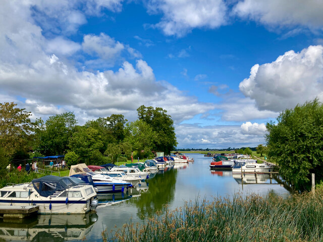
Sheepwash Channel is a waterway located in Oxfordshire, England. Despite its name, it is not a sea, estuary, or creek but rather a man-made watercourse. The channel was created in the 18th century as a diversion of the River Thames in order to improve navigation for boats and barges.

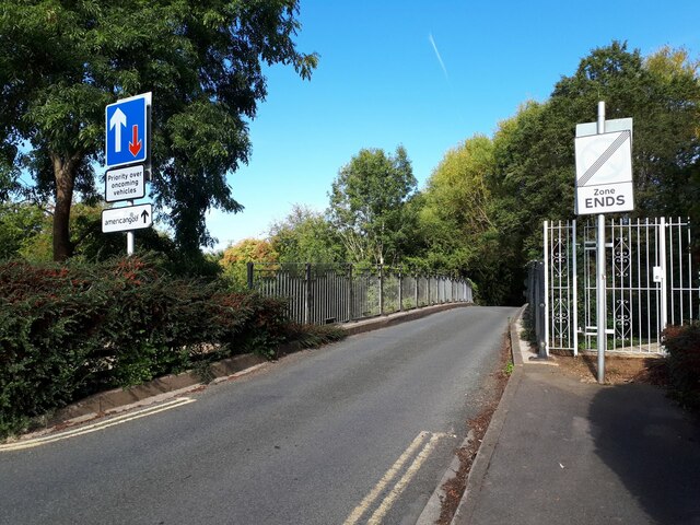
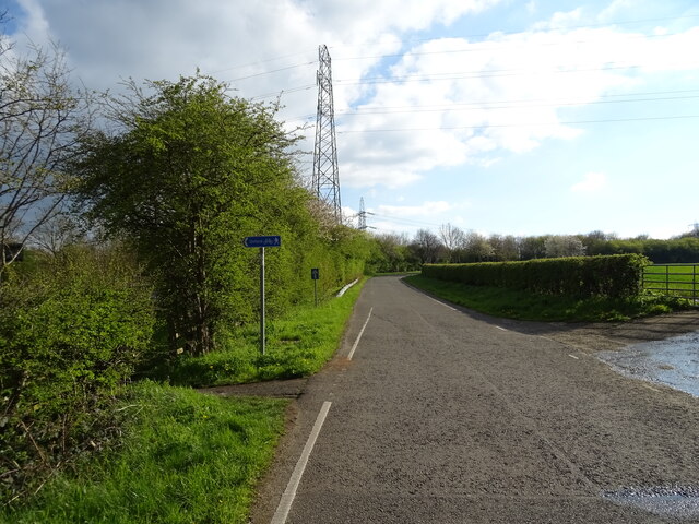
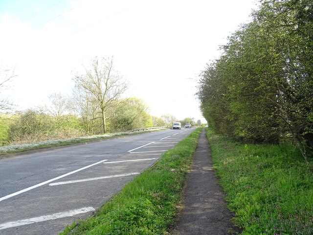
Stretching for approximately 2 miles, Sheepwash Channel starts near Folly Bridge in central Oxford and joins the River Thames near Iffley Lock. It is a narrow and winding watercourse with a gentle flow, creating a tranquil and picturesque setting. The channel is lined with lush greenery, including trees and reeds, which provide habitat for a variety of wildlife.

The name "Sheepwash" is derived from its historical use as a place for washing sheep before shearing. Farmers would bring their sheep to the channel, allowing them to wade in the shallow waters while being cleaned. Although this practice is no longer common, the name has stuck throughout the years.

Today, Sheepwash Channel is primarily used for recreational purposes. It is a popular spot for rowing and kayaking, offering a serene and peaceful escape from the bustling city of Oxford. Visitors can rent boats or take part in guided tours to explore the channel and its surroundings. Additionally, the area around Sheepwash Channel is a haven for walkers and nature enthusiasts, providing a pleasant environment for leisurely strolls and birdwatching.

Overall, Sheepwash Channel is a scenic and historically significant waterway, attracting both locals and tourists alike with its natural beauty and recreational opportunities.

If you have any feedback on the listing, please let us know in the comments section below.

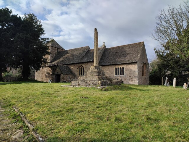
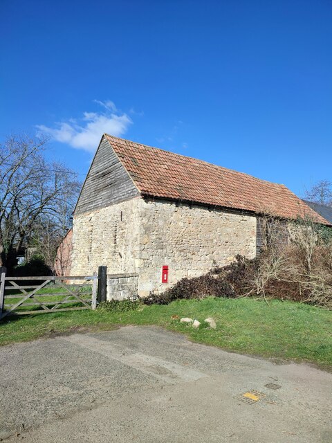
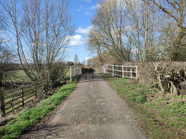
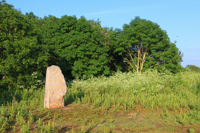
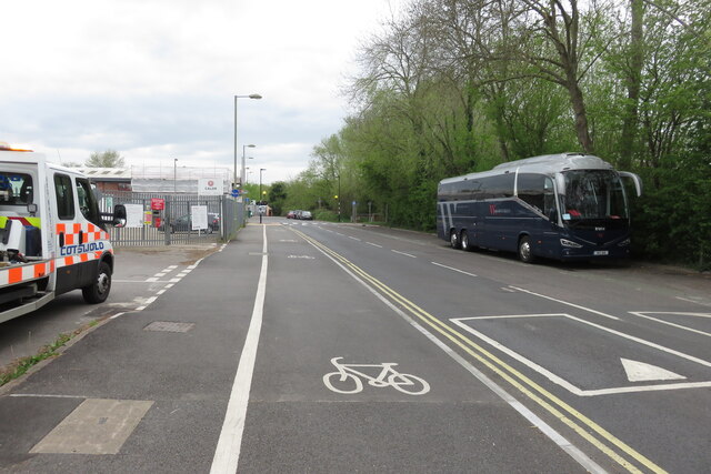
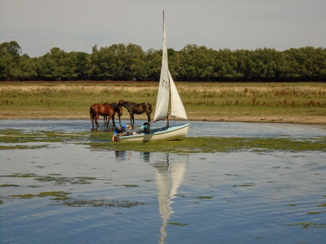
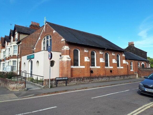
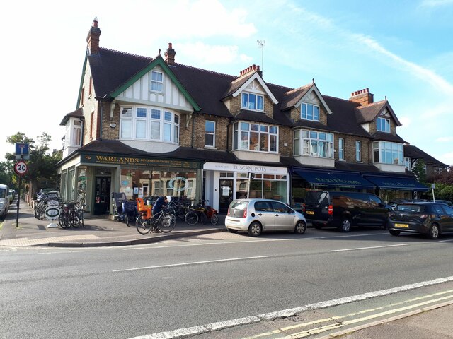
Sheepwash Channel Images

Images are sourced within 2km of 51.755506/-1.2712221 or Grid Reference SP5006. Thanks to Geograph Open Source API. All images are credited.

St Lawrence Church
St Lawrence Church
Barn, Binsey
Barn, Binsey
Bridge, Lane to Binsey Church
Memorial Stone John Thompson stone, in Burgess Field, Oxford.
Memorial Stone
John Thompson stone, in Burgess Field, Oxford.
Ferry Hinksey Road Spine road for the Osney Mead insutrial estate.
Ferry Hinksey Road
Spine road for the Osney Mead insutrial estate.
Horses in Thames amused by dinghy sailors Commoners' horses graze on Port Meadow, dinghy from Medley sailing club the other side of the Thames.
Horses in Thames amused by dinghy sailors
Commoners' horses graze on Port Meadow, dinghy from Medley sailing club the other side of the Thames.
Restoration Church, Helen Road, Osney Only a few years ago this was the Elim Chapel <a href="https://www.geograph.org.uk/photo/6217755">SP4906 : Elim Chapel, Helen Road</a> but it was probably not built as a church, as the 1921 map labels it a 'hall'. The style looks to be late 19th / early 20th century.
Restoration Church, Helen Road, Osney
Only a few years ago this was the Elim Chapel SP4906 : Elim Chapel, Helen Road but it was probably not built as a church, as the 1921 map labels it a 'hall'. The style looks to be late 19th / early 20th century.
Shops on Botley Road Currently comprising a cycle sales / repair business, high quality greengrocer and an antique shop specialising in Tuscan pottery. All very Oxford.
Shops on Botley Road
Currently comprising a cycle sales / repair business, high quality greengrocer and an antique shop specialising in Tuscan pottery. All very Oxford.
Binsey Lane bridge A narrow bridge taking a country lane over the Bulstake Stream, one of the many minor branches of the Thames around Oxford. <a href="https://www.geograph.org.uk/photo/6606806">SP4906 : Bridge over Bulstake Stream</a> shows it from the side.
Binsey Lane bridge
A narrow bridge taking a country lane over the Bulstake Stream, one of the many minor branches of the Thames around Oxford. SP4906 : Bridge over Bulstake Stream shows it from the side.
Binsey Lane A country lane from Osney to Binsey. There's something not quite right about those trees to the left: diseased, or badly pruned? The metal gates to the right are the access to an electricity substation.
Binsey Lane
A country lane from Osney to Binsey. There's something not quite right about those trees to the left: diseased, or badly pruned? The metal gates to the right are the access to an electricity substation.
DFS on Botley Road, Oxford I seem to remember DFS stands for Direct Furniture Services. I haven't been able to confirm it online.
DFS on Botley Road, Oxford
I seem to remember DFS stands for Direct Furniture Services. I haven't been able to confirm it online.
View across the Thames and bridge from the Towing Path Looking across the river toward Bossom's boatyard and Binsey from the towpath (seated at path level).
View across the Thames and bridge from the Towing Path
Looking across the river toward Bossom's boatyard and Binsey from the towpath (seated at path level).
Seacourt Lane
Seacourt Lane
Cycle Path beside the A34
Marina on the Thames near Binsey A view from the footpath over the Thames.
Marina on the Thames near Binsey
A view from the footpath over the Thames.
Medley Beer Garden by the Thames Not a pub, just a beer garden.
Medley Beer Garden by the Thames
Not a pub, just a beer garden.
Walking through Binsey Village A quiet village beside the River Thames.
Walking through Binsey Village
A quiet village beside the River Thames.
North Hinksey Conduit House Roofed reservoir for Oxford's first water mains, built during the early 17th century.
North Hinksey Conduit House
Roofed reservoir for Oxford's first water mains, built during the early 17th century.
Show me another place!

Sheepwash Channel is located at Grid Ref: SP5006 (Lat: 51.755506, Lng: -1.2712221)

Administrative County: Oxfordshire

District: Oxford

Police Authority: Thames Valley

What 3 Words

///loyal.cloth.nods. Near Oxford, Oxfordshire

Related Wikis

Sheepwash Channel

Sheepwash Channel connects the River Thames to the west and the Castle Mill Stream next to the Oxford Canal to the east (linked through Isis Lock), in...

Sheepwash Channel Railway Bridge

Sheepwash Channel Railway Bridge is a railway bridge over Sheepwash Channel in west Oxford, England, just north of Oxford railway station. To the north...

Rewley Road Swing Bridge

Rewley Road Swing Bridge is a disused railway swing bridge over Sheepwash Channel in west Oxford, England. To the north are Cripley Meadow and Fiddler...

Rewley Road

Rewley Road is in the west of central Oxford, England. It is located in St Thomas's parish. == History == The name derives from Rewley Abbey. A Rewley...
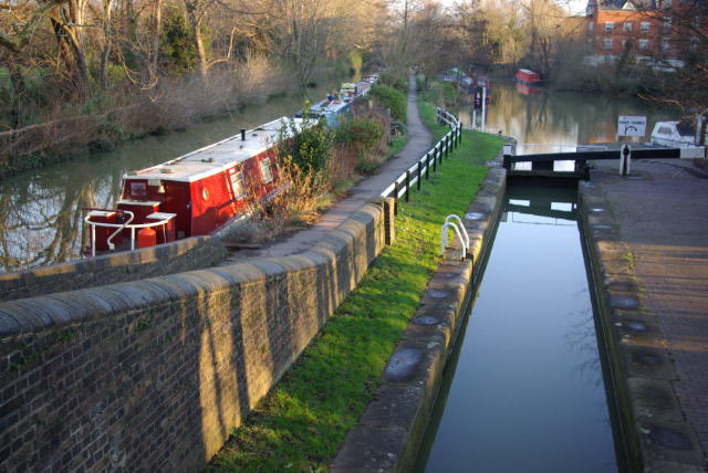
Isis Lock

Isis Lock (known to boatmen as "Louse Lock") is a lock connecting the Oxford Canal and the Castle Mill Stream, a backwater of the River Thames in Oxford...

Oxford railway station

Oxford railway station is a mainline railway station, one of two serving the city of Oxford, England. It is about 0.5 miles (800 m) west of the city centre...
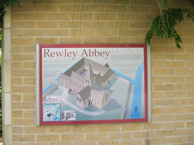
Rewley Abbey

The Cistercian Abbey of Rewley was an abbey in Oxford, England. It was founded in the 13th century by Edmund, 2nd Earl of Cornwall. Edmund's father, Richard...

St Barnabas Church, Oxford

St Barnabas Church is a Church of England parish church in Jericho, central Oxford, England, located close to the Oxford Canal. == History == St Barnabas...

Nearby Amenities

Located within 500m of 51.755506,-1.2712221
Traffic Signals
Lat/Long: 51.7524021/-1.2759593
Access: private
Lat/Long: 51.7570017/-1.2689838
Access: no
Barrier: swing_gate
Height: 2
Material: metal
Lat/Long: 51.7571459/-1.2710079
Turning Circle
Turning Circle: hammer
Lat/Long: 51.7545424/-1.2694352
Mini Roundabout
Direction: clockwise
Source: photograph
Lat/Long: 51.7541107/-1.2677935
Barrier: bollard
Lat/Long: 51.7536427/-1.277493
Maxspeed: 20 mph
Maxspeed Note: Oxford 20 mph zone
Maxspeed Spec: 10m E of jn w/ Abbey Rd
Lat/Long: 51.7525531/-1.271837
Operator: Network Rail
Railway: switch
Lat/Long: 51.7518769/-1.2699211
Jericho
Place: suburb
Wikidata: Q1507872
Lat/Long: 51.7587059/-1.2681711
Seamark Type: gate
Waterway: lock_gate
Lat/Long: 51.7560885/-1.269336
Seamark Type: gate
Waterway: lock_gate
Lat/Long: 51.7559014/-1.269102
Waterway: weir
Lat/Long: 51.7554856/-1.2737352
Waterway: weir
Lat/Long: 51.7553763/-1.2747254
Crossing: uncontrolled
Crossing Ref: zebra
Lat/Long: 51.7534853/-1.2696062
Main Entrance
Access: permissive
Entrance: main
Lat/Long: 51.7534655/-1.2697717
Pub
The Old Bookbinders
Addr Housenumber: 17-18
Addr Postcode: OX2 6BT
Addr Street: Victor Street
Brewery: various
Cuisine: french
Opening Hours: Tu-Sa 12:00-24:00; Su 16:00-23:00
Phone: +44 1865 553549
Toilets Wheelchair: no
Website: http://oldbookbinders.co.uk/
Wheelchair: limited
Lat/Long: 51.7584939/-1.2697797
Restaurant
Bangkok House
Addr City: Oxford
Addr Housenumber: 42a
Addr Postcode: OX1 2EP
Addr Street: Hythe Bridge Street
Cuisine: thai
Fhrs Id: 268811
Phone: +44 1865 200705
Lat/Long: 51.7534475/-1.2659115
Crossing
Button Operated: yes
Crossing: traffic_signals
Crossing Island: no
Tactile Paving: yes
Traffic Signals Sound: yes
Traffic Signals Vibration: yes
Lat/Long: 51.7524971/-1.274216
Rewley Abbey
Historic: ruins
Source: local_knowledge
Wikidata: Q2147035
Wikipedia: en:Rewley Abbey
Lat/Long: 51.7543071/-1.2683555
Bicycle Parking
Bicycle Parking: stands
Capacity: 36
Check Date: 2022-05-01
Covered: no
Source: survey
Lat/Long: 51.7532022/-1.2696227
Bicycle Parking
Bicycle Parking: stands
Capacity: 24
Check Date: 2022-10-15
Covered: no
Source: survey
Lat/Long: 51.7536822/-1.2697794
Bicycle Parking
Capacity: 12
Lat/Long: 51.7548664/-1.2690207
Bicycle Parking
Capacity: 4
Source: survey
Lat/Long: 51.7564881/-1.270872
Bicycle Parking
Capacity: 16
Source: survey
Lat/Long: 51.7560703/-1.270408
Fast Food
Currydor
Addr City: Oxford
Addr Housenumber: 25
Addr Postcode: OX2 0BN
Addr Street: Botley Road
Cuisine: indian
Delivery: yes
Fhrs Id: 723651
Opening Hours: Mo-Th 18:00-22:00, Fr,Sa 18:00-22:30, Tu-Sa 12:00-14:00
Phone: +44 1865 424343
Takeaway: yes
Lat/Long: 51.7522826/-1.2760978
Created By: osm2go v0.6-8
Lat/Long: 51.7518582/-1.2673073
Post Box
Brand: Royal Mail
Brand Wikidata: Q638098
Brand Wikipedia: en:Royal Mail
Collection Plate: CP1D
Collection Times: Mo-Fr 09:00; Sa 07:00
Operator: Royal Mail
Operator Wikidata: Q638098
Post Box Type: pillar
Postal Code: OX1
Ref: OX1 72D
Royal Cypher: GR
Royal Cypher Wikidata: Q33102273
Source: survey
Survey Date: 2013-02-23
Lat/Long: 51.7526034/-1.2679919
Telephone
Booth: KX100
Check Date: 2021-09-11
Covered: booth
Operator: BT
Operator Wikidata: Q593786
Payment Coins: yes
Payment Credit Cards: yes
Payment Debit Cards: yes
Source: photograph;Bing
Lat/Long: 51.7525888/-1.2677354
Nightclub
ATIK Oxford
Addr Postcode: OX1 1JD
Addr Street: Park End Street
Loc Name: Park End
Old Name: Park End Club
Opening Hours: Fr-Sa 22:00-03:00
Operator: Deltic Group
Smoking: outside
Website: https://www.atikclub.co.uk/oxford
Lat/Long: 51.7526452/-1.2656116
Pub
The Oxford Retreat
Addr City: Oxford
Addr Housenumber: 1-2
Addr Postcode: OX1 2TA
Addr Street: Hythe Bridge Street
Diet Vegan: limited
Diet Vegetarian: yes
Fhrs Id: 989695
Food: yes
Real Ale: yes
Source Addr: FHRS Open Data
Website: https://www.theoxfordretreat.com/
Wheelchair: yes
Lat/Long: 51.7533425/-1.2652021
Bicycle Parking
Bicycle Parking: stands
Capacity: 6
Covered: no
Fee: no
Lat/Long: 51.7536084/-1.265294
M&S Simply Food
Brand: M&S Simply Food
Brand Wikidata: Q714491
Brand Wikipedia: en:Marks & Spencer
Contact Website: https://www.marksandspencer.com/stores/oxford-rail-simply-food-120
Opening Hours: Mo-We 07:00-20:00; Th-Sa 07:00-22:00; Su 10:00-18:00
Shop: convenience
Source: local_knowledge
Wheelchair: yes
Lat/Long: 51.7532066/-1.2699836
Bicycle Parking
Bicycle Parking: stands
Capacity: 14
Covered: no
Lat/Long: 51.7527198/-1.2751377
Post Box
Collection Times: Mo-Fr 09:00; Sa 07:00
Post Box Type: pillar
Postal Code: OX2
Ref: OX2 20
Royal Cypher: EIIR
Royal Cypher Wikidata: Q33102113
Lat/Long: 51.7591439/-1.2673369
Bicycle Parking
Bicycle Parking: stands
Capacity: 8
Check Date: 2022-05-01
Covered: no
Created By: Potlatch 0.10f
Lat/Long: 51.7533453/-1.2661184
Bicycle Parking
Access: private
Capacity: 28
Lat/Long: 51.7532932/-1.2657912
Crossing
Button Operated: yes
Crossing: traffic_signals
Crossing Island: no
Crossing Markings: dashes
Crossing Ref: pelican
Tactile Paving: yes
Traffic Signals Sound: yes
Traffic Signals Vibration: no
Lat/Long: 51.752577/-1.271608
Bicycle Parking
Capacity: 16
Lat/Long: 51.7567964/-1.2723802
Addr City: Oxford
Addr Housenumber: 1
Addr Street: Venneit Close
Lat/Long: 51.7574189/-1.2725538
Addr Housenumber: 27
Addr Street: Venneit Close
Lat/Long: 51.7581826/-1.272795
Addr Housenumber: 87
Addr Street: Venneit Close
Lat/Long: 51.757228/-1.2728385
Bicycle Parking
Capacity: 25
Lat/Long: 51.7574808/-1.2731697
Bus Stop
Oxford Rail Station
Bench: yes
Bin: yes
Bus: yes
Lit: yes
Local Bearing: N
Local Ref: R2
Naptan AtcoCode: 340000006R2
Naptan CommonName: Railway Station
Naptan Indicator: Stop R2
Naptan Landmark: Stop R2
Naptan NaptanCode: oxfamjmj
Naptan PlusbusZoneRef: OXFD
Naptan Street: Station Forecourt
Public Transport: platform
Route Ref: 1;5
Shelter: yes
Short Route Ref: 1/5
Source: naptan_import
Tactile Paving: no
Lat/Long: 51.7533096/-1.269649
Bench
Backrest: no
Lat/Long: 51.7538808/-1.2651854
Bench
Lat/Long: 51.7596066/-1.2697564
Bench
Backrest: yes
Check Date: 2021-04-29
Lat/Long: 51.7593366/-1.2703961
Bus Stop
Oxford Rail Station
Bench: yes
Bin: yes
Bus: yes
Lit: yes
Local Bearing: W
Local Ref: R1
Naptan AtcoCode: 340000006R1
Naptan CommonName: Railway Station
Naptan Indicator: Stop R1
Naptan Landmark: Stop R1
Naptan NaptanCode: oxfamjmp
Naptan PlusbusZoneRef: OXFD
Naptan Street: Station Forecourt
Public Transport: platform
Route Ref: 500
Shelter: yes
Source: naptan_import
Tactile Paving: no
Lat/Long: 51.7531137/-1.2694204
Bus Stop
Oxford Rail Station
Bench: yes
Bin: no
Bus: yes
Check Date: 2024-03-21
Lit: yes
Local Bearing: N
Local Ref: R3
Naptan AtcoCode: 340000006R3
Naptan CommonName: Railway Station
Naptan Indicator: Stop R3
Naptan Landmark: Stop R3
Naptan NaptanCode: oxfamjmg
Naptan PlusbusZoneRef: OXFD
Naptan Street: Station Forecourt
Note: X3 currently not running to station
Public Transport: platform
Route Ref: X3
Shelter: yes
Source: naptan_import
Tactile Paving: no
Lat/Long: 51.7535388/-1.2696854
Crossing: uncontrolled
Crossing Ref: zebra
Lat/Long: 51.7535066/-1.2694297
Crossing: uncontrolled
Crossing Ref: zebra
Lat/Long: 51.7535301/-1.2692349
Frideswide Square
Abandoned Highway: bus_stop
Local Ref: R8
Naptan AtcoCode: 340002070R8
Naptan Bearing: E
Naptan CommonName: Frideswide Square
Naptan Indicator: R8
Naptan Landmark: Stop R8
Naptan NaptanCode: oxfatwmt
Naptan PlusbusZoneRef: OXFD
Naptan Street: Frideswide Square
Ref: R8
Route Ref: 11;14;14A;17A;17C;44;63;66;280;S1;NS1;U1;NU1;X30;N30;31
Source: naptan_import;photograph
Lat/Long: 51.7527766/-1.2662004
Bus Stop
Park End Street
Bench: no
Bin: yes
Bus: yes
Lit: yes
Local Ref: E-Bound
Naptan AtcoCode: 340002070DCS
Naptan NaptanCode: oxfgwdma
Public Transport: platform
Route Ref: CitySightseeing
Shelter: no
Tactile Paving: no
Tour Bus Only: yes
Lat/Long: 51.7527905/-1.2665693
Crossing
Crossing: unmarked
Crossing Island: no
Crossing Markings: no
Kerb: lowered
Tactile Paving: yes
Lat/Long: 51.7524428/-1.2737864
Bench
Backrest: yes
Check Date: 2021-04-29
Lat/Long: 51.7593116/-1.2705049
Post Box
Brand: Royal Mail
Brand Wikidata: Q638098
Brand Wikipedia: en:Royal Mail
Check Date: 2021-11-27
Collection Times: Mo-Fr 17:30, Sa 11:00
Operator: Royal Mail
Operator Wikidata: Q638098
Post Box Type: pillar
Ref: OX1 9
Royal Cypher: EIIR
Royal Cypher Wikidata: Q33102113
Source: survey
Lat/Long: 51.7535639/-1.2700965
Bus Stop
Oxford Rail Station
Bench: yes
Bin: no
Bus: yes
Lit: yes
Local Bearing: N
Local Ref: R4
Naptan AtcoCode: 340000006R4
Naptan CommonName: Railway Station
Naptan Indicator: Stop R4
Naptan Landmark: Stop R4
Naptan NaptanCode: oxfamjmd
Naptan PlusbusZoneRef: OXFD
Naptan Street: Station Forecourt
Note: 13 currently not running to station
Public Transport: platform
Route Ref: 13; 14
Shelter: no
Short Route Ref: 14
Source: naptan_import
Tactile Paving: no
Lat/Long: 51.7536972/-1.2697663
Bus Stop
Oxford Rail Station stop R5
Bench: yes
Bin: yes
Bus: yes
Lit: yes
Local Bearing: N
Local Ref: R5
Naptan AtcoCode: 340000006R5
Naptan CommonName: Railway Station
Naptan Indicator: Stop R5
Naptan Landmark: Stop R5
Naptan NaptanCode: oxfamjma
Naptan PlusbusZoneRef: OXFD
Naptan Street: Station Forecourt
Public Transport: platform
Route Ref: 7;280;S3
Shelter: yes
Short Route Ref: 7 S3
Source: naptan_import
Tactile Paving: no
Lat/Long: 51.7533884/-1.2694569
Bus Stop
Oxford Rail Station
Bench: yes
Bin: yes
Bus: yes
Lit: yes
Local Bearing: N
Local Ref: R6
Naptan AtcoCode: 340000006R6
Naptan CommonName: Railway Station
Naptan Indicator: Stop R6
Naptan Landmark: Stop R6
Naptan NaptanCode: oxfamjgw
Naptan PlusbusZoneRef: OXFD
Naptan Street: Station Forecourt
Public Transport: platform
Route Ref: CitySightseeing
Shelter: yes
Source: naptan_import
Tactile Paving: no
Lat/Long: 51.7536151/-1.2695161
Bus Stop
Osney Island
Bench: yes
Bin: yes
Bus: yes
Lit: yes
Local Ref: W-bound
Naptan AtcoCode: 340001093BSC
Naptan Bearing: W
Naptan CommonName: Osney Island
Naptan Indicator: Bridge St corner
Naptan Landmark: Osney Bridge
Naptan NaptanCode: oxfadgma
Naptan PlusbusZoneRef: OXFD
Naptan Street: Botley Road
Park And Ride: 400
Public Transport: platform
Shelter: yes
Source: naptan_import
Tactile Paving: no
Lat/Long: 51.7524372/-1.274493
Bus Stop
Osney Island
Bench: yes
Bin: yes
Bus: yes
Covered: yes
Lit: yes
Local Ref: E-bound
Naptan AtcoCode: 340001093OPB
Naptan Bearing: E
Naptan CommonName: Osney Island
Naptan Indicator: Opposite Bridge St
Naptan Landmark: Osney Bridge
Naptan NaptanCode: oxfadgjw
Naptan PlusbusZoneRef: OXFD
Naptan Street: Botley Road
Park And Ride: 400
Public Transport: platform
Ref: 69323459
Route Ref: 33;4A;400;S1;NS1;S6;S9;NU1;X9;63
Shelter: yes
Source: naptan_import
Tactile Paving: no
Lat/Long: 51.7525502/-1.2738394
Bus Stop
Frideswide Square
Bench: no
Bin: no
Bus: yes
Lit: yes
Local Ref: D6
Naptan AtcoCode: 340000009R9
Naptan Bearing: W
Naptan CommonName: Park End Street
Naptan Indicator: Stop D6
Naptan Landmark: Stop D6
Naptan NaptanCode: oxfgwadp
Naptan PlusbusZoneRef: OXFD
Naptan Street: Park End Street
Public Transport: platform
Route Ref: 5;7;13;14;14A;X3;280;500;S3
Set Down Only: yes
Shelter: no
Source: naptan_import;photograph
Tactile Paving: no
Lat/Long: 51.7526909/-1.2670249
Frideswide Square
Bench: yes
Bin: no
Bus: yes
Disused Highway: bus_stop
Disused Public Transport: platform
Lit: yes
Local Ref: R8
Naptan AtcoCode: 340002070R8
Naptan Bearing: W
Naptan CommonName: Frideswide Square
Naptan Indicator: R8
Naptan Landmark: Stop R8
Naptan NaptanCode: oxfatwmp
Naptan PlusbusZoneRef: OXFD
Naptan Street: Frideswide Square
Note: [2023-11-26] green county council bag: BUS STOP NOT IN USE
Park And Ride: 400
Ref: 69349234
Route Ref: 3B;4;4A;4B;4C;11;66;400;U1;NU1;X30;S1;NS1
Shelter: yes
Source: naptan_import;photograph
Lat/Long: 51.7527457/-1.2684944
Becket House B&B
Addr Housenumber: 5
Addr Postcode: OX1 1PP
Addr Street: Becket Street
Disused Tourism: guest_house
Phone: +44 1865 724675
Lat/Long: 51.7521313/-1.268827
Fast Food
Domino's
Addr City: Oxford
Addr Country: GB
Addr Housenumber: 18
Addr Postcode: OX1 1HU
Addr Street: Park End Street
Brand: Domino's
Brand Wikidata: Q839466
Brand Wikipedia: en:Domino's Pizza
Contact Phone: +44 1865 200222
Contact Website: https://www.dominos.co.uk/pizza-near-me/oxford/18-19-park-end-street
Cuisine: pizza
Fhrs Id: 269148
Takeaway: yes
Lat/Long: 51.7525133/-1.2688666
Fast Food
Dosa Park
Addr City: Oxford
Addr Housenumber: 25
Addr Postcode: OX1 1HU
Addr Street: Park End Street
Cuisine: indian
Drive Through: no
Fhrs Id: 269171
Outdoor Seating: yes
Phone: +44 1865 791197
Lat/Long: 51.7525435/-1.2680803
Finders Keepers
Addr Housenumber: 20-21
Addr Postcode: OX1 1HU
Addr Street: Park End Street
Cuisine: chinese
Phone: +44 1865 250988
Shop: estate_agent
Lat/Long: 51.752519/-1.268527
SBS Common Room
Addr Postcode: OX1 1HP
Lat/Long: 51.7538837/-1.2685483
Grit Bin
Lat/Long: 51.756264/-1.2718255
Crossing
Crossing: informal
Crossing Island: no
Kerb: flush
Tactile Paving: yes
Lat/Long: 51.7531753/-1.2674651
Barrier: lift_gate
Source: Bing
Lat/Long: 51.7518188/-1.2690855
Westgate Cafe
Door: hinged
Entrance: yes
Lat/Long: 51.7524921/-1.2710927
Bicycle Parking
Bicycle Parking: stands
Capacity: 8
Covered: no
Lat/Long: 51.7519645/-1.2726478
Crossing
Crossing: informal
Crossing Island: yes
Kerb: flush
Tactile Paving: yes
Lat/Long: 51.7525761/-1.2673886
Man Made: surveillance
Source: survey;Bing
Source Man Made: survey
Surveillance: outdoor
Lat/Long: 51.7526234/-1.2699446
Bicycle Rental
Brompton Dock Oxford - 2624
Access: private
Bicycle Parking: lockers
Capacity: 10
Covered: yes
Lockable: yes
Operator: Brompton Dock
Ref: 2624
Source: survey
Website: http://www.bromptondock.co.uk/our-docks/oxford-2624/
Lat/Long: 51.7529843/-1.2699294
Man Made: surveillance
Source Man Made: survey
Lat/Long: 51.7530963/-1.2700311
Man Made: surveillance
Source: survey;Bing
Source Man Made: survey
Surveillance: outdoor
Lat/Long: 51.7528173/-1.2698364
Board Type: notice
Check Date: 2022-05-01
Information: board
Source: local_knowledge
Tourism: information
Lat/Long: 51.7528615/-1.2691423
Crossing
Crossing: informal
Crossing Island: no
Kerb: flush
Tactile Paving: yes
Lat/Long: 51.753138/-1.2671854
Uni Food and Wine
Shop: kiosk
Lat/Long: 51.7525159/-1.2687975
Man Made: surveillance
Source: photograph;Bing
Surveillance: outdoor
Lat/Long: 51.7531176/-1.2677054
Entrance: yes
Lat/Long: 51.7596654/-1.2684577
Traffic Signals
Button Operated: yes
Crossing: traffic_signals
Crossing Ref: pelican
Tactile Paving: yes
Traffic Signals Sound: yes
Traffic Signals Vibration: no
Lat/Long: 51.7534432/-1.265392
Barrier: kerb
Kerb: flush
Tactile Paving: yes
Lat/Long: 51.7531783/-1.2674014
Crossing
Crossing: uncontrolled
Crossing Markings: surface
Tactile Paving: yes
Lat/Long: 51.7526184/-1.2718504
Crossing
Crossing: informal
Crossing Island: yes
Kerb: flush
Tactile Paving: yes
Lat/Long: 51.7525978/-1.2689528
Barrier: entrance
Note Barrier: gate, but left open
Lat/Long: 51.756553/-1.2725575
College Cruisers
Designation: waterway=boatyard
Leisure: marina
Waterway: marina
Lat/Long: 51.7580246/-1.270422
Barrier: ticket_barrier
Entrance: main
Lat/Long: 51.7534185/-1.2701235
Pumpkin
Brand: Pumpkin
Brand Wikidata: Q27825961
Cuisine: coffee_shop
Disused Amenity: cafe
Takeaway: yes
Lat/Long: 51.7536025/-1.2706508
Toilets
Fee: no
Wheelchair: yes
Lat/Long: 51.753616/-1.2701369
Elevator
Level: 0;1
Wheelchair: yes
Lat/Long: 51.7539031/-1.2706103
Elevator
Level: 0;1
Wheelchair: yes
Lat/Long: 51.7539378/-1.2702906
Railway: buffer_stop
Lat/Long: 51.7546473/-1.2701496
Waterway: weir
Lat/Long: 51.7568071/-1.2702138
Waterway: weir
Lat/Long: 51.7566982/-1.2701494
Restaurant
Sojo
Addr City: Oxford
Addr Housename: SoJo
Addr Housenumber: 6-9
Addr Postcode: OX1 2TA
Addr Street: Hythe Bridge Street
Cuisine: chinese
Fhrs Id: 268807
Phone: +44 1865 202888
Source Addr Postcode: FHRS Open Data
Website: http://sojooxford.co.uk/
Lat/Long: 51.7531836/-1.266041
Operator: Network Rail
Railway: switch
Lat/Long: 51.7524811/-1.2699914
Operator: Network Rail
Railway: switch
Lat/Long: 51.7518448/-1.269862
Oxford
Public Transport: stop_position
Railway: stop
Ref: 4
Train: yes
Lat/Long: 51.7534272/-1.2704053
Operator: Network Rail
Railway: switch
Lat/Long: 51.756048/-1.2710257
Operator: Network Rail
Railway: switch
Lat/Long: 51.757458/-1.271589
Oxford
Public Transport: stop_position
Railway: stop
Ref: 3
Train: yes
Lat/Long: 51.7534418/-1.2702618
Operator: Network Rail
Railway: switch
Lat/Long: 51.7587684/-1.2722533
WHSmith
Addr City: Oxford
Addr Housename: Oxford Railway Station
Addr Postcode: OX1 1HS
Addr Street: Park End Street
Brand: WHSmith
Brand Wikidata: Q1548712
Brand Wikipedia: en:WHSmith
Fhrs Id: 269158
Opening Hours: Mo-Th 06:00-20:30; Fr 06:00-21:00; Sa 06:30-21:00; Su 09:00-20:30
Shop: newsagent
Source Addr: FHRS Open Data
Wheelchair: yes
Lat/Long: 51.7531564/-1.269782
Central Backpackers Oxford
Addr Housenumber: 13
Addr Postcode: OX1 1HH
Addr Street: Park End Street
Level: 1
Phone: +44 1865 242288
Tourism: hostel
Website: https://www.centralbackpackers.co.uk/
Lat/Long: 51.7528733/-1.2657992
Entrance: main
Wheelchair: yes
Lat/Long: 51.7532229/-1.2682899
Addr Housenumber: 1
Addr Street: East Street
Lat/Long: 51.7519972/-1.2727967
Board Type: notice
Check Date: 2021-09-11
Information: map
Source: local_knowledge
Tourism: information
Lat/Long: 51.7526121/-1.2677516
Telephone
Addr Postcode: OX1 1HH
Booth: KX100
Check Date: 2021-09-11
Covered: booth
Operator: BT
Operator Wikidata: Q593786
Payment Coins: yes
Payment Credit Cards: yes
Payment Debit Cards: yes
Phone: +44 1865 244217
Source: photograph;Bing
Lat/Long: 51.7525884/-1.2677609
Public Transport: stop_position
Railway: stop
Train: yes
Lat/Long: 51.7539696/-1.2701911
Waterway: turning_point
Lat/Long: 51.7555542/-1.2689789
Maxlength: 52ft
Waterway: turning_point
Lat/Long: 51.7564295/-1.2696943
Public Transport: stop_position
Railway: stop
Train: yes
Lat/Long: 51.7539662/-1.2702377
Operator: Network Rail
Railway: switch
Lat/Long: 51.7556847/-1.2708296
Operator: Network Rail
Railway: switch
Lat/Long: 51.7559441/-1.2709205
Railway: buffer_stop
Lat/Long: 51.7561038/-1.2708745
Railway: switch
Lat/Long: 51.758034/-1.2715015
Operator: Network Rail
Railway: switch
Lat/Long: 51.7583216/-1.2715602
Operator: Network Rail
Railway: switch
Lat/Long: 51.7586815/-1.2716395
Operator: Network Rail
Railway: switch
Lat/Long: 51.7575253/-1.2713908
Operator: Network Rail
Railway: switch
Lat/Long: 51.7566418/-1.2711511
Operator: Network Rail
Railway: switch
Lat/Long: 51.7575831/-1.2714039
Bicycle Parking
Bicycle Parking: stands
Capacity: 4
Covered: no
Fee: no
Lat/Long: 51.759935/-1.270989
Bicycle Parking
Bicycle Parking: stands
Capacity: 74
Covered: no
Fee: no
Lat/Long: 51.7540939/-1.2696291
Oxford Up Carriage Sidings
Operator: Network Rail
Railway: switch
Ref Tiploc: OXFDCS2
Lat/Long: 51.7569445/-1.2712496
Operator: Network Rail
Railway: switch
Lat/Long: 51.7584056/-1.271882
Operator: Network Rail
Railway: switch
Lat/Long: 51.7570331/-1.271555
Operator: Network Rail
Railway: switch
Lat/Long: 51.7587074/-1.2722307
Operator: Network Rail
Railway: switch
Lat/Long: 51.7581285/-1.2719374
Bicycle Parking
Bicycle Parking: stands
Capacity: 8
Covered: no
Fee: no
Lat/Long: 51.7516387/-1.2717288
Bicycle Parking
Bicycle Parking: stands
Capacity: 8
Check Date Capacity: 2024-01-26
Covered: no
Lat/Long: 51.7520188/-1.2736793
Post Box
Brand: Royal Mail
Brand Wikidata: Q638098
Brand Wikipedia: en:Royal Mail
Collection Times: Mo-Fr 17:30; Sa 11:00
Operator: Royal Mail
Operator Wikidata: Q638098
Post Box Type: wall
Postal Code: OX2
Ref: OX2 103
Royal Cypher: GR
Royal Cypher Wikidata: Q33102273
Source: survey
Survey Date: 2014-01-15
Lat/Long: 51.7527466/-1.2712478
Atm
Cash In: no
Check Date: 2024-01-11
Covered: yes
Drive Through: no
Fee: no
Indoor: yes
Network: Link
Operator: LINK
Lat/Long: 51.7536107/-1.2700124
Bicycle Parking
Bicycle Parking: stands
Capacity: 8
Covered: no
Fee: no
Lat/Long: 51.7535055/-1.2751868
Bench
Backrest: no
Covered: no
Lat/Long: 51.7549421/-1.2765118
Bench
Backrest: yes
Covered: no
Lat/Long: 51.7542783/-1.2781859
Cafe
Tumbling Bay Cafe
Addr City: Oxford
Addr Housename: West Oxford Community Centre
Addr Postcode: OX2 0BT
Addr Street: Botley Road
Cuisine: cafe;lunch
Fhrs Id: 952041
Internet Access: wlan
Opening Hours: Mo-Fr 09:00-16:00; Sa,Su 10:00-16:00; Mo off
Outdoor Seating: yes
Source Addr: FHRS Open Data
Wheelchair: no
Lat/Long: 51.75297/-1.275232
Access: permissive
Entrance: main
Lat/Long: 51.7578266/-1.2698761
Operator: Network Rail
Railway: switch
Lat/Long: 51.7564111/-1.2712741
Operator: Network Rail
Railway: switch
Lat/Long: 51.7557081/-1.2711151
Oxford Railway Station Ticket Office
Shop: ticket
Wheelchair: yes
Lat/Long: 51.7537418/-1.2700441
Vending Machine
Check Date: 2024-04-29
Indoor: yes
Vending: public_transport_tickets
Lat/Long: 51.7535804/-1.2700043
Taxi
Lat/Long: 51.7536905/-1.2696263
Crossing
Crossing: unmarked
Crossing Island: yes
Crossing Markings: no
Kerb: flush
Tactile Paving: yes
Lat/Long: 51.7530158/-1.2690076
Crossing
Crossing: informal
Crossing Island: yes
Kerb: flush
Tactile Paving: yes
Lat/Long: 51.752746/-1.2691862
Access: private
Addr City: Oxford
Addr Housenumber: 53
Addr Postcode: OX2 6AX
Addr Street: Great Clarendon Street
Description: Peter and Christine a house
Entrance: home
Wheelchair: no
Lat/Long: 51.7573292/-1.2690716
Addr City: Oxford
Addr Housenumber: 54
Addr Street: Great Clarendon Street
Entrance: yes
Lat/Long: 51.7573126/-1.2691053
Addr City: Oxford
Addr Housenumber: 55
Addr Street: Great Clarendon Street
Entrance: yes
Lat/Long: 51.7572808/-1.2691703
Addr City: Oxford
Addr Housenumber: 56
Addr Street: Great Clarendon Street
Entrance: yes
Lat/Long: 51.7572675/-1.2691975
Mini Roundabout
Direction: clockwise
Lat/Long: 51.7526881/-1.2673723
Note: not sure how far back this was but I think it ran prpincular out from the back of these buildings [the fenceline]
Source: visit
Lat/Long: 51.7523906/-1.2686499
Access: customers
Entrance: main
Lat/Long: 51.7525782/-1.267184
Mini Roundabout
Direction: clockwise
Lat/Long: 51.7527509/-1.2689472
Crossing
Crossing: informal
Crossing Island: yes
Kerb: flush
Tactile Paving: yes
Lat/Long: 51.7527141/-1.2671159
Crossing
Crossing: informal
Crossing Island: yes
Kerb: flush
Tactile Paving: yes
Lat/Long: 51.7527743/-1.2686862
Crossing
Crossing: informal
Crossing Island: yes
Kerb: flush
Tactile Paving: yes
Lat/Long: 51.7528461/-1.2679585
Bus Stop
Frideswide Square
Bench: yes
Bin: yes
Bus: yes
Lit: yes
Local Ref: R7
Naptan AtcoCode: 340002070R7
Naptan Bearing: E
Naptan CommonName: Frideswide Square
Naptan Indicator: R7
Naptan Landmark: Stop R7
Naptan NaptanCode: oxfatwmw
Naptan PlusbusZoneRef: OXFD
Naptan Street: Frideswide Square
Park And Ride: 400
Public Transport: platform
Ref: R7
Route Ref: 3B;4;4A;4B;4C;11;66;400;S1;NS1;U1;NU1;X30
Shelter: yes
Source: naptan_import;photograph
Tactile Paving: no
Lat/Long: 51.7528455/-1.2680785
Mini Roundabout
Direction: clockwise
Lat/Long: 51.7528648/-1.2677085
Fast Food
Upper Crust
Brand: Upper Crust
Brand Wikidata: Q7898585
Brand Wikipedia: en:Upper Crust (restaurant chain)
Cuisine: sandwich
Opening Hours: Mo-Sa 06:30-20:30; Su 08:30-20:30
Takeaway: yes
Wheelchair: yes
Lat/Long: 51.7533368/-1.2700488
Fast Food
Greggs
Brand: Greggs
Brand Wikidata: Q3403981
Cuisine: sandwich;bakery
Opening Hours: Mo-Fr 07:00-20:00; Sa 07:30-20:00; Su 09:00-17:00
Takeaway: yes
Wheelchair: yes
Lat/Long: 51.7533274/-1.2697793
Toilets
Changing Table: yes
Check Date: 2022-05-01
Fee: no
Wheelchair: yes
Lat/Long: 51.753674/-1.2707177
Traffic Calming: bump
Lat/Long: 51.7584659/-1.2724822
Turning Circle
Lat/Long: 51.7583592/-1.2725662
Railway: buffer_stop
Lat/Long: 51.7570118/-1.2720791
Operator: Network Rail
Railway: switch
Lat/Long: 51.7577332/-1.2721471
Operator: Network Rail
Railway: switch
Lat/Long: 51.7579482/-1.2721742
Railway: buffer_stop
Lat/Long: 51.7570133/-1.2721343
Railway: buffer_stop
Lat/Long: 51.7570107/-1.2720019
Operator: Network Rail
Railway: switch
Lat/Long: 51.7583329/-1.2723145
Railway: buffer_stop
Lat/Long: 51.7594464/-1.2727605
Operator: Network Rail
Railway: switch
Lat/Long: 51.7576436/-1.2718957
Operator: Network Rail
Railway: switch
Lat/Long: 51.7591165/-1.2724168
Defibrillator
Defibrillator Location: Oxford Railway Station, Platform 3.
Emergency: defibrillator
Indoor: yes
Ref GB The Circuit: D2E04083-17C6-4467-8773-B13801157828
Lat/Long: 51.7536702/-1.2702245
Man Made: surveillance
Lat/Long: 51.7548421/-1.268945
Man Made: surveillance
Lat/Long: 51.7557906/-1.2703897
Addr City: Oxford
Addr Housenumber: 1
Addr Street: Albert Street
Lat/Long: 51.7570386/-1.2667427
Addr City: Oxford
Addr Housenumber: 7
Addr Street: Albert Street
Lat/Long: 51.7571512/-1.2668207
Addr City: Oxford
Addr Housenumber: 8
Addr Street: Albert Street
Lat/Long: 51.7571783/-1.2668561
Parcel Locker
Othello
Addr City: Oxford
Addr Postcode: OX1 1HS
Addr Street: Park End Street
Brand: Amazon Hub
Brand Wikidata: Q100274430
Brand Wikipedia: en:Amazon Locker
Operator: Amazon
Parcel Mail In: yes
Ref: Othello
Wheelchair: yes
Lat/Long: 51.753704/-1.2698699
Recycling
Recycling Cardboard: yes
Recycling Paper: yes
Recycling Type: container
Lat/Long: 51.7536994/-1.2698684
Waterway: water_point
Lat/Long: 51.754261/-1.2659721
Barrier: bollard
Lat/Long: 51.7525853/-1.2690423
Cafe
Yellow Submarine
Addr City: Oxford
Addr Housenumber: 12
Addr Postcode: OX1 1HH
Addr Street: Park End Street
Fhrs Id: 889450
Website: https://www.yellowsubmarine.org.uk/
Lat/Long: 51.7528528/-1.2657492
Oxford
Addr City: Oxford
Addr Housename: Oxford Train Station
Addr Postcode: OX1 1HS
Addr Street: Park End Street
Name Cy: Rhydychen
Naptan AtcoCode: 9100OXFD
Network: National Rail
Network Website: https://www.nationalrail.co.uk/stations/oxf/
Network Wikidata: Q26334
Operator: Great Western Railway
Operator Website: https://www.gwr.com/stations-and-destinations/stations/oxford
Operator Wikidata: Q1419438
Platforms: 3
Public Transport: station
Railway: station
Ref Crs: OXF
Train: yes
Wheelchair: yes
Wikidata: Q1880536
Wikipedia: en:Oxford railway station
Lat/Long: 51.7534512/-1.2699542
Entrance: yes
Lat/Long: 51.7536712/-1.26986
Vending Machine
Check Date: 2024-04-29
Indoor: yes
Vending: public_transport_tickets
Lat/Long: 51.7535681/-1.2699996
Photo Booth
Photo-Me
Lat/Long: 51.7535303/-1.2700917
Vending Machine
Check Date: 2024-03-11
Vending: parking_tickets
Lat/Long: 51.7534181/-1.2658621
Nightclub
The Bridge
Addr City: Oxford
Addr Housenumber: 6-9
Addr Postcode: OX1 2EW
Addr Street: Hythe Bridge Street
Fhrs Id: 268806
Source Addr: FHRS Open Data
Lat/Long: 51.7532421/-1.2659645
Entrance: main
Lat/Long: 51.753332/-1.266514
University of Oxford Finance Division
Level: 0
Office: company
Lat/Long: 51.7534252/-1.2665468
Information: map
Tourism: information
Lat/Long: 51.7529608/-1.2687841
Genomics plc
Addr City: Oxford
Addr Housename: King Charles House
Addr Postcode: OX1 1JD
Addr Street: Park End Street
Office: yes
Lat/Long: 51.7526063/-1.2668426
West Oxford Democrats Club
Addr City: Oxford
Addr Housenumber: 1
Addr Postcode: OX2 0AY
Addr Street: North Street
Check Date: 2024-01-26
Club: yes
Website: http://thedemos.co.uk/
Lat/Long: 51.7521716/-1.272882
Bicycle Parking
Covered: yes
Lat/Long: 51.7563598/-1.265714
Critchley’s
Check Date: 2024-03-11
Office: company
Lat/Long: 51.7532927/-1.2671722
Life Ring
Emergency: life_ring
Lat/Long: 51.7536151/-1.2652522
Waste Disposal
Lat/Long: 51.7536373/-1.2661544
Man Made: chimney
Lat/Long: 51.7536397/-1.2661027
Parking Entrance
Access: private
Lat/Long: 51.7536254/-1.266353
Entrance: yes
Lat/Long: 51.7532202/-1.2672569
Information: map
Tourism: information
Lat/Long: 51.7536368/-1.2648391
Bench
Backrest: no
Lat/Long: 51.7537203/-1.2649441
Railway: buffer_stop
Lat/Long: 51.7539162/-1.2701747
Railway: buffer_stop
Lat/Long: 51.7539115/-1.2702197
Cafe
The Olive Branch Cafe
Cuisine: mediterranean;breakfast;coffee_shop
Lat/Long: 51.7528365/-1.2672111
Sainsbury's Local
Brand: Sainsbury's Local
Brand Wikidata: Q13218434
Brand Wikipedia: en:Sainsbury's Local
Shop: convenience
Wheelchair: yes
Lat/Long: 51.7529157/-1.2672633
Entrance: yes
Lat/Long: 51.7537704/-1.2699344
Barrier: ticket_barrier
Lat/Long: 51.7538029/-1.2700023
Telephone
Check Date: 2022-05-01
Indoor: no
Lat/Long: 51.7535856/-1.2706249
Telephone
Check Date: 2022-05-01
Lat/Long: 51.7535611/-1.2706138
Oxford Computer Consultants
Office: consulting
Lat/Long: 51.7534069/-1.2672555
Entrance: yes
Lat/Long: 51.7590353/-1.2671979
Entrance: yes
Lat/Long: 51.7589487/-1.2671042
Oxford Down Turnback Lane
Railway: junction
Ref Tiploc: OXFDDTB
Lat/Long: 51.7578799/-1.2718499
Bench
Backrest: yes
Lat/Long: 51.7582204/-1.2699127
Atm
Lat/Long: 51.7528423/-1.2657231
Bar
Spirit
Addr City: Oxford
Addr Housenumber: 13
Addr Postcode: OX1 1HH
Addr Street: Park End Street
Cocktails: yes
Lat/Long: 51.7528455/-1.2658343
Oxford Audio Consultants
Phone: +44 1865 790879
Shop: hifi
Website: https://www.oxfordaudio.co.uk/
Lat/Long: 51.7526658/-1.2660424
Cherwell College Oxford
Office: yes
Website: https://www.cherwell-college.co.uk
Lat/Long: 51.7526767/-1.2658854
Clinic
Stratum
Healthcare: clinic
Website: https://stratumclinics.com/
Lat/Long: 51.7526832/-1.2657647
The Ox
Artist Name: Olivia Musgrave
Artwork Type: statue
Material: bronze
Tourism: artwork
Lat/Long: 51.7535461/-1.2690758
Waste Disposal
Lat/Long: 51.7536281/-1.2647796
Bench
Backrest: no
Lat/Long: 51.7526704/-1.2687238
Bench
Lat/Long: 51.7526538/-1.2687445
Bench
Backrest: no
Lat/Long: 51.7528829/-1.2688086
Bench
Backrest: no
Lat/Long: 51.752962/-1.2678517
Bench
Backrest: no
Lat/Long: 51.7529807/-1.2678289
Parking Entrance
Lat/Long: 51.7544055/-1.2695258
Bicycle Parking
Bicycle Parking: stands
Capacity: 8
Covered: no
Source: Oxfordshire County Council
Lat/Long: 51.7586199/-1.2682824
Bicycle Parking
Capacity: 8
Source: Oxfordshire County Council
Lat/Long: 51.7515255/-1.2736729
Bicycle Parking
Capacity: 18
Source: Oxford City Council
Lat/Long: 51.7595372/-1.2699655
Bicycle Parking
Note: OCC surveyed capacity is 44 here and 120 by the Said corner, OSM has 208 across the two?
Source: Oxford City Council
Lat/Long: 51.7535045/-1.2676762
Bicycle Parking
Bicycle Parking: stands
Capacity: 4
Covered: no
Fee: yes
Source: Oxford City Council
Lat/Long: 51.7583619/-1.269677
Addr Unit: 1
Entrance: yes
Lat/Long: 51.752032/-1.2671881
Addr Flats: 2-3
Entrance: yes
Lat/Long: 51.7519764/-1.2672061
Addr Unit: 4
Entrance: yes
Lat/Long: 51.7519123/-1.2671921
Addr Unit: 6
Entrance: yes
Lat/Long: 51.7518534/-1.2670667
Addr Unit: 5
Entrance: yes
Lat/Long: 51.7518519/-1.2670936
Board Type: notice
Information: board
Tourism: information
Lat/Long: 51.7525659/-1.2749472
Leisure: pitch
Sport: table_tennis
Lat/Long: 51.7535458/-1.2754073
Bench
Backrest: yes
Lat/Long: 51.753777/-1.2755329
Bench
Backrest: yes
Lat/Long: 51.7534703/-1.2755008
Cafe
Costa
Addr City: Oxford
Addr Housename: Inside Oxford railway station concourse to the right of the main entrance, Unit 4
Addr Postcode: OX1 1HS
Addr Street: Park End Street
Brand: Costa
Brand Wikidata: Q608845
Brand Wikipedia: en:Costa Coffee
Cuisine: coffee_shop
Opening Hours: Mo-Fr 06:00-18:30; Sa 06:00-18:00; Su 07:30-18:00
Source: visit to cafe
Source Address: poster on the window of this cafe
Takeaway: yes
Website: https://www.costa.co.uk/locations/store-locator
Wheelchair: yes
Lat/Long: 51.7537054/-1.2699181
Entrance: main
Lat/Long: 51.7522585/-1.2675135
Heating: yes
Leisure: outdoor_seating
Lit: yes
Operator: The Oxford Retreat
Lat/Long: 51.7532753/-1.2653962
Entrance: main
Lat/Long: 51.7532771/-1.2656996
Operator: Network Rail
Railway: switch
Lat/Long: 51.7580676/-1.2719129
Operator: Network Rail
Railway: switch
Lat/Long: 51.7565235/-1.2711787
Operator: Network Rail
Railway: railway_crossing
Lat/Long: 51.7562924/-1.27108
Operator: Network Rail
Railway: switch
Lat/Long: 51.7596137/-1.272664
Operator: Network Rail
Railway: switch
Lat/Long: 51.7579716/-1.2720966
Waterway: weir
Lat/Long: 51.7554856/-1.2737352
Waterway: weir
Lat/Long: 51.7554856/-1.2737352
Bench
Backrest: yes
Lat/Long: 51.7556674/-1.2720027
Bench
Backrest: yes
Lat/Long: 51.755787/-1.2721555
Oxford Rewley Road
Historic Railway: station
Railway: site
Wikidata: Q7115434
Wikipedia: en:Oxford Rewley Road railway station
Lat/Long: 51.7535244/-1.2684081
Vishuddha Yoga Centre
Addr City: Oxford
Addr Housenumber: 16
Addr Postcode: OX2 0AU
Addr Street: East Street
Leisure: fitness_centre
Sport: yoga
Website: https://www.vishuddhayoga.org/
Lat/Long: 51.7512456/-1.2726947
The Jericho Hotel
Addr Street: Walton Crescent
Internet Access: wlan
Internet Access Fee: no
Note: no breakfast
Rooms: 12
Stars: 1
Tourism: hotel
Wheelchair: no
Lat/Long: 51.7571102/-1.2661169
Direction: 175
Generator Method: photovoltaic
Generator Output Electricity: yes
Generator Solar Modules: 16
Generator Source: solar
Generator Type: solar_photovoltaic_panel
Location: roof
Power: generator
Lat/Long: 51.7520381/-1.2674989
Direction: 170
Generator Method: photovoltaic
Generator Output Electricity: yes
Generator Solar Modules: 52
Generator Source: solar
Generator Type: solar_photovoltaic_panel
Location: roof
Power: generator
Lat/Long: 51.7530842/-1.2687063
Direction: 170
Generator Method: photovoltaic
Generator Output Electricity: yes
Generator Solar Modules: 100
Generator Source: solar
Generator Type: solar_photovoltaic_panel
Location: roof
Power: generator
Lat/Long: 51.7532323/-1.267933
Direction: 255
Generator Method: photovoltaic
Generator Output Electricity: yes
Generator Solar Modules: 60
Generator Source: solar
Generator Type: solar_photovoltaic_panel
Location: roof
Power: generator
Lat/Long: 51.7537099/-1.2690172
Direction: 165
Generator Method: photovoltaic
Generator Output Electricity: yes
Generator Solar Modules: 10
Generator Source: solar
Generator Type: solar_photovoltaic_panel
Location: roof
Power: generator
Lat/Long: 51.753528/-1.2688795
Direction: 165
Generator Method: photovoltaic
Generator Output Electricity: yes
Generator Solar Modules: 10
Generator Source: solar
Generator Type: solar_photovoltaic_panel
Location: roof
Power: generator
Lat/Long: 51.7537917/-1.2689397
Direction: 165
Generator Method: photovoltaic
Generator Output Electricity: yes
Generator Solar Modules: 22
Generator Source: solar
Generator Type: solar_photovoltaic_panel
Location: roof
Power: generator
Lat/Long: 51.753626/-1.2680214
Direction: 165
Generator Method: photovoltaic
Generator Output Electricity: yes
Generator Solar Modules: 22
Generator Source: solar
Generator Type: solar_photovoltaic_panel
Location: roof
Power: generator
Lat/Long: 51.7538868/-1.2680984
Direction: 255
Generator Method: photovoltaic
Generator Output Electricity: yes
Generator Solar Modules: 60
Generator Source: solar
Generator Type: solar_photovoltaic_panel
Location: roof
Power: generator
Lat/Long: 51.7537839/-1.2679491
Direction: 255
Generator Method: photovoltaic
Generator Output Electricity: yes
Generator Solar Modules: 36
Generator Source: solar
Generator Type: solar_photovoltaic_panel
Location: roof
Power: generator
Lat/Long: 51.7540311/-1.2680259
Traffic Calming: bump
Lat/Long: 51.7531839/-1.2708187
Fixme: solar panels?
Lat/Long: 51.7559966/-1.2645479
Give Way
Direction: backward
Lat/Long: 51.7570277/-1.2663737
Direction: 220
Generator Method: photovoltaic
Generator Output Electricity: yes
Generator Solar Modules: 11
Generator Source: solar
Generator Type: solar_photovoltaic_panel
Location: roof
Power: generator
Lat/Long: 51.7564359/-1.2662146
Fixme: solar panels?
Lat/Long: 51.7562967/-1.2703876
Generator Method: photovoltaic
Generator Output Electricity: yes
Generator Solar Modules: 31
Generator Source: solar
Generator Type: solar_photovoltaic_panel
Location: roof
Power: generator
Tilted: no
Lat/Long: 51.7583264/-1.2676989
Direction: 140
Generator Method: photovoltaic
Generator Output Electricity: yes
Generator Solar Modules: 9
Generator Source: solar
Generator Type: solar_photovoltaic_panel
Location: roof
Power: generator
Lat/Long: 51.7584896/-1.267212
Direction: 145
Generator Method: photovoltaic
Generator Output Electricity: yes
Generator Solar Modules: 4
Generator Source: solar
Generator Type: solar_photovoltaic_panel
Location: roof
Power: generator
Lat/Long: 51.7570923/-1.2670982
Bench
Backrest: yes
Material: wood
Lat/Long: 51.7592687/-1.2704723
Waste Basket
Material: metal
Waste: trash
Lat/Long: 51.7582198/-1.2697834
Waste Basket
Material: metal
Waste: trash
Lat/Long: 51.7591649/-1.2704601
Bicycle Parking
Bicycle Parking: stands
Capacity: 8
Covered: no
Lat/Long: 51.759218/-1.2703832
Bench
Backrest: yes
Check Date: 2021-04-29
Lat/Long: 51.7592793/-1.2706122
Bicycle Parking
Bicycle Parking: stands
Capacity: 14
Covered: no
Lat/Long: 51.7528079/-1.2752982
Restaurant
Lula’s Ethiopian and Eritrean Cuisine
Addr City: Oxford
Addr Housename: Makespace Oxford’s The Community Works
Addr Housenumber: 21
Addr Postcode: OX1 1HU
Addr Street: Park End Street
Cuisine: ethiopian;eritrean;coffee_shop
Diet Gluten Free: yes
Diet Non-vegetarian: yes
Diet Vegan: yes
Diet Vegetarian: yes
Opening Hours: Tu-Sa 09:00-22:00
Outdoor Seating: yes
Phone: +44 7843 916756
Website: https://www.lulasethiopiancuisine.co.uk/
Lat/Long: 51.7525298/-1.2686898
Rainbow and Spoon Boutique
Addr City: Oxford
Addr Housenumber: 22
Addr Postcode: OX1 1HU
Addr Street: Park End Street
Clothes: women;fashion
Opening Hours: We-Sa 10:00-17:30; Mo 12:00-17:30
Phone: +44 1865 723 492
Shop: clothes
Website: https://rainbowandspoon.co.uk/
Lat/Long: 51.7524996/-1.268395
Station Barbers
Shop: hairdresser
Lat/Long: 51.7525457/-1.2681363
Board Type: notice
Description: Community Noticeboard
Information: board
Tourism: information
Lat/Long: 51.7524258/-1.2711315
Fast Food
Pret A Manger
Addr City: Oxford
Addr Housename: Unit 2, Oxford Train Station
Addr Postcode: OX1 1HS
Addr Street: Park End Street
Brand: Pret A Manger
Brand Wikidata: Q2109109
Cuisine: sandwich
Short Name: Pret
Takeaway: yes
Lat/Long: 51.7535575/-1.269882
Disused Amenity: restaurant
Lat/Long: 51.752872/-1.2655085
Mega Bet
Disused Amenity: shop
Lat/Long: 51.7528637/-1.2656681
Addr Housenumber: 8A
Lat/Long: 51.7596097/-1.2683871
Addr Housenumber: 9A
Lat/Long: 51.7596377/-1.2685414
Life Ring
Emergency: life_ring
Lat/Long: 51.7558253/-1.2721742
Waste Basket
Lat/Long: 51.7558053/-1.2721643
Leisure: slipway
Lat/Long: 51.7557611/-1.2722224
Waste Basket
Lat/Long: 51.7536059/-1.2648978
Addr Housenumber: 66
Addr Street: Cardigan Street
Lat/Long: 51.7585204/-1.2684708
Shelter
Shelter Type: public_transport
Lat/Long: 51.7527478/-1.2684706
Bus Stop
Osney Island
Bench: no
Bin: no
Lit: yes
Note: [2023-12-26] temporary bus stop confirmed by customer, no OxonTime/NAPTAN plate
Public Transport: platform
Route Ref: 4A;400;E1
Shelter: no
Source: photograph
Tactile Paving: no
Lat/Long: 51.7524535/-1.2734458
Addr City: Oxford
Addr Housenumber: 6
Addr Street: North Street
Lat/Long: 51.7522324/-1.2736401
Addr City: Oxford
Addr Housenumber: 5
Addr Street: North Street
Lat/Long: 51.7522338/-1.2736039
Addr City: Oxford
Addr Housenumber: 4a
Addr Street: North Street
Lat/Long: 51.7522222/-1.2734743
Addr City: Oxford
Addr Housenumber: 4
Addr Street: North Street
Lat/Long: 51.7522256/-1.2734159
Addr City: Oxford
Addr Housenumber: 3
Addr Street: North Street
Lat/Long: 51.7522296/-1.2733489
Addr City: Oxford
Addr Housenumber: 2
Addr Street: North Street
Lat/Long: 51.7522331/-1.2732898
Addr City: Oxford
Addr Housenumber: 107
Addr Street: Bridge Street
Lat/Long: 51.7521225/-1.2736253
Addr City: Oxford
Addr Housenumber: 109
Addr Street: Bridge Street
Lat/Long: 51.7520505/-1.2736129
Addr City: Oxford
Addr Housenumber: 111
Addr Street: Bridge Street
Lat/Long: 51.7519817/-1.273601
Addr City: Oxford
Addr Housenumber: 112
Addr Street: Bridge Street
Lat/Long: 51.7519447/-1.2735946
Addr City: Oxford
Addr Housenumber: 108
Addr Street: Bridge Street
Lat/Long: 51.7520933/-1.2736203
Addr City: Oxford
Addr Housenumber: 110
Addr Street: Bridge Street
Lat/Long: 51.752013/-1.2736064
Addr City: Oxford
Addr Housenumber: 105B
Addr Street: Bridge Street
Lat/Long: 51.7520224/-1.2738011
Addr City: Oxford
Addr Housenumber: 105A
Addr Street: Bridge Street
Lat/Long: 51.7519771/-1.2737934
Addr City: Oxford
Addr Housenumber: 105
Addr Street: Bridge Street
Lat/Long: 51.751928/-1.2737887
Addr City: Oxford
Addr Housenumber: 104
Addr Street: Bridge Street
Lat/Long: 51.7518784/-1.2737826
Addr City: Oxford
Addr Housenumber: 102
Addr Street: Bridge Street
Lat/Long: 51.7518312/-1.2737749
Addr City: Oxford
Addr Housenumber: 102A,102B
Addr Street: Bridge Street
Lat/Long: 51.7517873/-1.2737672
Addr City: Oxford
Addr Housenumber: 43
Addr Postcode: OX2 0DG
Addr Street: Henry Road
Lat/Long: 51.753607/-1.2776346
Addr City: Oxford
Addr Housenumber: 8
Addr Street: Henry Road
Lat/Long: 51.7532636/-1.2770707
Addr City: Oxford
Addr Housenumber: 20
Addr Street: Henry Road
Lat/Long: 51.7534982/-1.2772239
Addr City: Oxford
Addr Housenumber: 1
Addr Street: Arthur Street
Lat/Long: 51.7515699/-1.2715671
Addr City: Oxford
Addr Housenumber: 15
Addr Street: Russell Street
Lat/Long: 51.7516921/-1.2717236
Addr City: Oxford
Addr Housenumber: 16
Addr Street: Russell Street
Lat/Long: 51.7516993/-1.2716558
Addr City: Oxford
Addr Housenumber: 1
Addr Street: West Street
Lat/Long: 51.7518192/-1.2744888
Addr City: Oxford
Addr Housenumber: 4
Addr Street: West Street
Lat/Long: 51.7516866/-1.2745635
Addr City: Oxford
Addr Housenumber: A
Addr Street: West Street
Lat/Long: 51.7519513/-1.2743429
Addr City: Oxford
Addr Housenumber: B
Addr Street: West Street
Lat/Long: 51.7519122/-1.2743913
Addr City: Oxford
Addr Housenumber: C
Addr Street: West Street
Lat/Long: 51.7518679/-1.274447
Addr City: Oxford
Addr Housenumber: 95
Addr Street: Bridge Street
Lat/Long: 51.75148/-1.2736951
Addr City: Oxford
Addr Housenumber: 1
Addr Street: Bridge Street
Lat/Long: 51.7517999/-1.2735447
Addr City: Oxford
Addr Housenumber: 54
Addr Street: Botley Road
Lat/Long: 51.7525041/-1.2763526
Addr City: Oxford
Addr Housenumber: 101
Addr Street: Ferry Hinksey Road
Lat/Long: 51.7522568/-1.2756986
Addr City: Oxford
Addr Housenumber: 82
Addr Street: Abbey Road
Lat/Long: 51.7554747/-1.2714008
Addr City: Oxford
Addr Housenumber: 46
Addr Street: Abbey Road
Lat/Long: 51.754687/-1.2712899
Addr City: Oxford
Addr Housenumber: 25
Addr Street: Cripley Road
Lat/Long: 51.7544009/-1.2713416
Addr City: Oxford
Addr Housenumber: 9
Addr Street: Cripley Road
Lat/Long: 51.7536791/-1.2712253
Addr City: Oxford
Addr Housenumber: 18
Addr Street: Abbey Road
Lat/Long: 51.7536655/-1.2718357
Addr City: Oxford
Addr Housenumber: 44
Addr Street: Abbey Road
Lat/Long: 51.7542306/-1.2715961
Addr City: Oxford
Addr Housenumber: 54
Addr Street: Rewley Road
Lat/Long: 51.7560239/-1.2700875
Addr City: Oxford
Addr Housenumber: 102
Addr Street: Rewley Road
Lat/Long: 51.7570398/-1.2708674
Defibrillator
Defibrillator Location: Oxford Railway Station, Platform 4.
Emergency: defibrillator
Ref GB The Circuit: 747DC317-02E2-4F5A-877A-B13801157BBD
Lat/Long: 51.7534319/-1.2705167
Defibrillator
Defibrillator Location: In main concourse of Oxford railway station, to the left of ticket office.
Emergency: defibrillator
Indoor: yes
Ref GB The Circuit: AB5DE52E-9B25-44D9-8F7C-AF4800EA71E9
Lat/Long: 51.7537151/-1.2701773
Construction Electrified: contact_line
Construction Frequency: 50
Construction Voltage: 25000
Electrified: no
Gauge: 1435
Loading Gauge: W10
Lat/Long: 51.7528172/-1.2703942
Railway: switch
Lat/Long: 51.7556941/-1.271111
Defibrillator
Defibrillator Location: Outside wall to the right of the main entrance
Emergency: defibrillator
Indoor: no
Lat/Long: 51.7528006/-1.2750253
Entrance: yes
Lat/Long: 51.7527892/-1.2751052
Defibrillator
Defibrillator Location: Outside wall facing Al Shami Restaurant
Emergency: defibrillator
Indoor: no
Lat/Long: 51.7568967/-1.2660911
Vending Machine
Check Date: 2024-04-29
Indoor: no
Vending: public_transport_tickets
Lat/Long: 51.7537167/-1.2698741
Vending Machine
Check Date: 2024-04-29
Indoor: no
Vending: public_transport_tickets
Lat/Long: 51.7537099/-1.2698719
Vending Machine
Check Date: 2024-04-29
Indoor: yes
Vending: public_transport_tickets
Lat/Long: 51.753552/-1.2699929
Vending Machine
Check Date: 2024-04-29
Indoor: yes
Vending: public_transport_tickets
Lat/Long: 51.7535544/-1.2699747
Vending Machine
Check Date: 2024-04-29
Indoor: yes
Vending: public_transport_tickets
Lat/Long: 51.7535705/-1.2699801
Vending Machine
Check Date: 2024-04-29
Indoor: yes
Vending: public_transport_tickets
Lat/Long: 51.7535835/-1.2699846
The data included in this document is from www.openstreetmap.org. The data is made available under ODbL.

Have you been to Sheepwash Channel?

Leave your review of Sheepwash Channel below (or comments, questions and feedback).