Isle of Wight

Settlement in Kent Tunbridge Wells

England

Isle of Wight

Pond Garden within Marle Place This garden is divided into various garden rooms.
This has a waterlily pool.
Pond Garden within Marle Place Credit: David Anstiss

The Isle of Wight is a picturesque island located off the southern coast of England. It is the largest island in England and covers an area of approximately 147 square miles. The island is separated from the mainland by the Solent, a narrow stretch of water known for its strong tidal currents.

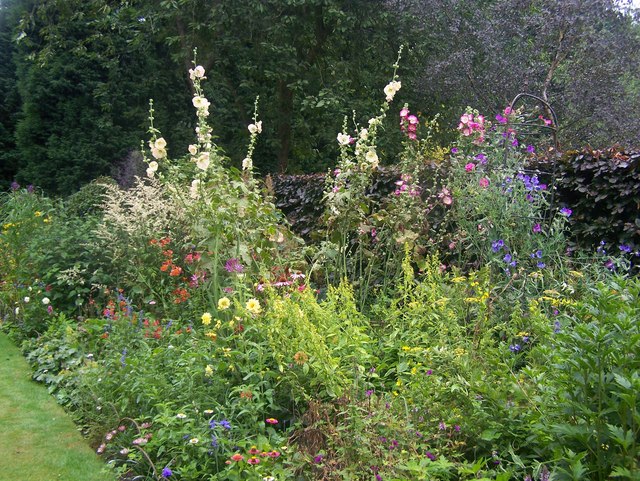
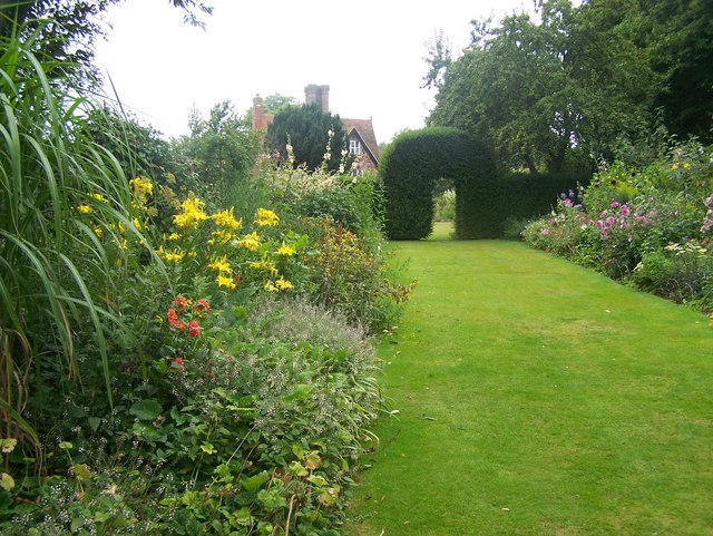
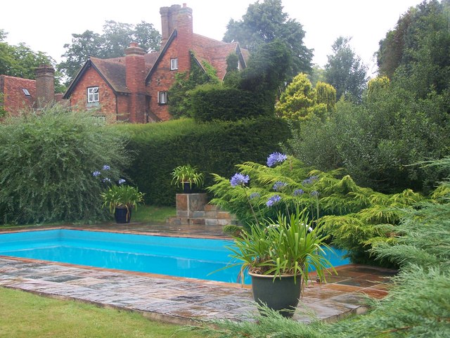
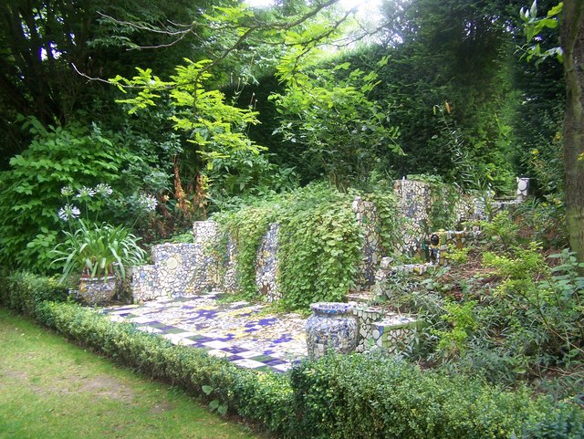
The Isle of Wight is renowned for its stunning natural beauty, with rolling hills, dramatic cliffs, and sandy beaches. It attracts a large number of tourists each year who come to enjoy its scenic landscapes and charming coastal towns. The island's coastline stretches for about 57 miles and offers a variety of beaches, ranging from secluded coves to bustling resort towns.

In addition to its natural attractions, the Isle of Wight is also famous for its rich history. It has been inhabited since prehistoric times and is home to several historical landmarks, including Carisbrooke Castle and Osborne House, the former royal residence of Queen Victoria. The island has also played a significant role in maritime history, with its main port, Cowes, hosting the world-famous Cowes Week sailing regatta.

The Isle of Wight boasts a mild climate, making it an ideal destination for outdoor activities such as hiking, cycling, and water sports. It is also known for its vibrant music scene, hosting the annual Isle of Wight Festival, which attracts renowned artists from around the world.

Overall, the Isle of Wight offers a perfect blend of natural beauty, historical significance, and recreational opportunities, making it a desirable destination for visitors of all ages and interests.

If you have any feedback on the listing, please let us know in the comments section below.

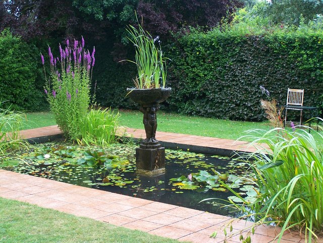
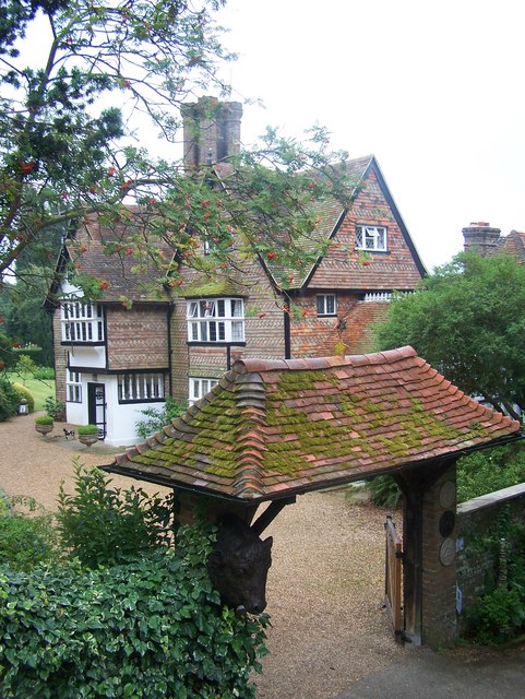
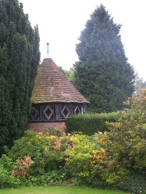
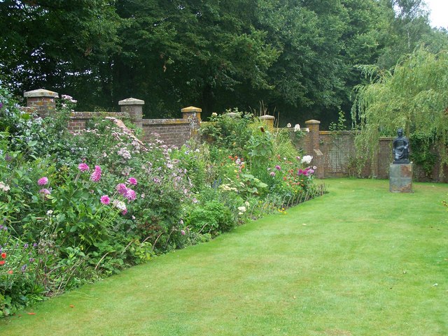
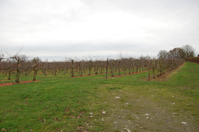
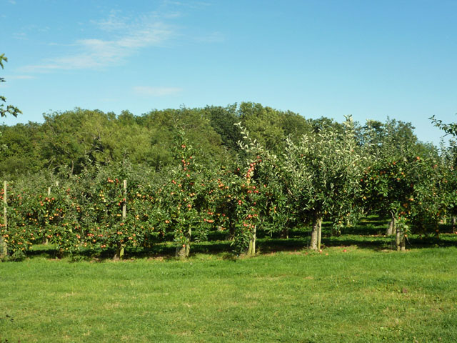
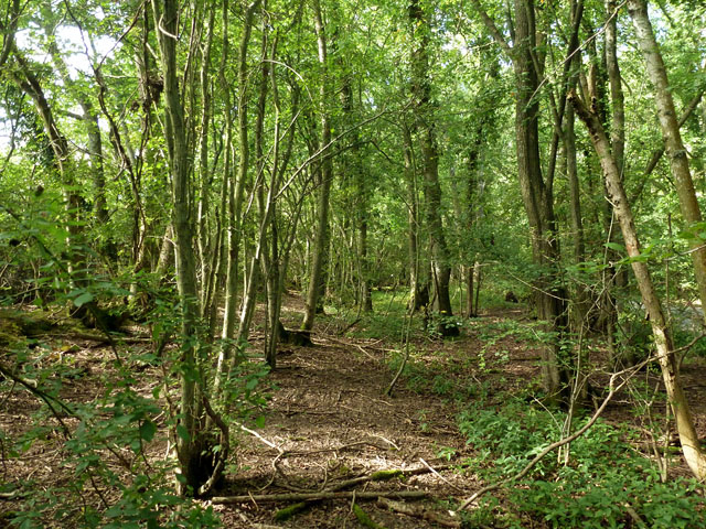
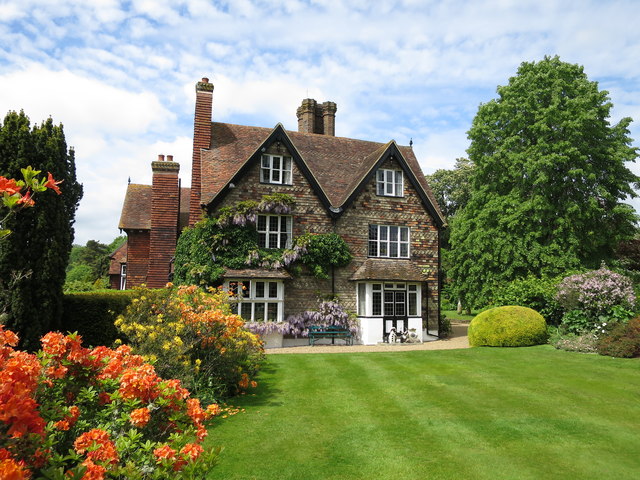
Isle of Wight Images

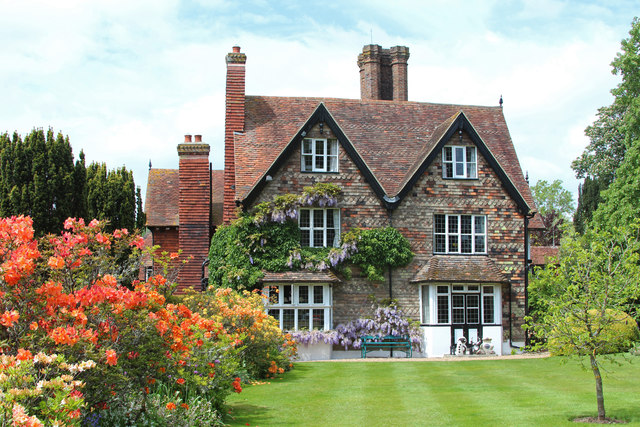
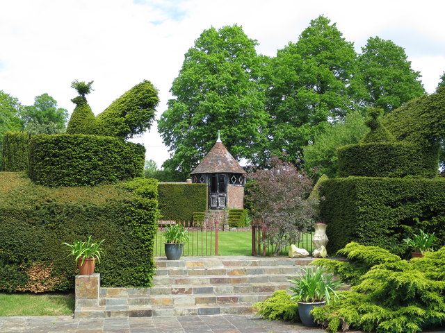
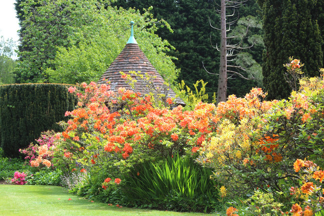
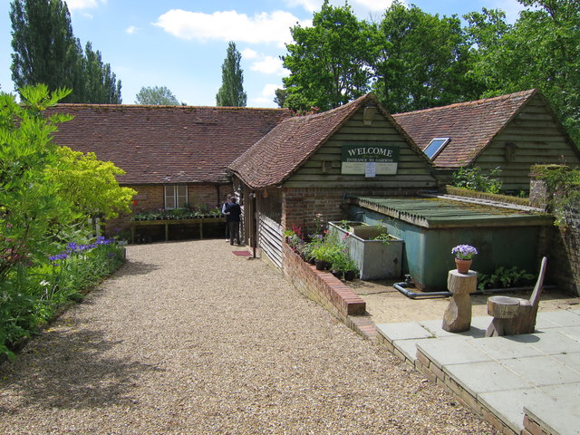
Images are sourced within 2km of 51.146892/0.39888863 or Grid Reference TQ6741. Thanks to Geograph Open Source API. All images are credited.

Pond Garden within Marle Place This garden is divided into various garden rooms.
This has a waterlily pool.
Pond Garden within Marle Place
This garden is divided into various garden rooms. This has a waterlily pool.
House and Archways, Marle Place As seen from the steps to the art gallery.
House and Archways, Marle Place
As seen from the steps to the art gallery.
Summerhouse in Marle Place This garden feature is in one of the garden rooms.
Summerhouse in Marle Place
This garden feature is in one of the garden rooms.
Flower Border in Marle Place One of the many flower borders in the gardens. Leading towards an iron statue.
Flower Border in Marle Place
One of the many flower borders in the gardens. Leading towards an iron statue.
Late Summer colour flower border in Marle Place One of the many flower borders in the garden.
Large cream and pink hollyhocks in the background.
Late Summer colour flower border in Marle Place
One of the many flower borders in the garden. Large cream and pink hollyhocks in the background.
Flower Borders in Marle Place This garden is divided into various garden rooms.
This flower border leads towards a hedge and archways leading towards the main house.
Flower Borders in Marle Place
This garden is divided into various garden rooms. This flower border leads towards a hedge and archways leading towards the main house.
Swimming Pool Garden in Marle Place This garden is divided into various garden rooms.
This garden room is close to the main house.
It has pots of agapanthus around the pool.
Swimming Pool Garden in Marle Place
This garden is divided into various garden rooms. This garden room is close to the main house. It has pots of agapanthus around the pool.
Mosaic steps in Marle Place This garden is divided into various garden rooms.
This feature is made of broken crockery.
Mosaic steps in Marle Place
This garden is divided into various garden rooms. This feature is made of broken crockery.
Apple Orchard
Apple Orchard
Apple orchard Almost certainly belonging to Clive and Richard Edmed of Hayle Farm.
Apple orchard
Almost certainly belonging to Clive and Richard Edmed of Hayle Farm.
Woodland by Marle Place Road A long narrow strip unfenced from the road.
Woodland by Marle Place Road
A long narrow strip unfenced from the road.
Marle Place Set around the grade II listed <span class="nowrap"><a title="http://list.historicengland.org.uk/resultsingle.aspx?uid=1250611" rel="nofollow ugc noopener" href="http://list.historicengland.org.uk/resultsingle.aspx?uid=1250611">Link</a><img style="margin-left:2px;" alt="External link" title="External link - shift click to open in new window" src="https://s1.geograph.org.uk/img/external.png" width="10" height="10"/></span> Marle Place,  10 acres of mature gardens and woodlands, some of which originate from the Victorian and Edwardian era. A rock garden near the visitor entrance dates back to 1900.
Marle Place
Set around the grade II listed LinkExternal link Marle Place, 10 acres of mature gardens and woodlands, some of which originate from the Victorian and Edwardian era. A rock garden near the visitor entrance dates back to 1900.
Marle Place Gardens Set around the grade II listed <span class="nowrap"><a title="http://list.historicengland.org.uk/resultsingle.aspx?uid=1250611" rel="nofollow ugc noopener" href="http://list.historicengland.org.uk/resultsingle.aspx?uid=1250611">Link</a><img style="margin-left:2px;" alt="External link" title="External link - shift click to open in new window" src="https://s1.geograph.org.uk/img/external.png" width="10" height="10"/></span> Marle Place,  10 acres of mature gardens and woodlands, some of which originate from the Victorian and Edwardian era. A rock garden near the visitor entrance dates back to 1900.
Marle Place Gardens
Set around the grade II listed LinkExternal link Marle Place, 10 acres of mature gardens and woodlands, some of which originate from the Victorian and Edwardian era. A rock garden near the visitor entrance dates back to 1900.
Marle Place Gardens visitor entrance Set around the grade II listed <span class="nowrap"><a title="http://list.historicengland.org.uk/resultsingle.aspx?uid=1250611" rel="nofollow ugc noopener" href="http://list.historicengland.org.uk/resultsingle.aspx?uid=1250611">Link</a><img style="margin-left:2px;" alt="External link" title="External link - shift click to open in new window" src="https://s1.geograph.org.uk/img/external.png" width="10" height="10"/></span> Marle Place,  10 acres of mature gardens and woodlands, some of which originate from the Victorian and Edwardian era. A rock garden near the visitor entrance dates back to 1900.
Marle Place Gardens visitor entrance
Set around the grade II listed LinkExternal link Marle Place, 10 acres of mature gardens and woodlands, some of which originate from the Victorian and Edwardian era. A rock garden near the visitor entrance dates back to 1900.
Marle Place Gardens, Rockery garden
Marle Place Gardens, Rockery garden Set around the grade II listed <span class="nowrap"><a title="http://list.historicengland.org.uk/resultsingle.aspx?uid=1250611" rel="nofollow ugc noopener" href="http://list.historicengland.org.uk/resultsingle.aspx?uid=1250611">Link</a><img style="margin-left:2px;" alt="External link" title="External link - shift click to open in new window" src="https://s1.geograph.org.uk/img/external.png" width="10" height="10"/></span> Marle Place,  10 acres of mature gardens and woodlands, some of which originate from the Victorian and Edwardian era. A rock garden near the visitor entrance dates back to 1900.
Marle Place Gardens, Rockery garden
Set around the grade II listed LinkExternal link Marle Place, 10 acres of mature gardens and woodlands, some of which originate from the Victorian and Edwardian era. A rock garden near the visitor entrance dates back to 1900.
Show me another place!

Isle of Wight is located at Grid Ref: TQ6741 (Lat: 51.146892, Lng: 0.39888863)

Administrative County: Kent

District: Tunbridge Wells

Police Authority: Kent

What 3 Words

///chapels.plotting.circulate. Near Brenchley, Kent

Related Wikis

All Saints Church, Brenchley

All Saints Church is a parish church in Brenchley, Kent, England. It is a Grade I listed building.It is dedicated to All Saints. == Building == A Chapel...

Brenchley

Brenchley is a village in the civil parish of Brenchley and Matfield, in the borough of Tunbridge Wells, Kent, England. All Saints Church is located in...

Matfield House

Matfield House is a Grade I listed Georgian house in the village of Matfield, Kent, England.The house was built in 1728 in the Queen Anne style for Thomas...

Horsmonden

Horsmonden ( HORZ-mən-DEN) is a village in the borough of Tunbridge Wells in Kent, England. The village is located in the Weald of Kent. It is situated...

Matfield

Matfield is a small village, part of the civil parish of Brenchley and Matfield, in the Tunbridge Wells borough of Kent, England. Matfield was awarded...

St Luke's Church, Matfield

St Luke's Church is a parish church in the village of Matfield, Kent, England. It is a Grade II listed building.The church is dedicated to Luke the Evangelist...

Mascalls Academy

Mascalls Academy (formerly Mascalls School) is a co-educational secondary school and a sixth form with academy status located in Paddock Wood, Kent....

Horsmonden railway station

Horsmonden is a closed railway station on the closed Hawkhurst Branch in Kent, England. == Background == The station was opened on 1 October 1892, when...

Nearby Amenities

Located within 500m of 51.146892,0.39888863
Brenchley
Is In: Kent, England, UK
Place: village
Source: npe
Website: http://www.brenchleyandmatfield.co.uk/
Lat/Long: 51.1508465/0.3998846
The Bull at Brenchley
Addr City: Brenchley
Addr Housename: The Bull at Brenchley
Addr Postcode: TN12 7NQ
Addr Street: High Street
Tourism: guest_house
Website: https://thebullatbrenchley.co.uk/
Wikidata: Q26542143
Lat/Long: 51.1505593/0.3997031
Post Box
Collection Times: Mo-Fr 17:00; Sa 10:30
Post Box Type: pillar
Ref: TN12 126
Royal Cypher: GR
Royal Cypher Wikidata: Q33102273
Lat/Long: 51.1506853/0.3997846
Bus Stop
Church
Fixme: Move routes to relations
Naptan AtcoCode: 2400A037760A
Naptan Bearing: E
Naptan CommonName: Church
Naptan Indicator: opp
Naptan Landmark: Brenchley Church
Naptan NaptanCode: kntdpdad
Naptan Street: High Street
Naptan Verified: no
Note: 296 - Tunbridge Wells, Pembury, Brenchley, Horsmonden, Paddock Wood
Note 2: Dear MapRoulette users, the NAPTAN data says the name for this object is actually "Church" - please don't remove the name as generic.
Operator: Arriva
Public Transport: platform
Ref: kntdpdad
Shelter: no
Source: naptan_import
Source Date: 2018-08-20T15:20:00
Lat/Long: 51.1506164/0.4001669
Bus Stop
Halfway House
Fixme: Can someone confirm whether or not busses stop here?
Flag: no
Naptan AtcoCode: 2400A037770A
Naptan Bearing: NW
Naptan BusStopType: CUS
Naptan CommonName: Halfway House
Naptan Indicator: o/s
Naptan Landmark: Halfway House
Naptan NaptanCode: kntdpdag
Naptan Street: Horsmonden Road
Naptan Verified: no
Public Transport: platform
Ref: kntdpdag
Source: naptan_import
Source Date: 2018-08-20T15:19:00
Lat/Long: 51.1469048/0.4035793
Bus Stop
Church
Fixme: Can someone confirm whether or not busses stop here?
Flag: no
Naptan AtcoCode: 2400A037780A
Naptan Bearing: W
Naptan BusStopType: CUS
Naptan CommonName: Church
Naptan Indicator: adj
Naptan Landmark: Church
Naptan NaptanCode: kntdpdaj
Naptan Street: High Street
Naptan Verified: no
Note: Dear MapRoulette users, the NAPTAN data says the name for this object is actually "Church" - please don't remove the name as generic.
Public Transport: platform
Ref: kntdpdaj
Source: naptan_import
Source Date: 2018-08-20T15:21:00
Lat/Long: 51.1504762/0.4000327
Pub
The Halfway House
Wikidata: Q26542252
Lat/Long: 51.1466913/0.4035251
Post Office
Brenchley Post Office
Addr Postcode: TN12 7NL
Branch: Brenchley
Brand: Post Office
Brand Wikidata: Q1783168
Check Date: 2020-02-20
Contact Website: https://www.postoffice.co.uk/branch-finder/1519484/brenchley
Ref Pol Id: 2928
Lat/Long: 51.1507806/0.3995893
Barrier: stile
Lat/Long: 51.1482416/0.4017821
Parking
Parking: surface
Lat/Long: 51.1505374/0.3992686
Toilets
Source: Survey
Lat/Long: 51.1506653/0.3992015
Bench
Backrest: yes
Lat/Long: 51.1506343/0.4000302
Bus Stop
Halfway House
Fixme: Can someone confirm whether or not busses stop here?
Flag: no
Naptan AtcoCode: 2400102928
Naptan Bearing: S
Naptan BusStopType: CUS
Naptan CommonName: Halfway House
Naptan Indicator: opp
Naptan Landmark: Halfway House
Naptan NaptanCode: kntjatwt
Naptan Street: Horsmonden Road
Naptan Verified: no
Public Transport: platform
Ref: kntjatwt
Source: NAPTAN
Source Date: 2018-08-20T15:19:00
Lat/Long: 51.1468447/0.4038764
The data included in this document is from www.openstreetmap.org. The data is made available under ODbL.

Have you been to Isle of Wight?

Leave your review of Isle of Wight below (or comments, questions and feedback).