Pond Shaw Wood

Wood, Forest in Kent Tunbridge Wells

England

Pond Shaw Wood

Pond Garden within Marle Place This garden is divided into various garden rooms.
This has a waterlily pool.
Pond Garden within Marle Place Credit: David Anstiss

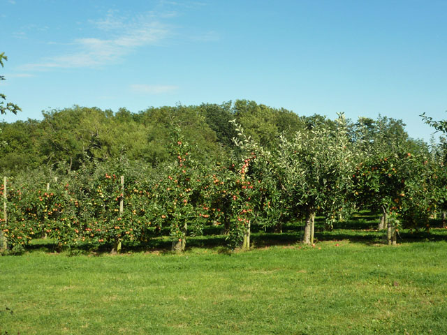
Pond Shaw Wood is a charming forest situated in the county of Kent, England. Covering an area of approximately 100 acres, it is a popular destination for nature enthusiasts and outdoor enthusiasts alike.

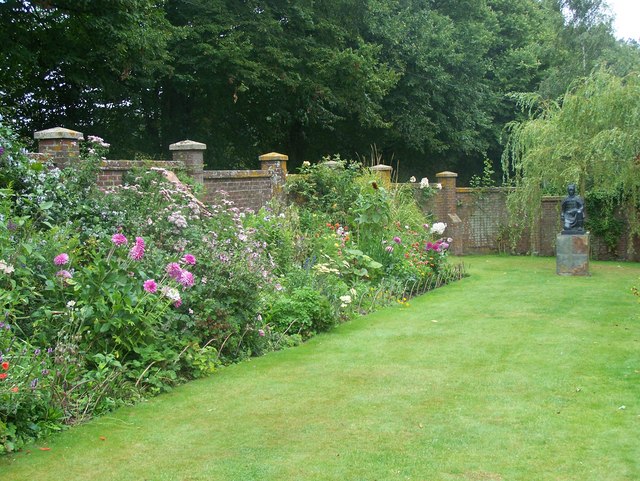
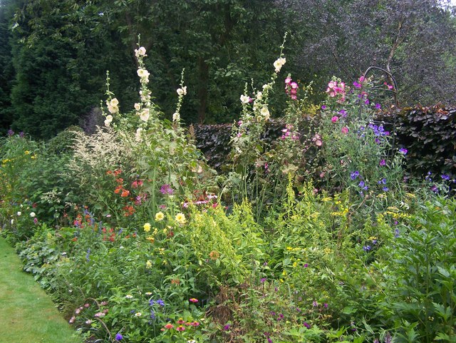
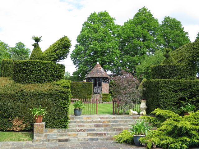
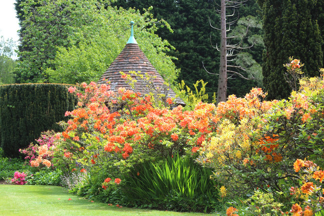
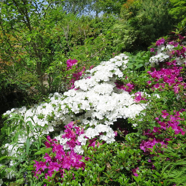
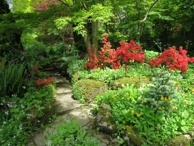
The wood is characterized by its diverse range of flora and fauna, which thrives in the rich and fertile soil. The canopy of the forest is dominated by an array of towering oak and beech trees, creating a picturesque and serene atmosphere. In spring, the forest floor comes alive with a carpet of bluebells, creating a breathtaking sight.

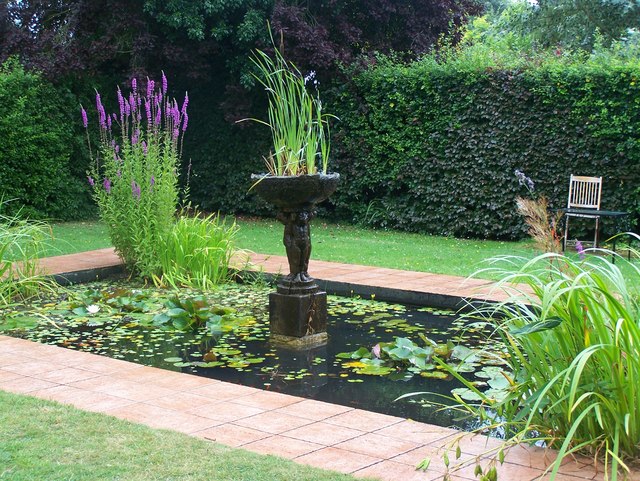
Pond Shaw Wood is home to a variety of wildlife species. Visitors may catch glimpses of deer, foxes, badgers, and an abundance of bird species such as woodpeckers and owls. The tranquil pond located within the wood provides a habitat for a range of aquatic creatures.

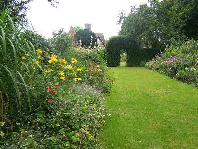
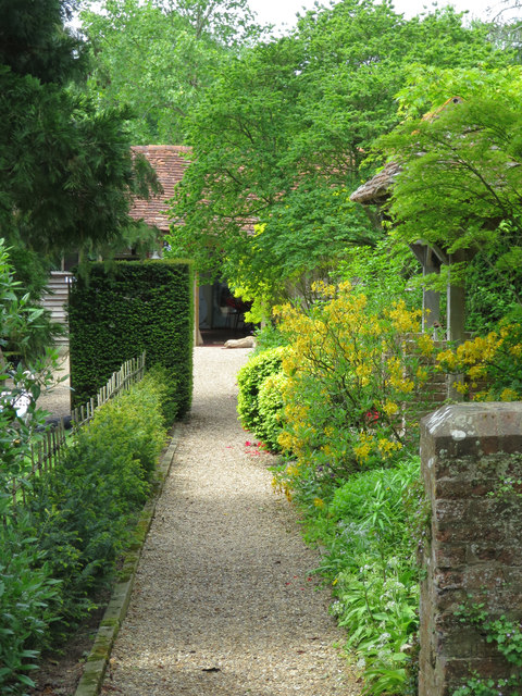
The wood offers several walking trails and footpaths, allowing visitors to explore its natural beauty at their own pace. These trails are well-maintained, and information boards along the way provide interesting facts about the woodland's history and ecology.

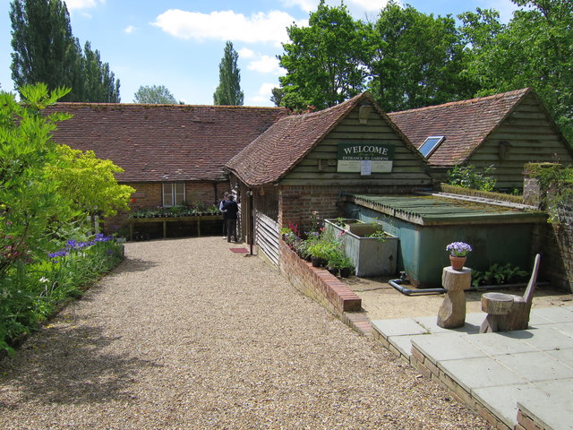
Pond Shaw Wood is easily accessible, with ample parking and nearby amenities. It offers a peaceful escape from the hustle and bustle of daily life, providing visitors with an opportunity to reconnect with nature and enjoy the tranquility of the forest.

Overall, Pond Shaw Wood is a hidden gem in Kent, offering a beautiful and peaceful woodland experience for all who visit.

If you have any feedback on the listing, please let us know in the comments section below.

Pond Shaw Wood Images

Images are sourced within 2km of 51.147884/0.38732937 or Grid Reference TQ6741. Thanks to Geograph Open Source API. All images are credited.

Pond Garden within Marle Place This garden is divided into various garden rooms.
This has a waterlily pool.
Pond Garden within Marle Place
This garden is divided into various garden rooms. This has a waterlily pool.
House and Archways, Marle Place As seen from the steps to the art gallery.
House and Archways, Marle Place
As seen from the steps to the art gallery.
Summerhouse in Marle Place This garden feature is in one of the garden rooms.
Summerhouse in Marle Place
This garden feature is in one of the garden rooms.
Flower Border in Marle Place One of the many flower borders in the gardens. Leading towards an iron statue.
Flower Border in Marle Place
One of the many flower borders in the gardens. Leading towards an iron statue.
Late Summer colour flower border in Marle Place One of the many flower borders in the garden.
Large cream and pink hollyhocks in the background.
Late Summer colour flower border in Marle Place
One of the many flower borders in the garden. Large cream and pink hollyhocks in the background.
Flower Borders in Marle Place This garden is divided into various garden rooms.
This flower border leads towards a hedge and archways leading towards the main house.
Flower Borders in Marle Place
This garden is divided into various garden rooms. This flower border leads towards a hedge and archways leading towards the main house.
Swimming Pool Garden in Marle Place This garden is divided into various garden rooms.
This garden room is close to the main house.
It has pots of agapanthus around the pool.
Swimming Pool Garden in Marle Place
This garden is divided into various garden rooms. This garden room is close to the main house. It has pots of agapanthus around the pool.
Mosaic steps in Marle Place This garden is divided into various garden rooms.
This feature is made of broken crockery.
Mosaic steps in Marle Place
This garden is divided into various garden rooms. This feature is made of broken crockery.
Apple orchard Almost certainly belonging to Clive and Richard Edmed of Hayle Farm.
Apple orchard
Almost certainly belonging to Clive and Richard Edmed of Hayle Farm.
Track through a Maize field Near Cryals Farm.
Track through a Maize field
Near Cryals Farm.
Marle Place Set around the grade II listed <span class="nowrap"><a title="http://list.historicengland.org.uk/resultsingle.aspx?uid=1250611" rel="nofollow ugc noopener" href="http://list.historicengland.org.uk/resultsingle.aspx?uid=1250611">Link</a><img style="margin-left:2px;" alt="External link" title="External link - shift click to open in new window" src="https://s1.geograph.org.uk/img/external.png" width="10" height="10"/></span> Marle Place,  10 acres of mature gardens and woodlands, some of which originate from the Victorian and Edwardian era. A rock garden near the visitor entrance dates back to 1900.
Marle Place
Set around the grade II listed LinkExternal link Marle Place, 10 acres of mature gardens and woodlands, some of which originate from the Victorian and Edwardian era. A rock garden near the visitor entrance dates back to 1900.
Marle Place Gardens Set around the grade II listed <span class="nowrap"><a title="http://list.historicengland.org.uk/resultsingle.aspx?uid=1250611" rel="nofollow ugc noopener" href="http://list.historicengland.org.uk/resultsingle.aspx?uid=1250611">Link</a><img style="margin-left:2px;" alt="External link" title="External link - shift click to open in new window" src="https://s1.geograph.org.uk/img/external.png" width="10" height="10"/></span> Marle Place,  10 acres of mature gardens and woodlands, some of which originate from the Victorian and Edwardian era. A rock garden near the visitor entrance dates back to 1900.
Marle Place Gardens
Set around the grade II listed LinkExternal link Marle Place, 10 acres of mature gardens and woodlands, some of which originate from the Victorian and Edwardian era. A rock garden near the visitor entrance dates back to 1900.
Marle Place Gardens visitor entrance Set around the grade II listed <span class="nowrap"><a title="http://list.historicengland.org.uk/resultsingle.aspx?uid=1250611" rel="nofollow ugc noopener" href="http://list.historicengland.org.uk/resultsingle.aspx?uid=1250611">Link</a><img style="margin-left:2px;" alt="External link" title="External link - shift click to open in new window" src="https://s1.geograph.org.uk/img/external.png" width="10" height="10"/></span> Marle Place,  10 acres of mature gardens and woodlands, some of which originate from the Victorian and Edwardian era. A rock garden near the visitor entrance dates back to 1900.
Marle Place Gardens visitor entrance
Set around the grade II listed LinkExternal link Marle Place, 10 acres of mature gardens and woodlands, some of which originate from the Victorian and Edwardian era. A rock garden near the visitor entrance dates back to 1900.
Marle Place Gardens, Rockery garden
Marle Place Gardens, Rockery garden Set around the grade II listed <span class="nowrap"><a title="http://list.historicengland.org.uk/resultsingle.aspx?uid=1250611" rel="nofollow ugc noopener" href="http://list.historicengland.org.uk/resultsingle.aspx?uid=1250611">Link</a><img style="margin-left:2px;" alt="External link" title="External link - shift click to open in new window" src="https://s1.geograph.org.uk/img/external.png" width="10" height="10"/></span> Marle Place,  10 acres of mature gardens and woodlands, some of which originate from the Victorian and Edwardian era. A rock garden near the visitor entrance dates back to 1900.
Marle Place Gardens, Rockery garden
Set around the grade II listed LinkExternal link Marle Place, 10 acres of mature gardens and woodlands, some of which originate from the Victorian and Edwardian era. A rock garden near the visitor entrance dates back to 1900.
Marle Place Gardens Set around the grade II listed <span class="nowrap"><a title="http://list.historicengland.org.uk/resultsingle.aspx?uid=1250611" rel="nofollow ugc noopener" href="http://list.historicengland.org.uk/resultsingle.aspx?uid=1250611">Link</a><img style="margin-left:2px;" alt="External link" title="External link - shift click to open in new window" src="https://s1.geograph.org.uk/img/external.png" width="10" height="10"/></span> Marle Place,  10 acres of mature gardens and woodlands, some of which originate from the Victorian and Edwardian era. A rock garden near the visitor entrance dates back to 1900.
Marle Place Gardens
Set around the grade II listed LinkExternal link Marle Place, 10 acres of mature gardens and woodlands, some of which originate from the Victorian and Edwardian era. A rock garden near the visitor entrance dates back to 1900.
Show me another place!

Pond Shaw Wood is located at Grid Ref: TQ6741 (Lat: 51.147884, Lng: 0.38732937)

Administrative County: Kent

District: Tunbridge Wells

Police Authority: Kent

What 3 Words

///rejoins.fragments.pits. Near Brenchley, Kent

Related Wikis

Brenchley

Brenchley is a village in the civil parish of Brenchley and Matfield, in the borough of Tunbridge Wells, Kent, England. All Saints Church is located in...

All Saints Church, Brenchley

All Saints Church is a parish church in Brenchley, Kent, England. It is a Grade I listed building.It is dedicated to All Saints. == Building == A Chapel...

Matfield House

Matfield House is a Grade I listed Georgian house in the village of Matfield, Kent, England.The house was built in 1728 in the Queen Anne style for Thomas...

Matfield

Matfield is a small village, part of the civil parish of Brenchley and Matfield, in the Tunbridge Wells borough of Kent, England. Matfield was awarded...

St Luke's Church, Matfield

St Luke's Church is a parish church in the village of Matfield, Kent, England. It is a Grade II listed building.The church is dedicated to Luke the Evangelist...

Brenchley Wood

Brenchley Wood is a 15-hectare (37-acre) nature reserve south of Paddock Wood in Kent. It is managed by the Kent Wildlife Trust, and it is part of the...

Mascalls Academy

Mascalls Academy (formerly Mascalls School) is a co-educational secondary school and a sixth form with academy status located in Paddock Wood, Kent....

Foal Hurst Wood

Foal Hurst Wood is a 12.9-hectare (32-acre) Local Nature Reserve on the south-western outskirts of Paddock Wood in Kent. It is owned by Tunbridge Wells...

Nearby Amenities

Located within 500m of 51.147884,0.38732937
Bus Stop
Petteridge Lane
Naptan AtcoCode: 2400A037800A
Naptan Bearing: W
Naptan CommonName: Petteridge Lane
Naptan Indicator: adj
Naptan Landmark: Petteridge Lane
Naptan NaptanCode: kntdpdap
Naptan Street: Brenchley Road
Naptan Verified: no
Public Transport: platform
Ref: kntdpdap
Source: naptan_import
Source Date: 2018-08-20T15:27:00
Lat/Long: 51.1508036/0.3884382
Addr City: Brenchley
Addr Postcode: TN12 7BF
Addr Street: Market Heath Close
Building: residential
Lat/Long: 51.1506605/0.3894809
Post Box
Collection Times: Mo-Fr 09:00; Sa 07:00
Post Box Type: wall
Ref: TN12 104D
Royal Cypher: GR
Royal Cypher Wikidata: Q33102273
Lat/Long: 51.1507489/0.3869778
Turning Circle
Lat/Long: 51.1498135/0.3884046
Bus Stop
Petteridge Lane
Fixme: Can someone confirm whether or not busses stop here?
Flag: no
Naptan AtcoCode: 2400104968
Naptan Bearing: E
Naptan BusStopType: CUS
Naptan CommonName: Petteridge Lane
Naptan Indicator: opp
Naptan Landmark: Petteridge Lane
Naptan NaptanCode: kntjptdj
Naptan Street: Brenchley Road
Naptan Verified: no
Public Transport: platform
Ref: kntjptdj
Source: NAPTAN
Source Date: 2012-01-31T10:52:00
Lat/Long: 51.1509291/0.388459
The data included in this document is from www.openstreetmap.org. The data is made available under ODbL.

Have you been to Pond Shaw Wood?

Leave your review of Pond Shaw Wood below (or comments, questions and feedback).