Holme

Settlement in Yorkshire

England

Holme

Multi-story car park, Hall Ings, Bradford The car park is being readied for demolition.
Multi-story car park, Hall Ings, Bradford Credit: habiloid

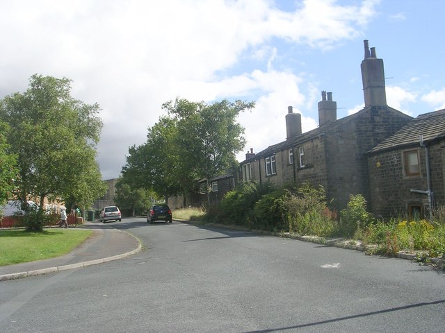
Holme is a small village located in the Holme Valley of West Yorkshire, England. Situated approximately 4 miles south of Huddersfield, it falls within the Kirklees district. The village is surrounded by picturesque countryside and is nestled in the valley, offering stunning views of the Pennines.

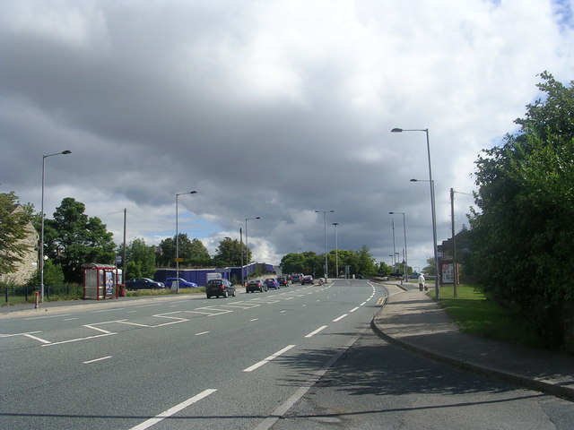
With a population of around 1,500 people, Holme exudes a charming and close-knit community feel. The village is well-connected, with easy access to the nearby cities of Manchester and Leeds via the M62 motorway. The local public transportation system also provides regular bus services to Huddersfield and other nearby towns.

Historically, Holme was an agricultural village, and remnants of its rural past can still be seen today. The village features a mix of traditional stone-built houses, quaint cottages, and modern developments. The local economy primarily revolves around agriculture, small businesses, and services catering to the needs of the local community.

Holme offers several amenities, including a primary school, a village hall, a community center, and a church. The village also boasts a range of recreational facilities, such as sports fields, playgrounds, and walking trails, making it an ideal location for outdoor enthusiasts.

The surrounding countryside provides ample opportunities for outdoor activities, including hiking, cycling, and horse riding. The Holme Valley is also known for its vibrant arts scene, with numerous art galleries, craft shops, and annual events showcasing local talent.

Overall, Holme is a charming and peaceful village that combines rural tranquility with convenient access to nearby cities, making it an attractive place to live or visit for those seeking a slower pace of life.

If you have any feedback on the listing, please let us know in the comments section below.
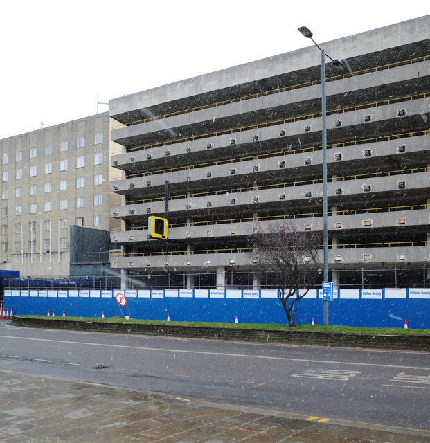
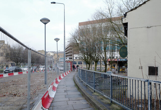
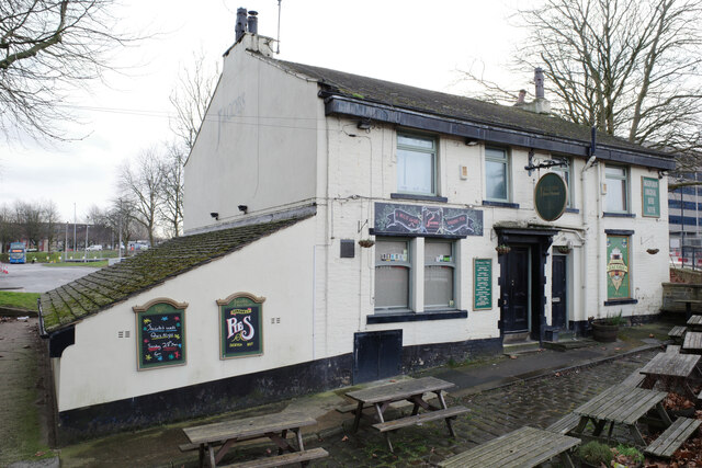
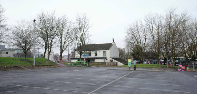
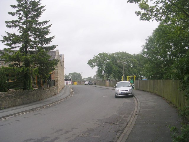
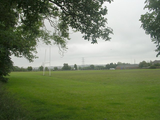
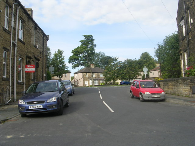
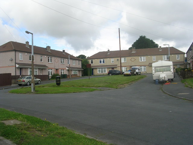
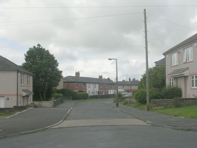
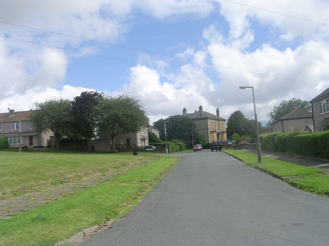
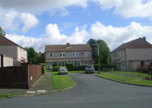
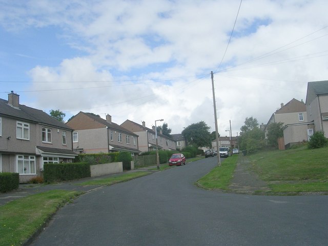
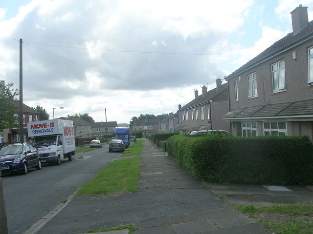
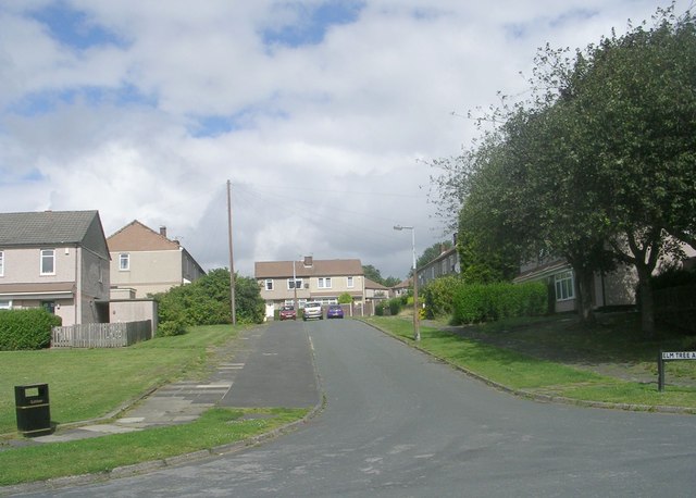
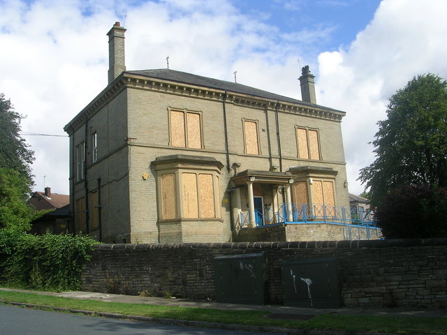
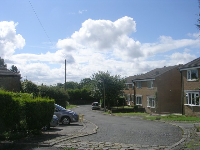
Holme Images

Images are sourced within 2km of 53.780563/-1.761055 or Grid Reference SE1531. Thanks to Geograph Open Source API. All images are credited.

Multi-story car park, Hall Ings, Bradford The car park is being readied for demolition.
Multi-story car park, Hall Ings, Bradford
The car park is being readied for demolition.
Hall Ings, Bradford
Hall Ings, Bradford
Jacob's Well seen from Hall Ings, Bradford
Jacob's Well car park, Bradford
Stadium Road - off Cleckheaton Road
Recreation Ground - Cleckheaton Road
Triangle - White Lane
Elm Tree Gardens - Elmfield Drive
Dawson Avenue - Elmfield Drive
Thornfield Avenue - Elmfield Drive
Elm Tree Close - Elmfield Drive
Elmfield Drive - viewed from Thornfield Avenue
Elm Tree Avenue - Thornfield Avenue
The former Odsal Clinic - viewed from Elmfield Drive
Hatton Close - Halifax Road
Halifax Road - viewed from Hatton Close
Show me another place!

Holme is located at Grid Ref: SE1531 (Lat: 53.780563, Lng: -1.761055)

Division: West Riding

Unitary Authority: Bradford

Police Authority: West Yorkshire

What 3 Words

///client.hulk.fled. Near Bradford, West Yorkshire

Related Wikis

Manchester Road railway station (West Yorkshire)

Manchester Road railway station is a closed station in the city of Bradford, West Yorkshire, England. The station opened in 1878 but closed to passengers...

Dixons City Academy

Dixons City Academy is an academy in Bradford, West Yorkshire, England. The school was founded in 1990 as Dixons City Technology College which focused...

Trident, West Yorkshire

Trident is a civil parish in the City of Bradford in West Yorkshire, England, created in 2009. The population of the civil parish as at the 2011 Census...

St Luke's Hospital, Bradford

St Luke's Hospital is an NHS hospital in Bradford, West Yorkshire, England. It is situated on Little Horton Lane to the south-west of Bradford city centre...

Park Avenue (stadium)

Park Avenue is a sports ground on Horton Park Avenue in Bradford, West Yorkshire, England that has been used for cricket, football and both codes of rugby...

Bradford Grand Mosque

The Bradford Grand Mosque, or Al-Jamia Suffa-Tul-Islam Grand Mosque, is the largest mosque in Bradford, West Yorkshire, England.It was founded in 1983...

Birch Lane

Birch Lane was a rugby league ground in Bradford, England. It was the first long term home of Bradford Northern Rugby League Football Club, who played...

Horton Park railway station

Horton Park railway station was a railway station on the Queensbury-Bradford section of the Queensbury Lines which ran between Bradford, Keighley and Halifax...

Nearby Amenities

Located within 500m of 53.780563,-1.761055
Traffic Signals
Crossing: no
Lat/Long: 53.7794501/-1.7605868
Crossing
Button Operated: yes
Crossing: traffic_signals
Crossing Island: no
Crossing Ref: pelican
Kerb: flush
Tactile Paving: yes
Lat/Long: 53.7782152/-1.7610068
Mini Roundabout
Direction: clockwise
Lat/Long: 53.7829654/-1.7641178
Mini Roundabout
Direction: clockwise
Lat/Long: 53.779088/-1.7543021
Place Of Worship
Denomination: jehovahs_witness
Religion: christian
Lat/Long: 53.7799891/-1.7599629
Turning Circle
Lat/Long: 53.7774598/-1.7636497
Pub
The Bridge Tavern
Lat/Long: 53.7828925/-1.7545403
Crossing
Button Operated: yes
Crossing: traffic_signals
Crossing Island: no
Tactile Paving: yes
Lat/Long: 53.7816759/-1.758502
Crossing
Crossing: traffic_signals
Crossing Island: no
Crossing Ref: puffin
Kerb: flush
Tactile Paving: yes
Lat/Long: 53.7817002/-1.75879
Crossing
Crossing: traffic_signals
Crossing Island: no
Tactile Paving: yes
Lat/Long: 53.7816858/-1.758669
Telephone
Booth: InLink
Covered: booth
Internet Access: wlan
Internet Access Fee: no
Operator: BT
Lat/Long: 53.7816499/-1.7589471
Bus Stop
Bus: yes
Public Transport: platform
Lat/Long: 53.781881/-1.7582136
Bus Stop
Bus: yes
Public Transport: platform
Lat/Long: 53.7801559/-1.7599581
Crossing
Crossing: unmarked
Crossing Island: no
Tactile Paving: yes
Traffic Calming: table
Lat/Long: 53.7788359/-1.7570942
Crossing
Crossing: marked
Crossing Island: no
Crossing Markings: zebra
Crossing Ref: zebra
Tactile Paving: yes
Traffic Calming: table
Lat/Long: 53.7786764/-1.7586043
Akbar General Food Store
Shop: convenience
Lat/Long: 53.777625/-1.7586648
Traffic Signals
Crossing: no
Lat/Long: 53.7776061/-1.760643
Post Box
Operator: Royal Mail
Lat/Long: 53.7784236/-1.7672232
Doctors
Little Horton Lane Medical Centre
Healthcare: doctor
Lat/Long: 53.7824723/-1.764861
Premier
Brand: Premier
Brand Wikidata: Q7240340
Brand Wikipedia: en:Premier Stores
Shop: convenience
Lat/Long: 53.7829557/-1.764357
Pub
The Black Bull
Lat/Long: 53.7809659/-1.7651546
Bus Stop
Bus: yes
Public Transport: platform
Lat/Long: 53.7784653/-1.7637963
Pub
Lister's
Lat/Long: 53.7824407/-1.7582481
Turning Circle
Lat/Long: 53.7830206/-1.7573582
Pub
Central division sports and social club
Addr City: Bradford
Addr Housenumber: 4-6
Addr Postcode: BD5 0RA
Addr Street: Clayton Lane
Addr Village: Little Horton
Fhrs Id: 328077
Source Addr: FHRS Open Data
Lat/Long: 53.7835475/-1.7565605
Restaurant
Classic Persian
Addr City: Bradford
Addr Housenumber: 368
Addr Postcode: BD5 0NB
Addr Street: Little Horton Lane
Cuisine: persian
Diet Vegan: limited
Diet Vegetarian: limited
Fhrs Id: 801447
Level: 0
Opening Hours: Mo closed; Tu-Th 16:00-22:00; Fr 16:00-23:00; Sa 12:00-23:00; Su 12:00-22:00
Takeaway: yes
Lat/Long: 53.7834892/-1.7639004
Pharmacy
Cohens Chemist
Addr City: Bradford
Addr Housenumber: 392a
Addr Postcode: BD5 0NX
Addr Street: Little Horton Lane
Dispensing: yes
Fhrs Id: 325680
Healthcare: pharmacy
Opening Hours: Mo-Fr 08:30-18:30; Sa 09:00-13:00
Phone: +44 1274 722564
Lat/Long: 53.7822809/-1.764782
Place Of Worship
The Light Of The World Gospel Hall Community Church
Religion: christian
Lat/Long: 53.780571/-1.7544477
Pub
The Newby Square
Lat/Long: 53.7808075/-1.7546241
Bus Stop
Lat/Long: 53.7771896/-1.7606635
Bus Stop
Bus: yes
Public Transport: platform
Lat/Long: 53.7795921/-1.7608632
Power: substation
Lat/Long: 53.7815011/-1.7594023
Fuel
Shell
Addr City: Bradford
Addr Postcode: BD5 7JX
Addr Street: Manchester Road
Brand: Shell
Brand Wikidata: Q110716465
Phone: +44 1274 733991
Ref Navads: NVDS353_10019323
Website: https://find.shell.com/gb/fuel/10019323-listers-arms-self-serve
Lat/Long: 53.7823663/-1.7573028
Spar
Brand: Spar
Brand Wikidata: Q610492
Brand Wikipedia: en:Spar (retailer)
Shop: convenience
Lat/Long: 53.7822395/-1.7574551
Turning Circle
Lat/Long: 53.7823036/-1.7654931
Barrier: bollard
Lat/Long: 53.7792757/-1.7638846
Barrier: bollard
Lat/Long: 53.7842417/-1.7580184
Bus Stop
Manchester Road Burnett Avenue
Local Ref: 45014588
Naptan AtcoCode: 450014588
Naptan Bearing: N
Naptan CommonName: Manchester Road Burnett Avenue
Naptan Crossing: Burnett Avenue
Naptan Indicator: Stop 45014588
Naptan Landmark: Chapel of Rest
Naptan Notes: OSR taken place 160805
Naptan PlusbusZoneRef: LEEDS
Naptan ShortCommonName: Burnett Avenue
Naptan Street: Manchester Road
Naptan Verified: no
Source: naptan_import
Lat/Long: 53.777239/-1.7606945
Bus Stop
Manchester Road Roundhill Street
Bus: yes
Local Ref: 45014589
Naptan AtcoCode: 450014589
Naptan Bearing: N
Naptan CommonName: Manchester Road Roundhill Street
Naptan Crossing: Roundhill Street
Naptan Indicator: Stop 45014589
Naptan Notes: OSR taken place 160805 size 1 case fitted
Naptan PlusbusZoneRef: LEEDS
Naptan ShortCommonName: Roundhill Street
Naptan Street: Manchester Road
Naptan Verified: no
Public Transport: platform
Source: naptan_import
Lat/Long: 53.7795763/-1.7608785
Bus Stop
Manchester Road Newall Street
Bench: no
Bin: no
Bus: yes
Lit: yes
Local Ref: 45014590
Naptan AtcoCode: 450014590
Naptan Bearing: NE
Naptan CommonName: Manchester Road Newall Street
Naptan Crossing: Newall Street
Naptan Indicator: Stop 45014590
Naptan Landmark: The New Inn
Naptan Notes: OSR taken place 170805
Naptan PlusbusZoneRef: LEEDS
Naptan ShortCommonName: Newall Street
Naptan Street: Manchester Road
Naptan Verified: no
Public Transport: platform
Shelter: no
Source: naptan_import
Tactile Paving: no
Lat/Long: 53.7813168/-1.7592751
Bus Stop
Manchester Road Clayton Lane
Bus: yes
Local Ref: 45014591
Naptan AtcoCode: 450014591
Naptan Bearing: NE
Naptan CommonName: Manchester Road Clayton Lane
Naptan Crossing: Clayton Lane
Naptan Indicator: Stop 45014591
Naptan Landmark: Filling Station
Naptan PlusbusZoneRef: LEEDS
Naptan ShortCommonName: Clayton Lane
Naptan Street: Manchester Road
Naptan Verified: no
Public Transport: platform
Source: naptan_import
Lat/Long: 53.7828231/-1.7574149
Bus Stop
Manchester Road Bowling Old Lane
Bus: yes
Local Ref: 45014596
Naptan AtcoCode: 450014596
Naptan Bearing: SW
Naptan CommonName: Manchester Road Bowling Old Lane
Naptan Crossing: Bowling Old Lane
Naptan Indicator: Stop 45014596
Naptan Notes: OSR taken place 160805
Naptan PlusbusZoneRef: LEEDS
Naptan ShortCommonName: Bowling Old Lane
Naptan Street: Manchester Road
Naptan Verified: no
Public Transport: platform
Source: naptan_import
Lat/Long: 53.7829922/-1.7565944
Bus Stop
Manchester Road Ripley Street
Bus: yes
Local Ref: 45014597
Naptan AtcoCode: 450014597
Naptan Bearing: SW
Naptan CommonName: Manchester Road Ripley Street
Naptan Crossing: Ripley Street
Naptan Indicator: Stop 45014597
Naptan Landmark: Shell Garage - Adj Technical College
Naptan Notes: OSR taken place 160805
Naptan PlusbusZoneRef: LEEDS
Naptan ShortCommonName: Ripley Street
Naptan Street: Manchester Road
Naptan Verified: no
Public Transport: platform
Source: naptan_import
Lat/Long: 53.7816924/-1.758332
Bus Stop
Manchester Road Jacob Street
Bus: yes
Local Ref: 45014598
Naptan AtcoCode: 450014598
Naptan Bearing: SW
Naptan CommonName: Manchester Road Jacob Street
Naptan Crossing: Jacob Street
Naptan Indicator: Stop 45014598
Naptan Landmark: Kingdom Hall
Naptan Notes: OSR taken place 160805
Naptan PlusbusZoneRef: LEEDS
Naptan ShortCommonName: Jacob Street
Naptan Street: Manchester Road
Naptan Verified: no
Public Transport: platform
Source: naptan_import
Lat/Long: 53.7802752/-1.7597818
Bus Stop
Manchester Road Donisthorpe Street
Local Ref: 45014599
Naptan AtcoCode: 450014599
Naptan Bearing: S
Naptan CommonName: Manchester Road Donisthorpe Street
Naptan Crossing: Donisthorpe Street
Naptan Indicator: Stop 45014599
Naptan Landmark: Funeral Directors
Naptan Notes: L/C 59B
Naptan PlusbusZoneRef: LEEDS
Naptan ShortCommonName: Donisthorpe Street
Naptan Street: Manchester Road
Naptan Verified: no
Source: naptan_import
Lat/Long: 53.7769412/-1.7601044
Bus Stop
Little Horton Lane Clarges Street
Bus: yes
Local Ref: 45022301
Naptan AtcoCode: 450022301
Naptan Bearing: NE
Naptan CommonName: Little Horton Lane Clarges Street
Naptan Crossing: Clarges Street
Naptan Indicator: Stop 45022301
Naptan PlusbusZoneRef: LEEDS
Naptan ShortCommonName: Clarges Street
Naptan Street: Little Horton Lane
Naptan Verified: no
Public Transport: platform
Source: naptan_import
Lat/Long: 53.778878/-1.7668312
Bus Stop
Little Horton Lane Park Lane
Bench: no
Bin: no
Bus: yes
Local Ref: 45022302
Naptan AtcoCode: 450022302
Naptan Bearing: SW
Naptan CommonName: Little Horton Lane Park Lane
Naptan Crossing: Park Lane
Naptan Indicator: Stop 45022302
Naptan PlusbusZoneRef: LEEDS
Naptan ShortCommonName: Park Lane
Naptan Street: Little Horton Lane
Naptan Verified: no
Public Transport: platform
Shelter: yes
Source: naptan_import
Tactile Paving: no
Lat/Long: 53.7797391/-1.7659614
Bus Stop
Little Horton Lane Nurser Lane
Bus: yes
Local Ref: 45022303
Naptan AtcoCode: 450022303
Naptan Bearing: N
Naptan CommonName: Little Horton Lane Nurser Lane
Naptan Crossing: Nurser Lane
Naptan Indicator: Stop 45022303
Naptan Landmark: Medical Centre
Naptan PlusbusZoneRef: LEEDS
Naptan ShortCommonName: Nurser Lane
Naptan Street: Little Horton Lane
Naptan Verified: no
Public Transport: platform
Source: naptan_import
Lat/Long: 53.7805835/-1.7656684
Bus Stop
Little Horton Lane Louis Avenue
Bus: yes
Local Ref: 45022304
Naptan AtcoCode: 450022304
Naptan Bearing: S
Naptan CommonName: Little Horton Lane Louis Avenue
Naptan Crossing: Louis Avenue
Naptan Indicator: Stop 45022304
Naptan PlusbusZoneRef: LEEDS
Naptan ShortCommonName: Louis Avenue
Naptan Street: Little Horton Lane
Naptan Verified: no
Public Transport: platform
Source: naptan_import
Lat/Long: 53.7814542/-1.765102
Bus Stop
Little Horton Lane Holme Street
Bus: yes
Local Ref: 45022305
Naptan AtcoCode: 450022305
Naptan Bearing: N
Naptan CommonName: Little Horton Lane Holme Street
Naptan Crossing: Holme Street
Naptan Indicator: Stop 45022305
Naptan Landmark: Medical Centre
Naptan Notes: L/C 85
Naptan PlusbusZoneRef: LEEDS
Naptan ShortCommonName: Holme Street
Naptan Street: Little Horton Lane
Naptan Verified: no
Public Transport: platform
Source: naptan_import
Lat/Long: 53.78167/-1.7651311
Bus Stop
Little Horton Lane Pullan Street
Local Ref: 45022306
Naptan AtcoCode: 450022306
Naptan Bearing: NE
Naptan CommonName: Little Horton Lane Pullan Street
Naptan Crossing: Pullan Street
Naptan Indicator: Stop 45022306
Naptan Landmark: St Lukes Hospital
Naptan PlusbusZoneRef: LEEDS
Naptan ShortCommonName: Pullan Street
Naptan Street: Little Horton Lane
Naptan Verified: no
Shelter: yes
Source: naptan_import
Lat/Long: 53.7837522/-1.7635563
Bus Stop
Little Horton Lane Holme Top Lane
Local Ref: 45022307
Naptan AtcoCode: 450022307
Naptan Bearing: SW
Naptan CommonName: Little Horton Lane Holme Top Lane
Naptan Crossing: Holme Top Lane
Naptan Indicator: Stop 45022307
Naptan Landmark: Adj St Lukes Hospital
Naptan PlusbusZoneRef: LEEDS
Naptan ShortCommonName: Holme Top Lane
Naptan Street: Little Horton Lane
Naptan Verified: no
Shelter: yes
Source: naptan_import
Lat/Long: 53.7827018/-1.7641692
Bus Stop
Little Horton Lane Little Horton Green
Local Ref: 45022308
Naptan AtcoCode: 450022308
Naptan Bearing: SW
Naptan CommonName: Little Horton Lane Little Horton Green
Naptan Crossing: Little Horton Green
Naptan Indicator: Stop 45022308
Naptan Landmark: St Lukes Hospital
Naptan Notes: New shelter installed awaiting photograph & details as at 6/5/09
Naptan PlusbusZoneRef: LEEDS
Naptan ShortCommonName: Little Horton Green
Naptan Street: Little Horton Lane
Naptan Verified: no
Source: naptan_import
Lat/Long: 53.7847103/-1.7617448
Bus Stop
A Horton Park Avenue
Bus: yes
Local Ref: 45022312
Naptan AtcoCode: 450022312
Naptan Bearing: E
Naptan CommonName: A Horton Park Avenue
Naptan Crossing: Little Horton Lane
Naptan Indicator: Stop 45022312
Naptan PlusbusZoneRef: LEEDS
Naptan ShortCommonName: Horton Park Av A
Naptan Street: Horton Park Avenue
Naptan Verified: no
Public Transport: platform
Source: naptan_import
Lat/Long: 53.7831791/-1.7646674
Bus Stop
B Horton Park Avenue
Bus: yes
Local Ref: 45022313
Naptan AtcoCode: 450022313
Naptan Bearing: W
Naptan CommonName: B Horton Park Avenue
Naptan Crossing: Loius Avenue
Naptan Indicator: Stop 45022313
Naptan PlusbusZoneRef: LEEDS
Naptan ShortCommonName: Horton Park Av B
Naptan Street: Horton Park Avenue
Naptan Verified: no
Public Transport: platform
Source: naptan_import
Lat/Long: 53.783117/-1.7650775
Bus Stop
Park Lane Launton Way
Local Ref: 45022346
Naptan AtcoCode: 450022346
Naptan Bearing: SW
Naptan CommonName: Park Lane Launton Way
Naptan Crossing: Nr-At Launton Way
Naptan Indicator: Stop 45022346
Naptan Landmark: Unknown
Naptan Notes: OSR taken place 170805L/C 18
Naptan PlusbusZoneRef: LEEDS
Naptan ShortCommonName: Mayfair
Naptan Street: Park Lane
Naptan Verified: no
Source: naptan_import
Lat/Long: 53.7808652/-1.7626467
Bus Stop
Park Lane Holme Top Lane
Local Ref: 45022347
Naptan AtcoCode: 450022347
Naptan Bearing: SW
Naptan CommonName: Park Lane Holme Top Lane
Naptan Crossing: Holme Top Lane
Naptan Indicator: Stop 45022347
Naptan Notes: OSR taken place 170805
Naptan PlusbusZoneRef: LEEDS
Naptan ShortCommonName: Holme Top Lane
Naptan Street: Park Lane
Naptan Verified: no
Source: naptan_import
Lat/Long: 53.781717/-1.7616403
Bus Stop
Park Lane Herbert Street
Local Ref: 45022348
Naptan AtcoCode: 450022348
Naptan Bearing: NE
Naptan CommonName: Park Lane Herbert Street
Naptan Crossing: Herbert Street
Naptan Indicator: Stop 45022348
Naptan Landmark: Hospital
Naptan Notes: OSR taken place 170805
Naptan PlusbusZoneRef: LEEDS
Naptan ShortCommonName: Herbert Street
Naptan Street: Park Lane
Naptan Verified: no
Source: naptan_import
Lat/Long: 53.7823452/-1.7611056
Bus Stop
Park Lane Tudor Street
Local Ref: 45022349
Naptan AtcoCode: 450022349
Naptan Bearing: SE
Naptan CommonName: Park Lane Tudor Street
Naptan Crossing: Tudor Street
Naptan Indicator: Stop 45022349
Naptan Landmark: Hospital
Naptan PlusbusZoneRef: LEEDS
Naptan ShortCommonName: Tudor Street
Naptan Street: Park Lane
Naptan Verified: no
Source: naptan_import
Lat/Long: 53.7830799/-1.7599479
Bus Stop
Park Lane Otterburn Close
Bus: yes
Local Ref: 45022350
Naptan AtcoCode: 450022350
Naptan Bearing: S
Naptan CommonName: Park Lane Otterburn Close
Naptan Crossing: Otterburn Close
Naptan Indicator: Stop 45022350
Naptan Landmark: St Lukes Hospital
Naptan Notes: OSR taken place 170805L/C 5
Naptan PlusbusZoneRef: LEEDS
Naptan ShortCommonName: Otterburn Close
Naptan Street: Park Lane
Naptan Verified: no
Public Transport: platform
Source: naptan_import
Lat/Long: 53.7840675/-1.7593959
Bus Stop
Little Horton Lane Clarges Street
Bus: yes
Local Ref: 45021400
Naptan AtcoCode: 450021400
Naptan Bearing: SW
Naptan CommonName: Little Horton Lane Clarges Street
Naptan Crossing: Clarges Street
Naptan Indicator: Stop 45021400
Naptan PlusbusZoneRef: LEEDS
Naptan ShortCommonName: Clarges Street
Naptan Street: Little Horton Lane
Naptan Verified: no
Public Transport: platform
Source: naptan_import
Lat/Long: 53.7783661/-1.7670616
Bus Stop
Lindley Road Stirton Street
Bus: yes
Local Ref: 45023720
Naptan AtcoCode: 450023720
Naptan Bearing: S
Naptan CommonName: Lindley Road Stirton Street
Naptan Crossing: Stirton Street
Naptan Indicator: Stop 45023720
Naptan Notes: OSR taken place 170805L/C 2
Naptan PlusbusZoneRef: LEEDS
Naptan ShortCommonName: Stirton Street
Naptan Street: Lindley Road
Naptan Verified: no
Public Transport: platform
Source: naptan_import
Lat/Long: 53.7796259/-1.7632304
Bus Stop
Ransdale Road Ransdale Drive
Bus: yes
Local Ref: 45023769
Naptan AtcoCode: 450023769
Naptan Bearing: W
Naptan CommonName: Ransdale Road Ransdale Drive
Naptan Crossing: Ransdale Drive
Naptan Indicator: Stop 45023769
Naptan Landmark: Family Centre
Naptan PlusbusZoneRef: LEEDS
Naptan ShortCommonName: Ransdale Drive
Naptan Street: Ransdale Road
Naptan Verified: no
Public Transport: platform
Source: naptan_import
Lat/Long: 53.7781011/-1.7648324
Bus Stop
Lindley Road Ransdale Road
Bus: yes
Local Ref: 45023770
Naptan AtcoCode: 450023770
Naptan Bearing: S
Naptan CommonName: Lindley Road Ransdale Road
Naptan Crossing: Ransdale Road
Naptan Indicator: Stop 45023770
Naptan Notes: OSR taken place 170805L/C 8
Naptan PlusbusZoneRef: LEEDS
Naptan ShortCommonName: Ransdale Road
Naptan Street: Lindley Road
Naptan Verified: no
Public Transport: platform
Source: naptan_import
Lat/Long: 53.7783597/-1.7637838
Bus Stop
Park Lane Tudor Street
Local Ref: 45025141
Naptan AtcoCode: 450025141
Naptan Bearing: NE
Naptan CommonName: Park Lane Tudor Street
Naptan Crossing: Tudor Street
Naptan Indicator: Stop 45025141
Naptan Landmark: St Lukes Hospital
Naptan Notes: OSR taken place 170805
Naptan PlusbusZoneRef: LEEDS
Naptan ShortCommonName: Tudor Street
Naptan Street: Park Lane
Naptan Verified: no
Source: naptan_import
Lat/Long: 53.7831251/-1.7600691
Bus Stop
St Stephens Road Bowling Old Lane
Local Ref: 45025721
Naptan AtcoCode: 450025721
Naptan Bearing: E
Naptan CommonName: St Stephens Road Bowling Old Lane
Naptan Crossing: Bowling Old Lane
Naptan Indicator: Stop 45025721
Naptan Landmark: School
Naptan PlusbusZoneRef: LEEDS
Naptan ShortCommonName: Bowling Old Lane
Naptan Street: St Stephen-s Road
Naptan Verified: no
Source: naptan_import
Lat/Long: 53.7790005/-1.7561318
Bus Stop
St Stephens Road Bowling Old Lane
Local Ref: 45025722
Naptan AtcoCode: 450025722
Naptan Bearing: W
Naptan CommonName: St Stephens Road Bowling Old Lane
Naptan Crossing: Bowling Old Lane
Naptan Indicator: Stop 45025722
Naptan Landmark: School
Naptan Notes: OSR taken place 160805L/C 10
Naptan PlusbusZoneRef: LEEDS
Naptan ShortCommonName: Bowling Old Lane
Naptan Street: St Stephen-s Road
Naptan Verified: no
Source: naptan_import
Lat/Long: 53.778831/-1.7567702
Bus Stop
Manchester Road Pakington Street
Bus: yes
Local Ref: 45024856
Naptan AtcoCode: 450024856
Naptan Bearing: SW
Naptan CommonName: Manchester Road Pakington Street
Naptan Crossing: Pakington Street
Naptan Indicator: Stop 45024856
Naptan Landmark: Lidl Supermarket
Naptan Notes: OSR taken place 180805
Naptan PlusbusZoneRef: LEEDS
Naptan ShortCommonName: Pakington Street
Naptan Street: Manchester Road
Naptan Verified: no
Public Transport: platform
Source: naptan_import
Lat/Long: 53.7819082/-1.7583763
Bus Stop
Manchester Road Cotewall Road
Bus: yes
Local Ref: 45024857
Naptan AtcoCode: 450024857
Naptan Bearing: S
Naptan CommonName: Manchester Road Cotewall Road
Naptan Crossing: Cotewall Road
Naptan Indicator: Stop 45024857
Naptan Landmark: Unknown
Naptan Notes: OSR taken place 160805
Naptan PlusbusZoneRef: LEEDS
Naptan ShortCommonName: Cotewall Road
Naptan Street: Manchester Road
Naptan Verified: no
Public Transport: platform
Shelter: yes
Source: naptan_import
Lat/Long: 53.7796656/-1.7605745
Bus Stop
Manchester Road Donisthorpe Street
Local Ref: 45024858
Naptan AtcoCode: 450024858
Naptan Bearing: S
Naptan CommonName: Manchester Road Donisthorpe Street
Naptan Crossing: Donisthorpe Street
Naptan Indicator: Stop 45024858
Naptan Landmark: Funeral Directors
Naptan Notes: OSR taken place 160805
Naptan PlusbusZoneRef: LEEDS
Naptan ShortCommonName: Donisthorpe Street
Naptan Street: Manchester Road
Naptan Verified: no
Source: naptan_import
Lat/Long: 53.7772926/-1.7605121
Bus Stop
Ransdale Road Back Greaves Street
Bus: yes
Naptan AtcoCode: 450028388
Naptan Bearing: E
Naptan CommonName: Ransdale Road Back Greaves Street
Naptan Crossing: Back Greaves Street
Naptan Landmark: Unknown
Naptan PlusbusZoneRef: LEEDS
Naptan ShortCommonName: Back Greaves Street
Naptan Street: Ransdlale Road
Naptan Verified: no
Public Transport: platform
Source: naptan_import
Lat/Long: 53.7781815/-1.7646043
Lindley Road Sidhu Mini Market
Local Ref: 45051316
Naptan AtcoCode: 450051316
Naptan Bearing: N
Naptan BusStopType: CUS
Naptan CommonName: Lindley Road Sidhu Mini Market
Naptan Indicator: Stop 45051316
Naptan PlusbusZoneRef: LEEDS
Naptan ShortCommonName: Roundhill Street
Naptan Street: Lindley Road
Naptan Verified: no
Source: naptan_import
Lat/Long: 53.7796351/-1.7633214
Lindley Road Ransdale Road
Local Ref: 45051330
Naptan AtcoCode: 450051330
Naptan Bearing: N
Naptan BusStopType: CUS
Naptan CommonName: Lindley Road Ransdale Road
Naptan Indicator: Stop 45051330
Naptan PlusbusZoneRef: LEEDS
Naptan ShortCommonName: Ransdale Road
Naptan Street: Lindley Road
Naptan Verified: no
Source: naptan_import
Lat/Long: 53.778396/-1.7639506
Park Lane Austell House
Local Ref: 45051201
Naptan AtcoCode: 450051201
Naptan Bearing: NE
Naptan BusStopType: CUS
Naptan CommonName: Park Lane Austell House
Naptan Indicator: Stop 45051201
Naptan PlusbusZoneRef: LEEDS
Naptan ShortCommonName: Mayfair
Naptan Street: Park Lane
Naptan Verified: no
Source: naptan_import
Lat/Long: 53.7809463/-1.762798
Gate 2
Entrance: exit
Lat/Long: 53.784377/-1.7624531
Post Box
Operator: Royal Mail
Ref: BD5 161
Lat/Long: 53.7797788/-1.7541717
Gate 5
Entrance: yes
Lat/Long: 53.782826/-1.7604627
Crossing
Crossing: unmarked
Crossing Island: no
Tactile Paving: yes
Traffic Calming: table
Lat/Long: 53.7834097/-1.7571869
Crossing
Button Operated: yes
Crossing: traffic_signals
Crossing Island: no
Crossing Ref: pelican
Kerb: flush
Tactile Paving: yes
Lat/Long: 53.778292/-1.7611688
Crossing
Button Operated: yes
Crossing: traffic_signals
Crossing Island: no
Tactile Paving: yes
Lat/Long: 53.778459/-1.7610278
Crossing
Crossing: unmarked
Crossing Island: no
Tactile Paving: yes
Traffic Calming: table
Lat/Long: 53.7806311/-1.7611602
Crossing
Crossing: unmarked
Crossing Island: no
Tactile Paving: yes
Traffic Calming: table
Lat/Long: 53.7816318/-1.760542
Crossing
Crossing: unmarked
Crossing Island: no
Tactile Paving: yes
Traffic Calming: table
Lat/Long: 53.7817905/-1.7602507
Crossing
Crossing: unmarked
Crossing Island: no
Tactile Paving: yes
Traffic Calming: table
Lat/Long: 53.7817209/-1.7595961
Turning Circle
Lat/Long: 53.7774216/-1.764486
Crossing
Crossing: unmarked
Crossing Island: no
Tactile Paving: yes
Traffic Calming: table
Lat/Long: 53.7811429/-1.7608329
Traffic Signals
Crossing: no
Lat/Long: 53.7774355/-1.7607758
Crossing
Button Operated: yes
Crossing: traffic_signals
Crossing Island: no
Kerb: flush
Tactile Paving: yes
Lat/Long: 53.7774924/-1.7608058
Crossing
Button Operated: yes
Crossing: traffic_signals
Crossing Island: no
Kerb: flush
Tactile Paving: yes
Lat/Long: 53.7775073/-1.7607134
Crossing
Button Operated: yes
Crossing: traffic_signals
Crossing Island: no
Crossing Ref: pelican
Kerb: flush
Tactile Paving: yes
Lat/Long: 53.778167/-1.7611344
Crossing
Button Operated: yes
Crossing: traffic_signals
Crossing Island: no
Crossing Ref: pelican
Kerb: flush
Tactile Paving: yes
Lat/Long: 53.7782175/-1.7608827
Crossing
Button Operated: yes
Crossing: traffic_signals
Crossing Island: no
Crossing Ref: pelican
Kerb: flush
Tactile Paving: yes
Lat/Long: 53.7782712/-1.7607635
Crossing
Button Operated: yes
Crossing: traffic_signals
Crossing Island: no
Tactile Paving: yes
Lat/Long: 53.7832798/-1.7565183
Crossing
Button Operated: yes
Crossing: traffic_signals
Crossing Island: no
Tactile Paving: yes
Lat/Long: 53.7833139/-1.7566634
Crossing
Button Operated: yes
Crossing: traffic_signals
Crossing Island: no
Tactile Paving: yes
Lat/Long: 53.7833254/-1.7567935
Crossing
Button Operated: yes
Crossing: traffic_signals
Crossing Island: no
Tactile Paving: yes
Lat/Long: 53.7832521/-1.7563856
Pub
Lat/Long: 53.7820071/-1.7614203
Crossing
Button Operated: yes
Crossing: traffic_signals
Crossing Island: no
Tactile Paving: yes
Lat/Long: 53.7785198/-1.7606476
Community Centre
All Saints Landmark Centre
Addr City: Bradford
Addr Housename: All Saints Church
Addr Postcode: BD5 0NG
Addr Street: Little Horton Green
Lat/Long: 53.784459/-1.7633249
Gate 4
Entrance: yes
Lat/Long: 53.7823597/-1.7625301
Gate 1
Access: staff
Entrance: yes
Lat/Long: 53.784867/-1.7613069
Gate 3
Entrance: yes
Lat/Long: 53.783166/-1.7637372
Turning Circle
Lat/Long: 53.7775402/-1.7660411
Turning Circle
Lat/Long: 53.7837214/-1.7571548
Turning Circle
Lat/Long: 53.7842212/-1.7570969
Shop: laundry
Lat/Long: 53.7838854/-1.7562948
Betfred
Brand: Betfred
Brand Wikidata: Q4897425
Brand Wikipedia: en:Betfred
Shop: bookmaker
Lat/Long: 53.7839693/-1.7562005
Jaydess Newsagents
Shop: newsagent
Lat/Long: 53.7840288/-1.7562025
Crossing
Crossing: marked
Traffic Calming: table
Lat/Long: 53.783442/-1.7554436
Traffic Signals
Traffic Signals: signal
Lat/Long: 53.7827921/-1.7572246
Traffic Signals
Traffic Signals: signal
Lat/Long: 53.7827618/-1.7571737
Crossing
Crossing: unmarked
Crossing Island: no
Tactile Paving: yes
Lat/Long: 53.7815518/-1.7590945
Crossing
Button Operated: yes
Crossing: traffic_signals
Crossing Island: no
Tactile Paving: yes
Lat/Long: 53.7793976/-1.7606143
Crossing
Button Operated: yes
Crossing: traffic_signals
Crossing Island: no
Tactile Paving: yes
Lat/Long: 53.7793885/-1.7607429
Traffic Signals
Crossing: no
Lat/Long: 53.7794396/-1.7605023
Crossing
Button Operated: yes
Crossing: traffic_signals
Crossing Island: no
Tactile Paving: yes
Lat/Long: 53.7793799/-1.7605155
Crossing
Button Operated: yes
Crossing: traffic_signals
Crossing Island: no
Tactile Paving: yes
Lat/Long: 53.7793633/-1.7608741
Crossing
Button Operated: yes
Crossing: traffic_signals
Crossing Island: no
Tactile Paving: yes
Lat/Long: 53.77841/-1.7606287
Crossing
Button Operated: yes
Crossing: traffic_signals
Crossing Island: no
Tactile Paving: yes
Lat/Long: 53.7785061/-1.7607816
Crossing
Button Operated: yes
Crossing: traffic_signals
Crossing Island: no
Tactile Paving: yes
Lat/Long: 53.7775931/-1.7605126
Crossing
Button Operated: yes
Crossing: traffic_signals
Crossing Island: no
Tactile Paving: yes
Lat/Long: 53.7775538/-1.7606168
Crossing
Crossing: marked
Traffic Calming: table
Lat/Long: 53.7769888/-1.7619188
Crossing
Crossing: marked
Traffic Calming: table
Lat/Long: 53.7768318/-1.7627087
Crossing
Crossing: marked
Traffic Calming: table
Lat/Long: 53.776971/-1.7633863
Barrier: bollard
Lat/Long: 53.7770181/-1.7606769
Manchester Road
Abandoned Railway: station
Railway: site
Wikidata: Q6747492
Wikipedia: en:Manchester Road railway station (West Yorkshire)
Lat/Long: 53.7820234/-1.7575243
Traffic Signals
Crossing: no
Traffic Signals Direction: forward
Lat/Long: 53.7834091/-1.7567705
Crossing
Crossing: unmarked
Crossing Island: no
Tactile Paving: yes
Lat/Long: 53.7833425/-1.756061
Cycleway: asl
Direction: forward
Lat/Long: 53.7833282/-1.7560262
Traffic Signals
Crossing: no
Traffic Signals Direction: forward
Lat/Long: 53.7833037/-1.7559618
Traffic Signals
Crossing: no
Lat/Long: 53.7816452/-1.7588485
Traffic Signals
Crossing: no
Lat/Long: 53.7816444/-1.7587191
Traffic Signals
Crossing: no
Lat/Long: 53.7817256/-1.7584515
Traffic Signals
Crossing: no
Lat/Long: 53.7835866/-1.7561415
Traffic Signals
Crossing: no
Lat/Long: 53.7835533/-1.756057
Crossing
Button Operated: yes
Crossing: traffic_signals
Crossing Island: no
Tactile Paving: yes
Lat/Long: 53.7834085/-1.7566981
Traffic Signals
Crossing: no
Lat/Long: 53.7832966/-1.7567799
Traffic Signals
Crossing: no
Lat/Long: 53.7832676/-1.7567262
Traffic Signals
Crossing: no
Lat/Long: 53.7832292/-1.756576
Crossing
Crossing: unmarked
Crossing Island: no
Tactile Paving: yes
Lat/Long: 53.7814303/-1.7585964
Crossing
Crossing: unmarked
Crossing Island: no
Tactile Paving: yes
Lat/Long: 53.781354/-1.7586746
Traffic Signals
Crossing: no
Lat/Long: 53.7793345/-1.7607716
Traffic Signals
Crossing: no
Lat/Long: 53.7793012/-1.7609024
Cycleway: asl
Direction: forward
Lat/Long: 53.7784196/-1.7605765
Traffic Signals
Crossing: no
Traffic Signals Direction: forward
Lat/Long: 53.7784354/-1.7605001
Cycleway: asl
Direction: forward
Lat/Long: 53.7782805/-1.7612223
Traffic Signals
Crossing: no
Traffic Signals Direction: forward
Lat/Long: 53.7782639/-1.7613021
Cycleway: asl
Lat/Long: 53.7785404/-1.7607817
Traffic Signals
Crossing: no
Lat/Long: 53.7785737/-1.760783
Traffic Signals
Crossing: no
Lat/Long: 53.7785483/-1.7606919
Cycleway: asl
Lat/Long: 53.7781826/-1.7609983
Traffic Signals
Crossing: no
Lat/Long: 53.7781474/-1.7609869
Traffic Signals
Crossing: no
Lat/Long: 53.7781585/-1.7608729
Crossing
Button Operated: yes
Crossing: traffic_signals
Crossing Island: no
Tactile Paving: yes
Lat/Long: 53.7785039/-1.7609091
Traffic Signals
Crossing: no
Lat/Long: 53.7785396/-1.7609098
Traffic Signals
Crossing: no
Lat/Long: 53.7781331/-1.7610727
Traffic Signals
Crossing: no
Lat/Long: 53.7776441/-1.7605403
Traffic Signals
Crossing: no
Lat/Long: 53.7774516/-1.7606851
Crossing
Button Operated: yes
Crossing: traffic_signals
Crossing Island: no
Tactile Paving: yes
Lat/Long: 53.7766936/-1.7601323
Crossing
Button Operated: yes
Crossing: traffic_signals
Crossing Island: no
Tactile Paving: yes
Lat/Long: 53.7766457/-1.7602379
Crossing
Button Operated: yes
Crossing: traffic_signals
Crossing Island: no
Tactile Paving: yes
Lat/Long: 53.7765748/-1.7603268
Traffic Signals
Crossing: no
Lat/Long: 53.776751/-1.7601514
Traffic Signals
Crossing: no
Lat/Long: 53.776518/-1.7603116
Traffic Signals
Crossing: no
Lat/Long: 53.7766971/-1.7602533
Crossing
Crossing: unmarked
Crossing Island: no
Tactile Paving: yes
Traffic Calming: table
Lat/Long: 53.7825123/-1.7594838
Crossing
Crossing: unmarked
Crossing Island: no
Tactile Paving: yes
Traffic Calming: table
Lat/Long: 53.7786344/-1.7601253
Crossing
Crossing: unmarked
Crossing Island: no
Tactile Paving: yes
Traffic Calming: table
Lat/Long: 53.7790602/-1.7546125
Crossing
Crossing: marked
Crossing Island: no
Crossing Markings: zebra
Crossing Ref: zebra
Tactile Paving: yes
Traffic Calming: table
Lat/Long: 53.7787635/-1.7542688
Barrier: bollard
Lat/Long: 53.7786612/-1.754417
Crossing
Lat/Long: 53.7784685/-1.7543569
Crossing
Lat/Long: 53.7786317/-1.7543651
Bench
Lat/Long: 53.784739/-1.761386
Bench
Lat/Long: 53.7847452/-1.7620748
Bench
Lat/Long: 53.7846397/-1.7625037
Waste Basket
Lat/Long: 53.7846841/-1.7624266
Bench
Lat/Long: 53.7846886/-1.7625338
Bench
Lat/Long: 53.7837584/-1.7636454
Bench
Lat/Long: 53.7837706/-1.7637037
Bench
Lat/Long: 53.7830683/-1.7636623
Waste Basket
Lat/Long: 53.7830494/-1.7636792
Bench
Lat/Long: 53.782716/-1.7631413
Waste Basket
Lat/Long: 53.7826938/-1.7631545
Waste Basket
Lat/Long: 53.7826749/-1.7630209
Bench
Lat/Long: 53.7825738/-1.76272
Cafe
Deli Marche
Lat/Long: 53.7833272/-1.7629382
Waste Basket
Lat/Long: 53.7833595/-1.762893
Bench
Lat/Long: 53.7832728/-1.7627106
Bench
Lat/Long: 53.7832417/-1.7627444
Bench
Lat/Long: 53.7832361/-1.7627012
Bench
Lat/Long: 53.7832661/-1.7624623
Atm
Lat/Long: 53.7832394/-1.76253
Waste Basket
Lat/Long: 53.7832661/-1.7625808
Bicycle Parking
Bicycle Parking: lockers
Lat/Long: 53.7834195/-1.7624811
Grit Bin
Lat/Long: 53.783894/-1.7621031
Bench
Lat/Long: 53.7839585/-1.7617758
Bench
Lat/Long: 53.7840074/-1.761661
Bench
Lat/Long: 53.7839162/-1.7617306
Bench
Lat/Long: 53.7838873/-1.7616893
Bench
Lat/Long: 53.7839707/-1.7616121
Bench
Lat/Long: 53.783934/-1.7615689
Waste Basket
Lat/Long: 53.783944/-1.7617777
Waste Basket
Lat/Long: 53.7838729/-1.7616817
Bench
Lat/Long: 53.783924/-1.7614259
Waste Basket
Lat/Long: 53.7837918/-1.7608259
Bench
Lat/Long: 53.7828879/-1.7603401
Waste Basket
Lat/Long: 53.7829077/-1.7603248
Waste Basket
Lat/Long: 53.7828228/-1.7601686
Telephone
Booth: KX100
Covered: booth
Lat/Long: 53.7825708/-1.7605046
Bench
Lat/Long: 53.781411/-1.758272
Bench
Lat/Long: 53.7814358/-1.75828
Bench
Lat/Long: 53.781458/-1.7582943
The data included in this document is from www.openstreetmap.org. The data is made available under ODbL.

Have you been to Holme?

Leave your review of Holme below (or comments, questions and feedback).