Chapel Green

Settlement in Yorkshire

England

Chapel Green

Stadium Road - off Cleckheaton Road
Stadium Road - off Cleckheaton Road Credit: Betty Longbottom

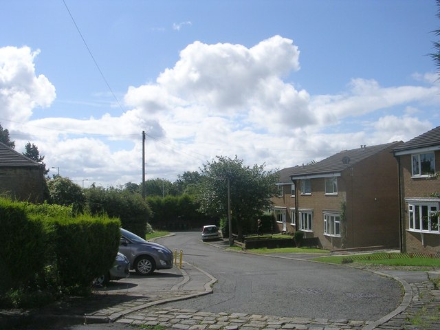
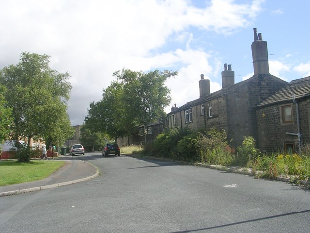
Chapel Green is a picturesque village located in the county of Yorkshire, England. Nestled amidst the rolling hills and lush green countryside, this charming village offers a tranquil and idyllic setting for its residents and visitors alike. Situated approximately 10 miles west of the historic town of York, Chapel Green enjoys the best of both worlds – a peaceful rural environment while still being within easy reach of urban amenities.

The village is known for its quaint architecture, with many traditional stone cottages and farmhouses that exude a sense of timeless charm. The local community is friendly and close-knit, and there is a strong sense of pride in preserving the village's heritage and natural beauty.

Nature lovers will find themselves in paradise in Chapel Green, as the surrounding area boasts stunning landscapes and abundant wildlife. The nearby Yorkshire Wolds provide ample opportunities for outdoor activities such as hiking, cycling, and birdwatching. Additionally, the village is home to a beautiful village green, a central hub where locals gather for social events and recreational activities.

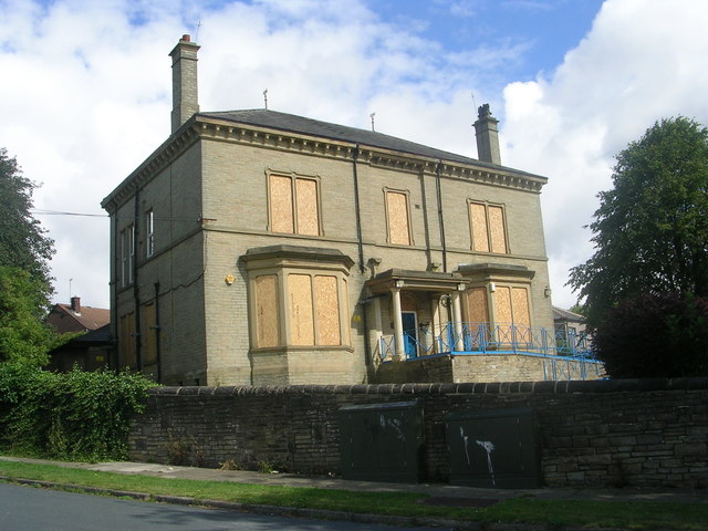
Chapel Green is also known for its rich history, with several historic landmarks and sites of interest nearby. The village's medieval church, St. Mary's Chapel, is a notable architectural gem and a testament to the area's religious heritage. Visitors can also explore the nearby ruins of an ancient castle, which offer a glimpse into the region's past.

In summary, Chapel Green is a quintessential Yorkshire village that offers a serene and scenic escape from the hustle and bustle of modern life. With its picturesque landscapes, friendly community, and rich history, it is truly a hidden gem waiting to be discovered.

If you have any feedback on the listing, please let us know in the comments section below.
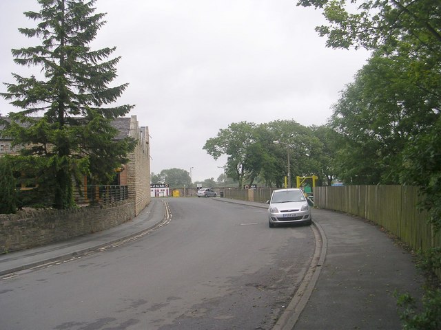
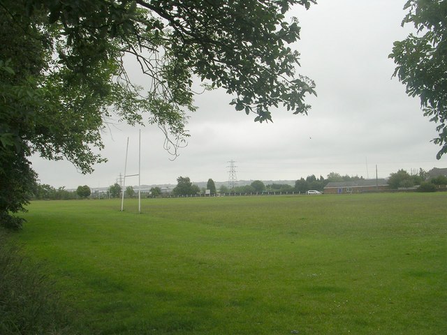
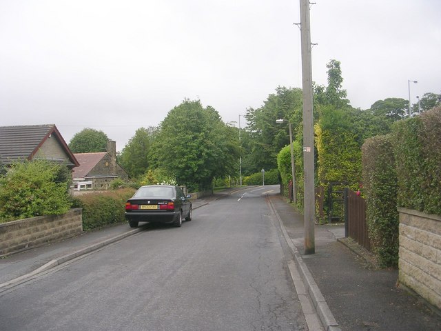
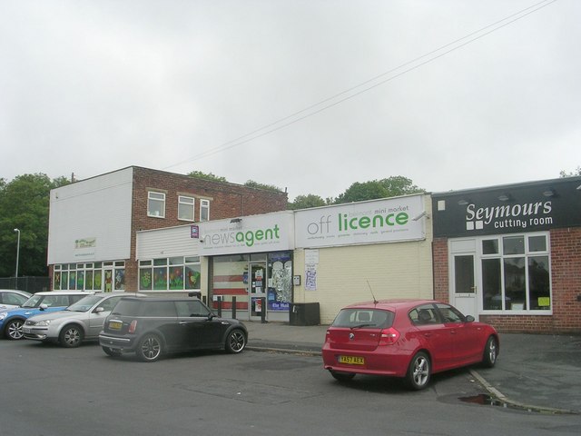
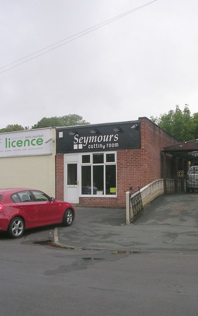
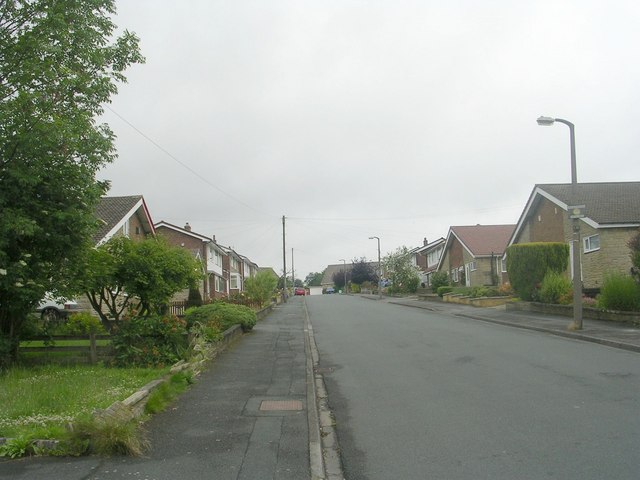
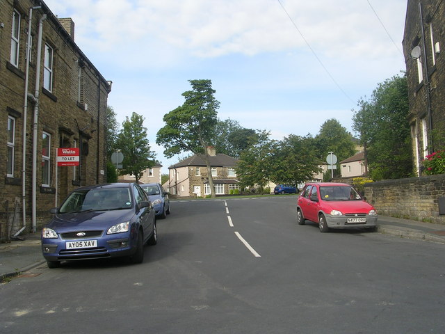
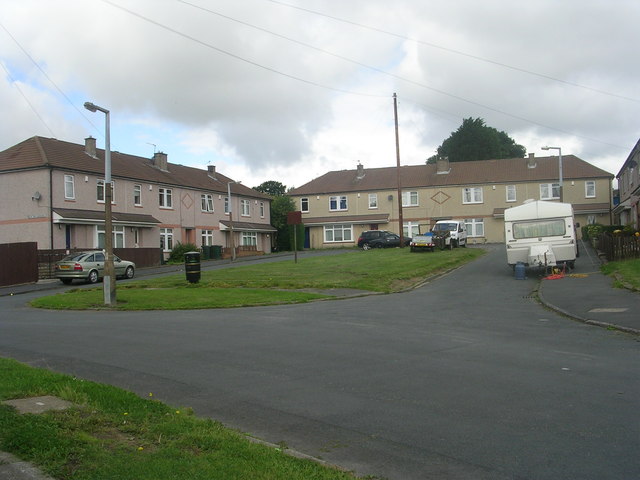
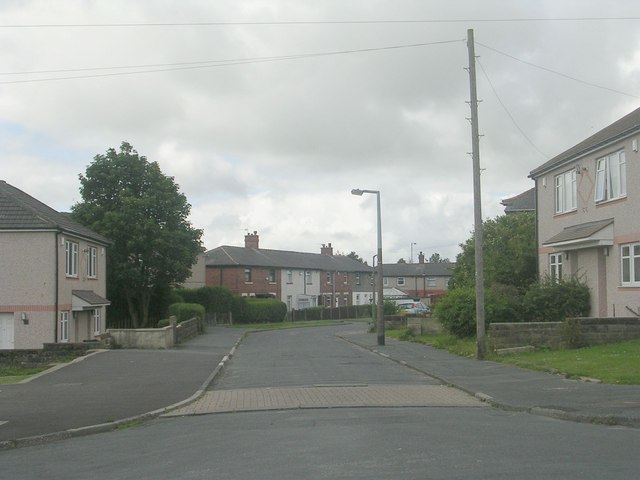
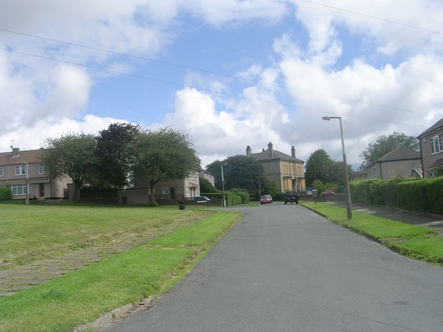
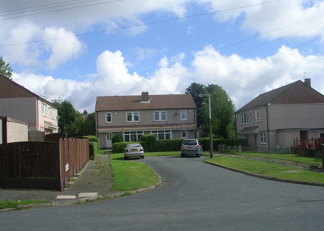
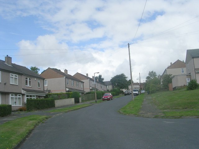
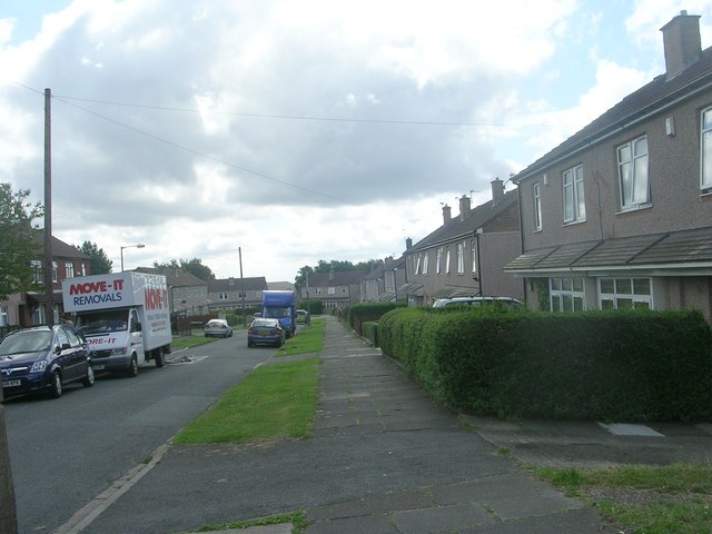
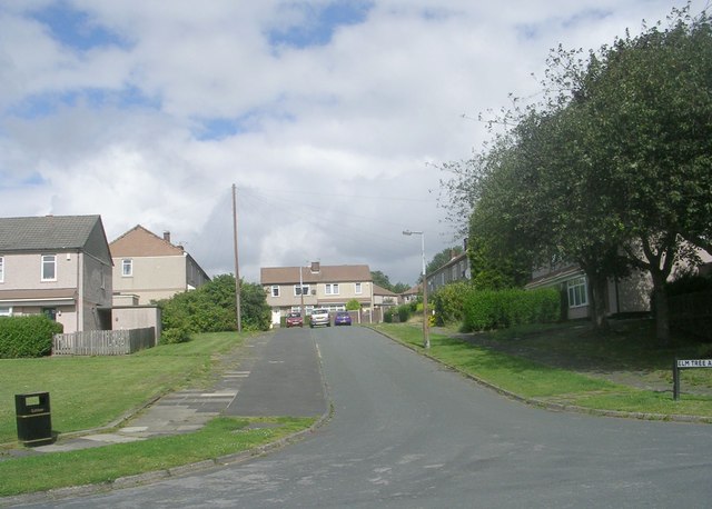
Chapel Green Images

Images are sourced within 2km of 53.77726/-1.764912 or Grid Reference SE1531. Thanks to Geograph Open Source API. All images are credited.

Stadium Road - off Cleckheaton Road
Recreation Ground - Cleckheaton Road
Belmont Gardens - looking towards Wesley Avenue
Belmont Mini-Market - Belmont Avenue
Seymours Cutting Room - Belmont Avenue
Wynford Way - viewed from Belmont Crescent
Electricity Substation No 1065 - Belmont Crescent
Triangle - White Lane
Elm Tree Gardens - Elmfield Drive
Dawson Avenue - Elmfield Drive
Thornfield Avenue - Elmfield Drive
Elm Tree Close - Elmfield Drive
Elmfield Drive - viewed from Thornfield Avenue
Elm Tree Avenue - Thornfield Avenue
The former Odsal Clinic - viewed from Elmfield Drive
Hatton Close - Halifax Road
Show me another place!

Chapel Green is located at Grid Ref: SE1531 (Lat: 53.77726, Lng: -1.764912)

Division: West Riding

Unitary Authority: Bradford

Police Authority: West Yorkshire

What 3 Words

///online.tuned.bind. Near Bradford, West Yorkshire

Related Wikis

Trident, West Yorkshire

Trident is a civil parish in the City of Bradford in West Yorkshire, England, created in 2009. The population of the civil parish as at the 2011 Census...

Dixons City Academy

Dixons City Academy is an academy in Bradford, West Yorkshire, England. The school was founded in 1990 as Dixons City Technology College which focused...

Manchester Road railway station (West Yorkshire)

Manchester Road railway station is a closed station in the city of Bradford, West Yorkshire, England. The station opened in 1878 but closed to passengers...

Park Avenue (stadium)

Park Avenue is a sports ground on Horton Park Avenue in Bradford, West Yorkshire, England that has been used for cricket, football and both codes of rugby...

Bradford Grand Mosque

The Bradford Grand Mosque, or Al-Jamia Suffa-Tul-Islam Grand Mosque, is the largest mosque in Bradford, West Yorkshire, England.It was founded in 1983...

St Luke's Hospital, Bradford

St Luke's Hospital is an NHS hospital in Bradford, West Yorkshire, England. It is situated on Little Horton Lane to the south-west of Bradford city centre...

Birch Lane

Birch Lane was a rugby league ground in Bradford, England. It was the first long term home of Bradford Northern Rugby League Football Club, who played...

Horton Park railway station

Horton Park railway station was a railway station on the Queensbury-Bradford section of the Queensbury Lines which ran between Bradford, Keighley and Halifax...

Nearby Amenities

Located within 500m of 53.77726,-1.764912
Traffic Signals
Crossing: traffic_signals
Crossing Ref: pelican
Tactile Paving: yes
Lat/Long: 53.7739866/-1.7673244
Traffic Signals
Crossing: no
Lat/Long: 53.7794501/-1.7605868
Crossing
Button Operated: yes
Crossing: traffic_signals
Crossing Island: no
Crossing Ref: pelican
Kerb: flush
Tactile Paving: yes
Lat/Long: 53.7782147/-1.7610067
Place Of Worship
Denomination: jehovahs_witness
Religion: christian
Lat/Long: 53.7799891/-1.7599629
Turning Circle
Lat/Long: 53.7774598/-1.7636497
Turning Circle
Lat/Long: 53.7765194/-1.7663462
Crossing
Lat/Long: 53.7770299/-1.7689963
Bus Stop
Bus: yes
Public Transport: platform
Lat/Long: 53.7801559/-1.7599581
Crossing
Crossing: marked
Crossing Island: no
Crossing Markings: zebra
Crossing Ref: zebra
Tactile Paving: yes
Traffic Calming: table
Lat/Long: 53.7786764/-1.7586043
Akbar General Food Store
Shop: convenience
Lat/Long: 53.777625/-1.7586648
Traffic Signals
Crossing: no
Lat/Long: 53.7776061/-1.760643
Place Of Worship
Jamia Mosque Tabbligh-Ul-Islam
Religion: muslim
Lat/Long: 53.7762355/-1.7587549
Post Box
Operator: Royal Mail
Lat/Long: 53.7784236/-1.7672232
Bus Stop
Lat/Long: 53.7741789/-1.7678717
Pub
The Black Bull
Lat/Long: 53.7809659/-1.7651546
Bus Stop
Bus: yes
Public Transport: platform
Lat/Long: 53.7784653/-1.7637963
Fast Food
Fish & Chips
Lat/Long: 53.7750655/-1.7597617
Pharmacy
Lat/Long: 53.775036/-1.7595234
Doctors
Lat/Long: 53.7751404/-1.7591352
Bus Stop
Lat/Long: 53.7748315/-1.7604804
Bus Stop
Lat/Long: 53.7771896/-1.7606635
Bus Stop
Bus: yes
Public Transport: platform
Lat/Long: 53.7795921/-1.7608632
Barrier: bollard
Lat/Long: 53.7792757/-1.7638846
Turning Circle
Lat/Long: 53.7744538/-1.7643124
Turning Circle
Lat/Long: 53.7777045/-1.7691074
Turning Circle
Lat/Long: 53.7781565/-1.7684269
Turning Circle
Lat/Long: 53.7793956/-1.7691226
Little Horton
Place: locality
Lat/Long: 53.7766287/-1.7722637
Bus Stop
Manchester Road Marsh Street
Local Ref: 45014587
Naptan AtcoCode: 450014587
Naptan Bearing: N
Naptan CommonName: Manchester Road Marsh Street
Naptan Crossing: Marsh Street
Naptan Indicator: Stop 45014587
Naptan Landmark: Admiral Nelson PH
Naptan PlusbusZoneRef: LEEDS
Naptan ShortCommonName: Marsh Street
Naptan Street: Manchester Road
Naptan Verified: no
Source: naptan_import
Lat/Long: 53.7751621/-1.7603725
Bus Stop
Manchester Road Burnett Avenue
Local Ref: 45014588
Naptan AtcoCode: 450014588
Naptan Bearing: N
Naptan CommonName: Manchester Road Burnett Avenue
Naptan Crossing: Burnett Avenue
Naptan Indicator: Stop 45014588
Naptan Landmark: Chapel of Rest
Naptan Notes: OSR taken place 160805
Naptan PlusbusZoneRef: LEEDS
Naptan ShortCommonName: Burnett Avenue
Naptan Street: Manchester Road
Naptan Verified: no
Source: naptan_import
Lat/Long: 53.777239/-1.7606945
Bus Stop
Manchester Road Roundhill Street
Bus: yes
Local Ref: 45014589
Naptan AtcoCode: 450014589
Naptan Bearing: N
Naptan CommonName: Manchester Road Roundhill Street
Naptan Crossing: Roundhill Street
Naptan Indicator: Stop 45014589
Naptan Notes: OSR taken place 160805 size 1 case fitted
Naptan PlusbusZoneRef: LEEDS
Naptan ShortCommonName: Roundhill Street
Naptan Street: Manchester Road
Naptan Verified: no
Public Transport: platform
Source: naptan_import
Lat/Long: 53.7795763/-1.7608785
Bus Stop
Manchester Road Jacob Street
Bus: yes
Local Ref: 45014598
Naptan AtcoCode: 450014598
Naptan Bearing: SW
Naptan CommonName: Manchester Road Jacob Street
Naptan Crossing: Jacob Street
Naptan Indicator: Stop 45014598
Naptan Landmark: Kingdom Hall
Naptan Notes: OSR taken place 160805
Naptan PlusbusZoneRef: LEEDS
Naptan ShortCommonName: Jacob Street
Naptan Street: Manchester Road
Naptan Verified: no
Public Transport: platform
Source: naptan_import
Lat/Long: 53.7802752/-1.7597818
Bus Stop
Manchester Road Donisthorpe Street
Local Ref: 45014599
Naptan AtcoCode: 450014599
Naptan Bearing: S
Naptan CommonName: Manchester Road Donisthorpe Street
Naptan Crossing: Donisthorpe Street
Naptan Indicator: Stop 45014599
Naptan Landmark: Funeral Directors
Naptan Notes: L/C 59B
Naptan PlusbusZoneRef: LEEDS
Naptan ShortCommonName: Donisthorpe Street
Naptan Street: Manchester Road
Naptan Verified: no
Source: naptan_import
Lat/Long: 53.7769412/-1.7601044
Bus Stop
Little Horton Lane Clarges Street
Bus: yes
Local Ref: 45022301
Naptan AtcoCode: 450022301
Naptan Bearing: NE
Naptan CommonName: Little Horton Lane Clarges Street
Naptan Crossing: Clarges Street
Naptan Indicator: Stop 45022301
Naptan PlusbusZoneRef: LEEDS
Naptan ShortCommonName: Clarges Street
Naptan Street: Little Horton Lane
Naptan Verified: no
Public Transport: platform
Source: naptan_import
Lat/Long: 53.778878/-1.7668312
Bus Stop
Little Horton Lane Park Lane
Bench: no
Bin: no
Bus: yes
Local Ref: 45022302
Naptan AtcoCode: 450022302
Naptan Bearing: SW
Naptan CommonName: Little Horton Lane Park Lane
Naptan Crossing: Park Lane
Naptan Indicator: Stop 45022302
Naptan PlusbusZoneRef: LEEDS
Naptan ShortCommonName: Park Lane
Naptan Street: Little Horton Lane
Naptan Verified: no
Public Transport: platform
Shelter: yes
Source: naptan_import
Tactile Paving: no
Lat/Long: 53.7797391/-1.7659614
Bus Stop
Little Horton Lane Nurser Lane
Bus: yes
Local Ref: 45022303
Naptan AtcoCode: 450022303
Naptan Bearing: N
Naptan CommonName: Little Horton Lane Nurser Lane
Naptan Crossing: Nurser Lane
Naptan Indicator: Stop 45022303
Naptan Landmark: Medical Centre
Naptan PlusbusZoneRef: LEEDS
Naptan ShortCommonName: Nurser Lane
Naptan Street: Little Horton Lane
Naptan Verified: no
Public Transport: platform
Source: naptan_import
Lat/Long: 53.7805835/-1.7656684
Bus Stop
Little Horton Lane Louis Avenue
Bus: yes
Local Ref: 45022304
Naptan AtcoCode: 450022304
Naptan Bearing: S
Naptan CommonName: Little Horton Lane Louis Avenue
Naptan Crossing: Louis Avenue
Naptan Indicator: Stop 45022304
Naptan PlusbusZoneRef: LEEDS
Naptan ShortCommonName: Louis Avenue
Naptan Street: Little Horton Lane
Naptan Verified: no
Public Transport: platform
Source: naptan_import
Lat/Long: 53.7814542/-1.765102
Bus Stop
Little Horton Lane Holme Street
Bus: yes
Local Ref: 45022305
Naptan AtcoCode: 450022305
Naptan Bearing: N
Naptan CommonName: Little Horton Lane Holme Street
Naptan Crossing: Holme Street
Naptan Indicator: Stop 45022305
Naptan Landmark: Medical Centre
Naptan Notes: L/C 85
Naptan PlusbusZoneRef: LEEDS
Naptan ShortCommonName: Holme Street
Naptan Street: Little Horton Lane
Naptan Verified: no
Public Transport: platform
Source: naptan_import
Lat/Long: 53.78167/-1.7651311
Bus Stop
Southfield Road Hutton Road
Local Ref: 45022330
Naptan AtcoCode: 450022330
Naptan Bearing: NW
Naptan CommonName: Southfield Road Hutton Road
Naptan Crossing: Hutton Road
Naptan Indicator: Stop 45022330
Naptan Landmark: School
Naptan Notes: OSR taken place 280905
Naptan PlusbusZoneRef: LEEDS
Naptan ShortCommonName: Hutton Road
Naptan Street: Southfield Road
Naptan Verified: no
Source: naptan_import
Lat/Long: 53.7740801/-1.7677985
Bus Stop
Southfield Road Hutton Road
Local Ref: 45022331
Naptan AtcoCode: 450022331
Naptan Bearing: SE
Naptan CommonName: Southfield Road Hutton Road
Naptan Crossing: Hutton Road
Naptan Indicator: Stop 45022331
Naptan Landmark: Marshfield Primary School
Naptan Notes: OSR taken place 270905
Naptan PlusbusZoneRef: LEEDS
Naptan ShortCommonName: Hutton Road
Naptan Street: Southfield Road
Naptan Verified: no
Source: naptan_import
Lat/Long: 53.774287/-1.7679036
Bus Stop
Southfield Road Mitten Street
Local Ref: 45022332
Naptan AtcoCode: 450022332
Naptan Bearing: E
Naptan CommonName: Southfield Road Mitten Street
Naptan Crossing: Mitten Street
Naptan Indicator: Stop 45022332
Naptan Landmark: Black Horse PH
Naptan Notes: OSR taken place 270905
Naptan PlusbusZoneRef: LEEDS
Naptan ShortCommonName: Mitten Street
Naptan Street: Southfield Road
Naptan Verified: no
Source: naptan_import
Lat/Long: 53.7757958/-1.7719013
Bus Stop
Hutton Road Smiddles Lane
Local Ref: 45022342
Naptan AtcoCode: 450022342
Naptan Bearing: NE
Naptan CommonName: Hutton Road Smiddles Lane
Naptan Crossing: Smiddles Lane
Naptan Indicator: Stop 45022342
Naptan Landmark: School
Naptan PlusbusZoneRef: LEEDS
Naptan ShortCommonName: Smiddles Lane
Naptan Street: Hutton Road
Naptan Verified: no
Source: naptan_import
Lat/Long: 53.7742401/-1.7668872
Bus Stop
Thornton Lane Marsh Street
Local Ref: 45022343
Naptan AtcoCode: 450022343
Naptan Bearing: SE
Naptan CommonName: Thornton Lane Marsh Street
Naptan Crossing: Marsh Street
Naptan Indicator: Stop 45022343
Naptan Landmark: Primary School
Naptan Notes: OSR taken place 270905
Naptan PlusbusZoneRef: LEEDS
Naptan ShortCommonName: Marsh Lane
Naptan Street: Thornton Lane
Naptan Verified: no
Source: naptan_import
Lat/Long: 53.7746709/-1.7665662
Bus Stop
Thornton Lane Little Horton Lane
Local Ref: 45022344
Naptan AtcoCode: 450022344
Naptan Bearing: SE
Naptan CommonName: Thornton Lane Little Horton Lane
Naptan Crossing: Little Horton Lane
Naptan Indicator: Stop 45022344
Naptan Landmark: Hindu Temple
Naptan Notes: OSR taken place 270905
Naptan PlusbusZoneRef: LEEDS
Naptan ShortCommonName: Little Horton Lane
Naptan Street: Thornton Lane
Naptan Verified: no
Source: naptan_import
Lat/Long: 53.7767165/-1.7692863
Bus Stop
Park Lane Launton Way
Local Ref: 45022346
Naptan AtcoCode: 450022346
Naptan Bearing: SW
Naptan CommonName: Park Lane Launton Way
Naptan Crossing: Nr-At Launton Way
Naptan Indicator: Stop 45022346
Naptan Landmark: Unknown
Naptan Notes: OSR taken place 170805L/C 18
Naptan PlusbusZoneRef: LEEDS
Naptan ShortCommonName: Mayfair
Naptan Street: Park Lane
Naptan Verified: no
Source: naptan_import
Lat/Long: 53.7808652/-1.7626467
Bus Stop
Little Horton Lane Thornton Lane
Local Ref: 45021398
Naptan AtcoCode: 450021398
Naptan Bearing: NE
Naptan CommonName: Little Horton Lane Thornton Lane
Naptan Crossing: Thornton Lane
Naptan Indicator: Stop 45021398
Naptan PlusbusZoneRef: LEEDS
Naptan ShortCommonName: Thornton Lane
Naptan Street: Little Horton Lane
Naptan Verified: no
Source: naptan_import
Lat/Long: 53.7768347/-1.7699685
Bus Stop
Little Horton Lane Thornton Lane
Local Ref: 45021399
Naptan AtcoCode: 450021399
Naptan Bearing: SW
Naptan CommonName: Little Horton Lane Thornton Lane
Naptan Crossing: Thornton Lane
Naptan Indicator: Stop 45021399
Naptan PlusbusZoneRef: LEEDS
Naptan ShortCommonName: Thornton Lane
Naptan Street: Little Horton Lane
Naptan Verified: no
Source: naptan_import
Lat/Long: 53.7766642/-1.7700908
Bus Stop
Little Horton Lane Clarges Street
Bus: yes
Local Ref: 45021400
Naptan AtcoCode: 450021400
Naptan Bearing: SW
Naptan CommonName: Little Horton Lane Clarges Street
Naptan Crossing: Clarges Street
Naptan Indicator: Stop 45021400
Naptan PlusbusZoneRef: LEEDS
Naptan ShortCommonName: Clarges Street
Naptan Street: Little Horton Lane
Naptan Verified: no
Public Transport: platform
Source: naptan_import
Lat/Long: 53.7783661/-1.7670616
Bus Stop
Lindley Road Stirton Street
Bus: yes
Local Ref: 45023720
Naptan AtcoCode: 450023720
Naptan Bearing: S
Naptan CommonName: Lindley Road Stirton Street
Naptan Crossing: Stirton Street
Naptan Indicator: Stop 45023720
Naptan Notes: OSR taken place 170805L/C 2
Naptan PlusbusZoneRef: LEEDS
Naptan ShortCommonName: Stirton Street
Naptan Street: Lindley Road
Naptan Verified: no
Public Transport: platform
Source: naptan_import
Lat/Long: 53.7796259/-1.7632304
Bus Stop
Dorset Street Gurney Close
Local Ref: 45023721
Naptan AtcoCode: 450023721
Naptan Bearing: N
Naptan CommonName: Dorset Street Gurney Close
Naptan Crossing: Gurney Close
Naptan Indicator: Stop 45023721
Naptan PlusbusZoneRef: LEEDS
Naptan ShortCommonName: Gurney Close
Naptan Street: Dorset Street
Naptan Verified: no
Source: naptan_import
Lat/Long: 53.7767631/-1.765462
Bus Stop
Ransdale Road Ransdale Drive
Bus: yes
Local Ref: 45023769
Naptan AtcoCode: 450023769
Naptan Bearing: W
Naptan CommonName: Ransdale Road Ransdale Drive
Naptan Crossing: Ransdale Drive
Naptan Indicator: Stop 45023769
Naptan Landmark: Family Centre
Naptan PlusbusZoneRef: LEEDS
Naptan ShortCommonName: Ransdale Drive
Naptan Street: Ransdale Road
Naptan Verified: no
Public Transport: platform
Source: naptan_import
Lat/Long: 53.7781011/-1.7648324
Bus Stop
Lindley Road Ransdale Road
Bus: yes
Local Ref: 45023770
Naptan AtcoCode: 450023770
Naptan Bearing: S
Naptan CommonName: Lindley Road Ransdale Road
Naptan Crossing: Ransdale Road
Naptan Indicator: Stop 45023770
Naptan Notes: OSR taken place 170805L/C 8
Naptan PlusbusZoneRef: LEEDS
Naptan ShortCommonName: Ransdale Road
Naptan Street: Lindley Road
Naptan Verified: no
Public Transport: platform
Source: naptan_import
Lat/Long: 53.7783597/-1.7637838
Bus Stop
Dorset Street Dorset Close
Local Ref: 45023771
Naptan AtcoCode: 450023771
Naptan Bearing: E
Naptan CommonName: Dorset Street Dorset Close
Naptan Crossing: Dorset Close
Naptan Indicator: Stop 45023771
Naptan PlusbusZoneRef: LEEDS
Naptan ShortCommonName: Dorset Close
Naptan Street: Dorset Street
Naptan Verified: no
Source: naptan_import
Lat/Long: 53.7761279/-1.766983
Bus Stop
Hutton Road Hawes Road
Local Ref: 45023772
Naptan AtcoCode: 450023772
Naptan Bearing: SW
Naptan CommonName: Hutton Road Hawes Road
Naptan Crossing: Hawes Road
Naptan Indicator: Stop 45023772
Naptan Notes: OSR taken place 170805 L/C 6
Naptan PlusbusZoneRef: LEEDS
Naptan ShortCommonName: Hawes Road
Naptan Street: Hutton Road
Naptan Verified: no
Source: naptan_import
Lat/Long: 53.7731274/-1.7678038
Bus Stop
Thornton Lane Christopher Terrace
Local Ref: 45024177
Naptan AtcoCode: 450024177
Naptan Bearing: SW
Naptan CommonName: Thornton Lane Christopher Terrace
Naptan Crossing: Christopher Terrace
Naptan Indicator: Stop 45024177
Naptan Landmark: Shree Hindu Temple
Naptan PlusbusZoneRef: LEEDS
Naptan ShortCommonName: Christopher Terrace
Naptan Street: Thornton Lane
Naptan Verified: no
Source: naptan_import
Lat/Long: 53.7764557/-1.7691815
Bus Stop
Manchester Road Cotewall Road
Bus: yes
Local Ref: 45024857
Naptan AtcoCode: 450024857
Naptan Bearing: S
Naptan CommonName: Manchester Road Cotewall Road
Naptan Crossing: Cotewall Road
Naptan Indicator: Stop 45024857
Naptan Landmark: Unknown
Naptan Notes: OSR taken place 160805
Naptan PlusbusZoneRef: LEEDS
Naptan ShortCommonName: Cotewall Road
Naptan Street: Manchester Road
Naptan Verified: no
Public Transport: platform
Shelter: yes
Source: naptan_import
Lat/Long: 53.7796656/-1.7605745
Bus Stop
Manchester Road Donisthorpe Street
Local Ref: 45024858
Naptan AtcoCode: 450024858
Naptan Bearing: S
Naptan CommonName: Manchester Road Donisthorpe Street
Naptan Crossing: Donisthorpe Street
Naptan Indicator: Stop 45024858
Naptan Landmark: Funeral Directors
Naptan Notes: OSR taken place 160805
Naptan PlusbusZoneRef: LEEDS
Naptan ShortCommonName: Donisthorpe Street
Naptan Street: Manchester Road
Naptan Verified: no
Source: naptan_import
Lat/Long: 53.7772926/-1.7605121
Bus Stop
Manchester Road Parkside Road
Local Ref: 45024859
Naptan AtcoCode: 450024859
Naptan Bearing: N
Naptan CommonName: Manchester Road Parkside Road
Naptan Crossing: Parkside Road
Naptan Indicator: Stop 45024859
Naptan PlusbusZoneRef: LEEDS
Naptan ShortCommonName: Parkside Road
Naptan Street: Manchester Road
Naptan Verified: no
Public Transport: platform
Shelter: yes
Source: naptan_import
Lat/Long: 53.7744232/-1.7603831
Bus Stop
Ransdale Road Back Greaves Street
Bus: yes
Naptan AtcoCode: 450028388
Naptan Bearing: E
Naptan CommonName: Ransdale Road Back Greaves Street
Naptan Crossing: Back Greaves Street
Naptan Landmark: Unknown
Naptan PlusbusZoneRef: LEEDS
Naptan ShortCommonName: Back Greaves Street
Naptan Street: Ransdlale Road
Naptan Verified: no
Public Transport: platform
Source: naptan_import
Lat/Long: 53.7781815/-1.7646043
Bus Stop
Canterbury Avenue Central Avenue
Local Ref: 45028046
Naptan AtcoCode: 450028046
Naptan Bearing: S
Naptan CommonName: Canterbury Avenue Central Avenue
Naptan Crossing: Central Avenue
Naptan Indicator: Stop 45028046
Naptan Landmark: Unknown
Naptan Notes: L/C 20
Naptan PlusbusZoneRef: LEEDS
Naptan ShortCommonName: Central Avenue
Naptan Street: Canterbury Avenue
Naptan Verified: no
Source: naptan_import
Lat/Long: 53.7808693/-1.7694001
Bus Stop
Canterbury Avenue
Local Ref: 45028047
Naptan AtcoCode: 450028047
Naptan Bearing: S
Naptan CommonName: Canterbury Avenue
Naptan Crossing: Darwin Street
Naptan Indicator: Stop 45028047
Naptan Landmark: Unknown
Naptan PlusbusZoneRef: LEEDS
Naptan ShortCommonName: Dawnay Road
Naptan Street: Canterbury Avenue
Naptan Verified: no
Source: naptan_import
Lat/Long: 53.7791812/-1.7702743
Bus Stop
Canterbury Avenue Little Horton Lane
Local Ref: 45028048
Naptan AtcoCode: 450028048
Naptan Bearing: S
Naptan CommonName: Canterbury Avenue Little Horton Lane
Naptan Crossing: Little Horton Lane
Naptan Indicator: Stop 45028048
Naptan Landmark: Unknown
Naptan Notes: L/C 38
Naptan PlusbusZoneRef: LEEDS
Naptan ShortCommonName: Little Horton Lane
Naptan Street: Canterbury Avenue
Naptan Verified: no
Source: naptan_import
Lat/Long: 53.7767838/-1.7715469
Bus Stop
Canterbury Avenue Little Horton Lane
Local Ref: 45028049
Naptan AtcoCode: 450028049
Naptan Bearing: N
Naptan CommonName: Canterbury Avenue Little Horton Lane
Naptan Crossing: Little Horton Lane
Naptan Indicator: Stop 45028049
Naptan Landmark: Unknown
Naptan Notes: L/C 37
Naptan PlusbusZoneRef: LEEDS
Naptan ShortCommonName: Little Horton Lane
Naptan Street: Canterbury Avenue
Naptan Verified: no
Source: naptan_import
Lat/Long: 53.777072/-1.771864
Bus Stop
Canterbury Avenue Darwin Street
Local Ref: 45028050
Naptan AtcoCode: 450028050
Naptan Bearing: N
Naptan CommonName: Canterbury Avenue Darwin Street
Naptan Crossing: Darwin Street
Naptan Indicator: Stop 45028050
Naptan Landmark: Unknown
Naptan Notes: L/C 29
Naptan PlusbusZoneRef: LEEDS
Naptan ShortCommonName: Dawnay Road
Naptan Street: Canterbury Avenue
Naptan Verified: no
Source: naptan_import
Lat/Long: 53.7794691/-1.7704093
Lindley Road Sidhu Mini Market
Local Ref: 45051316
Naptan AtcoCode: 450051316
Naptan Bearing: N
Naptan BusStopType: CUS
Naptan CommonName: Lindley Road Sidhu Mini Market
Naptan Indicator: Stop 45051316
Naptan PlusbusZoneRef: LEEDS
Naptan ShortCommonName: Roundhill Street
Naptan Street: Lindley Road
Naptan Verified: no
Source: naptan_import
Lat/Long: 53.7796351/-1.7633214
Dorset Street Gurney Close
Local Ref: 45051317
Naptan AtcoCode: 450051317
Naptan Bearing: S
Naptan BusStopType: CUS
Naptan CommonName: Dorset Street Gurney Close
Naptan Indicator: Stop 45051317
Naptan PlusbusZoneRef: LEEDS
Naptan ShortCommonName: Gurney Close
Naptan Street: Dorset Street
Naptan Verified: no
Source: naptan_import
Lat/Long: 53.7767628/-1.7653558
Lindley Road Ransdale Road
Local Ref: 45051330
Naptan AtcoCode: 450051330
Naptan Bearing: N
Naptan BusStopType: CUS
Naptan CommonName: Lindley Road Ransdale Road
Naptan Indicator: Stop 45051330
Naptan PlusbusZoneRef: LEEDS
Naptan ShortCommonName: Ransdale Road
Naptan Street: Lindley Road
Naptan Verified: no
Source: naptan_import
Lat/Long: 53.778396/-1.7639506
Park Lane Austell House
Local Ref: 45051201
Naptan AtcoCode: 450051201
Naptan Bearing: NE
Naptan BusStopType: CUS
Naptan CommonName: Park Lane Austell House
Naptan Indicator: Stop 45051201
Naptan PlusbusZoneRef: LEEDS
Naptan ShortCommonName: Mayfair
Naptan Street: Park Lane
Naptan Verified: no
Source: naptan_import
Lat/Long: 53.7809463/-1.762798
Dorset Street Dorset Close
Local Ref: 45051331
Naptan AtcoCode: 450051331
Naptan Bearing: W
Naptan BusStopType: CUS
Naptan CommonName: Dorset Street Dorset Close
Naptan Indicator: Stop 45051331
Naptan PlusbusZoneRef: LEEDS
Naptan ShortCommonName: Dorset Close
Naptan Street: Dorset Street
Naptan Verified: no
Source: naptan_import
Lat/Long: 53.7760829/-1.7669832
Hutton Road Hawes Road
Local Ref: 45051332
Naptan AtcoCode: 450051332
Naptan Bearing: NE
Naptan BusStopType: CUS
Naptan CommonName: Hutton Road Hawes Road
Naptan Indicator: Stop 45051332
Naptan PlusbusZoneRef: LEEDS
Naptan ShortCommonName: Hawes Road
Naptan Street: Hutton Road
Naptan Verified: no
Source: naptan_import
Lat/Long: 53.7732087/-1.7680309
Turning Circle
Dorset Close
Turning Circle: square
Lat/Long: 53.7766229/-1.7672207
Crossing
Button Operated: yes
Crossing: traffic_signals
Crossing Island: no
Crossing Ref: pelican
Kerb: flush
Tactile Paving: yes
Lat/Long: 53.778292/-1.7611688
Crossing
Button Operated: yes
Crossing: traffic_signals
Crossing Island: no
Tactile Paving: yes
Lat/Long: 53.778459/-1.7610278
Crossing
Crossing: unmarked
Crossing Island: no
Tactile Paving: yes
Traffic Calming: table
Lat/Long: 53.7806311/-1.7611602
Turning Circle
Lat/Long: 53.7774216/-1.764486
Traffic Signals
Crossing: no
Lat/Long: 53.7774355/-1.7607758
Crossing
Button Operated: yes
Crossing: traffic_signals
Crossing Island: no
Kerb: flush
Tactile Paving: yes
Lat/Long: 53.7774924/-1.7608058
Crossing
Button Operated: yes
Crossing: traffic_signals
Crossing Island: no
Kerb: flush
Tactile Paving: yes
Lat/Long: 53.7775073/-1.7607134
Crossing
Button Operated: yes
Crossing: traffic_signals
Crossing Island: no
Crossing Ref: pelican
Kerb: flush
Tactile Paving: yes
Lat/Long: 53.778167/-1.7611344
Crossing
Button Operated: yes
Crossing: traffic_signals
Crossing Island: no
Crossing Ref: pelican
Kerb: flush
Tactile Paving: yes
Lat/Long: 53.77822/-1.760883
Crossing
Button Operated: yes
Crossing: traffic_signals
Crossing Island: no
Crossing Ref: pelican
Kerb: flush
Tactile Paving: yes
Lat/Long: 53.7782712/-1.7607635
Crossing
Button Operated: yes
Crossing: traffic_signals
Crossing Island: no
Tactile Paving: yes
Lat/Long: 53.7785198/-1.7606476
Barrier: bollard
Bollard: fixed
Motor Vehicle: no
Lat/Long: 53.7735723/-1.7659855
Turning Circle
Lat/Long: 53.7775402/-1.7660411
Crossing
Button Operated: yes
Crossing: traffic_signals
Crossing Island: no
Tactile Paving: yes
Lat/Long: 53.7793976/-1.7606143
Crossing
Button Operated: yes
Crossing: traffic_signals
Crossing Island: no
Tactile Paving: yes
Lat/Long: 53.7793885/-1.7607429
Traffic Signals
Crossing: no
Lat/Long: 53.7794396/-1.7605023
Crossing
Button Operated: yes
Crossing: traffic_signals
Crossing Island: no
Tactile Paving: yes
Lat/Long: 53.7793799/-1.7605155
Crossing
Button Operated: yes
Crossing: traffic_signals
Crossing Island: no
Tactile Paving: yes
Lat/Long: 53.7793681/-1.7608707
Crossing
Button Operated: yes
Crossing: traffic_signals
Crossing Island: no
Tactile Paving: yes
Lat/Long: 53.77841/-1.7606287
Crossing
Button Operated: yes
Crossing: traffic_signals
Crossing Island: no
Tactile Paving: yes
Lat/Long: 53.778503/-1.7607816
Crossing
Button Operated: yes
Crossing: traffic_signals
Crossing Island: no
Tactile Paving: yes
Lat/Long: 53.7775931/-1.7605126
Crossing
Button Operated: yes
Crossing: traffic_signals
Crossing Island: no
Tactile Paving: yes
Lat/Long: 53.7775538/-1.7606168
Crossing
Crossing: marked
Traffic Calming: table
Lat/Long: 53.7769888/-1.7619188
Crossing
Crossing: marked
Traffic Calming: table
Lat/Long: 53.7768318/-1.7627087
Crossing
Crossing: marked
Traffic Calming: table
Lat/Long: 53.776971/-1.7633863
Barrier: bollard
Lat/Long: 53.7770181/-1.7606769
Barrier: yes
Lat/Long: 53.773097/-1.7666671
Barrier: bollard
Lat/Long: 53.7750139/-1.7694186
Crossing
Crossing: unmarked
Crossing Island: no
Tactile Paving: yes
Lat/Long: 53.7749509/-1.7599234
Crossing
Crossing: unmarked
Crossing Island: no
Tactile Paving: yes
Lat/Long: 53.7750384/-1.7598939
Traffic Signals
Crossing: no
Lat/Long: 53.7793345/-1.7607716
Traffic Signals
Crossing: no
Lat/Long: 53.7793012/-1.7609024
Cycleway: asl
Direction: forward
Lat/Long: 53.7784196/-1.7605765
Traffic Signals
Crossing: no
Traffic Signals Direction: forward
Lat/Long: 53.7784354/-1.7605001
Cycleway: asl
Direction: forward
Lat/Long: 53.7782805/-1.7612223
Traffic Signals
Crossing: no
Traffic Signals Direction: forward
Lat/Long: 53.7782639/-1.7613021
Cycleway: asl
Lat/Long: 53.7785404/-1.7607817
Traffic Signals
Crossing: no
Lat/Long: 53.7785737/-1.760783
Traffic Signals
Crossing: no
Lat/Long: 53.7785483/-1.7606919
Cycleway: asl
Lat/Long: 53.7781826/-1.7609983
Traffic Signals
Crossing: no
Lat/Long: 53.7781474/-1.7609869
Traffic Signals
Crossing: no
Lat/Long: 53.7781585/-1.7608729
Crossing
Button Operated: yes
Crossing: traffic_signals
Crossing Island: no
Tactile Paving: yes
Lat/Long: 53.7785035/-1.7609091
Traffic Signals
Crossing: no
Lat/Long: 53.7785396/-1.7609091
Traffic Signals
Crossing: no
Lat/Long: 53.7781331/-1.7610727
Traffic Signals
Crossing: no
Lat/Long: 53.7776441/-1.7605403
Traffic Signals
Crossing: no
Lat/Long: 53.7774516/-1.7606851
Crossing
Button Operated: yes
Crossing: traffic_signals
Crossing Island: no
Tactile Paving: yes
Lat/Long: 53.7766936/-1.7601323
Crossing
Button Operated: yes
Crossing: traffic_signals
Crossing Island: no
Tactile Paving: yes
Lat/Long: 53.7766457/-1.7602379
Crossing
Button Operated: yes
Crossing: traffic_signals
Crossing Island: no
Tactile Paving: yes
Lat/Long: 53.7765748/-1.7603268
Traffic Signals
Crossing: no
Lat/Long: 53.776751/-1.7601514
Traffic Signals
Crossing: no
Lat/Long: 53.776518/-1.7603116
Traffic Signals
Crossing: no
Lat/Long: 53.7766971/-1.7602533
Give Way
Lat/Long: 53.773714/-1.7609929
Crossing
Crossing: unmarked
Crossing Island: no
Tactile Paving: yes
Lat/Long: 53.7737129/-1.7611129
Crossing
Crossing: unmarked
Crossing Island: no
Tactile Paving: yes
Lat/Long: 53.7736548/-1.7611587
Crossing
Button Operated: yes
Crossing: traffic_signals
Crossing Island: no
Tactile Paving: yes
Lat/Long: 53.7746506/-1.76022
Crossing
Button Operated: yes
Crossing: traffic_signals
Crossing Island: no
Tactile Paving: yes
Lat/Long: 53.7746359/-1.7603539
Crossing
Button Operated: yes
Crossing: traffic_signals
Crossing Island: no
Tactile Paving: yes
Lat/Long: 53.7746197/-1.7604888
Traffic Signals
Crossing: no
Lat/Long: 53.7746952/-1.7603311
Traffic Signals
Crossing: no
Lat/Long: 53.7745612/-1.7605095
Traffic Signals
Crossing: no
Lat/Long: 53.7747118/-1.7601943
Noexit: yes
Lat/Long: 53.7752298/-1.7666425
Crossing
Crossing: unmarked
Crossing Island: no
Tactile Paving: yes
Traffic Calming: table
Lat/Long: 53.7786344/-1.7601253
The data included in this document is from www.openstreetmap.org. The data is made available under ODbL.

Have you been to Chapel Green?

Leave your review of Chapel Green below (or comments, questions and feedback).