Holbeck

Settlement in Lincolnshire East Lindsey

England

Holbeck

Direction Sign – Signpost near Stainsby House in Greetham with Somersby parish Located on the northwest side of T junction northwest of Stainsby House in Greetham with Somersby parish. 3 arms and no finial. See also <a title="https://www.geograph.org.uk/photo/6038852" href="https://www.geograph.org.uk/photo/6038852">Link</a>.

Milestone Society National ID: LI_TF3371
Direction Sign – Signpost near Stainsby House in Greetham with Somersby parish Credit: A Riley

Holbeck is a small village located in the East Lindsey district of Lincolnshire, England. Situated approximately 6 miles north of the market town of Louth, it is nestled amidst the picturesque Lincolnshire Wolds, an Area of Outstanding Natural Beauty.

The village is primarily residential, with a population of around 300 people. It is characterized by its charming, traditional cottages and well-maintained gardens, which contribute to its overall aesthetic appeal. The community is close-knit, and residents take pride in maintaining the village's cleanliness and attractive appearance.

Holbeck is renowned for its stunning natural surroundings and idyllic countryside. The Lincolnshire Wolds, with its rolling hills and expansive fields, offers ample opportunities for outdoor activities such as hiking, cycling, and horseback riding. The village itself is surrounded by lush greenery and offers a tranquil and peaceful atmosphere, making it an ideal place for those seeking a quiet and picturesque retreat.

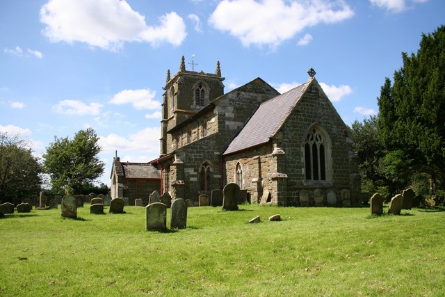
Despite its small size, Holbeck has a rich history. It is home to the Grade II listed St. Mary's Church, which dates back to the 14th century. The church features beautiful stained glass windows and intricate stonework, attracting visitors from far and wide.

Although it lacks commercial amenities, Holbeck benefits from its proximity to nearby towns, where residents can find a range of facilities such as schools, shops, and healthcare services. Overall, Holbeck offers a peaceful and scenic rural lifestyle, making it an appealing destination for those seeking a charming and tranquil village experience.

If you have any feedback on the listing, please let us know in the comments section below.
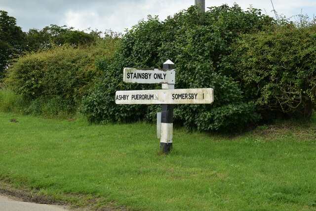
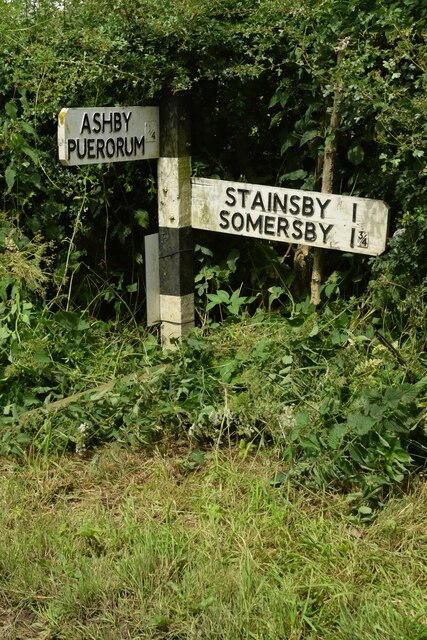
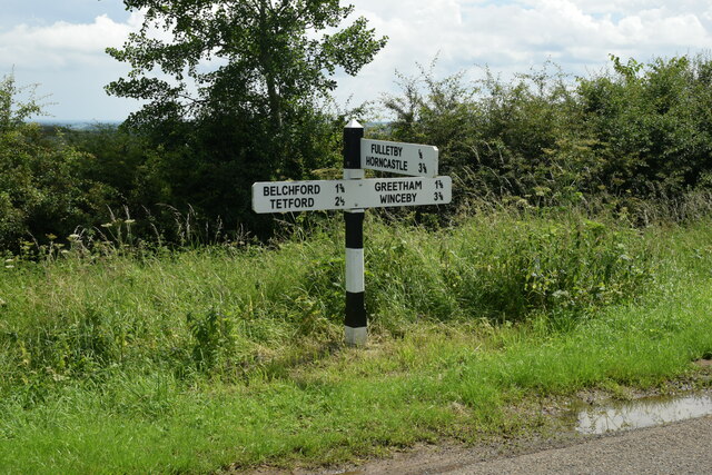
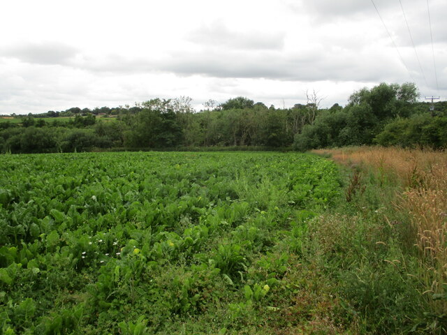
Holbeck Images

Images are sourced within 2km of 53.231244/-0.027810738 or Grid Reference TF3172. Thanks to Geograph Open Source API. All images are credited.

Direction Sign – Signpost near Stainsby House in Greetham with Somersby parish Located on the northwest side of T junction northwest of Stainsby House in Greetham with Somersby parish. 3 arms and no finial. See also <a title="https://www.geograph.org.uk/photo/6038852" href="https://www.geograph.org.uk/photo/6038852">Link</a>.

Milestone Society National ID: LI_TF3371
Direction Sign – Signpost near Stainsby House in Greetham with Somersby parish
Located on the northwest side of T junction northwest of Stainsby House in Greetham with Somersby parish. 3 arms and no finial. See also Link. Milestone Society National ID: LI_TF3371
Direction Sign – Signpost near Ashby Puerorum in Greetham with Somersby parish Located on the north side of a T junction north of Ashby Puerorum, Greetham with Somersby parish. 2 arms and no finial.

Milestone Society National ID: LI_TF3271
Direction Sign – Signpost near Ashby Puerorum in Greetham with Somersby parish
Located on the north side of a T junction north of Ashby Puerorum, Greetham with Somersby parish. 2 arms and no finial. Milestone Society National ID: LI_TF3271
Direction Sign – Signpost near Ashby Puerorum in Greetham with Somersby parish Located on the north side of a T junction at Clapgate Farm northwest of Ashby Puerorum, Greetham with Somersby parish. 2 arms and no finial. See also <a title="https://www.geograph.org.uk/photo/6596283" href="https://www.geograph.org.uk/photo/6596283">Link</a>.

Milestone Society National ID: LI_TF3271A
Direction Sign – Signpost near Ashby Puerorum in Greetham with Somersby parish
Located on the north side of a T junction at Clapgate Farm northwest of Ashby Puerorum, Greetham with Somersby parish. 2 arms and no finial. See also Link. Milestone Society National ID: LI_TF3271A
Direction Sign – Signpost on the junction of Mill Lane and Long Hedge Lane in Greetham Located on a grass triangle in the centre of the T junction of Mill Lane and Long Hedge Lane in Greetham, Greetham with Somersby parish. 3 arms and no finial. See also <a title="https://www.geograph.org.uk/photo/6678465" href="https://www.geograph.org.uk/photo/6678465">Link</a>.

Milestone Society National ID: LI_TF3070
Direction Sign – Signpost on the junction of Mill Lane and Long Hedge Lane in Greetham
Located on a grass triangle in the centre of the T junction of Mill Lane and Long Hedge Lane in Greetham, Greetham with Somersby parish. 3 arms and no finial. See also Link. Milestone Society National ID: LI_TF3070
Direction Sign – Signpost east of Fulletby Located on the east side of the T junction east of the village in Fulletby parish. 3 arms and no finial. See also <a title="https://www.geograph.org.uk/photo/6675144" href="https://www.geograph.org.uk/photo/6675144">Link</a>.

Milestone Society National ID: LI_TF3073
Direction Sign – Signpost east of Fulletby
Located on the east side of the T junction east of the village in Fulletby parish. 3 arms and no finial. See also Link. Milestone Society National ID: LI_TF3073
On field path, southwest of Holbeck, near Greetham
Greetham - All Saints' Church
Road junction southwest side of Greetham
Autumn sown field near Greetham I have no idea why the telegraph pole is where it is.
Autumn sown field near Greetham
I have no idea why the telegraph pole is where it is.
Disappearing pond, Greetham Very little open water left.
Disappearing pond, Greetham
Very little open water left.
All Saints' church, Greetham A church built over a long period - from the twelfth to twentieth centuries <span class="nowrap"><a title="https://historicengland.org.uk/listing/the-list/list-entry/1147285?section=official-listing" rel="nofollow ugc noopener" href="https://historicengland.org.uk/listing/the-list/list-entry/1147285?section=official-listing">Link</a><img style="margin-left:2px;" alt="External link" title="External link - shift click to open in new window" src="https://s1.geograph.org.uk/img/external.png" width="10" height="10"/></span>
All Saints' church, Greetham
A church built over a long period - from the twelfth to twentieth centuries LinkExternal link
The churchyard and Old Rectory, Greetham
Autumn sown crop near Greetham
Farmyard, Greetham House Farm
Snowdrops, Greetham churchyard
Farm track and Hook's Plantation
Stinkmoor Holt and field of sugar beet
Abandoned field near Stinkmoor Holt
Show me another place!

Holbeck is located at Grid Ref: TF3172 (Lat: 53.231244, Lng: -0.027810738)

Division: Parts of Lindsey

Administrative County: Lincolnshire

District: East Lindsey

Police Authority: Lincolnshire

What 3 Words

///giggles.clerk.trailing. Near Horncastle, Lincolnshire

Related Wikis

Greetham with Somersby

Greetham with Somersby is a civil parish in the East Lindsey district of Lincolnshire, England. It is situated approximately 3 miles (5 km) north-east...

Ashby Puerorum

Ashby Puerorum is a small village and former civil parish, now in the parish of Greetham with Somersby, in the East Lindsey district of Lincolnshire, England...

Salmonby

Salmonby is a village in the civil parish of Tetford, in the East Lindsey district of Lincolnshire, England. It is situated 5.5 miles (8.9 km) north-east...

Greetham, Lincolnshire

Greetham ( GREET-əm) is a village and former civil parish, now in the parish of Greetham with Somersby, in the East Lindsey district of Lincolnshire, England...

Fulletby

Fulletby is a village and a civil parish in the East Lindsey district of Lincolnshire, England. It is in the Lincolnshire Wolds, and 3 miles (5 km) north...

Tetford

Tetford is a village and civil parish in the East Lindsey district of Lincolnshire, England. == History == Tetford is listed as "Tesforde" in the Domesday...

East Lindsey

East Lindsey is a local government district in Lincolnshire, England. Its council is based in Horncastle and the largest town is Skegness. Other towns...

Somersby Grange

Somersby Grange is a Grade I listed Georgian country house in Somersby, Lincolnshire.The house was built in 1722 for Robert Burton, the local lord of the...

Nearby Amenities

Located within 500m of 53.231244,-0.027810738
Power: pole
Lat/Long: 53.2286344/-0.0231452
Power: pole
Lat/Long: 53.2295298/-0.0232269
Power: pole
Lat/Long: 53.2303943/-0.0232822
Power: pole
Lat/Long: 53.2312806/-0.0233639
Power: pole
Lat/Long: 53.2320541/-0.0234293
Power: pole
Lat/Long: 53.2327809/-0.0234808
Power: pole
Lat/Long: 53.2336175/-0.0235575
Power: pole
Lat/Long: 53.234251/-0.0236103
Power: pole
Lat/Long: 53.2349377/-0.0236641
Holbeck
Alt Name: Houldbeck
Place: hamlet
Source: Bing
Lat/Long: 53.2348816/-0.0304433
Place: farm
Source: Bing
Lat/Long: 53.2344381/-0.0326025
The Gatehouse
Place: isolated_dwelling
Source: Bing
Lat/Long: 53.2302808/-0.0284058
The data included in this document is from www.openstreetmap.org. The data is made available under ODbL.

Have you been to Holbeck?

Leave your review of Holbeck below (or comments, questions and feedback).