Highway

Settlement in Somerset South Somerset

England

Highway

Disused quarry on Ham Hill
Disused quarry on Ham Hill Credit: David Martin

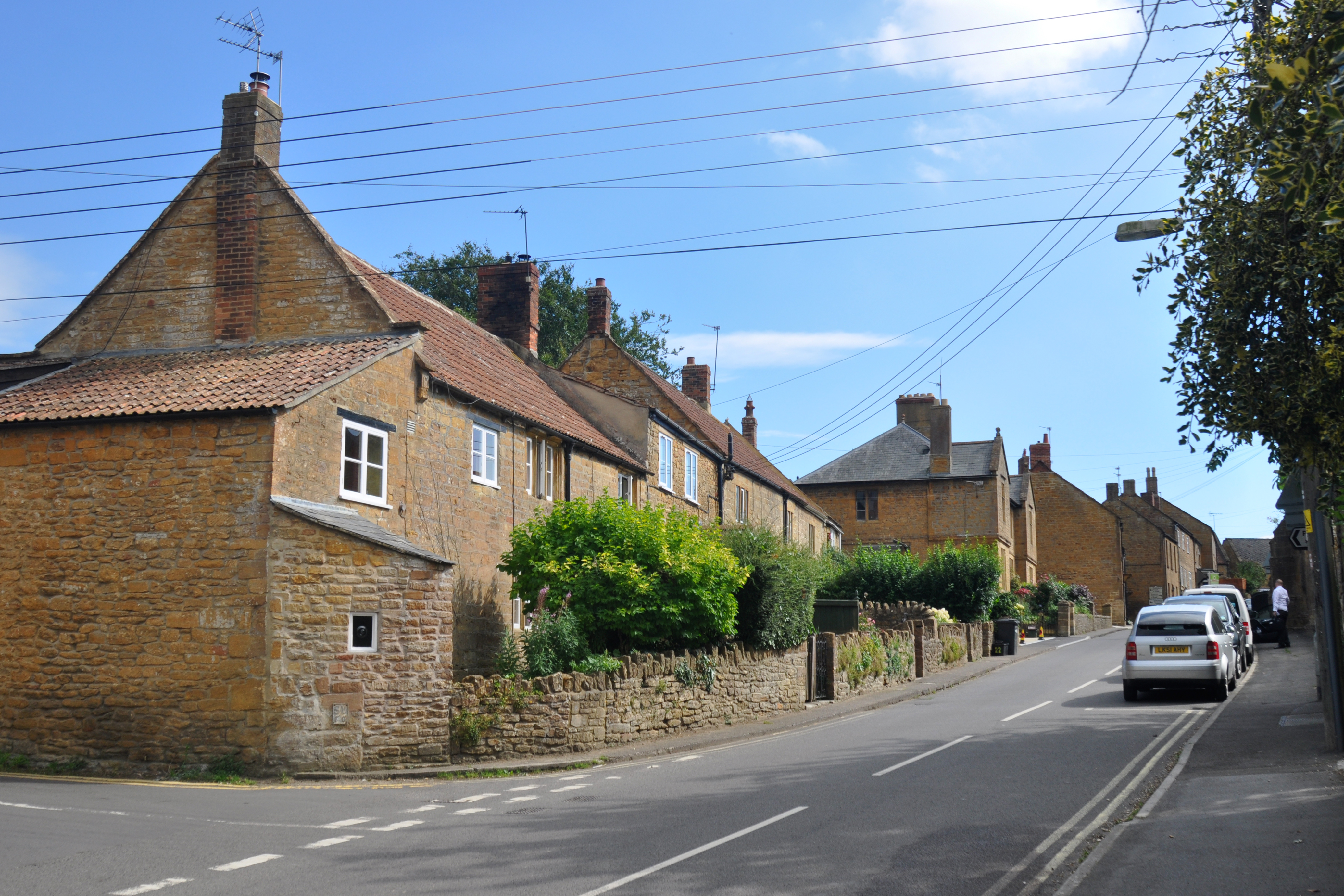
Highway is a small village located in the county of Somerset, England. It is situated about 5 miles northwest of the town of Yeovil and lies on the A30 road, which connects it to other nearby towns and villages. The village is part of the South Somerset district.

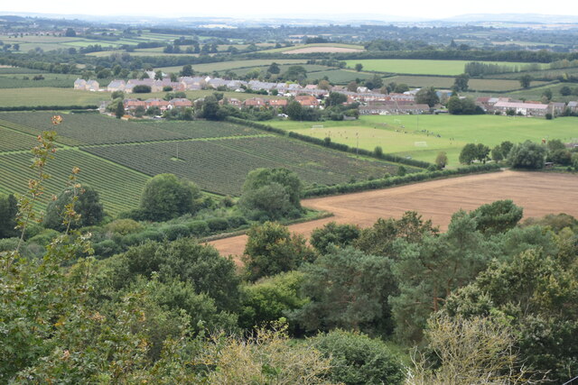
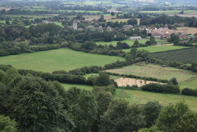
Highway is a predominantly rural area characterized by its picturesque countryside and rolling hills. The village itself is small, with a population of around 500 residents. It has a close-knit community and a peaceful atmosphere, making it an ideal place for those seeking a quiet and tranquil lifestyle.

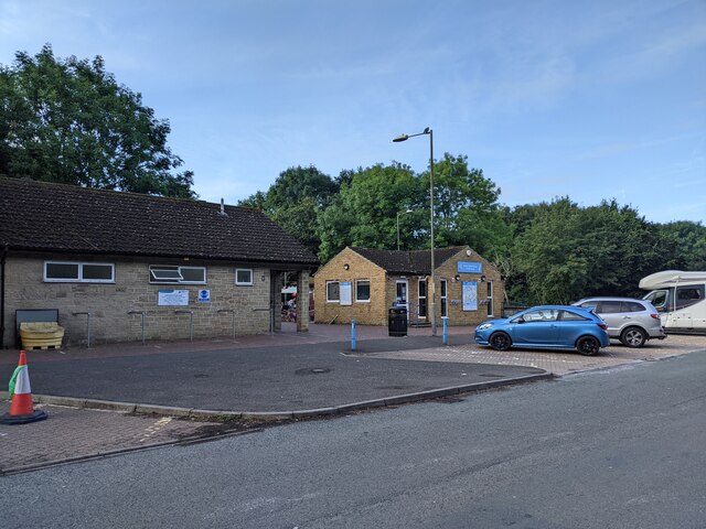
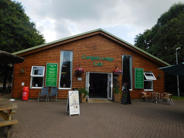
The village has a few amenities to cater to the needs of its residents. These include a local pub, a primary school, and a small convenience store. For more extensive shopping and recreational facilities, residents can easily access the nearby town of Yeovil. Additionally, the village is well-connected to public transportation, with regular bus services passing through.

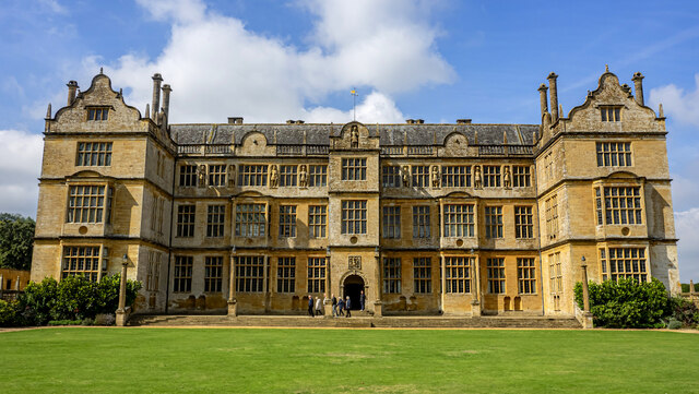
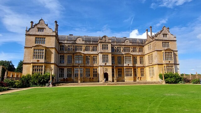
The surrounding area offers plenty of opportunities for outdoor activities and exploration. Nature lovers can enjoy walks and hikes in the nearby countryside, while history enthusiasts can visit the historic sites and landmarks in the region, such as the Montacute House and Ham Hill Country Park.

In conclusion, Highway is a charming village in Somerset, offering a peaceful and rural lifestyle. Its proximity to larger towns ensures residents have access to additional amenities and services, while the beautiful countryside provides ample opportunities for outdoor pursuits.

If you have any feedback on the listing, please let us know in the comments section below.
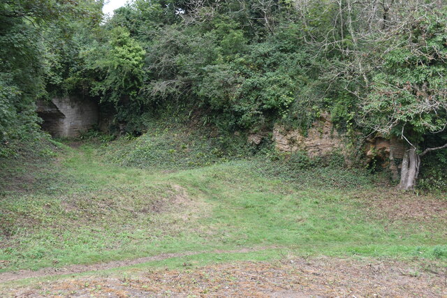
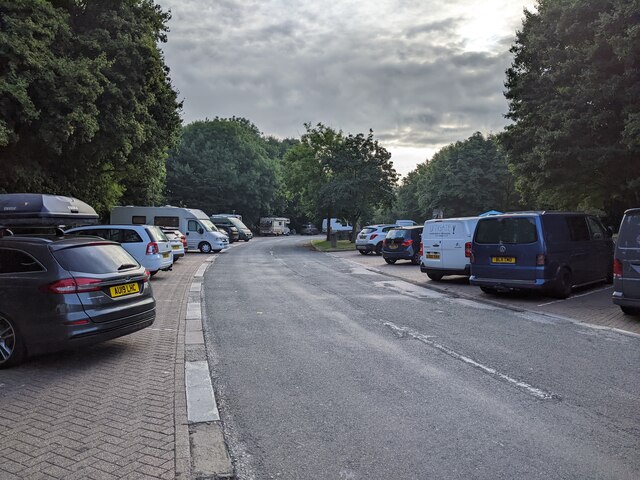
Highway Images

Images are sourced within 2km of 50.954966/-2.7418143 or Grid Reference ST4717. Thanks to Geograph Open Source API. All images are credited.

Disused quarry on Ham Hill
View from Ham Hill
View from Ham Hill
View towards Norton Sub Hamdon
Buildings and parking at Cartgate picnic area on the A303
Parking at Cartgate picnic area
Montacute House The East facade glowing in the September sunshine.
Montacute House
The East facade glowing in the September sunshine.
Montacute House This was the original front facade, east facing.
Montacute House
This was the original front facade, east facing.
Montacute House The eastern side of the magnificent Elizabethan mansion.
Montacute House
The eastern side of the magnificent Elizabethan mansion.
St. Mary the Virgin, Stoke sub Hamdon, Somerset Built c1100, the original Norman church did not include the North and South transepts or the porch. It is thought that the North transept was built c1190 with the South transept, tower and porch being added in the early part of the 14th-century.
St. Mary the Virgin, Stoke sub Hamdon, Somerset
Built c1100, the original Norman church did not include the North and South transepts or the porch. It is thought that the North transept was built c1190 with the South transept, tower and porch being added in the early part of the 14th-century.
St. Mary the Virgin, Stoke sub Hamdon, Somerset Built c1100, the Chancel and Nave formed the original Norman church.
St. Mary the Virgin, Stoke sub Hamdon, Somerset
Built c1100, the Chancel and Nave formed the original Norman church.
St. Mary the Virgin, Stoke sub Hamdon, Somerset Built c1100, the Chancel and Nave formed the original Norman church.
St. Mary the Virgin, Stoke sub Hamdon, Somerset
Built c1100, the Chancel and Nave formed the original Norman church.
St. Mary the Virgin, Stoke sub Hamdon, Somerset The Font - late 12th or early 13th Century. The inserted stone at the top replaced the original lock, which allowed the cover to be secure enough to protect the Holy water.
St. Mary the Virgin, Stoke sub Hamdon, Somerset
The Font - late 12th or early 13th Century. The inserted stone at the top replaced the original lock, which allowed the cover to be secure enough to protect the Holy water.
Hutchings & Cornelius bus passing the Phelips Arms, Montacute – 1971 H&C was a small family run bus company based at South Petherton, their main service being between that village and Yeovil. 633BYA is seen on that service passing through Montacute with the 18th century Phelips Arms in the background – compare with <a title="https://www.geograph.org.uk/photo/709295" href="https://www.geograph.org.uk/photo/709295">Link</a> (without bus!). Relatively unusually for a small company, this bus was bought new, in 1958. It is a Dennis Loline with East Lancs body, and was one of only three Lolines to be bought by small independent operators.

This is one of a series of views featuring buses in the 60s, 70s, and 80s. <a title="https://www.geograph.org.uk/search.php?i=137652761" href="https://www.geograph.org.uk/search.php?i=137652761">Link</a>
Hutchings & Cornelius bus passing the Phelips Arms, Montacute – 1971
H&C was a small family run bus company based at South Petherton, their main service being between that village and Yeovil. 633BYA is seen on that service passing through Montacute with the 18th century Phelips Arms in the background – compare with Link (without bus!). Relatively unusually for a small company, this bus was bought new, in 1958. It is a Dennis Loline with East Lancs body, and was one of only three Lolines to be bought by small independent operators. This is one of a series of views featuring buses in the 60s, 70s, and 80s. Link
Cartgate Lodge café, A303, Yeovil
Artwork, Cartgate Lodge café, A303, Yeovil
South Somerset Visitor Information Centre, A303, Yeovil
Show me another place!

Highway is located at Grid Ref: ST4717 (Lat: 50.954966, Lng: -2.7418143)

Administrative County: Somerset

District: South Somerset

Police Authority: Avon and Somerset

What 3 Words

///interests.beefed.bluffing. Near Stoke-sub-Hamdon, Somerset

Related Wikis

Ham Hill, Somerset

Ham Hill is a geological Site of Special Scientific Interest (SSSI), Scheduled Ancient Monument, Iron Age hill fort, Roman site, Local Nature Reserve and...

Ham Hill Hillfort

Ham Hill Hillfort is an Iron Age hillfort located on Ham Hill, Somerset, England. It was also occupied during the mesolithic and neolithic periods and...

Stanchester Academy

Stanchester Academy, formerly Stanchester Community School, is an academy for children between the ages of 11 and 16 in Stoke-sub-Hamdon, Somerset, England...

Stoke-sub-Hamdon

Stoke-sub-Hamdon (or Stoke sub Hamdon), also known as Stoke under Ham, is a large village and civil parish in the South Somerset district of Somerset,...

Stoke sub Hamdon Priory

Stoke sub Hamdon Priory is a complex of buildings and ruins which initially formed a 14th-century college for the chantry chapel of St Nicholas, and later...

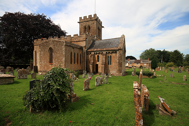
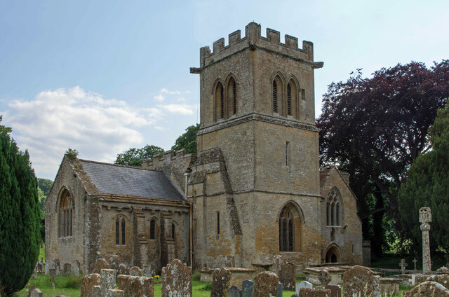
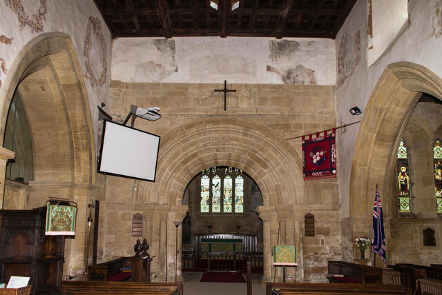
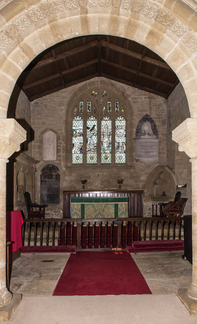
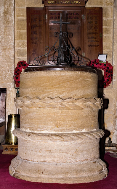
Church of St Mary the Virgin, East Stoke

The Church of St Mary the Virgin at East Stoke in Stoke-sub-Hamdon, Somerset, England dates from the 12th century. It has been designated as a Grade I...

United Reformed Church, Stoke-sub-Hamdon

The United Reformed Church is a former United Reformed church in Stoke-sub-Hamdon, Somerset, England. It was built in 1865-66 and closed for religious...

Montacute Castle

Montacute Castle was a castle built on a hill overlooking the village of Montacute, Somerset, England. == Details == Montacute Castle was built after the...

Nearby Amenities

Located within 500m of 50.954966,-2.7418143
Hamdon Hill War Memorial
Historic: memorial
Memorial: war_memorial
Start Date: 1923
Lat/Long: 50.9528551/-2.7458867
Turning Circle
Lat/Long: 50.9548517/-2.7383101
View Guide
Tourism: information
Lat/Long: 50.9523239/-2.7465173
Bench
Lat/Long: 50.9515044/-2.7462598
Post Box
Collection Times: Mo-Fr 16:00; Sa 09:30
Operator: Royal Mail
Operator Wikidata: Q638098
Post Box Type: wall
Ref: TA14 90
Royal Cypher: GVIR
Royal Cypher Wikidata: Q33102169
Lat/Long: 50.9555533/-2.7480321
Barrier: cycle_barrier
Lat/Long: 50.9557237/-2.7482354
Entrance: yes
Lat/Long: 50.9526376/-2.7361468
East Stoke
Place: hamlet
Lat/Long: 50.9542115/-2.7383707
Ham Hill
Ele: 121
Natural: peak
Wikidata: Q5643844
Wikipedia: en:Ham Hill, Somerset
Lat/Long: 50.9519375/-2.7452822
The data included in this document is from www.openstreetmap.org. The data is made available under ODbL.

Have you been to Highway?

Leave your review of Highway below (or comments, questions and feedback).