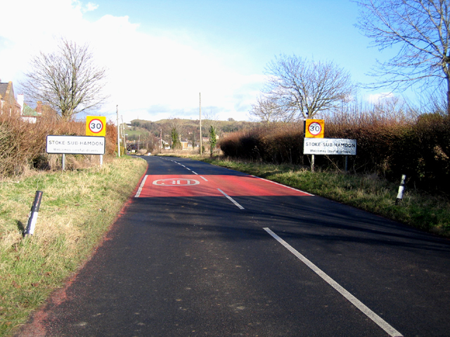
Stoke Sub Hamdon

Settlement in Somerset South Somerset

England

Stoke Sub Hamdon

Cartgate Picnic Area, Near Stoke sub Hamdon, Somerset A large picnic area just off the junction of the A303 (London-Exeter Trunk road) and A3088 (Yeovil spur). Toilets, tourist information office, snack bar and picnic tables.
Cartgate Picnic Area, Near Stoke sub Hamdon, Somerset Credit: Pete Chapman

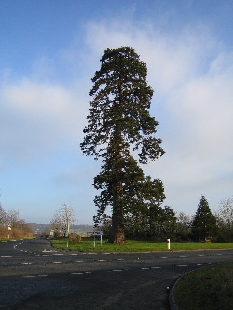
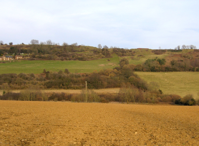
Stoke Sub Hamdon is a picturesque village located in the county of Somerset, England. Situated on the southern slope of Ham Hill, it is nestled amidst rolling hills and stunning countryside, offering residents and visitors alike a tranquil and scenic environment.

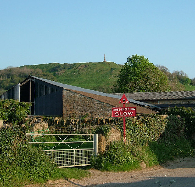
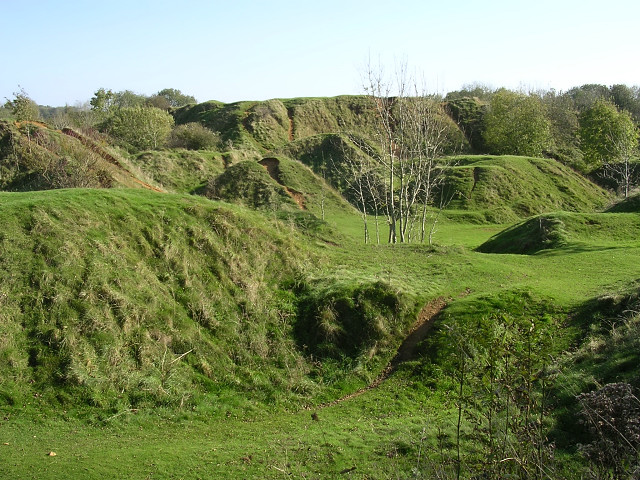
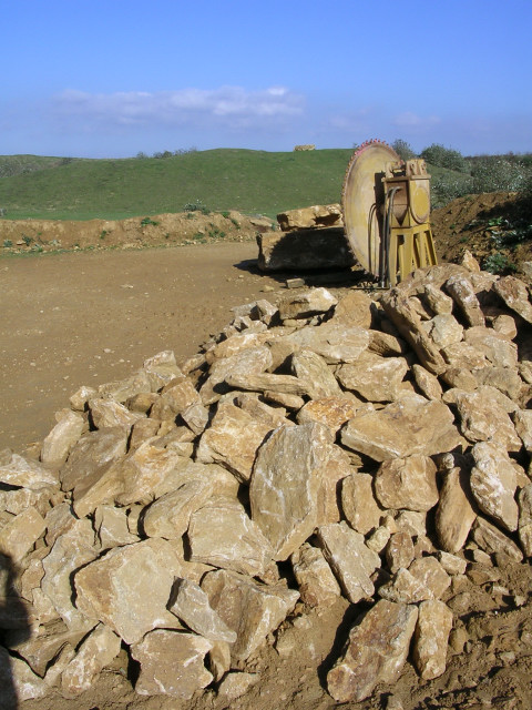
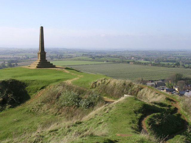
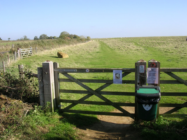
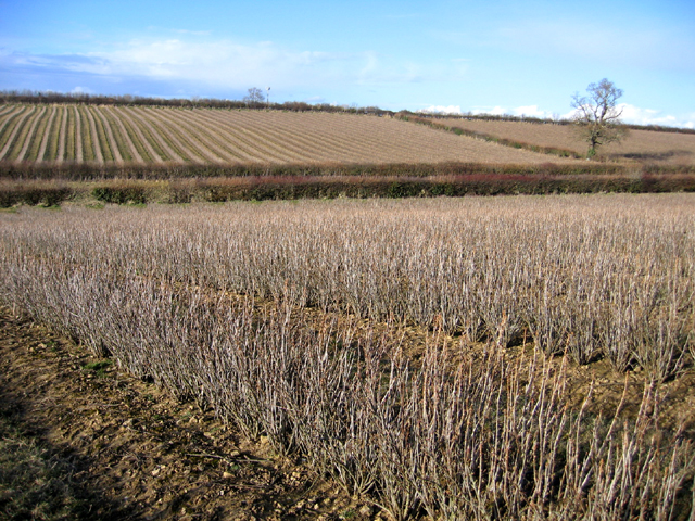
The village has a rich history dating back to the Iron Age, with evidence of settlements found on Ham Hill. It is home to the famous Ham Hill Country Park, a vast open space with walking trails, picnic areas, and breathtaking views over the surrounding landscapes. The park also boasts an ancient hillfort, providing a glimpse into the area's past.

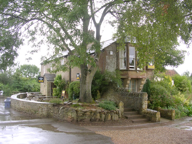
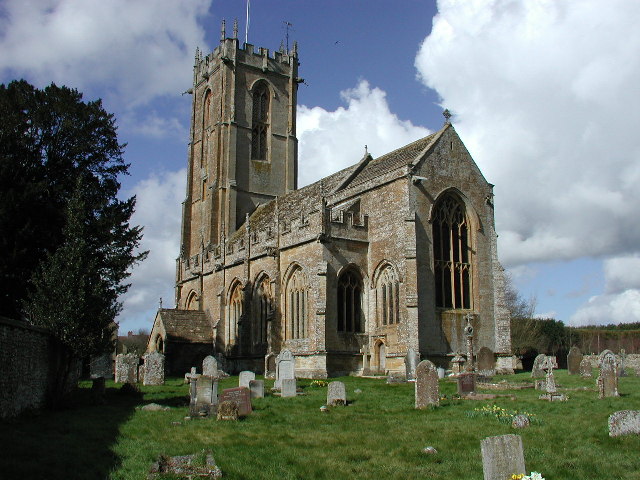
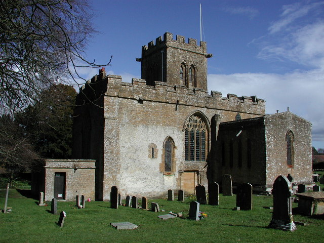
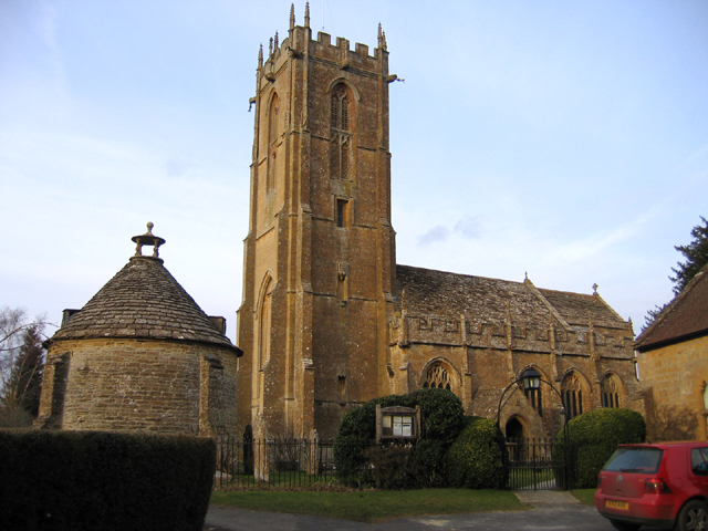
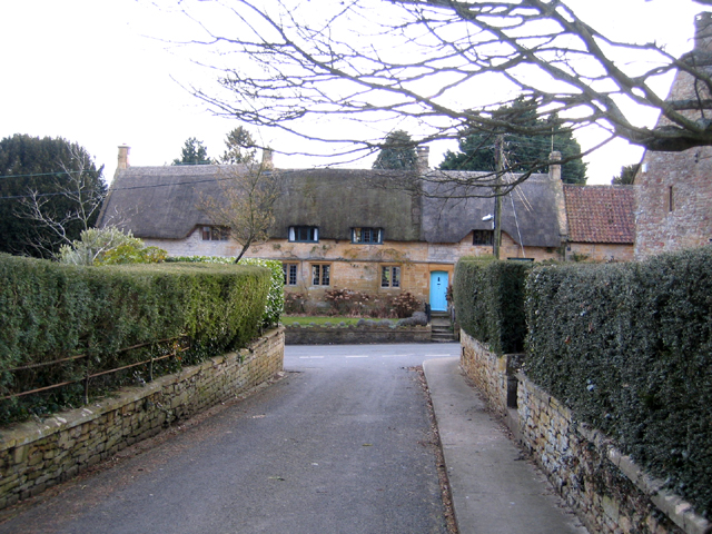
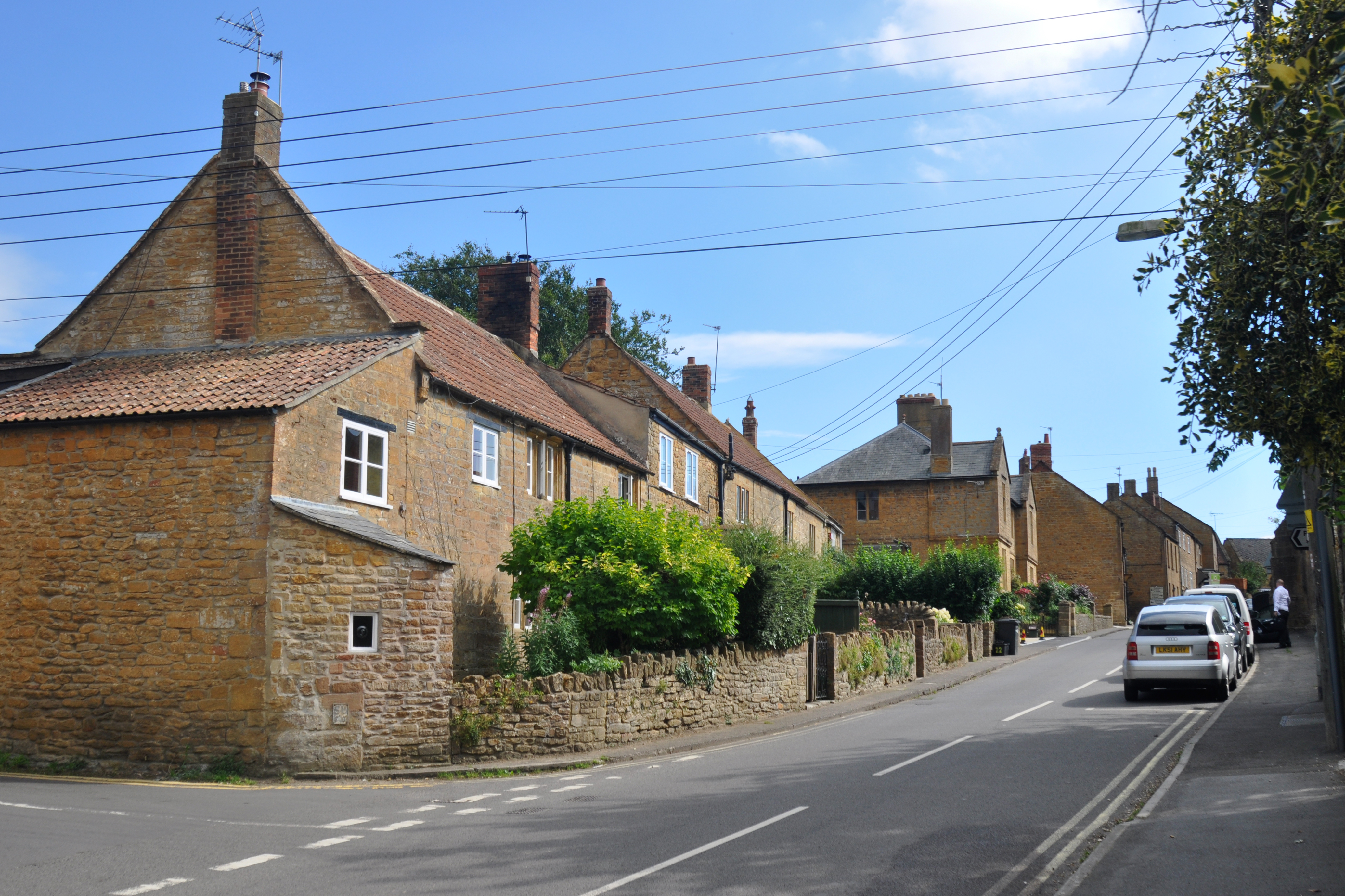
Stoke Sub Hamdon is known for its quaint charm and well-preserved architecture. The village center features a range of traditional stone-built cottages and historic buildings, including the 13th-century St. Michael's Church. The church is an architectural gem, showcasing its medieval origins with its beautiful stained glass windows and intricate stonework.

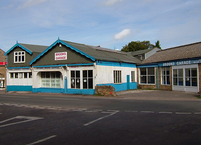
The community in Stoke Sub Hamdon is close-knit and welcoming, with a range of amenities catering to residents' needs. There are several local shops, a post office, a primary school, and a village hall that hosts various events and gatherings throughout the year.

For those seeking recreational activities, the village offers a cricket club and a football club, providing opportunities for sports enthusiasts to engage in friendly local matches. The surrounding countryside also offers ample opportunities for outdoor pursuits such as hiking, cycling, and horse riding.

With its idyllic setting, rich history, and strong sense of community, Stoke Sub Hamdon is a charming village that continues to enchant both residents and visitors with its timeless beauty.

If you have any feedback on the listing, please let us know in the comments section below.

Stoke Sub Hamdon Images

Images are sourced within 2km of 50.953259/-2.75072 or Grid Reference ST4717. Thanks to Geograph Open Source API. All images are credited.

Cartgate Picnic Area, Near Stoke sub Hamdon, Somerset A large picnic area just off the junction of the A303 (London-Exeter Trunk road) and A3088 (Yeovil spur). Toilets, tourist information office, snack bar and picnic tables.
Cartgate Picnic Area, Near Stoke sub Hamdon, Somerset
A large picnic area just off the junction of the A303 (London-Exeter Trunk road) and A3088 (Yeovil spur). Toilets, tourist information office, snack bar and picnic tables.
Stoke-sub-Hamdon An evening view of Ham Hill from North St in Stoke sub Hamdon - note the old sign with alternative name for the village
Stoke-sub-Hamdon
An evening view of Ham Hill from North St in Stoke sub Hamdon - note the old sign with alternative name for the village
Martock Brooks Garage, on the outskirts of Martock.
Martock
Brooks Garage, on the outskirts of Martock.
The Prince of Wales public house, Ham Hill, Somerset The appropriately-named Prince of Wales pub lies within Duchy of Cornwall land on top of Ham Hill, near Yeovil.
The Prince of Wales public house, Ham Hill, Somerset
The appropriately-named Prince of Wales pub lies within Duchy of Cornwall land on top of Ham Hill, near Yeovil.
NORTON-SUB-HAMDON, Somerset The stunningly beautiful church of St Mary
NORTON-SUB-HAMDON, Somerset
The stunningly beautiful church of St Mary
Stoke Sub Hamdon, Somerset Also known as Stoke under Ham, the parish church of St Mary is well away from its main centre on the road to Montacute.
Stoke Sub Hamdon, Somerset
Also known as Stoke under Ham, the parish church of St Mary is well away from its main centre on the road to Montacute.
Old quarry spoil heaps at Ham Hill Country Park Centuries of quarrying the golden "Ham" stone from Ham Hill has left behind this landscape of lumps and bumps, now part of the Ham Hill Country Park. Signs request that visitors on bikes should keep to the waymarked paths, but the erosion on these grassed-over spoil heaps shows that not everyone can resist the temptation.
Old quarry spoil heaps at Ham Hill Country Park
Centuries of quarrying the golden "Ham" stone from Ham Hill has left behind this landscape of lumps and bumps, now part of the Ham Hill Country Park. Signs request that visitors on bikes should keep to the waymarked paths, but the erosion on these grassed-over spoil heaps shows that not everyone can resist the temptation.
Quarrying at the northern end of Hamdon Hill This shows the quarry workings at the northern end of Hamdon Hill, within the Hamdon Hill Country Park. The interior of this part of the hill has been scooped out by many centuries of quarrying (some dating back to the Iron Age) and although this part of the hill is dedicated to conservation and recreation, limited permission has been given to allow some quarrying; this is supposed to meet demand for the characteristic stone, as well as improve the safety and appearance of this part of the hill.
Quarrying at the northern end of Hamdon Hill
This shows the quarry workings at the northern end of Hamdon Hill, within the Hamdon Hill Country Park. The interior of this part of the hill has been scooped out by many centuries of quarrying (some dating back to the Iron Age) and although this part of the hill is dedicated to conservation and recreation, limited permission has been given to allow some quarrying; this is supposed to meet demand for the characteristic stone, as well as improve the safety and appearance of this part of the hill.
Stoke-sub-Hamdon war memorial, Hamdon Hill Looking east from the highest point of Hamdon Hill (on top of the inner rampart of the hillfort) towards the Norton-sub-Hamdon war memorial. This is a very blustery spot in an exposed location, with very wide views over the south Somerset countryside. The war memorial is a prominent landmark.
Stoke-sub-Hamdon war memorial, Hamdon Hill
Looking east from the highest point of Hamdon Hill (on top of the inner rampart of the hillfort) towards the Norton-sub-Hamdon war memorial. This is a very blustery spot in an exposed location, with very wide views over the south Somerset countryside. The war memorial is a prominent landmark.
Gate into a field on Butcher's Hill The southeastern part of the massive Hamdon hillfort is known as Butcher's Hill, this view is of a field to the south of the road that runs through the interior of the hillfort. The area is popular with dog-walkers, and the various signs on this gate warn about sheep worrying and the possible consequences of not cleaning up after your dog.
Gate into a field on Butcher's Hill
The southeastern part of the massive Hamdon hillfort is known as Butcher's Hill, this view is of a field to the south of the road that runs through the interior of the hillfort. The area is popular with dog-walkers, and the various signs on this gate warn about sheep worrying and the possible consequences of not cleaning up after your dog.
View west from the tower on St Michael's Hill, Montacute This view is looking WNW from the top of the tower on St Michael's Hill. The wood on the slopes of Hedgecock Hill are deep in shadow on this autumn afternoon. Beyond this is the northern spur of Hamdon Hill, with its Iron Age ramparts and the prominent Stoke-sub-Hamdon war memorial. Nestling in "The Coombe" between Hamdon Hill and Hedgecock Hill is the parish church of St Mary, Stoke-sub-Hamdon.
View west from the tower on St Michael's Hill, Montacute
This view is looking WNW from the top of the tower on St Michael's Hill. The wood on the slopes of Hedgecock Hill are deep in shadow on this autumn afternoon. Beyond this is the northern spur of Hamdon Hill, with its Iron Age ramparts and the prominent Stoke-sub-Hamdon war memorial. Nestling in "The Coombe" between Hamdon Hill and Hedgecock Hill is the parish church of St Mary, Stoke-sub-Hamdon.
The tower on St Michael's Hill, Montacute This 18th century lookout tower tops the conical hill that gives the village of Montacute its name (from the Latin "mons acutus", literally meaning "steep hill"). The tower was constructed as a folly by the Phelips family in 1760, and can clearly be seen from Montacute House in the village below. The greek inscription above the doorway to the tower describes it as a lookout, and there is a small fireplace and chimney at the top of the 52-step spiral staircase. There are stories that the tower is connected to Montacute House by a 'secret tunnel' but these have never been substantiated. The tower is privately owned, but open to the public, and there are views over the whole of south Somerset from the windows at the top.
The tower on St Michael's Hill, Montacute
This 18th century lookout tower tops the conical hill that gives the village of Montacute its name (from the Latin "mons acutus", literally meaning "steep hill"). The tower was constructed as a folly by the Phelips family in 1760, and can clearly be seen from Montacute House in the village below. The greek inscription above the doorway to the tower describes it as a lookout, and there is a small fireplace and chimney at the top of the 52-step spiral staircase. There are stories that the tower is connected to Montacute House by a 'secret tunnel' but these have never been substantiated. The tower is privately owned, but open to the public, and there are views over the whole of south Somerset from the windows at the top.
Holy Tree Cross The Holy Tree stands at the cross roads on the old main road just outside Stoke-Sub-Hamdon, now bypassed by the A303. Branches on the far side of trunk probably fall within adjacent grid square.
Holy Tree Cross
The Holy Tree stands at the cross roads on the old main road just outside Stoke-Sub-Hamdon, now bypassed by the A303. Branches on the far side of trunk probably fall within adjacent grid square.
Entrance to Stoke-sub-Hamdon village, Somerset – view E towards West End.
Entrance to Stoke-sub-Hamdon village, Somerset
– view E towards West End.
Blackcurrant fields in winter, Stoke-sub-Hamdon, Somerset – view N over the Small Moor Brook valley.
Blackcurrant fields in winter, Stoke-sub-Hamdon, Somerset
– view N over the Small Moor Brook valley.
Parish church, Norton-sub-Hamdon, Somerset dedicated to St Mary the Virgin <span class="nowrap"><a title="http://www.nortonchurch.org.uk/guide1.asp" rel="nofollow ugc noopener" href="http://www.nortonchurch.org.uk/guide1.asp">Link</a><img style="margin-left:2px;" alt="External link" title="External link - shift click to open in new window" src="https://s1.geograph.org.uk/img/external.png" width="10" height="10"/></span> ; view N from Church Lane.
Parish church, Norton-sub-Hamdon, Somerset
dedicated to St Mary the Virgin LinkExternal link ; view N from Church Lane.
Cottages on Great Street, Norton-sub-Hamdon, Somerset – view S from Church Lane.
Cottages on Great Street, Norton-sub-Hamdon, Somerset
– view S from Church Lane.
Ham or Hamdon Hill Country Park, Stoke-sub-Hamdon, Somerset – view E from near the Norton Road.
Ham or Hamdon Hill Country Park, Stoke-sub-Hamdon, Somerset
– view E from near the Norton Road.
Show me another place!

Stoke Sub Hamdon is located at Grid Ref: ST4717 (Lat: 50.953259, Lng: -2.75072)

Administrative County: Somerset

District: South Somerset

Police Authority: Avon and Somerset

What 3 Words

///rafters.ambient.bins. Near Stoke-sub-Hamdon, Somerset

Related Wikis

United Reformed Church, Stoke-sub-Hamdon

The United Reformed Church is a former United Reformed church in Stoke-sub-Hamdon, Somerset, England. It was built in 1865-66 and closed for religious...

Stanchester Academy

Stanchester Academy, formerly Stanchester Community School, is an academy for children between the ages of 11 and 16 in Stoke-sub-Hamdon, Somerset, England...

Stoke-sub-Hamdon

Stoke-sub-Hamdon (or Stoke sub Hamdon), also known as Stoke under Ham, is a large village and civil parish in the South Somerset district of Somerset,...

Stoke sub Hamdon Priory

Stoke sub Hamdon Priory is a complex of buildings and ruins which initially formed a 14th-century college for the chantry chapel of St Nicholas, and later...

Nearby Amenities

Located within 500m of 50.953259,-2.75072
Stoke-sub-Hamdon
Place: village
Wikidata: Q3122563
Wikipedia: en:Stoke-sub-Hamdon
Lat/Long: 50.9539757/-2.7501133
Hamdon Hill War Memorial
Historic: memorial
Memorial: war_memorial
Start Date: 1923
Lat/Long: 50.9528551/-2.7458867
Turning Circle
Lat/Long: 50.9521483/-2.7513438
View Guide
Tourism: information
Lat/Long: 50.9523239/-2.7465173
Bench
Lat/Long: 50.9515044/-2.7462598
Pub
Fleur de Lis
Wikidata: Q26410560
Lat/Long: 50.9530451/-2.7510106
The Shop at the Cross
Shop: convenience
Lat/Long: 50.9533604/-2.7503311
Post Box
Collection Times: Mo-Fr 16:15; Sa 11:45
Operator: Royal Mail
Operator Wikidata: Q638098
Post Box Type: wall
Ref: TA14 74
Royal Cypher: GVIR
Royal Cypher Wikidata: Q33102169
Lat/Long: 50.9535836/-2.7499717
Post Box
Collection Times: Mo-Fr 16:00; Sa 09:30
Operator: Royal Mail
Operator Wikidata: Q638098
Post Box Type: wall
Ref: TA14 90
Royal Cypher: GVIR
Royal Cypher Wikidata: Q33102169
Lat/Long: 50.9555533/-2.7480321
Barrier: cycle_barrier
Lat/Long: 50.9557237/-2.7482354
Power: pole
Lat/Long: 50.9573052/-2.7536396
Power: pole
Lat/Long: 50.9567849/-2.7537014
Power: pole
Lat/Long: 50.956095/-2.7537706
Power: pole
Lat/Long: 50.9554899/-2.7538433
Pharmacy
Day Lewis Pharmacy
Addr City: Stoke-sub-Hamdon
Addr Country: GB
Addr County: Somerset
Addr Postcode: TA14 6QE
Addr Street: Matt's Lane
Brand: Day Lewis Pharmacy
Brand Wikidata: Q62563772
Dispensing: yes
Drive Through: no
Healthcare: pharmacy
Is In: Hamdon Medical Centre
Opening Hours: Mo-We 08:30-18:30, Th 08:30-17:00, Fr 08:30-18:30, Sa 09:00-12:00
Lat/Long: 50.951372/-2.7520456
Post Office
Stoke-sub-Hamdon Post Office
Addr City: Stoke-sub-Hamdon
Addr Country: GB
Addr County: Somerset
Addr Housename: The Shop at the Cross
Addr Housenumber: 6
Addr Postcode: TA14 6PP
Addr Street: High Street
Addr Village: Stoke Sub Hamdon
Brand: Post Office
Brand Wikidata: Q1783168
Brand Wikipedia: en:Post Office Ltd
Contact Website: https://www.postoffice.co.uk/branch-finder/6054706/stoke-sub-hamdon
Opening Hours: Mo,Fr 09:00-12:00; Th 13:00-16:00
Operator: Post Office Ltd
Ref Pol Id: 115990
Lat/Long: 50.9533094/-2.7504193
Ham Hill
Ele: 121
Natural: peak
Wikidata: Q5643844
Wikipedia: en:Ham Hill, Somerset
Lat/Long: 50.9519375/-2.7452822
Booth: K6
Covered: booth
Disused Amenity: telephone
Man Made: telephone_box
Lat/Long: 50.9526838/-2.7521904
Leisure: playground
Lat/Long: 50.95292/-2.7523764
Advertising: board
Lat/Long: 50.9529899/-2.7516111
The data included in this document is from www.openstreetmap.org. The data is made available under ODbL.

Have you been to Stoke Sub Hamdon?

Leave your review of Stoke Sub Hamdon below (or comments, questions and feedback).