Greenhow

Settlement in Yorkshire Harrogate

England

Greenhow

Greenhow Hill Top Greenhow Hill Top, the highest point around here at about 1390ft. The fence in the foreground surrounds the old East Engine Shaft which was sunk onto Banks Vein of the Sunside Lead Mines.
Greenhow Hill Top Credit: Malcolm Street

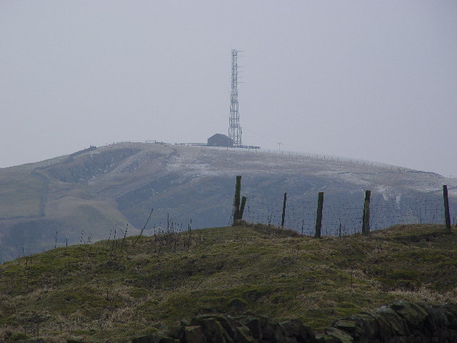
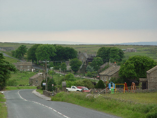
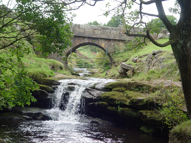
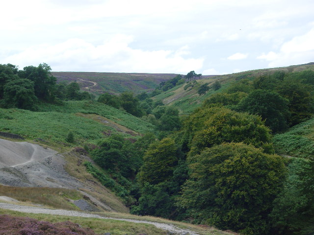
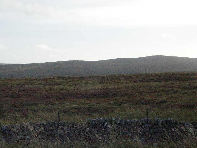
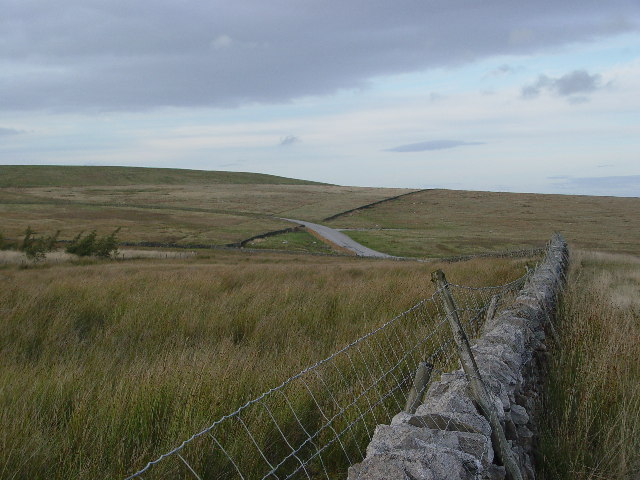
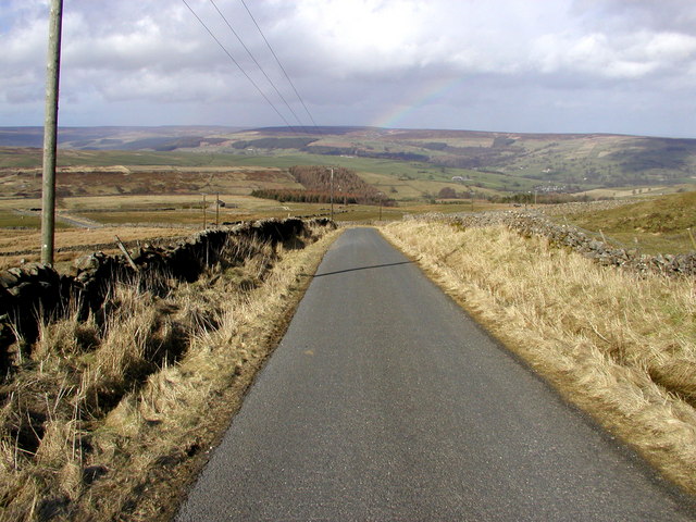
Greenhow is a small village located in the county of Yorkshire, England. Situated in the heart of Nidderdale, an Area of Outstanding Natural Beauty, it is surrounded by picturesque landscapes and rolling hills. The village is part of the Harrogate district and lies approximately 15 miles west of the town of Harrogate.

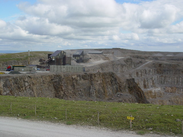
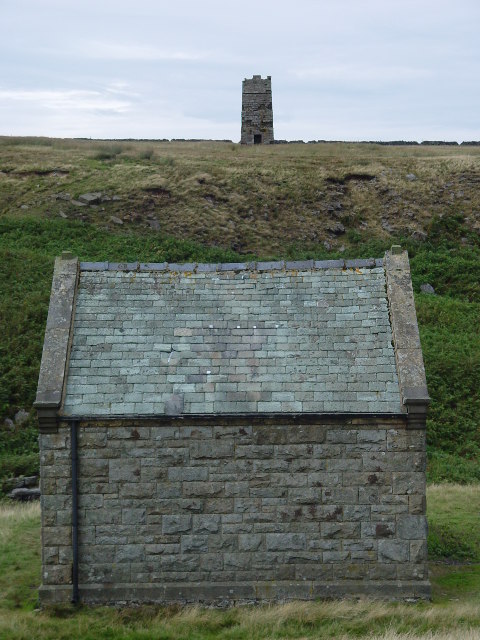
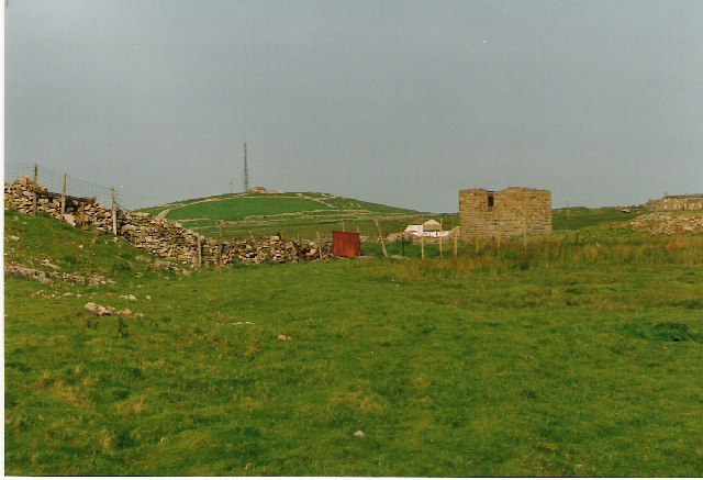
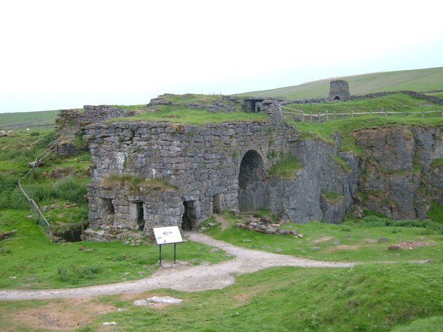
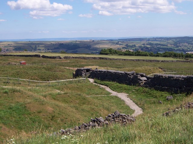
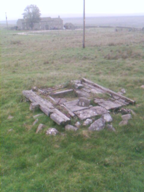
Greenhow has a rich history, with its origins dating back to the 17th century when lead mining was a prominent industry in the area. Evidence of this can still be seen in the form of old mine workings and ruins scattered throughout the village. Today, Greenhow is a peaceful and tranquil place, attracting visitors who seek to explore its historical roots and enjoy the stunning natural scenery.

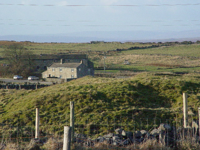
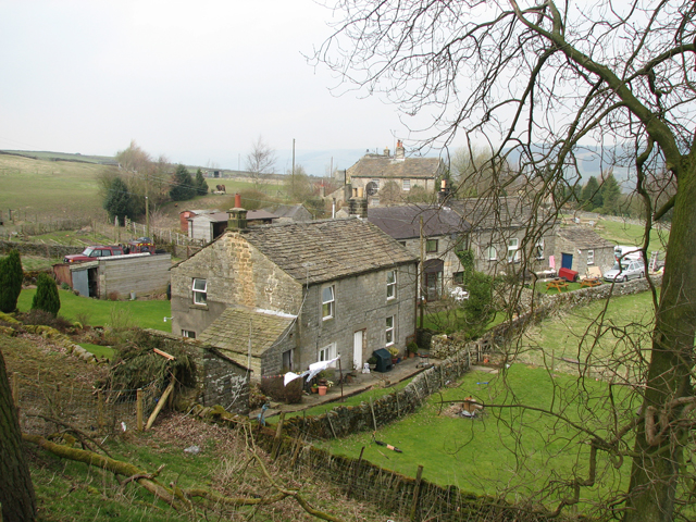
Despite its small size, the village has a tight-knit community and a range of amenities to serve its residents and visitors. These include a local pub, a village hall, and a primary school. Additionally, Greenhow offers a number of outdoor activities such as hiking, cycling, and horse riding, thanks to its extensive network of footpaths and bridleways.

Greenhow is particularly well-known for its annual village fete, which brings together the community for a day of traditional games, stalls, and entertainment. The fete is a popular event that attracts visitors from nearby towns and villages.

In summary, Greenhow is a charming village in the heart of Yorkshire's Nidderdale, known for its rich history, breathtaking natural beauty, and close-knit community. It offers a peaceful retreat for those seeking a break from the hustle and bustle of city life.

If you have any feedback on the listing, please let us know in the comments section below.

Greenhow Images

Images are sourced within 2km of 54.073394/-1.8295846 or Grid Reference SE1164. Thanks to Geograph Open Source API. All images are credited.

Greenhow Hill Top Greenhow Hill Top, the highest point around here at about 1390ft. The fence in the foreground surrounds the old East Engine Shaft which was sunk onto Banks Vein of the Sunside Lead Mines.
Greenhow Hill Top
Greenhow Hill Top, the highest point around here at about 1390ft. The fence in the foreground surrounds the old East Engine Shaft which was sunk onto Banks Vein of the Sunside Lead Mines.
Greenhow Village Named after the hill it sits under. Green - because this is a limestone area, the alkaline soil seems to produce very green grass.
Greenhow Village
Named after the hill it sits under. Green - because this is a limestone area, the alkaline soil seems to produce very green grass.
Greenhow Hill at Toft Gate Greenhow Hill rises 900 feet from Pateley Bridge to the hill top village of Greenhow 3 miles away. This difference in altitude can mean feet of snow on the hill and sunshine in Pateley.
Greenhow Hill at Toft Gate
Greenhow Hill rises 900 feet from Pateley Bridge to the hill top village of Greenhow 3 miles away. This difference in altitude can mean feet of snow on the hill and sunshine in Pateley.
Coldstones Quarry, Greenhow Hill Large open limestone quarry.
Coldstones Quarry, Greenhow Hill
Large open limestone quarry.
Brandstone Dub and Bridge Brandstone Dub and Bridge, on Brandstone Beck, Sunside, just below the old, long abandoned village of Hardcastle. The term Dub refers to a pool, here deep enough to bathe in, although not very big - may be it was the local washing hole at sometime?
Brandstone Dub and Bridge
Brandstone Dub and Bridge, on Brandstone Beck, Sunside, just below the old, long abandoned village of Hardcastle. The term Dub refers to a pool, here deep enough to bathe in, although not very big - may be it was the local washing hole at sometime?
Surveying Tower, Hardcastle Moor The surveying tower was used in the driving of the aqueduct tunnel under Greenhow Hill abt 1900. The tunnel is part of a long aqueduct from Scar House Reservoir to Bradford. In the foreground is No1 Well Shaft, one of 3 access points in the tunnel which is 3.5 miles long and reaches its greatest depth below the ground surface at No2 Shaft, Craven Cross, Greenhow, where it is 600 feet down. This is deeper than any of the mines reached. For further information see <span class="nowrap"><a title="http://www.greenhow-hill.org.uk/mining/bcww.html" rel="nofollow ugc noopener" href="http://www.greenhow-hill.org.uk/mining/bcww.html">Link</a><img style="margin-left:2px;" alt="External link" title="External link - shift click to open in new window" src="https://s1.geograph.org.uk/img/external.png" width="10" height="10"/></span>
Surveying Tower, Hardcastle Moor
The surveying tower was used in the driving of the aqueduct tunnel under Greenhow Hill abt 1900. The tunnel is part of a long aqueduct from Scar House Reservoir to Bradford. In the foreground is No1 Well Shaft, one of 3 access points in the tunnel which is 3.5 miles long and reaches its greatest depth below the ground surface at No2 Shaft, Craven Cross, Greenhow, where it is 600 feet down. This is deeper than any of the mines reached. For further information see LinkExternal link
The valley of Ashfoldside Beck Looking up from Prosperous Smelt Mill.
The valley of Ashfoldside Beck
Looking up from Prosperous Smelt Mill.
Katty White's Allotments Presumably named after a relation of Sir Thomas Woollaston White who owned the land around here in the 1800's. Further research has revealed that Catherine Simpson (born abt 1756) married Richard White at Fewston 19th Sept 1777 - they had at least 3 children 1787-1785 who were recorded in the Baptism Register as being born at Greenhow Hill. A relively featureless patch of moorland shown here with the boundary wall in the foreground, and the heights of Pockstones Moor in the background to break the monotony.
Katty White's Allotments
Presumably named after a relation of Sir Thomas Woollaston White who owned the land around here in the 1800's. Further research has revealed that Catherine Simpson (born abt 1756) married Richard White at Fewston 19th Sept 1777 - they had at least 3 children 1787-1785 who were recorded in the Baptism Register as being born at Greenhow Hill. A relively featureless patch of moorland shown here with the boundary wall in the foreground, and the heights of Pockstones Moor in the background to break the monotony.
Coldstones from the south The maps say White Mere, don't know why. The hill on the upper left is the bund which shields the industry of Coldstones Quarry from the casual passerby, and villager. The road seen here leads to the quarry and was built 20 years ago to allow the passage of quarry wagons without them having to pass through Greenhow Village.
Coldstones from the south
The maps say White Mere, don't know why. The hill on the upper left is the bund which shields the industry of Coldstones Quarry from the casual passerby, and villager. The road seen here leads to the quarry and was built 20 years ago to allow the passage of quarry wagons without them having to pass through Greenhow Village.
Craven Cross, Greenhow The square building in the middle surrounds No2 Shaft, sunk by Bradford Corporation Water Works abt 1900 as they drove the 3.5 mile long aqueduct tunnel under the hill. The depth to the tunnel from the surface is about 400 feet at this point
Craven Cross, Greenhow
The square building in the middle surrounds No2 Shaft, sunk by Bradford Corporation Water Works abt 1900 as they drove the 3.5 mile long aqueduct tunnel under the hill. The depth to the tunnel from the surface is about 400 feet at this point
Lily Green, Greenhow The mound in the foreground is an old mine shaft for the Prim or Prime Gap Vein which was worked for lead.
Lily Green, Greenhow
The mound in the foreground is an old mine shaft for the Prim or Prime Gap Vein which was worked for lead.
Looking towards Upper Nidderdale Taken from the minor road just off the Grassington to Pately Bridge road.
Looking towards Upper Nidderdale
Taken from the minor road just off the Grassington to Pately Bridge road.
Toft Gate Lime Kiln,  Greenhow The kiln in the foreground was loaded with limestone through the top and with coal through the rectangular openings in the end and side walls.  A stone lined flue runs from the kiln up a gentle slope to the chimney base in the distance.  
The hill behind the chimney is the west flank of the modern day limestone quarry.
Toft Gate Lime Kiln, Greenhow
The kiln in the foreground was loaded with limestone through the top and with coal through the rectangular openings in the end and side walls. A stone lined flue runs from the kiln up a gentle slope to the chimney base in the distance. The hill behind the chimney is the west flank of the modern day limestone quarry.
Mouseman lychgate at Greenhow Covered entry in carved oak to a small roadside cemetery about 1/2 mile outside of the village of Greenhow.  There are two carved "mice" in the curved trusses and following Biblical quotes on the outer and inner lintels:-
"I will lift up mine eyes unto the hills, from whence cometh my help."

"The sun shall not burn you by day, neither the moon by night"
Mouseman lychgate at Greenhow
Covered entry in carved oak to a small roadside cemetery about 1/2 mile outside of the village of Greenhow. There are two carved "mice" in the curved trusses and following Biblical quotes on the outer and inner lintels:- "I will lift up mine eyes unto the hills, from whence cometh my help." "The sun shall not burn you by day, neither the moon by night"
Mouseman mouse Detail of carving on Greenhow cemetery lychgate.
Mouseman mouse
Detail of carving on Greenhow cemetery lychgate.
View from Toft Gate Lime Kilns
Chimney Shaft, Greenhow Cover of a 300 ft mine shaft. In M C Gill's book there are photographs of a steam boiler underground below this point taken 30 years ago.
Chimney Shaft, Greenhow
Cover of a 300 ft mine shaft. In M C Gill's book there are photographs of a steam boiler underground below this point taken 30 years ago.
Show me another place!

Greenhow is located at Grid Ref: SE1164 (Lat: 54.073394, Lng: -1.8295846)

Division: West Riding

Administrative County: North Yorkshire

District: Harrogate

Police Authority: North Yorkshire

What 3 Words

///panoramic.couriers.systems. Near Pateley Bridge, North Yorkshire

Related Wikis

Greenhow

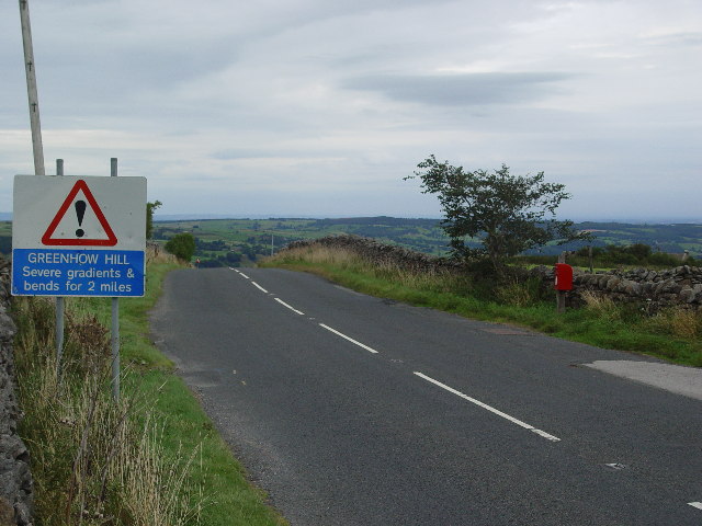
Greenhow is a village in North Yorkshire, England, often referred to as Greenhow Hill. The term how derives from the Old Norse word haugr meaning a hill...

Stump Cross Caverns

Stump Cross Caverns is a limestone cave system between Wharfedale and Nidderdale in North Yorkshire, England. == Geography == The caverns at Stump Cross...

Heathfield, North Yorkshire

Heathfield is a hamlet in the civil parish of Stonebeck Down in upper Nidderdale, in North Yorkshire, England. It lies on a broad terrace on the west...

Nidderdale High School

Nidderdale High School is a coeducational secondary school located in Pateley Bridge, North Yorkshire, England. The school is named after Nidderdale, one...

Bewerley

Bewerley is a village and civil parish in the Harrogate district of North Yorkshire, England, about twelve miles west of Ripon. The parish includes the...

Pateley Bridge

Pateley Bridge (known locally as Pateley) is a market town in Nidderdale in the county and district of North Yorkshire, England. Historically part of the...

Pateley Bridge railway station (Nidd Valley Light Railway)

Pateley Bridge railway station (NVLR) was a railway station serving the southern terminus of the Nidd Valley Light Railway, in Pateley Bridge, North Yorkshire...

Pateley Bridge railway station

Pateley Bridge railway station is a disused railway station in North Yorkshire, England. The station was the terminating station on the North Eastern Railway...

Nearby Amenities

Located within 500m of 54.073394,-1.8295846
Greenhow Hill
Description: Old lead mining village. Local lead mining goes back to Roman times
Is In: UK, England, North Yorkshire
Is In Country: UK
Is In County: North Yorkshire
Is In Historical County: Yorkshire
Place: hamlet
Wikidata: Q5604184
Wikipedia: en:Greenhow
Lat/Long: 54.072817/-1.8278744
Cock Hill
Natural: peak
Source: OS 1:25k
Lat/Long: 54.0747956/-1.8298633
Historic: mine_shaft
Mineral: lead
Source: Bing
Lat/Long: 54.0698904/-1.8329562
Historic: mine_shaft
Mineral: lead
Source: Bing
Lat/Long: 54.0696449/-1.8290295
Historic: mine_shaft
Mineral: lead
Source: Bing
Lat/Long: 54.0722072/-1.8233325
Historic: mine_shaft
Mineral: lead
Source: Bing
Lat/Long: 54.0710236/-1.8241371
Historic: mine_shaft
Mineral: lead
Source: Bing
Lat/Long: 54.0716472/-1.8293192
Historic: mine_shaft
Mineral: lead
Source: Bing
Lat/Long: 54.0733277/-1.8371941
Historic: mine_shaft
Mineral: lead
Source: Bing
Lat/Long: 54.0713258/-1.824577
Historic: mine_shaft
Mineral: lead
Source: Bing
Lat/Long: 54.0736617/-1.8369581
Historic: mine_shaft
Mineral: lead
Source: Bing
Lat/Long: 54.0692738/-1.8316688
Historic: mine_shaft
Mineral: lead
Source: Bing
Lat/Long: 54.0712065/-1.8234934
Historic: mine_shaft
Mineral: lead
Source: Bing
Lat/Long: 54.072006/-1.8243517
Archaeological Site: mineral_extraction
Historic: mine_shaft
Mineral: lead
Source: Bing
Lat/Long: 54.0743412/-1.8244697
Historic: mine_shaft
Mineral: lead
Source: Bing
Lat/Long: 54.0712254/-1.8242659
Historic: mine_shaft
Mineral: lead
Source: Bing
Lat/Long: 54.0710932/-1.829641
Historic: mine_shaft
Mineral: lead
Source: Bing
Lat/Long: 54.0731467/-1.836935
Historic: mine_shaft
Mineral: lead
Source: Bing
Lat/Long: 54.0700919/-1.8249311
Historic: mine_shaft
Mineral: lead
Source: Bing
Lat/Long: 54.0724338/-1.823429
Historic: mine_shaft
Mineral: lead
Source: Bing
Lat/Long: 54.0730916/-1.835677
Historic: mine_shaft
Mineral: lead
Source: Bing
Lat/Long: 54.0731687/-1.836699
Historic: mine_shaft
Mineral: lead
Source: Bing
Lat/Long: 54.0749584/-1.82889
Historic: mine_shaft
Mineral: lead
Source: Bing
Lat/Long: 54.0748231/-1.828051
Historic: mine_shaft
Mineral: lead
Source: Bing
Lat/Long: 54.0735052/-1.8371521
Historic: mine_shaft
Mineral: lead
Source: Bing
Lat/Long: 54.072097/-1.8367822
Historic: mine_shaft
Mineral: lead
Source: Bing
Lat/Long: 54.0715528/-1.8241049
Historic: mine_shaft
Mineral: lead
Source: Bing
Lat/Long: 54.0746434/-1.829008
Historic: mine_shaft
Mineral: lead
Source: Bing
Lat/Long: 54.0710992/-1.8245126
Historic: mine_shaft
Mineral: lead
Source: Bing
Lat/Long: 54.0721253/-1.8251349
Historic: mine_shaft
Mineral: lead
Source: Bing
Lat/Long: 54.0706588/-1.8281712
Historic: mine_shaft
Mineral: lead
Source: Bing
Lat/Long: 54.0745175/-1.8296303
Historic: mine_shaft
Mineral: lead
Source: Bing
Lat/Long: 54.0690909/-1.8309392
Historic: mine_shaft
Mineral: lead
Source: Bing
Lat/Long: 54.072289/-1.8244697
Historic: mine_shaft
Mineral: lead
Source: Bing
Lat/Long: 54.072176/-1.8228711
Historic: mine_shaft
Mineral: lead
Source: Bing
Lat/Long: 54.0713891/-1.822796
Historic: mine_shaft
Mineral: lead
Source: Bing
Lat/Long: 54.0718927/-1.8238153
Historic: mine_shaft
Mineral: lead
Source: Bing
Lat/Long: 54.0714143/-1.8242659
Archaeological Site: mineral_extraction
Historic: mine_shaft
Mineral: lead
Source: Bing
Lat/Long: 54.0741461/-1.8242551
Archaeological Site: mineral_extraction
Historic: mine_shaft
Mineral: lead
Source: Bing
Lat/Long: 54.0723834/-1.8349303
Historic: mine_shaft
Mineral: lead
Source: Bing
Lat/Long: 54.0714709/-1.8245877
Historic: mine_shaft
Mineral: lead
Source: Bing
Lat/Long: 54.0738234/-1.8369028
Historic: mine_shaft
Mineral: lead
Source: Bing
Lat/Long: 54.0715461/-1.8238796
Archaeological Site: mineral_extraction
Historic: mine_shaft
Mineral: lead
Source: Bing:survey
Lat/Long: 54.0757323/-1.827456
Historic: mine_shaft
Mineral: lead
Source: Bing
Lat/Long: 54.0720249/-1.822796
Historic: mine_shaft
Mineral: lead
Source: Bing
Lat/Long: 54.0735291/-1.836647
Archaeological Site: mineral_extraction
Historic: mine_shaft
Mineral: lead
Source: Bing
Lat/Long: 54.0714017/-1.8301989
Historic: mine_shaft
Mineral: lead
Source: Bing
Lat/Long: 54.0715713/-1.8245556
Historic: mine_shaft
Mineral: lead
Source: Bing
Lat/Long: 54.0724845/-1.8249847
Barrier: cattle_grid
Source: Bing
Lat/Long: 54.0747974/-1.8301719
Archaeological Site: mineral_extraction
Historic: mine_shaft
Mineral: lead
Source: Bing
Lat/Long: 54.0752732/-1.8230213
Historic: mine_shaft
Mineral: lead
Source: Bing
Lat/Long: 54.0706462/-1.8236114
Historic: mine_shaft
Mineral: lead
Source: Bing
Lat/Long: 54.0729566/-1.8372156
Historic: mine_shaft
Mineral: lead
Source: Bing
Lat/Long: 54.0711936/-1.824695
Archaeological Site: mineral_extraction
Historic: mine_shaft
Mineral: lead
Source: Bing:survey
Lat/Long: 54.0752917/-1.827903
Historic: mine_shaft
Mineral: lead
Source: Bing
Lat/Long: 54.0723519/-1.8240084
Historic: mine_shaft
Mineral: lead
Source: Bing
Lat/Long: 54.0712191/-1.8239226
Historic: mine_shaft
Mineral: lead
Source: Bing
Lat/Long: 54.0692234/-1.8307783
Historic: mine_shaft
Mineral: lead
Source: Bing
Lat/Long: 54.0725472/-1.8351679
Historic: mine_shaft
Mineral: lead
Source: Bing
Lat/Long: 54.0725912/-1.8352698
Telephone
Booth: K6
Covered: booth
Source: survey
Lat/Long: 54.0734698/-1.8231945
Historic: mine_shaft
Mineral: lead
Source: Bing
Lat/Long: 54.0722887/-1.8230925
Historic: mine_shaft
Mineral: lead
Source: Bing
Lat/Long: 54.0722463/-1.823578
Historic: mine_shaft
Source: Bing
Lat/Long: 54.0722134/-1.8277965
Historic: mine_shaft
Mineral: lead
Source: Bing
Lat/Long: 54.0718607/-1.8230443
Greenhow Hill Top
Ele: 427
Ele Ft: 1400
Natural: peak
Source: OS 1:25k
Source Ele: OS sheet 135, publ. 1854
Lat/Long: 54.0707851/-1.8314107
Historic: mine_shaft
Mineral: lead
Source: Bing
Lat/Long: 54.0721346/-1.8242512
Archaeological Site: mineral_extraction
Historic: mine_shaft
Mineral: lead
Source: Bing
Lat/Long: 54.0702113/-1.826515
Historic: mine_shaft
Mineral: lead
Source: Bing
Lat/Long: 54.0695692/-1.8264185
Historic: mine_shaft
Mineral: lead
Source: Bing
Lat/Long: 54.0721298/-1.8230335
Historic: mine_shaft
Mineral: lead
Source: Bing
Lat/Long: 54.0707071/-1.8234573
Historic: mine_shaft
Mineral: lead
Source: Bing
Lat/Long: 54.071557/-1.8227868
Historic: mine_shaft
Mineral: lead
Source: Bing
Lat/Long: 54.0716529/-1.8228833
Historic: mine_shaft
Mineral: lead
Source: Bing
Lat/Long: 54.0716168/-1.8234224
Historic: mine_shaft
Mineral: lead
Source: Bing
Lat/Long: 54.0717698/-1.831326
Historic: mine_shaft
Mineral: lead
Source: Bing
Lat/Long: 54.0702097/-1.8331507
Historic: mine_shaft
Mineral: lead
Source: Bing
Lat/Long: 54.0699643/-1.8305168
Historic: mine_shaft
Mineral: lead
Source: Bing
Lat/Long: 54.0702097/-1.8324533
Historic: mine_shaft
Mineral: lead
Source: Bing
Lat/Long: 54.0702621/-1.8309773
Historic: mine_shaft
Mineral: lead
Source: Bing
Lat/Long: 54.070238/-1.8327483
Man Made: tower
Source: Bing
Tower Type: communication
Lat/Long: 54.0709135/-1.8315298
Historic: mine_shaft
Mineral: lead
Source: Bing
Lat/Long: 54.071581/-1.8304891
Historic: mine_shaft
Mineral: lead
Source: Bing
Lat/Long: 54.0689853/-1.8291756
Historic: mine_shaft
Mineral: lead
Source: Bing
Lat/Long: 54.0702777/-1.831106
Historic: mine_shaft
Source: Bing
Lat/Long: 54.0744764/-1.8320053
Historic: mine_shaft
Source: Bing
Lat/Long: 54.0744009/-1.8322441
Historic: mine_shaft
Source: Bing
Lat/Long: 54.0746401/-1.8304523
Historic: mine_shaft
Source: Bing
Lat/Long: 54.0746275/-1.8322333
Historic: mine_shaft
Source: Bing
Lat/Long: 54.0745504/-1.8313455
Historic: mine_shaft
Source: Bing
Lat/Long: 54.0747786/-1.8293176
Historic: mine_shaft
Source: Bing
Lat/Long: 54.0742908/-1.8279422
Post Box
Post Box Type: wall
Ref: HG3 169
Royal Cypher: GR
Royal Cypher Wikidata: Q33102273
Lat/Long: 54.0733529/-1.8237843
Historic: memorial
Lat/Long: 54.0735008/-1.8226122
Historic: mine_shaft
Mineral: lead
Source: Bing
Lat/Long: 54.0756441/-1.8336226
Historic: mine_shaft
Mineral: lead
Source: Bing
Lat/Long: 54.0735227/-1.8369807
Historic: mine_shaft
Mineral: lead
Source: Bing
Lat/Long: 54.073573/-1.8371738
Historic: mine_shaft
Mineral: lead
Source: Bing
Lat/Long: 54.0735006/-1.8355725
Historic: mine_shaft
Mineral: lead
Source: Bing
Lat/Long: 54.0733511/-1.8354331
Historic: mine_shaft
Mineral: lead
Source: Bing
Lat/Long: 54.0753766/-1.8336896
Historic: mine_shaft
Mineral: lead
Source: Bing
Lat/Long: 54.0747799/-1.8341535
Abandoned: yes
Historic: mine_shaft
Mineral: lead
Source: Bing
Lat/Long: 54.0741097/-1.835822
Historic: mine_shaft
Source: Bing
Lat/Long: 54.0746161/-1.8311334
Historic: mine_shaft
Source: Bing
Lat/Long: 54.0747436/-1.8292397
Historic: mine_shaft
Source: Bing
Lat/Long: 54.0745957/-1.8315491
Historic: mine_shaft
Source: Bing
Lat/Long: 54.0744131/-1.8321794
Historic: mine_shaft
Mineral: lead
Source: Bing
Lat/Long: 54.0726984/-1.8243209
Archaeological Site: mineral_extraction
Historic: mine_shaft
Mineral: lead
Source: Bing
Lat/Long: 54.0710236/-1.8238987
Archaeological Site: mineral_extraction
Historic: mine_shaft
Mineral: lead
Source: Bing
Lat/Long: 54.0711274/-1.8238612
Historic: mine_shaft
Mineral: lead
Source: Bing
Lat/Long: 54.0726355/-1.8231407
Archaeological Site: mineral_extraction
Historic: mine_shaft
Mineral: lead
Source: Bing
Lat/Long: 54.0715525/-1.8232228
Historic: mine_shaft
Mineral: lead
Source: Bing
Lat/Long: 54.0725883/-1.8228993
Archaeological Site: mineral_extraction
Historic: mine_shaft
Mineral: lead
Source: Bing
Lat/Long: 54.0701329/-1.8248697
Archaeological Site: mineral_extraction
Historic: mine_shaft
Mineral: lead
Source: Bing
Lat/Long: 54.071842/-1.8345181
Archaeological Site: mineral_extraction
Historic: mine_shaft
Mineral: lead
Source: Bing
Lat/Long: 54.0719711/-1.8332146
Archaeological Site: mineral_extraction
Historic: mine_shaft
Mineral: lead
Source: Bing
Lat/Long: 54.0723158/-1.8333165
Archaeological Site: mineral_extraction
Historic: mine_shaft
Mineral: lead
Source: Bing
Lat/Long: 54.0711403/-1.8297923
Archaeological Site: mineral_extraction
Historic: mine_shaft
Mineral: lead
Source: Bing
Lat/Long: 54.0712725/-1.8299265
Archaeological Site: mineral_extraction
Historic: mine_shaft
Mineral: lead
Source: Bing
Lat/Long: 54.0690278/-1.8280937
Archaeological Site: mineral_extraction
Historic: mine_shaft
Mineral: lead
Source: Bing
Lat/Long: 54.070284/-1.826082
Archaeological Site: mineral_extraction
Historic: mine_shaft
Mineral: lead
Source: Bing
Lat/Long: 54.0752602/-1.8266115
lime_kiln
Archaeological Site: lime_kiln
Fixme: exact location uncertain
Historic: archaeological_site
Mineral: limestone
Output: lime
Source: OS sheet 135, publ. 1854
Lat/Long: 54.0700448/-1.8274645
Direction: 90
Man Made: adit
Lat/Long: 54.0708388/-1.8275865
Barrier: stile
Lat/Long: 54.0774565/-1.8278011
Give Way
Direction: backward
Lat/Long: 54.0733897/-1.8295317
Power: pole
Lat/Long: 54.0745316/-1.8226323
Power: pole
Lat/Long: 54.0744394/-1.8239732
Power: pole
Lat/Long: 54.0743058/-1.8254424
Power: pole
Lat/Long: 54.0743737/-1.824696
Power: pole
Lat/Long: 54.0743273/-1.8246725
Power: pole
Lat/Long: 54.0739139/-1.8243713
Power: pole
Lat/Long: 54.0734606/-1.8240492
Power: pole
Lat/Long: 54.0728736/-1.8242011
Power: pole
Lat/Long: 54.0722421/-1.8243529
Power: pole
Lat/Long: 54.0716566/-1.8244917
Power: pole
Lat/Long: 54.0708621/-1.8246855
Power: pole
Lat/Long: 54.0702121/-1.8244839
Power: pole
Lat/Long: 54.0694591/-1.8269325
Power: pole
Lat/Long: 54.0742074/-1.8268383
Power: pole
Lat/Long: 54.0743027/-1.8281399
Power: pole
Lat/Long: 54.0744241/-1.8297138
Power: pole
Lat/Long: 54.0739646/-1.8312144
Power: pole
Lat/Long: 54.0735513/-1.8326155
Power: pole
Lat/Long: 54.0726401/-1.835478
Power: pole
Lat/Long: 54.0731244/-1.8339565
Power: pole
Lat/Long: 54.0737203/-1.8344985
Power: pole
Lat/Long: 54.0744579/-1.8351061
Power: pole
Lat/Long: 54.0724111/-1.8362898
Power: pole
Lat/Long: 54.0722098/-1.8369367
The data included in this document is from www.openstreetmap.org. The data is made available under ODbL.

Have you been to Greenhow?

Leave your review of Greenhow below (or comments, questions and feedback).