Greenhill

Settlement in Essex Uttlesford

England

Greenhill

Road junction between Brickkiln Spring and Canfield Hart These are each the names of woods nearby. The B183 runs across ahead in the shot.
Road junction between Brickkiln Spring and Canfield Hart Credit: Trevor Harris

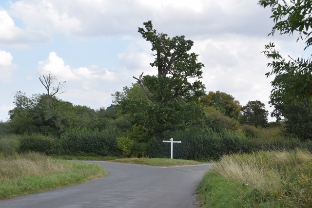
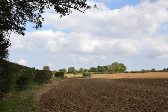
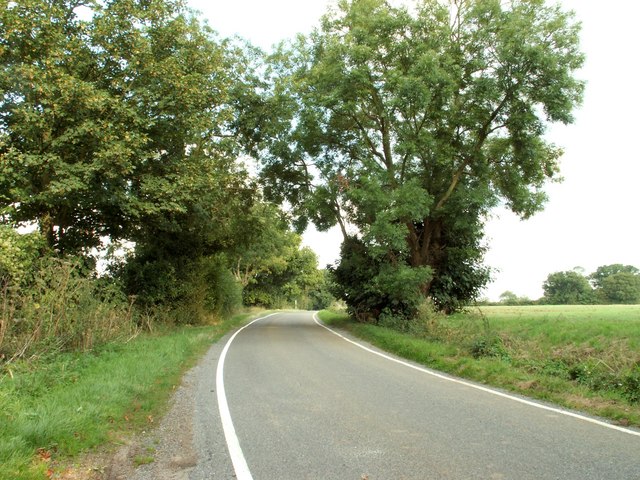
Greenhill is a small village located in the county of Essex, England. Situated approximately 20 miles northeast of London, it forms part of the borough of Epping Forest. The village is set within a picturesque rural landscape, surrounded by fields, woodlands, and rolling hills.

Greenhill is known for its quaint and charming atmosphere, offering residents and visitors a peaceful escape from the hustle and bustle of city life. The village is home to a close-knit community, with a population of around 1,000 people.

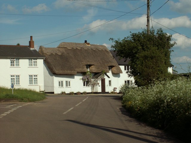
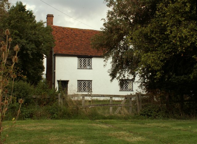
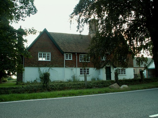
The heart of Greenhill is centered around the village green, a well-maintained open space where locals gather for various events and recreational activities. The green is lined with traditional cottages, adding to the village's timeless appeal. A local pub, The Greenhill Arms, serves as a popular meeting point and offers a selection of traditional British cuisine.

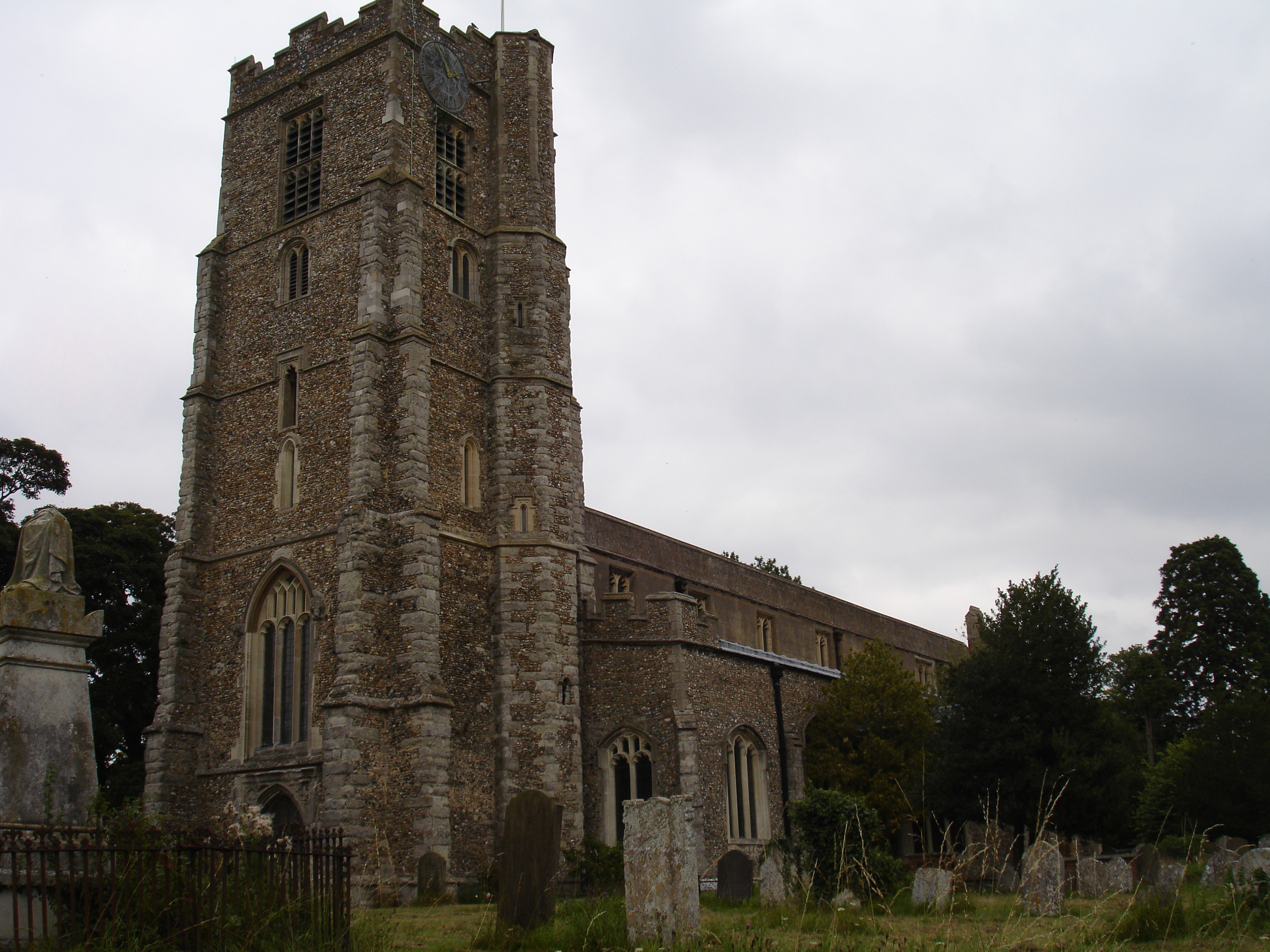
The village also boasts a primary school, providing education for children aged 4 to 11, and a small church, St. Mary's, which dates back to the 12th century. The church is a significant historical landmark and attracts visitors interested in its architectural and cultural heritage.

Greenhill benefits from its close proximity to the nearby town of Epping, which offers a wider range of amenities such as shops, supermarkets, and leisure facilities. Additionally, the village benefits from excellent transport links, with easy access to major road networks and a nearby train station providing regular services to London and other surrounding areas.

Overall, Greenhill offers a tranquil and idyllic living environment, making it an attractive place to reside for those seeking a peaceful countryside lifestyle within commuting distance of the capital.

If you have any feedback on the listing, please let us know in the comments section below.
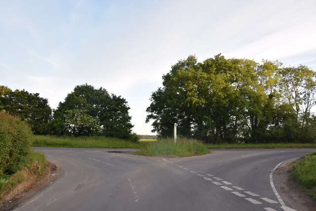
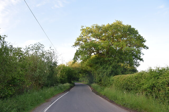
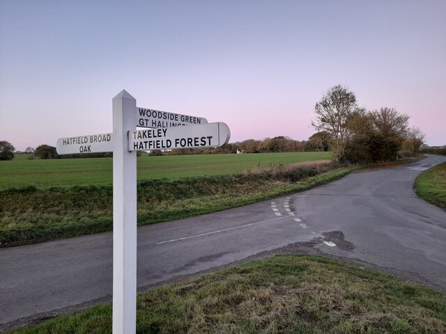
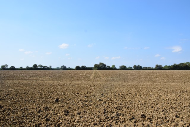
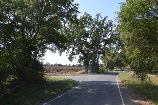
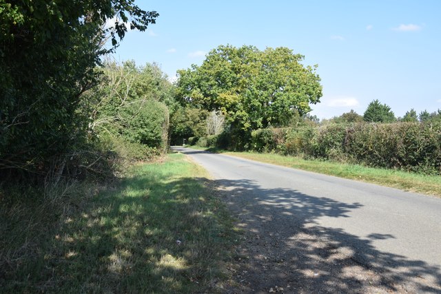
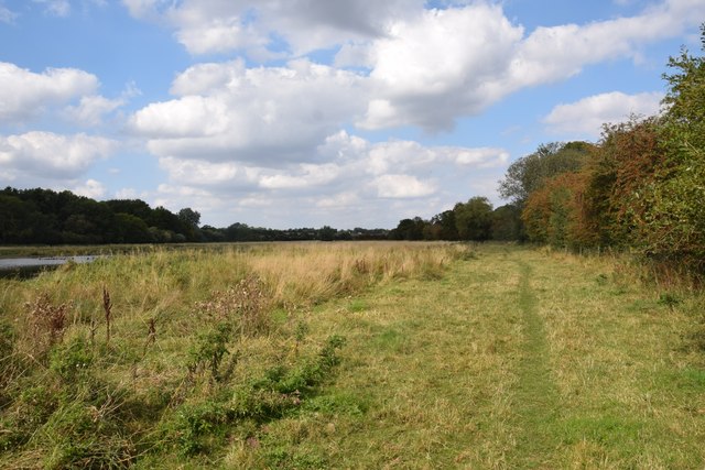
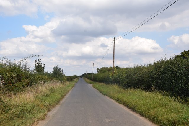
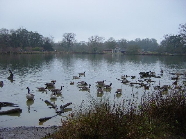
Greenhill Images

Images are sourced within 2km of 51.844299/0.25387678 or Grid Reference TL5518. Thanks to Geograph Open Source API. All images are credited.

Road junction between Brickkiln Spring and Canfield Hart These are each the names of woods nearby. The B183 runs across ahead in the shot.
Road junction between Brickkiln Spring and Canfield Hart
These are each the names of woods nearby. The B183 runs across ahead in the shot.
Lane to Great Canfield
Junction and Sign The meeting of Hatfield Forest Road/ Wood Row/ Greenhill.
Junction and Sign
The meeting of Hatfield Forest Road/ Wood Row/ Greenhill.
Field north of Crabbs Green Farm Taken from Crabbs Green Lane looking west. The tractor track dead ahead shows the line of the public footpath crossing this field.
Field north of Crabbs Green Farm
Taken from Crabbs Green Lane looking west. The tractor track dead ahead shows the line of the public footpath crossing this field.
Road junction at Taverners Green With the lane called Crabbs Green on the left ahead.
Road junction at Taverners Green
With the lane called Crabbs Green on the left ahead.
On the lane to Broomshawbury Looking north here with the fingerpost for Boxley Lane just visible in the centre ahead.
On the lane to Broomshawbury
Looking north here with the fingerpost for Boxley Lane just visible in the centre ahead.
Footpath through The Marsh This area north of Hatfield Broad Oak, formerly apparently common grazing, is a good wildlife habitat. Though there are some areas of standing water (one can be seen to the right here), most of the marshy area was dry today - as was Pincey Brook, whose course the path runs beside.
Footpath through The Marsh
This area north of Hatfield Broad Oak, formerly apparently common grazing, is a good wildlife habitat. Though there are some areas of standing water (one can be seen to the right here), most of the marshy area was dry today - as was Pincey Brook, whose course the path runs beside.
Straight road near Forest Farm This very straight section is about a kilometre in length and may mark the route of a Roman road heading for Takeley Street (several other straight sections occur between here and Takeley Street). "Street" in a place name often denotes a settlement on a Roman road and indeed Takeley Street is on Stane Street running east to west. I think it's not too fanciful to see this as a Roman route to Stane Street.
Straight road near Forest Farm
This very straight section is about a kilometre in length and may mark the route of a Roman road heading for Takeley Street (several other straight sections occur between here and Takeley Street). "Street" in a place name often denotes a settlement on a Roman road and indeed Takeley Street is on Stane Street running east to west. I think it's not too fanciful to see this as a Roman route to Stane Street.
Finger post at junction near Bridgefoot Farm Directions shown are left to Takeley and Hatfield Forest, right to Hatfield Broad Oak, and towards the photographer, to Woodside Green and Hallingbury. For a close-up see photo from contributor David Bremner <a href="https://www.geograph.org.uk/photo/7329457">TL5418 : Junction and Sign</a>
Finger post at junction near Bridgefoot Farm
Directions shown are left to Takeley and Hatfield Forest, right to Hatfield Broad Oak, and towards the photographer, to Woodside Green and Hallingbury. For a close-up see photo from contributor David Bremner TL5418 : Junction and Sign
Little Barrington Hall Farm
Field south of Greenhill Is beside, or was part of Brumsted Common.
Field south of Greenhill
Is beside, or was part of Brumsted Common.
Hatfield Forest. Now a popular park cared for by the National Trust.
Hatfield Forest.
Now a popular park cared for by the National Trust.
The Shell House, Hatfield Forest Jacob Houblon III built The Shell House in about 1754. It was attached to a cottage by his new lake and was occupied by a housekeeper who kept poultry and peacocks. The cottage was later demolished. The Shell House has recently been restored by The National Trust.
The Shell House, Hatfield Forest
Jacob Houblon III built The Shell House in about 1754. It was attached to a cottage by his new lake and was occupied by a housekeeper who kept poultry and peacocks. The cottage was later demolished. The Shell House has recently been restored by The National Trust.
The Lake, Hatfield Forest Looking SW across to the Shell House. This lake was created by Jacob Houblon III in circa 1750 from marshland fed by the Shermore Brook.
The Lake, Hatfield Forest
Looking SW across to the Shell House. This lake was created by Jacob Houblon III in circa 1750 from marshland fed by the Shermore Brook.
Cottages at Greenhill, near Hatfield Broad Oak, Essex
House at Bush End, near Hatfield Forest, Essex
Country road near Great Canfield, Essex
Peckers farmhouse, near Hellman's Cross, Essex Hellman's Cross is close to Great Canfield. The road in the photo is Green Street.
Peckers farmhouse, near Hellman's Cross, Essex
Hellman's Cross is close to Great Canfield. The road in the photo is Green Street.
Show me another place!

Greenhill is located at Grid Ref: TL5518 (Lat: 51.844299, Lng: 0.25387678)

Administrative County: Essex

District: Uttlesford

Police Authority: Essex

What 3 Words

///estimates.thinnest.safest. Near Takeley, Essex

Related Wikis

Barrington Hall, Essex

Barrington Hall is a Grade II* listed 18th-century English country house in Hatfield Broad Oak, Essex, England. Barrington Hall is built in red brick...

Taverners Green

Taverners Green is a hamlet in the Hatfield Broad Oak civil parish of the Uttlesford district, in the county of Essex, England. Nearby settlements include...

Hatfield Regis Priory

Hatfield Broad Oak Priory, or Hatfield Regis Priory, is a former Benedictine priory in Hatfield Broad Oak, Essex, England. Founded by 1139, it was dissolved...

Hatfield Broad Oak

Hatfield Broad Oak (also known as Hatfield Regis) is a village and civil parish in the Uttlesford district of Essex, England. The village is approximately...

Hatfield Forest

Hatfield Forest is a 403.2-hectare (996-acre) biological Site of Special Scientific Interest in Essex, three miles east of Bishop's Stortford. It is also...

Takeley F.C.

Takeley Football Club is an English football club based in Takeley, Essex. The club are currently members of the Essex Senior League and play at Station...

Stane Street Halt railway station

Stane Street Halt railway station was a station serving the community of Takeley Street to the west of the village of Takeley near Bishop's Stortford,...

Takeley railway station

Takeley railway station was a station serving the Hockerill area of Takeley in Bishop's Stortford, England. The station was 5 miles 11 chains (8.27 km...

Nearby Amenities

Located within 500m of 51.844299,0.25387678
Collier Street
Naptan AtcoCode: 150020013001
Naptan Bearing: N
Naptan BusStopType: CUS
Naptan CommonName: Greenhill
Naptan Crossing: Collier Street
Naptan Indicator: N-bound
Naptan Landmark: Greenhill
Naptan NaptanCode: esxdgjdt
Naptan Street: Dunmow Road
Naptan Verified: no
Public Transport: platform
Source: naptan_import
Lat/Long: 51.8446152/0.2536623
Collier Street
Naptan AtcoCode: 1500200130Y1
Naptan Bearing: S
Naptan BusStopType: CUS
Naptan CommonName: Greenhill
Naptan Crossing: Collier Street
Naptan Indicator: S-bound
Naptan Landmark: Greenhill
Naptan NaptanCode: esxgtamp
Naptan Street: Dunmow Road
Naptan Verified: no
Public Transport: platform
Source: naptan_import
Lat/Long: 51.8446217/0.2537933
Collier Street
Place: hamlet
Lat/Long: 51.8449373/0.2494579
Broadfield Common
Place: locality
Lat/Long: 51.8433133/0.2518389
Colour: red and white
Marker: aerial
Utility: gas
Lat/Long: 51.8417306/0.2543326
Colour: yellow
Marker: post
Utility: gas
Lat/Long: 51.841734/0.2541794
Greenhill
Place: locality
Lat/Long: 51.8443971/0.2537841
Brumsted Common
Place: locality
Lat/Long: 51.8428627/0.2560586
The data included in this document is from www.openstreetmap.org. The data is made available under ODbL.

Have you been to Greenhill?

Leave your review of Greenhill below (or comments, questions and feedback).