Grangefield

Settlement in Durham

England

Grangefield

Wetland Area Small area of wetland in urban Stockton. Residential estates are hidden by the line of shrubs and trees lining the Durham Coast Railway.
Wetland Area Credit: David Robinson

Grangefield is a small village located in County Durham, England. Situated approximately 3 miles southwest of the city of Durham, it lies within the civil parish of Elvet and Gilesgate. The village is primarily residential and offers a peaceful and picturesque setting for its residents.

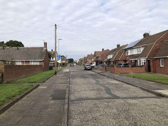
Grangefield is known for its quaint charm and beautiful surrounding countryside. The village boasts a mix of traditional stone-built cottages and modern houses, giving it a unique character. The local community is close-knit and provides a welcoming atmosphere for both old and new residents.

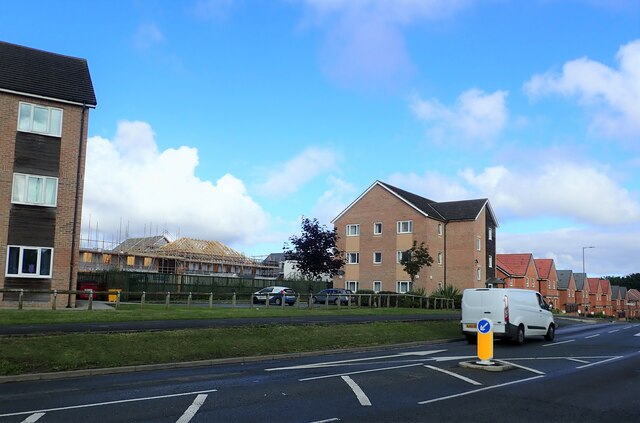
Although small in size, Grangefield offers a range of amenities and services to its residents. These include a village hall, a local convenience store, and a primary school, providing essential facilities for the community. The village is well-connected to nearby towns and cities with convenient transportation links, allowing residents to easily access larger urban areas for work or leisure.

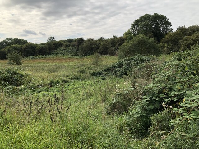
The village is surrounded by stunning natural landscapes, with rolling hills, meandering rivers, and lush green fields. This makes Grangefield an ideal location for outdoor enthusiasts who enjoy activities like hiking, cycling, and fishing. The nearby River Wear offers opportunities for boating and scenic walks along its banks.

In summary, Grangefield is a charming and peaceful village in County Durham, offering a close-knit community, essential amenities, and beautiful natural surroundings. Its proximity to the city of Durham provides residents with the best of both worlds - a tranquil rural escape with easy access to urban facilities.

If you have any feedback on the listing, please let us know in the comments section below.
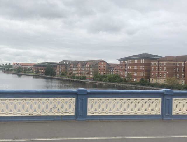
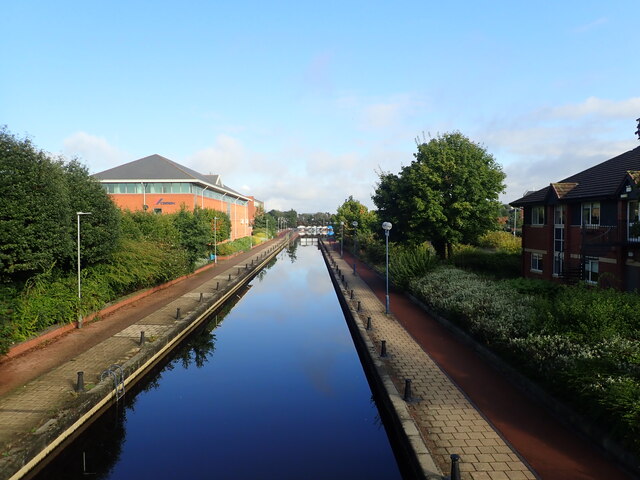
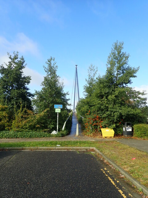
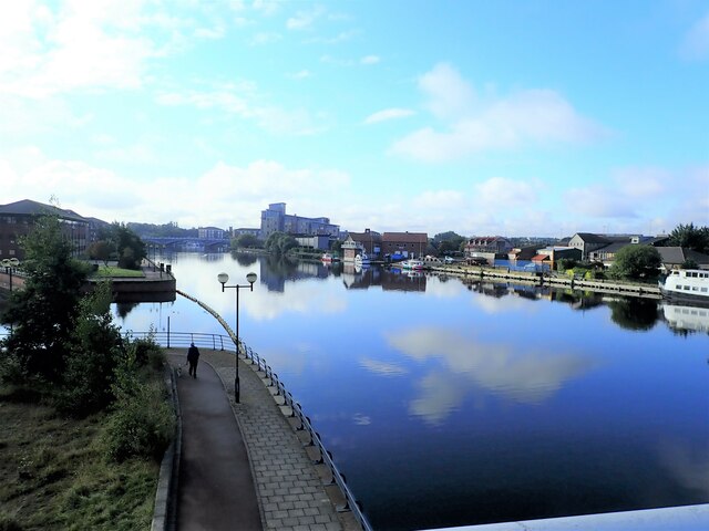
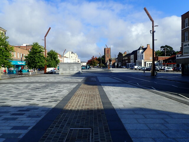
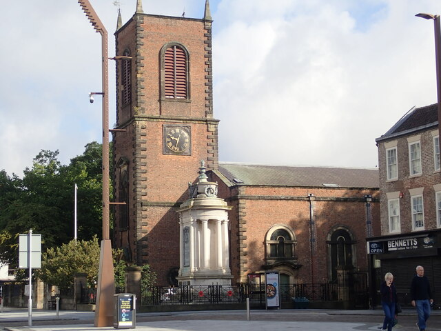
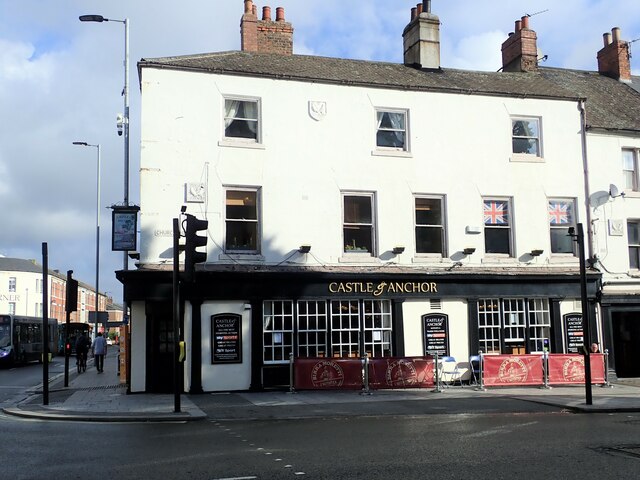
Grangefield Images

Images are sourced within 2km of 54.566545/-1.3342308 or Grid Reference NZ4319. Thanks to Geograph Open Source API. All images are credited.

Wetland Area Small area of wetland in urban Stockton. Residential estates are hidden by the line of shrubs and trees lining the Durham Coast Railway.
Wetland Area
Small area of wetland in urban Stockton. Residential estates are hidden by the line of shrubs and trees lining the Durham Coast Railway.
Rothwell Crescent, Roseworth, Stockton
Overgrown Entrance to Nature Reserve Gated entrance that doesn't appear to see a lot of use at the north end of Hardwick Dene & Elm Tree Woods Nature Reserve. The reserve lies within urban Stockton, behind the site of the General Hospital.
Overgrown Entrance to Nature Reserve
Gated entrance that doesn't appear to see a lot of use at the north end of Hardwick Dene & Elm Tree Woods Nature Reserve. The reserve lies within urban Stockton, behind the site of the General Hospital.
New houses being built west of Norton Road
North Shore Academy The North Shore Academy is a secondary school which opened in 2010, and replaced Blakeston School and Norton Comprehensive School.
North Shore Academy
The North Shore Academy is a secondary school which opened in 2010, and replaced Blakeston School and Norton Comprehensive School.
The River Tees Crossing the river on the Victoria Bridge. The apartments by the side of the river are student accommodation flats.
The River Tees
Crossing the river on the Victoria Bridge. The apartments by the side of the river are student accommodation flats.
Canal connecting the River Tees to a Wharf
Approaching the Teesquay Millennium Bridge Footbridge linking Teesdale with Stockton Town Centre. The bridge opened in 2000.
Approaching the Teesquay Millennium Bridge
Footbridge linking Teesdale with Stockton Town Centre. The bridge opened in 2000.
View upstream from the Teesquay Millennium Bridge
Commemorative plaque on the Teesquay Millennium Bridge Looking slightly the worse for wear, the names of funding partners have all but disappeared. This footbridge links Teesdale and the Castlegate Centre in the High Street and, in the process, spans Riverside Road. It is of cable stay design supported by a 40 metre high mast.
Commemorative plaque on the Teesquay Millennium Bridge
Looking slightly the worse for wear, the names of funding partners have all but disappeared. This footbridge links Teesdale and the Castlegate Centre in the High Street and, in the process, spans Riverside Road. It is of cable stay design supported by a 40 metre high mast.
Teesquay Millennium Bridge This footbridge links Teesdale and the Castlegate Centre in the High Street and, in the process, spans Riverside Road. It is of cable stay design supported by a 40 metre high mast.
Teesquay Millennium Bridge
This footbridge links Teesdale and the Castlegate Centre in the High Street and, in the process, spans Riverside Road. It is of cable stay design supported by a 40 metre high mast.
Footbridge over the A1305 The bridge connects the riverside walk with the shopping centre
Footbridge over the A1305
The bridge connects the riverside walk with the shopping centre
The Old Town Hall, Stockton-on-Tees The building in the High Street, which is the meeting place of Stockton-on-Tees Borough Council, is a Grade II* listed building.
The Old Town Hall, Stockton-on-Tees
The building in the High Street, which is the meeting place of Stockton-on-Tees Borough Council, is a Grade II* listed building.
Stag Inn, Silver Street
Pedestrian area on Stockton High Street Wide pedestrian area in Castlegate. Many of the large department stores to the east of the High Street have closed and there is a plan to demolish them and create a five-acre park with trees, art installations and a land-bridge to the River Tees.
Pedestrian area on Stockton High Street
Wide pedestrian area in Castlegate. Many of the large department stores to the east of the High Street have closed and there is a plan to demolish them and create a five-acre park with trees, art installations and a land-bridge to the River Tees.
St Thomas' Church and War Memorial Stockton Parish Church, built in the early 1700's and restored in 1893. The War Memorial beside the tower at the south west corner of churchyard. It is made of Portland stone with bronze panels and is listed Grade II* and the church Grade I.
St Thomas' Church and War Memorial
Stockton Parish Church, built in the early 1700's and restored in 1893. The War Memorial beside the tower at the south west corner of churchyard. It is made of Portland stone with bronze panels and is listed Grade II* and the church Grade I.
The Castle and Anchor Public houses at the corner of Church Road and the High Street, facing St Thomas' Church
The Castle and Anchor
Public houses at the corner of Church Road and the High Street, facing St Thomas' Church
Globe Theatre, Stockton The original Globe Theatre was built in 1913 and was Teesside's first purpose-built cinema. This was demolished in 1925 and rebuilt in 1926, Art Deco style. Its history can be found here - <span class="nowrap"><a title="https://heritage.stockton.gov.uk/articles/buildings/the-globe/" rel="nofollow ugc noopener" href="https://heritage.stockton.gov.uk/articles/buildings/the-globe/">Link</a><img style="margin-left:2px;" alt="External link" title="External link - shift click to open in new window" src="https://s1.geograph.org.uk/img/external.png" width="10" height="10"/></span>  The doors of the Globe closed in 1975, only to re-open as a bingo hall until finally closing in 1997.In 2010, it was announced that the building would be restored to its former glory and would reopen as a centrepiece venue for music, comedy and other events in the town. Work was completed in 2021 and it reopened in September 2021
Globe Theatre, Stockton
The original Globe Theatre was built in 1913 and was Teesside's first purpose-built cinema. This was demolished in 1925 and rebuilt in 1926, Art Deco style. Its history can be found here - LinkExternal link The doors of the Globe closed in 1975, only to re-open as a bingo hall until finally closing in 1997.In 2010, it was announced that the building would be restored to its former glory and would reopen as a centrepiece venue for music, comedy and other events in the town. Work was completed in 2021 and it reopened in September 2021
Show me another place!

Grangefield is located at Grid Ref: NZ4319 (Lat: 54.566545, Lng: -1.3342308)

Unitary Authority: Stockton-on-Tees

Police Authority: Cleveland

What 3 Words

///spite.clown.love. Near Stockton-on-Tees, Co. Durham

Related Wikis

The Grangefield Ground

The Grangefield Ground is a multi-purpose sport grounds located in Grangefield, Stockton-on-Tees, England. It focuses on cricket and rugby union. It is...

The Grangefield Academy

The Grangefield Academy is a secondary school with academy status in the borough of Stockton on Tees, on Oxbridge Avenue, Grangefield, Stockton-on-Tees...

Stockton Town F.C.

Stockton Town Football Club is an English football club based in Stockton-on-Tees, England. They are currently members of the Northern Premier League Division...

Oxbridge, Stockton-on-Tees

Oxbridge is an area of Stockton-on-Tees within the borough of Stockton-on-Tees and the ceremonial county of County Durham, England. It is situated to the...

Related Videos

Preston Park and River Tees Walk, Stockton on Tees

We discovered Preston Park, was a short walking distance from our hotel, (Near Yarm, Stockton on Tees.) In addition to our ...

Nearby Amenities

Located within 500m of 54.566545,-1.3342308
Traffic Calming: cushion
Lat/Long: 54.5697421/-1.3303069
Bus: yes
Public Transport: stop_position
Lat/Long: 54.5703838/-1.3314368
Post Box
Lat/Long: 54.5685723/-1.3328191
Grays Road Off-license
Shop: convenience
Lat/Long: 54.5669808/-1.3307223
Turning Circle
Lat/Long: 54.5677798/-1.3360016
Bus: yes
Public Transport: stop_position
Lat/Long: 54.5703272/-1.3308919
Crossing: traffic_signals
Lat/Long: 54.5653708/-1.338529
Traffic Calming: hump
Lat/Long: 54.565197/-1.3345186
Traffic Calming: hump
Lat/Long: 54.5656061/-1.3343984
Traffic Calming: hump
Lat/Long: 54.5661401/-1.3342752
Addr Housename: Grangefield School
Addr Street: Oxbridge Avenue
Lat/Long: 54.5663809/-1.338924
Addr Country: GB
Addr Housenumber: 57
Addr Street: Grays Road
Lat/Long: 54.5672084/-1.3306824
Rtc Rate: cushion
Lat/Long: 54.5680562/-1.3272029
Bicycle: yes
Foot: yes
Motorcar: yes
Lat/Long: 54.5649635/-1.3279755
Ambulance Station
Emergency: ambulance_station
Lat/Long: 54.5646665/-1.3272155
Traffic Signals
Lat/Long: 54.566786/-1.3385833
Crossing
Crossing: traffic_signals
Crossing Island: no
Crossing Ref: pelican
Tactile Paving: yes
Lat/Long: 54.5653409/-1.3386339
Bus Stop
Bench: no
Bus: yes
Kerb: raised
Naptan AtcoCode: 077072801B
Naptan NaptanCode: sktjmgt
Public Transport: platform
Shelter: no
Source: survey
Tactile Paving: yes
Lat/Long: 54.5703121/-1.3314513
Bus Stop
Bench: no
Bus: yes
Kerb: raised
Naptan AtcoCode: 077072801A
Naptan NaptanCode: sktjmgw
Public Transport: platform
Shelter: no
Source: survey
Tactile Paving: yes
Lat/Long: 54.5703525/-1.3308868
Source: Bing
Traffic Calming: hump
Lat/Long: 54.5704919/-1.3306359
Traffic Calming: hump
Lat/Long: 54.5709641/-1.3329907
Access: yes
Leisure: playground
Lat/Long: 54.5660527/-1.3309106
Crossing
Crossing: unmarked
Crossing Island: no
Tactile Paving: no
Lat/Long: 54.5633871/-1.3391352
Crossing
Crossing: unmarked
Crossing Island: no
Tactile Paving: yes
Lat/Long: 54.5665056/-1.3342463
Crossing
Crossing: marked
Crossing Island: no
Tactile Paving: yes
Lat/Long: 54.5666604/-1.3385905
Shop: car_repair
Lat/Long: 54.564405/-1.3277597
Crossing
Crossing: unmarked
Crossing Island: no
Tactile Paving: yes
Lat/Long: 54.5665531/-1.3313216
Crossing
Crossing: unmarked
Lat/Long: 54.5667639/-1.3365689
Crossing
Crossing: marked
Crossing Island: no
Tactile Paving: yes
Lat/Long: 54.5667807/-1.3384393
Crossing
Crossing: unmarked
Crossing Island: no
Tactile Paving: no
Lat/Long: 54.5645052/-1.3385877
Crossing
Lat/Long: 54.5629113/-1.3384449
Crossing
Crossing: unmarked
Lat/Long: 54.5666625/-1.3362309
Grangefield News
Addr City: Stockton-on-Tees
Addr Housenumber: 15
Addr Postcode: TS18 4LA
Addr Street: Grangefield Road
Check Date Opening Hours: 2024-02-18
Opening Hours Signed: no
Payment Cash: yes
Shop: newsagent
Wheelchair: no
Lat/Long: 54.5663973/-1.3337549
Crossing
Crossing: unmarked
Tactile Paving: no
Lat/Long: 54.565701/-1.338499
Crossing
Crossing: unmarked
Crossing Island: no
Tactile Paving: no
Lat/Long: 54.5640286/-1.3392507
Crossing
Crossing: unmarked
Crossing Island: no
Tactile Paving: yes
Lat/Long: 54.5687576/-1.3386257
Bus Stop
Bench: no
Bin: no
Bus: yes
Public Transport: platform
Shelter: no
Tactile Paving: yes
Lat/Long: 54.569565/-1.3384735
Traffic Calming: cushion
Lat/Long: 54.5683609/-1.3395126
Traffic Calming: cushion
Lat/Long: 54.5684282/-1.3406333
Traffic Calming: cushion
Lat/Long: 54.5689708/-1.3406657
Traffic Calming: cushion
Lat/Long: 54.5687697/-1.3388277
Bus Stop
Bench: yes
Bin: no
Bus: yes
Naptan AtcoCode: 077072376A
Naptan NaptanCode: sktatmt
Public Transport: platform
Shelter: yes
Lat/Long: 54.5684525/-1.3383122
Crossing
Crossing: unmarked
Crossing Island: yes
Tactile Paving: yes
Lat/Long: 54.5692594/-1.3383741
Crossing
Crossing: unmarked
Crossing Island: yes
Tactile Paving: yes
Lat/Long: 54.5685915/-1.3384414
Barrier: bollard
Lat/Long: 54.5684256/-1.3412414
Barrier: bollard
Lat/Long: 54.5679426/-1.3386949
Barrier: bollard
Lat/Long: 54.5679592/-1.3386841
Generator Method: photovoltaic
Generator Output Electricity: yes
Generator Source: solar
Generator Type: solar_photovoltaic_panel
Location: roof
Power: generator
Lat/Long: 54.5710013/-1.3334683
Generator Method: photovoltaic
Generator Output Electricity: yes
Generator Source: solar
Generator Type: solar_photovoltaic_panel
Location: roof
Power: generator
Lat/Long: 54.5710028/-1.3335595
Generator Method: photovoltaic
Generator Output Electricity: yes
Generator Source: solar
Generator Type: solar_photovoltaic_panel
Location: roof
Power: generator
Lat/Long: 54.5709468/-1.3332269
Traffic Signals
Crossing: no
Traffic Signals Direction: forward
Lat/Long: 54.5653855/-1.3386309
Traffic Signals
Crossing: no
Traffic Signals Direction: backward
Lat/Long: 54.5653247/-1.3386351
Bench
Backrest: yes
Material: wood
Seats: 3
Lat/Long: 54.5625521/-1.335709
Traffic Calming: cushion
Lat/Long: 54.5679361/-1.3304908
Traffic Calming: cushion
Lat/Long: 54.5687127/-1.3304028
Traffic Calming: cushion
Lat/Long: 54.5672775/-1.3308054
Stockton Cricket Club A
Bus: yes
Public Transport: station
Lat/Long: 54.5666902/-1.3376477
The data included in this document is from www.openstreetmap.org. The data is made available under ODbL.

Have you been to Grangefield?

Leave your review of Grangefield below (or comments, questions and feedback).