Stockton-on-Tees

Settlement in Durham

England

Stockton-on-Tees

Wetland Area Small area of wetland in urban Stockton. Residential estates are hidden by the line of shrubs and trees lining the Durham Coast Railway.
Wetland Area Credit: David Robinson

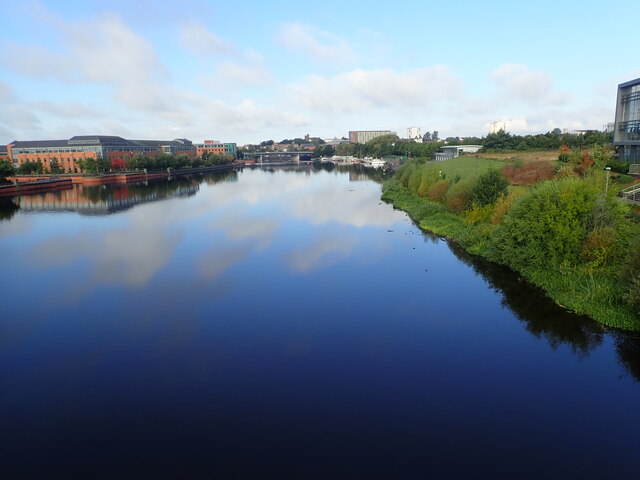
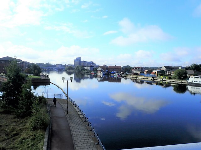
Stockton-on-Tees is a town located in the ceremonial county of Durham, in the northeast of England. Situated on the southern bank of the River Tees, it is known for its industrial heritage and its role as a key trading port during the 18th and 19th centuries.

With a population of around 80,000 people, Stockton-on-Tees is the largest town in the borough of Stockton-on-Tees and forms part of the Teesside conurbation. The town is well-connected, with the A19 road passing nearby and a railway station providing links to major cities such as Newcastle and Darlington.

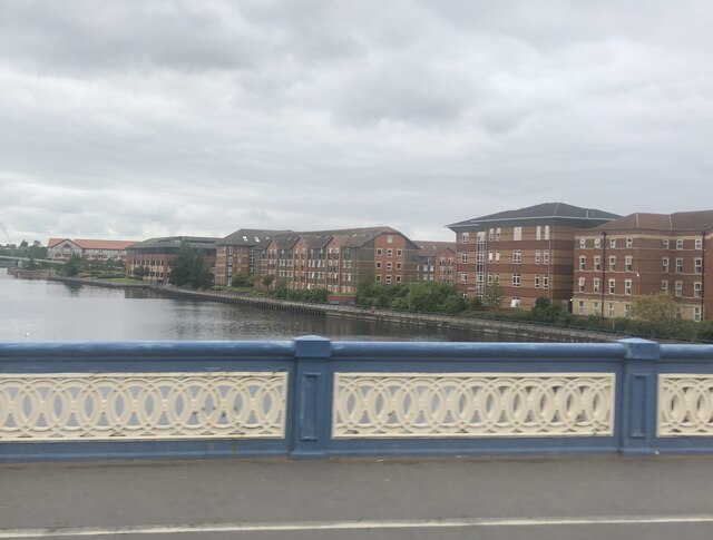
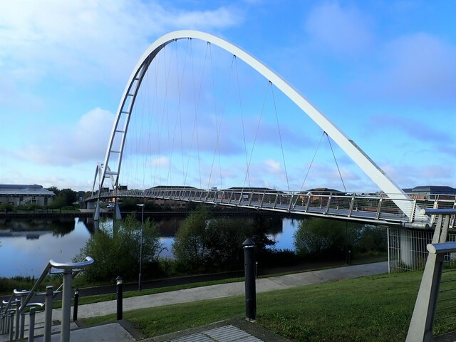
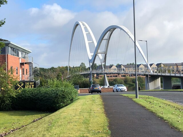
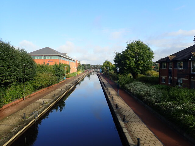
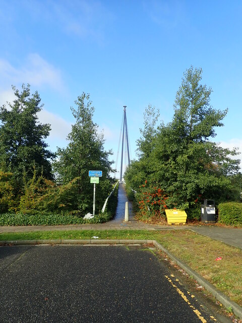
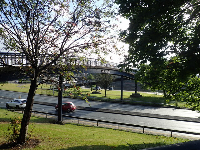
The town boasts a rich history, with notable landmarks including the 14th-century St. Thomas' Church and the iconic Infinity Bridge, an award-winning pedestrian and cycle bridge that spans the River Tees. Stockton-on-Tees also hosts the annual Stockton International Riverside Festival, one of Europe's largest outdoor arts festivals, attracting visitors from far and wide.

In recent years, the town has undergone significant regeneration, particularly in the waterfront area. The redevelopment has seen the creation of modern housing, leisure facilities, and retail spaces, breathing new life into the town center. Stockton-on-Tees is also home to several educational institutions, including Stockton Riverside College and Durham University's Queen's Campus.

The town offers a range of amenities, with a variety of shops, restaurants, and entertainment venues catering to the needs of residents and visitors alike. With its blend of history, culture, and ongoing development, Stockton-on-Tees remains a vibrant and evolving town in the heart of County Durham.

If you have any feedback on the listing, please let us know in the comments section below.

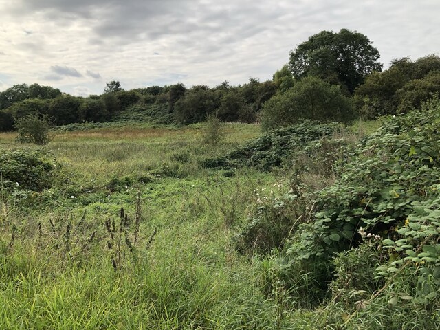
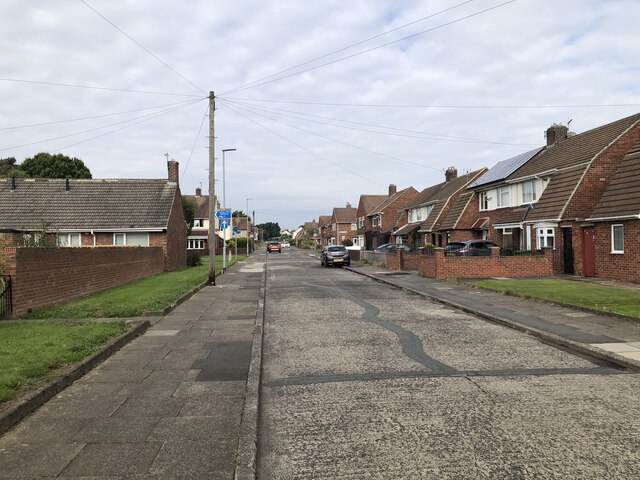
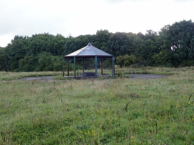
Stockton-on-Tees Images

Images are sourced within 2km of 54.566985/-1.328718 or Grid Reference NZ4319. Thanks to Geograph Open Source API. All images are credited.

Wetland Area Small area of wetland in urban Stockton. Residential estates are hidden by the line of shrubs and trees lining the Durham Coast Railway.
Wetland Area
Small area of wetland in urban Stockton. Residential estates are hidden by the line of shrubs and trees lining the Durham Coast Railway.
Pedestrian & Cycle Route, Roseworth
Rothwell Crescent, Roseworth, Stockton
New houses being built west of Norton Road
North Shore Academy The North Shore Academy is a secondary school which opened in 2010, and replaced Blakeston School and Norton Comprehensive School.
North Shore Academy
The North Shore Academy is a secondary school which opened in 2010, and replaced Blakeston School and Norton Comprehensive School.
Pavilion in a Recreation Ground Could not find a name for this green area. Lustrum Beck flows around it, but the whole are looks rather uncared for. The pavilion is covered in graffiti and has broken glass and an old shopping trolley.
Pavilion in a Recreation Ground
Could not find a name for this green area. Lustrum Beck flows around it, but the whole are looks rather uncared for. The pavilion is covered in graffiti and has broken glass and an old shopping trolley.
The River Tees Crossing the river on the Victoria Bridge. The apartments by the side of the river are student accommodation flats.
The River Tees
Crossing the river on the Victoria Bridge. The apartments by the side of the river are student accommodation flats.
Infinity Bridge over the River Tees The distinctive curve of this footbridge creates a reflection in the river below forming the mathematical symbol for infinity. This bridge opened in May 2009 after construction works lasting 18 months
Infinity Bridge over the River Tees
The distinctive curve of this footbridge creates a reflection in the river below forming the mathematical symbol for infinity. This bridge opened in May 2009 after construction works lasting 18 months
Crossing the Infinity Bridge Over the River Tees. This is a cycle/footbridge opened in May 2009 after construction works lasting 18 months
Crossing the Infinity Bridge
Over the River Tees. This is a cycle/footbridge opened in May 2009 after construction works lasting 18 months
River Tees upstream from the Infinity Bridge
Beautiful curves of the Infinity Bridge This is a cycle/footbridge connecting the Queen's Campus with the left bank of the River Tees
Beautiful curves of the Infinity Bridge
This is a cycle/footbridge connecting the Queen's Campus with the left bank of the River Tees
Medway House Office building on University Boulevard
Medway House
Office building on University Boulevard
Canal connecting the River Tees to a Wharf
Approaching the Teesquay Millennium Bridge Footbridge linking Teesdale with Stockton Town Centre. The bridge opened in 2000.
Approaching the Teesquay Millennium Bridge
Footbridge linking Teesdale with Stockton Town Centre. The bridge opened in 2000.
View upstream from the Teesquay Millennium Bridge
Commemorative plaque on the Teesquay Millennium Bridge Looking slightly the worse for wear, the names of funding partners have all but disappeared. This footbridge links Teesdale and the Castlegate Centre in the High Street and, in the process, spans Riverside Road. It is of cable stay design supported by a 40 metre high mast.
Commemorative plaque on the Teesquay Millennium Bridge
Looking slightly the worse for wear, the names of funding partners have all but disappeared. This footbridge links Teesdale and the Castlegate Centre in the High Street and, in the process, spans Riverside Road. It is of cable stay design supported by a 40 metre high mast.
Teesquay Millennium Bridge This footbridge links Teesdale and the Castlegate Centre in the High Street and, in the process, spans Riverside Road. It is of cable stay design supported by a 40 metre high mast.
Teesquay Millennium Bridge
This footbridge links Teesdale and the Castlegate Centre in the High Street and, in the process, spans Riverside Road. It is of cable stay design supported by a 40 metre high mast.
Footbridge over the A1305 The bridge connects the riverside walk with the shopping centre
Footbridge over the A1305
The bridge connects the riverside walk with the shopping centre
Show me another place!

Stockton-on-Tees is located at Grid Ref: NZ4319 (Lat: 54.566985, Lng: -1.328718)

Unitary Authority: Stockton-on-Tees

Police Authority: Cleveland

What 3 Words

///motivations.fruits.worry. Near Stockton-on-Tees, Co. Durham

Related Wikis

The Grangefield Ground

The Grangefield Ground is a multi-purpose sport grounds located in Grangefield, Stockton-on-Tees, England. It focuses on cricket and rugby union. It is...

Oxbridge, Stockton-on-Tees

Oxbridge is an area of Stockton-on-Tees within the borough of Stockton-on-Tees and the ceremonial county of County Durham, England. It is situated to the...

Newtown, Stockton-on-Tees

Newtown is an area of Stockton-on-Tees within the borough of Stockton-on-Tees, County Durham, England. It is next to the Stockton town centre's north-west...

Stockton-on-Tees

Stockton-on-Tees, often simply referred to as Stockton, is a market town in the Stockton-on-Tees unitary authority borough of County Durham, England. With...

Stockton railway station (County Durham)

Stockton is a railway station on the Durham Coast Line, which runs between Newcastle and Middlesbrough via Hartlepool. The station, situated 5 miles 45...

Stockton Town F.C.

Stockton Town Football Club is an English football club based in Stockton-on-Tees, England. They are currently members of the Northern Premier League Division...

The Grangefield Academy

The Grangefield Academy is a secondary school with academy status situated in the heart of the borough of Stockton on Tees, on Oxbridge Avenue, Grangefield...

Globe Theatre, Stockton-on-Tees

The Globe is a Grade II listed Art Deco theatre, in Stockton-on-Tees, England. == History == Situated at the north-western end of High Street, the original...

Nearby Amenities

Located within 500m of 54.566985,-1.328718
Traffic Calming: cushion
Lat/Long: 54.5697421/-1.3303069
Bus: yes
Public Transport: stop_position
Lat/Long: 54.5703838/-1.3314368
Post Box
Lat/Long: 54.5685723/-1.3328191
Grays Road Off-license
Shop: convenience
Lat/Long: 54.5669808/-1.3307223
Turning Circle
Lat/Long: 54.5677798/-1.3360016
Bus: yes
Public Transport: stop_position
Lat/Long: 54.5703272/-1.3308919
Traffic Calming: hump
Lat/Long: 54.565197/-1.3345186
Traffic Calming: hump
Lat/Long: 54.5656061/-1.3343984
Traffic Calming: hump
Lat/Long: 54.5661401/-1.3342752
Addr Country: GB
Addr Housenumber: 57
Addr Street: Grays Road
Lat/Long: 54.5672084/-1.3306824
Turning Circle
Lat/Long: 54.5626855/-1.3282524
Traffic Calming: cushion
Lat/Long: 54.5687684/-1.3266339
Traffic Calming: cushion
Lat/Long: 54.5684216/-1.3271743
Rtc Rate: cushion
Lat/Long: 54.5680562/-1.3272029
Traffic Calming: hump
Lat/Long: 54.5685393/-1.3258872
Traffic Calming: hump
Lat/Long: 54.5695402/-1.3248127
Traffic Calming: cushion
Lat/Long: 54.5698455/-1.3244039
Bicycle: yes
Foot: yes
Motorcar: yes
Lat/Long: 54.5649635/-1.3279755
Traffic Calming: cushion
Lat/Long: 54.5701881/-1.3239076
Ambulance Station
Emergency: ambulance_station
Lat/Long: 54.5646665/-1.3272155
Traffic Calming: hump
Lat/Long: 54.568226/-1.3245835
Traffic Calming: hump
Lat/Long: 54.5682283/-1.3256099
Barrier: bollard
Lat/Long: 54.5689457/-1.3245568
Source: local_knowledge
Traffic Calming: cushion
Lat/Long: 54.5693375/-1.3256106
Bus Stop
Bench: no
Bus: yes
Kerb: raised
Naptan AtcoCode: 077072801B
Naptan NaptanCode: sktjmgt
Public Transport: platform
Shelter: no
Source: survey
Tactile Paving: yes
Lat/Long: 54.5703121/-1.3314513
Bus Stop
Bench: no
Bus: yes
Kerb: raised
Naptan AtcoCode: 077072801A
Naptan NaptanCode: sktjmgw
Public Transport: platform
Shelter: no
Source: survey
Tactile Paving: yes
Lat/Long: 54.5703525/-1.3308868
Source: Bing
Traffic Calming: hump
Lat/Long: 54.5704919/-1.3306359
Traffic Calming: hump
Lat/Long: 54.5711324/-1.3307434
Access: yes
Leisure: playground
Lat/Long: 54.5660527/-1.3309106
Barrier: bollard
Bollard: fixed
Lat/Long: 54.5642519/-1.3249648
Crossing
Crossing: unmarked
Crossing Island: no
Tactile Paving: yes
Lat/Long: 54.5665056/-1.3342463
Shop: car_repair
Lat/Long: 54.564405/-1.3277597
Traffic Calming: island
Lat/Long: 54.5642263/-1.3260756
Crossing
Crossing: unmarked
Crossing Island: no
Tactile Paving: yes
Lat/Long: 54.5665531/-1.3313216
Crossing
Crossing: unmarked
Lat/Long: 54.5666625/-1.3362309
Grangefield News
Addr City: Stockton-on-Tees
Addr Housenumber: 15
Addr Postcode: TS18 4LA
Addr Street: Grangefield Road
Check Date Opening Hours: 2024-02-18
Opening Hours Signed: no
Payment Cash: yes
Shop: newsagent
Wheelchair: no
Lat/Long: 54.5663973/-1.3337549
Place Of Worship
Saint Bede's Catholic Church
Addr City: Stockton-on-Tees
Addr Postcode: TS18 4PA
Addr Street: Bishopton Road
Denomination: roman_catholic
Religion: christian
Source: survey
Lat/Long: 54.5706956/-1.3257939
Barrier: kerb
Lat/Long: 54.5629764/-1.3259516
Barrier: kerb
Lat/Long: 54.5629167/-1.3259592
Traffic Calming: cushion
Lat/Long: 54.5679361/-1.3304908
Traffic Calming: cushion
Lat/Long: 54.5687127/-1.3304028
Traffic Calming: cushion
Lat/Long: 54.5672775/-1.3308054
The data included in this document is from www.openstreetmap.org. The data is made available under ODbL.

Have you been to Stockton-on-Tees?

Leave your review of Stockton-on-Tees below (or comments, questions and feedback).