Beechen Cliff

Settlement in Somerset

England

Beechen Cliff

River Avon downstream from St James's Bridge, Bath
River Avon downstream from St James's Bridge, Bath Credit: Colin Park

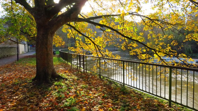
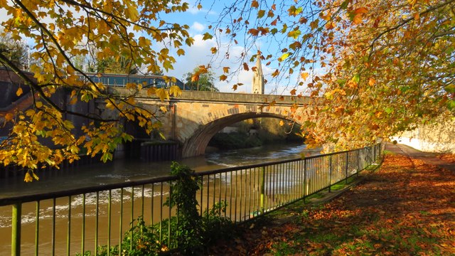
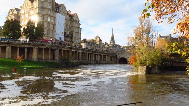
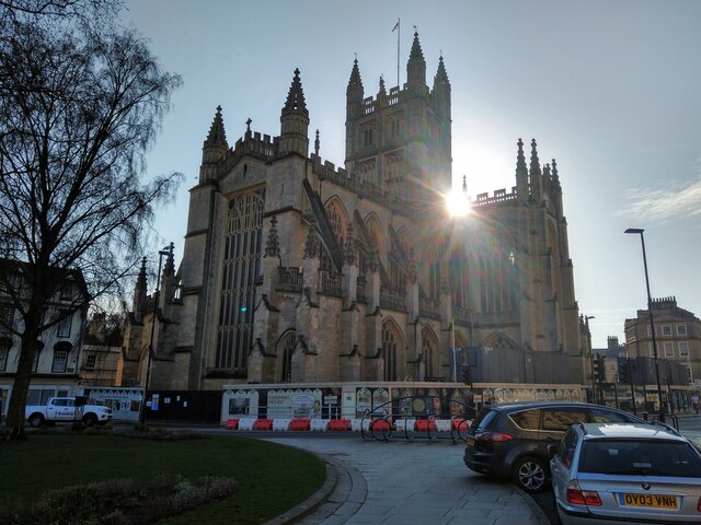
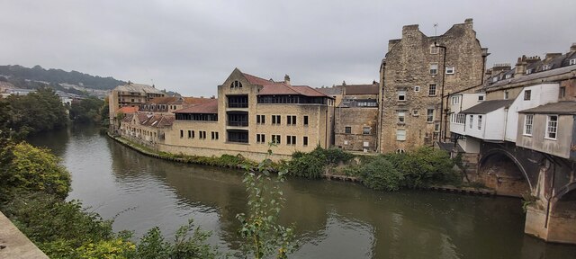
Beechen Cliff is a picturesque area located in Somerset, England. Situated on a hillside, it offers stunning views of the surrounding countryside and the city of Bath. It is a popular destination for locals and tourists alike due to its natural beauty and historical significance.

The main attraction in Beechen Cliff is the eponymous Georgian mansion that sits atop the hill. Built in the 18th century, it is known for its elegant architecture and well-preserved interiors. The mansion is surrounded by beautifully landscaped gardens, providing a tranquil and serene atmosphere for visitors to enjoy.

The area is also known for its extensive network of walking trails, making it a paradise for nature lovers and hikers. The trails offer panoramic views of the rolling hills and valleys, as well as access to nearby attractions such as the Prior Park Landscape Garden and the Bath Skyline Walk.

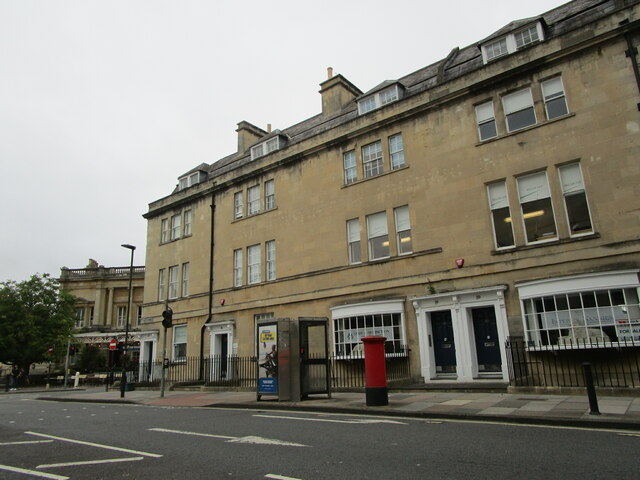
Another notable feature of Beechen Cliff is its historical significance. During the Victorian era, the area was a popular retreat for the wealthy and influential, who built magnificent estates and villas in the vicinity. Many of these historic buildings still stand today, offering a glimpse into the area's rich past.

Overall, Beechen Cliff is a charming and idyllic destination that combines natural beauty, historical significance, and recreational opportunities. Whether one is interested in exploring the outdoors, learning about history, or simply enjoying the breathtaking views, this Somerset gem has something to offer for everyone.

If you have any feedback on the listing, please let us know in the comments section below.

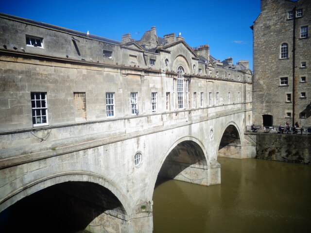
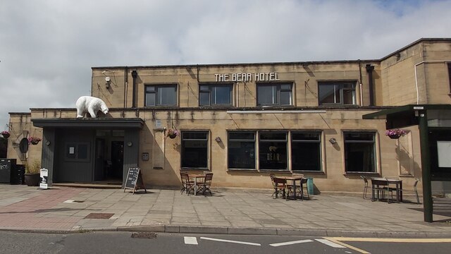
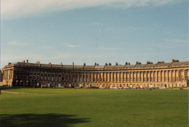
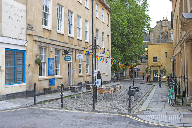
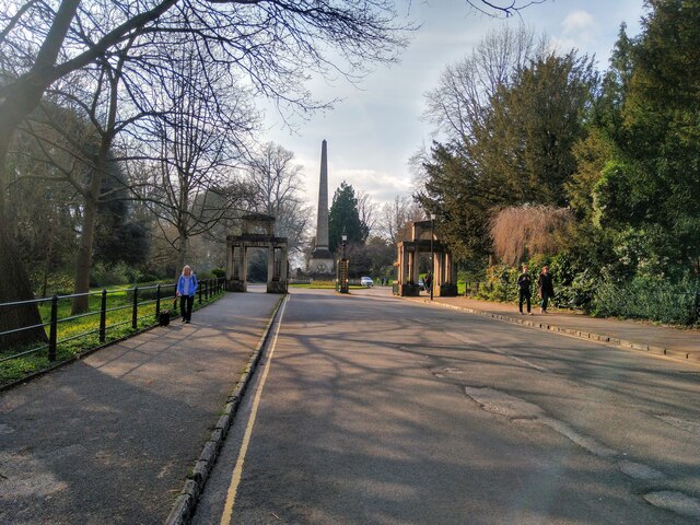
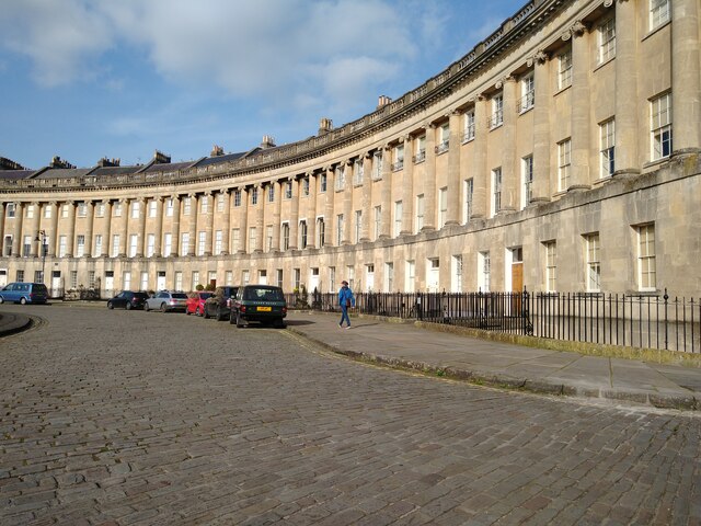
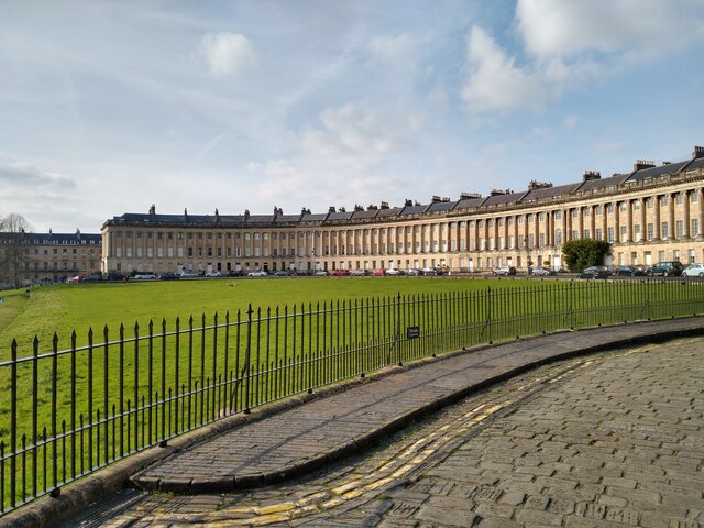
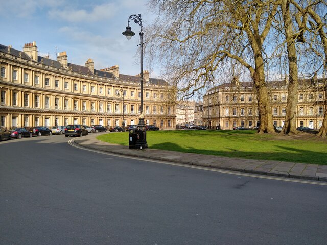
Beechen Cliff Images

Images are sourced within 2km of 51.375072/-2.36231 or Grid Reference ST7464. Thanks to Geograph Open Source API. All images are credited.

River Avon downstream from St James's Bridge, Bath
River Avon and St James's Bridge, Bath
Pulteney Weir and the River Avon, Bath The river is running high meaning that there is little drop in the water level downstream from the weir.
Pulteney Weir and the River Avon, Bath
The river is running high meaning that there is little drop in the water level downstream from the weir.
No Basket, No Ball A simple image of one of the two net ball court rings, at The Brickfields, Oldfield Park, Bath.
The image shows detail in the basketless ring, the nearby trees, grass and court, clouds.
No Basket, No Ball
A simple image of one of the two net ball court rings, at The Brickfields, Oldfield Park, Bath. The image shows detail in the basketless ring, the nearby trees, grass and court, clouds.
Pulteney Bridge, Bath
The Bear Hotel - Bear Flat
Fortune Cookie Take Away - Odd Down
Greendown Terrace
Greendown Terrace
The Hadley Arms
The Hadley Arms
Bath The Royal Crescent at Bath
Bath
The Royal Crescent at Bath
Standing in York Street, Looking Down Abbey Street
East Gateway and Victoria Column, Royal Victoria Park, Bath The eastern entrance to Royal Victoria Park in Bath, showing the entrance gates on Cotswold Way and the obelisk erected in honour of the royal visit of Victoria in 1837 to open the park, before she became Queen.
East Gateway and Victoria Column, Royal Victoria Park, Bath
The eastern entrance to Royal Victoria Park in Bath, showing the entrance gates on Cotswold Way and the obelisk erected in honour of the royal visit of Victoria in 1837 to open the park, before she became Queen.
Royal Crescent, Bath The eastern end of Royal Crescent in Bath.
Royal Crescent, Bath
The eastern end of Royal Crescent in Bath.
Royal Crescent, Bath View of the western end of Royal Crescent, looking over the green.
Marlborough Buildings is in the background.
Royal Crescent, Bath
View of the western end of Royal Crescent, looking over the green. Marlborough Buildings is in the background.
The Circus, Bath Photograph of The Circus in Bath, looking east from Brock Street towards Bennett Street.
The Circus, Bath
Photograph of The Circus in Bath, looking east from Brock Street towards Bennett Street.
Bath Abbey from Orange Grove NCN4 Bath Abbey with evening sun behind it.
Hoarding is up alongside the Abbey due to renovation work being carried out.
Photograph taken from the cycle way through Orange Grove, part of NCN4.
Bath Abbey from Orange Grove NCN4
Bath Abbey with evening sun behind it. Hoarding is up alongside the Abbey due to renovation work being carried out. Photograph taken from the cycle way through Orange Grove, part of NCN4.
The River Avon at Pulteney Bridge
Charles Street, Bath The former Green Park Station visible on the left.
Charles Street, Bath
The former Green Park Station visible on the left.
Show me another place!

Beechen Cliff is located at Grid Ref: ST7464 (Lat: 51.375072, Lng: -2.36231)

Unitary Authority: Bath and North East Somerset

Police Authority: Avon and Somerset

What 3 Words

///nods.tones.scary. Near Bath, Somerset

Related Wikis

Bear Flat

Bear Flat is a neighbourhood within the city of Bath, Somerset, England, to the south of the city centre and to the west of Beechen Cliff (a heavily wooded...

Beechen Cliff School

Beechen Cliff School is a boys' secondary school in Bath, Somerset, England, with about 1,150 pupils. Its earliest predecessor school was founded in 1896...

Bath power station

Bath power station supplied electricity to the City of Bath and the wider area from 1890. The station was originally built and operated by the City of...

Bath bus station

Bath bus station serves as part of an integrated transport interchange for the city of Bath, Somerset, England. The Manvers Street bus station opened in...

The Forum, Bath

The Forum was built as an art deco cinema in Bath, Somerset, England, in 1934, and was designated as a Grade II* listed building on 28 May 1986. The building...

Lyncombe, Bath

Lyncombe is a district and electoral ward in Bath, Somerset, and a former parish in the Diocese of Bath and Wells. In the mid-19th century the parish was...

Heart Bath

Heart 103 (formerly GWR Radio Bath and GWR FM Bath) was an Independent Local Radio station serving Bath in Somerset, England, broadcasting on 103 MHz FM...

Westmoreland Road goods yard

Westmoreland Road goods yard was the main Great Western Railway goods station for the city of Bath in England, situated on the main line between the passenger...

Nearby Amenities

Located within 500m of 51.375072,-2.36231
Traffic Signals
Lat/Long: 51.3780334/-2.3595161
Crossing
Crossing: unmarked
Crossing Island: no
Tactile Paving: no
Lat/Long: 51.3750355/-2.3673078
Traffic Signals
Button Operated: yes
Crossing: traffic_signals
Crossing Ref: puffin
Tactile Paving: yes
Traffic Signals Sound: yes
Traffic Signals Vibration: yes
Lat/Long: 51.3780361/-2.357023
Turning Circle
Lat/Long: 51.3716281/-2.3624624
Turning Circle
Lat/Long: 51.3723254/-2.3626049
Crossing
Button Operated: yes
Crossing: traffic_signals
Mapillary: 321325262829723
Survey Date: 2021-05-30
Tactile Paving: yes
Traffic Signals Sound: no
Traffic Signals Vibration: yes
Lat/Long: 51.3767615/-2.3563009
Post Box
Collection Times: Mo-Fr 09:00, Sa 07:00
Post Box Mounting: wall
Post Box Type: wall
Postal Code: BA2
Ref: BA2 46D
Royal Cypher: VR
Royal Cypher Wikidata: Q33102356
Lat/Long: 51.3764145/-2.3565925
Post Box
Brand: Royal Mail
Brand Wikidata: Q638098
Collection Times: Mo-Fr 09:00, Sa 07:00
Mapillary: 866691538463128
Operator: Royal Mail
Operator Wikidata: Q638098
Post Box Type: pillar
Postal Code: BA2
Ref: BA2 56
Survey Date: 2023-10-22
Lat/Long: 51.3717536/-2.3661268
Post Box
Postal Code: BA2
Ref: BA2 22
Lat/Long: 51.3738431/-2.3623352
Crossing
Crossing: traffic_signals
Crossing Ref: pelican
Tactile Paving: yes
Lat/Long: 51.3780022/-2.359649
Crossing
Crossing: traffic_signals
Crossing Ref: pelican
Tactile Paving: yes
Lat/Long: 51.3780702/-2.3597685
Access: yes
Barrier: cycle_barrier
Bicycle: yes
Cycle Barrier: double
Cycle Barrier Installation: fixed
Motor Vehicle: no
Lat/Long: 51.3764232/-2.3590977
Barrier: cycle_barrier
Cycle Barrier: double
Cycle Barrier Installation: fixed
Lat/Long: 51.3757688/-2.3647005
Mini Roundabout
Lat/Long: 51.3773852/-2.3564694
Bath Spa
Public Transport: stop_position
Railway: stop
Ref: 2
Short Name: Bath Spa
Train: yes
Lat/Long: 51.3776339/-2.3567451
Traffic Signals
Button Operated: yes
Crossing: traffic_signals
Crossing Ref: puffin
Tactile Paving: yes
Traffic Signals Sound: yes
Traffic Signals Vibration: yes
Lat/Long: 51.3779166/-2.3571995
Traffic Signals
Lat/Long: 51.3779729/-2.3583763
Man Made: surveillance
Surveillance: outdoor
Surveillance Type: camera
Lat/Long: 51.3777564/-2.3571655
Crossing
Crossing: traffic_signals
Crossing Ref: pelican
Tactile Paving: yes
Lat/Long: 51.3780885/-2.3596634
Bath Spa
Public Transport: stop_position
Railway: stop
Ref: 1
Short Name: Bath Spa
Train: yes
Lat/Long: 51.3776181/-2.3565442
Taxi
Check Date: 2024-03-30
Lat/Long: 51.3778053/-2.3569161
Avon Valley Cyclery
Brand: Tern;Giant;Brompton Bicycle
Phone: +44 1225 442442
Shop: bicycle
Website: https://www.avonvalleycyclery.co.uk/
Wheelchair: yes
Lat/Long: 51.3775066/-2.357437
Crossing
Crossing: traffic_signals
Crossing Ref: puffin
Kerb: lowered
Tactile Paving: yes
Lat/Long: 51.3785615/-2.3612392
Crossing
Button Operated: yes
Crossing: traffic_signals
Tactile Paving: yes
Traffic Signals Sound: no
Traffic Signals Vibration: yes
Lat/Long: 51.3766414/-2.3562583
Post Box
Brand: Royal Mail
Brand Wikidata: Q638098
Collection Times: Mo-Fr 09:00; Sa 07:00
Mapillary: 3198441587124831
Operator: Royal Mail
Operator Wikidata: Q638098
Post Box Mounting: stone_wall
Post Box Type: wall
Ref: BA2 83D
Royal Cypher: EIIR
Survey Date: 2023-10-22
Lat/Long: 51.3772088/-2.3646314
Crossing
Button Operated: yes
Crossing: traffic_signals
Crossing Island: yes
Crossing Ref: pelican
Tactile Paving: yes
Traffic Signals Sound: yes
Traffic Signals Vibration: yes
Lat/Long: 51.3738275/-2.3664976
Crossing
Button Operated: yes
Crossing: traffic_signals
Crossing Island: no
Crossing Ref: pelican
Tactile Paving: yes
Traffic Signals Sound: no
Traffic Signals Vibration: yes
Lat/Long: 51.377975/-2.358541
Crossing
Crossing: traffic_signals
Crossing Ref: pelican
Lat/Long: 51.3782058/-2.359666
Crossing
Crossing: traffic_signals
Crossing Ref: pelican
Lat/Long: 51.378154/-2.3596644
Crossing
Crossing: traffic_signals
Crossing Ref: pelican
Lat/Long: 51.3785483/-2.3600121
Crossing
Crossing: traffic_signals
Crossing Ref: pelican
Lat/Long: 51.3782678/-2.3597579
Cafe
The White Feather Coffee Co
Addr City: Bath
Addr Housename: Bath Spa Railway Station
Addr Postcode: BA1 1SU
Addr Street: Station Place
Fhrs Id: 1582386
Level: 1
Smoking: no
Takeaway: yes
Wheelchair: no
Wheelchair Description: 1 step of about 4 inches
Lat/Long: 51.3776957/-2.3568879
Post Box
Brand: Royal Mail
Brand Wikidata: Q638098
Collection Plate: CP7
Collection Times: Mo-Fr 16:00; Sa 11:30
Operator: Royal Mail
Operator Wikidata: Q638098
Post Box Mounting: wall
Post Box Type: lamp
Postal Code: BA1
Ref: BA1 71
Royal Cypher: EIIR
Royal Cypher Wikidata: Q33102113
Lat/Long: 51.3776498/-2.3569275
Bench
Backrest: yes
Colour: brown
Material: wood
Seats: 3
Lat/Long: 51.3738348/-2.3579098
Bench
Backrest: yes
Material: wood
Lat/Long: 51.3743949/-2.3580212
Tourism: viewpoint
Wheelchair: no
Lat/Long: 51.3748243/-2.3605522
Bench
Backrest: yes
Colour: brown
Material: wood
Seats: 3
Lat/Long: 51.3740106/-2.3579474
Bench
Backrest: yes
Colour: brown
Material: wood
Seats: 3
Lat/Long: 51.3739135/-2.3579299
Bench
Backrest: yes
Material: wood
Lat/Long: 51.3743848/-2.3581083
Barrier: cycle_barrier
Cycle Barrier: double
Cycle Barrier Installation: fixed
Lat/Long: 51.3772791/-2.3563497
Barrier: cycle_barrier
Cycle Barrier: double
Cycle Barrier Installation: fixed
Lat/Long: 51.3768389/-2.3563145
Bus Stop
Dorchester St Bk
Bus: yes
Naptan AtcoCode: 0180BAA01317
Naptan Bearing: W
Naptan CommonName: Dorchester St Bk
Naptan NaptanCode: bthmtwd
Naptan Street: Dorchester Street
Naptan Verified: no
Public Transport: platform
Shelter: yes
Source: naptan_import
Wheelchair: yes
Lat/Long: 51.3779191/-2.3589141
Bus Stop
Dorchester St Bl
Bus: yes
Naptan AtcoCode: 0180BAA01318
Naptan Bearing: W
Naptan CommonName: Dorchester St Bl
Naptan NaptanCode: bthmtwg
Naptan Street: Dorchester Street
Naptan Verified: no
Public Transport: platform
Shelter: no
Source: naptan_import
Wheelchair: yes
Lat/Long: 51.3779364/-2.3592446
Bus Stop
Bath Bus Station Bay 1
Bench: yes
Bin: yes
Bus: yes
Lit: yes
Naptan AtcoCode: 0180BAA01319
Naptan CommonName: Bath Bus Station Bay 1
Naptan NaptanCode: bthmtwj
Naptan Street: Dorchester Street
Naptan Verified: no
Public Transport: platform
Shelter: yes
Source: naptan_import
Tactile Paving: yes
Wheelchair: yes
Lat/Long: 51.3778654/-2.3594484
Bus Stop
Bath Bus Station Bay 2
Bench: yes
Bin: yes
Bus: yes
Lit: yes
Naptan AtcoCode: 0180BAA01320
Naptan CommonName: Bath Bus Station Bay 2
Naptan NaptanCode: bthmtwm
Naptan Street: Dorchester Street
Naptan Verified: no
Public Transport: platform
Shelter: yes
Source: naptan_import
Tactile Paving: yes
Wheelchair: yes
Lat/Long: 51.3778586/-2.3593758
Bus Stop
Bath Bus Station Bay 3
Bench: yes
Bin: yes
Bus: yes
Lit: yes
Naptan AtcoCode: 0180BAA01321
Naptan CommonName: Bath Bus Station Bay 3
Naptan NaptanCode: bthmtwp
Naptan Street: Dorchester Street
Naptan Verified: no
Public Transport: platform
Shelter: yes
Source: naptan_import
Tactile Paving: no
Wheelchair: yes
Lat/Long: 51.377854/-2.359297
Bus Stop
Bath Bus Station Bay 4
Bench: yes
Bin: yes
Bus: yes
Lit: yes
Naptan AtcoCode: 0180BAA01322
Naptan CommonName: Bath Bus Station Bay 4
Naptan NaptanCode: bthmtwt
Naptan Street: Dorchester Street
Naptan Verified: no
Public Transport: platform
Shelter: yes
Source: naptan_import
Tactile Paving: no
Wheelchair: yes
Lat/Long: 51.3778519/-2.3592176
Bus Stop
Bath Bus Station Bay 5
Bench: yes
Bin: yes
Bus: yes
Lit: yes
Naptan AtcoCode: 0180BAA01323
Naptan CommonName: Bath Bus Station Bay 5
Naptan NaptanCode: bthmwad
Naptan Street: Dorchester Street
Naptan Verified: no
Public Transport: platform
Shelter: yes
Source: naptan_import
Tactile Paving: no
Wheelchair: yes
Lat/Long: 51.3778524/-2.3591521
Bus Stop
Bath Bus Station Bay 6
Bench: yes
Bin: yes
Bus: yes
Lit: yes
Naptan AtcoCode: 0180BAA01324
Naptan CommonName: Bath Bus Station Bay 6
Naptan NaptanCode: bthmwag
Naptan Street: Dorchester Street
Naptan Verified: no
Public Transport: platform
Shelter: yes
Source: naptan_import
Tactile Paving: no
Wheelchair: yes
Lat/Long: 51.3778512/-2.3590972
Bus Stop
Bath Bus Station Bay 7
Bench: yes
Bin: yes
Bus: yes
Lit: yes
Naptan AtcoCode: 0180BAA01325
Naptan CommonName: Bath Bus Station Bay 7
Naptan NaptanCode: bthmwaj
Naptan Street: Dorchester Street
Naptan Verified: no
Public Transport: platform
Shelter: yes
Source: naptan_import
Tactile Paving: yes
Wheelchair: yes
Lat/Long: 51.3778486/-2.3590393
Bus Stop
Bath Bus Station Bay 8
Bench: yes
Bin: yes
Bus: yes
Lit: yes
Naptan AtcoCode: 0180BAA01326
Naptan CommonName: Bath Bus Station Bay 8
Naptan NaptanCode: bthmwam
Naptan Street: Dorchester Street
Naptan Verified: no
Public Transport: platform
Shelter: yes
Source: naptan_import
Tactile Paving: yes
Wheelchair: yes
Lat/Long: 51.3778452/-2.3589814
Bus Stop
Bath Bus Station Bay 9
Bench: yes
Bin: yes
Bus: yes
Lit: yes
Naptan AtcoCode: 0180BAA01327
Naptan CommonName: Bath Bus Station Bay 9
Naptan NaptanCode: bthmwap
Naptan Street: Dorchester Street
Naptan Verified: no
Public Transport: platform
Shelter: yes
Source: naptan_import
Tactile Paving: yes
Wheelchair: yes
Lat/Long: 51.3778423/-2.358925
Bus Stop
Bath Bus Station Bay 10
Bench: yes
Bin: yes
Bus: yes
Lit: yes
Naptan AtcoCode: 0180BAA01328
Naptan CommonName: Bath Bus Station Bay 10
Naptan NaptanCode: bthmwat
Naptan Street: Dorchester Street
Naptan Verified: no
Public Transport: platform
Shelter: yes
Source: naptan_import
Tactile Paving: yes
Wheelchair: yes
Lat/Long: 51.3778384/-2.3588599
Bus Stop
Bath Bus Station Bay 11
Bench: yes
Bin: yes
Bus: yes
Lit: yes
Naptan AtcoCode: 0180BAA01329
Naptan CommonName: Bath Bus Station Bay 11
Naptan NaptanCode: bthmwaw
Naptan Street: Dorchester Street
Naptan Verified: no
Public Transport: platform
Shelter: yes
Source: naptan_import
Tactile Paving: yes
Wheelchair: yes
Lat/Long: 51.3778338/-2.3588014
Bus Stop
Bath Bus Station Bay 12
Bench: yes
Bin: yes
Bus: yes
Lit: yes
Naptan AtcoCode: 0180BAA01330
Naptan CommonName: Bath Bus Station Bay 12
Naptan NaptanCode: bthmwda
Naptan Street: Dorchester Street
Naptan Verified: no
Public Transport: platform
Shelter: yes
Source: naptan_import
Tactile Paving: yes
Wheelchair: yes
Lat/Long: 51.3778333/-2.3587476
Bus Stop
Bath Bus Station Bay 13
Bench: yes
Bin: yes
Bus: yes
Lit: yes
Naptan AtcoCode: 0180BAA01331
Naptan CommonName: Bath Bus Station Bay 13
Naptan NaptanCode: bthmwdg
Naptan Street: Dorchester Street
Naptan Verified: no
Public Transport: platform
Shelter: yes
Source: naptan_import
Tactile Paving: yes
Wheelchair: yes
Lat/Long: 51.3778287/-2.3586872
Bus Stop
Bath Bus Station Bay 14
Bench: yes
Bin: yes
Bus: yes
Lit: yes
Naptan AtcoCode: 0180BAA01332
Naptan CommonName: Bath Bus Station Bay 14
Naptan NaptanCode: bthmwdj
Naptan Street: Dorchester Street
Naptan Verified: no
Public Transport: platform
Shelter: yes
Source: naptan_import
Tactile Paving: yes
Wheelchair: yes
Lat/Long: 51.3778266/-2.3586237
Bus Stop
Bath Bus Station Bay 15
Bench: yes
Bin: yes
Bus: yes
Lit: yes
Naptan AtcoCode: 0180BAA01333
Naptan CommonName: Bath Bus Station Bay 15
Naptan NaptanCode: bthmwdm
Naptan Street: Dorchester Street
Naptan Verified: no
Public Transport: platform
Shelter: yes
Source: naptan_import
Tactile Paving: yes
Wheelchair: yes
Lat/Long: 51.3778225/-2.3585613
Bus Stop
Bath Bus Station Bay 16
Bench: yes
Bin: yes
Bus: yes
Lit: yes
Naptan AtcoCode: 0180BAA01334
Naptan CommonName: Bath Bus Station Bay 16
Naptan NaptanCode: bthmwdp
Naptan Street: Dorchester Street
Naptan Verified: no
Public Transport: platform
Shelter: yes
Source: naptan_import
Tactile Paving: yes
Wheelchair: yes
Lat/Long: 51.3778213/-2.358509
Bus Stop
Kipling Ave
Bench: yes
Bin: yes
Bus: yes
Lit: yes
Naptan AtcoCode: 0180BAC30146
Naptan Bearing: N
Naptan CommonName: Kipling Ave
Naptan Crossing: Bloomfield Road
Naptan NaptanCode: bthjgtp
Naptan PlusbusZoneRef: BATHSPA
Naptan Street: Wellsway
Naptan Verified: no
Public Transport: platform
Shelter: yes
Source: naptan_import
Tactile Paving: no
Wheelchair: yes
Lat/Long: 51.372264/-2.3664459
Bus Stop
Bear Flat (A)
Bench: yes
Bin: yes
Bus: yes
Lit: yes
Naptan AtcoCode: 0180BAC30147
Naptan Bearing: N
Naptan CommonName: Bear Flat
Naptan Crossing: Bruton Avenue
Naptan NaptanCode: bthjgtg
Naptan PlusbusZoneRef: BATHSPA
Naptan Street: Wellsway
Naptan Verified: no
Public Transport: platform
Shelter: yes
Source: naptan_import
Tactile Paving: no
Toilets Wheelchair: no
Wheelchair: yes
Lat/Long: 51.3739161/-2.3666143
Bus Stop
Oldfield Road
Bench: yes
Bin: no
Bus: yes
Lit: no
Naptan AtcoCode: 0180BAC30148
Naptan Bearing: N
Naptan CommonName: Oldfield Road
Naptan Crossing: Oldfield Road
Naptan NaptanCode: bthjgjp
Naptan PlusbusZoneRef: BATHSPA
Naptan Street: Wells Road
Naptan Verified: no
Public Transport: platform
Shelter: yes
Source: naptan_import
Tactile Paving: no
Toilets Wheelchair: no
Wheelchair: yes
Lat/Long: 51.375298/-2.3687069
Bus Stop
Oldfield Road
Bench: no
Bin: no
Bus: yes
Lit: no
Naptan AtcoCode: 0180BAC30149
Naptan Bearing: S
Naptan CommonName: Oldfield Road
Naptan Crossing: Oldfield Road
Naptan NaptanCode: bthjgma
Naptan PlusbusZoneRef: BATHSPA
Naptan Street: Wells Road
Naptan Verified: no
Public Transport: platform
Shelter: no
Source: naptan_import
Tactile Paving: no
Toilets Wheelchair: no
Wheelchair: yes
Lat/Long: 51.3750481/-2.3686513
Bus Stop
Wells Road Bottom
Bench: yes
Bin: yes
Bus: yes
Lit: no
Naptan AtcoCode: 0180BAC30150
Naptan Bearing: E
Naptan CommonName: Wells Road Bottom
Naptan NaptanCode: bthjmdp
Naptan PlusbusZoneRef: BATHSPA
Naptan Street: Wells Road
Naptan Verified: no
Public Transport: platform
Shelter: yes
Source: naptan_import
Tactile Paving: no
Toilets Wheelchair: no
Wheelchair: yes
Lat/Long: 51.3771977/-2.3647454
Bus Stop
Wells Road Bottom
Bus: yes
Naptan AtcoCode: 0180BAC30151
Naptan Bearing: W
Naptan CommonName: Wells Road Bottom
Naptan NaptanCode: bthjmaw
Naptan PlusbusZoneRef: BATHSPA
Naptan Street: Wells Road
Naptan Verified: no
Public Transport: platform
Shelter: yes
Source: naptan_import
Toilets Wheelchair: no
Wheelchair: yes
Lat/Long: 51.376991/-2.3655921
Bus Stop
Bear Flat (B)
Bench: yes
Bin: no
Bus: yes
Departures Board: realtime
Lit: yes
Naptan AtcoCode: 0180BAC30152
Naptan Bearing: S
Naptan CommonName: Shakespeare Avenue
Naptan Crossing: Shakespeare Avenue
Naptan NaptanCode: bthjgwa
Naptan PlusbusZoneRef: BATHSPA
Naptan Street: Wellsway
Naptan Verified: no
Public Transport: platform
Shelter: yes
Source: naptan_import
Tactile Paving: no
Wheelchair: yes
Lat/Long: 51.3733335/-2.3663443
Bus Stop
Bear Flat (C)
Bench: yes
Bin: no
Bus: yes
Check Date Tactile Paving: 2022-12-02
Departures Board: realtime
Lit: yes
Naptan AtcoCode: 0180BAC30153
Naptan Bearing: S
Naptan CommonName: Kipling Avenue
Naptan Crossing: Shakespeare Avenue
Naptan NaptanCode: bthjgwd
Naptan PlusbusZoneRef: BATHSPA
Naptan Street: Wellsway
Naptan Verified: no
Public Transport: platform
Shelter: yes
Source: naptan_import
Tactile Paving: no
Wheelchair: yes
Lat/Long: 51.3731761/-2.3663232
Bus Stop
Wells Road
Bench: no
Bin: no
Bus: yes
Lit: no
Naptan AtcoCode: 0180BAC30241
Naptan Bearing: W
Naptan CommonName: Wells Road
Naptan Crossing: Wells Road
Naptan NaptanCode: bthjgdp
Naptan PlusbusZoneRef: BATHSPA
Naptan Street: Oldfield Road
Naptan Verified: no
Public Transport: platform
Shelter: no
Source: naptan_import
Tactile Paving: no
Wheelchair: yes
Lat/Long: 51.3743354/-2.3693926
Bus Stop
St James's Parade We
Bench: no
Bin: no
Bus: yes
Naptan AtcoCode: 0180BAC30341
Naptan Bearing: NW
Naptan CommonName: St James's Parade We
Naptan Crossing: Amery Lane
Naptan NaptanCode: bthjmwp
Naptan Street: St James's Parade
Naptan Verified: no
Public Transport: platform
Shelter: no
Source: naptan_import
Toilets Wheelchair: no
Wheelchair: yes
Lat/Long: 51.3791675/-2.3607609
Bus Stop
Dorchester St Bh
Bench: yes
Bin: no
Bus: yes
Lit: yes
Naptan AtcoCode: 0180BAC30587
Naptan Bearing: W
Naptan CommonName: Dorchester St Bh
Naptan NaptanCode: bthjpta
Naptan PlusbusZoneRef: BATHSPA
Naptan Street: Dorchester Street
Naptan Verified: no
Public Transport: platform
Shelter: yes
Source: naptan_import
Tactile Paving: no
Wheelchair: yes
Lat/Long: 51.3778476/-2.3576629
Bus Stop
Dorchester St Bi
Bench: yes
Bin: no
Bus: yes
Lit: yes
Naptan AtcoCode: 0180BAC30588
Naptan Bearing: W
Naptan CommonName: Dorchester St Bi
Naptan NaptanCode: bthjpmp
Naptan PlusbusZoneRef: BATHSPA
Naptan Street: Dorchester Street
Naptan Verified: no
Public Transport: platform
Shelter: yes
Source: naptan_import
Tactile Paving: no
Wheelchair: yes
Lat/Long: 51.3778574/-2.3578415
Bus Stop
St James's Parade Wh
Bus: yes
Naptan AtcoCode: 0180BAC30592
Naptan Bearing: SE
Naptan CommonName: St James's Parade Wh
Naptan Crossing: Wine Street
Naptan NaptanCode: bthjpad
Naptan PlusbusZoneRef: BATHSPA
Naptan Street: St James's Parade
Naptan Verified: no
Public Transport: platform
Source: naptan_import
Wheelchair: yes
Lat/Long: 51.3786537/-2.3600304
Bus Stop
Dorchester Street
Bench: yes
Bin: no
Bus: yes
Lit: yes
Naptan AtcoCode: 0180BAC31197
Naptan Bearing: W
Naptan CommonName: Dorchester Street
Naptan NaptanCode: bthjptw
Naptan PlusbusZoneRef: BATHSPA
Naptan Street: Dorchester Street
Naptan Verified: no
Public Transport: platform
Shelter: yes
Source: naptan_import
Tactile Paving: no
Wheelchair: yes
Lat/Long: 51.3778428/-2.3574588
Bus Stop
Ambury Wr
Bench: yes
Bin: yes
Bus: yes
Naptan AtcoCode: 0180BAC49598
Naptan Bearing: N
Naptan CommonName: Ambury Wr
Naptan Crossing: Quay Street
Naptan NaptanCode: bthmtma
Naptan PlusbusZoneRef: BATHSPA
Naptan Street: Ambury
Naptan Verified: no
Public Transport: platform
Shelter: yes
Source: naptan_import
Tactile Paving: no
Wheelchair: yes
Lat/Long: 51.3782637/-2.3615231
Bus Stop
Ambury Wq
Bus: yes
Naptan AtcoCode: 0180BAC49599
Naptan Bearing: N
Naptan CommonName: Ambury Wq
Naptan Crossing: Quay Street
Naptan NaptanCode: bthmtmd
Naptan PlusbusZoneRef: BATHSPA
Naptan Street: Ambury
Naptan Verified: no
Public Transport: platform
Shelter: yes
Source: naptan_import
Wheelchair: yes
Lat/Long: 51.3783629/-2.3614838
Bus Stop
Ambury Wp
Bus: yes
Naptan AtcoCode: 0180BAC49600
Naptan Bearing: N
Naptan CommonName: Ambury Wp
Naptan Crossing: Quay Street
Naptan NaptanCode: bthmtmg
Naptan PlusbusZoneRef: BATHSPA
Naptan Street: Ambury
Naptan Verified: no
Public Transport: platform
Source: naptan_import
Wheelchair: yes
Lat/Long: 51.3784583/-2.3614503
Bus Stop
Ambury Wn
Bus: yes
Naptan AtcoCode: 0180BAC49601
Naptan Bearing: N
Naptan CommonName: Ambury Wn
Naptan Crossing: Corn Street
Naptan NaptanCode: bthmtmj
Naptan PlusbusZoneRef: BATHSPA
Naptan Street: Ambury
Naptan Verified: no
Public Transport: platform
Source: naptan_import
Wheelchair: yes
Lat/Long: 51.37874/-2.3612871
Bus Stop
Corn Street Wt
Bus: yes
Naptan AtcoCode: 0180BAC49605
Naptan Bearing: E
Naptan CommonName: Corn Street Wt
Naptan Crossing: Avon Street
Naptan NaptanCode: bthmtpa
Naptan PlusbusZoneRef: BATHSPA
Naptan Street: Corn Street
Naptan Verified: no
Public Transport: platform
Source: naptan_import
Wheelchair: yes
Lat/Long: 51.379209/-2.3624507
Bus Stop
Corn Street Wu
Bus: yes
Naptan AtcoCode: 0180BAC49606
Naptan Bearing: E
Naptan CommonName: Corn Street Wu
Naptan Crossing: Avon Street
Naptan NaptanCode: bthmtpd
Naptan PlusbusZoneRef: BATHSPA
Naptan Street: Corn Street
Naptan Verified: no
Public Transport: platform
Source: naptan_import
Wheelchair: yes
Lat/Long: 51.3792297/-2.3627937
Bus Stop
Rossiter Road
Bench: no
Bin: no
Bus: yes
Lit: yes
Naptan AtcoCode: 0180BAY38419
Naptan Bearing: E
Naptan CommonName: Rossiter Road
Naptan Crossing: Claverton Street
Naptan NaptanCode: bthjpwa
Naptan PlusbusZoneRef: BATHSPA
Naptan Street: Rossiter Road
Naptan Verified: no
Public Transport: platform
Shelter: no
Source: naptan_import
Tactile Paving: no
Wheelchair: yes
Lat/Long: 51.376908/-2.3575167
Bus Stop
Lyncombe Hill
Bench: yes
Bin: yes
Bus: yes
Lit: yes
Naptan AtcoCode: 0180BAY38422
Naptan Bearing: N
Naptan CommonName: Lyncombe Hill
Naptan Crossing: Rossiter Road
Naptan NaptanCode: bthmwpd
Naptan PlusbusZoneRef: BATHSPA
Naptan Street: Claverton Street
Naptan Verified: no
Network: 20
Public Transport: platform
Shelter: yes
Source: naptan_import
Tactile Paving: yes
Wheelchair: yes
Lat/Long: 51.3765816/-2.3568852
Waste Basket
Check Date: 2021-04-03
Lat/Long: 51.3779426/-2.3588648
Atm
Brand: Sainsbury's Bank
Brand Wikidata: Q7400525
Cash In: no
Operator: Sainsbury's Bank
Operator Wikidata: Q7400525
Toilets Wheelchair: no
Wheelchair: yes
Lat/Long: 51.3782149/-2.3588371
Bench
Backrest: yes
Material: plastic
Seats: 4
Lat/Long: 51.3788718/-2.3597244
Bench
Backrest: yes
Material: plastic
Seats: 4
Lat/Long: 51.3788946/-2.3597261
Waste Basket
Lat/Long: 51.3787466/-2.359747
Bench
Backrest: yes
Material: plastic
Seats: 4
Lat/Long: 51.3790299/-2.3597282
Bench
Backrest: yes
Material: plastic
Seats: 4
Lat/Long: 51.3791544/-2.3597303
Bench
Backrest: yes
Material: plastic
Seats: 4
Lat/Long: 51.3792674/-2.3597327
Bicycle Parking
Southgate
Bicycle Parking: stands
Capacity: 32
Covered: no
Lat/Long: 51.3785501/-2.3597849
Bench
Backrest: yes
Material: plastic
Seats: 4
Lat/Long: 51.3790133/-2.359728
Bench
Backrest: yes
Material: plastic
Seats: 4
Lat/Long: 51.3788616/-2.3597247
Bench
Backrest: yes
Material: plastic
Seats: 4
Lat/Long: 51.3790498/-2.3597288
Bench
Backrest: yes
Material: plastic
Seats: 4
Lat/Long: 51.37914/-2.3597302
Bench
Backrest: yes
Material: plastic
Seats: 4
Lat/Long: 51.3791719/-2.3597311
Bicycle Parking
Bicycle Parking: stands
Capacity: 20
Covered: no
Lat/Long: 51.3777318/-2.3600508
Bicycle Parking
Bicycle Parking: stands
Capacity: 4
Covered: no
Lat/Long: 51.3737629/-2.3666257
Crossing
Button Operated: yes
Crossing: traffic_signals
Crossing Island: no
Crossing Ref: pelican
Tactile Paving: yes
Traffic Signals Sound: yes
Traffic Signals Vibration: yes
Lat/Long: 51.3769978/-2.3659188
Crossing
Crossing: uncontrolled
Crossing Island: yes
Kerb: lowered
Tactile Paving: yes
Lat/Long: 51.3755186/-2.3686198
Crossing
Button Operated: yes
Crossing: traffic_signals
Crossing Island: no
Crossing Ref: pelican
Tactile Paving: yes
Traffic Signals Sound: no
Traffic Signals Vibration: yes
Lat/Long: 51.3779525/-2.3579593
Crossing
Crossing: unmarked
Crossing Island: yes
Crossing Markings: no
Tactile Paving: yes
Lat/Long: 51.3724047/-2.3663197
Cafe
Starbucks
Addr City: Bath
Addr Place: Platform 2 Bath Spa Station
Addr Postcode: BA1 1SU
Brand: Starbucks
Brand Wikidata: Q37158
Brand Wikipedia: en:Starbucks
Cuisine: coffee_shop
Fhrs Id: 1026890
Level: 1
Official Name: Starbucks Coffee
Opening Hours: Mo-Sa 06:00-20:00; Su 08:30-19:30
Takeaway: yes
Toilets Wheelchair: no
Website: https://www.starbucks.com/store-locator/store/1009228/bath-spa-station-platform-2-bath-spa-station-platform-1-bath-eng-ba-1-1-su-gb
Wheelchair: yes
Lat/Long: 51.3775814/-2.3572976
Cafe
Pumpkin
Addr City: Bath
Addr Place: Platform 1 Bath Spa Station
Addr Postcode: BA1 1SU
Brand: Pumpkin
Brand Wikidata: Q27825961
Brand Wikipedia: en:Pumpkin Café Shop
Cuisine: coffee_shop
Disused Fhrs Id: 204300
Opening Hours: Mo-Sa 06:30-19:00;Su 10:00-17:00
Takeaway: yes
Toilets Wheelchair: no
Wheelchair: yes
Lat/Long: 51.3774079/-2.3570828
Toilets
Bath Spa Station
Wheelchair: yes
Wheelchair Description: Lift to both platforms
Lat/Long: 51.3776473/-2.3569862
Post Box
Collection Times: Mo-Fr 16:00; Sa 12:00
Description: on platform 1
Level: 1
Post Box Mounting: wall
Post Box Type: lamp
Postal Code: BA1
Ref: BA1 217
Royal Cypher: EIIR
Royal Cypher Wikidata: Q33102113
Lat/Long: 51.3774557/-2.3568285
Crossing
Check Date Crossing: 2022-11-22
Crossing: uncontrolled
Crossing Ref: zebra
Kerb: lowered
Tactile Paving: yes
Lat/Long: 51.3778178/-2.3606112
Bath MOT centre
Addr City: Bath
Addr Country: GB
Addr Housenumber: 87-88
Addr Postcode: BA2 3BJ
Addr Street: Wood Street
Email: bathmotcentre@hotmail.co.uk
Opening Hours: Mo-Fr 08:30-17:30
Phone: +44 1225 444 021
Shop: car_repair
Website: https://www.bathmotcentre.co.uk/
Wheelchair: yes
Lat/Long: 51.3775426/-2.362959
Crossing
Check Date Crossing: 2023-05-30
Crossing: uncontrolled
Crossing Ref: zebra
Kerb: lowered
Tactile Paving: yes
Lat/Long: 51.3777944/-2.3603589
Barrier: bollard
Lat/Long: 51.3781277/-2.3616416
Bath Spa Station
Board Type: history
Information: board
Short Name: Bath Spa
Tourism: information
Lat/Long: 51.3777706/-2.356772
Barrier: kissing_gate
Lat/Long: 51.3743013/-2.3567472
Toilets Wheelchair: no
Tourism: viewpoint
Wheelchair: yes
Lat/Long: 51.3753274/-2.364138
Toilets Wheelchair: no
Tourism: viewpoint
Wheelchair: yes
Lat/Long: 51.3755174/-2.3648874
Crossing
Crossing: uncontrolled
Crossing Ref: zebra
Tactile Paving: yes
Lat/Long: 51.3773426/-2.3563451
Crossing
Button Operated: yes
Crossing: traffic_signals
Crossing Island: no
Crossing Ref: pelican
Mapillary: 1493734497651600
Survey Date: 2021-05-04
Tactile Paving: yes
Traffic Signals Sound: yes
Traffic Signals Vibration: yes
Lat/Long: 51.3776217/-2.3620189
Kindergarten
Green Shoots Pre-School
Addr Postcode: BA2 4QJ
Addr Street: Bruton Avenue
Facebook: https://www.facebook.com/GreenShootsPreSchoolBath/
Fhrs Id: 642869
Lat/Long: 51.3739216/-2.3658005
Elevator
Lat/Long: 51.3773912/-2.3569887
Barrier: turnstile
Lat/Long: 51.377729/-2.3571589
Barrier: turnstile
Lat/Long: 51.3777312/-2.3571055
Parking
Southgate Car Park Entrance
Access: yes
Capacity: 876
Fee: yes
Layer: -1
Parking: underground
Surface: asphalt
Wheelchair: yes
Lat/Long: 51.3781898/-2.3594723
Barrier: kissing_gate
Lat/Long: 51.373111/-2.3614343
Barrier: kissing_gate
Lat/Long: 51.3713157/-2.3586782
Restaurant
The Cosy Club
Addr Housenumber: Unit R4
Addr Postcode: BA1 1AP
Addr Street: SouthGate Place
Diet Vegan: yes
Diet Vegetarian: yes
Fhrs Id: 204066
Level: 1
Opening Hours: Su-We 09:00-23:00, Th-Sa 09:00-00:30
Website: https://www.cosyclub.co.uk/bath
Wheelchair: yes
Lat/Long: 51.378649/-2.3583383
Atm
HSBC UK
Brand: HSBC UK
Brand Wikidata: Q64767453
Operator: HSBC UK
Operator Wikidata: Q64767453
Wheelchair: yes
Lat/Long: 51.3789403/-2.3598194
Bear Flat
Place: suburb
Wikidata: Q4876436
Wikipedia: en:Bear Flat
Lat/Long: 51.3725039/-2.3659421
Bus Stop
Dorchester Street
Bench: no
Bin: yes
Bus: yes
Lit: yes
Naptan AtcoCode: 0180BAA01344
Naptan Bearing: E
Naptan CommonName: Dorchester Street
Naptan Indicator: Bp
Naptan NaptanCode: bthmwja
Naptan PlusbusZoneRef: BATHSPA
Naptan Street: Dorchester Street
Naptan Verified: no
Public Transport: platform
Shelter: no
Tactile Paving: no
Toilets Wheelchair: no
Wheelchair: yes
Lat/Long: 51.3780339/-2.3588796
Tourism: viewpoint
Lat/Long: 51.3743906/-2.3581499
Bicycle Parking
Bicycle Parking: stands
Capacity: 78
Covered: yes
Lat/Long: 51.3774089/-2.3574263
Barrier: bollard
Bollard: fixed
Lat/Long: 51.3772548/-2.3573552
Bar
Ludo
Addr Housenumber: 9
Addr Postcode: BA1 1SX
Addr Street: Brunel Square
Fhrs Id: 1622812
Level: 1
Website: https://ludobath.co.uk/
Wheelchair: yes
Wheelchair Description: Lift out of order at time of check Lift still out of order on 4/5/17
Lat/Long: 51.3774867/-2.3580699
Fast Food
Gourmet Burger Kitchen
Addr Housenumber: 8
Addr Postcode: BA1 1SX
Addr Street: Brunel Square
Brand: Gourmet Burger Kitchen
Brand Wikidata: Q5588445
Brand Wikipedia: en:Gourmet Burger Kitchen
Cuisine: burger
Fhrs Id: 1295516
Short Name: GBK
Takeaway: yes
Website: https://www.gbk.co.uk/location/bath
Wheelchair: yes
Lat/Long: 51.3776069/-2.357914
Restaurant
Nando's
Addr Housenumber: 4-5
Addr Postcode: BA1 1SX
Addr Street: Brunel Square
Brand: Nando's
Brand Wikidata: Q3472954
Brand Wikipedia: en:Nando's
Cuisine: chicken;portuguese
Fhrs Id: 520694
Website: https://www.nandos.co.uk/restaurants/bath-vaults
Wheelchair: yes
Lat/Long: 51.3776078/-2.3582832
Restaurant
Yo! To Go
Addr Housenumber: 1-3
Addr Postcode: BA1 1SX
Addr Street: Brunel Square
Fhrs Id: 1225575
Website: https://yosushi.com/restaurants/bath-vaults
Wheelchair: yes
Lat/Long: 51.377753/-2.3583048
Crossing
Button Operated: yes
Crossing: traffic_signals
Crossing Island: no
Tactile Paving: yes
Traffic Signals Sound: yes
Traffic Signals Vibration: yes
Lat/Long: 51.3779409/-2.356756
Crossing
Crossing: unmarked
Crossing Markings: no
Tactile Paving: yes
Lat/Long: 51.3778454/-2.3572402
Crossing
Crossing: uncontrolled
Crossing Ref: zebra
Tactile Paving: yes
Lat/Long: 51.3774525/-2.3563732
Barrier: cycle_barrier
Lat/Long: 51.3768938/-2.3659333
Man Made: surveillance
Lat/Long: 51.3780249/-2.358341
Bicycle Parking
Bicycle Parking: stands
Capacity: 32
Check Date Capacity: 2022-11-19
Covered: no
Note: on platform
Lat/Long: 51.3772395/-2.3571773
Bicycle Parking
Bicycle Parking: stands
Capacity: 22
Covered: no
Note: on platform
Lat/Long: 51.3778701/-2.3580372
Bicycle Parking
Bicycle Parking: stands
Capacity: 2
Covered: no
Lat/Long: 51.3740149/-2.3663958
Toilets
First Bus Station
Fee: no
Wheelchair: yes
Lat/Long: 51.3778946/-2.3596667
Atm
Wheelchair: yes
Lat/Long: 51.3786212/-2.3598262
Atm
Wheelchair: yes
Lat/Long: 51.3786362/-2.3598142
Barrier: bollard
Bollard: fixed
Lat/Long: 51.3759343/-2.3632373
Restaurant
Franco Manca
Addr Housenumber: 12
Addr Postcode: BA1 1SX
Addr Street: Brunel Square
Brand: Franco Manca
Brand Wikidata: Q28404417
Cuisine: pizza
Fhrs Id: 1032144
Takeaway: yes
Website: https://www.francomanca.co.uk/restaurants/bath/
Wheelchair: yes
Lat/Long: 51.3774759/-2.3575605
Bicycle Parking
Bicycle Parking: stands
Capacity: 2
Lat/Long: 51.3739596/-2.3608547
Cafe
Koffee Time
Addr Housenumber: 7
Addr Postcode: BA1 1SS
Addr Street: Dorchester Street
Fhrs Id: 1639332
Toilets Wheelchair: no
Wheelchair: yes
Lat/Long: 51.3780625/-2.3583071
Cafe
Caffè Nero
Addr Postcode: BA1 1SS
Addr Street: Dorchester Street
Brand: Caffè Nero
Brand Wikidata: Q675808
Brand Wikipedia: en:Caffè Nero
Cuisine: coffee_shop
Fhrs Id: 205209
Takeaway: yes
Website: https://caffenero.com/uk/store/bath-southgate/
Wheelchair: yes
Lat/Long: 51.3780724/-2.3585697
Restaurant
Chilli Family Noodles
Addr Housenumber: 1
Addr Postcode: BA1 1SS
Addr Street: Dorchester Street
Cuisine: chinese
Facebook: https://www.facebook.com/Chilli-Family-Noodles-1396965740357423/
Fhrs Id: 905653
Wheelchair: yes
Lat/Long: 51.3778399/-2.3597475
Restaurant
Prezzo
Addr Housenumber: 6-7
Addr Postcode: BA1 1SX
Addr Street: Brunel Square
Brand: Prezzo
Brand Wikidata: Q7242489
Brand Wikipedia: en:Prezzo (restaurant)
Cuisine: italian
Fhrs Id: 565714
Website: https://www.prezzo.co.uk/restaurants/bath/
Wheelchair: yes
Lat/Long: 51.3776045/-2.3580916
Restaurant
Giraffe
Addr Postcode: BA1 1SS
Addr Street: Dorchester Street
Brand: Giraffe
Brand Wikidata: Q5564102
Cuisine: international;burger
Fhrs Id: 1154710
Website: https://www.giraffe.net/locations/bath
Wheelchair: yes
Lat/Long: 51.3780524/-2.3581502
Cinema
Tivoli Cinema
Addr City: Bath
Addr Housename: Tivoli Cinema, Bath
Addr Housenumber: 6-8
Addr Postcode: BA1 1SS
Addr Street: Dorchester Street
Fhrs Id: 1696854
Toilets Wheelchair: yes
Website: https://www.tivolicinemas.com/
Wheelchair: yes
Lat/Long: 51.3780675/-2.3584359
Railway: switch
Lat/Long: 51.3778332/-2.3663735
Railway: switch
Lat/Long: 51.3777201/-2.3655486
Railway: switch
Lat/Long: 51.3779124/-2.3671439
Bicycle Parking
Bicycle Parking: stands
Capacity: 6
Covered: no
Lat/Long: 51.3743043/-2.3664789
Crossing
Button Operated: no
Crossing: traffic_signals
Crossing Ref: toucan
Mapillary: 172368238182031
Survey Date: 2021-05-30
Tactile Paving: yes
Traffic Signals Sound: yes
Traffic Signals Vibration: no
Lat/Long: 51.3768602/-2.3557436
Bicycle Parking
Capacity: 10
Lat/Long: 51.3790376/-2.3622369
Traffic Signals
Lat/Long: 51.3767919/-2.3558007
Crossing
Crossing Markings: no
Crossing Signals: no
Tactile Paving: yes
Lat/Long: 51.3765528/-2.3565385
Crossing
Crossing Markings: no
Crossing Signals: no
Tactile Paving: yes
Lat/Long: 51.3765488/-2.3566737
Beechen Cliff
Place: suburb
Lat/Long: 51.3744911/-2.3630407
Life Ring
Emergency: life_ring
Lat/Long: 51.3780515/-2.3619586
Life Ring
Description: River Rescue Cabinets
Emergency: life_ring
Ref: N62
Lat/Long: 51.3787605/-2.3641945
Bicycle Parking
Bicycle Parking: stands
Capacity: 16
Check Date Capacity: 2021-03-06
Covered: no
Lat/Long: 51.3766746/-2.3558861
Man Made: mast
Lat/Long: 51.377967/-2.3672112
University of Bath Innovation Centre
Addr City: Bath
Addr Postcode: BA1 1UD
Addr Street: Broad Quay
Building: commercial
Website: http://ubic.org.uk/
Lat/Long: 51.3779345/-2.3605202
Toilets
Female: yes
Toilets Wheelchair: yes
Wheelchair: yes
Lat/Long: 51.3773756/-2.3572213
Vending Machine
Vending: food
Lat/Long: 51.3773974/-2.3571596
Toilets
Access: yes
Fee: no
Male: yes
Toilets Disposal: flush
Toilets Wheelchair: yes
Wheelchair: yes
Lat/Long: 51.3775732/-2.3565346
Bar
Be At One
Addr Housenumber: 11
Addr Postcode: BA1 1SX
Addr Street: Brunel Square
Brand: Be At One
Brand Wikidata: Q110016786
Cocktails: yes
Fhrs Id: 1083616
Operator: Stonegate
Operator Wikidata: Q7619176
Website: https://www.beatone.co.uk/bath
Wheelchair: yes
Lat/Long: 51.3774532/-2.357641
Crossing
Crossing: uncontrolled
Crossing Ref: zebra
Lat/Long: 51.3789179/-2.3611954
Crossing
Crossing: uncontrolled
Crossing Ref: zebra
Lat/Long: 51.3788591/-2.3612572
Bicycle Parking
Capacity: 4
Lat/Long: 51.3784977/-2.3610818
Crossing
Crossing: uncontrolled
Crossing Island: no
Crossing Ref: zebra
Kerb: lowered
Tactile Paving: yes
Lat/Long: 51.3792074/-2.3633988
Cafe
The Theatre Upstairs
Addr Postcode: BA1 1UF
Fhrs Id: 204402
Wheelchair: no
Wheelchair Description: High step to entrance. Closed so unsure whether ramp available. Narrow interior.
Lat/Long: 51.379101/-2.3616555
Oldfields House
Addr Postcode: BA2 3AL
Fhrs Id: 778121
Guest House: bed_and_breakfast
Tourism: guest_house
Website: https://www.oldfields.co.uk/
Wheelchair: limited
Wikidata: Q111368766
Lat/Long: 51.3759294/-2.368718
Addr Housename: Paradise House
Addr Housenumber: 86
Addr Postcode: BA2 4PX
Addr Street: Holloway
Wikidata: Q26674694
Lat/Long: 51.3760231/-2.3635868
Milton House
Addr Postcode: BA2 4RU
Fhrs Id: 556171
Guest House: bed_and_breakfast
Tourism: guest_house
Website: https://www.milton-house.co.uk/
Lat/Long: 51.3716874/-2.3659913
Abbey Rise
Addr Housenumber: 97
Addr Postcode: BA2 3AN
Addr Street: Wells Road
Fhrs Id: 204695
Guest House: bed_and_breakfast
Phone: +44 7595 600117
Toilets Wheelchair: no
Tourism: guest_house
Website: www.abbeyrise.co.uk/
Wheelchair: no
Lat/Long: 51.3769145/-2.3652982
Dorian House
Addr Housenumber: 1
Addr Postcode: BA2 3JX
Addr Street: Upper Oldfield Park
Fhrs Id: 1159005
Guest House: bed_and_breakfast
Toilets Wheelchair: no
Tourism: guest_house
Website: https://www.dorianhouse.co.uk/
Wheelchair: no
Wikidata: Q111368767
Lat/Long: 51.3753943/-2.3690882
Kindergarten
Widcombe Acorns Playgroup
Addr Postcode: BA2 4PA
Addr Street: Saint Mark's Road
Check Date: 2024-03-09
Disused Fhrs Id: 204883
Website: http://www.widcombeacorns.org.uk/
Wheelchair: no
Lat/Long: 51.3765074/-2.3585337
Hotel Chocolat
Addr Housenumber: SU31
Addr Postcode: BA1 1AP
Addr Street: Southgate Place
Brand: Hotel Chocolat
Brand Wikidata: Q5911369
Brand Wikipedia: en:Hotel Chocolat
Fhrs Id: 205027
Opening Hours Signed: no
Shop: confectionery
Website: https://www.hotelchocolat.com/uk/chocolate-shops/bath
Lat/Long: 51.3786941/-2.3583582
Crossing
Button Operated: yes
Crossing: traffic_signals
Crossing Ref: pelican
Traffic Signals Sound: no
Traffic Signals Vibration: yes
Lat/Long: 51.3779189/-2.3583834
Barrier: turnstile
Lat/Long: 51.3774302/-2.3567634
Check Date: 2022-11-19
Information: map
Map Type: street
Tourism: information
Lat/Long: 51.377715/-2.3574929
Information: map
Map Type: street
Tourism: information
Lat/Long: 51.3784482/-2.3597197
Information: map
Map Type: street
Tourism: information
Lat/Long: 51.3780234/-2.3587965
Information: map
Map Type: street
Tourism: information
Lat/Long: 51.3790234/-2.3621591
Bench
Backrest: yes
Check Date: 2021-03-06
Lat/Long: 51.3766209/-2.3558269
Atm
Wheelchair: yes
Lat/Long: 51.3789731/-2.3596356
Atm
Wheelchair: yes
Lat/Long: 51.3789941/-2.359636
Atm
HSBC UK
Brand: HSBC UK
Brand Wikidata: Q64767453
Operator: HSBC UK
Operator Wikidata: Q64767453
Wheelchair: yes
Lat/Long: 51.3788615/-2.359818
Urban Outfitters
Brand: Urban Outfitters
Brand Wikidata: Q3552193
Brand Wikipedia: en:Urban Outfitters
Name En: Urban Outfitters
Opening Hours: Mo-Sa 09:00-18:00; Su 11:00-17:00
Shop: clothes
Wheelchair: yes
Lat/Long: 51.3787026/-2.3585951
Bench
Lat/Long: 51.378873/-2.35852
Waste Basket
Lat/Long: 51.3788683/-2.3585363
Bench
Lat/Long: 51.3788179/-2.3585273
Bench
Backrest: no
Lat/Long: 51.3787285/-2.3582044
Bench
Lat/Long: 51.3787762/-2.3583766
Bench
Backrest: no
Lat/Long: 51.3787466/-2.3581668
Bench
Backrest: no
Lat/Long: 51.3787437/-2.3581566
Bench
Lat/Long: 51.3788787/-2.3585339
Barrier: bollard
Bollard: fixed
Lat/Long: 51.3781604/-2.3643443
Bus Stop
Oak Street
Bench: no
Bin: no
Bus: yes
Lit: no
Naptan AtcoCode: 0180BAA01338
Naptan Bearing: NW
Naptan CommonName: Oak Street
Naptan Indicator: NW-bound
Naptan NaptanCode: bthmwgd
Naptan PlusbusZoneRef: BATHSPA
Naptan Street: Lower Bristol Road
Naptan Verified: no
Public Transport: platform
Shelter: no
Tactile Paving: no
Wheelchair: yes
Lat/Long: 51.3784546/-2.3660342
Barrier: bollard
Lat/Long: 51.3783446/-2.3659884
Barrier: bollard
Lat/Long: 51.3775856/-2.3621637
Chandos Deli
Addr Housenumber: 10
Addr Postcode: BA1 1SX
Addr Street: Brunel Square
Facebook: https://www.facebook.com/ChandosDeliBath/
Fhrs Id: 1639320
Shop: deli
Wheelchair: yes
Lat/Long: 51.3774332/-2.3577335
Telephone
Addr City: Bath
Addr Place: Bath Spa Station Platform 2
Booth: KX200
Covered: booth
Operator: BT
Operator Wikidata: Q593786
Payment Coins: yes
Lat/Long: 51.3776156/-2.357059
Telephone
Addr City: Bath
Addr Place: Bath Spa Station Platform 2
Booth: KX200
Covered: booth
Operator: BT
Operator Wikidata: Q593786
Payment Coins: yes
Lat/Long: 51.3776215/-2.3570429
Barrier: bollard
Bollard: fixed
Lat/Long: 51.3750037/-2.3673898
Bicycle Parking
Capacity: 6
Covered: yes
Lat/Long: 51.3780007/-2.3602489
Bus Stop
Elm Place
Bench: no
Bin: no
Bus: yes
Lit: yes
Public Transport: platform
Shelter: no
Tactile Paving: no
Wheelchair: yes
Lat/Long: 51.3722626/-2.3665451
Waste Basket
Lat/Long: 51.3728034/-2.3665531
Waste Basket
Lat/Long: 51.3735092/-2.3663627
Waste Basket
Check Date: 2023-07-15
Lat/Long: 51.3739312/-2.3666666
Post Box
Bear Flat
Brand: Royal Mail
Brand Wikidata: Q638098
Collection Times: Mo-Fr 09:00; Sa 07:00
Mapillary: 325144063467128
Operator: Royal Mail
Operator Wikidata: Q638098
Post Box Type: pillar
Ref: BA2 1006
Royal Cypher: GVIR
Survey Date: 2023-10-22
Lat/Long: 51.3740266/-2.366643
Bicycle Parking
Bicycle Parking: stands
Capacity: 20
Check Date Capacity: 2022-05-04
Covered: no
Lat/Long: 51.377484/-2.3565474
Crossing
Lat/Long: 51.3711385/-2.3654216
Board Type: history
Information: board
Tourism: information
Lat/Long: 51.3756421/-2.364076
Bench
Backrest: yes
Lat/Long: 51.3756124/-2.3640349
Board Type: history
Information: board
Tourism: information
Lat/Long: 51.3754398/-2.3616694
Waste Basket
Lat/Long: 51.3755778/-2.3658021
Bench
Backrest: yes
Lat/Long: 51.3755963/-2.3657828
Barrier: bollard
Lat/Long: 51.3788245/-2.3613293
Artwork Type: installation
Booth: K6
Covered: booth
Disused Amenity: telephone
Installation: British red telephone box
Man Made: telephone_box
Note: This is not a usable telephone. It's a standard 'red phone box' now used for artistic & decorative purposes
Tourism: artwork
Lat/Long: 51.3781383/-2.3579952
Artwork Type: installation
Booth: K6
Covered: booth
Installation: British red telephone box
Man Made: telephone_box
Note: This is not a usable telephone. It's a standard 'red phone box' now used for artistic & decorative purposes
Tourism: artwork
Lat/Long: 51.3785752/-2.358014
Artwork Type: installation
Booth: K6
Covered: booth
Disused Amenity: telephone
Installation: British red telephone box
Man Made: telephone_box
Note: This is not a usable telephone. It's a standard 'red phone box' now used for artistic & decorative purposes
Tourism: artwork
Lat/Long: 51.377765/-2.3577831
Barrier: bollard
Lat/Long: 51.3780761/-2.3615999
Barrier: bollard
Lat/Long: 51.378042/-2.3616073
Information: map
Map Type: street
Tourism: information
Lat/Long: 51.3780188/-2.3615877
Barrier: bollard
Bollard: removable
Lat/Long: 51.3790958/-2.3641847
Defibrillator
Booth: K6
Booth Colour: yellow
Covered: booth
Defibrillator Location: in yellow phone box at junction of Newark Street and New Marchants Passage
Emergency: defibrillator
Indoor: yes
Man Made: telephone_box
Opening Hours: 24/7
Ref: BA1 1AQ
Lat/Long: 51.3786309/-2.3587251
Barrier: bollard
Lat/Long: 51.3781049/-2.3587641
Waste Basket
Lat/Long: 51.378069/-2.3588553
Barrier: bollard
Lat/Long: 51.3780523/-2.3579569
Waste Basket
Check Date: 2022-11-19
Lat/Long: 51.3776404/-2.3575799
Waste Basket
Lat/Long: 51.3777568/-2.359951
Strength For Endurance
Addr City: Bath
Addr Housenumber: 20
Addr Postcode: BA1 1UL
Addr Street: St James Parade
Leisure: fitness_centre
Website: https://www.strengthforendurance.com/
Lat/Long: 51.3789537/-2.3607529
Entrance: main
Lat/Long: 51.3789869/-2.3603449
Entrance: main
Lat/Long: 51.3788916/-2.3602819
Information: board
Tourism: information
Lat/Long: 51.3790534/-2.3616757
Entrance: main
Lat/Long: 51.3790575/-2.361697
Atm
Lat/Long: 51.3792518/-2.3596402
Life Ring
Description: River Rescue Cabinets
Emergency: life_ring
Ref: N84
Lat/Long: 51.3784781/-2.3628448
Waste Basket
Lat/Long: 51.3765598/-2.3562374
Grit Bin
Lat/Long: 51.3764142/-2.3565518
Power: substation
Lat/Long: 51.3773504/-2.356214
Defibrillator
Defibrillator Location: On platform 1, by the top of the stairs, just to left of the Tourist Information office.
Emergency: defibrillator
Ref GB The Circuit: 704A454D-555B-4BE8-8BED-B13E0084BF84
Lat/Long: 51.3774987/-2.3566651
Fast Food
Warrens
Addr Place: Bath Spa railway station Platform 1
Addr Postcode: BA1 1SU
Cuisine: sandwich
Website: https://warrensbakery.co.uk/
Lat/Long: 51.3774766/-2.3566822
Defibrillator
Defibrillator Location: On platform 2, just to the right of the 'Dashi' cafe.
Emergency: defibrillator
Ref GB The Circuit: C47F9FAF-21C3-47FE-89EC-B13E008CF338
Lat/Long: 51.3777099/-2.3567854
SouthGate
Addr Postcode: BA1 1AQ
Addr Street: Southgate Street
Shop: clothes
Website: https://www.southgatebath.com/
Wikidata: Q7565317
Lat/Long: 51.3789523/-2.3592734
Thérapie Clinic
Addr Housenumber: SU 32
Addr Postcode: BA1 1AP
Addr Street: Southgate Place
Beauty: aesthetic;hair_removal
Brand: Thérapie Clinic
Brand Wikidata: Q123034602
Shop: beauty
Website: https://www.therapieclinic.com
Lat/Long: 51.3787176/-2.3584561
Swarovski
Addr Postcode: BA1 1AP
Brand: Swarovski
Brand Wikidata: Q611115
Brand Wikipedia: en:Swarovski
Opening Hours Signed: no
Shop: jewelry
Website: https://www.swarovski.com/en_GB-GB/
Lat/Long: 51.3786433/-2.3581311
Barrier: cycle_barrier
Lat/Long: 51.3771758/-2.3638155
Access: yes
Entrance: yes
Lat/Long: 51.3779412/-2.3594151
Access: yes
Entrance: yes
Lat/Long: 51.377919/-2.3589641
Access: yes
Entrance: yes
Lat/Long: 51.3778951/-2.3584703
Bath Spa
Addr City: Bath
Addr Postcode: BA1 1SU
Addr Street: Dorchester Street
Alt Name: Bath Station;Bath Spa
Name Be: Бат Спа
Name En: Bath Spa
Name Ru: Бат Спа
Name Uk: Бат Спа
Naptan AtcoCode: 9100BATHSPA
Network: National Rail
Network Website: https://www.nationalrail.co.uk/stations/bth/
Network Wikidata: Q26334
Official Name: Bath Spa railway station
Operator: Great Western Railway
Operator Website: https://www.gwr.com/stations-and-destinations/stations/bath-spa
Operator Wikidata: Q1419438
Platforms: 2
Public Transport: station
Railway: station
Ref Crs: BTH
Short Name: Bath Spa
Station: train
Toilets Wheelchair: yes
Train: yes
Uic Ref: 7000353
Wheelchair: yes
Wheelchair Description: Station has lifts available, book assistance ahead of time for boarding ramp. Radar toilet available, key available from staff.
Wikidata: Q637185
Wikipedia: en:Bath Spa railway station
Lat/Long: 51.3776019/-2.3567189
Ground floor appartment Wells Road
Internet Access: wlan
Tourism: apartment
Lat/Long: 51.3767615/-2.3665178
Entrance: yes
Lat/Long: 51.3782532/-2.3588383
Waste Basket
Lat/Long: 51.3743385/-2.3580598
Shop: ticket
Lat/Long: 51.3778782/-2.3595908
Great Western Wine
Addr Housenumber: Unit 3-4
Addr Postcode: BA2 3AP
Addr Street: Wells Road
Email: orders@greatwesternwine.co.uk
Fhrs Id: 204343
Phone: +44 1225 322810
Shop: wine
Website: https://www.greatwesternwine.co.uk
Lat/Long: 51.3770835/-2.3617429
Defibrillator
Access: private
Defibrillator Location: Inside locked building. Accessible only to employees of Sougate
Emergency: defibrillator
Not Ref GB The Circuit: 80D0733D-7B5D-43D1-B971-AE6801372B7D;70772BC0-EA0F-44D1-84B4-B002007099F3;AE69746D-4135-4C0D-A669-B0030084AD67
Lat/Long: 51.378334/-2.3596198
CCTV
Man Made: surveillance
Surveillance: public
Lat/Long: 51.3786568/-2.3587094
204343
Addr Country: GB
Addr Postcode: BA2 3AP
Addr Street: Wells Road
Addr Unit: 1,2
Fhrs Id: 996077
Lat/Long: 51.3770976/-2.3620074
Barrier: kerb
Kerb: flush
Tactile Paving: yes
Wheelchair: yes
Lat/Long: 51.37917/-2.3634099
Barrier: kerb
Kerb: flush
Tactile Paving: no
Wheelchair: yes
Lat/Long: 51.3791017/-2.3643321
Fast Food
The Jolly Hog
Addr Place: Bath Spa Railway Station
Addr Postcode: BA1 1SU
Addr Street: Dorchester Street
Cuisine: sandwich
Disused Fhrs Id: 1217568
Website: https://thejollyhog.com/
Lat/Long: 51.3776376/-2.3570595
Barrier: kerb
Kerb: flush
Tactile Paving: yes
Wheelchair: yes
Lat/Long: 51.377932/-2.3585463
Barrier: kerb
Kerb: flush
Tactile Paving: yes
Wheelchair: yes
Lat/Long: 51.3780434/-2.3585289
Bench
Backrest: yes
Lat/Long: 51.3755435/-2.3639823
Waste Basket
Lat/Long: 51.3755138/-2.3648666
Waste Basket
Lat/Long: 51.3753204/-2.3641908
Waste Basket
Lat/Long: 51.3750304/-2.3620517
Waste Basket
Lat/Long: 51.3748159/-2.3606459
Board Type: history
Information: board
Tourism: information
Lat/Long: 51.3748215/-2.3605783
Bench
Lat/Long: 51.3747131/-2.3604871
Bench
Lat/Long: 51.3745294/-2.3604004
Bench
Backrest: yes
Material: wood
Lat/Long: 51.3742502/-2.3582217
Bench
Backrest: yes
Material: wood
Lat/Long: 51.3742629/-2.3583058
Recycling
Recycling Type: container
Lat/Long: 51.3742319/-2.3581377
Waste Basket
Lat/Long: 51.3742414/-2.3581759
Bench
Backrest: yes
Material: wood
Lat/Long: 51.3743369/-2.3582345
Bench
Backrest: yes
Material: wood
Lat/Long: 51.3742717/-2.3583823
Waste Basket
Lat/Long: 51.3739427/-2.3579288
Bench
Backrest: yes
Material: wood
Lat/Long: 51.3743834/-2.3582459
Bench
Backrest: yes
Colour: brown
Material: wood
Seats: 3
Lat/Long: 51.3736446/-2.357621
Bench
Backrest: yes
Colour: brown
Material: wood
Seats: 3
Lat/Long: 51.3736752/-2.3576333
Bench
Backrest: yes
Colour: brown
Material: wood
Seats: 3
Lat/Long: 51.3736172/-2.3585327
Waste Basket
Lat/Long: 51.3735949/-2.3585354
Bench
Backrest: yes
Colour: brown
Material: wood
Seats: 3
Lat/Long: 51.3737149/-2.3585148
Waste Basket
Lat/Long: 51.3737356/-2.3585148
Waste Basket
Lat/Long: 51.3730287/-2.3585176
Bench
Backrest: yes
Colour: brown
Material: wood
Seats: 3
Lat/Long: 51.373408/-2.3584205
Waste Basket
Lat/Long: 51.3729388/-2.3599265
Bench
Backrest: yes
Colour: brown
Material: wood
Seats: 3
Lat/Long: 51.3729347/-2.3599813
Waste Basket
Lat/Long: 51.3725004/-2.3612946
Waste Basket
Lat/Long: 51.372293/-2.3609686
Waste Basket
Lat/Long: 51.3722532/-2.3609253
Waste Basket
Lat/Long: 51.372212/-2.3608694
Cafe
Bubble Ci•Tea
Addr Housename: SU31
Addr Housenumber: 16
Addr Postcode: BA1 1AP
Addr Street: Southgate Place
Check Date Opening Hours: 2024-02-10
Fhrs Id: 1433876
Opening Hours Signed: no
Popup: yes
Website: https://bubblecitea.com/
Lat/Long: 51.3786711/-2.3582488
Barrier: bollard
Bollard: fixed
Vehicle: no
Lat/Long: 51.3750491/-2.3672772
Boots Opticians
Addr Housenumber: 1
Addr Postcode: BA1 1AT
Addr Street: Newark Street
Brand: Boots Opticians
Brand Wikidata: Q4944037
Brand Wikipedia: en:Boots UK
Description: On the first floor
Level: 1
Shop: optician
Short Name: Boots
Website: https://www.boots.com/stores/3001-bath-southgate-centre-opticians-ba1-1at
Wheelchair: yes
Lat/Long: 51.3784355/-2.3590257
Addr Housename: Bath Spa Railway Station
Disused Amenity: cafe
Disused Facebook: https://www.facebook.com/cantdancecoffee
Disused Fhrs Id: 1563081
Disused Name: Can’t Dance Coffee
Disused Website: https://www.cantdancecoffee.co.uk/
Note: Located at ground level with the entrance foyer.
Lat/Long: 51.3776954/-2.3569883
Barrier: cycle_barrier
Lat/Long: 51.3771361/-2.3633843
The Gym
Addr Postcode: BA1 1TG
Addr Street: Southgate Street
Brand: The Gym
Brand Wikidata: Q48815022
Leisure: fitness_centre
Level: 1
Note: Above Morrisons
Website: https://www.thegymgroup.com/find-a-gym/bath-gyms/bath-city/
Lat/Long: 51.3783601/-2.3596225
Barrier: bollard
Lat/Long: 51.3787571/-2.3656728
Barrier: bollard
Bollard: removable
Lat/Long: 51.3787463/-2.3655333
Barrier: bollard
Bollard: fixed
Lat/Long: 51.378507/-2.3651731
Barrier: bollard
Bollard: fixed
Lat/Long: 51.3786225/-2.3652138
Bicycle Parking
Bicycle Parking: stands
Capacity: 8
Covered: no
Lat/Long: 51.3787607/-2.3661053
Bicycle Parking
Bicycle Parking: stands
Capacity: 4
Covered: no
Lat/Long: 51.3787443/-2.3659846
Cafe
Mokoko
Addr Housename: Newark Works
Addr Housenumber: 2
Addr Street: Foundry Lane
Fhrs Id: 1602790
Fixme: rough location
Website: https://www.mokokocoffee.com/
Lat/Long: 51.3786384/-2.3656265
Bicycle Parking
Bicycle Parking: stands
Capacity: 4
Covered: no
Lat/Long: 51.3786853/-2.3655488
Bicycle Parking
Bicycle Parking: stands
Capacity: 8
Covered: no
Lat/Long: 51.378697/-2.3656534
Bicycle Parking
Bicycle Parking: stands
Capacity: 16
Covered: no
Lat/Long: 51.3781646/-2.3658854
Bicycle Parking
Bicycle Parking: stands
Capacity: 4
Covered: no
Lat/Long: 51.3783999/-2.3658156
Barrier: block
Lat/Long: 51.3786932/-2.3631892
Marketplace
Bear Flat Community Market
Addr Postcode: BA2 4QJ
Addr Street: Bruton Avenue
Fhrs Id: 914679
Website: https://bearflat.org.uk/market/
Lat/Long: 51.3738772/-2.3658181
Bench
Backrest: yes
Material: wood
Seats: 4
Lat/Long: 51.3787664/-2.3597204
Bench
Backrest: yes
Material: wood
Seats: 4
Lat/Long: 51.3787517/-2.3597201
Drinking Water
Access: yes
Bottle: yes
Fee: no
Ref: WRU014
Wheelchair: yes
Lat/Long: 51.3787664/-2.3597442
Bench
Backrest: yes
Material: wood
Seats: 4
Lat/Long: 51.3787564/-2.35972
Drinking Water
Access: yes
Bottle: yes
Fee: no
Fountain: bottle_refill
Wheelchair: yes
Lat/Long: 51.3786233/-2.358724
Life Ring
Description: River Rescue Cabinets
Emergency: life_ring
Ref: S55
Lat/Long: 51.3787712/-2.3650043
Bench
Backrest: no
Lat/Long: 51.3787553/-2.3650083
Life Ring
Description: River Rescue Cabinets
Emergency: life_ring
Ref: N66
Lat/Long: 51.3781553/-2.3622955
Waste Basket
Lat/Long: 51.3780305/-2.3616025
Waste Basket
Lat/Long: 51.3768293/-2.3562575
Waste Basket
Lat/Long: 51.3772709/-2.3563599
Waste Basket
Check Date: 2022-11-19
Lat/Long: 51.3776506/-2.3575852
Waste Basket
Check Date: 2022-11-19
Lat/Long: 51.3778866/-2.358513
Waste Basket
Check Date: 2022-11-19
Lat/Long: 51.3779134/-2.3589891
Barrier: bollard
Bollard: fixed
Lat/Long: 51.3764006/-2.3598253
Waste Basket
Lat/Long: 51.3764207/-2.3598397
Waste Basket
Lat/Long: 51.3761673/-2.3627423
Bench
Backrest: yes
Lat/Long: 51.3723087/-2.3664511
Waste Basket
Lat/Long: 51.3722861/-2.3664511
Waste Basket
Lat/Long: 51.3775551/-2.3613431
Waste Basket
Lat/Long: 51.3745373/-2.3661977
Telephone
Booth: KX100
Covered: booth
Lat/Long: 51.3745548/-2.366195
Parcel Locker
Brand: Amazon Locker
Brand Wikidata: Q16974764
Opening Hours: 24/7
Operator: Amazon Locker
Parcel Pickup: yes
Wheelchair: limited
Lat/Long: 51.3779329/-2.3637961
Waste Basket
Lat/Long: 51.3786271/-2.3632358
Bicycle Parking
Bicycle Parking: stands
Capacity: 14
Covered: no
Lat/Long: 51.3786011/-2.365238
Bicycle Parking
Bicycle Parking: stands
Capacity: 6
Covered: no
Lat/Long: 51.3786195/-2.3653681
Bicycle Parking
Bicycle Parking: stands
Capacity: 6
Covered: no
Lat/Long: 51.3788849/-2.3661003
Waste Basket
Lat/Long: 51.3787132/-2.3613328
Waste Basket
Lat/Long: 51.3786508/-2.3613351
Waste Basket
Lat/Long: 51.3783453/-2.3614974
Waste Basket
Lat/Long: 51.3784885/-2.3596687
Bench
Backrest: yes
Lat/Long: 51.3767189/-2.3608456
Waste Basket
Lat/Long: 51.376585/-2.3569202
Waste Basket
Lat/Long: 51.3769458/-2.365967
Waste Basket
Lat/Long: 51.3773199/-2.3622779
Waste Basket
Lat/Long: 51.3772019/-2.3647064
Waste Basket
Lat/Long: 51.3769248/-2.3593346
Waste Basket
Lat/Long: 51.3767331/-2.3608079
Atm
Lat/Long: 51.3740215/-2.3663157
Addr Housenumber: 22
Addr Postcode: BA1 1AN
Addr Street: St Lawrence Street
Fhrs Id: 1651235
Office: coworking
Lat/Long: 51.3781896/-2.358121
Railway: signal
Railway Signal Direction: forward
Railway Signal Main: GB-NR:main
Ref: D0 1917
Lat/Long: 51.3771869/-2.3586973
Railway: signal
Railway Signal Direction: backward
Railway Signal Main: GB-NR:main
Ref: D0 1919
Lat/Long: 51.3772256/-2.3603827
Railway: signal
Railway Signal Direction: forward
Railway Signal Main: GB-NR:main
Ref: D0 1920
Lat/Long: 51.377418/-2.3622648
Crossing
Crossing: traffic_signals
Crossing Ref: pelican
Lat/Long: 51.3784475/-2.3655318
Addr City: Bath
Addr Flats: 1ö2
Addr Housenumber: 2
Addr Street: Wells Road
Entrance: yes
Lat/Long: 51.3741931/-2.3670893
Addr City: Bath
Addr Flats: 1-14
Addr Housenumber: 130-133
Addr Street: Wells Road
Entrance: yes
Lat/Long: 51.3741928/-2.3671745
Addr City: Bath
Addr Housenumber: 30A
Addr Street: Wellsway
Entrance: yes
Lat/Long: 51.3728839/-2.3666503
Addr City: Bath
Addr Housenumber: 32
Addr Street: Wellsway
Entrance: yes
Lat/Long: 51.3727633/-2.3666522
Addr City: Bath
Addr Housenumber: 34A
Addr Street: Wellsway
Entrance: yes
Lat/Long: 51.372713/-2.3666821
Entrance: yes
Lat/Long: 51.3757436/-2.3654871
Waste Basket
Lat/Long: 51.3758609/-2.3628984
The data included in this document is from www.openstreetmap.org. The data is made available under ODbL.

Have you been to Beechen Cliff?

Leave your review of Beechen Cliff below (or comments, questions and feedback).