Beechcliffe
Settlement in Yorkshire
England
Beechcliffe

Beechcliffe is a charming village located in the picturesque region of Yorkshire, England. Situated in the Aire Valley, it is part of the metropolitan borough of Bradford. With a population of around 2,500 residents, Beechcliffe offers a close-knit community and a peaceful environment.
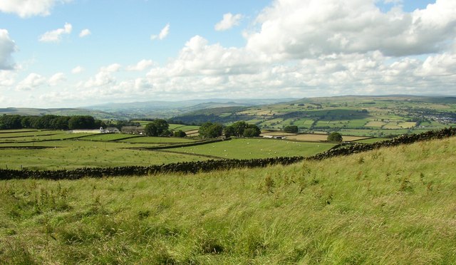
The village is known for its idyllic setting, surrounded by rolling hills, green fields, and beautiful woodland areas. The nearby River Aire adds to the tranquility, providing a serene backdrop for leisurely walks and outdoor activities.
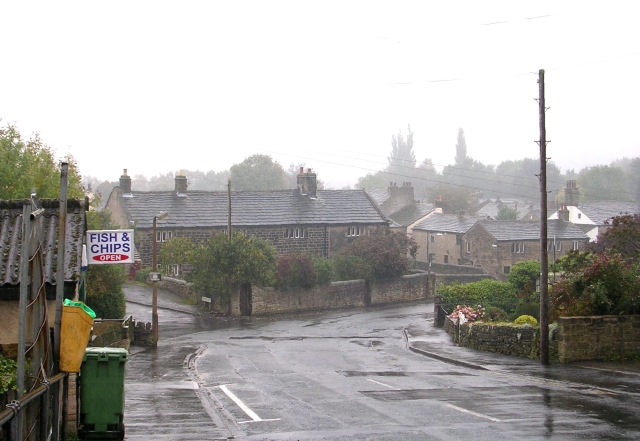
Beechcliffe boasts a rich history, with evidence of settlements dating back centuries. The village's architecture reflects its heritage, with a mix of traditional stone-built houses and more modern developments. The local church, St. Mary's, is a notable landmark, showcasing stunning stained glass windows and intricate stonework.
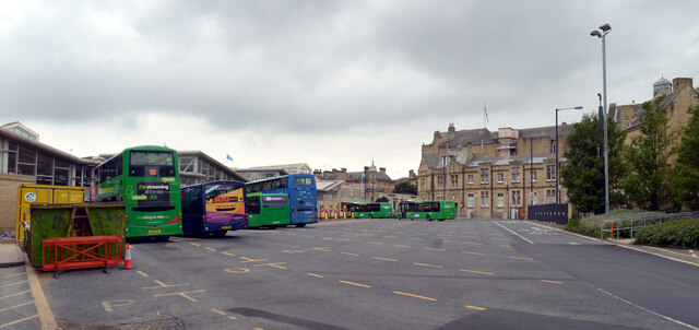
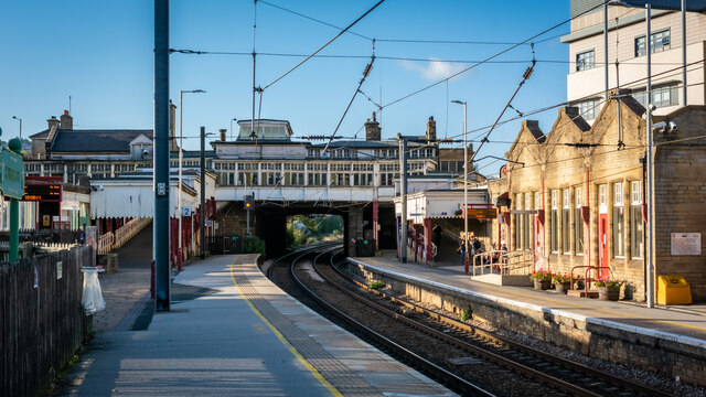
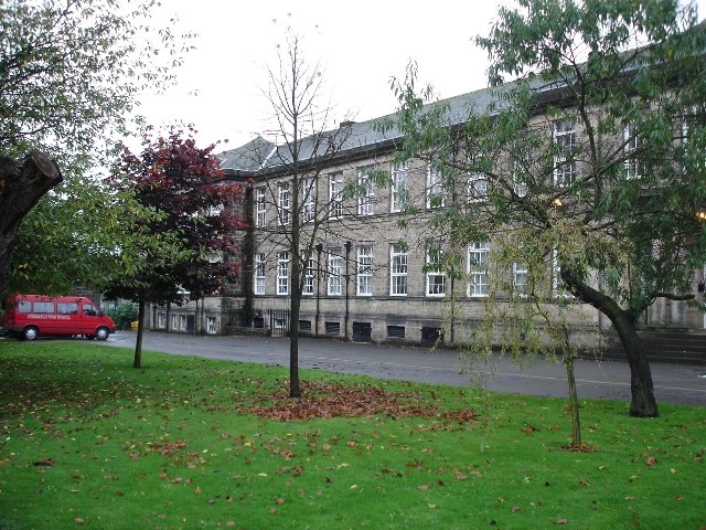
Residents of Beechcliffe enjoy a range of amenities, including a primary school, shops, and a village hall, which hosts various community events throughout the year. The village also benefits from excellent transport links, with nearby road connections and a train station in the neighboring town of Bingley.
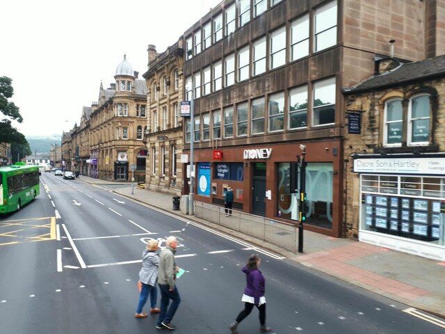
Nature lovers will appreciate the proximity to numerous outdoor attractions, including the beautiful Yorkshire Dales National Park and the historic Saltaire Village, a UNESCO World Heritage Site. Additionally, the bustling city of Bradford is just a short distance away, offering a wide range of cultural, shopping, and entertainment options.
Overall, Beechcliffe is a delightful village that offers a peaceful and picturesque living environment, combined with easy access to both rural and urban attractions.
If you have any feedback on the listing, please let us know in the comments section below.
Beechcliffe Images
Images are sourced within 2km of 53.878303/-1.908852 or Grid Reference SE0642. Thanks to Geograph Open Source API. All images are credited.


![East Riddlesden Hall and grounds [1] The south front of the hall.
Built on the site of an earlier building, the hall was erected in the 1640s and added to in 1692. Constructed of ashlar under stone slate roofs, the hall has two two-storey porches with wheel (or Yorkshire rose) windows. Many original internal features and fittings remain. Listed, grade I, with details at:
<span class="nowrap"><a title="https://historicengland.org.uk/listing/the-list/list-entry/1283478" rel="nofollow ugc noopener" href="https://historicengland.org.uk/listing/the-list/list-entry/1283478">Link</a><img style="margin-left:2px;" alt="External link" title="External link - shift click to open in new window" src="https://s1.geograph.org.uk/img/external.png" width="10" height="10"/></span>
East Riddlesden Hall is sited on the banks of the River Aire, in Riddlesden, about 1¼ miles northeast of Keighley. Once the centre of a thriving agricultural estate, the grounds of the hall include a tithe barn. Saved from demolition by two local men in 1934, the house and grounds are now in the care of the National Trust.](https://s3.geograph.org.uk/geophotos/07/02/14/7021447_f9e03490.jpg)
![East Riddlesden Hall and grounds [2] The entrance porch in the south front.
Built on the site of an earlier building, the hall was erected in the 1640s and added to in 1692. Constructed of ashlar under stone slate roofs, the hall has two two-storey porches with wheel (or Yorkshire rose) windows. Many original internal features and fittings remain. Listed, grade I, with details at:
<span class="nowrap"><a title="https://historicengland.org.uk/listing/the-list/list-entry/1283478" rel="nofollow ugc noopener" href="https://historicengland.org.uk/listing/the-list/list-entry/1283478">Link</a><img style="margin-left:2px;" alt="External link" title="External link - shift click to open in new window" src="https://s1.geograph.org.uk/img/external.png" width="10" height="10"/></span>
East Riddlesden Hall is sited on the banks of the River Aire, in Riddlesden, about 1¼ miles northeast of Keighley. Once the centre of a thriving agricultural estate, the grounds of the hall include a tithe barn. Saved from demolition by two local men in 1934, the house and grounds are now in the care of the National Trust.](https://s3.geograph.org.uk/geophotos/07/02/14/7021451_f4beef7d.jpg)
![East Riddlesden Hall and grounds [3] The north front of the hall.
Built on the site of an earlier building, the hall was erected in the 1640s and added to in 1692. Constructed of ashlar under stone slate roofs, the hall has two two-storey porches with wheel (or Yorkshire rose) windows. Many original internal features and fittings remain. Listed, grade I, with details at:
<span class="nowrap"><a title="https://historicengland.org.uk/listing/the-list/list-entry/1283478" rel="nofollow ugc noopener" href="https://historicengland.org.uk/listing/the-list/list-entry/1283478">Link</a><img style="margin-left:2px;" alt="External link" title="External link - shift click to open in new window" src="https://s1.geograph.org.uk/img/external.png" width="10" height="10"/></span>
East Riddlesden Hall is sited on the banks of the River Aire, in Riddlesden, about 1¼ miles northeast of Keighley. Once the centre of a thriving agricultural estate, the grounds of the hall include a tithe barn. Saved from demolition by two local men in 1934, the house and grounds are now in the care of the National Trust.](https://s2.geograph.org.uk/geophotos/07/02/14/7021454_c4022af1.jpg)
![East Riddlesden Hall and grounds [4] The south front of the hall.
Built on the site of an earlier building, the hall was erected in the 1640s and added to in 1692. Constructed of ashlar under stone slate roofs, the hall has two two-storey porches with wheel (or Yorkshire rose) windows. Many original internal features and fittings remain. Listed, grade I, with details at:
<span class="nowrap"><a title="https://historicengland.org.uk/listing/the-list/list-entry/1283478" rel="nofollow ugc noopener" href="https://historicengland.org.uk/listing/the-list/list-entry/1283478">Link</a><img style="margin-left:2px;" alt="External link" title="External link - shift click to open in new window" src="https://s1.geograph.org.uk/img/external.png" width="10" height="10"/></span>
East Riddlesden Hall is sited on the banks of the River Aire, in Riddlesden, about 1¼ miles northeast of Keighley. Once the centre of a thriving agricultural estate, the grounds of the hall include a tithe barn. Saved from demolition by two local men in 1934, the house and grounds are now in the care of the National Trust.](https://s3.geograph.org.uk/geophotos/07/02/14/7021455_f86a2c1a.jpg)
![East Riddlesden Hall and grounds [5] One of the rooms of the hall.
Built on the site of an earlier building, the hall was erected in the 1640s and added to in 1692. Constructed of ashlar under stone slate roofs, the hall has two two-storey porches with wheel (or Yorkshire rose) windows. Many original internal features and fittings remain. Listed, grade I, with details at:
<span class="nowrap"><a title="https://historicengland.org.uk/listing/the-list/list-entry/1283478" rel="nofollow ugc noopener" href="https://historicengland.org.uk/listing/the-list/list-entry/1283478">Link</a><img style="margin-left:2px;" alt="External link" title="External link - shift click to open in new window" src="https://s1.geograph.org.uk/img/external.png" width="10" height="10"/></span>
East Riddlesden Hall is sited on the banks of the River Aire, in Riddlesden, about 1¼ miles northeast of Keighley. Once the centre of a thriving agricultural estate, the grounds of the hall include a tithe barn. Saved from demolition by two local men in 1934, the house and grounds are now in the care of the National Trust.](https://s3.geograph.org.uk/geophotos/07/02/14/7021459_7feb94f1.jpg)
![East Riddlesden Hall and grounds [6] One of the rooms of the hall.
Built on the site of an earlier building, the hall was erected in the 1640s and added to in 1692. Constructed of ashlar under stone slate roofs, the hall has two two-storey porches with wheel (or Yorkshire rose) windows. Many original internal features and fittings remain. Listed, grade I, with details at:
<span class="nowrap"><a title="https://historicengland.org.uk/listing/the-list/list-entry/1283478" rel="nofollow ugc noopener" href="https://historicengland.org.uk/listing/the-list/list-entry/1283478">Link</a><img style="margin-left:2px;" alt="External link" title="External link - shift click to open in new window" src="https://s1.geograph.org.uk/img/external.png" width="10" height="10"/></span>
East Riddlesden Hall is sited on the banks of the River Aire, in Riddlesden, about 1¼ miles northeast of Keighley. Once the centre of a thriving agricultural estate, the grounds of the hall include a tithe barn. Saved from demolition by two local men in 1934, the house and grounds are now in the care of the National Trust.](https://s2.geograph.org.uk/geophotos/07/02/14/7021462_a66091ac.jpg)
![East Riddlesden Hall and grounds [7] The remains of a wing added in 1708 and demolished in 1905.
Built on the site of an earlier building, the hall was erected in the 1640s and added to in 1692. Constructed of ashlar under stone slate roofs, the hall has two two-storey porches with wheel (or Yorkshire rose) windows. Many original internal features and fittings remain. Listed, grade I, with details at:
<span class="nowrap"><a title="https://historicengland.org.uk/listing/the-list/list-entry/1283478" rel="nofollow ugc noopener" href="https://historicengland.org.uk/listing/the-list/list-entry/1283478">Link</a><img style="margin-left:2px;" alt="External link" title="External link - shift click to open in new window" src="https://s1.geograph.org.uk/img/external.png" width="10" height="10"/></span>
East Riddlesden Hall is sited on the banks of the River Aire, in Riddlesden, about 1¼ miles northeast of Keighley. Once the centre of a thriving agricultural estate, the grounds of the hall include a tithe barn. Saved from demolition by two local men in 1934, the house and grounds are now in the care of the National Trust.](https://s0.geograph.org.uk/geophotos/07/02/14/7021476_84ab1d01.jpg)
![East Riddlesden Hall and grounds [8] Dated 1642, this outbuilding is now used as a National Trust shop. Originally, possibly, the building was a range of guest accommodation. Constructed of ashlar under a stone slate roof. Listed, grade II, with details at: <span class="nowrap"><a title="https://historicengland.org.uk/listing/the-list/list-entry/1283458" rel="nofollow ugc noopener" href="https://historicengland.org.uk/listing/the-list/list-entry/1283458">Link</a><img style="margin-left:2px;" alt="External link" title="External link - shift click to open in new window" src="https://s1.geograph.org.uk/img/external.png" width="10" height="10"/></span>
East Riddlesden Hall is sited on the banks of the River Aire, in Riddlesden, about 1¼ miles northeast of Keighley. Once the centre of a thriving agricultural estate, the grounds of the hall include a tithe barn. Saved from demolition by two local men in 1934, the house and grounds are now in the care of the National Trust.](https://s0.geograph.org.uk/geophotos/07/02/14/7021488_46ad888b.jpg)
![East Riddlesden Hall and grounds [9] This 17th century outbuilding is now used as visitor toilets.
Constructed of squared, coursed stone under a stone slate roof. Listed, grade II, with details at: <span class="nowrap"><a title="https://historicengland.org.uk/listing/the-list/list-entry/1313909" rel="nofollow ugc noopener" href="https://historicengland.org.uk/listing/the-list/list-entry/1313909">Link</a><img style="margin-left:2px;" alt="External link" title="External link - shift click to open in new window" src="https://s1.geograph.org.uk/img/external.png" width="10" height="10"/></span>
East Riddlesden Hall is sited on the banks of the River Aire, in Riddlesden, about 1¼ miles northeast of Keighley. Once the centre of a thriving agricultural estate, the grounds of the hall include a tithe barn. Saved from demolition by two local men in 1934, the house and grounds are now in the care of the National Trust.](https://s3.geograph.org.uk/geophotos/07/02/14/7021495_fb5e6497.jpg)
Beechcliffe is located at Grid Ref: SE0642 (Lat: 53.878303, Lng: -1.908852)
Division: West Riding
Unitary Authority: Bradford
Police Authority: West Yorkshire
What 3 Words
///begins.part.dent. Near Keighley, West Yorkshire
Nearby Locations
Related Wikis
Utley, West Yorkshire
Utley is a village that forms a suburb of the town of Keighley within the county of West Yorkshire, England, approximately 1.5 miles (2.4 km) from the...
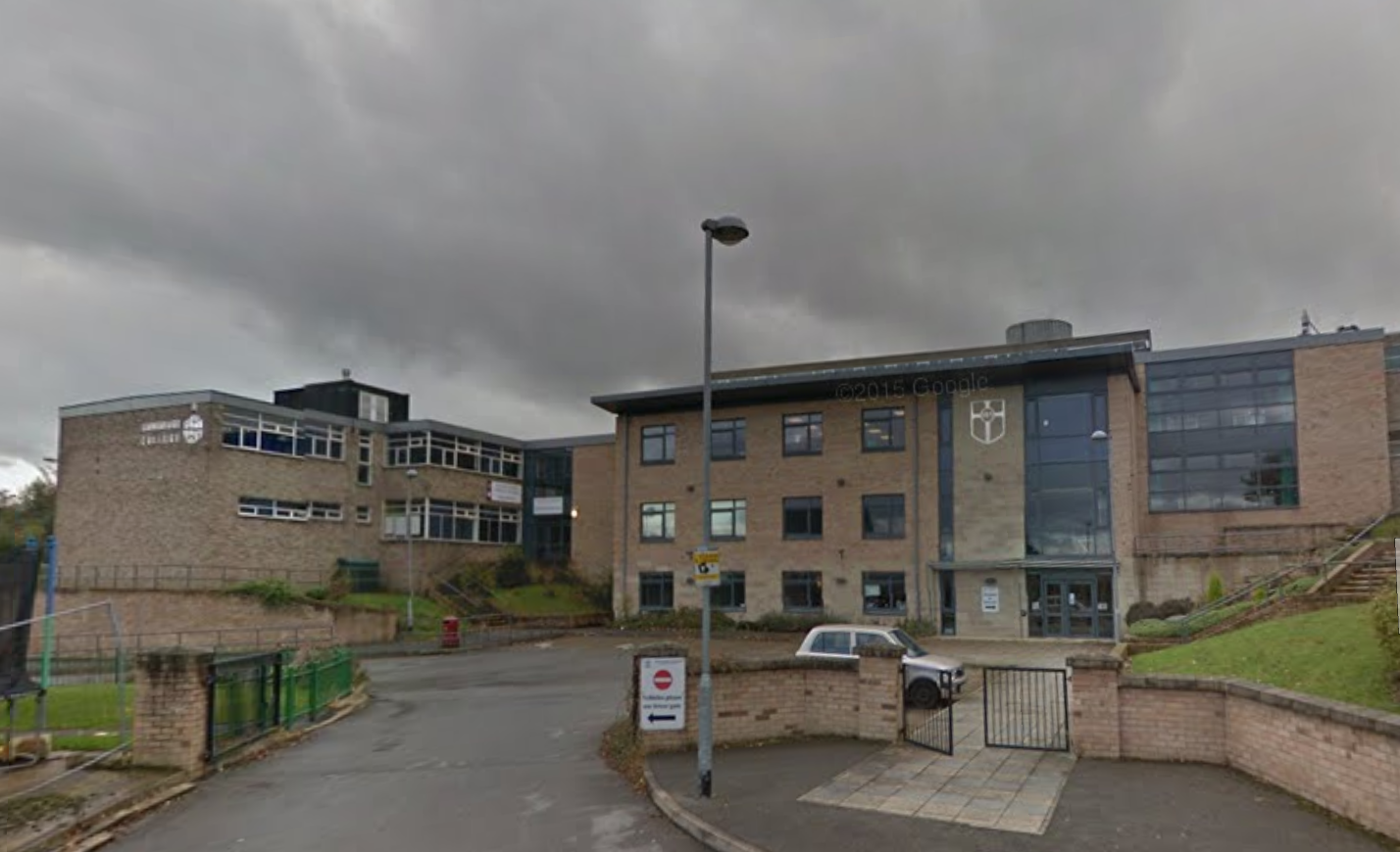
Carlton Keighley
Carlton Keighley (formerly Greenhead Grammar School, Greenhead High School and then University Academy Keighley) is a coeducational secondary school located...

Cliffe Castle Museum
Cliffe Castle Museum, Keighley, West Yorkshire, England, is a local heritage museum which opened in the grand, Victorian, neo-Gothic Cliffe Castle in 1959...
Airedale
Airedale is a valley, or dale, in North Yorkshire and West Yorkshire, England. It is named after the River Aire, which flows through it. The upper valley...

Cougar Park
Cougar Park is a rugby league stadium in Keighley, England, which is the home stadium of the Keighley Cougars. Its capacity is 7,800 people. It also hosted...
Holy Family Catholic School, Keighley
The Holy Family Catholic School is a coeducational Roman Catholic secondary school and sixth form serving the parishes and communities in and around the...

Keighley Picture House
Keighley Picture House is a cinema located in Keighley, West Yorkshire, England. It opened in 1913 as a receiving house theatre which also showed films...

Keighley Town Hall
Keighley Town Hall is an early 20th century municipal building in Keighley, West Yorkshire, England. It is a Grade II listed building. == History == After...
Related Videos


An Explore of Cliffe Castle Museum. Keighley.
in 1984, one school holiday, I sat, for the first time, in the front seat of a car. A strange event I can clearly remember from 40 years ...
Nearby Amenities
Located within 500m of 53.878303,-1.908852Have you been to Beechcliffe?
Leave your review of Beechcliffe below (or comments, questions and feedback).