Dove Head

Settlement in Derbyshire High Peak

England

Dove Head

View from the Longnor Road To "The Knights Table" inn - by the A53 Buxton/Leek road.
View from the Longnor Road Credit: Neil Theasby

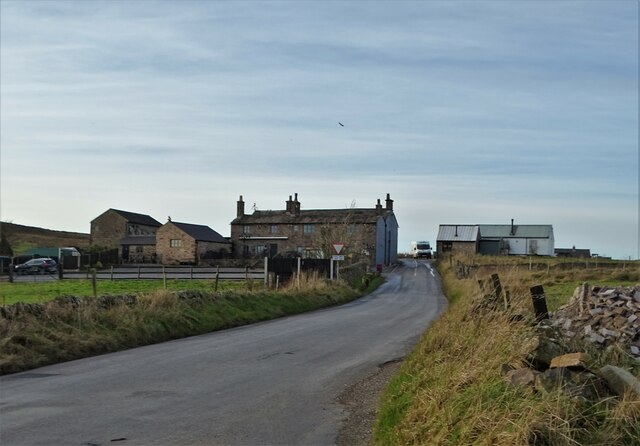
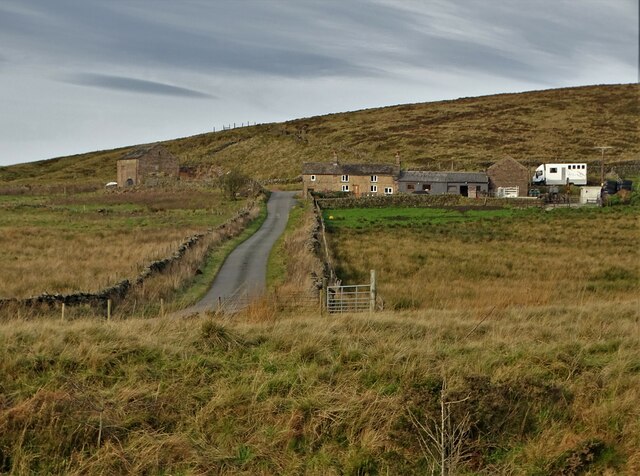
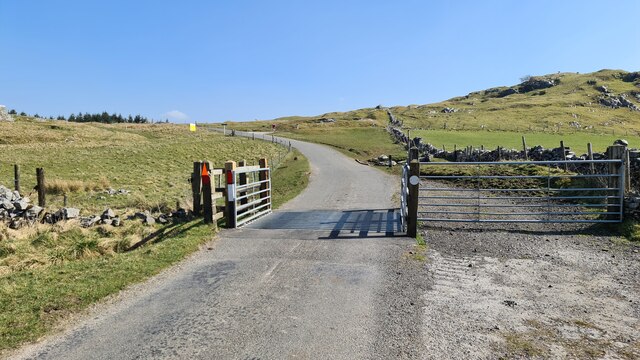
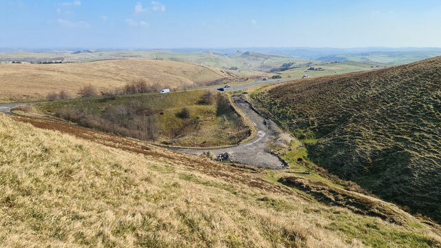
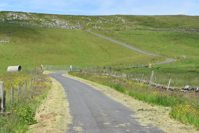
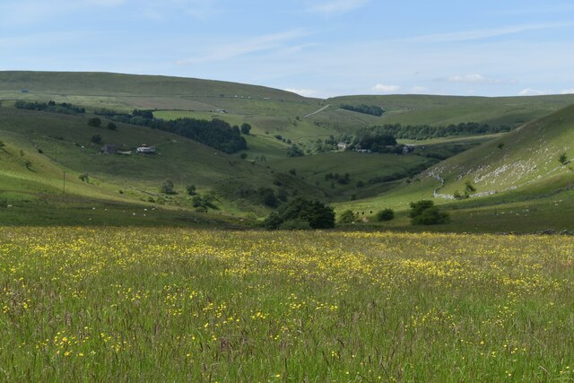
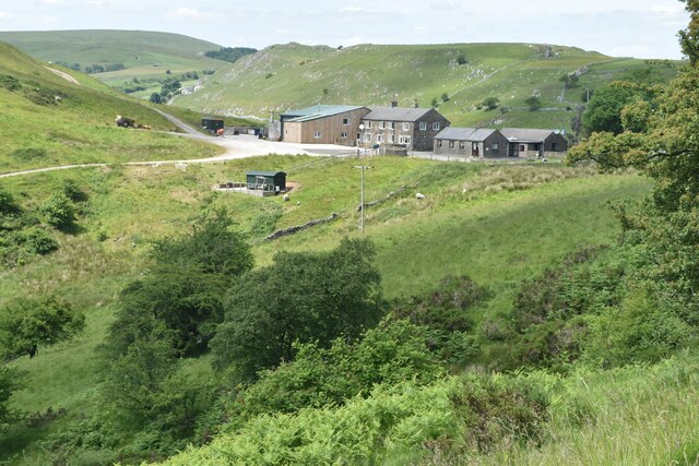
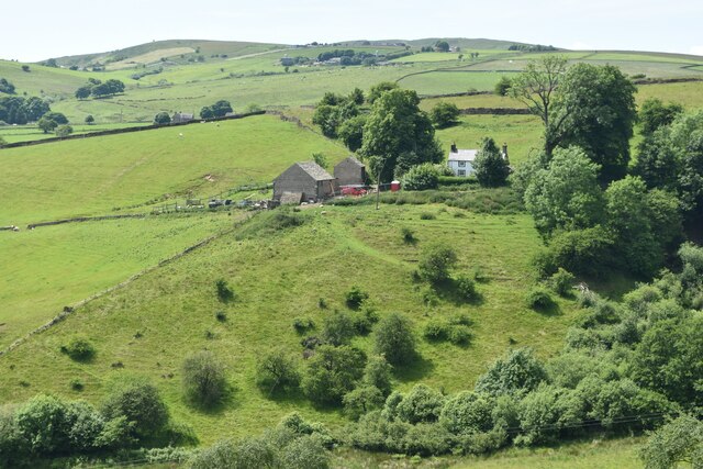
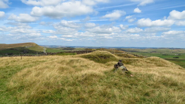
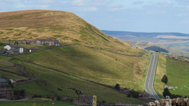
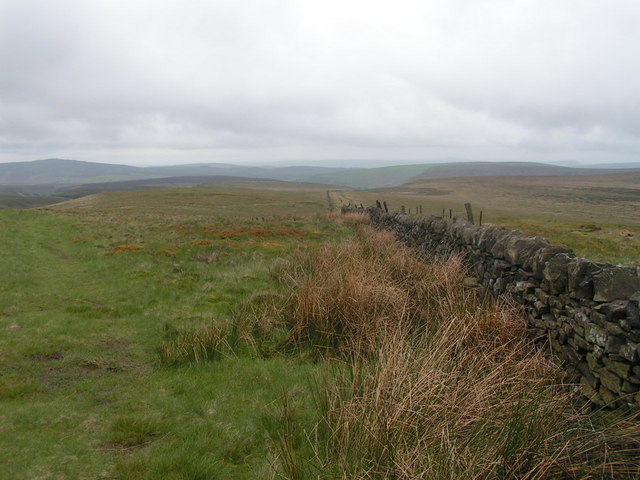
Dove Head is a small village nestled in the county of Derbyshire, England. Situated in the heart of the Peak District National Park, it is surrounded by breathtaking natural beauty and offers a tranquil retreat for nature lovers and outdoor enthusiasts alike.

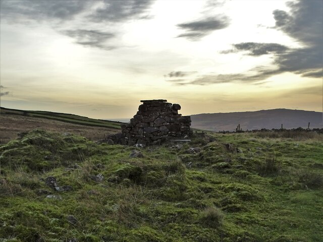
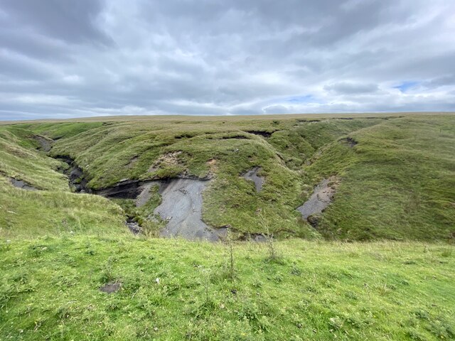
The village is located on the banks of the River Dove, from which it derives its name. The river meanders through the picturesque countryside, providing opportunities for fishing and scenic walks along its banks. The area is renowned for its diverse wildlife, with numerous bird species and mammals calling Dove Head home.

Despite its small size, Dove Head boasts a rich history. The village is dotted with charming stone cottages and traditional buildings, reflecting its heritage as an agricultural community. Nearby, visitors can explore historical landmarks such as the medieval Dove Head Hall and the ancient St. Mary's Church, which dates back to the 12th century.

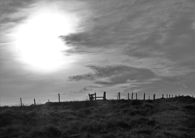
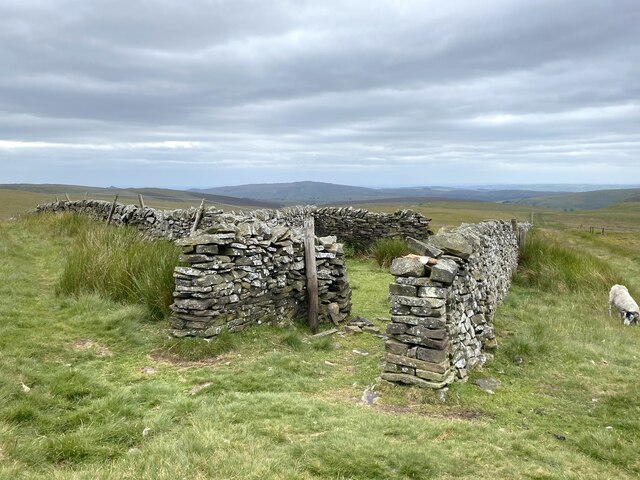
For those seeking outdoor adventure, Dove Head offers a multitude of activities. The surrounding hills and valleys provide excellent opportunities for hiking, mountain biking, and rock climbing. The village is also a popular base for exploring the wider Peak District, with its network of trails, caves, and caverns.

In terms of amenities, Dove Head has a small but friendly community. There is a local pub that serves traditional British fare and provides a welcoming atmosphere for locals and visitors alike. Nearby towns offer additional amenities, such as shops, restaurants, and accommodation options.

Overall, Dove Head is a hidden gem in the Derbyshire countryside, offering a peaceful and idyllic setting for those seeking a retreat in nature or a gateway to the Peak District's natural wonders.

If you have any feedback on the listing, please let us know in the comments section below.
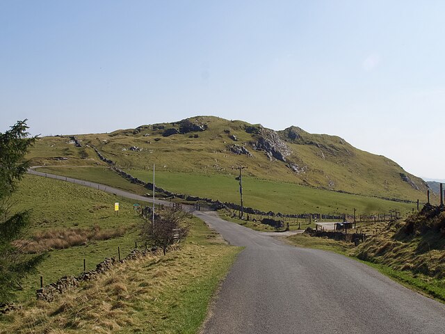
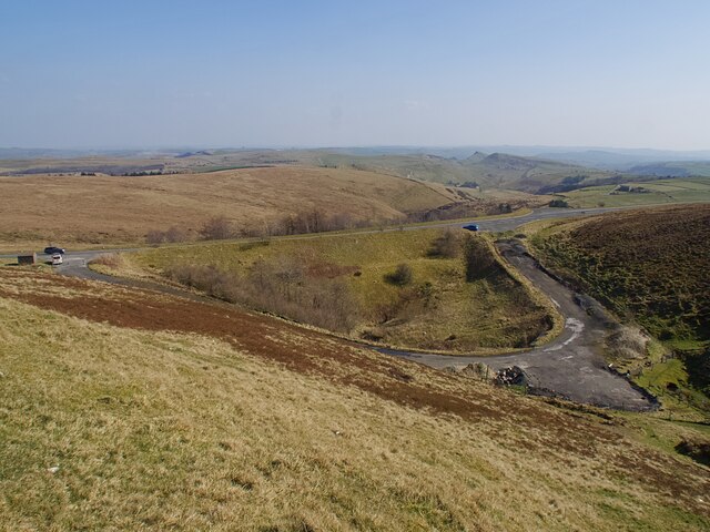
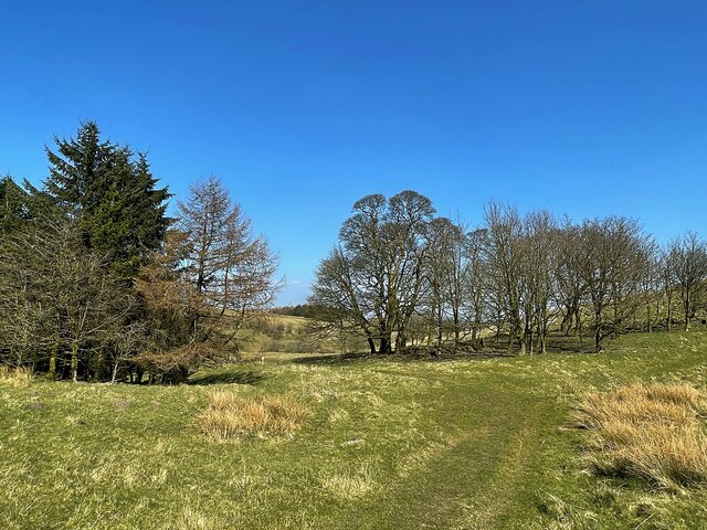
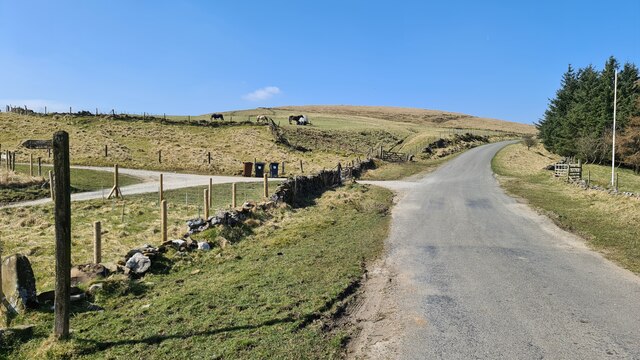
Dove Head Images

Images are sourced within 2km of 53.215982/-1.9409726 or Grid Reference SK0468. Thanks to Geograph Open Source API. All images are credited.

View from the Longnor Road To "The Knights Table" inn - by the A53 Buxton/Leek road.
View from the Longnor Road
To "The Knights Table" inn - by the A53 Buxton/Leek road.
View to Readyleech Green Farm
Lonely ruin on Oliver Hill Long ago someone might have lived here but more likely it was a sheep barn.
Lonely ruin on Oliver Hill
Long ago someone might have lived here but more likely it was a sheep barn.
On the path to Oliver Hill
Minor road passing Thirkelow Rocks
Overlooking the A53 Leek - Buxton Road Evidence of the road having been straightened here.
Overlooking the A53 Leek - Buxton Road
Evidence of the road having been straightened here.
Footpath through trees On moorland near Turncliffe Common
Footpath through trees
On moorland near Turncliffe Common
Road below Thirkelow Rocks
A53 below Axe Edge
A53 below Axe Edge
Road from Booth Farm
Valley view north of Booth Farm
View towards Booth Farm
Cross-valley view towards Leycote
Orchard Clough South of Axe Edge.
Orchard Clough
South of Axe Edge.
Boundary sheepfold Situated on the boundary of Derbyshire and Staffordshire.
Boundary sheepfold
Situated on the boundary of Derbyshire and Staffordshire.
Oliver Hill summit
Oliver Hill summit
A53 below Axe Edge from Oliver Hill
Show me another place!

Dove Head is located at Grid Ref: SK0468 (Lat: 53.215982, Lng: -1.9409726)

Administrative County: Derbyshire

District: High Peak

Police Authority: Derbyshire

What 3 Words

///opposites.ruffling.carting. Near Buxton, Derbyshire

Related Wikis

Axe Edge Moor

Axe Edge Moor is the major moorland southwest of Buxton in the Peak District, England. It is mainly gritstone (Namurian shale and sandstone). Its highest...

Cheeks Hill

Cheeks Hill is a hill on Axe Edge Moor in the Peak District, England. It lies just south of the Cat and Fiddle Road near Buxton, and forms part of the...

Oliver Hill (Peak District)

Oliver Hill is a hill, 513 metres (1,683 ft) high, in the Peak District in the county of Staffordshire in England. It is a treeless summit surrounded by...

Quarnford

Quarnford is a village and civil parish in the Staffordshire Moorlands district of Staffordshire, England. According to the 2001 census it had a population...

Hollins Hill

Hollins Hill is a gritstone hill in the Derbyshire Peak District near the village of Hollinsclough. The summit is 450 metres (1,480 ft) above sea level...

Health and Safety Laboratory

The Health and Safety Laboratory (HSE Laboratory or HSL Buxton) is a large 550-acre research site in rural High Peak, Derbyshire, south of Buxton. It researches...

Flash, Staffordshire

Flash is a village in the Staffordshire Moorlands, England, and Peak District National Park. At 1,519 feet (463 m) above sea level, it is the highest village...

High Edge

High Edge is a limestone hill overlooking Harpur Hill, Buxton in Derbyshire, in the Peak District. The summit is 472 metres (1,549 ft) above sea level...

Nearby Amenities

Located within 500m of 53.215982,-1.9409726
Barrier: cattle_grid
Lat/Long: 53.213582/-1.9350357
Telephone
Defibrillator
Booth: K6
Covered: booth
Defibrillator Location: inside old red phone box
Emergency: defibrillator
Man Made: telephone_box
Lat/Long: 53.2141421/-1.9362297
Barrier: stile
Material: wood
Source: survey;gps
Stile: stepover
Lat/Long: 53.2144986/-1.9361312
Post Box
Collection Times: Mo-Fr 09:00; Sa 08:00
Post Box Type: lamp
Ref: SK17 131
Royal Cypher: EIIR
Royal Cypher Wikidata: Q33102113
Lat/Long: 53.214472/-1.9362583
Barrier: stile
Material: stone
Source: survey;gps
Stile: squeezer
Lat/Long: 53.2166605/-1.9378578
Barrier: stile
Material: wood
Source: survey;gps
Stile: stepover
Lat/Long: 53.2116413/-1.9423854
Barrier: stile
Material: stone
Source: survey;gps
Stile: squeezer
Lat/Long: 53.2119393/-1.9437079
Barrier: stile
Material: stone
Source: survey;gps
Stile: stepover
Lat/Long: 53.2131907/-1.943201
Barrier: stile
Material: stone
Source: survey;gps
Stile: stepover
Lat/Long: 53.2140705/-1.9430489
Barrier: stile
Material: stone
Source: survey;gps
Stile: squeezer
Lat/Long: 53.214663/-1.9431409
Barrier: stile
Material: stone
Source: survey;gps
Stile: stepover
Lat/Long: 53.2158548/-1.9435434
Barrier: stile
Material: wood
Source: survey;gps
Stile: stepover
Lat/Long: 53.2166261/-1.9475332
Barrier: stile
Material: wood
Source: survey;gps
Stile: stepover
Lat/Long: 53.214823/-1.9353537
Barrier: stile
Material: wood
Source: survey;gps
Stile: stepover
Lat/Long: 53.2148263/-1.9352759
Barrier: stile
Material: stone
Source: survey;gps
Stile: stepover
Lat/Long: 53.2167073/-1.9361928
Barrier: stile
Material: wood
Source: survey;gps
Stile: stepover
Lat/Long: 53.2169727/-1.937173
Barrier: stile
Material: wood
Source: survey;gps
Stile: stepover
Lat/Long: 53.2174253/-1.9365804
Barrier: stile
Material: wood
Source: survey;gps
Stile: stepover
Lat/Long: 53.2176243/-1.9357709
Barrier: stile
Material: wood
Source: survey;gps
Stile: stepover
Lat/Long: 53.2177186/-1.9362906
Barrier: stile
Material: wood
Source: survey;gps
Stile: stepover
Lat/Long: 53.2124712/-1.9430009
Barrier: stile
Material: stone
Source: survey;gps
Stile: squeezer
Lat/Long: 53.2124845/-1.9431531
Barrier: stile
Material: wood
Source: survey;gps
Stile: stepover
Lat/Long: 53.2129231/-1.9413411
Barrier: stile
Material: stone
Source: survey;gps
Stile: squeezer
Lat/Long: 53.2129244/-1.9360025
Barrier: stile
Material: stone
Source: survey;gps
Stile: squeezer
Lat/Long: 53.2138511/-1.9376563
Barrier: stile
Material: stone
Source: survey;gps
Stile: squeezer
Lat/Long: 53.2180618/-1.9443681
Barrier: stile
Material: stone
Source: survey;gps
Stile: stepover
Lat/Long: 53.2181958/-1.9446638
Barrier: stile
Material: wood
Source: survey;gps
Stile: stepover
Lat/Long: 53.2191326/-1.9371141
Barrier: stile
Material: stone
Source: survey;gps
Stile: squeezer
Lat/Long: 53.2191901/-1.9383563
Historic: memorial
Lat/Long: 53.2137578/-1.9358324
The data included in this document is from www.openstreetmap.org. The data is made available under ODbL.

Have you been to Dove Head?

Leave your review of Dove Head below (or comments, questions and feedback).