Dovecote

Settlement in East Lothian

Scotland

Dovecote

Letham Holdings
Letham Holdings Credit: Richard Webb

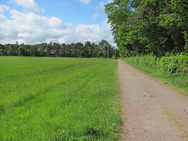
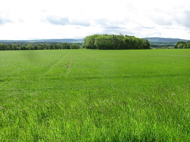
Dovecote is a small village located in the county of East Lothian, Scotland. Situated approximately 20 miles east of the capital city, Edinburgh, Dovecote is known for its tranquil and picturesque setting. The village is surrounded by rolling hills, lush green fields, and offers stunning views of the nearby coast.

Despite its small size, Dovecote has a rich history that dates back centuries. The village is named after a dovecote, a structure used for housing pigeons, which was once a prominent feature in the area. Today, remnants of the dovecote can still be seen, adding to the village's charm and historical significance.

Dovecote is primarily a residential area, with a close-knit community that takes pride in its natural surroundings. The village offers a peaceful and friendly atmosphere, making it an attractive place for families and those seeking a slower pace of life.

The surrounding countryside provides ample opportunities for outdoor activities such as hiking, cycling, and birdwatching. The nearby coastline is also a popular spot for locals and visitors alike, with sandy beaches and rugged cliffs offering breathtaking views.

While Dovecote may be a quiet village, it is within easy reach of larger towns and cities in East Lothian, such as Haddington and North Berwick. Residents have access to a range of amenities, including shops, schools, and healthcare facilities, ensuring that the village meets the needs of its population.

In conclusion, Dovecote offers a tranquil and idyllic setting, rich in history and natural beauty. It is a place where residents can enjoy a peaceful lifestyle while still having easy access to the amenities of nearby towns and cities.

If you have any feedback on the listing, please let us know in the comments section below.

Dovecote Images

Images are sourced within 2km of 55.949381/-2.7968315 or Grid Reference NT5073. Thanks to Geograph Open Source API. All images are credited.

Letham Holdings
Letham Holdings
East Lothian core path no.110 Singletrack through a stripwood. The path leads through woodland and along field margins to Liberty Hall.
East Lothian core path no.110
Singletrack through a stripwood. The path leads through woodland and along field margins to Liberty Hall.
Letham Holdings A large area of land west of Haddington has been used for small holdings. Nowadays there is a fair scattering of trophy homes amongst the small flocks of sheep and gardening enterprise. A house with a bit of land is very attractive to horse owners. This view is of the more traditional land use, the foreground field contains sheep.
Letham Holdings
A large area of land west of Haddington has been used for small holdings. Nowadays there is a fair scattering of trophy homes amongst the small flocks of sheep and gardening enterprise. A house with a bit of land is very attractive to horse owners. This view is of the more traditional land use, the foreground field contains sheep.
Woodland path, Letham Holdings A lovely stretch of woodland singletrack. The path runs between Haddington and Liberty Hall via Letham Holdings. East Lothian core path 109.
Woodland path, Letham Holdings
A lovely stretch of woodland singletrack. The path runs between Haddington and Liberty Hall via Letham Holdings. East Lothian core path 109.
Letham Burn At the end of a stripwood near Letham House.
Letham Burn
At the end of a stripwood near Letham House.
East Lothian core path no.109 Lovely piece of singletrack between Haddington and Letham Holdings. The track that crosses it here runs from Letham House to fields.
East Lothian core path no.109
Lovely piece of singletrack between Haddington and Letham Holdings. The track that crosses it here runs from Letham House to fields.
Estate road, Clerkington
Cereals, Clerkington Arable farming at Clerkington Mains.
Cereals, Clerkington
Arable farming at Clerkington Mains.
Road, Westfield The cyclist in the picture was benefiting from a fierce tail wind. Guess which way I was going?  The short distance to the Samuelston Bridge was quite a struggle.
Road, Westfield
The cyclist in the picture was benefiting from a fierce tail wind. Guess which way I was going? The short distance to the Samuelston Bridge was quite a struggle.
Path, Letham Mains Path running through a stripwood. East Lothian core path no. 110.
Path, Letham Mains
Path running through a stripwood. East Lothian core path no. 110.
Spring barley near Haddington Looking southwest from the road to Letham Mains, with the Moorfoot and Lammermuir Hills in the distance.
Spring barley near Haddington
Looking southwest from the road to Letham Mains, with the Moorfoot and Lammermuir Hills in the distance.
Dods of Haddington Large and long-established seed merchants in Eastern Scotland.
Dods of Haddington
Large and long-established seed merchants in Eastern Scotland.
Oak Tree Junction west of Haddington Looking across stubble to the complex junction of the A1, A199 and the B6471, with Traprain Law in the distance.
Oak Tree Junction west of Haddington
Looking across stubble to the complex junction of the A1, A199 and the B6471, with Traprain Law in the distance.
Hedge Bindweed Calystegia sepium, a bindweed or convolvulus with striking white flowers, in the hedgerow on the road to Letham Mains.
Hedge Bindweed
Calystegia sepium, a bindweed or convolvulus with striking white flowers, in the hedgerow on the road to Letham Mains.
Rural East Lothian : Spring Is Here At Last
Rural East Lothian : Bus Stop On The Old A1 at Letham Mains Road-end
Haddington railway path Nearing Haddington and about to pass under a bridge carrying a road/driveway up to Huntington.
Haddington railway path
Nearing Haddington and about to pass under a bridge carrying a road/driveway up to Huntington.
Haddington railway path The path along the old Haddington Branch is approaching Haddington. The bridge carries the first Haddington bypass on the A1 and the current bypass is on the left.
Haddington railway path
The path along the old Haddington Branch is approaching Haddington. The bridge carries the first Haddington bypass on the A1 and the current bypass is on the left.
Show me another place!

Dovecote is located at Grid Ref: NT5073 (Lat: 55.949381, Lng: -2.7968315)

Unitary Authority: East Lothian

Police Authority: The Lothians and Scottish Borders

What 3 Words

///lightens.blanket.worthy. Near Haddington, East Lothian

Related Wikis

Knox Academy

Knox Academy is a co-educational state secondary school located in Haddington, East Lothian, Scotland. Originally founded in 1379 as a medieval grammar...

East Lothian Community Hospital

East Lothian Community Hospital is a hospital located on Station Road, Haddington, East Lothian, Scotland. The hospital is operated by NHS Lothian. �...

Haddington railway station

Haddington railway station served the town of Haddington, Scotland. Services were provided by trains on the Haddington line. == History == The station...

Haddington Athletic F.C.

Haddington Athletic Football Club are a Scottish football club based in Haddington, the county town of East Lothian. Nicknamed the Hi-His, the club were...

Nearby Amenities

Located within 500m of 55.949381,-2.7968315
Traffic Calming: cushion
Lat/Long: 55.9529617/-2.79709
Turning Circle
Lat/Long: 55.9502529/-2.7904135
Bus Stop
Long Cram
Bus: yes
Naptan AtcoCode: 627009050300
Naptan Bearing: S
Naptan CommonName: Long Cram
Naptan Indicator: at Long Cram
Naptan NaptanCode: 58232969
Naptan Street: Wellside
Naptan Verified: no
Public Transport: platform
Source: naptan_import
Lat/Long: 55.9518816/-2.7903621
Ford: yes
Lat/Long: 55.9490495/-2.792538
Natural: spring
Lat/Long: 55.952478/-2.7932918
Traffic Signals
Traffic Signals: signal
Lat/Long: 55.9486066/-2.7999322
Post Box
Ref: EH41 339
Lat/Long: 55.9512221/-2.793575
Traffic Calming: table
Lat/Long: 55.9480644/-2.7979859
Traffic Calming: table
Lat/Long: 55.9478636/-2.7993248
Traffic Calming: table
Lat/Long: 55.9474804/-2.8003968
Traffic Calming: table
Lat/Long: 55.9471644/-2.7987586
Traffic Calming: table
Lat/Long: 55.947969/-2.7986135
Bus Stop
Clerkington Mill
Bus: yes
Public Transport: platform
Lat/Long: 55.9506369/-2.7962473
Ford: yes
Lat/Long: 55.9493241/-2.7935949
Traffic Calming: cushion
Lat/Long: 55.9522561/-2.7963861
Traffic Calming: cushion
Lat/Long: 55.9526445/-2.7967619
Traffic Calming: cushion
Lat/Long: 55.9515587/-2.7955456
Traffic Calming: cushion
Lat/Long: 55.9518937/-2.7960141
Traffic Calming: cushion
Lat/Long: 55.9536124/-2.7961051
Traffic Calming: cushion
Lat/Long: 55.9533656/-2.7965799
Ford: yes
Lat/Long: 55.9468468/-2.7901976
Power: pole
Lat/Long: 55.9473522/-2.8033526
Power: pole
Lat/Long: 55.9504965/-2.8045424
Power: pole
Lat/Long: 55.9505875/-2.8030068
Power: pole
Lat/Long: 55.9506692/-2.8015398
Power: pole
Lat/Long: 55.9508372/-2.8003605
Power: pole
Lat/Long: 55.9510285/-2.7988602
Power: pole
Lat/Long: 55.951081/-2.7973121
Barrier: kerb
Lat/Long: 55.9506242/-2.8001806
Barrier: cycle_barrier
Lat/Long: 55.9491179/-2.7988334
Barrier: kerb
Lat/Long: 55.952564/-2.8018878
Traffic Calming: table
Lat/Long: 55.9483363/-2.7968151
Traffic Calming: table
Lat/Long: 55.9491081/-2.7981742
Traffic Calming: table
Lat/Long: 55.9486734/-2.7976968
Crossing
Crossing: traffic_signals
Lat/Long: 55.9486648/-2.799768
Crossing
Crossing: traffic_signals
Lat/Long: 55.9487007/-2.8000536
Crossing
Crossing: traffic_signals
Lat/Long: 55.9485088/-2.7998352
Location: outdoor
Power: substation
Substation: minor_distribution
Lat/Long: 55.9518798/-2.7902082
Give Way
Direction: backward
Lat/Long: 55.9515974/-2.7940129
Give Way
Direction: backward
Lat/Long: 55.9498576/-2.7912703
Give Way
Direction: backward
Lat/Long: 55.949929/-2.7919248
Give Way
Direction: backward
Lat/Long: 55.9518925/-2.7946901
Give Way
Direction: backward
Lat/Long: 55.9512719/-2.793453
Give Way
Direction: forward
Lat/Long: 55.9517979/-2.7959695
Give Way
Direction: backward
Lat/Long: 55.9519991/-2.79605
Give Way
Direction: forward
Lat/Long: 55.9532989/-2.7966025
Barrier: kerb
Lat/Long: 55.9520487/-2.8007171
Barrier: kerb
Lat/Long: 55.9522154/-2.8017215
Barrier: kerb
Lat/Long: 55.9527891/-2.8017215
Give Way
Direction: backward
Lat/Long: 55.9497762/-2.7973871
Location Transition: yes
Power: pole
Transformer: distribution
Lat/Long: 55.9500694/-2.7970793
Noexit: yes
Lat/Long: 55.947167/-2.7980818
Noexit: yes
Lat/Long: 55.9471422/-2.7983554
Location: indoor
Power: substation
Substation: minor_distribution
Lat/Long: 55.9468914/-2.7980416
Location: indoor
Power: substation
Substation: minor_distribution
Lat/Long: 55.9482717/-2.7984667
Traffic Calming: table
Lat/Long: 55.9482522/-2.7995557
Traffic Calming: table
Lat/Long: 55.9470182/-2.8003589
Traffic Calming: table
Lat/Long: 55.9469362/-2.8001276
Traffic Calming: table
Lat/Long: 55.9473093/-2.7990733
Traffic Calming: table
Lat/Long: 55.9470878/-2.7996991
Give Way
Direction: forward
Lat/Long: 55.9490549/-2.7986182
Give Way
Direction: forward
Lat/Long: 55.9502654/-2.7964993
Traffic Calming: table
Lat/Long: 55.9500416/-2.7960943
Traffic Calming: table
Lat/Long: 55.9495024/-2.795767
Traffic Calming: table
Lat/Long: 55.9485818/-2.7960098
The data included in this document is from www.openstreetmap.org. The data is made available under ODbL.

Have you been to Dovecote?

Leave your review of Dovecote below (or comments, questions and feedback).