Blairdrummond

Settlement in Perthshire

Scotland

Blairdrummond

Former tollhouse On the A84 south of Doune at the B826 junction is this former tollhouse known as Loch-Hills Wood which may date from about 1825.  On the OS 1st Edition it is noted that there is a 'weighing machine'.  In 2009 it was lived in and well-cared for.   By 2021 it was empty and deteriorating.   However it is to be renovated, hopefully, in 2022.   It is B Listed LB8412 and its Canmore reference is 363352.
Former tollhouse Credit: Chris Minto

Blairdrummond is a small village located in the county of Perthshire, Scotland. Situated approximately 5 miles southwest of the city of Stirling, it is nestled amidst the picturesque countryside and offers a peaceful and tranquil atmosphere.

The village is known for its stunning natural beauty, surrounded by lush greenery, rolling hills, and the stunning backdrop of the Trossachs National Park. The local area is a haven for outdoor enthusiasts, offering an array of walking and cycling trails, as well as opportunities for fishing and golf.

Blairdrummond is also home to the popular Blairdrummond Safari Park, which attracts visitors from far and wide. This wildlife park spans over 120 acres and is home to a diverse range of animals, including lions, tigers, elephants, giraffes, and many more. Visitors can enjoy a thrilling safari drive, getting up close and personal with these majestic creatures, or explore the park's other attractions, such as the sea lion show or the adventure playground.

In addition to its natural beauty and wildlife park, Blairdrummond boasts a close-knit community and a range of amenities. The village has a primary school, a local shop, and a charming village hall where various community events are held throughout the year. The nearby city of Stirling offers further amenities, including shops, restaurants, and cultural attractions.

Overall, Blairdrummond is a delightful village that offers a perfect blend of natural beauty, wildlife, and a welcoming community. It is an ideal destination for those seeking a peaceful retreat or a fun-filled day out exploring the wonders of nature.

If you have any feedback on the listing, please let us know in the comments section below.

Blairdrummond Images

Images are sourced within 2km of 56.167821/-4.055809 or Grid Reference NS7299. Thanks to Geograph Open Source API. All images are credited.

Former tollhouse On the A84 south of Doune at the B826 junction is this former tollhouse known as Loch-Hills Wood which may date from about 1825.  On the OS 1st Edition it is noted that there is a 'weighing machine'.  In 2009 it was lived in and well-cared for.   By 2021 it was empty and deteriorating.   However it is to be renovated, hopefully, in 2022.   It is B Listed LB8412 and its Canmore reference is 363352.
Former tollhouse
On the A84 south of Doune at the B826 junction is this former tollhouse known as Loch-Hills Wood which may date from about 1825. On the OS 1st Edition it is noted that there is a 'weighing machine'. In 2009 it was lived in and well-cared for. By 2021 it was empty and deteriorating. However it is to be renovated, hopefully, in 2022. It is B Listed LB8412 and its Canmore reference is 363352.
A84 towards Doune
A84 towards Doune
Doune Castle Ruined tower house above the River Teith.
Doune Castle
Ruined tower house above the River Teith.
River Teith Autumn on the River Teith by Doune Castle.
River Teith
Autumn on the River Teith by Doune Castle.
Kilmadock Cemetery
Kilmadock Cemetery
Inverardoch Mains (farm) Features an interesting tower which seems windowless
Inverardoch Mains (farm)
Features an interesting tower which seems windowless
Loch Watston White water-lilies at the southern end of the loch.
Loch Watston
White water-lilies at the southern end of the loch.
Yellow iris Growing in a damp field/woodland margin west of Loch Watston.
Yellow iris
Growing in a damp field/woodland margin west of Loch Watston.
Doune Castle
Doune Castle
Doune Castle
Doune Castle
Doune Castle
Doune Castle
Rosebay Willow Herb Fields off the A84 just before Doune
Rosebay Willow Herb
Fields off the A84 just before Doune
Doune Castle Site of filming for some Monty Python episodes.
Doune Castle
Site of filming for some Monty Python episodes.
Doune Castle Doune
Doune Castle
Doune
Spot the Rabbits Taken from near Doune Castle looking towards the river bank.
Spot the Rabbits
Taken from near Doune Castle looking towards the river bank.
Doune Castle
Doune Castle
Doune Castle
Doune Castle
Doune Castle
Doune Castle
Show me another place!

Blairdrummond is located at Grid Ref: NS7299 (Lat: 56.167821, Lng: -4.055809)

Unitary Authority: Stirling

Police Authority: Forth Valley

What 3 Words

///coconuts.small.pastime. Near Doune, Stirling

Related Wikis

Stirling torcs

The Stirling torcs make up a hoard of four gold Iron Age torcs, a type of necklace, all of which date to between 300 and 100 BC and which were buried deliberately...

Kincardine-in-Menteith

Kincardine is a civil parish in the Scottish council area of Stirling and the former county of Perthshire in the historic district of Menteith. It lies...

Blair Drummond

Blair Drummond is a small rural community 5 miles (8 kilometres) northwest of Stirling in the Stirling district of Scotland, predominantly located along...

Menteith

Menteith or Monteith (Scottish Gaelic: Mòine Tèadhaich), a district of south Perthshire, Scotland, roughly comprises the territory between the Teith and...

Blair Drummond Safari Park

Blair Drummond Safari Park is a family visitor attraction located near Stirling in Scotland. It opened to the public on 15 May 1970 and is home to over...
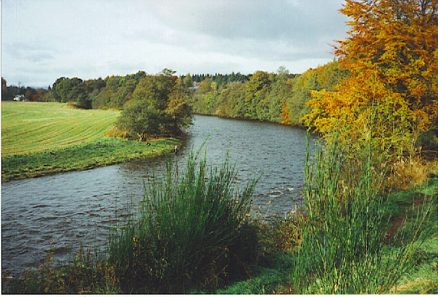
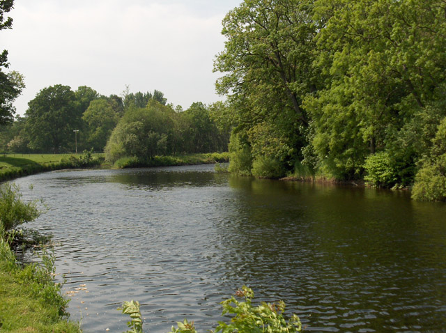
Ardoch Burn

The Ardoch Burn is a stream in Stirling council area, Scotland, which flows from the Braes Of Doune into the River Teith at Inverardoch, just behind Doune...
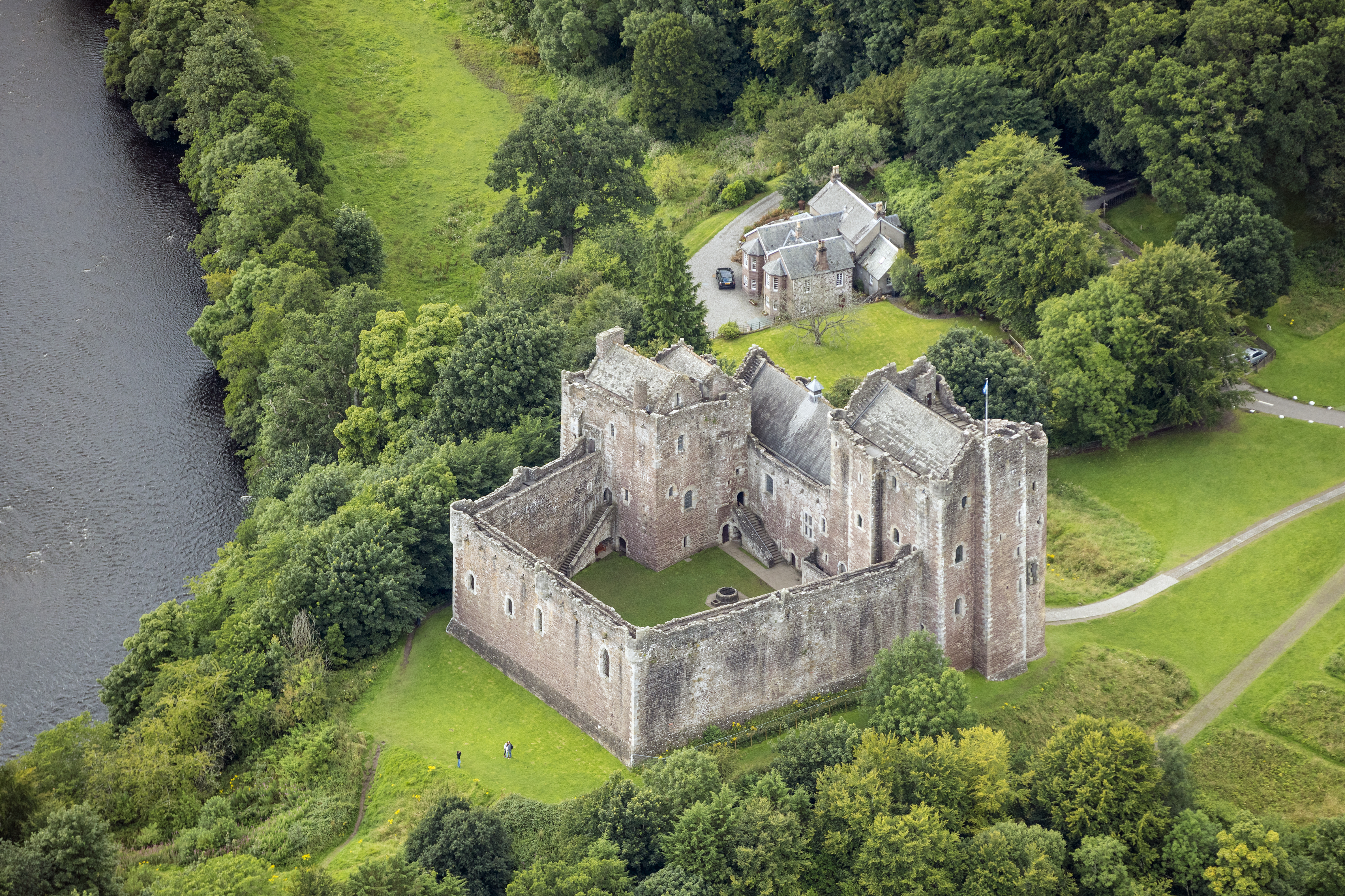
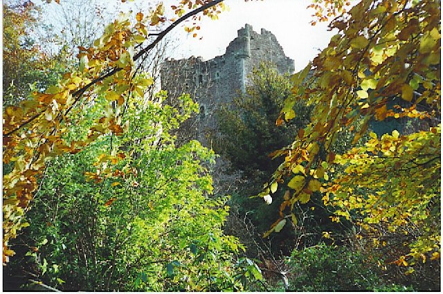
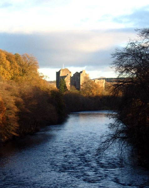
Doune Castle

Doune Castle is a medieval stronghold near the village of Doune, in the Stirling council area of central Scotland and the historic county of Perthshire...

Doune

Doune (; from Scottish Gaelic: An Dùn, meaning 'the fort') is a burgh within Perthshire. The town is administered by Stirling Council. Doune is assigned...

Nearby Amenities

Located within 500m of 56.167821,-4.055809
Power: pole
Lat/Long: 56.1711132/-4.0508094
Power: pole
Lat/Long: 56.1712378/-4.0522987
Power: pole
Lat/Long: 56.1714614/-4.0536228
Power: pole
Lat/Long: 56.1716699/-4.054905
Power: pole
Lat/Long: 56.1718993/-4.0562981
Power: pole
Lat/Long: 56.1689903/-4.0486256
Power: pole
Lat/Long: 56.1696145/-4.0497217
Power: pole
Lat/Long: 56.1701735/-4.0507048
Power: pole
Lat/Long: 56.1708535/-4.0516712
Power: pole
Lat/Long: 56.1716198/-4.0523301
Power: pole
Lat/Long: 56.1677651/-4.0565105
Power: pole
Lat/Long: 56.1681366/-4.0558327
Power: pole
Lat/Long: 56.1685559/-4.0550651
Power: pole
Lat/Long: 56.1689425/-4.0543811
Power: pole
Lat/Long: 56.1694864/-4.0533791
Power: pole
Lat/Long: 56.1701723/-4.0532975
Power: pole
Lat/Long: 56.1709805/-4.0531867
Power: pole
Lat/Long: 56.1713543/-4.05267
Post Box
Collection Plate: CP5D
Collection Plate Date: 2023-01-05
Collection Times: Mo-Fr 09:00; Sa 07:00
Manufacturer: W.T.Allen & Co. London
Operator: Royal Mail
Post Box Mounting: brick_pillar
Post Box Type: wall
Ref: FK9 52D
Royal Cypher: EVIIR
Source: survey
Lat/Long: 56.1685461/-4.0521772
The data included in this document is from www.openstreetmap.org. The data is made available under ODbL.

Have you been to Blairdrummond?

Leave your review of Blairdrummond below (or comments, questions and feedback).