Blairdaff

Settlement in Aberdeenshire

Scotland

Blairdaff

Storm damaged trees
Storm damaged trees Credit: Ralph Greig

Blairdaff is a small rural village located in Aberdeenshire, Scotland. It is situated approximately 10 miles west of the city of Aberdeen and is nestled in the beautiful countryside of the River Don Valley.

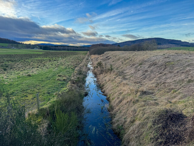
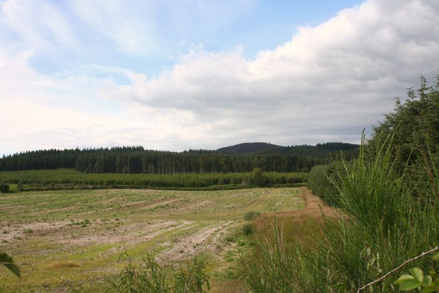
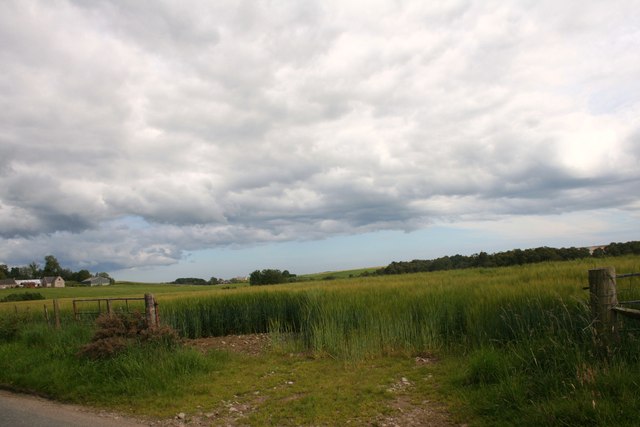
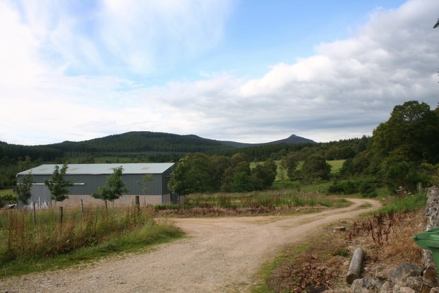
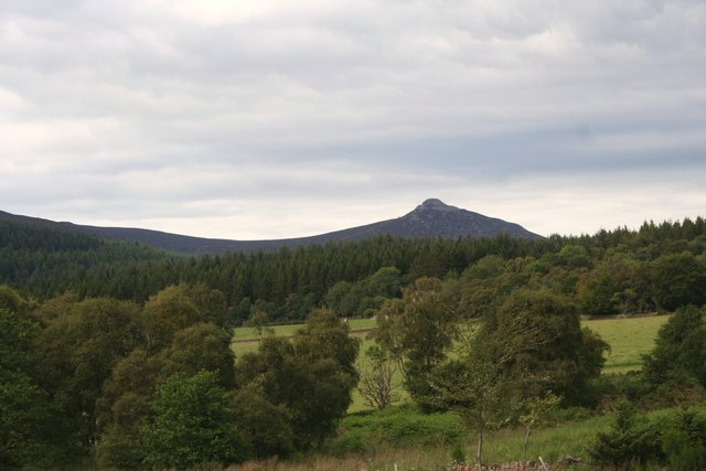
The village is known for its picturesque setting, surrounded by rolling hills, fertile farmland, and lush green fields. It has a population of around 200 residents, giving it a close-knit and friendly community atmosphere.

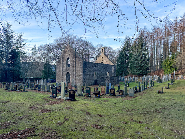
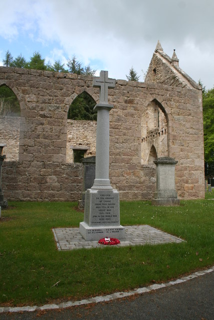
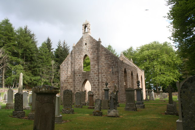
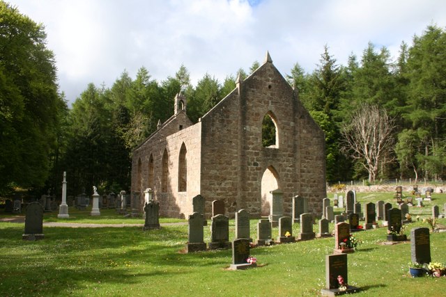
Blairdaff is steeped in history, with its origins dating back to the 12th century. The village is home to several historic buildings, including Blairdaff Parish Church, which was built in the 18th century and is a notable architectural landmark.

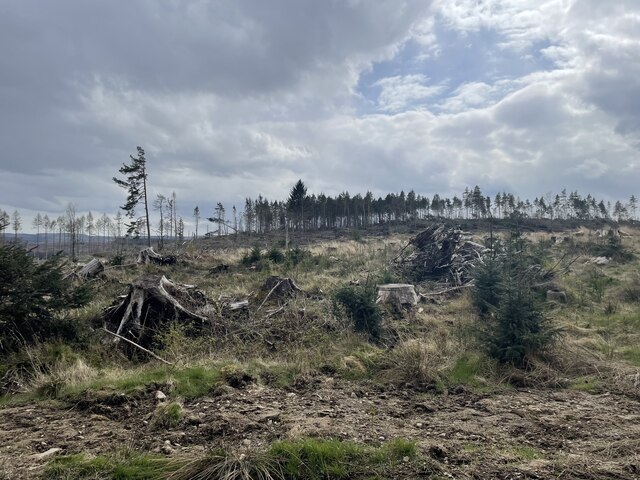
Agriculture plays a significant role in the local economy, as the fertile soil and favorable climate make it an ideal location for farming. The village is known for its thriving agriculture industry, with many residents engaged in farming and related activities.

Despite its small size, Blairdaff offers a range of amenities and services for its residents. These include a village hall, where various community events and gatherings take place, and a primary school, providing education for local children.

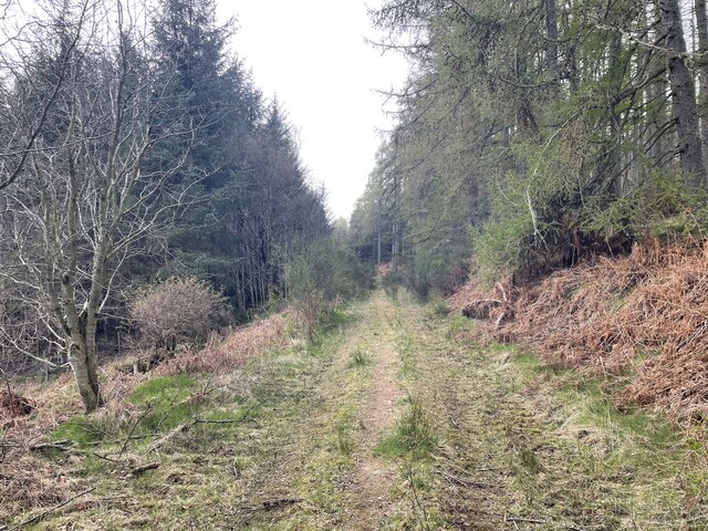
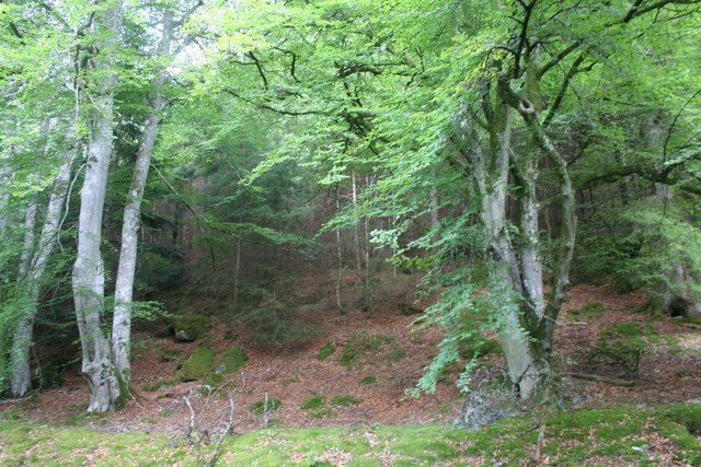
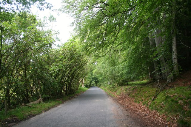
Blairdaff is also a popular destination for nature enthusiasts and outdoor lovers. The surrounding countryside offers ample opportunities for walking, hiking, and exploring the scenic landscapes. Additionally, the nearby River Don provides opportunities for fishing and wildlife spotting.

Overall, Blairdaff is a tranquil and idyllic village, offering a peaceful escape from the hustle and bustle of city life.

If you have any feedback on the listing, please let us know in the comments section below.
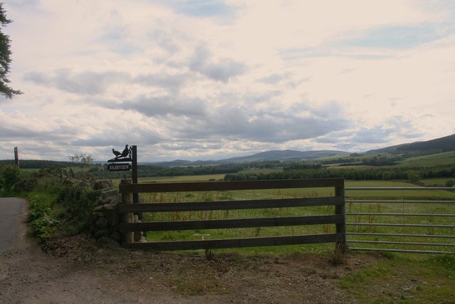
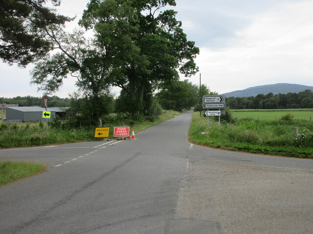
Blairdaff Images

Images are sourced within 2km of 57.248833/-2.50274 or Grid Reference NJ6917. Thanks to Geograph Open Source API. All images are credited.

Storm damaged trees
Storm damaged trees
Around the back of Scare hill Bennachie is a range of hills in Aberdeenshire, Scotland.It has several tops, the highest of which, Oxen Craig, has a height of 528 metres (1,732 ft). Though not particularly high, compared to other peaks within Scotland, the mountain is very prominent, owing to its isolation and the relative flatness of the surrounding terrain, and dominates the skyline from several viewpoints.
Around the back of Scare hill
Bennachie is a range of hills in Aberdeenshire, Scotland.It has several tops, the highest of which, Oxen Craig, has a height of 528 metres (1,732 ft). Though not particularly high, compared to other peaks within Scotland, the mountain is very prominent, owing to its isolation and the relative flatness of the surrounding terrain, and dominates the skyline from several viewpoints.
Scottish Water stuff
Burn of Blairdaff Geocaching is a type of global treasure hunt of people looking for caches, or hidden stashes of objects. Geocaching may also be described as a series of hide-and-seek games, where hiders provide online clues for seekers. Seekers use global positioning system (GPS) devices to find hidden caches
Burn of Blairdaff
Geocaching is a type of global treasure hunt of people looking for caches, or hidden stashes of objects. Geocaching may also be described as a series of hide-and-seek games, where hiders provide online clues for seekers. Seekers use global positioning system (GPS) devices to find hidden caches
Blairdaff kirk Geocaching is a type of global treasure hunt of people looking for caches, or hidden stashes of objects. Geocaching may also be described as a series of hide-and-seek games, where hiders provide online clues for seekers. Seekers use global positioning system (GPS) devices to find hidden caches
Blairdaff kirk
Geocaching is a type of global treasure hunt of people looking for caches, or hidden stashes of objects. Geocaching may also be described as a series of hide-and-seek games, where hiders provide online clues for seekers. Seekers use global positioning system (GPS) devices to find hidden caches
War Memorial at Blairdaff A memorial in the grounds of the ruined church at Blairdaff.
War Memorial at Blairdaff
A memorial in the grounds of the ruined church at Blairdaff.
Blairdaff Church The ruinous church at Blairdaff.
Blairdaff Church
The ruinous church at Blairdaff.
Blairdaff Churchyard The churchyard and earview of the ruined church at Blairdaff.
Blairdaff Churchyard
The churchyard and earview of the ruined church at Blairdaff.
Forest Edge The edge of the Bennachie Forest from the roadside.
Forest Edge
The edge of the Bennachie Forest from the roadside.
Bennachie Road The road bordering the Bennachie forest between Ramstone and Tilliehashlach.
Bennachie Road
The road bordering the Bennachie forest between Ramstone and Tilliehashlach.
Don and Paradise The River Don and Paradise Wood.
Don and Paradise
The River Don and Paradise Wood.
Farmland by Bairdaff Fields by woodland at Blairdaff with Scare Hill behind.
Farmland by Bairdaff
Fields by woodland at Blairdaff with Scare Hill behind.
Barley Field Barley in a field by Blairdaff.
Barley Field
Barley in a field by Blairdaff.
Fairview Farm Fairview farm by Blairdaff.
Fairview Farm
Fairview farm by Blairdaff.
Fairview Farm Sign The roadside sign for Fairview Farm beside a field gate.
Fairview Farm Sign
The roadside sign for Fairview Farm beside a field gate.
The View at Fairview A view over farmland and woodland to Bennachie from the appropriately named Fairview.
The View at Fairview
A view over farmland and woodland to Bennachie from the appropriately named Fairview.
Farmland to Scarehill Open farmland between Whitehill Wood and Scare Hill.
Farmland to Scarehill
Open farmland between Whitehill Wood and Scare Hill.
Road closed and diversion Road closed heading west near Fetternear Hall.
Road closed and diversion
Road closed heading west near Fetternear Hall.
Show me another place!

Blairdaff is located at Grid Ref: NJ6917 (Lat: 57.248833, Lng: -2.50274)

Unitary Authority: Aberdeenshire

Police Authority: North East

What 3 Words

///coping.public.spells. Near Kemnay, Aberdeenshire

Nearby Locations

Blairdaff

Related Wikis

Blairdaff

Blairdaff is a parish in Garioch, Aberdeenshire, Scotland, next to the villages of Kemnay and Monymusk. Blairdaff had a grocery store, a post office, and...

Bograxie

Bograxie is a farm in Aberdeenshire, Scotland. == References ==

House of Monymusk

The House of Monymusk is located on the outskirts of the Scottish village of Monymusk, in the Marr region of Aberdeenshire. The house is located near the...

Fetternear Palace

Fetternear Bishop's Palace is an archaeological site of what was one of the palaces (or residences) of the medieval bishops of Aberdeen. It is near Kemnay...

Nearby Amenities

Located within 500m of 57.248833,-2.50274
Blairdaff
Place: hamlet
Lat/Long: 57.2491643/-2.5049263
Power: pole
Lat/Long: 57.2461863/-2.4960254
Power: pole
Lat/Long: 57.2467485/-2.4961972
Power: pole
Lat/Long: 57.2473524/-2.4963953
Power: pole
Lat/Long: 57.2479587/-2.4965912
Power: pole
Lat/Long: 57.2485804/-2.4967872
Power: pole
Lat/Long: 57.248721/-2.4978528
Power: pole
Lat/Long: 57.2489163/-2.4991407
Power: pole
Lat/Long: 57.2491009/-2.5004177
Power: pole
Lat/Long: 57.2492927/-2.5017584
Power: pole
Lat/Long: 57.2495142/-2.5032203
Power: pole
Lat/Long: 57.2496309/-2.5040591
Power: pole
Lat/Long: 57.2497834/-2.5048913
Power: pole
Lat/Long: 57.2509464/-2.4969754
Power: pole
Lat/Long: 57.2511775/-2.4958504
Power: pole
Lat/Long: 57.2506951/-2.4953264
Power: pole
Lat/Long: 57.2499865/-2.4957866
Power: pole
Lat/Long: 57.249279/-2.4962951
The data included in this document is from www.openstreetmap.org. The data is made available under ODbL.

Have you been to Blairdaff?

Leave your review of Blairdaff below (or comments, questions and feedback).