Boreland Hill

Hill, Mountain in Perthshire

Scotland

Boreland Hill

Old fingerpost Near Doune on the south side of the River Teith is this pre Worboys fingerpost still standing by the wall opposite the B826.   It is sadly lacking its 3 fingers.   The lane leads down to the river.
Old fingerpost Credit: John Riddell

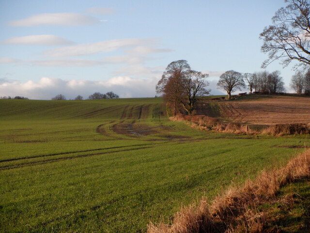
Boreland Hill is a prominent hill located in Perthshire, Scotland. Situated in the southern part of the region, it forms part of the picturesque landscape of the Scottish countryside. Rising to an elevation of approximately 486 meters (1,594 feet), Boreland Hill offers breathtaking views of the surrounding area.

The hill is characterized by its gently sloping sides and is covered in heather, grasses, and scattered patches of woodland. It is a popular destination for hikers and nature enthusiasts, who are drawn to its serene and tranquil atmosphere. The well-maintained trails provide a range of walking opportunities for visitors of all abilities, making it an accessible outdoor space for everyone to enjoy.

From the summit of Boreland Hill, one can admire the stunning vistas of the surrounding Perthshire countryside, with rolling hills, lush green valleys, and sparkling lochs stretching out as far as the eye can see. On a clear day, it is even possible to catch a glimpse of the distant peaks of the Scottish Highlands.

Boreland Hill is also known for its rich biodiversity, with various species of plants, birds, and wildlife calling it home. The hill provides a habitat for a range of bird species, including buzzards, kestrels, and peregrine falcons, making it a haven for birdwatchers.

Overall, Boreland Hill offers a unique blend of natural beauty, recreational opportunities, and diverse wildlife, making it a must-visit destination for those exploring the Perthshire region.

If you have any feedback on the listing, please let us know in the comments section below.

Boreland Hill Images

Images are sourced within 2km of 56.169977/-4.0590814 or Grid Reference NS7299. Thanks to Geograph Open Source API. All images are credited.

Old fingerpost Near Doune on the south side of the River Teith is this pre Worboys fingerpost still standing by the wall opposite the B826.   It is sadly lacking its 3 fingers.   The lane leads down to the river.
Old fingerpost
Near Doune on the south side of the River Teith is this pre Worboys fingerpost still standing by the wall opposite the B826. It is sadly lacking its 3 fingers. The lane leads down to the river.
Old fingerpost This is a close up of the top of the old signpost on the A84 just south of the River Teith at Doune.  The shape of the post top, the size of the ball finial and the way the fingers were attached shows this post was made at the Grangemouth Iron Works.  At a later date another finger, also now lost, had been added lower down the post.

Milestone Society National ID: STL_NN7201
Old fingerpost
This is a close up of the top of the old signpost on the A84 just south of the River Teith at Doune. The shape of the post top, the size of the ball finial and the way the fingers were attached shows this post was made at the Grangemouth Iron Works. At a later date another finger, also now lost, had been added lower down the post. Milestone Society National ID: STL_NN7201
Former tollhouse On the A84 south of Doune at the B826 junction is this former tollhouse known as Loch-Hills Wood which may date from about 1825.  On the OS 1st Edition it is noted that there is a 'weighing machine'.  In 2009 it was lived in and well-cared for.   By 2021 it was empty and deteriorating.   However it is to be renovated, hopefully, in 2022.   It is B Listed LB8412 and its Canmore reference is 363352.
Former tollhouse
On the A84 south of Doune at the B826 junction is this former tollhouse known as Loch-Hills Wood which may date from about 1825. On the OS 1st Edition it is noted that there is a 'weighing machine'. In 2009 it was lived in and well-cared for. By 2021 it was empty and deteriorating. However it is to be renovated, hopefully, in 2022. It is B Listed LB8412 and its Canmore reference is 363352.
Doune Castle The Royal Hunting Lodge, Doune Castle.
Doune Castle
The Royal Hunting Lodge, Doune Castle.
Winter cereals, Deanston
A84 towards Doune
A84 towards Doune
B8032 near Deanston
B8032 near Deanston
B826 at Causewayend
B826 at Causewayend
Doune Castle Ruined tower house above the River Teith.
Doune Castle
Ruined tower house above the River Teith.
River Teith Autumn on the River Teith by Doune Castle.
River Teith
Autumn on the River Teith by Doune Castle.
Kilmadock Cemetery
Kilmadock Cemetery
Inverardoch Mains (farm) Features an interesting tower which seems windowless
Inverardoch Mains (farm)
Features an interesting tower which seems windowless
Loch Watston White water-lilies at the southern end of the loch.
Loch Watston
White water-lilies at the southern end of the loch.
Yellow iris Growing in a damp field/woodland margin west of Loch Watston.
Yellow iris
Growing in a damp field/woodland margin west of Loch Watston.
Doune Castle
Doune Castle
Doune Castle
Doune Castle
Doune Castle
Doune Castle
Rosebay Willow Herb Fields off the A84 just before Doune
Rosebay Willow Herb
Fields off the A84 just before Doune
Show me another place!

Boreland Hill is located at Grid Ref: NS7299 (Lat: 56.169977, Lng: -4.0590814)

Unitary Authority: Stirling

Police Authority: Forth Valley

What 3 Words

///february.optimists.florists. Near Doune, Stirling

Related Wikis

Menteith

Menteith or Monteith (Scottish Gaelic: Mòine Tèadhaich), a district of south Perthshire, Scotland, roughly comprises the territory between the Teith and...

Stirling torcs

The Stirling torcs make up a hoard of four gold Iron Age torcs, a type of necklace, all of which date to between 300 and 100 BC and which were buried deliberately...

Kincardine-in-Menteith

Kincardine is a civil parish in the Scottish council area of Stirling and the former county of Perthshire in the historic district of Menteith. It lies...

Blair Drummond

Blair Drummond is a small rural community 5 miles (8 kilometres) northwest of Stirling in the Stirling district of Scotland, predominantly located along...

Blair Drummond Safari Park

Blair Drummond Safari Park is a family visitor attraction located near Stirling in Scotland. It opened to the public on 15 May 1970 and is home to over...
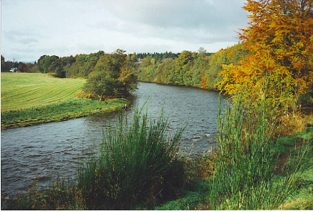
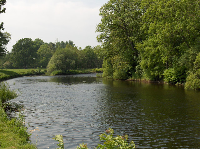
Ardoch Burn

The Ardoch Burn is a stream in Stirling council area, Scotland, which flows from the Braes Of Doune into the River Teith at Inverardoch, just behind Doune...
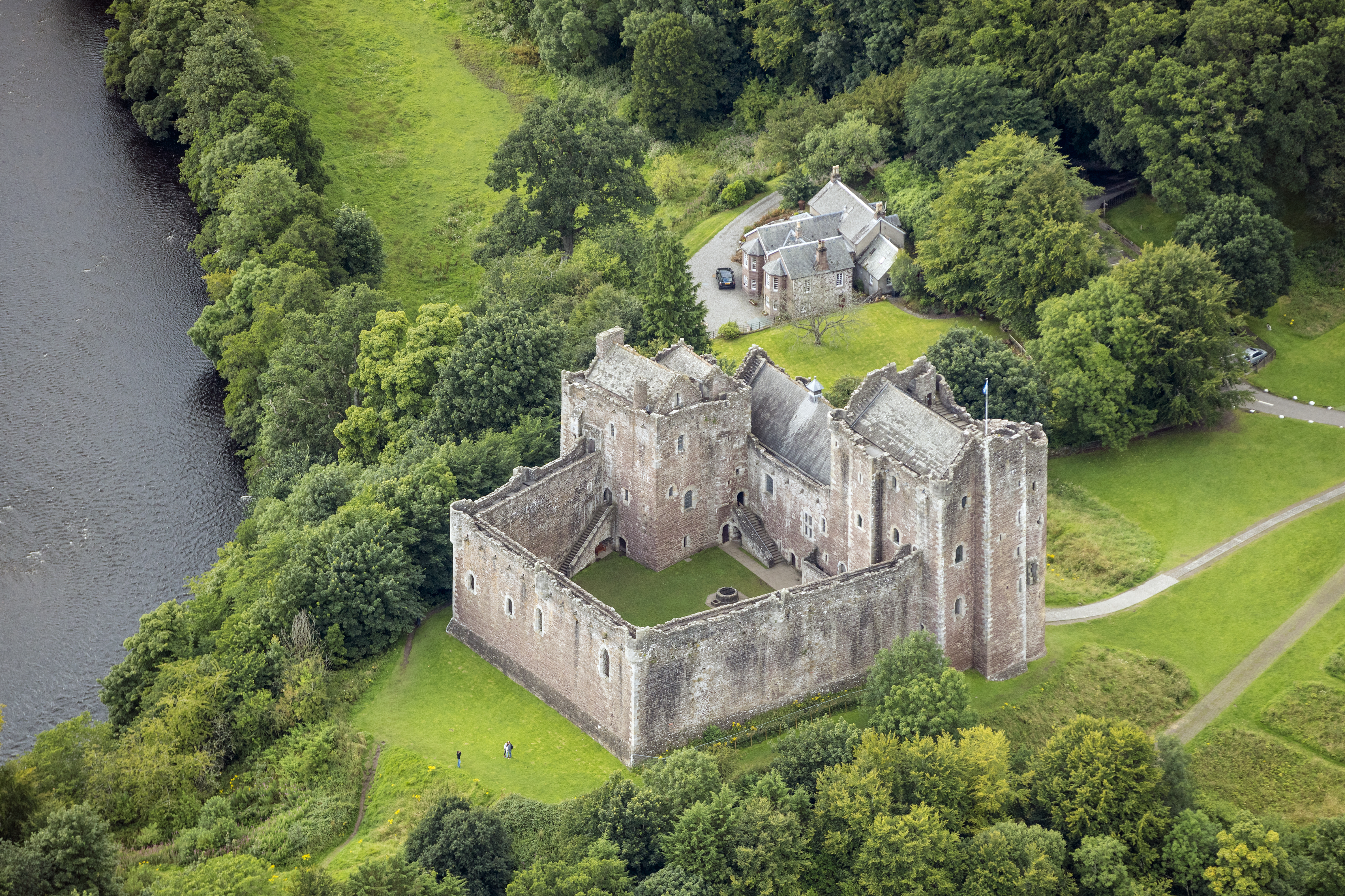
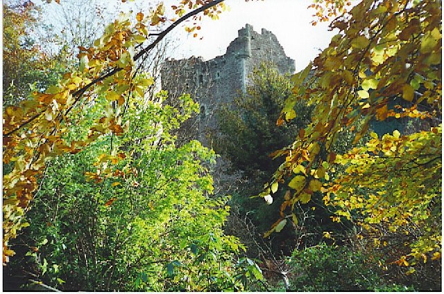
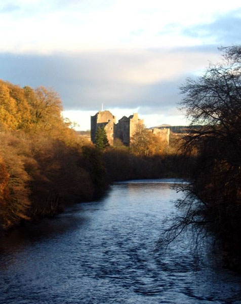
Doune Castle

Doune Castle is a medieval stronghold near the village of Doune, in the Stirling council area of central Scotland and the historic county of Perthshire...

Doune

Doune (; from Scottish Gaelic: An Dùn, meaning 'the fort') is a burgh within Perthshire. The town is administered by Stirling Council. Doune is assigned...

Nearby Amenities

Located within 500m of 56.169977,-4.0590814
Power: pole
Lat/Long: 56.1712378/-4.0522987
Power: pole
Lat/Long: 56.1714614/-4.0536228
Power: pole
Lat/Long: 56.1716699/-4.054905
Power: pole
Lat/Long: 56.1718993/-4.0562981
Power: pole
Lat/Long: 56.1722195/-4.0576933
Power: pole
Lat/Long: 56.1725153/-4.0589547
Power: pole
Lat/Long: 56.1728227/-4.0602557
Power: pole
Lat/Long: 56.1731382/-4.06163
Power: pole
Lat/Long: 56.1735551/-4.0545808
Power: pole
Lat/Long: 56.1708535/-4.0516712
Power: pole
Lat/Long: 56.1716198/-4.0523301
Power: pole
Lat/Long: 56.172287/-4.0528991
Power: pole
Lat/Long: 56.1729147/-4.0537253
Power: pole
Lat/Long: 56.1731278/-4.0609711
Power: pole
Lat/Long: 56.1733781/-4.0596679
Power: pole
Lat/Long: 56.1736378/-4.0582958
Power: pole
Lat/Long: 56.1738951/-4.0568943
Power: pole
Lat/Long: 56.1731417/-4.0631779
Power: pole
Lat/Long: 56.1731464/-4.0644392
Power: pole
Lat/Long: 56.1677651/-4.0565105
Power: pole
Lat/Long: 56.1681366/-4.0558327
Power: pole
Lat/Long: 56.1685559/-4.0550651
Power: pole
Lat/Long: 56.1689425/-4.0543811
Power: pole
Lat/Long: 56.1694864/-4.0533791
Power: pole
Lat/Long: 56.1701723/-4.0532975
Power: pole
Lat/Long: 56.1709805/-4.0531867
Power: pole
Lat/Long: 56.1713543/-4.05267
Post Box
Collection Plate: CP5D
Collection Plate Date: 2023-01-05
Collection Times: Mo-Fr 09:00; Sa 07:00
Manufacturer: W.T.Allen & Co. London
Operator: Royal Mail
Post Box Mounting: brick_pillar
Post Box Type: wall
Ref: FK9 52D
Royal Cypher: EVIIR
Source: survey
Lat/Long: 56.1685461/-4.0521772
The data included in this document is from www.openstreetmap.org. The data is made available under ODbL.

Have you been to Boreland Hill?

Leave your review of Boreland Hill below (or comments, questions and feedback).