Blackwood

Settlement in Ross-shire

Scotland

Blackwood

Coulags seen from the railway The settlement is at the end of a Hill Track to Torridon.
Coulags seen from the railway Credit: Julian Paren

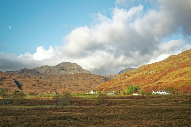
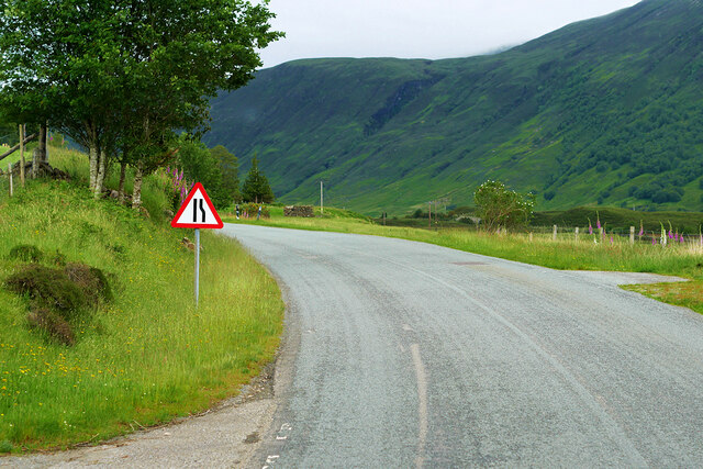
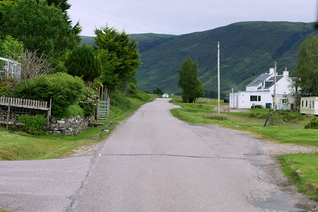
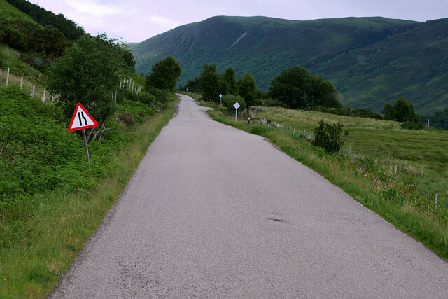
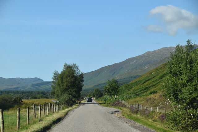
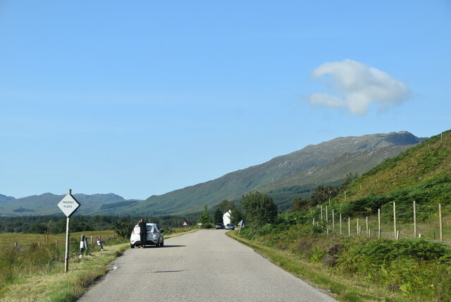
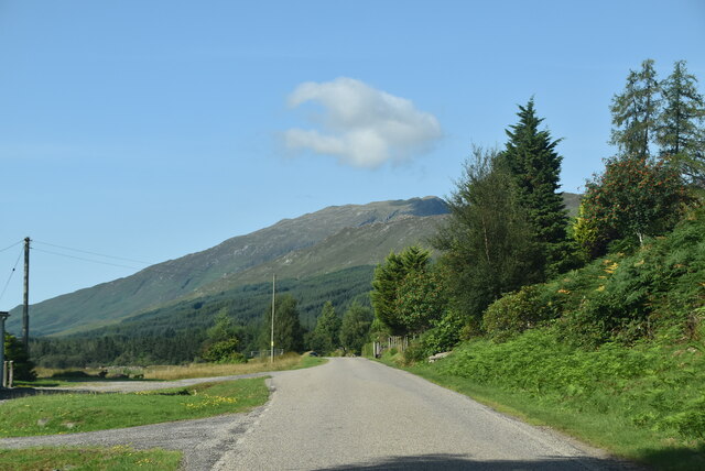
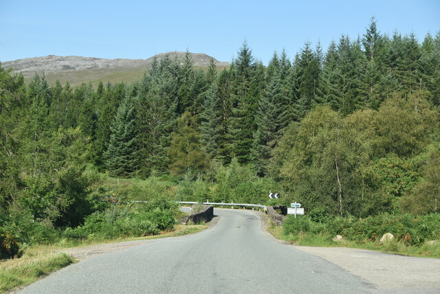
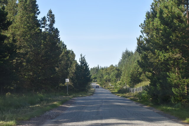
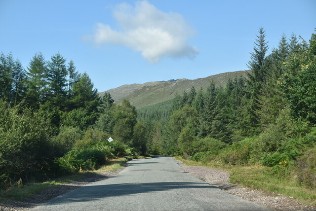
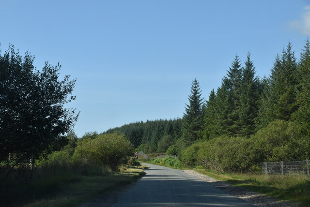
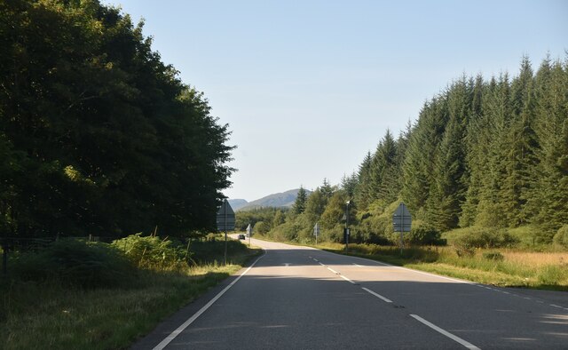
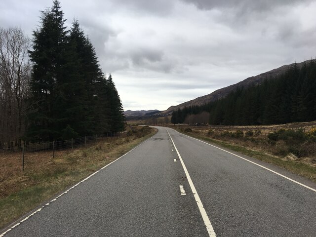
Blackwood is a small village located in Ross-shire, a historic county in the Scottish Highlands. Situated approximately 20 miles northwest of Inverness, Blackwood is nestled in a picturesque setting surrounded by rolling hills, dense forests, and tranquil lochs. The village itself is characterized by its charming stone cottages, well-maintained gardens, and a close-knit community atmosphere.

Despite its small size, Blackwood offers a range of amenities and services to its residents. The village boasts a village hall, a post office, and a local convenience store, providing essential goods and services to the community. Additionally, there is a primary school in the nearby vicinity, ensuring that families have access to quality education for their children.

The natural beauty of Blackwood is a major draw for both locals and visitors alike. The surrounding landscape offers numerous opportunities for outdoor activities such as fishing, hiking, and wildlife spotting. Nearby lochs and rivers are renowned for their fishing opportunities, attracting anglers from far and wide. The area is also home to a variety of wildlife, including red deer, golden eagles, and otters, making it a haven for nature enthusiasts.

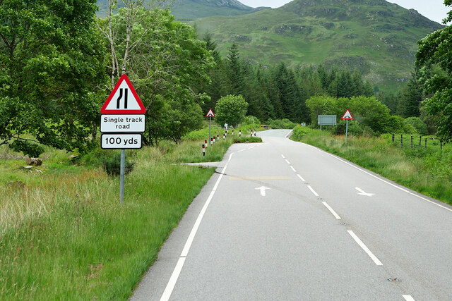
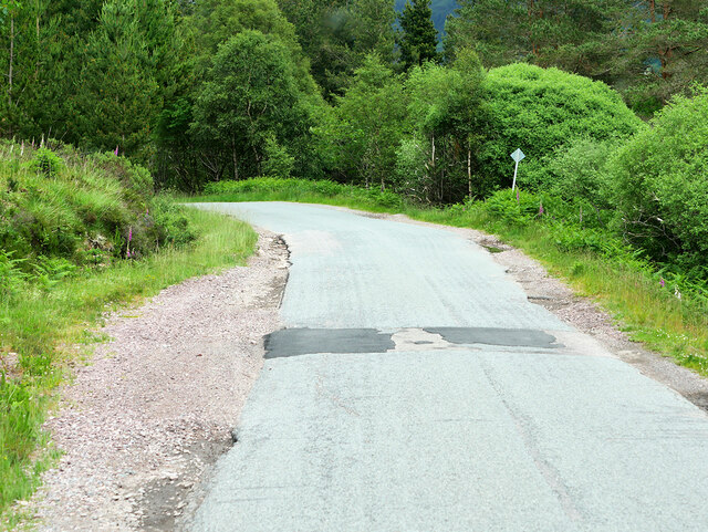
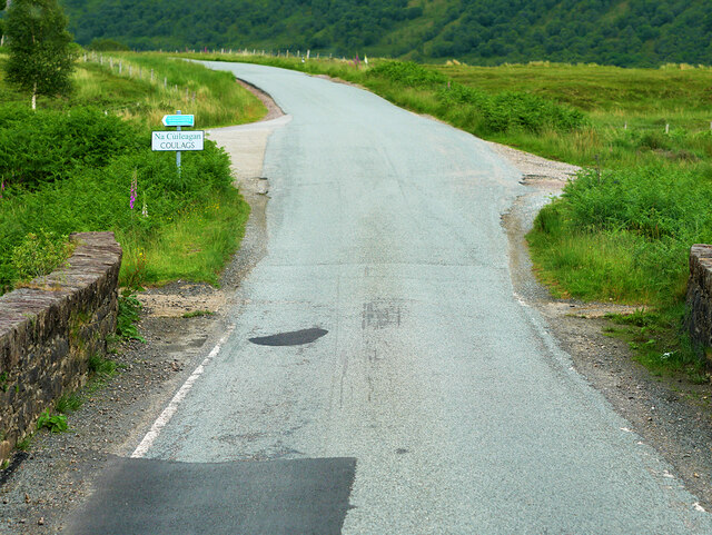
Blackwood is well-connected to the wider region via a network of roads, making it easily accessible for those wishing to explore the surrounding areas. The village's proximity to Inverness also provides residents with access to a wider range of amenities, including shopping centers, healthcare facilities, and cultural attractions.

Overall, Blackwood offers a peaceful and idyllic retreat for those seeking a slower pace of life amidst stunning natural surroundings.

If you have any feedback on the listing, please let us know in the comments section below.
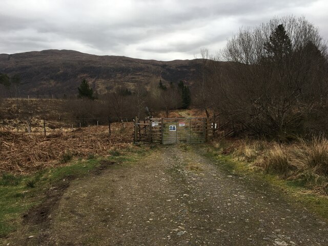
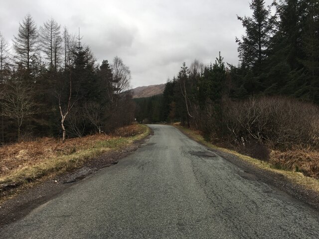
Blackwood Images

Images are sourced within 2km of 57.439434/-5.4037706 or Grid Reference NG9543. Thanks to Geograph Open Source API. All images are credited.

Coulags seen from the railway The settlement is at the end of a Hill Track to Torridon.
Coulags seen from the railway
The settlement is at the end of a Hill Track to Torridon.
A890 Eastbound The A890 is a non-primary cross-country route in sparsely populated, mountainous terrain from Lochalsh and Skye on the west coast of the Highlands to Achnasheen where it joins the A832 to Inverness. Like many Highland roads, the A890 was entirely single track until the 1960s, but road improvements in recent years (along with improvements on the A832) have made it increasingly popular as an alternative route between Inverness and the Isle of Skye, avoiding the A82 along Loch Ness. It is also an important route for residents of the Lochalsh, Applecross and Strathcarron areas, connecting them to the services of  Kyle of Lochalsh , as well as the High School in Plockton.
A890 Eastbound
The A890 is a non-primary cross-country route in sparsely populated, mountainous terrain from Lochalsh and Skye on the west coast of the Highlands to Achnasheen where it joins the A832 to Inverness. Like many Highland roads, the A890 was entirely single track until the 1960s, but road improvements in recent years (along with improvements on the A832) have made it increasingly popular as an alternative route between Inverness and the Isle of Skye, avoiding the A82 along Loch Ness. It is also an important route for residents of the Lochalsh, Applecross and Strathcarron areas, connecting them to the services of Kyle of Lochalsh , as well as the High School in Plockton.
Passing Place on the A890 The A890 is a non-primary cross-country route in sparsely populated, mountainous terrain from Lochalsh and Skye on the west coast of the Highlands to Achnasheen where it joins the A832 to Inverness. Like many Highland roads, the A890 was entirely single track until the 1960s, but road improvements in recent years (along with improvements on the A832) have made it increasingly popular as an alternative route between Inverness and the Isle of Skye, avoiding the A82 along Loch Ness. It is also an important route for residents of the Lochalsh, Applecross and Strathcarron areas, connecting them to the services of  Kyle of Lochalsh , as well as the High School in Plockton.
Passing Place on the A890
The A890 is a non-primary cross-country route in sparsely populated, mountainous terrain from Lochalsh and Skye on the west coast of the Highlands to Achnasheen where it joins the A832 to Inverness. Like many Highland roads, the A890 was entirely single track until the 1960s, but road improvements in recent years (along with improvements on the A832) have made it increasingly popular as an alternative route between Inverness and the Isle of Skye, avoiding the A82 along Loch Ness. It is also an important route for residents of the Lochalsh, Applecross and Strathcarron areas, connecting them to the services of Kyle of Lochalsh , as well as the High School in Plockton.
A890, Coulags Bridge The A890 is a non-primary cross-country route in sparsely populated, mountainous terrain from Lochalsh and Skye on the west coast of the Highlands to Achnasheen where it joins the A832 to Inverness. Like many Highland roads, the A890 was entirely single track until the 1960s, but road improvements in recent years (along with improvements on the A832) have made it increasingly popular as an alternative route between Inverness and the Isle of Skye, avoiding the A82 along Loch Ness. It is also an important route for residents of the Lochalsh, Applecross and Strathcarron areas, connecting them to the services of  Kyle of Lochalsh , as well as the High School in Plockton.
A890, Coulags Bridge
The A890 is a non-primary cross-country route in sparsely populated, mountainous terrain from Lochalsh and Skye on the west coast of the Highlands to Achnasheen where it joins the A832 to Inverness. Like many Highland roads, the A890 was entirely single track until the 1960s, but road improvements in recent years (along with improvements on the A832) have made it increasingly popular as an alternative route between Inverness and the Isle of Skye, avoiding the A82 along Loch Ness. It is also an important route for residents of the Lochalsh, Applecross and Strathcarron areas, connecting them to the services of Kyle of Lochalsh , as well as the High School in Plockton.
A890 near Coulags The A890 is a non-primary cross-country route in sparsely populated, mountainous terrain from Lochalsh and Skye on the west coast of the Highlands to Achnasheen where it joins the A832 to Inverness. Like many Highland roads, the A890 was entirely single track until the 1960s, but road improvements in recent years (along with improvements on the A832) have made it increasingly popular as an alternative route between Inverness and the Isle of Skye, avoiding the A82 along Loch Ness. It is also an important route for residents of the Lochalsh, Applecross and Strathcarron areas, connecting them to the services of  Kyle of Lochalsh , as well as the High School in Plockton.
A890 near Coulags
The A890 is a non-primary cross-country route in sparsely populated, mountainous terrain from Lochalsh and Skye on the west coast of the Highlands to Achnasheen where it joins the A832 to Inverness. Like many Highland roads, the A890 was entirely single track until the 1960s, but road improvements in recent years (along with improvements on the A832) have made it increasingly popular as an alternative route between Inverness and the Isle of Skye, avoiding the A82 along Loch Ness. It is also an important route for residents of the Lochalsh, Applecross and Strathcarron areas, connecting them to the services of Kyle of Lochalsh , as well as the High School in Plockton.
A890, Strath View The A890 is a non-primary cross-country route in sparsely populated, mountainous terrain from Lochalsh and Skye on the west coast of the Highlands to Achnasheen where it joins the A832 to Inverness. Like many Highland roads, the A890 was entirely single track until the 1960s, but road improvements in recent years (along with improvements on the A832) have made it increasingly popular as an alternative route between Inverness and the Isle of Skye, avoiding the A82 along Loch Ness. It is also an important route for residents of the Lochalsh, Applecross and Strathcarron areas, connecting them to the services of  Kyle of Lochalsh , as well as the High School in Plockton.
A890, Strath View
The A890 is a non-primary cross-country route in sparsely populated, mountainous terrain from Lochalsh and Skye on the west coast of the Highlands to Achnasheen where it joins the A832 to Inverness. Like many Highland roads, the A890 was entirely single track until the 1960s, but road improvements in recent years (along with improvements on the A832) have made it increasingly popular as an alternative route between Inverness and the Isle of Skye, avoiding the A82 along Loch Ness. It is also an important route for residents of the Lochalsh, Applecross and Strathcarron areas, connecting them to the services of Kyle of Lochalsh , as well as the High School in Plockton.
A890 East of Coulags The A890 is a non-primary cross-country route in sparsely populated, mountainous terrain from Lochalsh and Skye on the west coast of the Highlands to Achnasheen where it joins the A832 to Inverness. Like many Highland roads, the A890 was entirely single track until the 1960s, but road improvements in recent years (along with improvements on the A832) have made it increasingly popular as an alternative route between Inverness and the Isle of Skye, avoiding the A82 along Loch Ness. It is also an important route for residents of the Lochalsh, Applecross and Strathcarron areas, connecting them to the services of  Kyle of Lochalsh , as well as the High School in Plockton.
A890 East of Coulags
The A890 is a non-primary cross-country route in sparsely populated, mountainous terrain from Lochalsh and Skye on the west coast of the Highlands to Achnasheen where it joins the A832 to Inverness. Like many Highland roads, the A890 was entirely single track until the 1960s, but road improvements in recent years (along with improvements on the A832) have made it increasingly popular as an alternative route between Inverness and the Isle of Skye, avoiding the A82 along Loch Ness. It is also an important route for residents of the Lochalsh, Applecross and Strathcarron areas, connecting them to the services of Kyle of Lochalsh , as well as the High School in Plockton.
A890, Strath Carron The A890 runs 32 miles from Achnasheen to Auchtertyre.
<span class="nowrap"><a title="https://www.sabre-roads.org.uk/wiki/index.php?title=A890" rel="nofollow ugc noopener" href="https://www.sabre-roads.org.uk/wiki/index.php?title=A890">Link</a><img style="margin-left:2px;" alt="External link" title="External link - shift click to open in new window" src="https://s1.geograph.org.uk/img/external.png" width="10" height="10"/></span>
A890, Strath Carron
The A890 runs 32 miles from Achnasheen to Auchtertyre. LinkExternal link
A890, Coulags The A890 runs 32 miles from Achnasheen to Auchtertyre.
<span class="nowrap"><a title="https://www.sabre-roads.org.uk/wiki/index.php?title=A890" rel="nofollow ugc noopener" href="https://www.sabre-roads.org.uk/wiki/index.php?title=A890">Link</a><img style="margin-left:2px;" alt="External link" title="External link - shift click to open in new window" src="https://s1.geograph.org.uk/img/external.png" width="10" height="10"/></span>
A890, Coulags
The A890 runs 32 miles from Achnasheen to Auchtertyre. LinkExternal link
A890 passing Coulags The A890 runs 32 miles from Achnasheen to Auchtertyre.
<span class="nowrap"><a title="https://www.sabre-roads.org.uk/wiki/index.php?title=A890" rel="nofollow ugc noopener" href="https://www.sabre-roads.org.uk/wiki/index.php?title=A890">Link</a><img style="margin-left:2px;" alt="External link" title="External link - shift click to open in new window" src="https://s1.geograph.org.uk/img/external.png" width="10" height="10"/></span>
A890 passing Coulags
The A890 runs 32 miles from Achnasheen to Auchtertyre. LinkExternal link
A890, Coulags Bridge The A890 runs 32 miles from Achnasheen to Auchtertyre.
<span class="nowrap"><a title="https://www.sabre-roads.org.uk/wiki/index.php?title=A890" rel="nofollow ugc noopener" href="https://www.sabre-roads.org.uk/wiki/index.php?title=A890">Link</a><img style="margin-left:2px;" alt="External link" title="External link - shift click to open in new window" src="https://s1.geograph.org.uk/img/external.png" width="10" height="10"/></span>
A890, Coulags Bridge
The A890 runs 32 miles from Achnasheen to Auchtertyre. LinkExternal link
Forested section of A890 The A890 runs 32 miles from Achnasheen to Auchtertyre.
<span class="nowrap"><a title="https://www.sabre-roads.org.uk/wiki/index.php?title=A890" rel="nofollow ugc noopener" href="https://www.sabre-roads.org.uk/wiki/index.php?title=A890">Link</a><img style="margin-left:2px;" alt="External link" title="External link - shift click to open in new window" src="https://s1.geograph.org.uk/img/external.png" width="10" height="10"/></span>
Forested section of A890
The A890 runs 32 miles from Achnasheen to Auchtertyre. LinkExternal link
A890, westbound The A890 runs 32 miles from Achnasheen to Auchtertyre.
<span class="nowrap"><a title="https://www.sabre-roads.org.uk/wiki/index.php?title=A890" rel="nofollow ugc noopener" href="https://www.sabre-roads.org.uk/wiki/index.php?title=A890">Link</a><img style="margin-left:2px;" alt="External link" title="External link - shift click to open in new window" src="https://s1.geograph.org.uk/img/external.png" width="10" height="10"/></span>
A890, westbound
The A890 runs 32 miles from Achnasheen to Auchtertyre. LinkExternal link
A890 The A890 runs 32 miles from Achnasheen to Auchtertyre.
<span class="nowrap"><a title="https://www.sabre-roads.org.uk/wiki/index.php?title=A890" rel="nofollow ugc noopener" href="https://www.sabre-roads.org.uk/wiki/index.php?title=A890">Link</a><img style="margin-left:2px;" alt="External link" title="External link - shift click to open in new window" src="https://s1.geograph.org.uk/img/external.png" width="10" height="10"/></span>
A890
The A890 runs 32 miles from Achnasheen to Auchtertyre. LinkExternal link
A890 near Strathcarron
Gated forestry entrance in Strath Carron
A890 near Coulags Bridge
Show me another place!

Blackwood is located at Grid Ref: NG9543 (Lat: 57.439434, Lng: -5.4037706)

Unitary Authority: Highland

Police Authority: Highlands and Islands

What 3 Words

///column.snowballs.herbs. Near Lochcarron, Highland

Related Wikis

Coulags

Coulags (Scottish Gaelic: Na Cùileagan) is a small hamlet in Glen Carron in Strathcarron, west Ross-shire, Scottish Highlands and is in the Scottish...

Strathcarron, Highland

Strathcarron (Scottish Gaelic: Srath Carrann) is a hamlet, in the Highland council area of Scotland. == Geography == It is situated at the head of the...

River Carron, Wester Ross

River Carron (Scottish Gaelic: Carrann, pronounced [ˈkʰaᵲən̴̪]) is a west coast river in Wester Ross, in the Highlands of Scotland. The river rises in...

Strathcarron railway station

Strathcarron railway station is a remote railway station on the Kyle of Lochalsh Line, serving the small village of Strathcarron and the larger village...

Balnacra

Balnacra (Scottish Gaelic: Beul-àtha na Crà) is a village in Strathcarron, Ross-Shire, Scotland, roughly seven miles from the village of Lochcarron. It...

Loch Dùghaill

Loch Dùghaill (also anglicised as Loch Doule or Loch Doughaill) is a freshwater tidal loch on the River Carron in Wester Ross, Scotland. The A890 road...
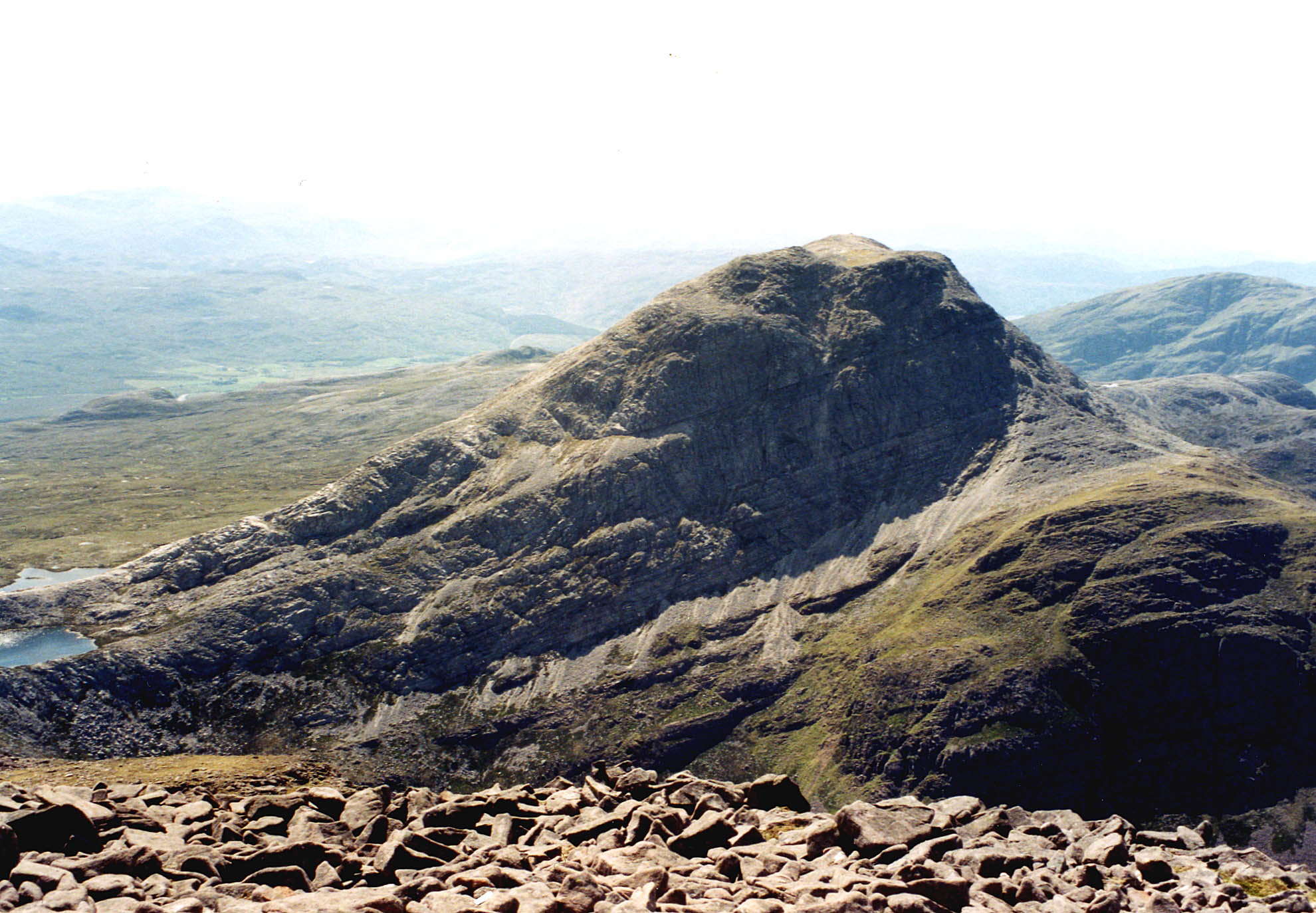
Fuar Tholl

Fuar Tholl is a mountain in the highlands of Scotland. The mountain is situated in the Coulin deer forest 21 km SW of Achnasheen in the Wester Ross region...

An Ruadh-stac

An Ruadh-stac is a Scottish mountain situated in the Wester Ross region of the Highland council area. It is located 26 km north east of Kyle of Lochalsh...

Nearby Amenities

Located within 500m of 57.439434,-5.4037706
Barrier: cattle_grid
Source: survey
Lat/Long: 57.4368267/-5.4073518
Access: private
Crossing Barrier: no
Railway: level_crossing
Lat/Long: 57.4394409/-5.4038454
Power: pole
Lat/Long: 57.4395337/-5.3956819
Power: pole
Lat/Long: 57.4390342/-5.3972992
Power: pole
Lat/Long: 57.4386777/-5.3984553
Power: pole
Lat/Long: 57.4381594/-5.4001987
Power: pole
Lat/Long: 57.4376989/-5.4016793
Power: pole
Lat/Long: 57.4372211/-5.4032108
Power: pole
Lat/Long: 57.4364675/-5.4047182
Power: pole
Lat/Long: 57.4359131/-5.4058045
Power: pole
Lat/Long: 57.43534/-5.4069498
Crossing Barrier: no
Railway: level_crossing
Lat/Long: 57.4426587/-5.4000502
Power: pole
Lat/Long: 57.4377453/-5.4042753
Material: wood
Power: pole
Lat/Long: 57.4381816/-5.4051389
Power: pole
Lat/Long: 57.4400883/-5.399955
Power: pole
Lat/Long: 57.4393886/-5.3992323
The data included in this document is from www.openstreetmap.org. The data is made available under ODbL.

Have you been to Blackwood?

Leave your review of Blackwood below (or comments, questions and feedback).