Benton Square

Settlement in Northumberland

England

Benton Square
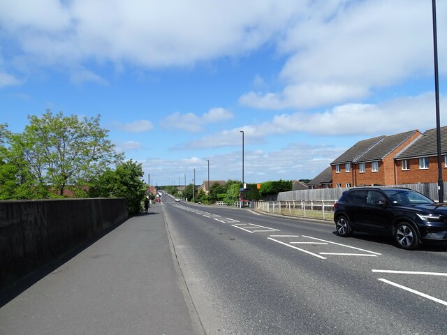
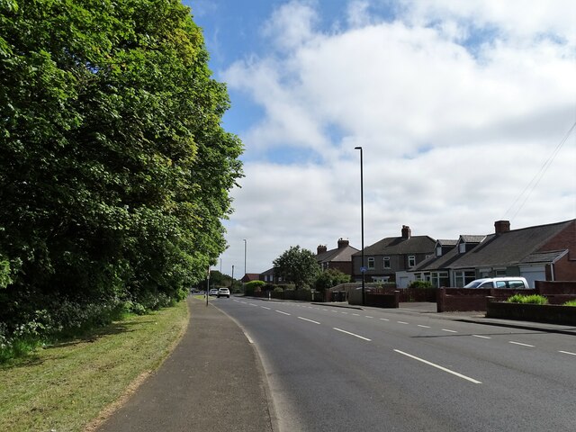
Great Lime Road, Palmersville View looking west along this very long straight road in the northern suburbs of Newcastle.
Great Lime Road, Palmersville Credit: Robert Graham

Benton Square is a charming village located in the county of Northumberland, situated in the northeast region of England. Nestled amidst picturesque countryside, this quaint village offers a serene and idyllic setting for its residents and visitors.

The village is known for its historic significance, with records dating back to the 12th century. Its rich heritage can be seen in its architecture, with several buildings showcasing stunning examples of Georgian and Victorian design. The village center is dominated by a beautiful village square, surrounded by local shops, cafes, and a few small businesses, creating a vibrant and friendly atmosphere.

Nature enthusiasts will be delighted by the surrounding countryside, with rolling hills, lush green meadows, and enchanting woodland areas. Benton Square also benefits from its close proximity to the Northumberland National Park, offering ample opportunities for outdoor activities such as hiking, cycling, and wildlife spotting.

The community in Benton Square is tight-knit and welcoming, with a strong sense of community spirit. The village hosts various events and festivals throughout the year, providing locals and visitors with a chance to come together and celebrate.

With its peaceful ambiance, historical charm, and natural beauty, Benton Square is a hidden gem in Northumberland, attracting those seeking a tranquil escape from the hustle and bustle of city life.

If you have any feedback on the listing, please let us know in the comments section below.

Benton Square Images

Images are sourced within 2km of 55.02489/-1.5307265 or Grid Reference NZ3070. Thanks to Geograph Open Source API. All images are credited.
Great Lime Road, Palmersville View looking west along this very long straight road in the northern suburbs of Newcastle.
Great Lime Road, Palmersville
View looking west along this very long straight road in the northern suburbs of Newcastle.
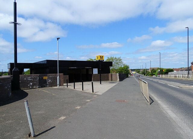
Palmersville Metro Station Located on Great Lime Road, this station was opened in 1986. This section of the  Metro line itself was opened in 1980, using mainly former stations on the old electrical line, but there wasn't one on this section, so this is a new station entirely.
Palmersville Metro Station
Located on Great Lime Road, this station was opened in 1986. This section of the Metro line itself was opened in 1980, using mainly former stations on the old electrical line, but there wasn't one on this section, so this is a new station entirely.
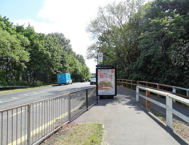
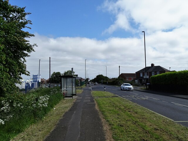
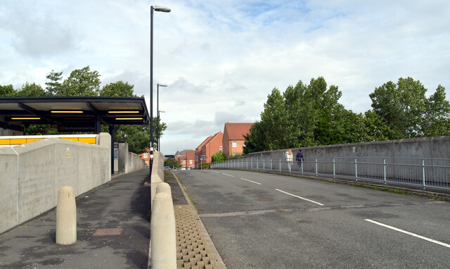
Bus stop on Great Lime Road Beside Palmersville Metro Station at Benton Square.
Bus stop on Great Lime Road
Beside Palmersville Metro Station at Benton Square.
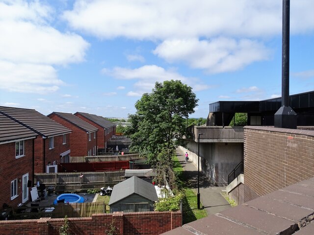
Houses beside the metro Gardens right beside Palmersville Metro Station. View looking west from the bridge over the line.
Houses beside the metro
Gardens right beside Palmersville Metro Station. View looking west from the bridge over the line.
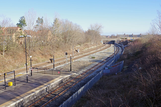
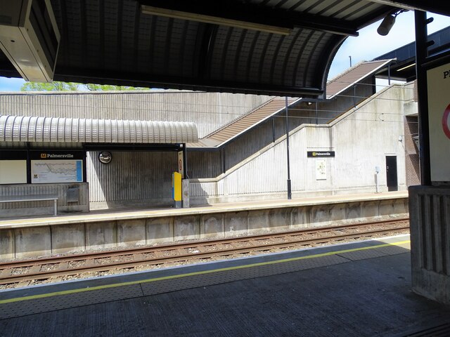
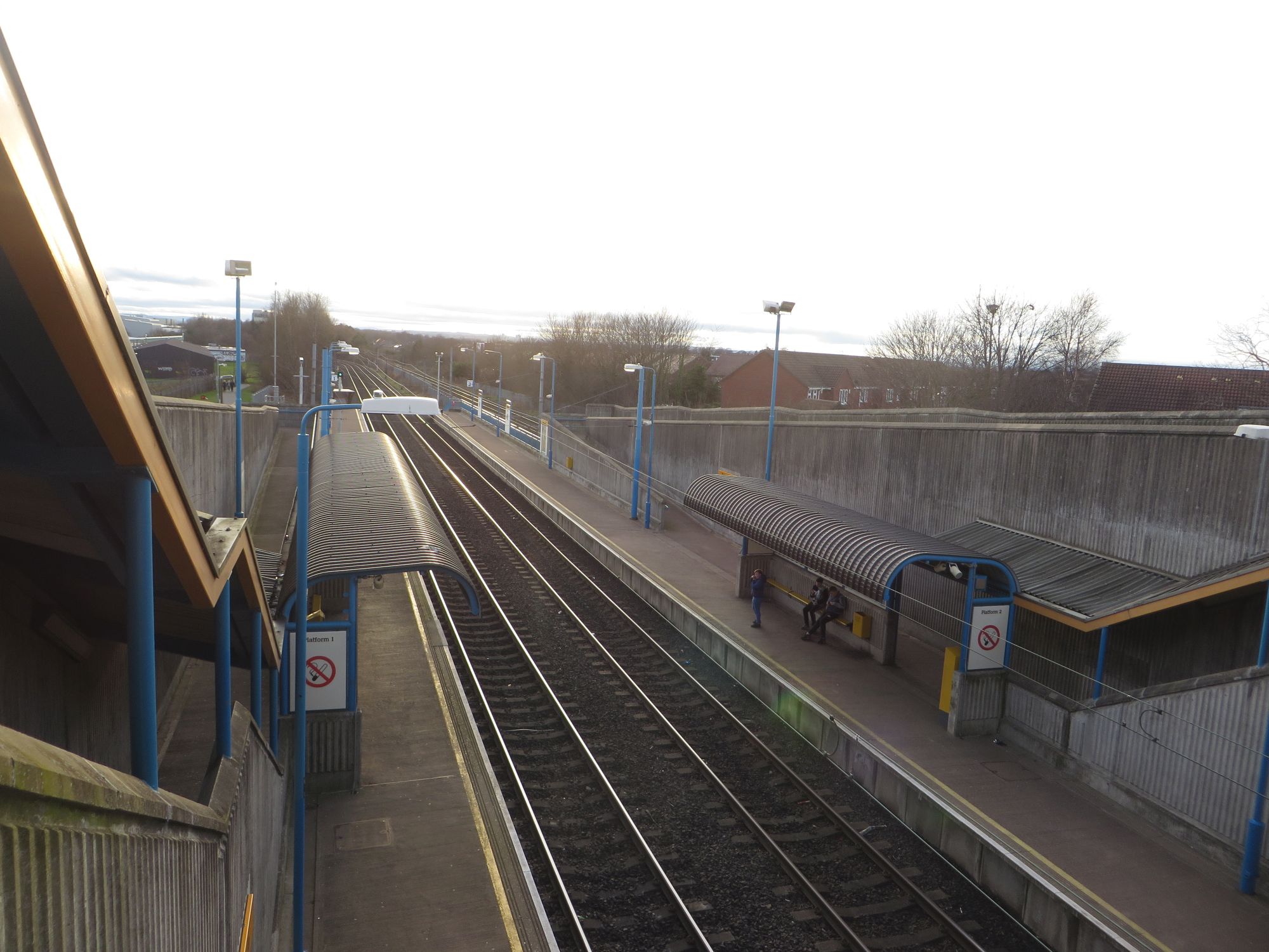
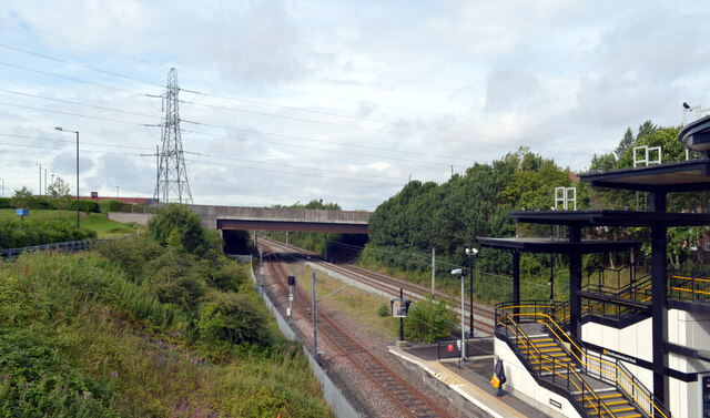
Platforms at Palmersville Metro The station here is one which was newly built for the Metro in 1986. It is right beside Great Lime Road, which crosses over the metro line, and is on the bridge on the right here.
Platforms at Palmersville Metro
The station here is one which was newly built for the Metro in 1986. It is right beside Great Lime Road, which crosses over the metro line, and is on the bridge on the right here.
Algernon Drive crossing the Metro line by Northumberland Park station The Tyne & Wear Metro opened in 1980.  Light rail vehicles replaced trains on suburban lines into Newcastle from north and south of the Tyne.  The system was integrated with the local bus network, with bus routes redesigned to carry people to Metro interchanges rather than direct into the centre of Newcastle.  A single ticket allowed passengers to interchange between bus and Metro.

The Metro was designed to be fully wheelchair-accessible right from the start, well before any other UK transport systems.
Algernon Drive crossing the Metro line by Northumberland Park station
The Tyne & Wear Metro opened in 1980. Light rail vehicles replaced trains on suburban lines into Newcastle from north and south of the Tyne. The system was integrated with the local bus network, with bus routes redesigned to carry people to Metro interchanges rather than direct into the centre of Newcastle. A single ticket allowed passengers to interchange between bus and Metro. The Metro was designed to be fully wheelchair-accessible right from the start, well before any other UK transport systems.
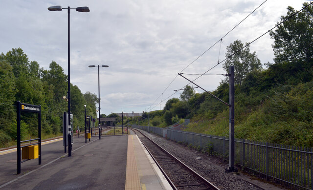
Northumberland Park Metro Station The Tyne & Wear Metro opened in 1980.  Light rail vehicles replaced trains on suburban lines into Newcastle from north and south of the Tyne.  The system was integrated with the local bus network, with bus routes redesigned to carry people to Metro interchanges rather than direct into the centre of Newcastle.  A single ticket allowed passengers to interchange between bus and Metro.

The Metro was designed to be fully wheelchair-accessible right from the start, well before any other UK transport systems.
Northumberland Park Metro Station
The Tyne & Wear Metro opened in 1980. Light rail vehicles replaced trains on suburban lines into Newcastle from north and south of the Tyne. The system was integrated with the local bus network, with bus routes redesigned to carry people to Metro interchanges rather than direct into the centre of Newcastle. A single ticket allowed passengers to interchange between bus and Metro. The Metro was designed to be fully wheelchair-accessible right from the start, well before any other UK transport systems.
Northumberland Park Metro Station
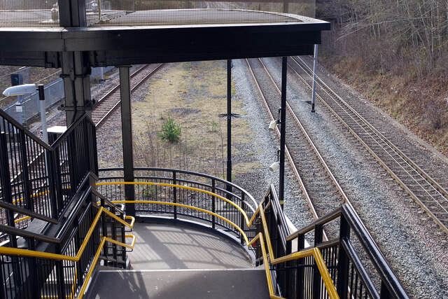
Northumberland Park Metro Station Northumberland Park was not part of the original Tyne & Wear Metro network but opened in December 2005 to serve new housing and business developments in the surrounding area. The covered steps with an unusual staged flat roof design, seen here, lead down to an island platform. This was, however, close to the site of Backworth station until 1977 when it was closed by British Rail to allow construction of the Metro. The single line on the right is not part of the Metro system but is in fact a Network Rail freight only line running to Blyth and Lynemouth Power Station. There are, however, plans to reopen this for a passenger service to Ashington.
Northumberland Park Metro Station
Northumberland Park was not part of the original Tyne & Wear Metro network but opened in December 2005 to serve new housing and business developments in the surrounding area. The covered steps with an unusual staged flat roof design, seen here, lead down to an island platform. This was, however, close to the site of Backworth station until 1977 when it was closed by British Rail to allow construction of the Metro. The single line on the right is not part of the Metro system but is in fact a Network Rail freight only line running to Blyth and Lynemouth Power Station. There are, however, plans to reopen this for a passenger service to Ashington.
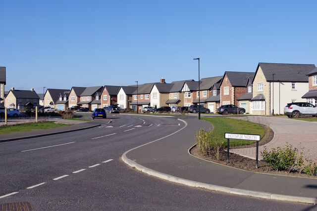
Hotspur North, Backworth Hotspur North forms the spine of a large housing development, all built within the last five years.
Hotspur North, Backworth
Hotspur North forms the spine of a large housing development, all built within the last five years.
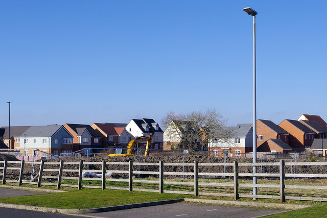
Housing development at Backworth Seen from the car park of The Pavilion, the land between the fence and the existing houses is being developed for further new housing.
Housing development at Backworth
Seen from the car park of The Pavilion, the land between the fence and the existing houses is being developed for further new housing.
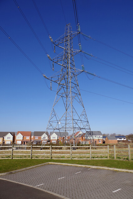
Pylon at Backworth This electricity transmission tower seems to be out of scale compared with the houses behind; it is seen against a brilliant blue sky, which was quite a contrast to the weather in the week before or the week after. This is the view from the car park of The Pavilion public house.
Pylon at Backworth
This electricity transmission tower seems to be out of scale compared with the houses behind; it is seen against a brilliant blue sky, which was quite a contrast to the weather in the week before or the week after. This is the view from the car park of The Pavilion public house.
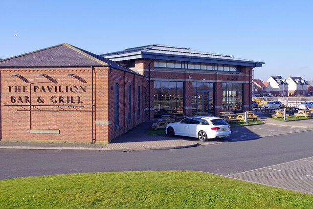
The Pavilion Bar and Grill, Backworth Very much a modern take on the pub, the Pavilion was opened in 2009 to serve the rapidly developing area. It describes itself as a 'modern cosmopolitan venue'.
The Pavilion Bar and Grill, Backworth
Very much a modern take on the pub, the Pavilion was opened in 2009 to serve the rapidly developing area. It describes itself as a 'modern cosmopolitan venue'.
Northumberland Park Metro Station Northumberland Park is one of the stops on the northern loop of the Tyne and Wear Metro; this is looking towards Whitley Bay from the Algernon Drive bridge. Somewhat confusingly, the bridge ahead carries Station Road; this is because, until its closure in 1977, Backworth station was located here. This view from 1970 shows the old station: <a href="https://www.geograph.org.uk/photo/1739814">NZ3071 : Backworth Station</a>. The line on the left is not part of the Metro system but is used by freight trains running to Blyth and Lynemouth Power Station. There are plans to run a passenger service (to be part of the National Rail network) over it to Ashington.
Northumberland Park Metro Station
Northumberland Park is one of the stops on the northern loop of the Tyne and Wear Metro; this is looking towards Whitley Bay from the Algernon Drive bridge. Somewhat confusingly, the bridge ahead carries Station Road; this is because, until its closure in 1977, Backworth station was located here. This view from 1970 shows the old station: NZ3071 : Backworth Station. The line on the left is not part of the Metro system but is used by freight trains running to Blyth and Lynemouth Power Station. There are plans to run a passenger service (to be part of the National Rail network) over it to Ashington.
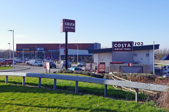
Northumberland Retail Park Home to some big name retailers, including Aldi and B&M Bargains, as well as a Costa Drive Thru, Northumberland Retail Park is located just off the A19. The developers claim that 553,880 million people live within a 15 minute drive of the site.
Northumberland Retail Park
Home to some big name retailers, including Aldi and B&M Bargains, as well as a Costa Drive Thru, Northumberland Retail Park is located just off the A19. The developers claim that 553,880 million people live within a 15 minute drive of the site.
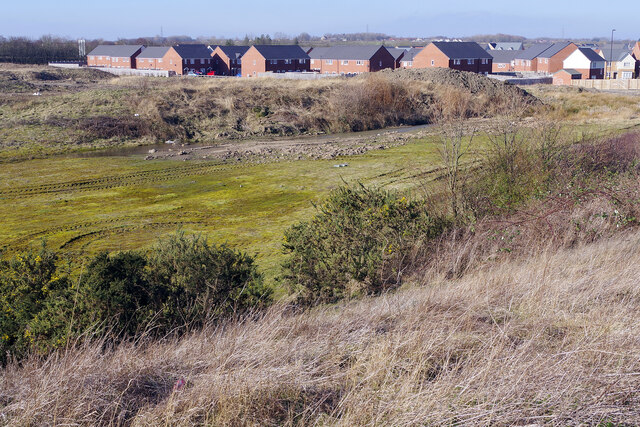
View to Roddam Close, Backworth The houses in the background are on Roddam Close. The land in between is the subject of a planning application for what is described as an 'ageing well village'. This comprises homes for those in later life as well as care facilities and a 'wellbeing hub' including a hydrotherapy pool, restaurant, hair salon, small shop, and therapy rooms. There would also be an 'integrated frailty hub', for those needing extra care, and a children's nursery. In all, it is claimed that almost 200 jobs would be created.
View to Roddam Close, Backworth
The houses in the background are on Roddam Close. The land in between is the subject of a planning application for what is described as an 'ageing well village'. This comprises homes for those in later life as well as care facilities and a 'wellbeing hub' including a hydrotherapy pool, restaurant, hair salon, small shop, and therapy rooms. There would also be an 'integrated frailty hub', for those needing extra care, and a children's nursery. In all, it is claimed that almost 200 jobs would be created.
Whitley Road, Holystone Village View looking northeast up the road which leads to Shiremoor.
Whitley Road, Holystone Village
View looking northeast up the road which leads to Shiremoor.
Bus stop on Whitley Road, Holystone Benton Square Industrial Estate on the left. The houses ahead and on the right are all postwar, as there was only a farm, a school and a few cottages in Holystone village before this time.
Bus stop on Whitley Road, Holystone
Benton Square Industrial Estate on the left. The houses ahead and on the right are all postwar, as there was only a farm, a school and a few cottages in Holystone village before this time.
Show me another place!

Benton Square is located at Grid Ref: NZ3070 (Lat: 55.02489, Lng: -1.5307265)

Unitary Authority: North Tyneside

Police Authority: Northumbria

What 3 Words

///comedy.vocally.ultra. Near Shiremoor, Tyne & Wear

Related Wikis

Holystone, Tyne and Wear

Holystone is a village in North Tyneside, Tyne and Wear, England. It is situated to the southwest of Whitley Bay, just off the A19. There is one school...

Benton Square railway station

Benton Square railway station served the district of Benton, Tyne and Wear, England, from 1909 to 1915 on the Blyth and Tyne Railway. == History == The...

Palmersville Metro station

Palmersville is a Tyne and Wear Metro station, serving the village of Holystone and suburb of Forest Hall, North Tyneside in Tyne and Wear, England. It...

West Allotment

West Allotment is a village in the Metropolitan Borough of North Tyneside. Prior to 1974 it was part of Northumberland. It is located approximately 4 miles...

Nearby Amenities

Located within 500m of 55.02489,-1.5307265
Mini Roundabout
Lat/Long: 55.0257883/-1.5294649
Railway: crossing
Lat/Long: 55.0273079/-1.5334923
Bus Stop
Whitley Road
Bench: yes
Bus: yes
Departures Board: timetable
Local Ref: E
Naptan AtcoCode: 410000004001
Naptan Bearing: NE
Naptan CommonName: WHITLEY ROAD-WESLEY WAY-E/B
Naptan Indicator: NE
Naptan Landmark: OUTSIDE WESLEY WAY BENTON INDUSTRIAL ESTATE
Naptan NaptanCode: twradpjw
Naptan Street: WHITLEY ROAD
Naptan Verified: no
Public Transport: platform
Shelter: yes
Source: naptan_import
Lat/Long: 55.0247314/-1.5310424
Bus Stop
HOLYSTONE
Bench: yes
Bus: yes
Departures Board: timetable
Lit: yes
Local Ref: NE
Naptan AtcoCode: 410000004002
Naptan Bearing: NE
Naptan CommonName: HOLYSTONE
Naptan Indicator: NE
Naptan Landmark: OUTSIDE NO.4 NEAR JUNCTION HOLYSTONE DRIVE
Naptan NaptanCode: twradpma
Naptan Street: WHITLEY ROAD
Naptan Verified: no
Public Transport: platform
Shelter: yes
Source: naptan_import
Lat/Long: 55.0275758/-1.5269669
Bus Stop
HOLYSTONE FIRST SCHOOL
Local Ref: NW
Naptan AtcoCode: 410000000035
Naptan Bearing: NW
Naptan CommonName: HOLYSTONE FIRST SCHOOL
Naptan Indicator: NW
Naptan Landmark: OUTSIDE HOLYSTONE PRIMARY SCHOOL
Naptan NaptanCode: twrgtmwd
Naptan Street: WHITLEY ROAD
Naptan Verified: no
Source: naptan_import
Lat/Long: 55.0281411/-1.5260562
Bus Stop
Holystone
Bench: yes
Bus: yes
Departures Board: timetable
Lit: yes
Local Ref: SW
Naptan AtcoCode: 410000004037
Naptan Bearing: SW
Naptan CommonName: HOLYSTONE
Naptan Indicator: SW
Naptan Landmark: OPPOSITE HOLLYSTONE DRIVE 60M
Naptan NaptanCode: twradtdp
Naptan Street: WHITLEY ROAD
Naptan Verified: no
Public Transport: platform
Shelter: yes
Source: naptan_import
Lat/Long: 55.0271015/-1.5274612
Bus Stop
Whitley Road
Bus: yes
Departures Board: timetable
Lit: yes
Local Ref: SW
Naptan AtcoCode: 410000004038
Naptan Bearing: SW
Naptan Indicator: SW-Bound
Naptan Landmark: Outside St Aidans Avenue
Naptan NaptanCode: twradtdt
Naptan Street: Whitley Road
Naptan Verified: no
Public Transport: platform
Shelter: yes
Source: naptan_import
Lat/Long: 55.0254552/-1.5297982
Bus Stop
GREAT LIME ROAD-WHITLEY ROAD-E/B
Bus: yes
Local Ref: E
Naptan AtcoCode: 410000009364
Naptan Bearing: E
Naptan CommonName: GREAT LIME ROAD-WHITLEY ROAD-E/B
Naptan Indicator: E
Naptan Landmark: OPPOSITE THE WHEATSHEAF PUBLIC HOUSE
Naptan NaptanCode: twrapapg
Naptan Street: GREAT LIME ROAD
Naptan Verified: no
Public Transport: platform
Source: naptan_import
Lat/Long: 55.0235448/-1.5356393
Bus Stop
GREAT LIME ROAD-WHITLEY ROAD-W/B
Bench: yes
Bus: yes
Local Ref: W
Naptan AtcoCode: 410000009365
Naptan Bearing: W
Naptan CommonName: GREAT LIME ROAD-WHITLEY ROAD-W/B
Naptan Indicator: W
Naptan Landmark: OUTSIDE THE WHEATSHEAF PUBLIC HOUSE
Naptan NaptanCode: twrapapj
Naptan Street: GREAT LIME ROAD
Public Transport: platform
Shelter: yes
Source: naptan_import
Lat/Long: 55.0234567/-1.5356921
Bus Stop
WHITLEY ROAD-BEDE CLOSE
Bench: yes
Bin: yes
Bus: yes
Departures Board: timetable
Local Ref: S
Naptan AtcoCode: 410000004957
Naptan Bearing: S
Naptan CommonName: WHITLEY ROAD-BEDE CLOSE
Naptan Indicator: S
Naptan Landmark: OPPOSITE THE WHEATSHEAF PUBLIC HOUSE
Naptan NaptanCode: twrgtjpt
Naptan Street: WHITLEY ROAD
Naptan Verified: no
Public Transport: platform
Shelter: yes
Source: naptan_import
Lat/Long: 55.0235688/-1.5333404
Bus Stop
BENTON SQUARE INDUSTRIAL ESTATE
Local Ref: NE
Naptan AtcoCode: 410000060003
Naptan Bearing: NE
Naptan CommonName: BENTON SQUARE INDUSTRIAL ESTATE
Naptan Indicator: NE
Naptan Landmark: BENTON SQUARE INDUSTRIAL ESTATE
Naptan NaptanCode: twrgpjta
Naptan Street: WESLEY WAY
Naptan Verified: no
Source: naptan_import
Lat/Long: 55.0254762/-1.5354606
Post Box
Collection Times: Mo-Fr 16:00; Sa 12:15
Drive Through: no
Operator: Royal Mail
Operator Wikidata: Q638098
Post Box Type: pillar
Ref: NE27 392
Royal Cypher: GVIR
Royal Cypher Wikidata: Q33102169
Lat/Long: 55.025715/-1.529828
Holystone
Place: village
Wikidata: Q23891272
Wikipedia: en:Holystone, Tyne and Wear
Lat/Long: 55.0259317/-1.5289602
Design: three-level
Line Management: transition
Material: steel
Power: tower
Lat/Long: 55.0242192/-1.5354478
Line Management: transition
Material: wood
Power: pole
Lat/Long: 55.0238083/-1.5357208
Power: tower
Lat/Long: 55.0218755/-1.5338421
Power: tower
Source: Bing
Lat/Long: 55.0268222/-1.5366291
Noexit: yes
Lat/Long: 55.025581/-1.5259506
Noexit: yes
Lat/Long: 55.0238513/-1.528853
Noexit: yes
Lat/Long: 55.0234865/-1.5276469
Noexit: yes
Lat/Long: 55.0261131/-1.5282727
Noexit: yes
Lat/Long: 55.0247872/-1.5295531
Noexit: yes
Lat/Long: 55.022439/-1.5311836
Crossing
Button Operated: yes
Crossing: traffic_signals
Crossing Island: no
Crossing Ref: pegasus
Tactile Paving: yes
Lat/Long: 55.023819/-1.5257369
Power: tower
Lat/Long: 55.0218514/-1.5287228
Power: pole
Lat/Long: 55.027215/-1.5372796
Railway: signal
Railway Signal Direction: backward
Ref: N101
Lat/Long: 55.0269646/-1.5342227
Railway: crossing
Lat/Long: 55.0272297/-1.533379
Railway: crossing
Lat/Long: 55.0272587/-1.5334153
Noexit: yes
Lat/Long: 55.0261418/-1.5280558
Noexit: yes
Lat/Long: 55.0272462/-1.5263599
Noexit: yes
Lat/Long: 55.0225392/-1.5362374
Noexit: yes
Lat/Long: 55.0230062/-1.5357869
Noexit: yes
Lat/Long: 55.0232019/-1.5358671
Traffic Calming: hump
Lat/Long: 55.0232352/-1.5369618
Addr Housenumber: 24
Lat/Long: 55.0231733/-1.5365376
Addr Housenumber: 25
Lat/Long: 55.0231725/-1.5367379
Addr Housenumber: 26
Lat/Long: 55.0231725/-1.5368789
Addr Housenumber: 27
Lat/Long: 55.0231647/-1.5371292
Power: pole
Lat/Long: 55.0254322/-1.5364638
Material: wood
Power: pole
Lat/Long: 55.0259364/-1.5366945
Noexit: yes
Lat/Long: 55.0250614/-1.5263506
Noexit: yes
Lat/Long: 55.0250729/-1.5267075
Noexit: yes
Lat/Long: 55.0264547/-1.5276305
Noexit: yes
Lat/Long: 55.0235533/-1.5273803
Noexit: yes
Lat/Long: 55.0236641/-1.5301316
Noexit: yes
Lat/Long: 55.0237511/-1.5308209
Noexit: yes
Lat/Long: 55.0238789/-1.5311131
Noexit: yes
Lat/Long: 55.0248555/-1.5259111
Noexit: yes
Lat/Long: 55.0249488/-1.5294991
Noexit: yes
Lat/Long: 55.025808/-1.5261584
Noexit: yes
Lat/Long: 55.0280151/-1.5253297
Crossing
Crossing: unmarked
Lat/Long: 55.022181/-1.5303789
Noexit: yes
Lat/Long: 55.026026/-1.5249312
Noexit: yes
Lat/Long: 55.0252494/-1.5230012
Post Box
Collection Times: Mo-Fr 16:00; Sa 12:15
Operator: Royal Mail
Operator Wikidata: Q638098
Post Box Type: pillar
Ref: NE12 360
Royal Cypher: EIIR
Royal Cypher Wikidata: Q33102113
Source: survey
Lat/Long: 55.0241693/-1.5371096
Noexit: yes
Lat/Long: 55.0243469/-1.5246748
Noexit: yes
Lat/Long: 55.0240635/-1.5248263
Crossing
Crossing: unmarked
Lat/Long: 55.0221022/-1.5303816
Crossing
Crossing: unmarked
Crossing Island: no
Crossing Markings: no
Tactile Paving: no
Traffic Calming: no
Lat/Long: 55.0230417/-1.5344326
Noexit: yes
Lat/Long: 55.0253132/-1.5239101
Noexit: yes
Lat/Long: 55.0248884/-1.5247693
Crossing
Crossing: unmarked
Crossing Island: no
Crossing Markings: no
Tactile Paving: no
Traffic Calming: no
Lat/Long: 55.0231783/-1.5345494
Crossing
Crossing: unmarked
Crossing Island: no
Crossing Markings: no
Tactile Paving: no
Traffic Calming: no
Lat/Long: 55.0230868/-1.534418
Traffic Calming: choker
Lat/Long: 55.0235428/-1.5335758
Priority: backward
Traffic Calming: chicane
Lat/Long: 55.0237726/-1.5328248
Noexit: yes
Lat/Long: 55.0227532/-1.5274926
Entrance: yes
Lat/Long: 55.0239136/-1.5373261
Crossing
Button Operated: yes
Crossing: traffic_signals
Crossing Island: no
Crossing Ref: pegasus
Tactile Paving: yes
Lat/Long: 55.0238077/-1.5256677
Bus Stop
Holystone Park / Edmund Road
Bench: no
Bus: yes
Departures Board: timetable
Fixme: add details
Public Transport: platform
Shelter: no
Lat/Long: 55.0266721/-1.5243327
Entrance: yes
Lat/Long: 55.0241371/-1.5375151
The Rising Sun Country Park
Board Type: plants
Information: board
Tourism: information
Lat/Long: 55.0223238/-1.5359824
Noexit: yes
Lat/Long: 55.0236795/-1.5255305
Noexit: yes
Lat/Long: 55.0229361/-1.5259194
Noexit: yes
Lat/Long: 55.0219682/-1.5247701
Noexit: yes
Lat/Long: 55.0219675/-1.5251443
Operator: Northern Powergrid
Operator Wikidata: Q7058871
Power: substation
Ref: Holystone
Voltage: 11000
Lat/Long: 55.0262666/-1.5295796
Generator Method: photovoltaic
Generator Output Electricity: yes
Generator Source: solar
Generator Type: solar_photovoltaic_panel
Location: roof
Power: generator
Lat/Long: 55.0275886/-1.5262891
Generator Method: photovoltaic
Generator Output Electricity: yes
Generator Source: solar
Generator Type: solar_photovoltaic_panel
Location: roof
Power: generator
Lat/Long: 55.0265185/-1.5263266
Generator Method: photovoltaic
Generator Output Electricity: yes
Generator Source: solar
Generator Type: solar_photovoltaic_panel
Location: roof
Power: generator
Lat/Long: 55.0260404/-1.5266646
Generator Method: photovoltaic
Generator Output Electricity: yes
Generator Source: solar
Generator Type: solar_photovoltaic_panel
Location: roof
Power: generator
Lat/Long: 55.0261818/-1.5262327
Generator Method: photovoltaic
Generator Output Electricity: yes
Generator Source: solar
Generator Type: solar_photovoltaic_panel
Location: roof
Power: generator
Lat/Long: 55.0243264/-1.5288228
Generator Method: photovoltaic
Generator Output Electricity: yes
Generator Source: solar
Generator Type: solar_photovoltaic_panel
Location: roof
Power: generator
Lat/Long: 55.0225293/-1.5288114
Generator Method: photovoltaic
Generator Output Electricity: yes
Generator Source: solar
Generator Type: solar_photovoltaic_panel
Location: roof
Power: generator
Lat/Long: 55.0224016/-1.5300881
Generator Method: photovoltaic
Generator Output Electricity: yes
Generator Source: solar
Generator Type: solar_photovoltaic_panel
Location: roof
Power: generator
Lat/Long: 55.0227721/-1.5317886
Generator Method: photovoltaic
Generator Output Electricity: yes
Generator Source: solar
Generator Type: solar_photovoltaic_panel
Location: roof
Power: generator
Lat/Long: 55.0231365/-1.5327167
Generator Method: photovoltaic
Generator Output Electricity: yes
Generator Source: solar
Generator Type: solar_photovoltaic_panel
Location: roof
Power: generator
Lat/Long: 55.0233963/-1.5320917
Generator Method: photovoltaic
Generator Output Electricity: yes
Generator Source: solar
Generator Type: solar_photovoltaic_panel
Location: roof
Power: generator
Lat/Long: 55.02361/-1.5316974
Generator Method: photovoltaic
Generator Output Electricity: yes
Generator Source: solar
Generator Type: solar_photovoltaic_panel
Location: roof
Power: generator
Lat/Long: 55.0238945/-1.5320327
Generator Method: photovoltaic
Generator Output Electricity: yes
Generator Source: solar
Generator Type: solar_photovoltaic_panel
Location: roof
Power: generator
Lat/Long: 55.0238668/-1.5319415
Generator Method: photovoltaic
Generator Output Electricity: yes
Generator Source: solar
Generator Type: solar_photovoltaic_panel
Location: roof
Power: generator
Lat/Long: 55.0229458/-1.5300961
Generator Method: photovoltaic
Generator Output Electricity: yes
Generator Source: solar
Generator Type: solar_photovoltaic_panel
Location: roof
Power: generator
Lat/Long: 55.023237/-1.5323069
Generator Method: photovoltaic
Generator Output Electricity: yes
Generator Source: solar
Generator Type: solar_photovoltaic_panel
Location: roof
Power: generator
Lat/Long: 55.0264557/-1.5287946
Generator Method: photovoltaic
Generator Output Electricity: yes
Generator Source: solar
Generator Type: solar_photovoltaic_panel
Location: roof
Power: generator
Lat/Long: 55.0264173/-1.5288482
Generator Method: photovoltaic
Generator Output Electricity: yes
Generator Source: solar
Generator Type: solar_photovoltaic_panel
Location: roof
Power: generator
Lat/Long: 55.0270069/-1.5289569
Generator Method: photovoltaic
Generator Output Electricity: yes
Generator Source: solar
Generator Type: solar_photovoltaic_panel
Location: roof
Power: generator
Lat/Long: 55.0269716/-1.528989
Generator Method: photovoltaic
Generator Output Electricity: yes
Generator Source: solar
Generator Type: solar_photovoltaic_panel
Location: roof
Power: generator
Lat/Long: 55.0268747/-1.5291393
Generator Method: photovoltaic
Generator Output Electricity: yes
Generator Source: solar
Generator Type: solar_photovoltaic_panel
Location: roof
Power: generator
Lat/Long: 55.0272744/-1.5291553
Generator Method: photovoltaic
Generator Output Electricity: yes
Generator Source: solar
Generator Type: solar_photovoltaic_panel
Location: roof
Power: generator
Lat/Long: 55.0265211/-1.5302229
Generator Method: photovoltaic
Generator Output Electricity: yes
Generator Source: solar
Generator Type: solar_photovoltaic_panel
Location: roof
Power: generator
Lat/Long: 55.0277403/-1.528981
Generator Method: photovoltaic
Generator Output Electricity: yes
Generator Source: solar
Generator Type: solar_photovoltaic_panel
Location: roof
Power: generator
Lat/Long: 55.027791/-1.5291446
Generator Method: photovoltaic
Generator Output Electricity: yes
Generator Source: solar
Generator Type: solar_photovoltaic_panel
Location: roof
Power: generator
Lat/Long: 55.0277295/-1.5285653
Generator Method: photovoltaic
Generator Output Electricity: yes
Generator Source: solar
Generator Type: solar_photovoltaic_panel
Location: roof
Power: generator
Lat/Long: 55.0281584/-1.5289488
Generator Method: photovoltaic
Generator Output Electricity: yes
Generator Source: solar
Generator Type: solar_photovoltaic_panel
Location: roof
Power: generator
Lat/Long: 55.0282015/-1.5291232
Generator Method: photovoltaic
Generator Output Electricity: yes
Generator Source: solar
Generator Type: solar_photovoltaic_panel
Location: roof
Power: generator
Lat/Long: 55.0282199/-1.5291848
Noexit: yes
Lat/Long: 55.0225387/-1.5300685
Noexit: yes
Lat/Long: 55.0235126/-1.5290326
Noexit: yes
Lat/Long: 55.0235935/-1.5289113
Noexit: yes
Lat/Long: 55.0244312/-1.5281525
Noexit: yes
Lat/Long: 55.0250513/-1.5254923
Crossing
Bicycle: yes
Button Operated: yes
Crossing: traffic_signals
Crossing Island: no
Crossing Ref: toucan
Tactile Paving: yes
Lat/Long: 55.0229289/-1.5335531
Bus: yes
Public Transport: stop_position
Lat/Long: 55.0235127/-1.5358101
Bus: yes
Public Transport: stop_position
Lat/Long: 55.0247143/-1.5309848
Give Way
Direction: forward
Lat/Long: 55.0250879/-1.5304685
Traffic Calming: chicane
Lat/Long: 55.0252678/-1.530211
Traffic Calming: cushion
Lat/Long: 55.0261142/-1.5289906
Bus: yes
Public Transport: stop_position
Lat/Long: 55.0271081/-1.5275382
Bus: yes
Public Transport: stop_position
Lat/Long: 55.0275647/-1.526873
Traffic Calming: cushion
Lat/Long: 55.0273349/-1.5272136
Crossing
Bicycle: yes
Crossing: zebra
Crossing Island: no
Crossing Ref: zebra
Tactile Paving: yes
Traffic Calming: yes
Lat/Long: 55.028031/-1.5261722
Bus: yes
Public Transport: stop_position
Lat/Long: 55.0236058/-1.5333894
Bus: yes
Public Transport: stop_position
Lat/Long: 55.0254738/-1.5299146
Noexit: yes
Lat/Long: 55.0224949/-1.5262762
Noexit: yes
Lat/Long: 55.0226886/-1.5265551
Noexit: yes
Lat/Long: 55.0220982/-1.5276454
Noexit: yes
Lat/Long: 55.0223042/-1.5277071
Barrier: stile
Stile: squeezer
Lat/Long: 55.027654/-1.5355088
Noexit: yes
Lat/Long: 55.0233966/-1.5285748
Noexit: yes
Lat/Long: 55.0225494/-1.5295029
Noexit: yes
Lat/Long: 55.0231391/-1.528265
Noexit: yes
Lat/Long: 55.0230784/-1.5334685
Noexit: yes
Lat/Long: 55.0227732/-1.5320697
Noexit: yes
Lat/Long: 55.0229308/-1.5319933
Give Way
Direction: forward
Lat/Long: 55.0238805/-1.5323811
Noexit: yes
Lat/Long: 55.0225418/-1.5304242
Noexit: yes
Lat/Long: 55.0227393/-1.5305369
Traffic Calming: table
Lat/Long: 55.0239276/-1.5262798
Give Way
Direction: forward
Lat/Long: 55.027772/-1.5266561
Direction: both
Traffic Calming: cushion
Lat/Long: 55.0266975/-1.5281293
Noexit: yes
Lat/Long: 55.0255108/-1.5242714
Noexit: yes
Lat/Long: 55.0255865/-1.5246291
Crossing
Crossing: unmarked
Crossing Markings: no
Tactile Paving: yes
Lat/Long: 55.0254203/-1.5243475
Crossing
Crossing: unmarked
Crossing Markings: no
Tactile Paving: yes
Lat/Long: 55.0253017/-1.524307
Crossing
Crossing: unmarked
Crossing Markings: no
Lat/Long: 55.0257171/-1.5252751
Crossing
Crossing: unmarked
Crossing Markings: no
Lat/Long: 55.0257373/-1.5250583
Crossing
Crossing: unmarked
Crossing Markings: no
Lat/Long: 55.0249182/-1.5250023
Crossing
Crossing: unmarked
Crossing Markings: no
Lat/Long: 55.0249466/-1.5252018
Crossing
Crossing: unmarked
Crossing Markings: no
Lat/Long: 55.0252556/-1.5256298
Crossing
Crossing: unmarked
Crossing Markings: no
Lat/Long: 55.0253661/-1.5256171
Give Way
Direction: forward
Lat/Long: 55.0234881/-1.5362599
Noexit: yes
Lat/Long: 55.0237534/-1.5249538
Noexit: yes
Lat/Long: 55.0245021/-1.5287854
Addr Housenumber: 24
Lat/Long: 55.0221473/-1.5269669
Addr Housenumber: 26
Lat/Long: 55.0221189/-1.5270466
Crossing
Bicycle: yes
Button Operated: yes
Crossing: traffic_signals
Crossing Island: no
Crossing Ref: toucan
Tactile Paving: yes
Lat/Long: 55.0228446/-1.5335996
CS Motor Engineering
Shop: car_repair
Lat/Long: 55.0255243/-1.5308603
AJC Car Sales
Shop: car
Lat/Long: 55.023925/-1.534969
Addr Housenumber: 4
Lat/Long: 55.0276015/-1.5271876
The data included in this document is from www.openstreetmap.org. The data is made available under ODbL.

Have you been to Benton Square?

Leave your review of Benton Square below (or comments, questions and feedback).