Back o' th' Moss

Settlement in Lancashire

England

Back o' th' Moss

WWII Lancashire: Ghost Signs of the Home Front (14) -
Emergency Rendezvous Point, Baker Street, at junction with Manchester Road, Heywood, Bury

"ERP 235"

Emergency Rendezvous Points (ERP) were designated places in the locality for the coordination of ARP and emergency services during civil emergencies, particularly for those services arriving from outside the area. The signs appear in a variety of designs, but most are diamond shapes framing the ERP locality number.

<a href="https://www.geograph.org.uk/photo/6945289">SD8609 : WWII Lancashire: Ghost Signs of the Home Front  (15)</a>
WWII Lancashire: Ghost Signs of the Home Front (14) Credit: Mike Searle

Back o' th' Moss is a small village located in the county of Lancashire, England. Nestled amidst picturesque countryside, it is situated approximately 10 miles northeast of the city of Preston. The village is surrounded by vast stretches of mossland, which gives it its distinctive name.

The history of Back o' th' Moss can be traced back several centuries, with evidence of human settlement in the area dating back to the Roman era. Over time, the village has flourished into a close-knit community with a population of around 500 residents.

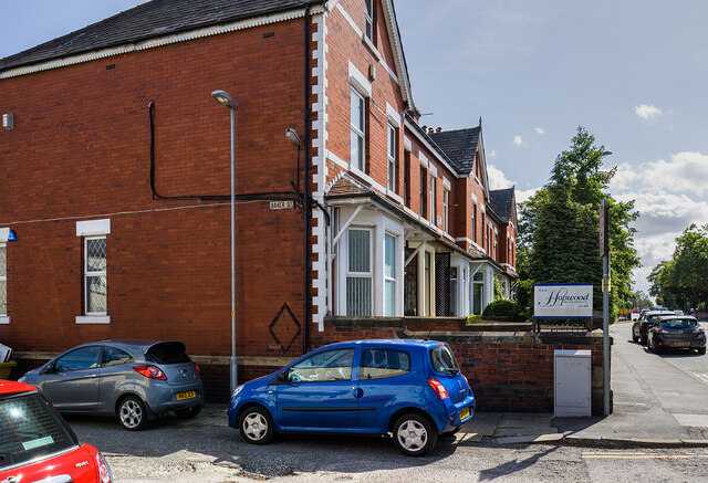
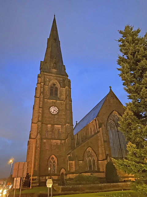
The village is characterized by its charming traditional cottages, built using local stone and slate roofs. The main focal point of the village is the St. Peter's Church, an architectural gem that dates back to the 14th century. The church is known for its intricate stained glass windows and beautiful wooden carvings.

Agriculture has been a vital part of the village's economy, with farming playing a significant role in the lives of the residents. The fertile soil and the surrounding mossland provide ideal conditions for growing crops and rearing livestock.

Despite its rural setting, Back o' th' Moss benefits from good transportation links, with several major roads passing nearby. This enables easy access to neighboring towns and cities, making it a popular choice for commuters seeking a quieter lifestyle.

The village boasts a strong sense of community, with various local events and activities organized throughout the year. These include agricultural shows, fairs, and traditional festivals that celebrate the village's rich cultural heritage.

Overall, Back o' th' Moss offers a tranquil and idyllic setting, combining natural beauty with a rich historical background, making it a beloved place to live for its residents and an appealing destination for visitors seeking a slice of rural England.

If you have any feedback on the listing, please let us know in the comments section below.

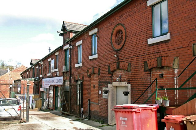
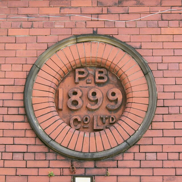
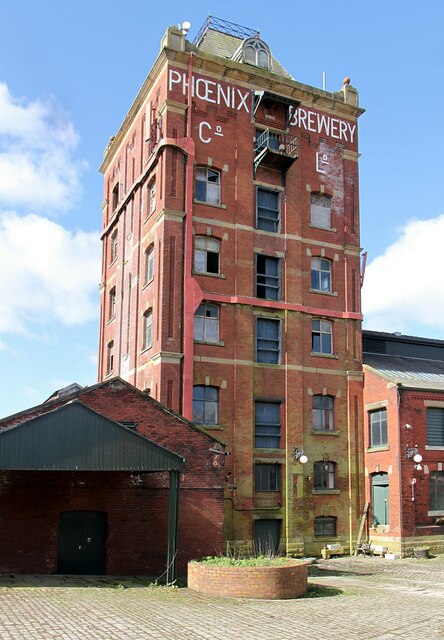
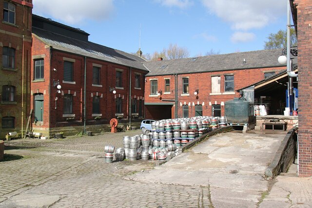
Back o' th' Moss Images

Images are sourced within 2km of 53.5991/-2.220483 or Grid Reference SD8511. Thanks to Geograph Open Source API. All images are credited.

WWII Lancashire: Ghost Signs of the Home Front (14) -
Emergency Rendezvous Point, Baker Street, at junction with Manchester Road, Heywood, Bury

"ERP 235"

Emergency Rendezvous Points (ERP) were designated places in the locality for the coordination of ARP and emergency services during civil emergencies, particularly for those services arriving from outside the area. The signs appear in a variety of designs, but most are diamond shapes framing the ERP locality number.

<a href="https://www.geograph.org.uk/photo/6945289">SD8609 : WWII Lancashire: Ghost Signs of the Home Front  (15)</a>
WWII Lancashire: Ghost Signs of the Home Front (14)
- Emergency Rendezvous Point, Baker Street, at junction with Manchester Road, Heywood, Bury "ERP 235" Emergency Rendezvous Points (ERP) were designated places in the locality for the coordination of ARP and emergency services during civil emergencies, particularly for those services arriving from outside the area. The signs appear in a variety of designs, but most are diamond shapes framing the ERP locality number. SD8609 : WWII Lancashire: Ghost Signs of the Home Front (15)
WWII Lancashire: Ghost Signs of the Home Front  (15) -
Emergency Rendezvous Point, Baker Street, at junction with Manchester Road, Heywood, Bury

"ERP 235"

Emergency Rendezvous Points (ERP) were designated places in the locality for the coordination of ARP and emergency services during civil emergencies, particularly for those services arriving from outside the area. The signs appear in a variety of designs, but most are diamond shapes framing the ERP locality number.

<a href="https://www.geograph.org.uk/photo/6945295">SD8013 : WWII Lancashire: Ghost Signs of the Home Front  (16)</a>
WWII Lancashire: Ghost Signs of the Home Front (15)
- Emergency Rendezvous Point, Baker Street, at junction with Manchester Road, Heywood, Bury "ERP 235" Emergency Rendezvous Points (ERP) were designated places in the locality for the coordination of ARP and emergency services during civil emergencies, particularly for those services arriving from outside the area. The signs appear in a variety of designs, but most are diamond shapes framing the ERP locality number. SD8013 : WWII Lancashire: Ghost Signs of the Home Front (16)
Housing on Shaftesbury Drive This housing estate has no direct vehicle access across the nearby railway to reach the centre of Heywood. The residents have quite a drive to the nearest crossing.
Housing on Shaftesbury Drive
This housing estate has no direct vehicle access across the nearby railway to reach the centre of Heywood. The residents have quite a drive to the nearest crossing.
Entrance to Broadfield Business Park Off Pilsworth Road. There is a public bridleway (by the side of the gatehouse) behind the security fencing - not that you would recognise it.
Entrance to Broadfield Business Park
Off Pilsworth Road. There is a public bridleway (by the side of the gatehouse) behind the security fencing - not that you would recognise it.
WWII Lancashire: Ghost Signs of the Home Front  (12) -
Emergency Rendezvous Point, Peel Street, at junction with  Bury Street, Heywood, Bury 

"ERP ---?"

Emergency Rendezvous Points (ERP) were designated places in the locality for the coordination of ARP and emergency services during civil emergencies, particularly for those services arriving from outside the area. The signs appear in a variety of designs, but most are diamond shapes framing the ERP locality number.

<a href="https://www.geograph.org.uk/photo/6945275">SD8410 : WWII Lancashire: Ghost Signs of the Home Front  (13)</a>
WWII Lancashire: Ghost Signs of the Home Front (12)
- Emergency Rendezvous Point, Peel Street, at junction with Bury Street, Heywood, Bury "ERP ---?" Emergency Rendezvous Points (ERP) were designated places in the locality for the coordination of ARP and emergency services during civil emergencies, particularly for those services arriving from outside the area. The signs appear in a variety of designs, but most are diamond shapes framing the ERP locality number. SD8410 : WWII Lancashire: Ghost Signs of the Home Front (13)
WWII Lancashire: Ghost Signs of the Home Front  (13) -
Emergency Rendezvous Point, Peel Street, at junction with  Bury Street, Heywood, Bury 

"ERP ---?"

Emergency Rendezvous Points (ERP) were designated places in the locality for the coordination of ARP and emergency services during civil emergencies, particularly for those services arriving from outside the area. The signs appear in a variety of designs, but most are diamond shapes framing the ERP locality number.

<a href="https://www.geograph.org.uk/photo/6945286">SD8609 : WWII Lancashire: Ghost Signs of the Home Front (14)</a>
WWII Lancashire: Ghost Signs of the Home Front (13)
- Emergency Rendezvous Point, Peel Street, at junction with Bury Street, Heywood, Bury "ERP ---?" Emergency Rendezvous Points (ERP) were designated places in the locality for the coordination of ARP and emergency services during civil emergencies, particularly for those services arriving from outside the area. The signs appear in a variety of designs, but most are diamond shapes framing the ERP locality number. SD8609 : WWII Lancashire: Ghost Signs of the Home Front (14)
Heywood Church Spire - St Lukes
OS Cut Mark: Heywood - Number 6 Hind Hill Street <span class="nowrap"><a title="https://www.bench-marks.org.uk/bm109138" rel="nofollow ugc noopener" href="https://www.bench-marks.org.uk/bm109138">Link</a><img style="margin-left:2px;" alt="External link" title="External link - shift click to open in new window" src="https://s1.geograph.org.uk/img/external.png" width="10" height="10"/></span>
OS Cut Mark: Heywood - Number 6 Hind Hill Street
The former Phoenix Brewery, Heywood – 1 I haven't worked out what the function of the buildings in the foreground was.
The former Phoenix Brewery, Heywood – 1
I haven't worked out what the function of the buildings in the foreground was.
The former Phoenix Brewery, Heywood – 2 This range may have been the stable block, now occupied by various small businesses.
The former Phoenix Brewery, Heywood – 2
This range may have been the stable block, now occupied by various small businesses.
The former Phoenix Brewery, Heywood – 3 Terracotta date plaque on the stable block. The whole set of brewery buildings appears to date from 1899, although the 1894 6-inch mapping shows buildings with a similar footprint already in existence.
The former Phoenix Brewery, Heywood – 3
Terracotta date plaque on the stable block. The whole set of brewery buildings appears to date from 1899, although the 1894 6-inch mapping shows buildings with a similar footprint already in existence.
The former Phoenix Brewery, Heywood – 4 The brewing tower, now out of use except as a support for communications transmitters.
The former Phoenix Brewery, Heywood – 4
The brewing tower, now out of use except as a support for communications transmitters.
The former Phoenix Brewery, Heywood – 5 The main brewery yard. The brewery closed in around 1960, but the 'Oak Brewing Company' of Ellesmere Port relocated here in 1991 and became Phoenix Brewing Ltd in 1996. It occupies the former maltings and office buildings and doesn't not 'replicate' the original brewery.
The former Phoenix Brewery, Heywood – 5
The main brewery yard. The brewery closed in around 1960, but the 'Oak Brewing Company' of Ellesmere Port relocated here in 1991 and became Phoenix Brewing Ltd in 1996. It occupies the former maltings and office buildings and doesn't not 'replicate' the original brewery.
Shining in the sunlight A stack of aluminium kegs at the Phoenix Brewery, Heywood.
Shining in the sunlight
A stack of aluminium kegs at the Phoenix Brewery, Heywood.
Mutual Mills, Heywood – 1 The tower of Mill No.1
Mutual Mills, Heywood – 1
The tower of Mill No.1
Mutual Mills, Heywood – 2 Office block of 1900 at Mill No.1, looking down Buckley Street.
Mutual Mills, Heywood – 2
Office block of 1900 at Mill No.1, looking down Buckley Street.
Mutual Mills, Heywood – 3 Aspinall Street facade of Mill No.1 and tower of Mill No.2
Mutual Mills, Heywood – 3
Aspinall Street facade of Mill No.1 and tower of Mill No.2
Mutual Mills, Heywood – 4 Razor wire tangle along Buckley Street.
Mutual Mills, Heywood – 4
Razor wire tangle along Buckley Street.
Show me another place!

Back o' th' Moss is located at Grid Ref: SD8511 (Lat: 53.5991, Lng: -2.220483)

Unitary Authority: Rochdale

Police Authority: Greater Manchester

What 3 Words

///influencing.obey.nobody. Near Heywood, Manchester

Related Wikis

Queen's Park, Rochdale

Queen's Park is a public park in Heywood, in the Metropolitan Borough of Rochdale, Greater Manchester, England. == History == The park is situated on land...

Naden Brook

Naden Brook is a watercourse in northwest England. It rises in the hills above Norden, near the boundary of Lancashire and Greater Manchester. From here...

Millers Brook

Millers Brook is a watercourse in Greater Manchester and tributary of the River Roch. It originates in Heywood and flows through Queens Park to join the...

Wrigley Brook

Wrigley Brook is a culverted watercourse in Greater Manchester which flows through Heywood and is a tributary of the River Roch. Originating in the Hareshill...

Related Videos

Heywood / Lancashire / England 🏴󠁧󠁢󠁥󠁮󠁧󠁿

The sun setting in the town of Heywood Lancashire…..wow purple Skys! Enjoy guys and girls, please if you like my content hit the ...

Ashworth Waterfall COLD WATER Dipping & WALKING! Lancashire Walks.

Another day, another cold water dip in Lancashire. Ashworth Waterfall in Heywood/Rochdale area.

Ashworth Waterfall

A short walk to swim in the Ashworth Waterfall Starting from the car park in Norden: OL11 5SN.

UK Springfield Park, Rochdale marland golf 😍😍😍 park walking 😍

Super view #4k #life #video #nature #all #beautiful.

Nearby Amenities

Located within 500m of 53.5991,-2.220483
Heywood
Is In: Rochdale, Greater Manchester, England, UK
Is In District: Rochdale
Name Ur: ہئے وڈ
Place: town
Population: 29726
Population Date: 2021
Wikidata: Q1013970
Wikipedia: en:Heywood, Greater Manchester
Lat/Long: 53.5967685/-2.2239715
Hooley Bridge
Is In: Heywood, Rochdale, Greater Manchester, England, UK
Place: suburb
Source: npe
Lat/Long: 53.6030715/-2.2228986
Turning Circle
Maxspeed: 20 mph
Lat/Long: 53.5995816/-2.2241673
Bus Stop
Queens Park Road/ Queens Park
Bus: yes
Naptan AtcoCode: 1800NE00141
Naptan Bearing: N
Naptan CommonName: Queens Park Road/ Queens Park
Naptan Indicator: School
Naptan Landmark: CAR Park
Naptan NaptanCode: mandtwmt
Naptan PlusbusZoneRef: MNCRPIC
Naptan ShortCommonName: Queens Park
Naptan Street: Queens Park Road
Naptan Verified: no
Network: TfGM
Public Transport: platform
Source: naptan_import
Lat/Long: 53.6012526/-2.2170477
Bus Stop
Queens Park Rd/Bury & Rochdale Old Rd
Bus: yes
Naptan AtcoCode: 1800NE00151
Naptan Bearing: N
Naptan CommonName: Queens Park Rd/Bury & Rochdale Old Rd
Naptan Indicator: Nr River
Naptan Landmark: NR RIVER
Naptan NaptanCode: mandtwmw
Naptan PlusbusZoneRef: MNCRPIC
Naptan ShortCommonName: Bury & Rochdale O
Naptan Street: Queens Park Road
Naptan Verified: no
Network: TfGM
Public Transport: platform
Source: naptan_import
Lat/Long: 53.6027265/-2.2171912
Bus Stop
Queens Park Road/Queens Park
Bus: yes
Naptan AtcoCode: 1800NE00411
Naptan Bearing: S
Naptan CommonName: Queens Park Road/Queens Park
Naptan Indicator: School
Naptan Landmark: PLAYGROUND
Naptan NaptanCode: mandwadm
Naptan PlusbusZoneRef: MNCRPIC
Naptan ShortCommonName: Queens Park
Naptan Street: Queens Park Road
Naptan Verified: no
Network: TfGM
Public Transport: platform
Source: naptan_import
Lat/Long: 53.6006509/-2.2167877
Bus Stop
Furness Avenue/Whitby Avenue
Bus: yes
Naptan AtcoCode: 1800NE04121
Naptan Bearing: S
Naptan CommonName: Furness Avenue/Whitby Avenue
Naptan Indicator: Nr House 90
Naptan Landmark: HOUSE 90
Naptan NaptanCode: mandwjpd
Naptan PlusbusZoneRef: MNCRPIC
Naptan ShortCommonName: Whitby Avenue
Naptan Street: FURNESS AVENUE
Naptan Verified: no
Network: TfGM
Public Transport: platform
Source: naptan_import
Lat/Long: 53.5995569/-2.2250931
Bus Stop
Cedar Avenue/Lime Grove
Bus: yes
Naptan AtcoCode: 1800NE04891
Naptan Bearing: NE
Naptan CommonName: Cedar Avenue/Lime Grove
Naptan Indicator: House 79
Naptan Landmark: House 81
Naptan NaptanCode: mantgdta
Naptan Notes: INDICATOR AMENDED
Naptan PlusbusZoneRef: MNCRPIC
Naptan ShortCommonName: Lime Grove
Naptan Street: Cedar Avenue
Naptan Verified: no
Network: TfGM
Public Transport: platform
Source: naptan_import
Lat/Long: 53.5991121/-2.2274027
Bus Stop
Furness Avenue/Whitby Avenue
Bus: yes
Naptan AtcoCode: 1800NE05421
Naptan Bearing: N
Naptan CommonName: Furness Avenue/Whitby Avenue
Naptan Indicator: Nr House 90
Naptan Landmark: HOUSE 93
Naptan NaptanCode: mantgtaw
Naptan PlusbusZoneRef: MNCRPIC
Naptan ShortCommonName: Whitby Avenue
Naptan Street: FURNESS AVENUE
Naptan Verified: no
Network: TfGM
Public Transport: platform
Source: naptan_import
Lat/Long: 53.5995297/-2.2252441
Bus Stop
Cedar Avenue/Lime Grove
Bus: yes
Naptan AtcoCode: 1800NE06711
Naptan Bearing: SW
Naptan CommonName: Cedar Avenue/Lime Grove
Naptan Indicator: House 79
Naptan Landmark: House 80
Naptan NaptanCode: mantgtdp
Naptan Notes: INDICATOR AMENDED
Naptan PlusbusZoneRef: MNCRPIC
Naptan ShortCommonName: Lime Grove
Naptan Street: Cedar Avenue
Naptan Verified: no
Network: TfGM
Public Transport: platform
Source: naptan_import
Lat/Long: 53.5990494/-2.2273117
Bus Stop
Bamford Road/Starkey Street
Bus: yes
Naptan AtcoCode: 1800NE32121
Naptan Bearing: S
Naptan CommonName: Bamford Road/Starkey Street
Naptan Indicator: Op House 70
Naptan Landmark: HOUSE 70
Naptan NaptanCode: mangdawp
Naptan PlusbusZoneRef: MNCRPIC
Naptan ShortCommonName: Starkey Street
Naptan Street: BAMFORD ROAD
Naptan Verified: no
Network: TfGM
Public Transport: platform
Source: naptan_import
Lat/Long: 53.5965454/-2.2204535
Bus Stop
Bamford Road/Starkey Street
Bus: yes
Naptan AtcoCode: 1800NE32131
Naptan Bearing: N
Naptan CommonName: Bamford Road/Starkey Street
Naptan Indicator: Opp House 70
Naptan Landmark: FOOTBALL FIELD
Naptan NaptanCode: mangdawt
Naptan PlusbusZoneRef: MNCRPIC
Naptan ShortCommonName: Starkey Street
Naptan Street: BAMFORD ROAD
Naptan Verified: no
Network: TfGM
Public Transport: platform
Source: naptan_import
Lat/Long: 53.5964283/-2.220604
Bus Stop
Bamford Road/Heywood Hall Road
Bus: yes
Naptan AtcoCode: 1800NE32141
Naptan Bearing: S
Naptan CommonName: Bamford Road/Heywood Hall Road
Naptan Indicator: O/s House 170
Naptan Landmark: HOUSE 178
Naptan NaptanCode: mangdgad
Naptan PlusbusZoneRef: MNCRPIC
Naptan ShortCommonName: Heywood Hall Road
Naptan Street: BAMFORD ROAD
Naptan Verified: no
Network: TfGM
Public Transport: platform
Source: naptan_import
Lat/Long: 53.598532/-2.2204034
Bus Stop
Bamford Road/Heywood Hall Road
Bus: yes
Naptan AtcoCode: 1800NE32151
Naptan Bearing: N
Naptan CommonName: Bamford Road/Heywood Hall Road
Naptan Indicator: Op House 182
Naptan Landmark: HOUSE 7
Naptan NaptanCode: mangdgag
Naptan PlusbusZoneRef: MNCRPIC
Naptan ShortCommonName: Heywood Hall Road
Naptan Street: BAMFORD ROAD
Naptan Verified: no
Network: TfGM
Public Transport: platform
Source: naptan_import
Lat/Long: 53.5989721/-2.2205417
Bus Stop
Clay Bank Street/Furness Avenue
Bus: yes
Naptan AtcoCode: 1800NE32161
Naptan Bearing: W
Naptan CommonName: Clay Bank Street/Furness Avenue
Naptan Indicator: O/s House 67
Naptan Landmark: HOUSE 67
Naptan NaptanCode: mangdgaj
Naptan PlusbusZoneRef: MNCRPIC
Naptan ShortCommonName: Furness Avenue
Naptan Street: Claybank Street
Naptan Verified: no
Network: TfGM
Public Transport: platform
Source: naptan_import
Lat/Long: 53.5983723/-2.2241047
Bus Stop
Clay Bank Street/Furness Avenue
Bus: yes
Naptan AtcoCode: 1800NE32171
Naptan Bearing: E
Naptan CommonName: Clay Bank Street/Furness Avenue
Naptan Indicator: O/s House 66
Naptan Landmark: HOUSE 66
Naptan NaptanCode: mangdgam
Naptan PlusbusZoneRef: MNCRPIC
Naptan ShortCommonName: Furness Avenue
Naptan Street: Claybank Street
Naptan Verified: no
Network: TfGM
Public Transport: platform
Source: naptan_import
Lat/Long: 53.5985529/-2.2236372
Bus Stop
Bamford Road/Hooley Bridge
Bus: yes
Naptan AtcoCode: 1800NE32201
Naptan Bearing: S
Naptan CommonName: Bamford Road/Hooley Bridge
Naptan Indicator: Coll Sew Machne
Naptan Landmark: COLL SEW MACHNE
Naptan NaptanCode: mangdgap
Naptan PlusbusZoneRef: MNCRPIC
Naptan ShortCommonName: Hooley Bridge
Naptan Street: BAMFORD ROAD
Naptan Verified: no
Network: TfGM
Public Transport: platform
Source: naptan_import
Lat/Long: 53.6013159/-2.2217628
Bus Stop
Bamford Road/Hooley Bridge
Bus: yes
Naptan AtcoCode: 1800NE32211
Naptan Bearing: NW
Naptan CommonName: Bamford Road/Hooley Bridge
Naptan Indicator: Derelict Mill
Naptan Landmark: DERELICT MILL
Naptan NaptanCode: mangdgat
Naptan PlusbusZoneRef: MNCRPIC
Naptan ShortCommonName: Hooley Bridge
Naptan Street: BAMFORD ROAD
Naptan Verified: no
Network: TfGM
Public Transport: platform
Source: naptan_import
Lat/Long: 53.601423/-2.2221563
Bus Stop
Bamford Road/Victoria Terrace
Bus: yes
Naptan AtcoCode: 1800NE32231
Naptan Bearing: N
Naptan CommonName: Bamford Road/Victoria Terrace
Naptan Indicator: O/s House 209
Naptan Landmark: HOUSE 209
Naptan NaptanCode: mangdgda
Naptan PlusbusZoneRef: MNCRPIC
Naptan ShortCommonName: Victoria Terrace
Naptan Street: BAMFORD ROAD
Naptan Verified: no
Network: TfGM
Public Transport: platform
Source: naptan_import
Lat/Long: 53.6026874/-2.2237497
Bus Stop
Bamford Road/Victoria Terrace
Bus: yes
Naptan AtcoCode: 1800NE32251
Naptan Bearing: S
Naptan CommonName: Bamford Road/Victoria Terrace
Naptan Indicator: Opp House 205
Naptan Landmark: HOUSE 205
Naptan NaptanCode: mangdgdj
Naptan PlusbusZoneRef: MNCRPIC
Naptan ShortCommonName: Victoria Terrace
Naptan Street: BAMFORD ROAD
Naptan Verified: no
Network: TfGM
Public Transport: platform
Source: naptan_import
Lat/Long: 53.6026247/-2.2236285
Barrier: bollard
Lat/Long: 53.6000148/-2.2238001
Barrier: yes
Lat/Long: 53.6025726/-2.2193282
Generator Method: photovoltaic
Generator Output Electricity: yes
Generator Source: solar
Generator Type: solar_photovoltaic_panel
Location: roof
Power: generator
Lat/Long: 53.6032461/-2.2189334
Generator Method: photovoltaic
Generator Output Electricity: yes
Generator Source: solar
Generator Type: solar_photovoltaic_panel
Location: roof
Power: generator
Lat/Long: 53.6024376/-2.2225557
Generator Method: photovoltaic
Generator Output Electricity: yes
Generator Source: solar
Generator Type: solar_photovoltaic_panel
Location: roof
Power: generator
Lat/Long: 53.5957695/-2.2181503
Generator Method: photovoltaic
Generator Output Electricity: yes
Generator Source: solar
Generator Type: solar_photovoltaic_panel
Location: roof
Power: generator
Lat/Long: 53.596516/-2.2202565
Generator Method: photovoltaic
Generator Output Electricity: yes
Generator Source: solar
Generator Type: solar_photovoltaic_panel
Location: roof
Power: generator
Lat/Long: 53.5986164/-2.2255711
Generator Method: photovoltaic
Generator Output Electricity: yes
Generator Source: solar
Generator Type: solar_photovoltaic_panel
Location: roof
Power: generator
Lat/Long: 53.5986473/-2.2193552
Barrier: bollard
Lat/Long: 53.5951163/-2.218227
Crossing
Button Operated: yes
Crossing: traffic_signals
Crossing Island: no
Crossing Markings: dots
Tactile Paving: yes
Lat/Long: 53.5960547/-2.2233158
Crossing
Crossing: unmarked
Crossing Island: no
Crossing Markings: no
Tactile Paving: yes
Lat/Long: 53.5962398/-2.223348
Barrier: cycle_barrier
Bicycle: yes
Foot: yes
Wheelchair: limited
Lat/Long: 53.5966546/-2.22343
Barrier: bollard
Motor Vehicle: no
Lat/Long: 53.5967981/-2.2236039
Barrier: cycle_barrier
Bicycle: yes
Foot: yes
Wheelchair: limited
Lat/Long: 53.5980121/-2.2242313
Barrier: block
Bicycle: yes
Foot: yes
Motor Vehicle: no
Wheelchair: yes
Lat/Long: 53.5982463/-2.2244368
Fountain
Fountain: decorative
Lat/Long: 53.6007458/-2.2153725
Barrier: cycle_barrier
Foot: yes
Wheelchair: limited
Lat/Long: 53.6007167/-2.2260038
Barrier: bollard
Motor Vehicle: no
Lat/Long: 53.5946813/-2.2218703
Bicycle Parking
Bicycle Parking: stands
Capacity: 8
Covered: no
Lat/Long: 53.5950193/-2.2230635
Bicycle Parking
Bicycle Parking: stands
Capacity: 16
Covered: no
Lat/Long: 53.5966921/-2.224536
Crossing
Lat/Long: 53.5960908/-2.215471
Barrier: bollard
Wheelchair: yes
Lat/Long: 53.5958713/-2.2233058
Barrier: cycle_barrier
Bicycle: yes
Foot: yes
Wheelchair: limited
Lat/Long: 53.5961301/-2.2233209
Crossing
Crossing: uncontrolled
Crossing Markings: zebra
Lat/Long: 53.59624/-2.2242935
Crossing
Crossing: uncontrolled
Crossing Markings: zebra
Lat/Long: 53.596381/-2.2242928
Crossing
Crossing: uncontrolled
Crossing Markings: zebra
Lat/Long: 53.5965192/-2.2242921
Give Way
Direction: forward
Lat/Long: 53.5965207/-2.2234323
Give Way
Direction: forward
Lat/Long: 53.5962398/-2.223317
Crossing
Crossing: traffic_signals
Crossing Island: no
Crossing Markings: dots
Tactile Paving: yes
Lat/Long: 53.6007377/-2.2169069
Barrier: cycle_barrier
Bicycle: yes
Foot: yes
Wheelchair: limited
Lat/Long: 53.5959922/-2.2233108
Waste Basket
Lat/Long: 53.5960019/-2.2233309
Barrier: cycle_barrier
Bicycle: yes
Foot: yes
Wheelchair: limited
Lat/Long: 53.5962903/-2.2233578
Waste Basket
Lat/Long: 53.5980205/-2.2242639
The data included in this document is from www.openstreetmap.org. The data is made available under ODbL.

Have you been to Back o' th' Moss?

Leave your review of Back o' th' Moss below (or comments, questions and feedback).