Heywood

Settlement in Lancashire

England

Heywood

WWII Lancashire: Ghost Signs of the Home Front (14) -
Emergency Rendezvous Point, Baker Street, at junction with Manchester Road, Heywood, Bury

"ERP 235"

Emergency Rendezvous Points (ERP) were designated places in the locality for the coordination of ARP and emergency services during civil emergencies, particularly for those services arriving from outside the area. The signs appear in a variety of designs, but most are diamond shapes framing the ERP locality number.

<a href="https://www.geograph.org.uk/photo/6945289">SD8609 : WWII Lancashire: Ghost Signs of the Home Front  (15)</a>
WWII Lancashire: Ghost Signs of the Home Front (14) Credit: Mike Searle

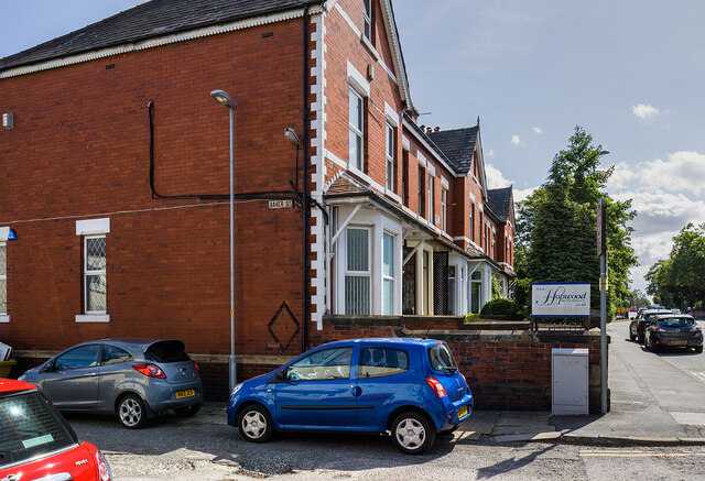
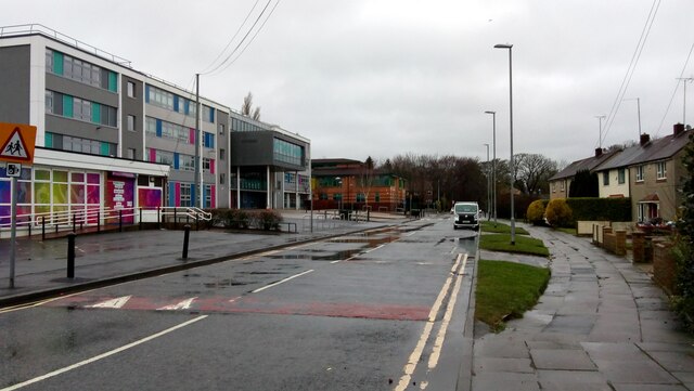
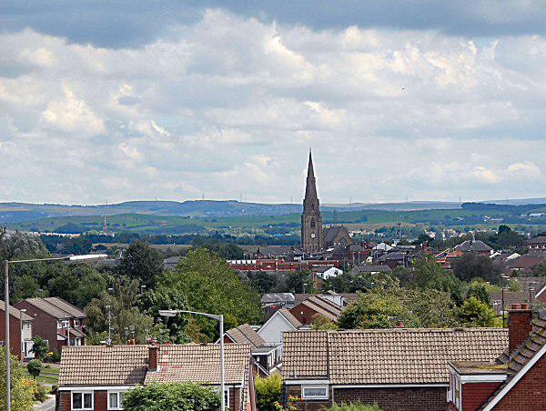
Heywood is a town located in the Metropolitan Borough of Rochdale, within the county of Lancashire, England. Situated on the River Roch, it is approximately 2.5 miles east of Bury and 8.3 miles north of Manchester. Heywood covers an area of around 5.5 square miles and has a population of approximately 28,000 people.

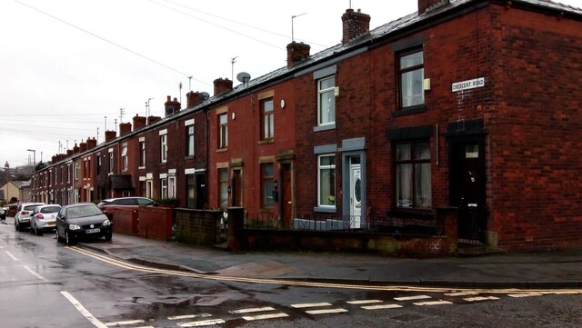
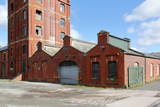
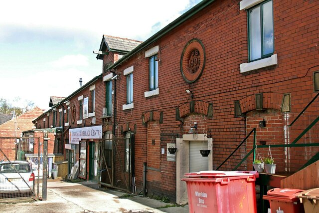
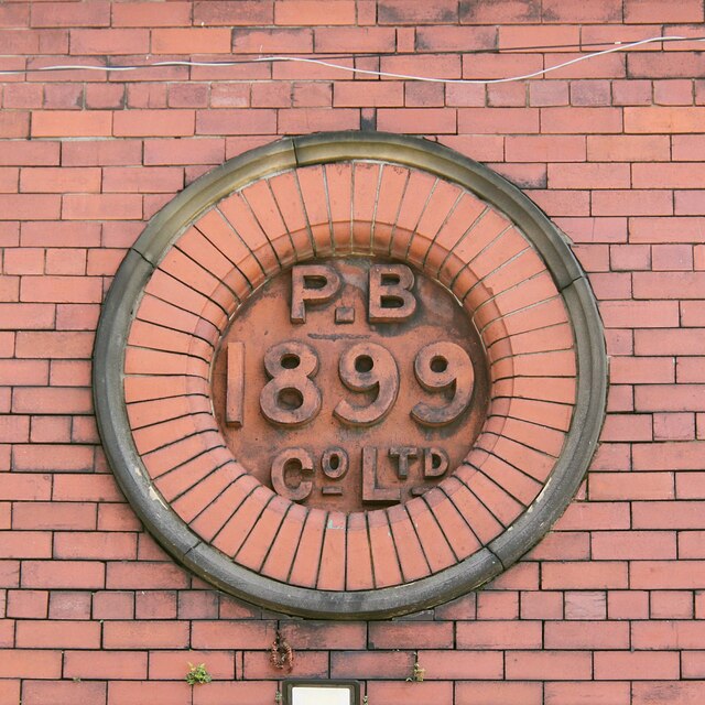
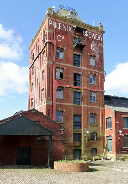
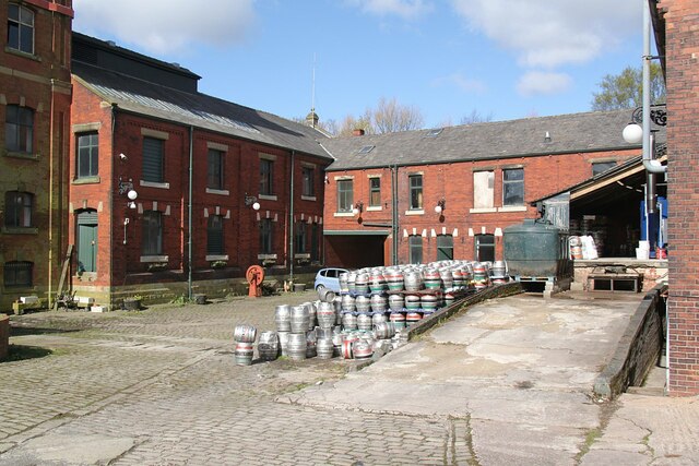
With a rich industrial heritage, Heywood was historically known for its cotton industry during the 19th century. The town later diversified into coal mining and engineering. Today, Heywood is a mix of residential, industrial, and commercial areas.

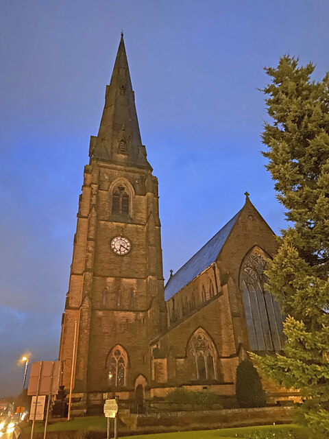
One of Heywood's prominent landmarks is the Grade II listed Heywood Hall, a former manor house dating back to 1590. The town also boasts a number of well-maintained parks and green spaces, including Queen's Park and Hopwood Park, offering recreational opportunities for residents and visitors.

Heywood is home to several primary and secondary schools, providing education to the local community. The town has good transportation links, with the M62 motorway nearby, connecting it to other major cities in the region. Heywood also benefits from regular bus services and a railway station, providing easy access to neighboring towns and cities.

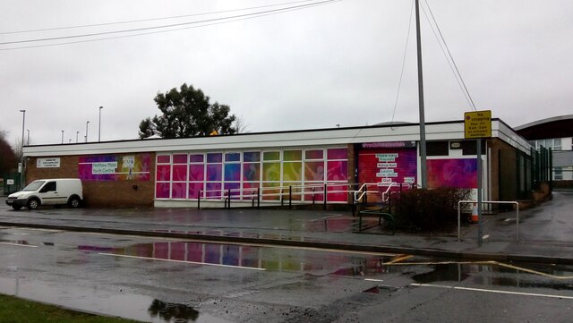
In terms of amenities, Heywood has a range of shops, supermarkets, pubs, and restaurants catering to the needs of its residents. The town also hosts various community events throughout the year, including the popular Heywood Food Festival and Heywood Show, showcasing local produce and talents.

Overall, Heywood offers a mix of historic charm, modern amenities, and a strong sense of community, making it a desirable place to live and visit in Lancashire.

If you have any feedback on the listing, please let us know in the comments section below.

Heywood Images

Images are sourced within 2km of 53.597167/-2.217551 or Grid Reference SD8511. Thanks to Geograph Open Source API. All images are credited.

WWII Lancashire: Ghost Signs of the Home Front (14) -
Emergency Rendezvous Point, Baker Street, at junction with Manchester Road, Heywood, Bury

"ERP 235"

Emergency Rendezvous Points (ERP) were designated places in the locality for the coordination of ARP and emergency services during civil emergencies, particularly for those services arriving from outside the area. The signs appear in a variety of designs, but most are diamond shapes framing the ERP locality number.

<a href="https://www.geograph.org.uk/photo/6945289">SD8609 : WWII Lancashire: Ghost Signs of the Home Front  (15)</a>
WWII Lancashire: Ghost Signs of the Home Front (14)
- Emergency Rendezvous Point, Baker Street, at junction with Manchester Road, Heywood, Bury "ERP 235" Emergency Rendezvous Points (ERP) were designated places in the locality for the coordination of ARP and emergency services during civil emergencies, particularly for those services arriving from outside the area. The signs appear in a variety of designs, but most are diamond shapes framing the ERP locality number. SD8609 : WWII Lancashire: Ghost Signs of the Home Front (15)
WWII Lancashire: Ghost Signs of the Home Front  (15) -
Emergency Rendezvous Point, Baker Street, at junction with Manchester Road, Heywood, Bury

"ERP 235"

Emergency Rendezvous Points (ERP) were designated places in the locality for the coordination of ARP and emergency services during civil emergencies, particularly for those services arriving from outside the area. The signs appear in a variety of designs, but most are diamond shapes framing the ERP locality number.

<a href="https://www.geograph.org.uk/photo/6945295">SD8013 : WWII Lancashire: Ghost Signs of the Home Front  (16)</a>
WWII Lancashire: Ghost Signs of the Home Front (15)
- Emergency Rendezvous Point, Baker Street, at junction with Manchester Road, Heywood, Bury "ERP 235" Emergency Rendezvous Points (ERP) were designated places in the locality for the coordination of ARP and emergency services during civil emergencies, particularly for those services arriving from outside the area. The signs appear in a variety of designs, but most are diamond shapes framing the ERP locality number. SD8013 : WWII Lancashire: Ghost Signs of the Home Front (16)
Housing on Shaftesbury Drive This housing estate has no direct vehicle access across the nearby railway to reach the centre of Heywood. The residents have quite a drive to the nearest crossing.
Housing on Shaftesbury Drive
This housing estate has no direct vehicle access across the nearby railway to reach the centre of Heywood. The residents have quite a drive to the nearest crossing.
Entrance to Broadfield Business Park Off Pilsworth Road. There is a public bridleway (by the side of the gatehouse) behind the security fencing - not that you would recognise it.
Entrance to Broadfield Business Park
Off Pilsworth Road. There is a public bridleway (by the side of the gatehouse) behind the security fencing - not that you would recognise it.
WWII Lancashire: Ghost Signs of the Home Front  (12) -
Emergency Rendezvous Point, Peel Street, at junction with  Bury Street, Heywood, Bury 

"ERP ---?"

Emergency Rendezvous Points (ERP) were designated places in the locality for the coordination of ARP and emergency services during civil emergencies, particularly for those services arriving from outside the area. The signs appear in a variety of designs, but most are diamond shapes framing the ERP locality number.

<a href="https://www.geograph.org.uk/photo/6945275">SD8410 : WWII Lancashire: Ghost Signs of the Home Front  (13)</a>
WWII Lancashire: Ghost Signs of the Home Front (12)
- Emergency Rendezvous Point, Peel Street, at junction with Bury Street, Heywood, Bury "ERP ---?" Emergency Rendezvous Points (ERP) were designated places in the locality for the coordination of ARP and emergency services during civil emergencies, particularly for those services arriving from outside the area. The signs appear in a variety of designs, but most are diamond shapes framing the ERP locality number. SD8410 : WWII Lancashire: Ghost Signs of the Home Front (13)
WWII Lancashire: Ghost Signs of the Home Front  (13) -
Emergency Rendezvous Point, Peel Street, at junction with  Bury Street, Heywood, Bury 

"ERP ---?"

Emergency Rendezvous Points (ERP) were designated places in the locality for the coordination of ARP and emergency services during civil emergencies, particularly for those services arriving from outside the area. The signs appear in a variety of designs, but most are diamond shapes framing the ERP locality number.

<a href="https://www.geograph.org.uk/photo/6945286">SD8609 : WWII Lancashire: Ghost Signs of the Home Front (14)</a>
WWII Lancashire: Ghost Signs of the Home Front (13)
- Emergency Rendezvous Point, Peel Street, at junction with Bury Street, Heywood, Bury "ERP ---?" Emergency Rendezvous Points (ERP) were designated places in the locality for the coordination of ARP and emergency services during civil emergencies, particularly for those services arriving from outside the area. The signs appear in a variety of designs, but most are diamond shapes framing the ERP locality number. SD8609 : WWII Lancashire: Ghost Signs of the Home Front (14)
Heywood Church Spire - St Lukes
OS Cut Mark: Heywood - Number 6 Hind Hill Street <span class="nowrap"><a title="https://www.bench-marks.org.uk/bm109138" rel="nofollow ugc noopener" href="https://www.bench-marks.org.uk/bm109138">Link</a><img style="margin-left:2px;" alt="External link" title="External link - shift click to open in new window" src="https://s1.geograph.org.uk/img/external.png" width="10" height="10"/></span>
OS Cut Mark: Heywood - Number 6 Hind Hill Street
Matthew Moss Lane, Rochdale Looking towards Bolton Road from Crescent Road, with Matthew Moss High School on the left.
Matthew Moss Lane, Rochdale
Looking towards Bolton Road from Crescent Road, with Matthew Moss High School on the left.
Matthew Moss Youth Centre, Rochdale Situated on Matthew Moss Lane, next to the High School.
Matthew Moss Youth Centre, Rochdale
Situated on Matthew Moss Lane, next to the High School.
Terraced Houses on Crescent Road, Rochdale
The former Phoenix Brewery, Heywood – 1 I haven't worked out what the function of the buildings in the foreground was.
The former Phoenix Brewery, Heywood – 1
I haven't worked out what the function of the buildings in the foreground was.
The former Phoenix Brewery, Heywood – 2 This range may have been the stable block, now occupied by various small businesses.
The former Phoenix Brewery, Heywood – 2
This range may have been the stable block, now occupied by various small businesses.
The former Phoenix Brewery, Heywood – 3 Terracotta date plaque on the stable block. The whole set of brewery buildings appears to date from 1899, although the 1894 6-inch mapping shows buildings with a similar footprint already in existence.
The former Phoenix Brewery, Heywood – 3
Terracotta date plaque on the stable block. The whole set of brewery buildings appears to date from 1899, although the 1894 6-inch mapping shows buildings with a similar footprint already in existence.
The former Phoenix Brewery, Heywood – 4 The brewing tower, now out of use except as a support for communications transmitters.
The former Phoenix Brewery, Heywood – 4
The brewing tower, now out of use except as a support for communications transmitters.
The former Phoenix Brewery, Heywood – 5 The main brewery yard. The brewery closed in around 1960, but the 'Oak Brewing Company' of Ellesmere Port relocated here in 1991 and became Phoenix Brewing Ltd in 1996. It occupies the former maltings and office buildings and doesn't not 'replicate' the original brewery.
The former Phoenix Brewery, Heywood – 5
The main brewery yard. The brewery closed in around 1960, but the 'Oak Brewing Company' of Ellesmere Port relocated here in 1991 and became Phoenix Brewing Ltd in 1996. It occupies the former maltings and office buildings and doesn't not 'replicate' the original brewery.
Shining in the sunlight A stack of aluminium kegs at the Phoenix Brewery, Heywood.
Shining in the sunlight
A stack of aluminium kegs at the Phoenix Brewery, Heywood.
Mutual Mills, Heywood – 1 The tower of Mill No.1
Mutual Mills, Heywood – 1
The tower of Mill No.1
Show me another place!

Heywood is located at Grid Ref: SD8511 (Lat: 53.597167, Lng: -2.217551)

Unitary Authority: Rochdale

Police Authority: Greater Manchester

What 3 Words

///placed.vague.films. Near Heywood, Manchester

Related Wikis

Queen's Park, Rochdale

Queen's Park is a public park in Heywood, in the Metropolitan Borough of Rochdale, Greater Manchester, England. == History == The park is situated on land...

Millers Brook

Millers Brook is a watercourse in Greater Manchester and tributary of the River Roch. It originates in Heywood and flows through Queens Park to join the...

Heywood, Greater Manchester

Heywood is a town in the Metropolitan Borough of Rochdale, Greater Manchester, England, in the historic county of Lancashire. It had a population of 28...

Municipal Borough of Heywood

The Municipal Borough of Heywood was, from 1881 to 1974, a local government district in the administrative county of Lancashire, England, with borough...

Nearby Amenities

Located within 500m of 53.597167,-2.217551
Heywood
Is In: Rochdale, Greater Manchester, England, UK
Is In District: Rochdale
Name Ur: ہئے وڈ
Place: town
Population: 29726
Population Date: 2021
Wikidata: Q1013970
Wikipedia: en:Heywood, Greater Manchester
Lat/Long: 53.5967685/-2.2239715
Traffic Signals
Lat/Long: 53.5935728/-2.2199856
Mini Roundabout
Direction: clockwise
Lat/Long: 53.5942279/-2.2210532
Crossing
Crossing: marked
Lat/Long: 53.5939439/-2.2221089
Bus Stop
Queens Park Road/ Queens Park
Bus: yes
Naptan AtcoCode: 1800NE00141
Naptan Bearing: N
Naptan CommonName: Queens Park Road/ Queens Park
Naptan Indicator: School
Naptan Landmark: CAR Park
Naptan NaptanCode: mandtwmt
Naptan PlusbusZoneRef: MNCRPIC
Naptan ShortCommonName: Queens Park
Naptan Street: Queens Park Road
Naptan Verified: no
Network: TfGM
Public Transport: platform
Source: naptan_import
Lat/Long: 53.6012526/-2.2170477
Bus Stop
Queens Park Road/Queens Park
Bus: yes
Naptan AtcoCode: 1800NE00411
Naptan Bearing: S
Naptan CommonName: Queens Park Road/Queens Park
Naptan Indicator: School
Naptan Landmark: PLAYGROUND
Naptan NaptanCode: mandwadm
Naptan PlusbusZoneRef: MNCRPIC
Naptan ShortCommonName: Queens Park
Naptan Street: Queens Park Road
Naptan Verified: no
Network: TfGM
Public Transport: platform
Source: naptan_import
Lat/Long: 53.6006509/-2.2167877
Bus Stop
York Street/Miller Street
Bus: yes
Naptan AtcoCode: 1800NE21991
Naptan Bearing: E
Naptan CommonName: York Street/Miller Street
Naptan Indicator: Wishing Well
Naptan Landmark: WISHING WELL
Naptan NaptanCode: mangagwd
Naptan PlusbusZoneRef: MNCRPIC
Naptan ShortCommonName: Miller Street
Naptan Street: YORK STREET
Naptan Verified: no
Network: TfGM
Public Transport: platform
Source: naptan_import
Lat/Long: 53.59341/-2.2146052
Bus Stop
Church Street/Heywood Library (Stop D)
Bus: yes
Local Ref: D
Naptan AtcoCode: 1800NE35601
Naptan Bearing: SE
Naptan CommonName: Church Street/Heywood Library (Stop D)
Naptan Indicator: Stop D
Naptan Landmark: CHURCH
Naptan NaptanCode: mangdmjg
Naptan PlusbusZoneRef: MNCRPIC
Naptan ShortCommonName: Heywood Library
Naptan Street: L/cpl Stephen Shaw Mc Way
Naptan Verified: no
Network: TfGM
Public Transport: platform
Source: naptan_import
Lat/Long: 53.5930973/-2.218547
Bus Stop
Church Street/Heywood Library (Stop E)
Bus: yes
Local Ref: E
Naptan AtcoCode: 1800NE35611
Naptan Bearing: SE
Naptan CommonName: Church Street/Heywood Library (Stop E)
Naptan Indicator: Stop E
Naptan Landmark: Public House
Naptan NaptanCode: mangdmjm
Naptan PlusbusZoneRef: MNCRPIC
Naptan ShortCommonName: Heywood Library
Naptan Street: L/cpl Stephen Shaw Mc Way
Naptan Verified: no
Network: TfGM
Public Transport: platform
Source: naptan_import
Lat/Long: 53.5930168/-2.2183048
Bus Stop
Church Street/Heywood Library (Stop G)
Bus: yes
Local Ref: G
Naptan AtcoCode: 1800NE35621
Naptan Bearing: NW
Naptan CommonName: Church Street/Heywood Library (Stop G)
Naptan Indicator: Stop G
Naptan Landmark: Park
Naptan NaptanCode: mangdmjp
Naptan PlusbusZoneRef: MNCRPIC
Naptan ShortCommonName: Heywood Library
Naptan Street: L/cpl Stephen Shaw Mc Way
Naptan Verified: no
Network: TfGM
Public Transport: platform
Source: naptan_import
Lat/Long: 53.593061/-2.2187583
Bus Stop
Church Street/Heywood Library (Stop F)
Bus: yes
Local Ref: F
Naptan AtcoCode: 1800NE35631
Naptan Bearing: NW
Naptan CommonName: Church Street/Heywood Library (Stop F)
Naptan Indicator: Stop F
Naptan Landmark: Park
Naptan NaptanCode: mangdmjt
Naptan PlusbusZoneRef: MNCRPIC
Naptan ShortCommonName: Heywood Library
Naptan Street: L/cpl Stephen Shaw Mc Way
Naptan Verified: no
Network: TfGM
Public Transport: platform
Source: naptan_import
Lat/Long: 53.592828/-2.2183643
Bus Stop
Bamford Road/Market Street (Stop B)
Bus: yes
Local Ref: B
Naptan AtcoCode: 1800NE32081
Naptan Bearing: NW
Naptan CommonName: Bamford Road/Market Street (Stop B)
Naptan Indicator: Stop B
Naptan Landmark: CHEMIST
Naptan NaptanCode: mangdawg
Naptan PlusbusZoneRef: MNCRPIC
Naptan ShortCommonName: Market Street
Naptan Street: BAMFORD ROAD
Naptan Verified: no
Network: TfGM
Public Transport: platform
Source: naptan_import
Lat/Long: 53.5940007/-2.2209842
Bus Stop
Bamford Road/Market Street (Stop C)
Bus: yes
Local Ref: C
Naptan AtcoCode: 1800NE32101
Naptan Bearing: SE
Naptan CommonName: Bamford Road/Market Street (Stop C)
Naptan Indicator: Stop C
Naptan Landmark: BUS LAYBY
Naptan NaptanCode: mangdawj
Naptan PlusbusZoneRef: MNCRPIC
Naptan ShortCommonName: Market Street
Naptan Street: BAMFORD ROAD
Naptan Verified: no
Network: TfGM
Public Transport: platform
Source: naptan_import
Lat/Long: 53.5941456/-2.2206346
Bus Stop
Bamford Road/Starkey Street
Bus: yes
Naptan AtcoCode: 1800NE32121
Naptan Bearing: S
Naptan CommonName: Bamford Road/Starkey Street
Naptan Indicator: Op House 70
Naptan Landmark: HOUSE 70
Naptan NaptanCode: mangdawp
Naptan PlusbusZoneRef: MNCRPIC
Naptan ShortCommonName: Starkey Street
Naptan Street: BAMFORD ROAD
Naptan Verified: no
Network: TfGM
Public Transport: platform
Source: naptan_import
Lat/Long: 53.5965454/-2.2204535
Bus Stop
Bamford Road/Starkey Street
Bus: yes
Naptan AtcoCode: 1800NE32131
Naptan Bearing: N
Naptan CommonName: Bamford Road/Starkey Street
Naptan Indicator: Opp House 70
Naptan Landmark: FOOTBALL FIELD
Naptan NaptanCode: mangdawt
Naptan PlusbusZoneRef: MNCRPIC
Naptan ShortCommonName: Starkey Street
Naptan Street: BAMFORD ROAD
Naptan Verified: no
Network: TfGM
Public Transport: platform
Source: naptan_import
Lat/Long: 53.5964283/-2.220604
Bus Stop
Bamford Road/Heywood Hall Road
Bus: yes
Naptan AtcoCode: 1800NE32141
Naptan Bearing: S
Naptan CommonName: Bamford Road/Heywood Hall Road
Naptan Indicator: O/s House 170
Naptan Landmark: HOUSE 178
Naptan NaptanCode: mangdgad
Naptan PlusbusZoneRef: MNCRPIC
Naptan ShortCommonName: Heywood Hall Road
Naptan Street: BAMFORD ROAD
Naptan Verified: no
Network: TfGM
Public Transport: platform
Source: naptan_import
Lat/Long: 53.598532/-2.2204034
Bus Stop
Bamford Road/Heywood Hall Road
Bus: yes
Naptan AtcoCode: 1800NE32151
Naptan Bearing: N
Naptan CommonName: Bamford Road/Heywood Hall Road
Naptan Indicator: Op House 182
Naptan Landmark: HOUSE 7
Naptan NaptanCode: mangdgag
Naptan PlusbusZoneRef: MNCRPIC
Naptan ShortCommonName: Heywood Hall Road
Naptan Street: BAMFORD ROAD
Naptan Verified: no
Network: TfGM
Public Transport: platform
Source: naptan_import
Lat/Long: 53.5989721/-2.2205417
Bus Stop
Clay Bank Street/Furness Avenue
Bus: yes
Naptan AtcoCode: 1800NE32161
Naptan Bearing: W
Naptan CommonName: Clay Bank Street/Furness Avenue
Naptan Indicator: O/s House 67
Naptan Landmark: HOUSE 67
Naptan NaptanCode: mangdgaj
Naptan PlusbusZoneRef: MNCRPIC
Naptan ShortCommonName: Furness Avenue
Naptan Street: Claybank Street
Naptan Verified: no
Network: TfGM
Public Transport: platform
Source: naptan_import
Lat/Long: 53.5983723/-2.2241047
Bus Stop
Clay Bank Street/Furness Avenue
Bus: yes
Naptan AtcoCode: 1800NE32171
Naptan Bearing: E
Naptan CommonName: Clay Bank Street/Furness Avenue
Naptan Indicator: O/s House 66
Naptan Landmark: HOUSE 66
Naptan NaptanCode: mangdgam
Naptan PlusbusZoneRef: MNCRPIC
Naptan ShortCommonName: Furness Avenue
Naptan Street: Claybank Street
Naptan Verified: no
Network: TfGM
Public Transport: platform
Source: naptan_import
Lat/Long: 53.5985529/-2.2236372
Crossing
Crossing: unmarked
Crossing Island: no
Crossing Markings: no
Tactile Paving: yes
Lat/Long: 53.5942892/-2.2203163
Generator Method: photovoltaic
Generator Output Electricity: yes
Generator Source: solar
Generator Type: solar_photovoltaic_panel
Location: roof
Power: generator
Lat/Long: 53.5952566/-2.2141863
Generator Method: photovoltaic
Generator Output Electricity: yes
Generator Source: solar
Generator Type: solar_photovoltaic_panel
Location: roof
Power: generator
Lat/Long: 53.5947885/-2.2126194
Generator Method: photovoltaic
Generator Output Electricity: yes
Generator Source: solar
Generator Type: solar_photovoltaic_panel
Location: roof
Power: generator
Lat/Long: 53.5957695/-2.2181503
Generator Method: photovoltaic
Generator Output Electricity: yes
Generator Source: solar
Generator Type: solar_photovoltaic_panel
Location: roof
Power: generator
Lat/Long: 53.596516/-2.2202565
Generator Method: photovoltaic
Generator Output Electricity: yes
Generator Source: solar
Generator Type: solar_photovoltaic_panel
Location: roof
Power: generator
Lat/Long: 53.5986473/-2.2193552
Barrier: bollard
Lat/Long: 53.5957487/-2.2128028
Barrier: bollard
Lat/Long: 53.5951163/-2.218227
Crossing
Button Operated: yes
Crossing: traffic_signals
Crossing Island: no
Crossing Markings: dots
Tactile Paving: yes
Lat/Long: 53.5960547/-2.2233158
Crossing
Crossing: unmarked
Crossing Island: no
Crossing Markings: no
Tactile Paving: yes
Lat/Long: 53.5962398/-2.223348
Barrier: cycle_barrier
Bicycle: yes
Foot: yes
Wheelchair: limited
Lat/Long: 53.5966546/-2.22343
Barrier: bollard
Motor Vehicle: no
Lat/Long: 53.5967981/-2.2236039
Barrier: cycle_barrier
Bicycle: yes
Foot: yes
Wheelchair: limited
Lat/Long: 53.5980121/-2.2242313
Barrier: block
Bicycle: yes
Foot: yes
Motor Vehicle: no
Wheelchair: yes
Lat/Long: 53.5982463/-2.2244368
Crossing
Crossing: traffic_signals
Lat/Long: 53.5937077/-2.2222119
Pub
The Edwin Waugh
Addr City: Heywood
Addr County: Manchester
Addr Housenumber: 10-12
Addr Postcode: OL10 4LY
Addr Street: Market Street
Address1: 10-12 Market Street
Brand: Wetherspoon
Brand Wikidata: Q6109362
Brand Wikipedia: en:Wetherspoons
Changing Table: yes
Contact Phone: 01706 621480
Contact Website: https://www.jdwetherspoon.com/pubs/all-pubs/england/manchester/the-edwin-waugh-heywood
Diet Vegan: Yes
Diet Vegetarian: Yes
Food: yes
Note: Has TV screens
Outdoor Seating: yes
Payment Debit Cards: Yes
Payment Mastercard: Yes
Payment Visa: Yes
Real Ale: yes
Toilets: yes
Toilets Access: customers
Wheelchair: yes
Lat/Long: 53.593798/-2.2213044
B&M Home Store
Addr Postcode: OL10 4PN
Addr Street: Dawson Street
Branch: Heywood
Brand: B&M Home Store
Brand Wikidata: Q4836931
Contact Website: https://www.bmstores.co.uk/stores/heywood-656
Opening Hours: Mo-Sa 08:00-22:00; Su 10:00-16:00
Shop: variety_store
Website: https://www.bmstores.co.uk
Lat/Long: 53.5944844/-2.2224816
Fountain
Fountain: decorative
Lat/Long: 53.6007458/-2.2153725
Crossing
Crossing: traffic_signals
Crossing Island: no
Crossing Markings: dots
Tactile Paving: yes
Lat/Long: 53.5934465/-2.216302
Crossing
Crossing: unmarked
Crossing Markings: no
Tactile Paving: yes
Lat/Long: 53.592735/-2.2167049
Barrier: bollard
Motor Vehicle: no
Lat/Long: 53.5946813/-2.2218703
Crossing
Crossing: unmarked
Crossing Island: no
Crossing Markings: no
Tactile Paving: yes
Lat/Long: 53.5943109/-2.2207899
Bench
Lat/Long: 53.5942325/-2.2206407
Bench
Lat/Long: 53.5941951/-2.2206432
Waste Basket
Lat/Long: 53.5942192/-2.2206412
Barrier: bollard
Motor Vehicle: no
Lat/Long: 53.5936018/-2.219106
Barrier: kerb
Wheelchair: limited
Lat/Long: 53.5936128/-2.2191057
Cycleway: asl
Direction: backward
Lat/Long: 53.5935692/-2.2193471
Cycleway: asl
Direction: forward
Lat/Long: 53.5934892/-2.2192419
Crossing
Crossing: traffic_signals
Crossing Island: yes
Crossing Markings: dots
Crossing Signals: yes
Lat/Long: 53.5935684/-2.2194311
Crossing
Crossing: traffic_signals
Crossing Island: yes
Crossing Markings: dots
Crossing Signals: yes
Lat/Long: 53.5934418/-2.2192656
Crossing
Crossing: traffic_signals
Crossing Island: yes
Crossing Markings: dots
Crossing Signals: yes
Lat/Long: 53.5934005/-2.2194533
Barrier: bollard
Motor Vehicle: no
Lat/Long: 53.5934609/-2.215001
Bicycle Parking
Bicycle Parking: stands
Capacity: 8
Covered: no
Lat/Long: 53.5950193/-2.2230635
Bicycle Parking
Bicycle Parking: stands
Capacity: 16
Covered: no
Lat/Long: 53.5966921/-2.224536
Crossing
Lat/Long: 53.5960908/-2.215471
Barrier: cycle_barrier
Bicycle: yes
Foot: yes
Lat/Long: 53.598344/-2.2109576
Barrier: bollard
Wheelchair: yes
Lat/Long: 53.5958713/-2.2233058
Barrier: cycle_barrier
Bicycle: yes
Foot: yes
Wheelchair: limited
Lat/Long: 53.5961301/-2.2233209
Crossing
Crossing: uncontrolled
Crossing Markings: zebra
Lat/Long: 53.59624/-2.2242935
Crossing
Crossing: uncontrolled
Crossing Markings: zebra
Lat/Long: 53.596381/-2.2242928
Crossing
Crossing: uncontrolled
Crossing Markings: zebra
Lat/Long: 53.5965192/-2.2242921
Give Way
Direction: forward
Lat/Long: 53.5965207/-2.2234323
Give Way
Direction: forward
Lat/Long: 53.5962398/-2.223317
Parking
Access: customers
Parking: surface
Lat/Long: 53.5981347/-2.2120827
Crossing
Crossing: traffic_signals
Crossing Island: no
Crossing Markings: dots
Tactile Paving: yes
Lat/Long: 53.6007377/-2.2169069
Crossing
Crossing: traffic_signals
Crossing Island: yes
Crossing Markings: dots
Crossing Signals: yes
Lat/Long: 53.5935082/-2.2194135
Barrier: cycle_barrier
Bicycle: yes
Foot: yes
Wheelchair: limited
Lat/Long: 53.5959922/-2.2233108
Waste Basket
Lat/Long: 53.5960019/-2.2233309
Barrier: cycle_barrier
Bicycle: yes
Foot: yes
Wheelchair: limited
Lat/Long: 53.5962903/-2.2233578
Waste Basket
Lat/Long: 53.5980205/-2.2242639
The data included in this document is from www.openstreetmap.org. The data is made available under ODbL.

Have you been to Heywood?

Leave your review of Heywood below (or comments, questions and feedback).