Cùl na Ceapaich

Settlement in Inverness-shire

Scotland

Cùl na Ceapaich

Craigview, near Kinloid/Ceann an Leothaid A smallholding and island of green in Arisaig.
Craigview, near Kinloid/Ceann an Leothaid Credit: M J Richardson

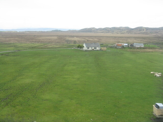
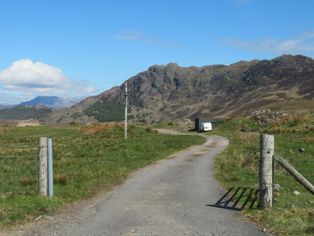
Cùl na Ceapaich is a small rural settlement located in the county of Inverness-shire, Scotland. Situated in the heart of the Scottish Highlands, it lies approximately 10 miles southeast of the town of Fort Augustus and is surrounded by breathtaking natural beauty.

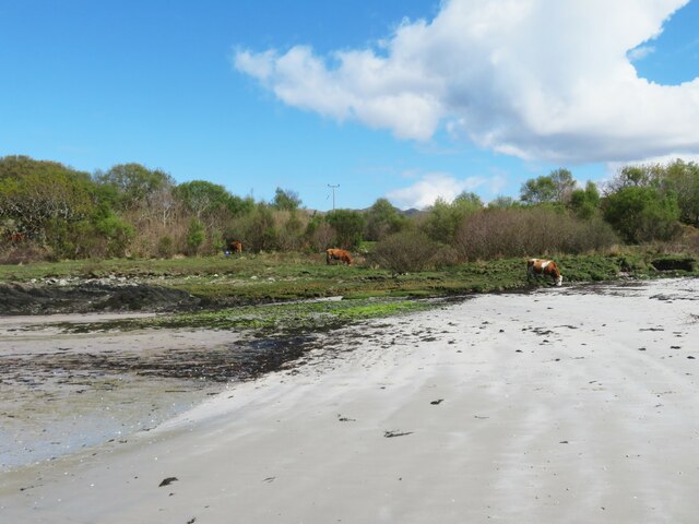
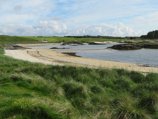
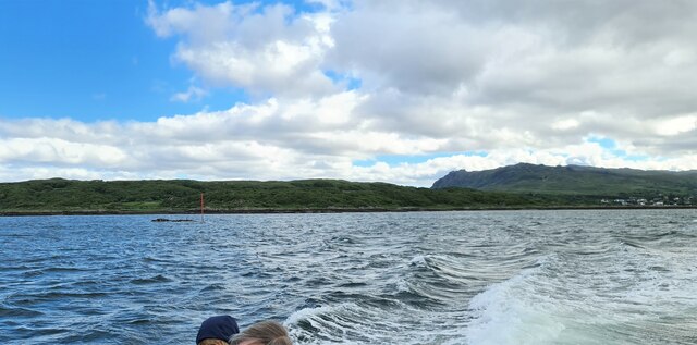
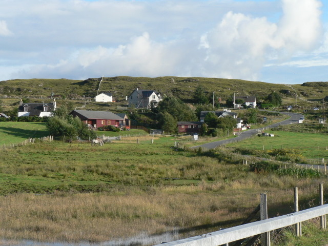
The landscape of Cùl na Ceapaich is dominated by rolling hills and verdant green pastures, making it an ideal location for farming and agriculture. The area is known for its picturesque views, with the nearby Loch Ness providing a stunning backdrop.

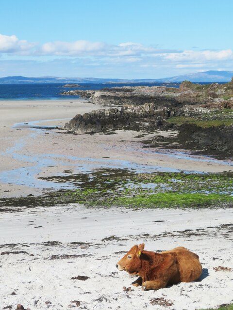
The settlement itself is home to a small community, with a population of around 200 residents. The local economy is primarily based on agriculture, with farming and livestock rearing being the main sources of income. Traditional Scottish Highland breeds, such as Highland cattle and Blackface sheep, can often be found grazing in the fields.

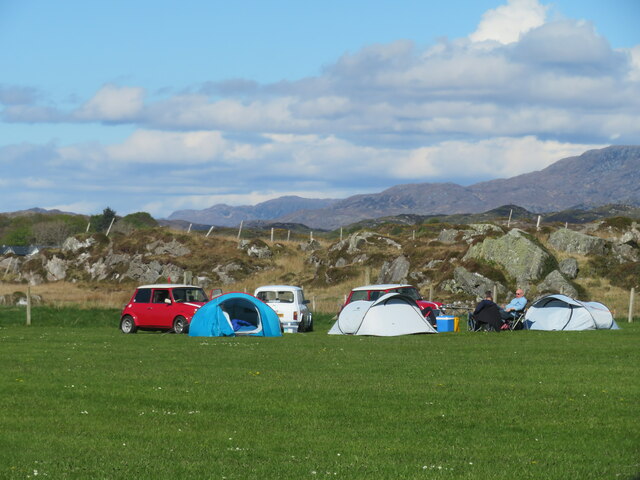
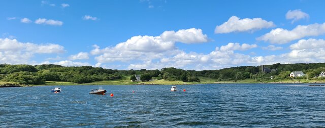
Cùl na Ceapaich is also a popular destination for outdoor enthusiasts. The surrounding countryside offers ample opportunities for hiking, cycling, and fishing. The nearby Great Glen Way, a long-distance walking trail, attracts visitors from all over the world who come to experience the stunning scenery and tranquil atmosphere.

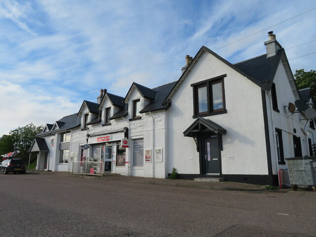
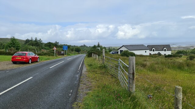
Although Cùl na Ceapaich is a relatively secluded settlement, it is well-connected to the rest of Inverness-shire. The nearest major town, Fort Augustus, offers amenities such as shops, schools, and healthcare facilities. Additionally, the A82 road provides easy access to the wider region.

Overall, Cùl na Ceapaich is a charming and idyllic rural retreat, offering a peaceful and picturesque setting amidst the natural splendor of the Scottish Highlands.

If you have any feedback on the listing, please let us know in the comments section below.

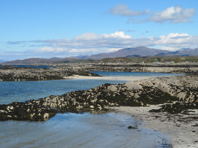
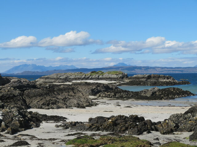
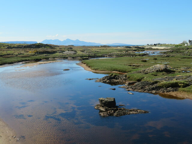
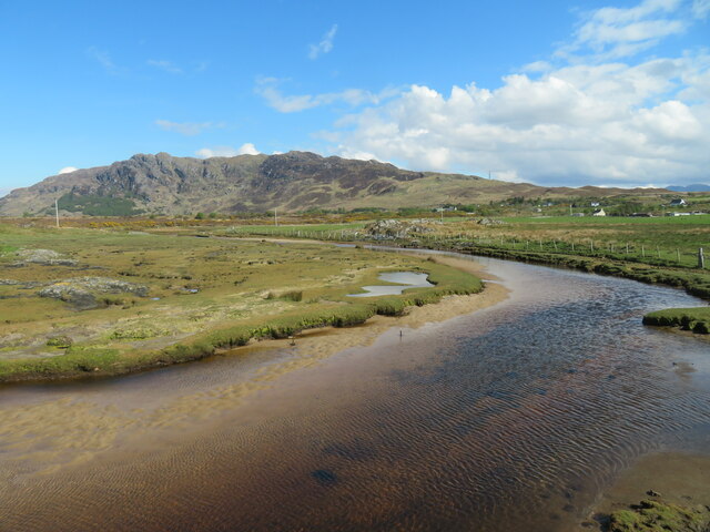
Cùl na Ceapaich Images

Images are sourced within 2km of 56.923289/-5.8589428 or Grid Reference NM6587. Thanks to Geograph Open Source API. All images are credited.

Craigview, near Kinloid/Ceann an Leothaid A smallholding and island of green in Arisaig.
Craigview, near Kinloid/Ceann an Leothaid
A smallholding and island of green in Arisaig.
The Arisaig Hotel Close to the village centre and just across the road from the sea.
The Arisaig Hotel
Close to the village centre and just across the road from the sea.
Yachts at Arisaig I'm no yachtsman, but it strikes me that a degree of expertise is needed to navigate through the many rocky shoals and islets just off the coast here.
Yachts at Arisaig
I'm no yachtsman, but it strikes me that a degree of expertise is needed to navigate through the many rocky shoals and islets just off the coast here.
Land, Sea and Island Centre, Arisaig Heritage and information centre at Arisaig.
Land, Sea and Island Centre, Arisaig
Heritage and information centre at Arisaig.
Farm road, Achraig The road doesn't appear to go anywhere in particular, but there is a good view towards the craggy slopes of Creag Mhor.
Farm road, Achraig
The road doesn't appear to go anywhere in particular, but there is a good view towards the craggy slopes of Creag Mhor.
White sand at Gortenachullish White sand beach at the road end from Back of Keppoch.
White sand at Gortenachullish
White sand beach at the road end from Back of Keppoch.
Beach bovine Just lazing on the beach and soaking up the spring sunshine at Gortenachullish.
Beach bovine
Just lazing on the beach and soaking up the spring sunshine at Gortenachullish.
Mini camping Mini enthusiasts with mini tents at Back of Keppoch.
Mini camping
Mini enthusiasts with mini tents at Back of Keppoch.
Coastline near Port Ban A fretted coastline of small sandy bays and rocky reefs.
Coastline near Port Ban
A fretted coastline of small sandy bays and rocky reefs.
Shoreline near Gortenchullish One can work one's way around the shoreline here at low tide, but further progress towards Eilean Ighe wasn't possible on this occasion via the shore, whilst any landward route has plenty of 'Private Keep Out' notices.
Shoreline near Gortenchullish
One can work one's way around the shoreline here at low tide, but further progress towards Eilean Ighe wasn't possible on this occasion via the shore, whilst any landward route has plenty of 'Private Keep Out' notices.
Allt Cam Carach heading seawards The last few metres of this burn which by this point has brackish waters. The mountains of Rum can be seen on the horizon.
Allt Cam Carach heading seawards
The last few metres of this burn which by this point has brackish waters. The mountains of Rum can be seen on the horizon.
Upstream along  Allt Cam Carach A slow and sluggish burn which drains a large area of low lying bog and scrubland known as Mointeach Mhor.
Upstream along Allt Cam Carach
A slow and sluggish burn which drains a large area of low lying bog and scrubland known as Mointeach Mhor.
Post Office and shop at Arisaig/Arasaig In the village on the B8008, which would have been the main Fort William-Mallaig road until it was bypassed.
Post Office and shop at Arisaig/Arasaig
In the village on the B8008, which would have been the main Fort William-Mallaig road until it was bypassed.
Lòn Liath - one of the Traigh beaches at Arisaig Never mind that Traigh is the Gaelic word for beach.
Lòn Liath - one of the Traigh beaches at Arisaig
Never mind that Traigh is the Gaelic word for beach.
Loch nan Ceall Taking a trip from Arisaig to Eigg
Loch nan Ceall
Taking a trip from Arisaig to Eigg
Arisaig harbour
Arisaig harbour
Back of Keppoch
Back of Keppoch
Southbound platyform at Arisaig station On the West Highland Line.
Southbound platyform at Arisaig station
On the West Highland Line.
Show me another place!

Cùl na Ceapaich is located at Grid Ref: NM6587 (Lat: 56.923289, Lng: -5.8589428)

Unitary Authority: Highland

Police Authority: Highlands and Islands

Also known as: Back of Keppoch

What 3 Words

///humid.importing.opinion. Near Arisaig, Highland

Related Wikis

Back of Keppoch

Back of Keppoch (Gaelic: Cùl na Ceapaich) is a small coastal settlement in the northwest Scottish Highlands, 40 miles (65 kilometres) west of Fort William...

Portnaluchaig

Portnaluchaig is a coastal hamlet, located 2 miles north of Arisaig in the Highlands of Scotland and is also in the council area of Highland. The Small...

Arisaig railway station

Arisaig railway station serves the village of Arisaig on the west coast of the Highland region of Scotland. This station is on the West Highland Line,...

Arisaig

Arisaig (Scottish Gaelic: Àrasaig) is a village in Lochaber, Inverness-shire. It lies 7 miles (11 kilometres) south of Mallaig on the west coast of the...

Eilean Ighe

Eilean Ighe is a small tidal island near Arisaig in the Inner Hebrides of Scotland. The area is popular for sea kayaking and a challenge for larger boats...

Làrach Mòr

Làrach Mòr is a garden in Lochaber, in the western Highlands of Scotland. It lies 1 kilometre (0.62 mi) east of Arisaig, in the crook of a bend in the...

Larichmore Viaduct

The Larichmore Viaduct is a railway viaduct in Scotland that carries the West Highland Line over the Brunery Burn. == History == The West Highland Railway...

Rhu Peninsula

Rhu Peninsula (Scottish Gaelic: Rudha Arasaig) and originally known as the Rhu Arisaig peninsula is a small, remote and largely deserted peninsula, at...

Related Videos

Back of Keppoch Beach(?) - Walking in Scotland - Virtual Walk

Another short walk to a "hidden" beach. Can't find the name anywhere, so I am assuming it's part of the Back of Keppoch. not the ...

Probably the best view in Scotland.. The mountain with no name.

Spectacular views of Eigg & Rum from an unnamed hill. Mountain stream scrambling & parenting advise. Music - Bowing 737 by ...

Nearby Amenities

Located within 500m of 56.923289,-5.8589428
Bus Stop
Back of Keppoch
Bench: yes
Bin: no
Lit: no
Naptan AtcoCode: 6700712400
Naptan Bearing: N
Naptan CommonName: Back of Keppoch
Naptan Indicator: at Back of Keppoch Road End
Naptan Landmark: Bus Shelter
Naptan NaptanCode: 45326796
Naptan Street: A830
Naptan Verified: no
Shelter: yes
Source: naptan_import
Tactile Paving: no
Lat/Long: 56.9231419/-5.8591546
Bus Stop
Back of Keppoch
Naptan AtcoCode: 6700712400A
Naptan Bearing: S
Naptan CommonName: Back of Keppoch
Naptan Indicator: opp Back of Keppoch Road End
Naptan Landmark: Bus Shelter
Naptan NaptanCode: 45326797
Naptan Street: A830
Naptan Verified: no
Source: naptan_import
Lat/Long: 56.9233443/-5.8587151
Post Box
Collection Times: Mo-Fr 11:45; Sa 11:45
Ref: PH39 77
Royal Cypher: scottish_crown
Source: survey
Lat/Long: 56.9228239/-5.8585297
Seann Airidh
Addr Street: Back of Keppoch Road
Tourism: guest_house
Lat/Long: 56.9234175/-5.8654638
Material: wood
Power: pole
Lat/Long: 56.9273468/-5.8557639
Power: pole
Lat/Long: 56.9265944/-5.8554044
Power: pole
Lat/Long: 56.9258757/-5.8551282
Power: pole
Lat/Long: 56.9251131/-5.8548251
Power: pole
Lat/Long: 56.9244354/-5.854522
Power: pole
Lat/Long: 56.9235849/-5.854235
Power: pole
Lat/Long: 56.9210436/-5.8528268
Power: pole
Lat/Long: 56.9219644/-5.8535671
Power: pole
Lat/Long: 56.9229452/-5.8539668
Power: pole
Lat/Long: 56.9229314/-5.8661732
Power: pole
Lat/Long: 56.9229329/-5.8644524
Power: pole
Lat/Long: 56.9233553/-5.8641209
Rhenetra B&B
Addr City: Arisaig
Addr Housename: Rhenetra
Addr Postcode: PH39 4NS
Addr Street: Moss Of Keppoch
Email: cjstewart61@icloud.com
Guest House: bed_and_breakfast
Internet Access: wlan
Internet Access Fee: customers
Operator: CJ
Phone: +44 01687450392
Rooms: 3
Tourism: guest_house
Wheelchair: no
Lat/Long: 56.9222263/-5.8560359
The data included in this document is from www.openstreetmap.org. The data is made available under ODbL.

Have you been to Cùl na Ceapaich?

Leave your review of Cùl na Ceapaich below (or comments, questions and feedback).