Heiskeir

Island in Sutherland

Scotland

Heiskeir

Coastal cliffs at Aird Torrisdale The distant sandy beach is on Neave, an island off Skerray.
Coastal cliffs at Aird Torrisdale Credit: Alan Reid

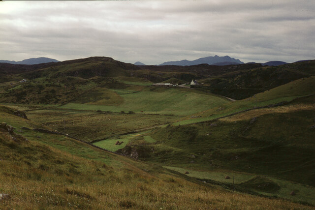
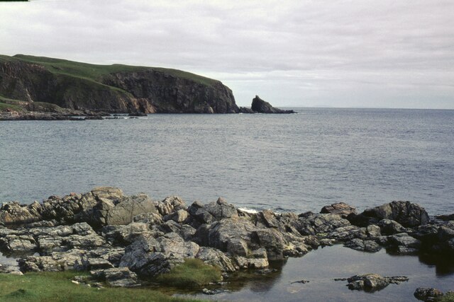
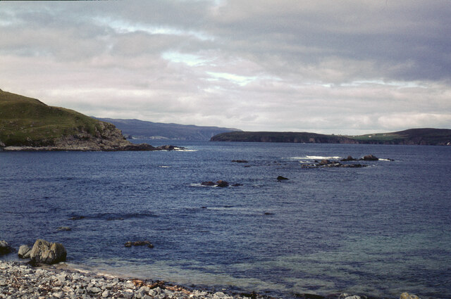
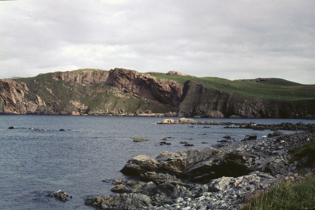
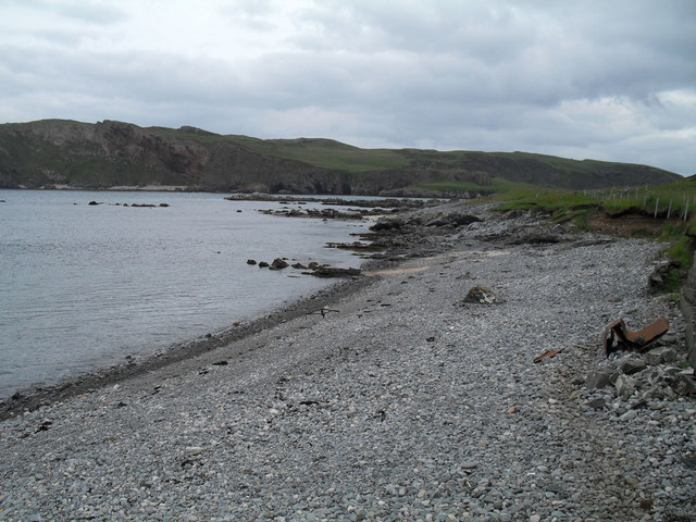
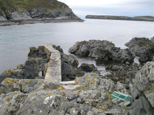
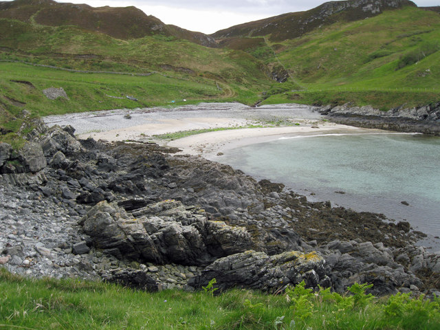
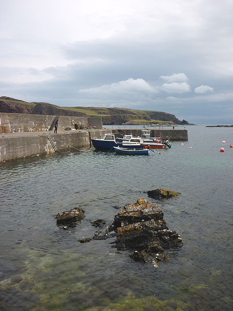
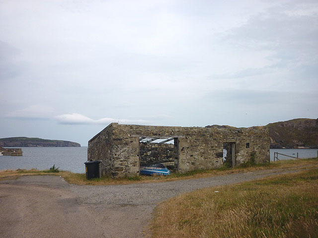
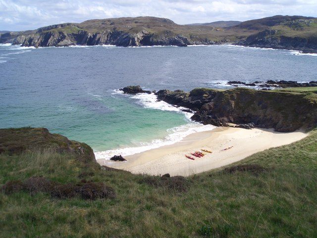
Heiskeir is a small uninhabited island located off the coast of Sutherland in the Highlands of Scotland. It is situated in the North Atlantic Ocean, approximately 4 miles southwest of Cape Wrath. The island is part of the North West Highlands Geopark and is known for its rugged and picturesque landscape.

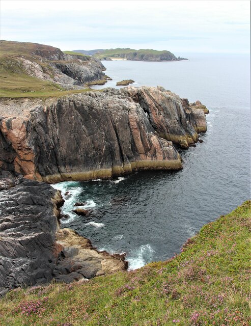
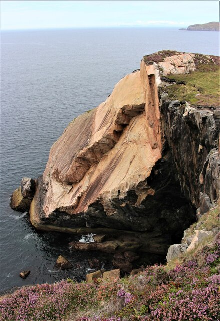
Heiskeir covers an area of around 48 hectares and is characterized by its rocky terrain, cliffs, and stunning sea views. The highest point on the island rises to about 100 meters above sea level. It is mostly composed of ancient Lewisian Gneiss, a type of metamorphic rock that dates back billions of years.

The island is rich in wildlife, attracting various seabirds such as razorbills, guillemots, and kittiwakes. It is also a breeding ground for a variety of marine mammals including seals and occasionally dolphins and whales.

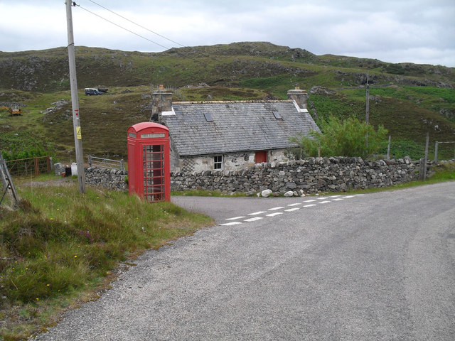
Access to Heiskeir is limited, with no regular ferry service available. However, the island is a popular destination for birdwatchers and nature enthusiasts who can visit by arranging private boat trips from nearby ports such as Keoldale or Durness.

Heiskeir offers a unique opportunity to explore a remote and unspoiled part of the Scottish coastline. Its wild and untamed beauty, along with its diverse range of flora and fauna, make it a captivating destination for those seeking a peaceful retreat amidst nature's wonders.

If you have any feedback on the listing, please let us know in the comments section below.
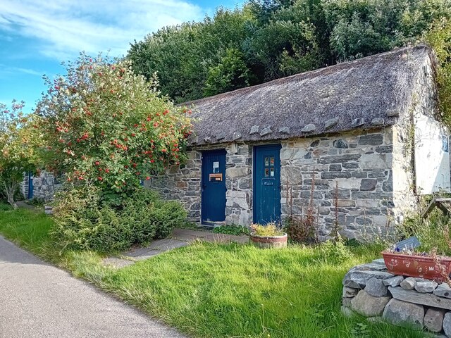
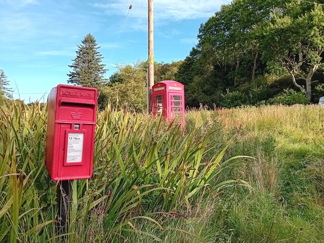
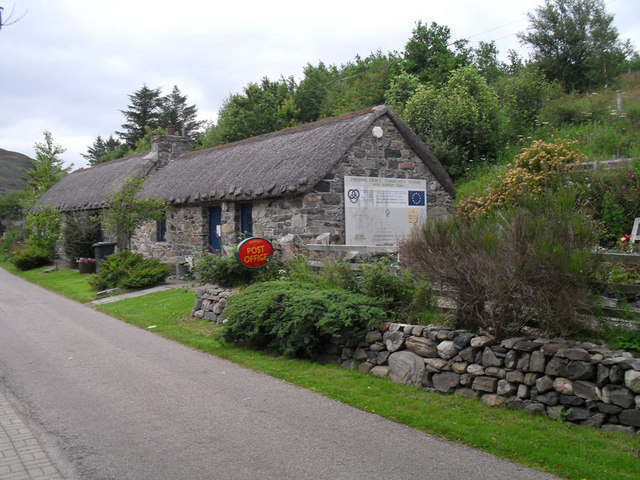
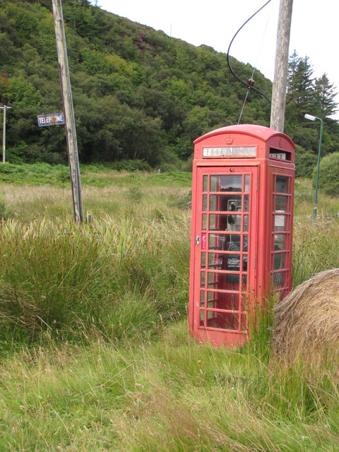
Heiskeir Images

Images are sourced within 2km of 58.543423/-4.2991504 or Grid Reference NC6663. Thanks to Geograph Open Source API. All images are credited.

Coastal cliffs at Aird Torrisdale The distant sandy beach is on Neave, an island off Skerray.
Coastal cliffs at Aird Torrisdale
The distant sandy beach is on Neave, an island off Skerray.
Coastal erosion at Aird Torrisdale A large rock slip, but how long ago did it occur?  Was it the result of an earth tremor or simply the erosive forces of sea and weather?
Coastal erosion at Aird Torrisdale
A large rock slip, but how long ago did it occur? Was it the result of an earth tremor or simply the erosive forces of sea and weather?
Skerray War Memorial Unveiled and dedicated in 1922.
Skerray War Memorial
Unveiled and dedicated in 1922.
Old Store, Skerray The ruin of the old store at Skerray.
Old Store, Skerray
The ruin of the old store at Skerray.
Skerray Post Office Village Post Office in a nicely restored building.
Skerray Post Office
Village Post Office in a nicely restored building.
Postbox at Skerray KW14 32. Royal Mail list this box as 'Skerray'.
Postbox at Skerray
KW14 32. Royal Mail list this box as 'Skerray'.
The hamlet of Skerray Looking south-south-west towards Ben Loyal.
The hamlet of Skerray
Looking south-south-west towards Ben Loyal.
Stac an Fhamhair A small stack, perhaps 15m high, at the east end of Neave (or Coomb) Island, seen across Caol Beag.
Stac an Fhamhair
A small stack, perhaps 15m high, at the east end of Neave (or Coomb) Island, seen across Caol Beag.
Skerray Bay Not a bay I would be very happy to navigate into (although there is, or was, a pier on the far side, just out of shot on the left).

The southern part of Eilean nan Ron is beyond the bay, with a few deserted houses visible.
Skerray Bay
Not a bay I would be very happy to navigate into (although there is, or was, a pier on the far side, just out of shot on the left). The southern part of Eilean nan Ron is beyond the bay, with a few deserted houses visible.
Neave or Coomb Island The central part of the island seen at close range (but still across a gridline!) across Caol Beag.
Neave or Coomb Island
The central part of the island seen at close range (but still across a gridline!) across Caol Beag.
Phonebox near Skerray
Stony beach at Skerray
Skerray Post Office
Skerray Post Office
Old jetty in Lamigo Bay The relatively new creel on the rocks indicates that the jetty is still in use, although no boat was visible at this time.
Old jetty in Lamigo Bay
The relatively new creel on the rocks indicates that the jetty is still in use, although no boat was visible at this time.
Telephone Box & sign Whilst the number of iconic red phone boxes dwindles there are even fewer with the "Telephone " roadside sign.  At Skerray there is also a "Telegraph" sign on the old Post Office.
Telephone Box & sign
Whilst the number of iconic red phone boxes dwindles there are even fewer with the "Telephone " roadside sign. At Skerray there is also a "Telegraph" sign on the old Post Office.
Lamigo Bay This deserted sandy beach lies at the head of Lamigo Bay.
Lamigo Bay
This deserted sandy beach lies at the head of Lamigo Bay.
Pier at Skerray Harbour Neave (or Coombe) Island beyond across Caol Beag.
Pier at Skerray Harbour
Neave (or Coombe) Island beyond across Caol Beag.
Roofless building, Skerray Bay Eilan nan Ron (left) and Neave (Coombe) Island off shore.
Roofless building, Skerray Bay
Eilan nan Ron (left) and Neave (Coombe) Island off shore.
Show me another place!

Heiskeir is located at Grid Ref: NC6663 (Lat: 58.543423, Lng: -4.2991504)

Unitary Authority: Highland

Police Authority: Highlands and Islands

What 3 Words

///salaried.commander.bugs. Near Altnaharra, Highland

Related Wikis

Skerray Bay

Skerray Bay is an arm of the Atlantic Ocean, located on the north coast of Sutherland, Highland, Scotland. Small and rocky, it is situated to the north...

Neave Island

Neave Island (Scottish Gaelic: Eilean na Naoimh, "Isle of the Saint") or Coomb(e) Island is an island on the north coast of the Scottish mainland. Neave...

Skerray

Skerray (Scottish Gaelic: Sgeirea) is a remote small crofting hamlet and fishing port on the north coast of Sutherland, Scotland. It is located 7+3⁄4 miles...

Achtoty

Achtoty (Scottish Gaelic: Achadh Toitidh) is a remote hamlet in the Scottish Highland Council area. Achtoty is about 26 miles (42 km) west of Thurso....

Nearby Amenities

Located within 500m of 58.543423,-4.2991504
Source: PGS
Lat/Long: 58.5407793/-4.2922198
Source: PGS
Lat/Long: 58.540999/-4.2927417
Source: PGS
Lat/Long: 58.5412754/-4.2939117
Source: PGS
Lat/Long: 58.5413028/-4.2941933
Source: PGS
Lat/Long: 58.5413974/-4.2943419
Source: PGS
Lat/Long: 58.5413493/-4.294049
Source: PGS
Lat/Long: 58.5413918/-4.2934418
Source: PGS
Lat/Long: 58.5416539/-4.2952539
Source: PGS
Lat/Long: 58.5419375/-4.2960891
Source: PGS
Lat/Long: 58.5425013/-4.2973154
Source: PGS
Lat/Long: 58.5424719/-4.2974184
Source: PGS
Lat/Long: 58.5425561/-4.2974061
Source: PGS
Lat/Long: 58.5429198/-4.2984827
Source: PGS
Lat/Long: 58.5432252/-4.2995014
Source: PGS
Lat/Long: 58.5431933/-4.299562
Source: PGS
Lat/Long: 58.543132/-4.2995513
Source: PGS
Lat/Long: 58.542926/-4.2991034
Source: PGS
Lat/Long: 58.5426026/-4.2994714
Source: PGS
Lat/Long: 58.5422493/-4.2998528
Source: PGS
Lat/Long: 58.5419019/-4.3003077
Source: PGS
Lat/Long: 58.5414464/-4.3008576
Source: PGS
Lat/Long: 58.5414231/-4.3041156
Caol Beag
Place: locality
Lat/Long: 58.5441073/-4.2982928
Port Gaineanhach
Place: locality
Lat/Long: 58.5454398/-4.2916849
Skerray Bay
Natural: bay
Wikidata: Q7534696
Wikipedia: en:Skerray Bay
Lat/Long: 58.5420621/-4.3030663
Bench
Lat/Long: 58.5409183/-4.3028869
Drinking Water
Fee: donation
Lat/Long: 58.5410047/-4.301162
The data included in this document is from www.openstreetmap.org. The data is made available under ODbL.

Have you been to Heiskeir?

Leave your review of Heiskeir below (or comments, questions and feedback).